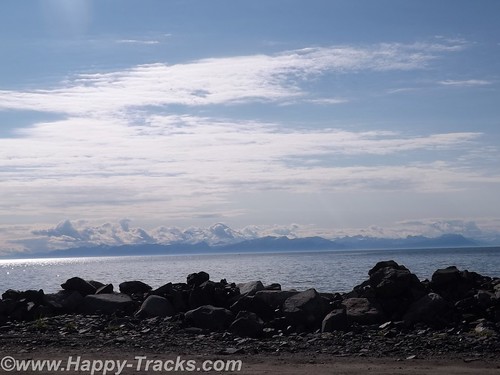
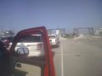
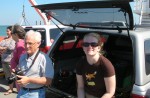
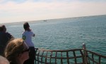
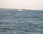
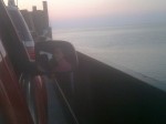
We pulled into Prince Rupert 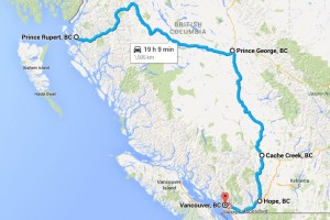 from the ferry and waited in line for Customs. Since this was the end of the line for the ferry, the Customs station was busy with the whole ship trying to get through Customs at the same time. As we left the ship in 6 lines, we merged into 3 to pass. All told, it really moved along rather quickly. We drove out of the Customs gate and up into the fog to make the drive into Prince Rupert. We had called ahead to the Prince Rupert Hotel and made arrangements for two nights stay.
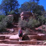
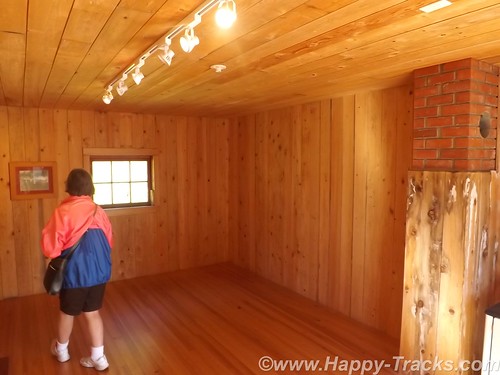
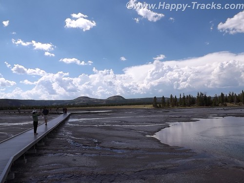
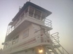
The next morning we set out to find Totem Park. Our map showed it to be a short walk away. Our map didn’t show the change in elevation though. Totem Park could be reached following a trail which looked to be little used and a bit overgrown. Luckily, a lady passed by walking her dogs and told us we could also take the public path between these houses to get there.
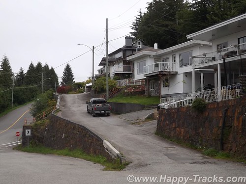
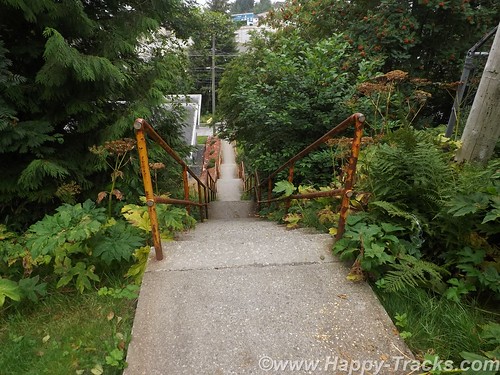
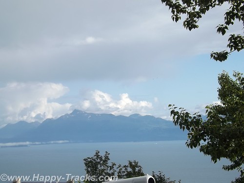
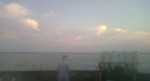
The public path was stairs. The stairs climbed up the 10 feet or so to reach the houses’ front yards and then continued up above their second stories and then still continued higher. I would estimate the climb was near 45 degrees and rose 100 feet in about 200. Then the stairs ended and the path climbed just a bit further. We finally reached the top after availing ourselves of several opportunities to stop and admire the view off the bluff and out to the harbor.
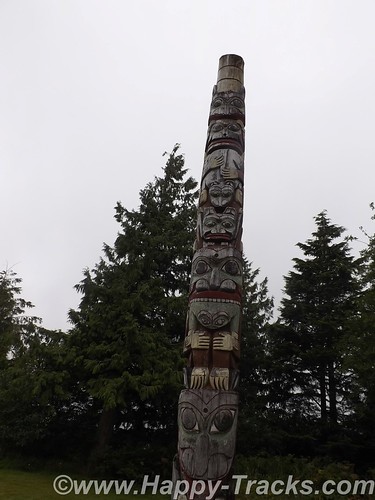
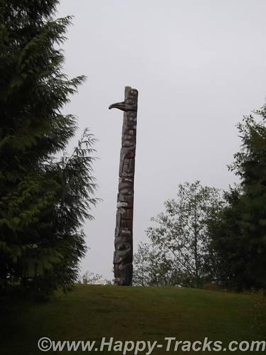
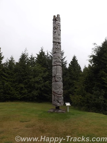
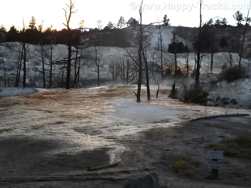
There are only three totems in Totem Park. You can see where there were two more that are no longer there. These totems are reproductions of authentic ones created by First Nations people.
We had thought there must be some universal code in totems and had tried to decipher but it just wasn’t to be. It starts with the totems having different purposes. Some are to celebrate a life, some are to commemorate an event, some are to give praise and some are to condemn or shame such as the one in Valdez meant to shame Exxon for wrongs no made right. Individual figures on the totem can also have meanings such as the frog meaning prosperity. As in other art, there is no universal key of this always means that.

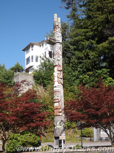
We walked down a different way than we had come up to see more of town. There were a couple of other totems standing by themselves and we also found two by city hall.
After setting on the ferry for 40 hours and the short drive to the hotel while powering our DC refrigerator, we had to jump start the truck this morning. We had been running the refrigerator off the truck battery rather than the spare battery we brought along and had used in Anchorage to jumpstart the stranded motorists. The spare battery started the truck instantly and we recharged the battery as we made our way to our next attraction.
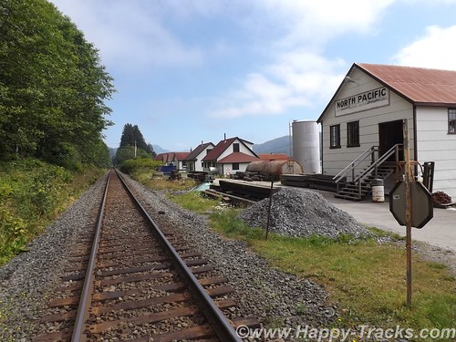
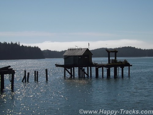
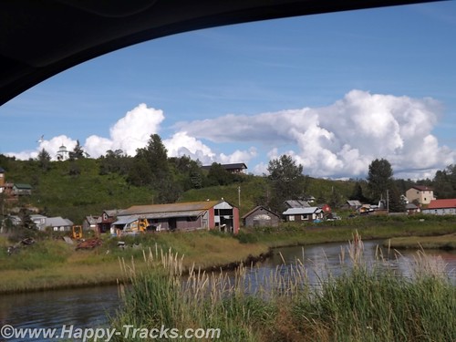
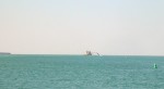
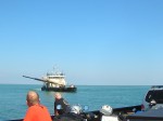
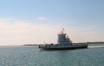
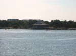
The maps and list of attractions listed the North Pacific Cannery and North Pacific Historic Fishing Village out past Port Edward. Since we had seen the cannery at Haines, we opted to go to the fishing village instead. The paved road led us toward the mouth of the Skeena River and we passed the cannery museum but then found only what looked to be private property as the road became a driveway. We carefully retraced our path but still found nothing other than the cannery museum so we went there instead.
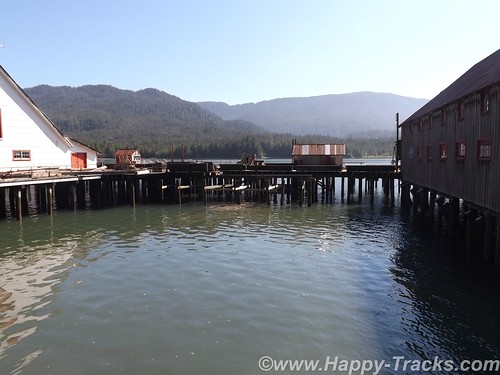
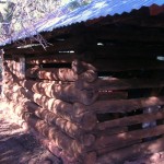
The cannery is built out over the water, probably to protect the buildings from bears and also to facilitate cleanups.
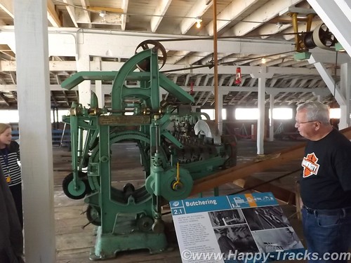
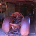
This cannery had a collection of much of the canning equipment, some from this facility and some from other locations. The tour guide described the process of making the cans from sheets of metal. This began several weeks before the fishing season so that there was an inventory of cans available to process the catch. The salmon was placed in the cans and the lids were attached and went through a heating and cooling process much like someone would can things at home. Finally the cans would be sealed with lead and a label would be placed on the cans.
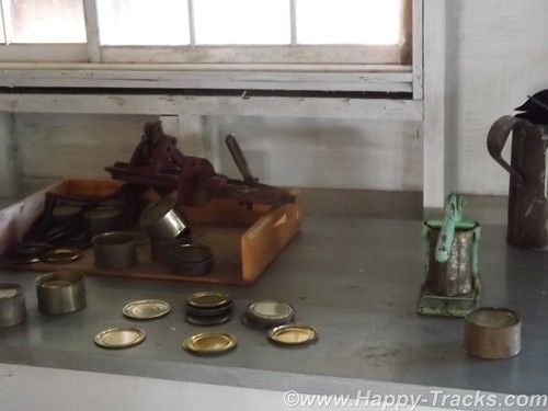
According to the guide, all the salmon that was canned here was the same and just had different labels placed on the cans. Marketing secrets of the salmon industry. The museum also had much of the equipment for the more modern vacuum-packed lead-free method of canning.
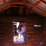
The cannery took the fish from the boats, cleaned them and then canned. Manual labor was a large part of the processing. Some of the steps required strength, some required dexterity while others just required labor. The jobs tended to be done by ethnic groups based on what we might refer to as stereotypes today. Asian women tended to do this job, First Nations men did that job and so forth.
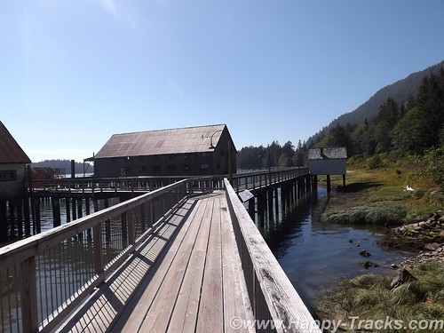
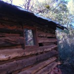
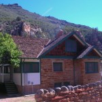
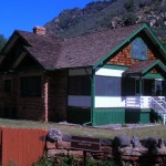
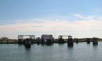
The dock included cabins that were used to house the workers during their temporary employment stints. These also tended to be segregated by ethnic groups. These were in varying states of restoration and preservation, too. This turned out to be the historic fishing village we had sought.
Separated from the processing building and the housing were the fuel storage tanks and pumps. There were also some administrative buildings for the cannery company.
The train tracks run between the cannery and the road for shipping the finished product. The displays also include a rather extensive model railroad and items from the time of the cannery’s productive days which was founded in 1888 and was in seasonal operation until 1968, the longest running cannery in BC.
We tried to find Canadian post card stamps while in Prince Rupert but the long weekend holiday had the post office closed.
We did find a great lunch at the Captain’s Table restaurant above the train museum park and with a great view of the water in Prince Rupert. We enjoyed it enough that we had lunch and dinner there.
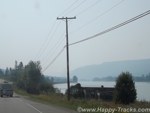
We left Prince Rupert on the Monday of a long holiday and the three day weekend had other vehicles on the road heading home but it only got heavy as we came to traffic lights or bridges. Rt. 16, Yellowhead Highway, roughly parallels the Skeena River and stayed along it all the way into Prince George, 450 miles away. This was a long day for us and the weather had gotten hot (98*).
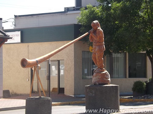
We stopped for lunch in Smithers at the Riverhouse Restaurant and then took a short detour down Main Street to see the Alpine Village which included an Alpenhorn player in the median of Main Street and a decorated bandstand.
As we continued on, we became more aware of smoke in the air from the wildfires that were ongoing. When we arrived in Prince George, it turned out that many of the hotel rooms were taken by firefighters who had been brought in from other areas to help with that effort.
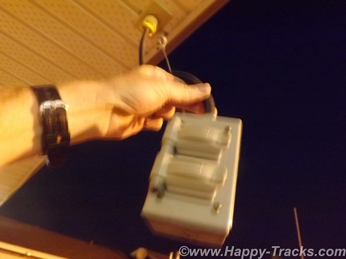
The hotel in Prince George was the first we had seen electrical outlets hanging outside the first floor overhang for winter vehicle heaters and chargers. We also discovered that all the “Do not back in” signs were to limit the exhaust from idling cars entering into the motel rooms. The misalignment of the front wheels on the truck had finally gotten to the other front tire so Keith replaced it while Betty went in search of postcards.
Some of our research includes checking out the postcard racks to see what local attractions are included there. Sometimes it helps, sometimes not so much. In the office of the hotel, Betty got involved in conversation with the desk clerk. She was born in Germany and had settled here with her husband several years ago after spending several years working here during the summers. She asked where we were headed and was disappointed that we would not be visiting Banff and Lake Louise. Betty told her we were feeling we had seen a lot of great scenery already and were headed to Vancouver to see a Canadian city instead. She did have some tips for our coming travels though, including recommendations for sights and a hotel in Vancouver.
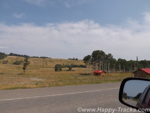
We left Price George headed south on Rt. 97, the Cariiboo Highway. Towns (settlements?) along the way were 150 Mile House and 100 Mile House named for the way stations along the way from frontier days.

Generally, the scenery looked arid but there were signs of forestry in the lumber yards and pulp mills along the way. There was also a cairn erected to commemorate Ft. Alexandria, the last Northwest Fur trading outpost west of the Rockies.
The area had been the site of mining operations in the past and when we next checked into the news, we discovered that a tailings pond had broken in Williams Lake and was in danger of polluting the drinking water and fishing waters with the toxic mess left over from the mining operations. That story was still breaking as we left the area.
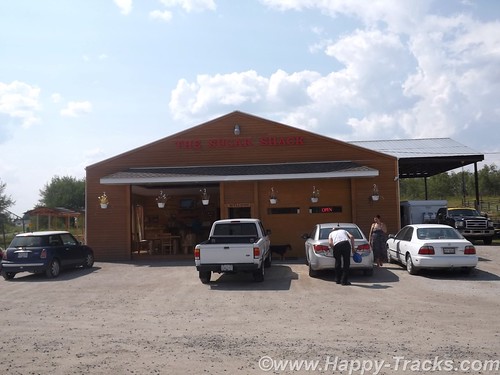
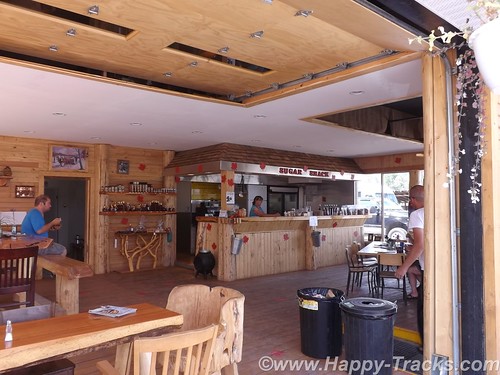
We stopped for lunch at The Sugar Shack, a side of the road eatery that looked to be in a building that could just as easily have been a large two car garage made from logs, complete with rollup doors. The special that day (and probably most days) was a Canadian delicacy, poutine. Originating in Quebec, poutine is a fast food dish sold in “greasy spoons” and roadside food wagons, made with French fries, topped with a light brown gravy-like sauce and cheese curds. (Can’t you just feel your arteries clog just reading that?) Easily large enough to be a meal by itself, it came as a side order to a brisket sandwich. They were also pushing maple sugar products but we passed on those.
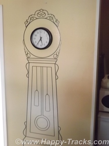
We continued on to Cache Creek for the night. When we pulled into town shortly before sunset, the thermometer was at 104! The room’s air conditioner got a workout but it quickly cooled to a more reasonable temperature after the sun went down. The room décor included a mural surrounding the clock on the wall, a large flower in the bathroom and a mesh drape hanging over the bed. As it was Monday night, the crowds had dissipated with only a couple of the other rooms being taken in the small motel.
We went to the post office the next morning to get stamps for a couple of remaining postcards. The post office was tucked on a ledge into a little space between the Old Cariboo Road, a creek and a high bluff of rock. We left Cache Creek on the Trans-Canada Highway (Route 1) heading towards Frasier Canyon.
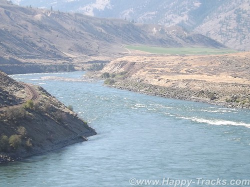
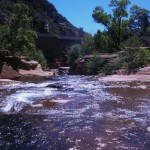
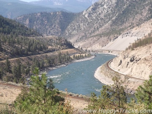
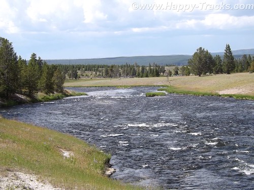
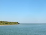
The scenery through Fraser Canyon was beautiful with the river leading the way. The landscape was greener than the day before.
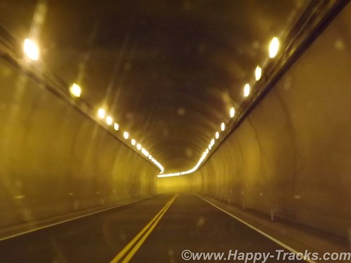
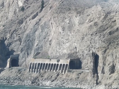
There are 7 tunnels built on the high banks of the river to allow the Trans-Canada highway to pass next to the rock bluffs and the railroad tracks.
One unusual thing here is that there are single railroad tracks on each side of the river. One set of tracks was built by the US government and one set was built by the Canadians. Each was asserting their presence and ownership of the territory and not cooperating at all. The US trains ran on one side of the river both north and south, the Canadian trains ran on the other side of the river both north and south. It’s only been in the last 15 years that agreement was finally reached to allow cooperation so one set of tracks is used for northbound and one set is used for southbound, increasing the efficiency for both.
We noted that the steep drop offs from the highway are protected by guardrails in only some areas but not others. While we aren’t certain, it seemed that the places where a vehicle going off the road and hindering rail traffic was a concern, there was a rail. Where going off the highway did not endanger the tracks below, there was no rail. Hmmm.
The Fraser Canyon is popular tourist territory with water activities like rafting and fishing and the mountains on either side hosting winter snow activities along with hiking and climbing.
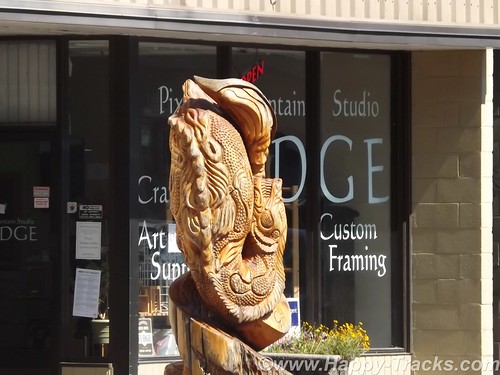
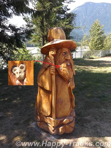
The canyon narrowed down to funnel us past the city of Hope where we took a break for lunch. Hope is a scenic little town with the river banks and an abundance of carved wood statues.
The statues are carved where the tree grew with the root structure. One story we read said that the trees were falling victim to blight and the chainsaw carvings were seen as a way to make use of the dying trees. Other chainsaw carvings were commissioned works. One of my favorites was the troll with the mouse in his beard.
Shortly after passing out of Hope, we turned west through farmland backing to low mountains and made our way toward Vancouver.
You can see all of the pictures from this leg of the trip here.
We invite you to continue along with us and hope you enjoy the account!
Tag Archives: traffic
Summer 2014: Alaska via the AlCan; Exit Glacier to Homer
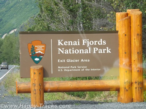
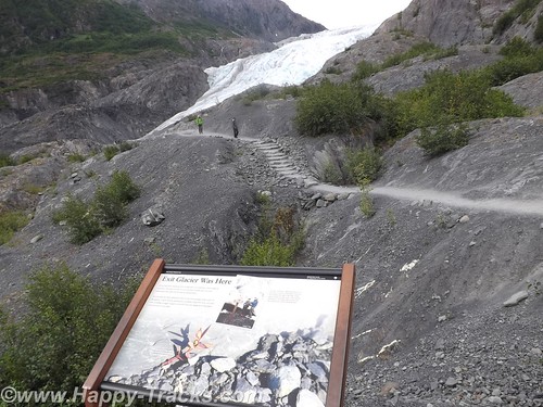
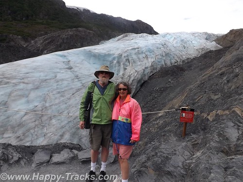
Our National Park system was established near the turn of the 20th century. We’ve come to learn that many of our country’s national parks are considerably newer than that. For example, the Kenai Fjords National Monument was established in 1978 by Executive Order of President Jimmy Carter. The Kenai Fjords National Park was established in 1980 with the Alaska National Interest Lands Conservation Act. Within the Kenai Fjords National Park is Exit Glacier. The name came from a newspaper story describing the first recorded passage across the Harding Icefield saying those crossing the icefield would soon be leaving via the “exit glacier”.
To access the Exit Glacier, we drove along a spur road off the Seward Highway for about 2 miles to the visitor center and a parking lot. There was a pulloff along the way which offered a view of the foot of the glacier and the stream flowing from there towards Resurrection Bay. Along this road were several tour guides both for the glacier and for kayak and other nature tours.
In the pulloff (posted with no camping signs), one visitor had a popup tent camper setup and appeared to be taking pictures perhaps for an advertisement or story layout of some sort.
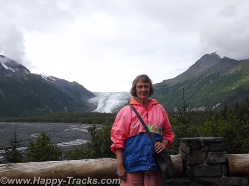
On the drive in, we passed signs marking the recession of the glacier as this current ice age plays out. The Ranger Station area includes a parking area including space for RV and bus parking which also took the overflow from the car parking area. It was a sunny and warm Saturday so there were many cars in the lot. The building includes some interpretive displays as well as a small shopping area along with the ever-present warning to beware of the bears and not to feed the wildlife. Ranger tours are available every couple of hours as well as a mid-day presentation at the visitor center.
We opted to walk on our own. Parts of the trail are ADA accessible. The accessible parts are relatively flat (and paved with asphalt or crushed gravel). That part of the trail goes to the rocky streambed at the foot of the glacier.
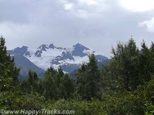
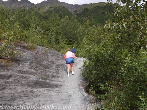
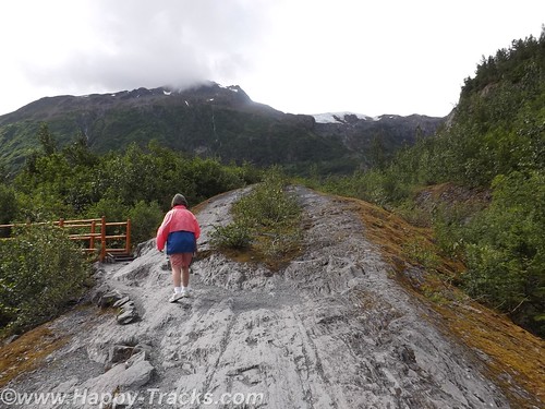
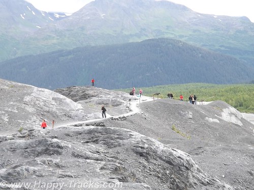
The trail also proceeds upward toward the glacier itself. Fairly easy walk if you’re in good health and there are places to step off and rest if that suits you. In several places the trail narrows so that you have to alternate for folks going up and down. There were a number of families on the trail from kid strollers to folks older than us. A bit more than halfway up the hill is a marker for where the edge of the glacier was in 1998. A half mile or more behind us was the marker for the 1980 edge.
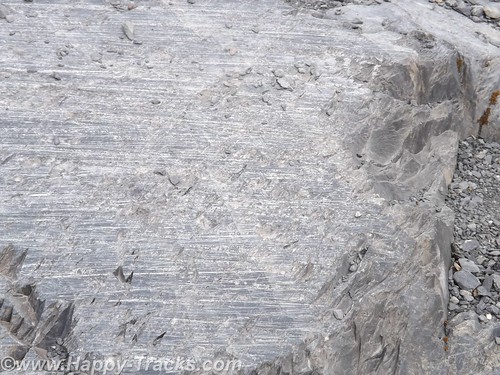
Along the way, you could see the drag marks in the rocks where the glacier had been moving. The rocks showed layers of lighter colored rock formed by mineral-laden steam pushed up from below which solidifies.
As the glacier recedes, moss and lichens take hold in the rock and slowly break it down to form soil. As the soil increases, smaller plants take root until eventually trees take root in the small crevasses.
While it was warm and sunny out, as you stood by the glacier you could feel the effects of the breeze blowing across miles of ice. Our light jackets felt good.
The glacial ice has a blue cast to it. We learned this is because the other colors of light are absorbed by the ice.
We meandered back down the hill and out onto the rocky streambed. The rocks were mainly rounded and varied in size from golfballs to softballs.
We stopped to look for postcards before making our way back to the truck and started driving north and west across the peninsula to head south.
We re-traced our route for about 30 miles before turning west. We stopped for lunch at another roadhouse that was doing a pretty good business. We sat at the counter and one of our dining companions ordered a beer with her lunch. First the server had to go find someone else to take her order (we don’t know if it was an age or training thing but the Alaskans seem to take alcohol more seriously than some other jurisdictions we’ve visited). Then the different server asked to see ID from the woman. She showed them her drivers license. After the server left, she remarked to us how they always ask for ID even though she told us she was 60. According to her, Alaska will mark your drivers license if you are convicted of DUI. She didn’t know whether that would prevent them from serving or just trigger a request for keys or a designated driver. Interesting. By the way, the burgers were very good.
As we continued on, we passed over a winding river that was full of fisherman even if not full of fish. We passed by the Funny River (another interesting name).
By the time we reached Soldotna, it was time to stretch our legs and grab a coffee. From the main road through town, Soldotna is a typical small crossroads town. Several motels, a couple of small shopping centers and restaurants along the main drive through town. Soldotna is sometimes referred to as red and green city as it boasts the only traffic lights (which create a bit of a jam) we’d seen since we got out of Anchorage!
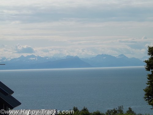
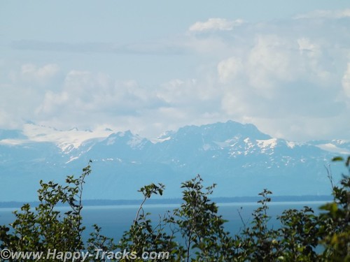
We’re approaching the western side of the peninsula and the highway runs parallel to the shore and along a high bluff. This gives us a great view across Cook Inlet to the line of the Chigmit Mountains, part of the Aleutian Range which stretches into the Aleutian Islands alongside the Bering Sea and northern Pacific Ocean. The view includes the highest point in the Aleutians, Redoubt Volcano (10,197 feet), and Iliamna Volcano (10,016 feet) which are part of the Aleutian trench of the Pacific Ring of Fire volcanoes.
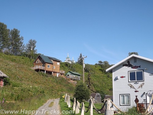
There are a number of B&Bs and vacation homes perched on the bluff with this gorgeous view. Also along the bluff is the The Transfiguration of Our Lord Russian Orthodox Church at Ninilchik.
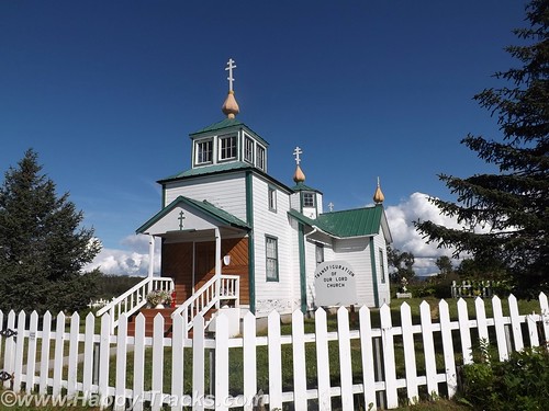
Ninilchik’s original settlers were Russians who migrated from Kodiak Island in 1847 before the sale of Alaska to the USA. Various sources indicate that the settlers chose to stay because it was too much effort to move back to Russia. The culture is still very definitely old Russian. Ninilchik is a popular tourist destination with halibut fishing and clams below the tide line. The Alaskan earthquake of 1964 caused part of the village to drop in elevation. Much of the town is now on the land (east) side of the highway.
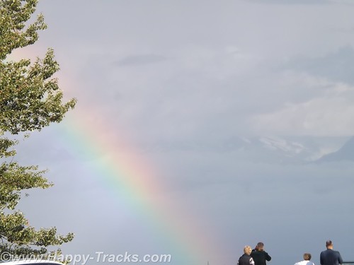
We continued on towards Homer. There is a scenic pulloff before the bluff descends above the town. We sighted a double rainbow and some more great scenery.
We went into town to secure lodging for the night. This task is easier said than done. We checked the chain motel (all full). We went to the Driftwood Inn which has cabins, RV park and lodge rooms but only the RV park had vacancies. The staff there was VERY, VERY helpful in trying to find us a room even making the calls for us. Apparently the Chamber of Commerce or Visitors Bureau maintains a website with listings of the various lodging which is updated with available rooms. The only place listed as having anything available was a B&B on past town. They called but only got voicemail. They left a message on our behalf and we decided to drive on out so we would be nearer should a room be available. We arrived at the B&B but still no callback. We went to the door but no one answered there either. We finally were able to talk to the innkeepers on the phone but they indicated they had rooms but only rented with a 3 night minimum. They did have a great view but we were off again.
We called down the list the folks at Driftwood gave us and finally got hold of cabins in Anchor Point (about 12 miles back up the road). The woman on the phone said she still had a cabin for one night available. I offered my credit card to hold it but she told us it wasn’t needed. She’d meet us there. OK, I guess. She gave us directions but we took the wrong turn. (Seems there’s two intersections with the highway and North Fork Road.) We called again and she corrected our way. We eventually reached the Sleepy Bear Cabins and got checked in. Sleepy Bear Cabins has 4 cabins and a couple of RV spots.
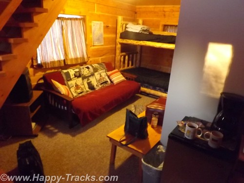
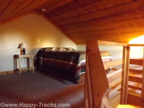
Our cabin would sleep 6 or so people, 2 on the futon downstairs, 2 on the bunkbeds downstairs and 2 in a double bed in the loft. We opted to sleep upstairs but had to remember to duck for the low ceilings and the really low ceiling over the stairs.
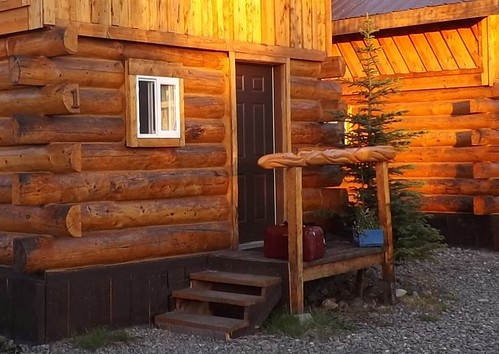
Our cabin was of logs and had some interesting fish carvings in a line for the small stoop rails.
There were no restaurants in the vicinity open so we had sandwiches from the refrigerator in the truck. This was only the second time we had to rely on our own supplies for a meal.
A good night’s sleep and we would try Homer again on Sunday.
You can see all of the pictures from this leg of the trip here.
We invite you to continue along with us and hope you enjoy the account!
Summer 2014: Alaska via the AlCan, Yellowstone National Park
Yellowstone National Park was established in 1872 by Act of Congress and signed by President Grant. It is widely thought to be the first national park in the world. The area was bypassed by the Lewis and Clark Expedition and exploration really started in the late 1860s. Initially, it was overseen by the US Army at Fort Yellowstone in the northern section of the park. Administration passed to the National Park Service following its establishment in 1917.
We left our cabin in Cody after breakfast and entered the park though the east entrance with plans to make a backward S and leave through the north entrance by day’s end.
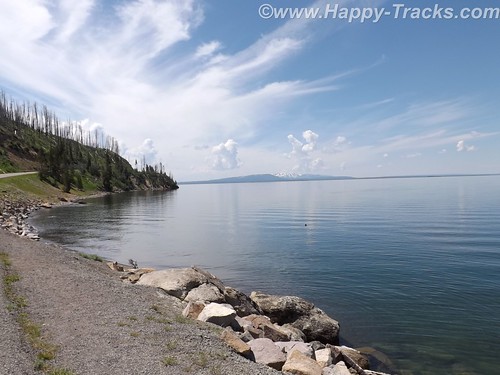
On entering the park, we received our separate handout sheet advising against feeding the animals and telling us that wild animals were dangerous. It also cautioned us to stay in the car when animals were nearby. The road in took us around the shoreline of Yellowstone Lake and into Lake Village.
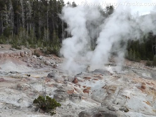
As we could first see the lake, we entered the area of the park where sulphur vents and you could smell it as soon as we entered the region. We stopped by the lake and took a few pictures then headed on towards Lake Village. On the way, there was a car stopped in the road for no apparent reason. As we got closer, we realize that they had stopped and gotten out of the car to take pictures of a bison in the field.
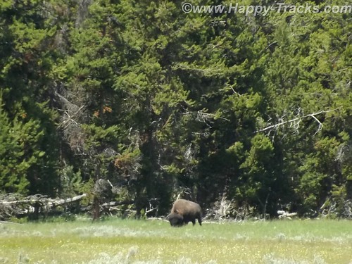
There was a pulloff nearby and we backed up to it and parked out of the road and took a picture of our own. We learned (and it would be reinforced throughout our trip) that when you see a car stopped, chances are someone has sighted a wild animal, even though the park literature reminds you frequently not to stop in the road.
We continued on to Lake Village where we would find a commercial area (gas, food, restaurants) as well as a visitor center. The ranger at the visitor center gave us the latest updates for expected eruptions at Old Faithful, one of our “must do” sights.
Shortly after we passed the West Thumb Information Station area and turned to continue on the Grand Loop Road, we were waved down by a young man who had been bicycling. His girlfriend had fallen off her bike and needed assistance. He said she was shaken up and we volunteered to call for help. Punching the OnStar button, we soon were in contact with their personnel who patched us through to emergency services in the park. While we were doing that, another truck stopped. Luckily, it was being driven by an off duty EMT who was able to assess her condition and was drafted to transport her and her bike over to the West Thumb first aid station. We informed the emergency services folks of the resolution and went on our way. While we were glad to be of assistance, we breathed a sigh of relief as we realized we would still be able to make the next eruption of Old Faithful if we got on our way.
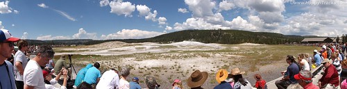
There was a crowd of people there, both for the geyser show and for the lodge, restaurant and shopping area. We found our spot on the viewing deck and waited for the show. As the time drew closer, more people crowded into the area.
While we were waiting, we saw steam erupting from the other geysers in the area but still we waited for the most famous one. After several smaller spurts and steam, the big show came and we were suitably impressed.
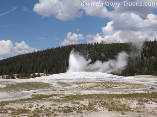
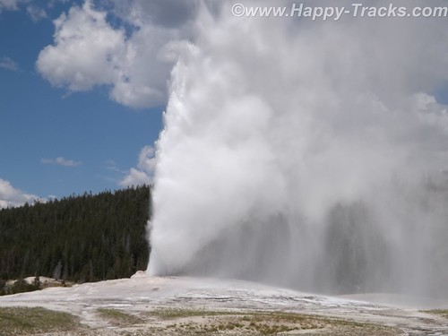
It is truly amazing to watch Mother Earth in action. We had seen pictures and video but its nothing like seeing it in person. One thing that no one ever mentioned was the sound and the noise. Anyone who has ever worked in a steam plant (such as a nuclear submarine) has nightmares about the sound of high velocity steam escaping. Wow.
After the show, we went into the Old Faithful Lodge for lunch and to visit the shops.
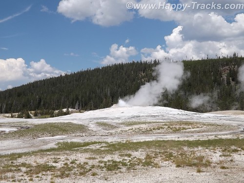
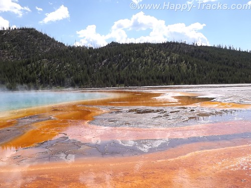
We continued on to the Grand Prismatic Spring. The parking area there is small and was very crowded with folks waiting for others to leave before being able to park. The hot spring is the largest in the US and the third largest in the world. First records of it appear in a trapper’s notes from the 1830s. The colors near the edges are the result of microbes in a mat around the mineral-rich water. The center blue area is sterile due to the heat and its color derives from its depth and purity.
The microbial mat is extremely fragile and there are numerous warnings and prohibitions against walking on or otherwise disturbing the mat. While we were there, someone’s hat blew into the pool. Park personnel remove things like that with poles. On August 2, shortly after our visit, a tourist’s aerial drone mounted camera crashed into the pool. It’s still being investigated about how (or if) to remove it and the owner is facing charges.
Connecting the parking lot and the spring is a pathway that includes a walkway over an ice cold stream fed from the mountains. What a contrast.
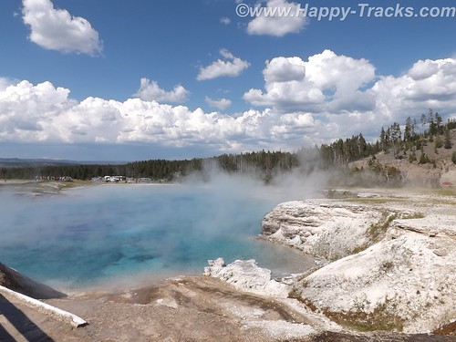
That area is the Midway Geyser Basin and contains the dormant Excelsior Geyser as well.
We continued around our backwards S on the Grand Loop Road to visit Steamboat Geyser, the world’s tallest active geyser. It infrequently (and unpredictably) has a major eruption up to 300 feet in the air. It had been almost a year since its last major eruption. It has more frequent minor eruptions, including the day we were there.
But as we started back towards the truck, the skies let loose and it poured rain. We had umbrellas and windbreaker/rain jackets…back in the truck! So we half walked, half ran back.
We continued our ride towards the north entrance and saw the now telltale sign of cars stopped along the road. 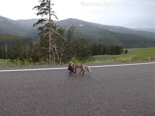
Animals? Sure enough, we saw this fox with something in its mouth coming along the road. We never were able to identify the prey in its mouth which appeared to be some sort of small mammal.
Traveling along, we again saw stopped cars, this time there were a number of them stopped in both lanes of the road. 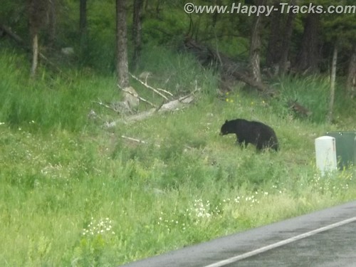
After a bit of sitting and waiting, we realized it was a black bear and three cubs working on crossing the road. Eventually, the adult bear crossed and the three cubs remained on the left side of the road. Then, to our absolute amazement, adults started getting out of their cars –with kids– and started walking up to where the bear and the cubs were on opposite sides of the road! Unbelievable! Finally some of the cars started moving by passing the parked and temporarily abandoned cars. When we were able to move on, the cubs remained on the left, the mother remained on the right and the humans kept on getting out and getting closer.
We stopped at Roosevelt Lodge and Cabins. This was the lodge used by President T. Roosevelt when he visited the area to hunt. There are also cabins, a restaurant and a small camping store there. We kept our comments about the bears and the tourists quiet as we weren’t sure how many of the patrons there had been part of the group. While paying for our purchases at the camping store, we got into a conversation with the clerk who was an older gentleman who had retired to this area from the New Bern area of NC.
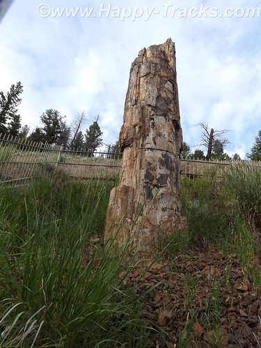
From there, we visited a petrified redwood tree that is the same as present-day redwoods in California, giving testament to a very different Yellowstone in the distant past.
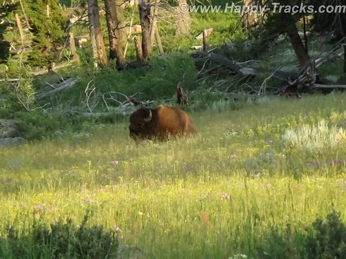
Our next wildlife sighting was another bison standing by himself in a grassy meadow. We found this one by ourselves without the aid of other cars.
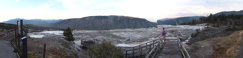
We next arrived at the Mammoth Hot Springs resort and campground at the site of the old Fort Yellowstone. The public buildings are reclaimed barracks and dining facilities. The springs are a series of cascading pools on a hill of travertine.
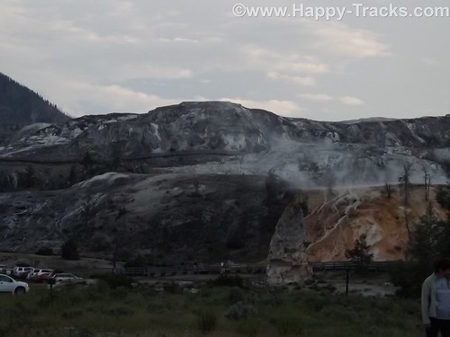
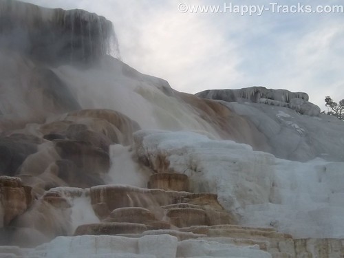
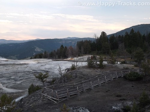
There is a roadway which winds up the hill and lets you look down on the pools and the historic district. These pools, still more hot springs, really give you a different view than the Prismatic Spring. There was a dormant hot spring cone, Liberty Cap, too.
Leaving the Mammoth Hot Springs, you wind down and behind the historic district and onto a winding road out of the park. Just as we reached the boundary, a herd of antelope was crossing the road along the stream bed. Approaching dusk prevents us getting more pictures.
As we exited the park, we followed the Yellowstone River through the canyon to Livingston MT where we found a motel around 11:00. The motel was a Best Western and had a covered garage with a keypad lock for parking which seemed unusual and we never did really figure out why. At first, we suspected the winter weather but it seemed to be the only motel in the area with that feature. It also had an indoor heated pool which our room’s door faced. The humidity outside the room was a reminder of the hot springs we had seen that day.
This is a longer than usual post but it also was a longer than usual day for us. While we don’t advise spending only a day when you get to visit Yellowstone, we proved you could actually see much of it in a day.
You can see all of the pictures from this leg of the trip here.
We invite you to continue along with us and hope you enjoy the account!
January 27: Old Friends Touring DC: Navy Memorial and National Portrait Gallery
A rare treat for the Old Friends weekend, we were able to tour on Sunday as well. Today included breakfast, church and then a trip to downtown DC to visit the Navy Memorial (site of the Lone Sailor) and the National Portrait Gallery.
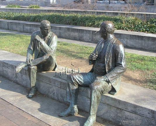
Our first stop after finding parking (which was free on the street where we were since it was Sunday), was a walking trip through Judiciary Square where we found these two gents deeply absorbed in an impromptu chess game. They didn’t include a timer. Russ pointed out that the board was also set wrong, not something to be noticed by the casual observer.
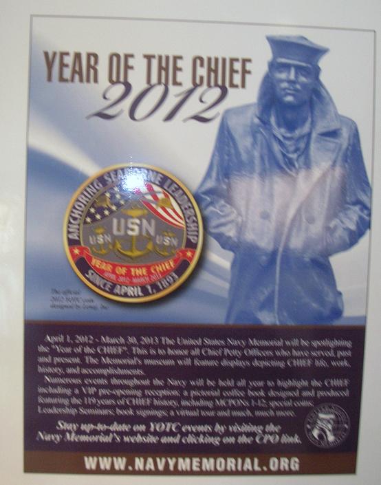
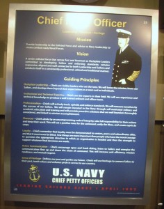
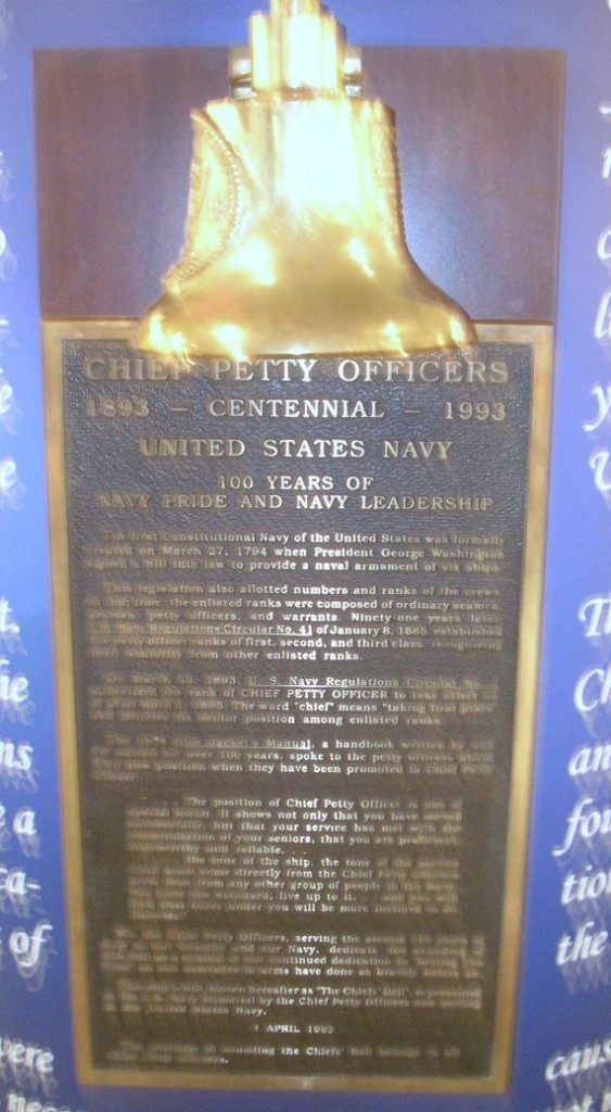
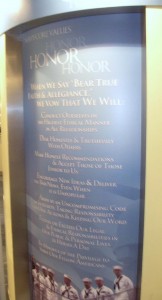
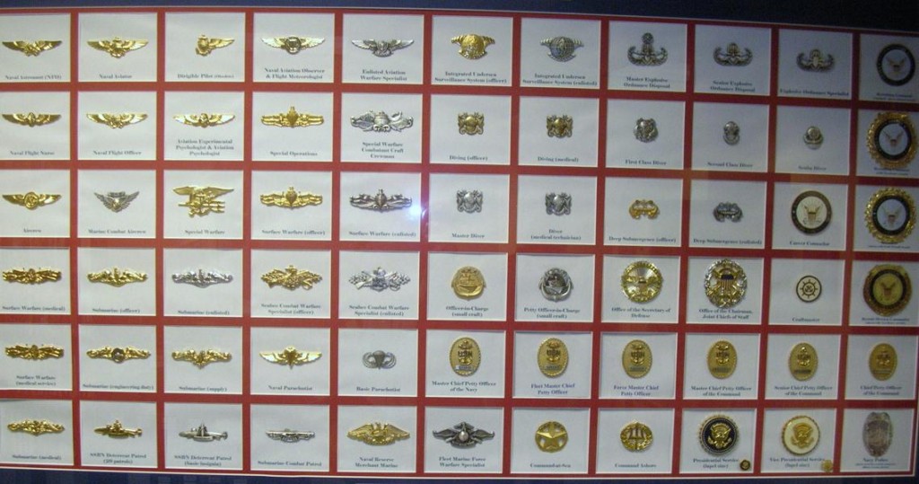
Our primary stop was just around the corner on Pennsylvania Avenue at the Navy Memorial. Best known for the statue of the Lone Sailor out front, there are exhibits and a theater inside. 2012 was celebrated as the Year of the Chief.
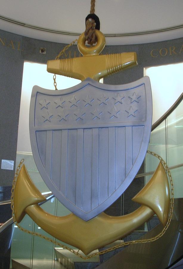
 This centerpiece hangs in the center of the spiral staircase leading down to the main exhibit floor. This one is beautifully made of wood with the woodgrain showing as the gold color with painted silver for the shield. This is a replica of the traditional Chief Petty Officer’s collar device, the fouled anchor.
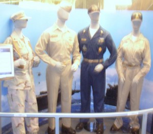
Chief Petty Officer uniforms
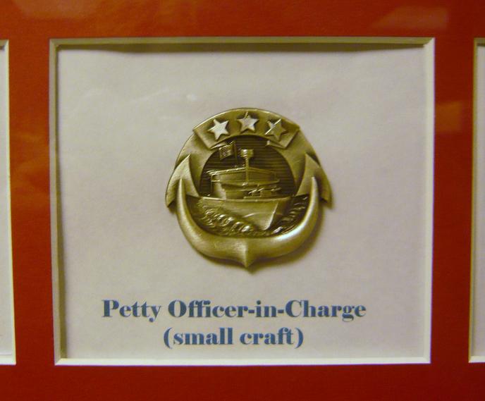
I’ll take a moment to apologize here for the quality of some of the pictures that follow. The lighting showed a glare on several of the displays. Normally, I’d reject those pictures but I believe the Navy Memorial needs to be shared a bit more and I’ll compromise the picture quality to give you a better idea what’s there.
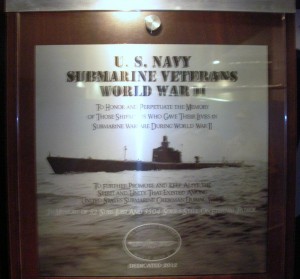
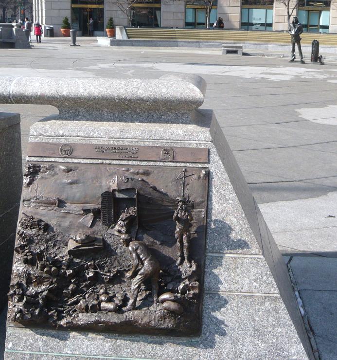
Memorial plaque for submarine sailors of WWII
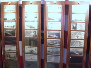
Multiple memorial plaques provided in exchange for donations. There were a number of displays similar to this one.
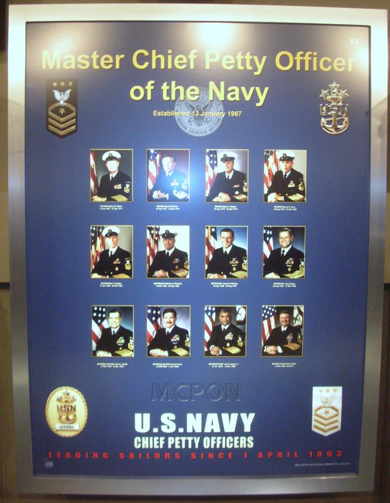
The Senior Enlisted Sailor in the Navy is the Master Chief Petty Officer of the Navy (MCPON). This display pays tribute to those who have served in this capacity. Of the 13 men who have served as MCPON, three were submarine-qualified (James Herdt 1998-2002; Terry Scott 2002-2006; and Rick West 2008-2012)
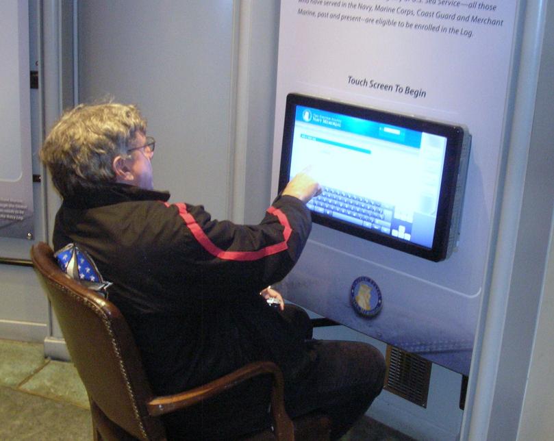 The Navy Memorial maintains a log that allows sailors or their families to enter pertinent data about the sailor as part of the memorial. Their goal is to include all Navy Sea Service Vets. Father Steve was looking things over but decided to complete the entry back at Chateau Pierre.
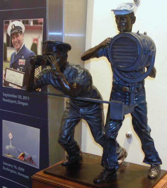
Signalmen and spotters served in good weather and bad.
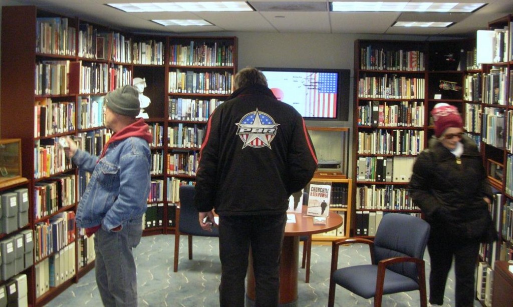
The Memorial includes a library of books (fiction and non-fiction) about the Navy and its sailors and also by some of the sailors.
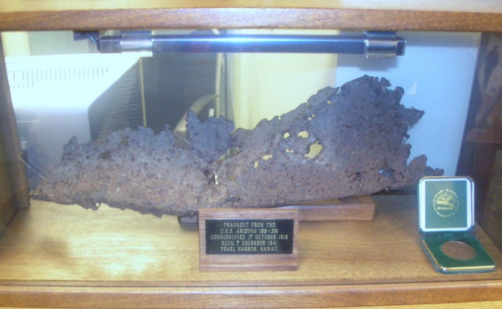
A piece of the USS Arizona, bombed and sunk in the attack on Pearl Harbor.
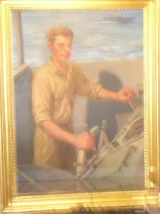
The display included portraits of Presidents who had served in the Navy. This one is John Kennedy. Also included were Lyndon Johnson, Richard Nixon, Gerald Ford, Jimmy Carter and George H.W. Bush.
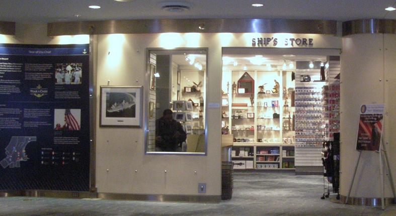
The Ship’s Store
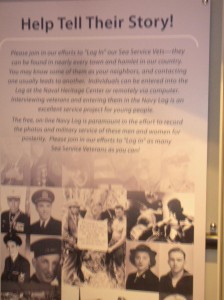
The Navy Memorial maintains a log of sea service veterans. This poster reminds us that sea service veterans are all around us and asks to help. Visit their website at www.NavyMemorial.org
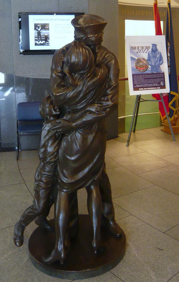
Statue depicts “The Kiss”, subject of a famous Life magazine cover at the end of WWII.
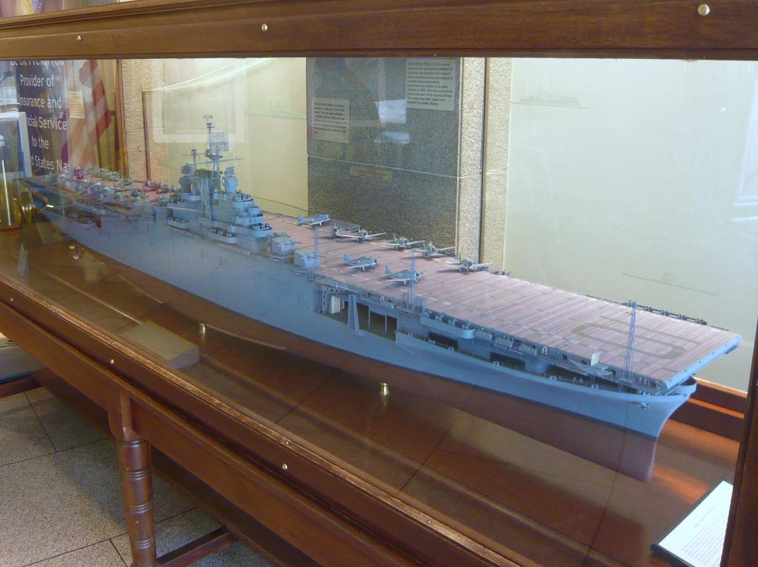
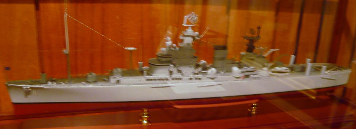
 There are a number of scale models of Navy ships on display.
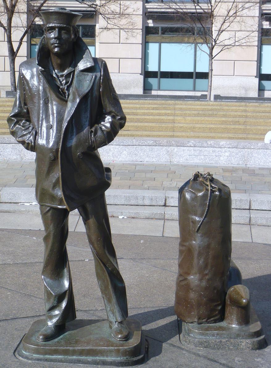
The Lone Sailor
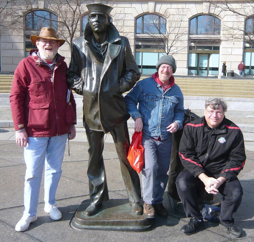
The Lone Sailor with friends
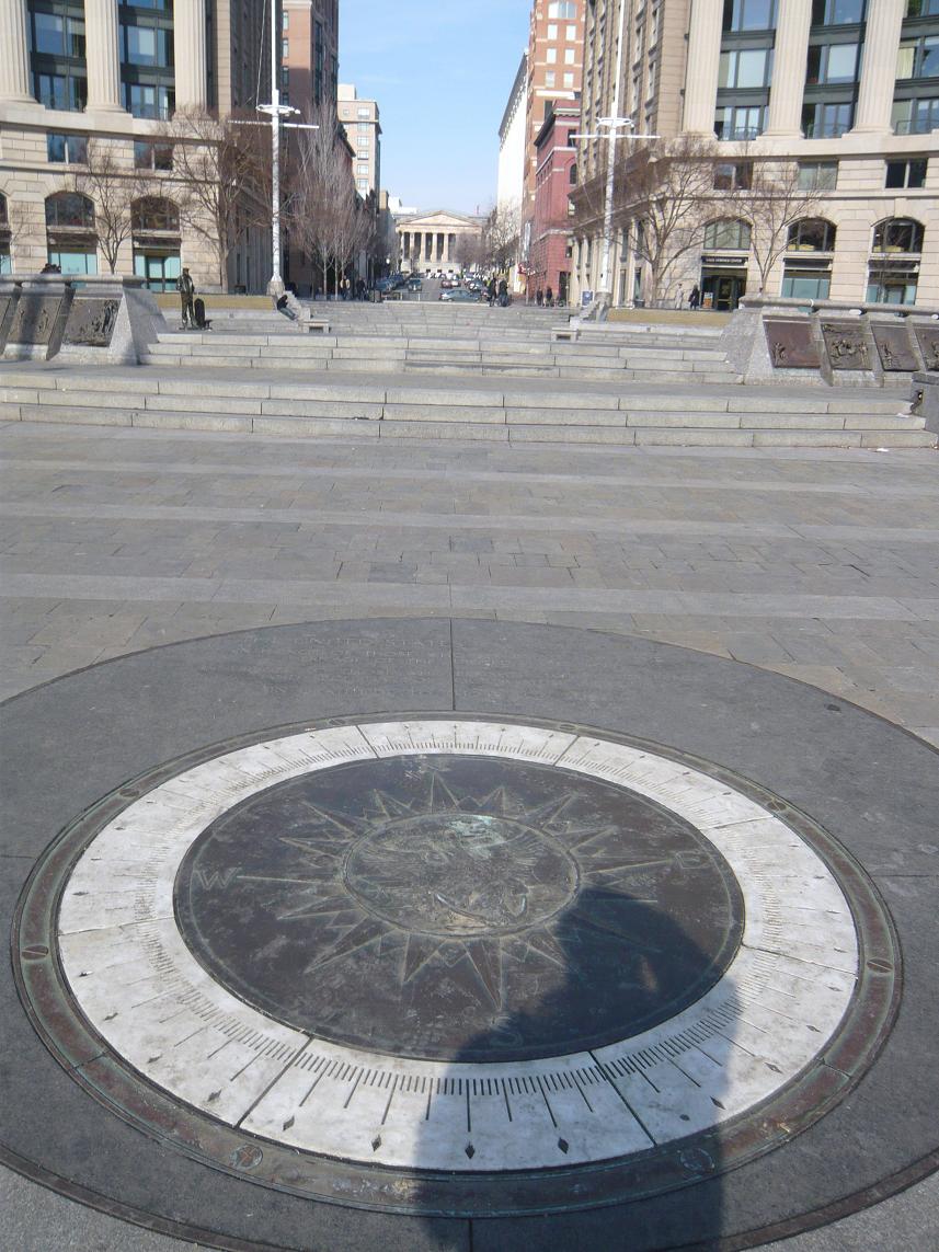
The compass in the Memorial Plaza.
After visiting the Navy Memorial we headed over to visit the National Portrait Gallery. The National Portrait Gallery is part of the Smithsonian Institution and is dedicated to the display of portraits of persons who have made significant contributions to American history and culture. There is an extensive display of Presidential portraiture including a wire sculpture of President George H.W. Bush pitching horseshoes. The American Art Museum (which shares the building) included exhibits displaying the national parks and other persons in our history. There was an exhibit depicting Amelia Earhart and artifacts from the US Patent Office.
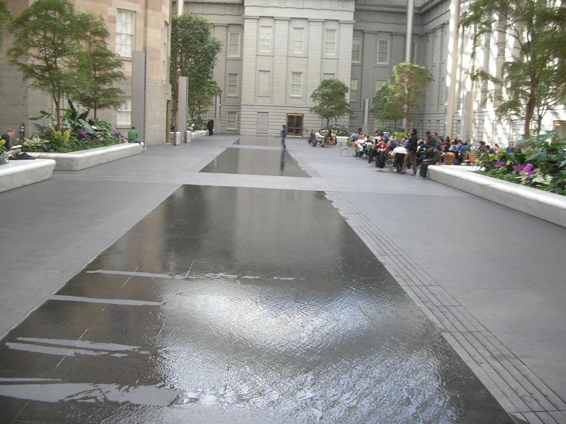
We highly recommend that you take the time to visit. While you’re there, allow time to take in the atrium in the center courtyard shown in the pictures below.
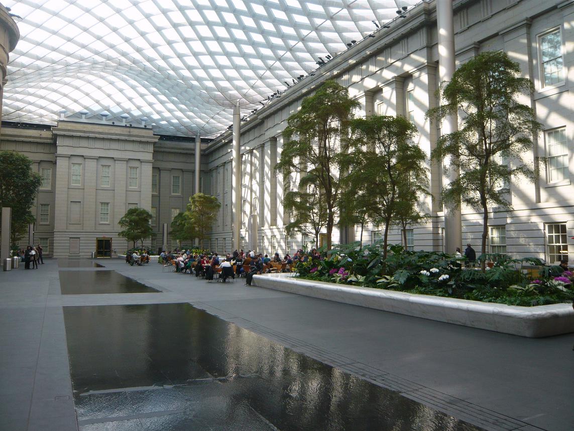
The water in this picture is no more than a quarter to half inch deep. Although it appears to be much deeper.
We chose to grab lunch in the atrium. There were a number of folks who seemed to be just enjoying the opportunity to relax and read or study in the pleasant temperatures and the sunshine coming through the glass roof. It sure beat the cold outside.
 After we left the Portrait Gallery, it was time for Russ to hit the road south while Father Steve, Betty and Keith headed back to Germantown.
Father Steve left on Monday via BWI where he experienced his unusual luck at finding delayed flights but arrived safely back at home, albeit a bit later than planned.
It was another great weekend with great friends, exploring the sights right here in our own backyard.
Columbus Day: Starting off Ugly and Staying out of the rain

Monday, October 8:
The federal recognition of Christopher Columbus’ landing in the Caribbean occurs on a Monday making for a 3 day weekend for those whose work recognizes this as a holiday. We were lucky that both Ryan’s and Keith’s employers considered it a day off.
") We cleared the room and checked out. Had a few more things we wanted to see and we needed to get home. First stop was the Orange Blossom Cafe to procure a legendary Apple Ugly. Sweets for breakfast wasn’t really going to be enough so next stop was Diamond Shoals Restaurant for a real breakfast involving eggs and bacon and we were headed north.
We cleared the room and checked out. Had a few more things we wanted to see and we needed to get home. First stop was the Orange Blossom Cafe to procure a legendary Apple Ugly. Sweets for breakfast wasn’t really going to be enough so next stop was Diamond Shoals Restaurant for a real breakfast involving eggs and bacon and we were headed north.
.Today’s plans include a trip up to Carova at the northern end of the barrier islands to hopefully find the wild horses. Betty and Keith’s last trip had been particularly productive in that regard and we hoped to share with Ryan.
The ride up Hatteras Island was more scenic than it had been coming in (since it was daylight and sunny!). We got to see the parasails in Canadian Hole and stopped to take a look at the renovations at Bodie Island Light. ") After we got to Nags Head, we shifted over to the beach road to find some recognizable landmarks from Ryan’s last trip (1993?). We had stayed at the Sea Oatel then (long gone) and the Holiday Inn Express (still there) and had really enjoyed the Keeper’s Galley restaurant (also gone, now a Sushi place).
After we got to Nags Head, we shifted over to the beach road to find some recognizable landmarks from Ryan’s last trip (1993?). We had stayed at the Sea Oatel then (long gone) and the Holiday Inn Express (still there) and had really enjoyed the Keeper’s Galley restaurant (also gone, now a Sushi place).
Somewhere along the way, it started to rain. When we got to Corolla, we took a short hop over to the beach access on  Albacore St. to visit another beached shipwreck we had discovered on a previous trip. We drove down a little ways to see what we’d come to see and then proceeded to go back the way we came.
A drift had built up on the Albacore Street ramp which had been no big deal on the way down to the beach but in going up the ramp, we found ourselves high-centered and blocking the ramp. We tried several ") things to get the truck loose and were in the process of digging as it appeared our only hope was to eliminate the sand drift that had high centered us. The winch didn’t help as it wasn’t functioning correctly and there was nothing to anchor to. (Note to self: Investigate pull pal.)
things to get the truck loose and were in the process of digging as it appeared our only hope was to eliminate the sand drift that had high centered us. The winch didn’t help as it wasn’t functioning correctly and there was nothing to anchor to. (Note to self: Investigate pull pal.)")
While we were digging, we saw a white pickup top the ramp and give us a short blast on the siren. In it were two young men who walked over and took a look and then told us they were headed down to the next ramp and would be back in a few to help get us out.
I continued digging while they circled around and came down the beach from another ramp. We hooked my tow strap to their truck and a gentle pull had us moving again.")
Recognizing the insignia on the truck as being Corolla Ocean Rescue I asked if there was a charge for the tow or even a suggested donation which they declined. Told me they were just doing their job of keeping the ramp clear for emergency use. Not quite sure I totally buy that but I sure appreciated their appearance and their help. Ryan noted the wardrobe of sweatsuits and bare feet.
Maybe they figured they’d have to haul this old guy to the hospital (or worse) if they let him keep digging. In any event, in my mind this is worthy of a shout out and much appreciated.
After we got down on the beach again, we headed north to the next ramp (why hadn’t I thought of that before getting stuck?) and headed back into Corolla for a restroom, place to change my wet jeans and maybe some lunch as the hour was advancing. We found it in the form of Dunkin Donuts.
We then headed on in the rain seeking the wild horses. We got a look at the Currituck Light as we drove by.")
We rode all the way up to the VA/NC line and saw none. OK, now what? Sometimes you see a few in the vicinity of the Post Office and Fire Department so we head over that way. More rain and no horses. Oh well, we tried. Time to throw in the towel and head for home.
")
")
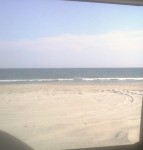
") As we pull past the town hall building, Betty spies something over there in the woods. We back up and sure enough, there is ONE horse huddled under a tree to stay out of the rain. At least someone has sense to come in out of the rain. That was not someone inside the truck. We snap a couple of wet and blurry pics and head towards home.
As we pull past the town hall building, Betty spies something over there in the woods. We back up and sure enough, there is ONE horse huddled under a tree to stay out of the rain. At least someone has sense to come in out of the rain. That was not someone inside the truck. We snap a couple of wet and blurry pics and head towards home. 

") We do make a quick stop for a couple of souvenirs and for gas and we’re off. By the time we got to the Border Station in Moyock, it was pouring rain which made it fun to get in and out and to refill the tires to regular pressure. I will commend their coin-op air for tires as being one of the best I’ve run into, sufficient pressure to be effective and it runs long enough to get to all four tires.
We do make a quick stop for a couple of souvenirs and for gas and we’re off. By the time we got to the Border Station in Moyock, it was pouring rain which made it fun to get in and out and to refill the tires to regular pressure. I will commend their coin-op air for tires as being one of the best I’ve run into, sufficient pressure to be effective and it runs long enough to get to all four tires. ")
") Border Station is located on the VA/NC line with parts of the store in one state and part in the other. Some things are treated differently tax wise in one state over the other so the gas pumps are in VA and the cigarettes and fast food are in NC.
Border Station is located on the VA/NC line with parts of the store in one state and part in the other. Some things are treated differently tax wise in one state over the other so the gas pumps are in VA and the cigarettes and fast food are in NC.
Much less traffic and a much quicker trip home than it had been down. We stopped at a Waffle House in Newport News for dinner. Wish we had been earlier to allow for some sightseeing there or to hit up Pitts BBQ in Williamsburg but it didn’t work out that way. We made it home around 11:00. We didn’t get quite as much rest and relaxation as we usually do on our OBX runs but it was still an enjoyable trip where we got to see our favorite beach and some great friends.
Next time, we’ll plan a little longer stay.")
“Quick” Trip to Hatteras with Family and Friends
Friday, Oct. 5 Worked all day but kept going because I knew the beach was beckoning. We pulled away from Ryan’s place on schedule around 6:00. Destination: Three days in Cape Hatteras National Seashore Recreation Area. We’d made reservations at the Cape Pines Motel which had been recommended for years from folks staying there but was somehow never our chosen landing base camp. During the shoulder season, their office closes at 10:00 pm so we knew we’d need to call ahead to have them leave the light on for us.
We figured a slow trip but had no idea just how much traffic there could be on 95 on the Friday evening of a three day (for many) weekend. We’d managed to avoid that particular trap with planning before. About 9:00 (3 hours into the trip), we called Cape Pines from Stafford and told them we expected to get there around 2:00. They left us instructions for getting in and we were to come down Saturday morning and take care of the registration details. It turned out to be about 3:30. One of our longest times for that trip. But it was worth it!
We hoped to meet Ryan’s friend and former roommate Sarah in Ocracoke over the weekend and also our friend Bruce who would be staying at the Cape Pines.
Saturday, Oct. 6 : The alarm went off promptly at 8:00. Darn it! Using the cell phone alarm made it an unusual noise and not an automatic reach out and slap it so we were up.
It was a beautiful morning despite the rapidity with which it arrived. We got all checked in and then met Bruce over at Diamond Shoals for breakfast and headed towards Ocracoke to meet Sarah.
We had heard there was a bit of a backup on the Hatteras to Ocracoke ferry because of shoaling and the need to run smaller ferries at slower  speeds. During the day, departures are still every 30 minutes so the wait wasn’t that long. There were a couple of large vehicles (a motorhome towing a vehicle and a gasoline tanker) so we feared being delayed but turned out not to be a problem as the tanker was going later.
 The ferry was crowded and we slowed in a couple of spots to clear the dredge and the returning ferry in the narrow channel. It was a new experience for Ryan and we enjoyed the time in the sun. After disembarking at the northern end of Ocracoke, we headed to the south end of the island through the village to meet Sarah where the big ferry had dropped her as she left her car on the mainland.
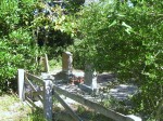
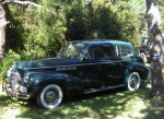
She reported the ride was pleasant but not well-suited for reading as she had just too much motion going on to be comfortable. We left the trucks and started walking the street. Our obligatory stop at Mermaid’s Folly was fruitful with a new skirt joining us. Bruce and Keith left the ladies to move the trucks from the one hour parking zone. We rejoined the ladies on Howard Street at the Village Craftsmen. Managed to spot an old graveyard inside someone’s yard. Also managed to spy a 1940 Buick looking all spiffy and well-preserved. Somehow, the ladies had managed to avoid seeing the dead snake in the road which was a good thing.
 It had been a while since breakfast and lunch was in order. We decided to try Dajio which had been recommended but never tried. We had been missing a treat. Various sandwiches and the bisque were delectable and just the right amount of food for our hungry group. For reference, the ladies room is apparently interesting as well. We spotted numerous rental golf carts and scooters and discussed those as ways to get about on the island.
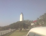
We headed back to the trucks to go take care of the paying of the toll (or whatever you call the fee to drive on the beach now) and then off in the general direction of the beach with a  stop by the Ocracoke Lighthouse . and then to Keith’s favorite part of Ocracoke, Southpoint and the beaches.
There had been chatter in the truck about this and that but as we cleared the dune line, it got real quiet and then we heard from the backseat just one word, “Wow.” We rode down to the point and got out to walk about a bit. This is heaven. Pictures do a better job than words but don’t adequately capture it.
After a bit, we got back in the truck (with someone unknowingly leaving his “nice” flip flops setting on the front bumper) and drove north as far as the closure
  for a turtle nest and then back to the pavement by way of the airport and then north to the
  pony pens. Today there were a few out in the enclosure but none near to the observation platform.
Then it was back to the Hatteras Ferry where we shared the ride with the gasoline tanker we had seen earlier. The combination of its weight with the shoaling channel and the smaller ferry left us with empty spaces as the sun began to set.
Dinner was next on the agenda and Rusty’s was the place. A big breakfast and lunch left Betty and Keith not finishing but the sea air had awakened Ryan’s appetite. We’ll just leave it that Rusty’s crew did not disappoint and there were no empty plates!
Our next stop was the Hatteras Island Inn where Ryan and Sarah were staying the night. Worth mentioning is that the long-awaited freshening seems to have gotten started inside the rooms with fresh paint and a generally cheerier appearance. The planned improvements in amenities and outside freshening aren’t there yet but there’s hope. The ladies reported satisfaction with their accommodations when we met for breakfast next morning.
The remaining three of us headed to the Cape Pines and fairly quickly called it a night. Apparently little sleep and sea air brought the sandman quickly.
A Different Beach and An Anniversary
Thursday April 26 found us traveling around Currituck County and Corolla at the northern end of the Outer Banks. It also marked the occasion of our 32nd wedding anniversary. Congratulations to us!
 We were staying at the Hampton Inn in Corolla. It’s located beachfront and we were in a “partial view” room. Partial view means you are on the side of the building.
 Currently, Hampton Inn has vacant land on both sides so it’s really a pretty good view of undeveloped Outer Banks with low scrub growth, the dune line and the water. Since the National Audubon Society decided (after years of paying the lower conservation area tax rate) that the land donated to them had no value as conservation, they decided a couple of years ago to sell it off for future development and $25 million. Seems a little underhanded to me as they were suing to shut down public access to much of the Cape Hatteras National Seashore Recreation Area just 20-30 miles south but there was apparently nothing illegal about the transaction. The development called Pine Island will fill in the area to the north and south of the Hampton soon as construction is currently underway.
After breakfast, we decided to head to the beach for a walk. The Hampton has a boardwalk over the dunes and we headed that way then north along the shore. It was a glorious day. We appreciated our jackets and met another couple walking along the shore. We continued as far the first few houses. Individual homes had boardwalks over the dune line. 


 As the wind moves the sand, the boardwalks get covered and homeowners build new ones, sometimes on top of the old one! It makes for an interesting sight with the double decker boardwalk with the lower level being only a few feet below the new one.
In our investigations, we had discovered there was another shipwreck sometimes visible next to the dune line in Corolla. Since our adventures last year, we have sort of “gotten into” finding the wrecks on the Outer Banks. With the shifts in sand due to the storms and just routine erosion by wind and water, what’s visible today may be buried tomorrow and vice versa.
Armed with an address for the house in front of the wreckage, we drove to Corolla where the Metropolis site is marked with an historic marker alongside Hwy. 12. We also discovered that Corolla has no on street parking. It looked like we would park n the shopping center and walk the half mile to the beach but we discovered a public access (including vehicle) at the end of the street. Carefully reading the sign, we discover that Currituck County allows driving on the beach from October 1 to April 30! Score! We drive the truck over the ramp to discover the beach is pretty much hard pack, similar to the beach at Daytona. While I wouldn’t recommend it in 2wd, it’s potentially doable.
The description we’d seen of the Metropolis indicated it was visible depending on the tides, erosion and the amount of digging the kids (primarily) had done on the beach and sometimes gave off the aroma of turpentine (pine). From the marker, we learned it was a steamer that had wrecked in 1878 and lost 85 lives. As a result of the tragedy, changes were made in the Coast Guard policies regarding beach rescue. We walked around a bit and took a few pictures and decided to drive along and see what the beaches there were like.


 The hard pack continued north all the way to the fence which separates the “4wd area” at the north edge of Corolla. The fence is primarily to keep the wild ponies out of town. There is a walk through gate (unlocked) with enough of a turn to keep the horses from walking through. There is a also a drive through gate which is locked and limited to “authorized vehicles” only. We took a couple of pictures and headed back south. The beach was pretty sparsely populated. We did see one or two other vehicles with a fisherman and all his gear and some tracks from earlier in the day. We headed back south just a short distance to the first off ramp which came out by the Corolla Lighthouse and turned north into the 4wd area.


The local news is abuzz with the Currituck County Commission considering adding a fee for a permit for the 4wd area beaches. In the past year, the tour companies which conduct the wild horse tours getting attention due to the amount of traffic they generate in the residential areas as well as a number fo folks not giving the horses the distance the rules require. On past trips, we had seen a few of the horses but always back behind the dunes in the residential areas. On this trip, we saw the horse on the beach. We were seeing more horses than we ever had seen anywhere and they were all on the beach. By the time we had gone north to the Virginia state line and back, we counted 44! For the most part, they were in groups of 5 or 6 but there was one by itself. We just couldn’t believe it. 44 horses sighted over a period of around two hours!


 The one horse by itself was at the foot of the dunes and eating the sea oat plants. I guess this is near the embodiment of the question: What am I supposed to do if I see an endangered animal eating an endangered plant? Neither comes under the category of endangered but both are protected.
One group of 3 or 4 were in the dunes next to another discovery for us, a life saving station! We had visited several on the Hatteras and Ocracoke Islands but not one that far north. It turns out that this one, Wash Woods, had been in service until the 1950s and was restored in 1999. It is currently in use as the Twiddy Real Estate office for the area. Parked outside was a neat bus that had been restored as well for touring the 4wd area.


As we came off the beach, we were in search of the deli where we had those terrific sandwiches on an earlier trip with friends Donna and Mike. We found the building but it was obviously in the process of changing tenants. Across the parking lot was the OBX Deli and Cheesesteaks which we hoped was the same establishment in a new location. As it turned out, it was another new business with a phenomenal selection of fudge and other candies but the deli sandwich was nothing special. It was good but disappointing after psyching ourselves up for the other place.
After lunch, we ventured over to the shops around the lighthouse for a couple of souvenirs and then went back onto the beach to see where we came out if we headed south. We continued south past the Hampton and the houses of Pine Island. Just offshore, maybe 20 years, we discovered a previously unknown to us piece of wreckage sticking up out of the water.  There were three pieces to it, 2 looked as if they could have been most anything, but the third was definitely machinery. It was shaped somewhat like an engine connecting rod (its the part that moves up and down and transmits the rotational motion of an engine’s crankshaft to up and down motion of a piston). I did a little internet research afterwards and found another reference to its existence but no help with identification. A gentleman walking along the beach also pointed out that there was a piece of wood further along the beach that could easily be wreckage as well. So we continued along to find a strong straight piece of wood with the rusty iron spikes common to the wrecks to be found in this area.
We continued along into Duck. The beaches in Duck are also open to drive but there is no public access from the town. It appears the only accesses are on private property or from the beach, as we entered and exited. As we got into Duck, the sand was softer and I was beginning to regret not lowering the tire pressure more when we had entered the beach. The beach also was getting narrower as it got softer so we turned around within sight of the Research Pier.
We traveled back north and exited the beach where we had entered in Corolla. We treated the truck to a full tank and went back to the hotel with plans for dinner at the Rt. 12 Steak and Seafood. As we were standing outside the doors, we ran into one of those fellows who is able to see the virtually invisible mark our family carries that apparently says “Talk to me”. He proceeded to share that business in America should be conducted more standing by the tailgate of a pickup truck than in an office or over the exchange of documents. After telling us how he had just worked out the details of the plumbing for his construction there, he launched into his political leanings and his opinion of the current occupant of the White House. Not generally a conversation one gets into with someone you just saw (but haven’t yet met) but apparently it worked for him.
Dinner was Shrimp Aristotle and Broiled shrimp. The Shrimp Aristotle was a combination of a cheesy garlic sauce with olives and was quite tasty. The broiled shrimp also pleased the palate. The vegetable medley (green beans, tomato and carrots) was just a bit too close to raw for our tastes but complemented the meal well. After dinner, we walked the shops which were mostly closed and then headed back to the Hampton and eventually to bed where the day’s activities in the sunshine and fresh air lead to a peaceful sleep.
Important numbers from today:
44 horses
32 years
3 new to us shipwrecks
1 new life saving station.
1 new beach where we could ride and enjoy the sights.
Friends Playing Tourists in DC: A Tribute to Our Military Heroes (Part 2.2)
From the Declaration monument, we made our way to one of the newer and more well-known memorials, the World War II Memorial. It is both striking in its design (even with the water drained for the cold weather as it is now) and awe-inspiring in its sobriety. It is also very popular at all times of year.
The World War II Memorial honors the service of sixteen million members of the Armed Forces of the United States of America, the support of countless millions on the home front, and the ultimate sacrifice of 405,399 Americans. On May 29, 2004, a four-day “grand reunion” of veterans on the National Mall culminated in the dedication of this tribute to the legacy of “The Greatest Generation.” See more at the official website.
It is situated between the Washington and Lincoln adjacent to the Reflecting Pool.  This was the first time that Steve and Russ had been to see it.
The Memorial includes granite columns for each of the states, districts and territories that sent their sons and daughters to fight.

 Connecting the granite columns are bronze ropes just as the country was bound together in a common purpose. (More than a few lament the passing of these binds while rejoicing that their cause has ended.)
 At opposite ends of the circle are soaring pavilions to signify the two major fronts of the war, the Atlantic (sea, land and air) and the Pacific (sea, land and air).
 In the center of the circle are pools of water (during normally warmer months). At various spots are bronze bas-reliefs and engraved granite recalling significant events or thoughts of the period.
 One of my favorite parts of this Memorial is the wall of over 4,000 gold stars commemorating those who were casualties or missing after the war. (We didn’t get a picture of them.)


Our next stop was the Korean War Veterans Memorial, located southeast of the Lincoln  Memorial on the National Mall. The Memorial commemorates the many who died (USA 54,246 United Nations 628,833), went missing (USA 8,177 UN 470,267), captured (USA 7,140 UN 92,970), and wounded (USA 103,284 UN 1,064,453) for a country of people they never knew.


 The Memorial contains 19 larger-than-life figures are made from stainless steel and are depicted marching next to a wall of polished granite where a multitude of faces look on. There is something haunting in the sculpture as well as the faces etched and reflections.


 The visit to the Korean Veterans Memorial was a first for the guys.
Our next stop was the Iwo Jima Memorial.
“The United States Marine Corps War Memorial stands as a symbol of this grateful nation’s esteem for the honored dead of the U.S. Marine Corps. While the statue depicts one of the most famous incidents of World War II, the memorial is dedicated to all Marines who have given their lives in the defense of the United States since 1775. ” You can read more about the Memorial at the official website.


The Pentagon September 11 Memorial opened on September 11, 2008 to honor the memory of the 184 people who died in the attack there on September 11, 2001 both on the ground and onboard the airplane. 
 The Memorial is located on the rounds of the Pentagon complex and not easily reached. The options include taking the Yellow or Blue Line Metro to Pentagon Station and then walking around to the opposite side of the complex or driving and parking on the opposite side of I-395 (although 5 handicap parking spaces are available next to the Memorial). There is also a walking tunnel under 395 from near the Pentagon City Mall. I believe that there is also a drop off for tour buses
 nearby so the “difficulty” and long walk is only if you’re traveling on your own.
For each person who died there, there is a bench rising from the ground on one end and suspended in the air on the other. Below each bench is a pool of moving water. On the end of the bench, the name of the person is engraved. You can tell whether the person was inside the Pentagon or onboard the airplane from which end of the bench with their name is anchored in the earth and which end is  elevated. If the anchored end is closer to the building, they were inside the Pentagon. If the anchored end is away from the building, they were onboard the airplane.
The benches are arranged based on the year of birth of the person. The younger children onboard the airplane are closer to the entrance. Thankfully, there are also fewer of them in that area. If more than one member of a family died during the attack, family names are listed in the reflecting pool under the bench, in addition to the separate benches that have been created for each individual. A wall along the edge of the Memorial begins at a height of 3 inches and rises to a height of 71 inches, the ages of the youngest and oldest victim of the attack, and approximately 85 paperbark maple trees are planted on the memorial grounds.


Former Sailors? Old Sailors? Long-time Friends: Playing tourists (Part 1)
The year was 19…well, it was some time ago. Russ, Steve and Keith were roommates and attending the same Navy school in the wilds of the Adirondacks when we all met Betty who was also a student at the same school at the same time. As you know, Betty and Keith eventually married and we’ve more or less stayed in touch or maybe gotten back in touch. On a pretty regular basis, the four of us get together to play tourist and catch up. It’s a great time. While I’ll not share the details of the conversations, Happy-Tracks is going to offer you the chance to tag along as we play tourist right here in the DC and Baltimore areas.
We’ll start on Thursday. Steve arrives via airplane at BWI-Thurgood Marshall. We used the occasion to conduct a little test of Maryland’s newish InterCounty Connector toll road. The results are in. It takes about the same time to get from our house to/from BWI whether you take the toll road or Warfield Road to Clarksville. By the way, a similar comparison test showed about the same time to get to/from work whether using the toll ICC or the non-toll Beltway. Oh well.
As Steve’s plane arrived in early afternoon, we stopped for lunch. At his request, we stopped at ChickFilA in Germantown.
On to the house. Russ arrived and we had a traditional eastern Eurpoean meal of sausage, chops, mushrooms and potatoes served with homemade mead (honeywine) which had been brewed by Ryan. Good hearty meal with good friends. After dinner, we moved on to Cape Codders and the Championship of Uno. The evening passed with good conversations until the early hours.
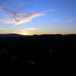
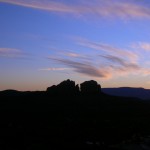
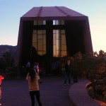
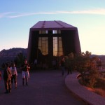
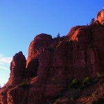
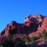
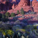
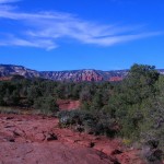
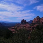
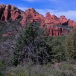
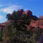
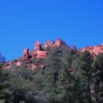
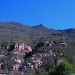
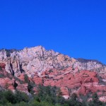
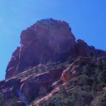
Turquoise and Red Rocks
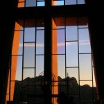
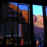
Sunday was to include a scenic detour, shopping, a water slide, some insight into a question that had been on my mind for quite a while and finished up the day with the full moon rising as we left a fascinating church structure. Still enjoying sleeping in a bit in the morning and breakfast just down the hall in the hotel lobby.
We swung by the Flagstaff WalMart to pick up a few supplies and then headed for Sedona. Since we were on vacation, it really wasn’t that big a deal when we missed our exit on the way, although the one we took looked familiar. We ended up winding through a residential area where the houses were set into the trees and looked like a combination of retirement cottages and weekend getaways. From a sheer directions standpoint, I think the Garmin could have gotten us back on the right track without quite as extensive a tour but it was a pleasant diversion to somewhere we hadn’t seen before.
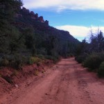
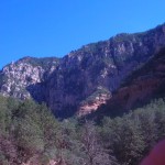
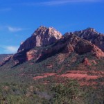
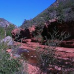
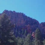
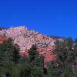
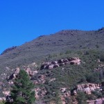
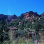
Rt. 89A takes one through Oak Creek Canyon and delivers some scenic forest and water views.


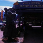
 Also along this stretch of 89A is a bridge across a gully known as Hoel’s Wash. Adjacent to Hoel’s Wash is Hoels Indian Shop and Rental Cabins. The open sign was lit so we stopped and went in. The merchandise was all Indian-themed and Mr. Hoel was very knowledgeable about his merchandise and his artists. We probably spent the better part of an hour looking at EVERYTHING and we found the piece that was “it”. Mr. Hoel wrapped it up and we were once again on our way. (It was a ring by Greg Lewis but I have no pictures. It was a gift for our daughter.)
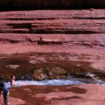
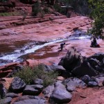
 Next along the way is Slide Rock Park, a joint venture between the US Forest Service and
 Arizona State Parks. Originally the Pendley Homestead, the park is a 43-acre historic apple farm located in Oak Creek Canyon. Frank L. Pendley, having arrived in the canyon in 1907, formally acquired the land under the Homestead Act in 1910. Due to his pioneering innovation, he succeeded where others failed by establishing a unique irrigation system still in use by the park today. This allowed Pendley to plant his first apple orchard in 1912, beginning the pattern of agricultural development that has dominated the site since that time. Pendley also grew garden produce and kept some livestock. Historically significant because of early efforts at agriculture and the 1930’s addition of guest cottages (no longer used). Recreationally, its significance is tied to the natural water chute and slide.
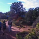
There were a number of families and small groups enjoying the park during our visit. Only one family seemed to be actually in the water and on the slide though. The rest were enjoying the sun and the view as we were. 

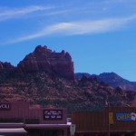
We spent some time enjoying the warm sunshine and then trekked back to our rented car to head into Sedona. The midday ride was a bit faster-paced than yesterday’s but not rushed at all. As we had scoped out the town somewhat, we quickly recognized that an on-street parking spot would work and lucked into finding one in the first block or so. We had some time and wandered about trying to find just the right spot for a light lunch. The Canyon Breeze is relatively open in a food-court sort of way and we chose tacos. My experience with tacos had always been either the crunchy corn shells or a soft flour more  like a burrito. These were flour but with some crunch. A bit lighter and a good flavor. They hit the spot quite well.
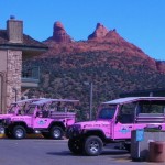
After we finished lunch, we made our way a few doors down to await our scheduled Jeep tour ride.
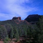
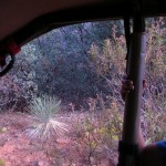
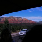
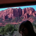
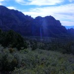
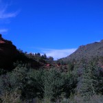
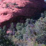
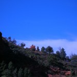
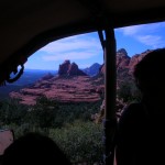
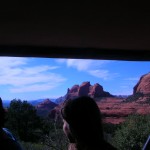
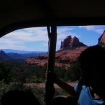
There were four of us scheduled to make the ride and the other two were being retrieved by our driver down the road a ways. We watched as other groups met with their drivers and departed. And then other groups would come along and depart with their driver. It was about to become an issue worth inquiring about when a red Jeep TJ pulled in off the main road and our driver, who introduced himself as Mike (I think), came to collect us. It turns out we had added another pair to the mix and there would be 6 of us plus our guide. Our tour was with the Red Rock Western Jeep Tours. It appears there are at least 6 tour companies in town specializing in this type of tour. Most of them use Jeep Wranglers of the YJ or TJ variety for those of you who know the difference. What they all share is modifications that include a higher canopy and additional seating in the rear area. In theory, the one we rode could carry 7 passengers plus the driver but it would be snug. The added seats were smooth and narrow so you really needed to cinch down on the seatbelt to stay in place when the going got rough.
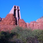
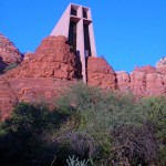
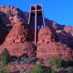
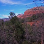
Our tour started going through town on our way to the Red Rock District of the Coconino National Forest. We passed through several traffic circles (or as they call them in Maryland — traffic calming devices!) We passed the house formerly owned by one of my personal favorites, Lucille Ball. A domineering and impressive structure with covered balcony porches overlooking the red rock landscape and the town of Sedona.
 This took us out Schnebly Road, named for one of the founders of the town. According to guide (and I add the appropriate disclaimer as all tour guides seem to have a blurry line between historical accuracy and delivering a good line, a practice commonly known by storytellers everywhere as not letting the facts ruin a good story) the town was to be named after the nearby Oak Creek Canyon but instead was named after one of the Schnebly brothers’ wives. Her death and the death of their only child within a few years lead to the Schneblys abandoning the area.
 National Forest. We passed through several traffic circles (or as they call them in Maryland — traffic calming devices!) We passed the house formerly owned by one of my personal favorites, Lucille Ball. A domineering and impressive structure with covered balcony porches overlooking the red rock landscape and the town of Sedona.
 This took us out Schnebly Road, named for one of the founders of the town. According to guide (and I add the appropriate disclaimer as all tour guides seem to have a blurry line between historical accuracy and delivering a good line, a practice commonly known by storytellers everywhere as not letting the facts ruin a good story) the town was to be named after the nearby Oak Creek Canyon but instead was named after one of the Schnebly brothers’ wives. Her death and the death of their only child within a few years lead to the Schneblys abandoning the area.
 Schnebly Road is typical US Forest Service (USFS) roadway, hard packed dirt and rock with gravel (of varying sizes up to softball size) which climbed up to our viewpoint. Our guide went out of his way to communicate the full feeling of the early stagecoach. (Translation: It was an uncomfortably rough ride, especially when combined with the seats described above.) This part actually surprised me. As most of the readers here would know, I recreationally travel/drive a 4×4 truck just to reach some otherwise inaccessible spots. I have often wondered why more folks didn’t share the interest and I wonder if their experience is with tour companies like this whose primary objective is to get the tour group from one spot to another on a schedule rather than to enjoy the journey. For example, traversing the same route, we would have lowered air pressure in tires to make it easier to negotiate the rocks and to make the ride more comfortable. Additionally we would have slowed down well below the 25 mph speed limit. In doing so, we would also have easily taken 6-8 hours to see the same sights that we were shown in 4 hours.
Old Bear Wallow
Climb this early stagecoach route along Schnebly Hill Road through Bear Wallow Canyon just below the Mogollon Rim to enjoy STUNNING VIEWS of Sedona and Oak Creek Canyon 2000 Feet below. Step onto Munds Wagon or Huckaby Trail and hear stories of Sedona’s early pioneer days. The 2-hour tour features a 4×4 excursion along the scenic volcanic Mogollon Rim Trail among the world’s largest continuous stand of Ponderosa Pines.Canyons & Cowboys
Your Red Rock Western Guide takes you through a scenic wonderland surrounded by seven majestic canyons into historic Dry Creek Basin. Relive early cowboy days with tales of MURDER AND MOONSHINE at the old “Van Derin” cabin, a focal point of your tour, permitted ONLY to select jeep tour companies.


The murder at the Van Derin cabin was never solved although it was suspected that robbery was the motive. Mike, being a good storyteller made it an engaging story, of course. The difficult-to-reach cabin could be much easier to reach if one were to approach from the opposite direction. In the middle of the last decade, that property was developed as an expensive country club with houses on the golf course. The economic bust of the last few years stopped that development after only a couple of memberships and houses were sold.
Final thoughts on the Jeep Tour: They took us to places we would not have gone nor found in the rental car. We got to see some of the surrounding area close up and heard local color stories that we would not have otherwise heard. I’m glad we went and it was money well-spent. I recommend that you take one at least once but that you keep in mind that this is not necessarily what your wacky friends who play with their 4x4s do when they go riding on the weekend. 
One more location we got to visit was the Chapel of the Holy Cross.
Built on a twin pinnacled spur about 250 feet high, jutting out of a thousand foot red rock wall, “solid as the Rock of Peter” the building of the Chapel was completed in April 1956. Just the physical construction was a physical miracle, overcoming difficult conditions to construct this chapel.
As before with the Watchtower, we arrived just before closing time for the day and it was located high up on the hill with a long winding ramp to the front doors. But the view was worth it! The wall behind the altar is made of glass with a floor to (very high) ceiling cross. The wall at the opposite end is also largely glass with the exception of two floor to ceiling doors. Around the perimeter the 14 Stations of the Cross were identified by Roman numerals formed from what appeared to be iron railroad spikes. Very dramatic! The pews were backless wooden benches and a woven tapestry hung on each of the side walls. We’ve included a few pictures and invite you to visit the website (link above).

 We finished the day with a last pass through the streets of Sedona and found a nice bar and grill, The Open Range. Looked like they enjoyed a brisk business and a nice view but since we were there after dark, the view was invisible. After finishing our dinner, we returned to Flagstaff via the Interstate and called it a night.