A young and skinny Theodore Roosevelt, Jr. made his way to the North Dakota from New York in 1883 to hunt bison. His time and experiences there shaped his perspective and the national conservation policy for decades to come. He was traveling to a place where he was an unknown and would not likely be warmly welcomed as he was an outsider, an Easterner and a “city slicker” to boot.
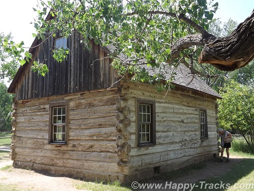
During his hunting trip, he expressed an interest in cattle ranching and eventually made an investment in that endeavor. In that year, the men who tended the cattle investment also built the Maltese Cross Cabin. Roosevelt’s investment of $14,000 (more than his annual salary at the time) was seen as an admission ticket to a different way of life in the wide open spaces. Dakota-grown cattle were seen as a solid investment partly because of the variety of grazing foods available and also because of the efforts of the Marquis de Morès to establish a meat packing industry to packing the meat in the Dakota territory and ship the meat in refrigerated rail cars to the markets in the east.
Roosevelt suffered double personal tragedies in February of 1884 when both his mother and his wife died the same day. The tragedy struck him hard (as to be expected) and he returned to his Dakota cabin for a period of mourning and introspection. He wrote a book about his hunting exploits and becoming a cattleman and expanded his holdings. He threw himself into his cattle raising business, becoming president of the Cattleman’s Association and stepping out to make peace with his neighbor, the Marquis, who was in jail on charges of murder. He also expanded his land holdings to include the Elkhorn Ranch.
Despite his personal warnings about overgrazing the territory, he also expanded his herds. In 1885, thieves stole his boat and he gave chase with two others eventually capturing the thieves downriver. He chose to walk the thieves back to authorities in Dickinson. The story is told in some places that he did so for the reward money or that he did so because they deserved a trial. In either event, his multiday walk to Dickinson with the perpetrators added to his reputation and helped dispel the view that he was a soft Easterner.
The seasons of 1886-1887 would prove disastrous to the cattle industry in Medora and eventually the town itself. The summer was brutally hot and dry with temperatures reaching 125F. Then after the grasses had been so devastated by the heat, the winter was equally extreme with temperatures as low as -41F. The cattle starved or froze that winter.
Although Roosevelt had been hit hard financially, he had grown tremendously in the eyes of the locals and eventually the nation. His embrace of the cowboy life contributed to his formation of the Rough Riders which brought him fame during the Spanish-American War and his experiences with the cattle contributed to his beliefs in conservation and management of our natural resources which carried into his Presidency. Although he would not return often or for long periods after 1887, the experiences shaped his actions later.
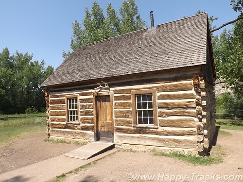
During Roosevelt’s presidency, the Maltese Cross cabin was exhibited at the World’s Fair in St. Louis, MO and at the Lewis and Clark Centennial Exposition in Portland, OR. Later it was moved to the state fairgrounds in Fargo, ND and then eventually to the state capitol grounds in Bismarck where it remained for 50 years. In 1959, the cabin was relocated to its present site and renovated. The most recent preservation work occurred in 2000.
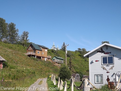
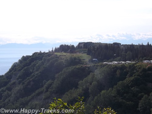
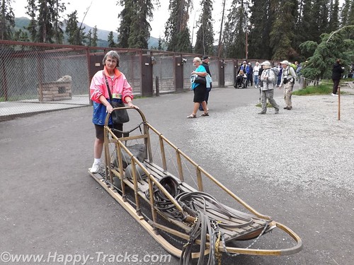
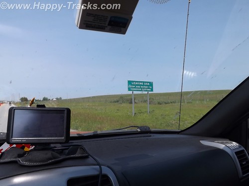
Fellow travelers onboard the SS Matanuska, the ferry we rode along the Inland Passage recommended that we include the North Dakota Badlands as part of our journey east as they are indeed different than the South Dakota Badlands.
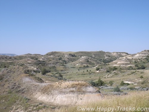
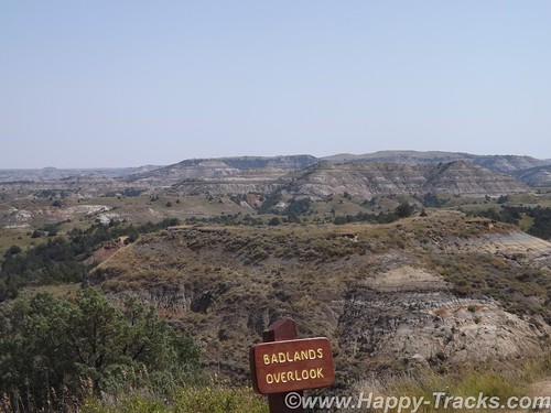
Theodore Roosevelt National Park is really three geographically separated areas of badlands in western North Dakota. The park covers 110 square miles of land in three sections: the North Unit, the South Unit, and the Elkhorn Ranch Unit.
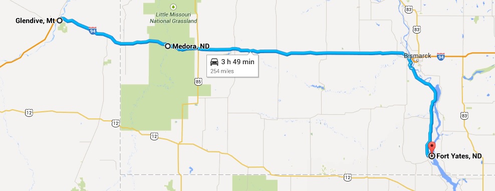
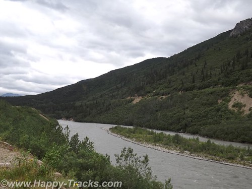
We visited only the park’s larger South Unit which lies alongside Interstate 94 near Medora, North Dakota. The smaller North Unit is situated about 80 mi (130 km) north of the South Unit, on U.S. Highway 85, just south of Watford City, North Dakota. Roosevelt’s Elkhorn Ranch is located between the North and South units, approximately 20 mi (32 km) west of US 85 and Fairfield, North Dakota. The Little Missouri River flows through all three units of the park. The Maah Daah Hey Trail connects all three units.
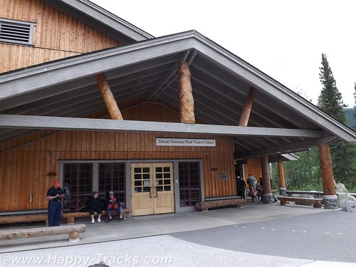
We started our visit in Medora at the South Unit Visitor Center. Located outside the visitor center is Roosevelt’s Maltese Cross cabin. The cabin has been expanded since its original building to include an upper half story and additional rooms on the main floor.
From there, we drove along East River Road alongside the Little Missouri River through the buttes. The topography of the North Dakota badlands seems almost to rise above the surrounding landscape while the South Dakota badlands seem to drop down into valleys and canyons below the surrounding landscape.
Generally the road was paved although we were stopped early on for construction ahead and the wait for a pilot car to guide us through the single lane in the dirt.

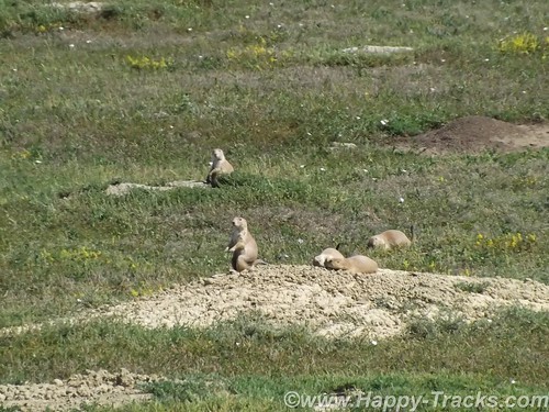
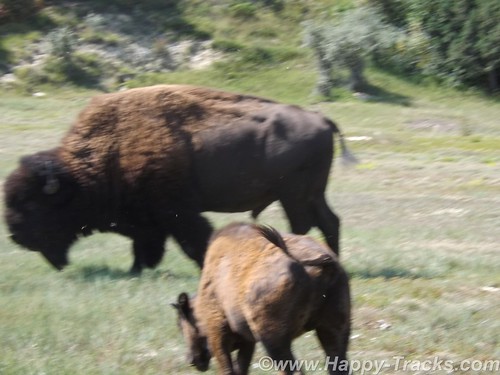
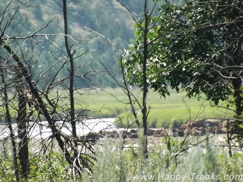
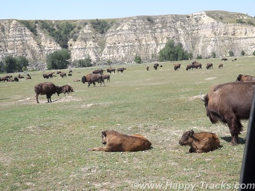
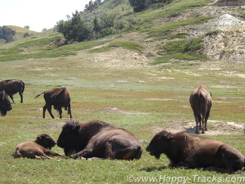
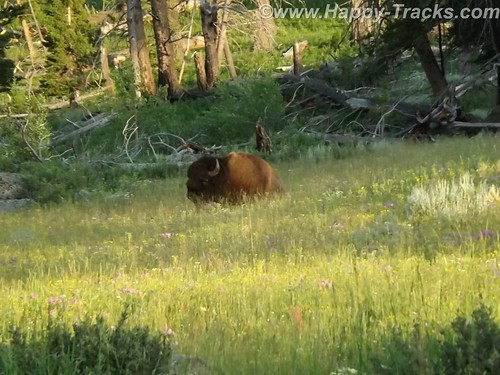
In our first stop, we were in the prairie dog area and they showed up for a few pictures. As we moved on again, we wound down to the waters edge and very soon were stopped for a view of the bison alongside the road.
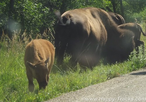
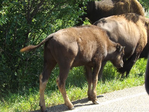
As we continued on, we were stopped further along by more bison along both sides of the road and in the road itself. There were several calves in the group and the interest at this particular spot seemed to include the water alongside the left side of the road. There were probably about 6 cars stopped to wait and it seemed almost as if the bison were playing.
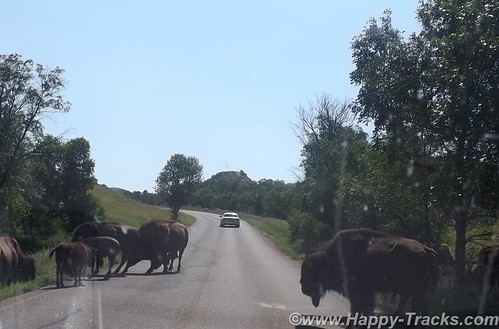
Three or four would be in the road and would finally start to move off to one side but before the first car could move, one or two more bison would come from the side. As they would move on, a couple would come from the other side of the road. Eventually, we would move on to more scenery.
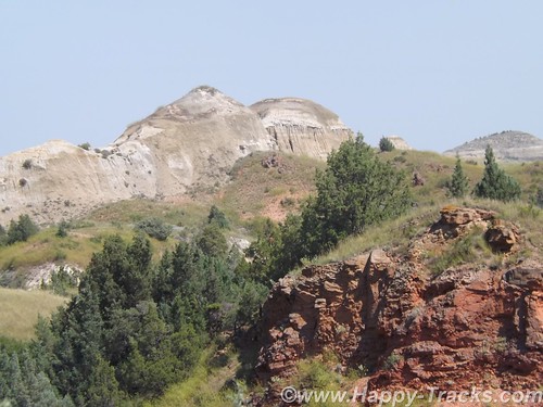
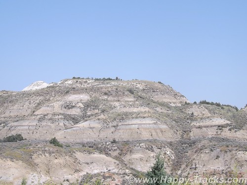
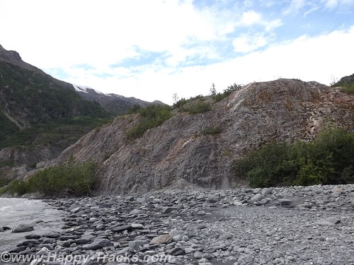
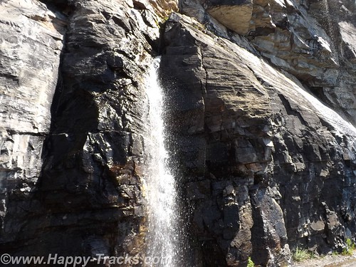
The earth showed the layers of different colors. The reds reflecting the iron content, the grays of granite-based soils, the blacks and browns of the thin layer of topsoil. There are veins of black coal. Fires in the veins of coal over the years have baked the sand and clay to a substance much like a clay brick in appearance and hardness which helps to hold the buttes and spires in place even as the lower, softer soil is eroded through the action of wind and water.
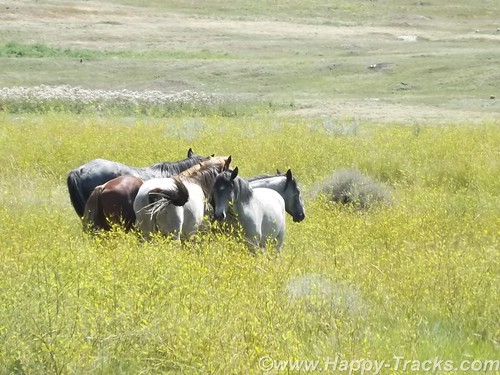
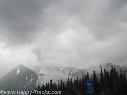
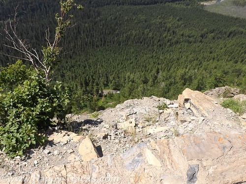
The road is a 36 miles long scenic loop which climbs and dips through all kinds of scenery as well as passing near recreation areas and hiking trails. Near one of the overlooks, we saw a quartet of horses off in a field. Chances are they were feral (of domesticated breed yet born in the wild). Towards the end, it drops again down near the river and a field where bison and prairie dogs seem to rule. The field, of several acres, included some dust wallows where the bison rolled around. You could also see that the older larger bison ruled, often causing the younger smaller ones to leave as they saw the large ones coming.
We circled on back to the visitors center where we got involved in conversation with other travelers. One was from northern Virginia and was just making their way west for this trip. Another was an old sub sailor who had served on the Nathaniel Greene and was meeting his former shipmate in the campgrounds later.
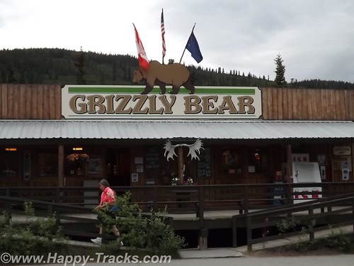
We went into Medora in search of a meal and to peruse the shops and then continue on our way to Ft. Yates for a night on the reservation.
You can see all of the pictures from this leg of the trip here.
We invite you to continue along with us and hope you enjoy the account!
Don’t forget the trip calendar we put together at CafePress. We think it turned out pretty well and would make a great holiday gift. 
Tag Archives: national park
Summer 2014: Alaska via the AlCan; Exit Glacier to Homer
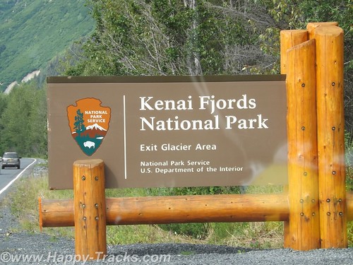
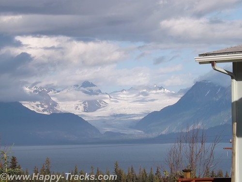
Our National Park system was established near the turn of the 20th century. We’ve come to learn that many of our country’s national parks are considerably newer than that. For example, the Kenai Fjords National Monument was established in 1978 by Executive Order of President Jimmy Carter. The Kenai Fjords National Park was established in 1980 with the Alaska National Interest Lands Conservation Act. Within the Kenai Fjords National Park is Exit Glacier. The name came from a newspaper story describing the first recorded passage across the Harding Icefield saying those crossing the icefield would soon be leaving via the “exit glacier”.
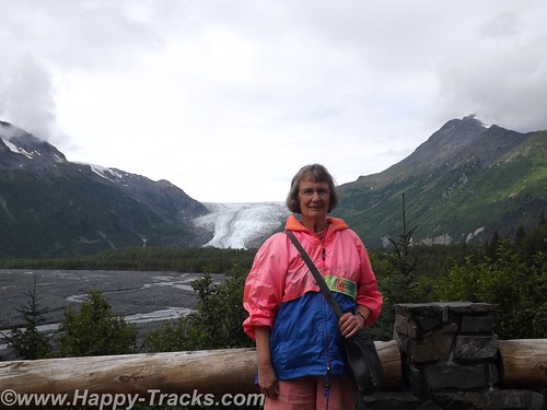
To access the Exit Glacier, we drove along a spur road off the Seward Highway for about 2 miles to the visitor center and a parking lot. There was a pulloff along the way which offered a view of the foot of the glacier and the stream flowing from there towards Resurrection Bay. Along this road were several tour guides both for the glacier and for kayak and other nature tours.
In the pulloff (posted with no camping signs), one visitor had a popup tent camper setup and appeared to be taking pictures perhaps for an advertisement or story layout of some sort.
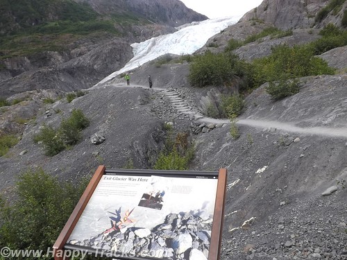
On the drive in, we passed signs marking the recession of the glacier as this current ice age plays out. The Ranger Station area includes a parking area including space for RV and bus parking which also took the overflow from the car parking area. It was a sunny and warm Saturday so there were many cars in the lot. The building includes some interpretive displays as well as a small shopping area along with the ever-present warning to beware of the bears and not to feed the wildlife. Ranger tours are available every couple of hours as well as a mid-day presentation at the visitor center.
We opted to walk on our own. Parts of the trail are ADA accessible. The accessible parts are relatively flat (and paved with asphalt or crushed gravel). That part of the trail goes to the rocky streambed at the foot of the glacier.
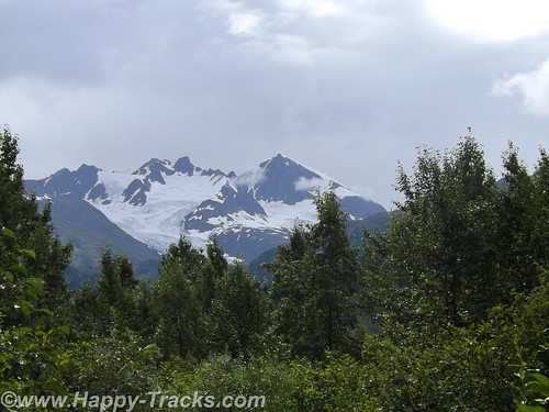
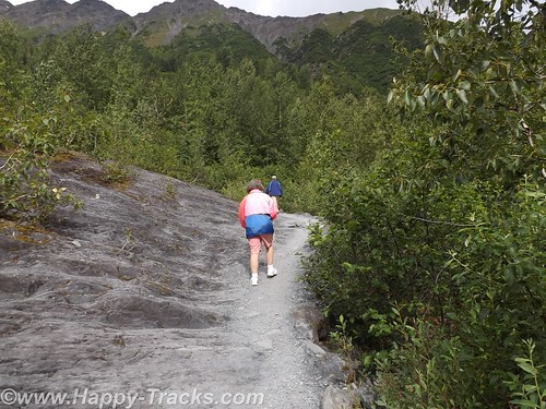
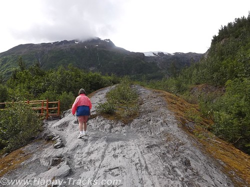
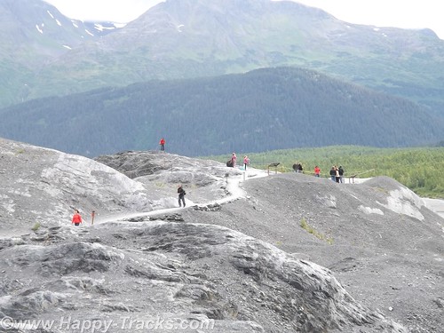
The trail also proceeds upward toward the glacier itself. Fairly easy walk if you’re in good health and there are places to step off and rest if that suits you. In several places the trail narrows so that you have to alternate for folks going up and down. There were a number of families on the trail from kid strollers to folks older than us. A bit more than halfway up the hill is a marker for where the edge of the glacier was in 1998. A half mile or more behind us was the marker for the 1980 edge.
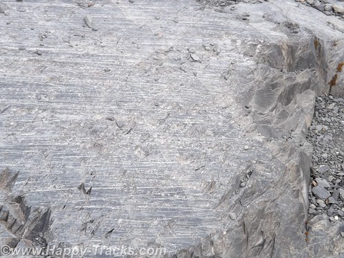
Along the way, you could see the drag marks in the rocks where the glacier had been moving. The rocks showed layers of lighter colored rock formed by mineral-laden steam pushed up from below which solidifies.
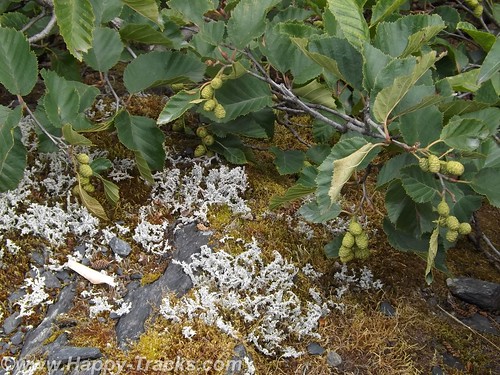
As the glacier recedes, moss and lichens take hold in the rock and slowly break it down to form soil. As the soil increases, smaller plants take root until eventually trees take root in the small crevasses.
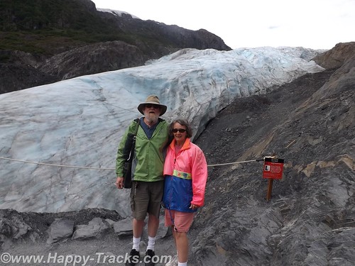
While it was warm and sunny out, as you stood by the glacier you could feel the effects of the breeze blowing across miles of ice. Our light jackets felt good.
The glacial ice has a blue cast to it. We learned this is because the other colors of light are absorbed by the ice.
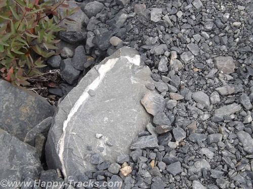
We meandered back down the hill and out onto the rocky streambed. The rocks were mainly rounded and varied in size from golfballs to softballs.
We stopped to look for postcards before making our way back to the truck and started driving north and west across the peninsula to head south.
We re-traced our route for about 30 miles before turning west. We stopped for lunch at another roadhouse that was doing a pretty good business. We sat at the counter and one of our dining companions ordered a beer with her lunch. First the server had to go find someone else to take her order (we don’t know if it was an age or training thing but the Alaskans seem to take alcohol more seriously than some other jurisdictions we’ve visited). Then the different server asked to see ID from the woman. She showed them her drivers license. After the server left, she remarked to us how they always ask for ID even though she told us she was 60. According to her, Alaska will mark your drivers license if you are convicted of DUI. She didn’t know whether that would prevent them from serving or just trigger a request for keys or a designated driver. Interesting. By the way, the burgers were very good.
As we continued on, we passed over a winding river that was full of fisherman even if not full of fish. We passed by the Funny River (another interesting name).
By the time we reached Soldotna, it was time to stretch our legs and grab a coffee. From the main road through town, Soldotna is a typical small crossroads town. Several motels, a couple of small shopping centers and restaurants along the main drive through town. Soldotna is sometimes referred to as red and green city as it boasts the only traffic lights (which create a bit of a jam) we’d seen since we got out of Anchorage!
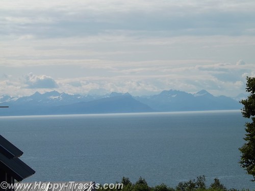
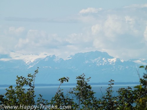
We’re approaching the western side of the peninsula and the highway runs parallel to the shore and along a high bluff. This gives us a great view across Cook Inlet to the line of the Chigmit Mountains, part of the Aleutian Range which stretches into the Aleutian Islands alongside the Bering Sea and northern Pacific Ocean. The view includes the highest point in the Aleutians, Redoubt Volcano (10,197 feet), and Iliamna Volcano (10,016 feet) which are part of the Aleutian trench of the Pacific Ring of Fire volcanoes.
There are a number of B&Bs and vacation homes perched on the bluff with this gorgeous view. Also along the bluff is the The Transfiguration of Our Lord Russian Orthodox Church at Ninilchik.
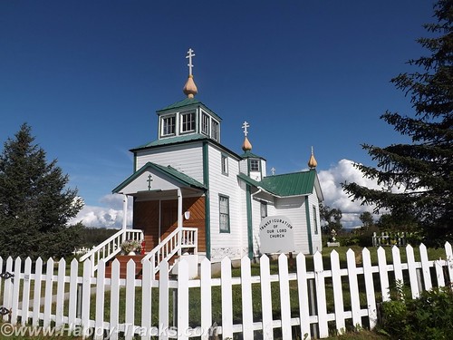
Ninilchik’s original settlers were Russians who migrated from Kodiak Island in 1847 before the sale of Alaska to the USA. Various sources indicate that the settlers chose to stay because it was too much effort to move back to Russia. The culture is still very definitely old Russian. Ninilchik is a popular tourist destination with halibut fishing and clams below the tide line. The Alaskan earthquake of 1964 caused part of the village to drop in elevation. Much of the town is now on the land (east) side of the highway.
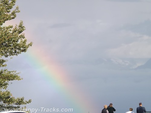
We continued on towards Homer. There is a scenic pulloff before the bluff descends above the town. We sighted a double rainbow and some more great scenery.
We went into town to secure lodging for the night. This task is easier said than done. We checked the chain motel (all full). We went to the Driftwood Inn which has cabins, RV park and lodge rooms but only the RV park had vacancies. The staff there was VERY, VERY helpful in trying to find us a room even making the calls for us. Apparently the Chamber of Commerce or Visitors Bureau maintains a website with listings of the various lodging which is updated with available rooms. The only place listed as having anything available was a B&B on past town. They called but only got voicemail. They left a message on our behalf and we decided to drive on out so we would be nearer should a room be available. We arrived at the B&B but still no callback. We went to the door but no one answered there either. We finally were able to talk to the innkeepers on the phone but they indicated they had rooms but only rented with a 3 night minimum. They did have a great view but we were off again.
We called down the list the folks at Driftwood gave us and finally got hold of cabins in Anchor Point (about 12 miles back up the road). The woman on the phone said she still had a cabin for one night available. I offered my credit card to hold it but she told us it wasn’t needed. She’d meet us there. OK, I guess. She gave us directions but we took the wrong turn. (Seems there’s two intersections with the highway and North Fork Road.) We called again and she corrected our way. We eventually reached the Sleepy Bear Cabins and got checked in. Sleepy Bear Cabins has 4 cabins and a couple of RV spots.
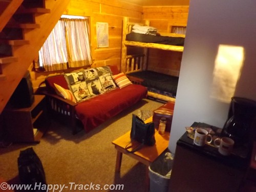
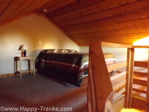
Our cabin would sleep 6 or so people, 2 on the futon downstairs, 2 on the bunkbeds downstairs and 2 in a double bed in the loft. We opted to sleep upstairs but had to remember to duck for the low ceilings and the really low ceiling over the stairs.
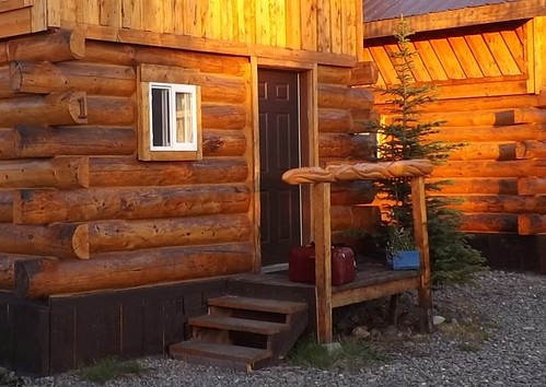
Our cabin was of logs and had some interesting fish carvings in a line for the small stoop rails.
There were no restaurants in the vicinity open so we had sandwiches from the refrigerator in the truck. This was only the second time we had to rely on our own supplies for a meal.
A good night’s sleep and we would try Homer again on Sunday.
You can see all of the pictures from this leg of the trip here.
We invite you to continue along with us and hope you enjoy the account!
Summer 2014: Alaska via the AlCan, Denali National Park
On leaving Fairbanks, we gave some consideration to traveling north up the Dalton Highway towards the Arctic Circle or even as far as the Arctic Ocean but it came down to making a choice between either of those and having to cut out a day or even two to somewhere else as we had reservations on the weekly ferry ride from Haines in about a week. The side trip just wasn’t worth it so we headed to our next planned destination, Denali National Park.
Denali National Park and Preserve dates back to 1917 when Congress approved the creation of McKinley National Park. While its most famous feature is the tallest mountain in the US, the park and preserve includes 6 million acres of wild country with a single ribbon of road through it. But first we have to get there!
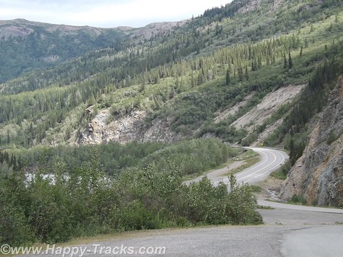
The ride from Fairbanks to Denali started out alternating between relatively flat with mountains in the distance or else riding along higher up with the scenery falling away to either side of the road. We crossed over the Nenana River where there was an old tug boat pulled up along the shore which had pulled freight up and down the river.
Eventually the road begins the dip into a canyon following the course of the Nenana Creek. We encountered more construction both for roads and bridges. The road construction had a pilot car for a length of unpaved road but the short bridges were controlled by a flagman or a portable traffic light.
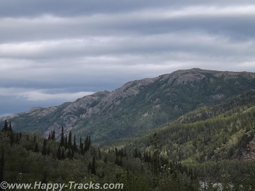
The skies were partly cloudy which resulted in light patterns on the landscape for additional texture.
Just before we got to the road into Denali, there was a village of hotels, cabins, resorts, stores, and outfitters catering to the tourist trade. They all looked to be doing a good business this day.
Charles Sheldon, a gentleman hunter from Vermont and others lobbied Congress for nearly a decade before persuading them to create Mt. McKinley National Park in 1917. In 1921, Harry Karstens, an outdoorsman and dog musher was hired as the first park superintendent. Gold miners and others in Fairbanks and nearby called the icy granite mountain Mt. McKinley. Sheldon referred to it as “the mountain” or Denali, the Athabascan name meaning the high one. Mt. McKinley is now officially 20,237 feet above sea level, the highest in North America. This figure is 83 feet shorter than the 1952 number (which would have been when my folks were in the area.) There is this interesting article on Discovery.com which talks about why the differences.
Along with the wild landscape there were also animals in the area that were to be protected. Specifically, the Dall sheep in the area were being aggressively killed by market hunters. Per the stories we were told there, the market hunters would kill the sheep they needed to market and would also kill the other sheep around and leave them to rot to limit their competitors ability to provide meat. The National Park and Preserve designation was a small step in providing some control over that situation.
Arriving at the park entrance, the roadway goes to the campgrounds and also to the visitors center. From the visitors center, there are options for interior transportation. There are guided tour buses which travel into the interior of the park and various shuttles to different points within the park.
We went directly to the visitors center. This is the spot to get acclimated and find out about the various accommodations for getting around. The visitors center also has a small cafeteria and a gift shop. The 85 mile road through the park has access limited to the tour buses and the campers’ shuttles. There are also flight-seeing tours from nearby Talkeetna that take you around, some even land to let you walk around.
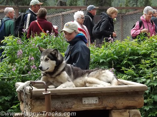
We chose to take the short shuttle to the Sled Dog Kennels. The dogs are working animals at the park providing access to remote areas and support for working and research parties even during the winter months. More about the kennels here.
The bus (similar to school buses) takes you on the 10 minute ride (or it could be except for the stops for road construction) to the kennels. During the summer months, rangers and the dogs demonstrate a working team. Before the demonstrations in the summer, you get a chance to visit with and pet the dogs. Visits and petting are opportunities year round but the demonstrations are summer months only.
We were surprised to learn that the dogs are controlled by voice command only. For some reason, we had always thought there were reins or similar like larger draft animals.
Each position in the dog team has a specific purpose and different dogs are better suited for each position. Nearest the sled is the wheel dog. The wheel dogs are the strongest and provide momentum to get the sled up on the surface and moving (like getting a boat up on plane).
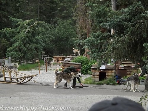
In front of the wheel dog is the swing dog. The swing dog provides power but is also trained to swing out on a turn, rather than follow directly in the tracks of the lead dog. The lead dog responds to voice control to turn, go or stop. The dog team may include up to 12 dogs depending on the load and course to be run.
The dogs typically have a 9 year life on the sleds with an average 14 year life span. That link above even talks about adopting retired dogs.
As an aside, we saw the tourist couple we met at LARS in Fairbanks and said hello.
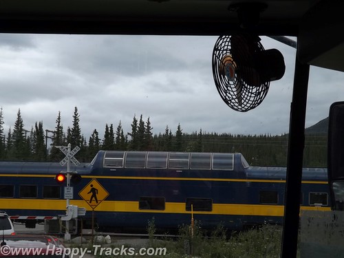
We rode back to the visitors center and decided to take one of the shuttle buses for a brief ride around to the campgrounds. It became more clear that many of the tourists in the park are camping or hiking parts of the large park. While on the shuttle, we stopped at the train crossing to let the Alaska Railroad Denali route train go by. Many tourists will board the train for the ride between Anchorage and Denali with a stop in Talkeetna for more of the beautiful scenery.
We didn’t really appreciate just how big the park and preserve are. We were unable to see Mt. McKinley from the visitors’ center. We were actually surprised that we asked several of the non-NPS workers which direction the Mountain was and they didn’t know. We’ve since learned Mt. McKinley is about 80 miles southwest from the visitors’ center.
After several hours at the park, we headed out for our accommodations which had been recommended by a fellow on ExpeditionPortal forums. Healy Denali Grizzly Bear Cedar Lodge is just a few miles south of the park entrance (although our GPS directions sent us north instead). The Grizzly Bear Cedar Lodge is away from the cluster of hotels in the village outside the gate and has RV sites, a small general store, a laundromat and a gift shop. The Cedar Lodge itself is set on the banks of the Nenana River. Its not as expensive as the village but doesn’t have all the shops and entertainment within walking distance.
We did get a recommendation for the restaurant just a bit further south, 229 Parks. The food was a more local produce with many non-fried food choices. We had the salmon and the crabcakes and would recommend both the restaurant and lodge to visitors to the area provided you have transportation with you.
The next morning, we headed south towards Anchorage. We still hadn’t seen Mt. McKinley but there were supposed to be several points along the road where we could see it, weather permitting. As we drove along, we saw fog and clouds where Mt. McKinley should be but we never saw the place where we could get out weather permits and thus left Alaska without seeing the Mountain.
You can see all of the pictures and 2 more short videos from this leg of the trip here.
We invite you to continue along with us and hope you enjoy the account!
Summer 2014: Alaska via the AlCan, Glacier National Park
Glacier National Park is located primarily in Montana and is the country’s 10th NP being signed into law in 1910 by Pres. Taft. In 1932, the US and Canada governments formed the first International Peace Park by coordinating on the management of Waterton Park and Glacier National Park to form Waterton-Glacier International Peace Park, sharing management strategies on protecting the waters, plants and animals.
Our route allowed for the more scenic route rather than the most direct which took us to Three Forks where we stopped at the Wheat Montana store.
Wheat Montana is a combination grain elevator, bakery and restaurant with a gas station and convenience store. I suppose having the grain right on site conveys an image of freshness. The bakery certainly smelled tasty! We continued on through Helena and then up to the southeast of the park, then along the scenic Route 2 and eventually over to Kalispell.
We stopped for lunch in Helena. When we came out of the restaurant, the gentleman who had sat across the aisle from us inside started up a conversation. He told us he was traveling to visit relatives and was telling us he was from a small town in Canada near Edmonton and told us about a bridge that we should make a point to see. 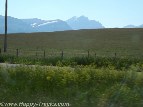
We had set the GPS to take us to Glacier National Park. It led us to Browning on the Reservation where we stopped to figure a more precise destination. While we were checking the paper maps, a man drove up and parked next to us to use the air hose. He had a young girl in the truck with him. It was very hot and the youngster was making her case for getting an ice cream or cold drink inside the store but she was unsuccessful. The man started a conversation with us and recommended that we plan our stop to include a place called Goat Lick Creek where the goats come on a regular frequency. He said that you could often see 40 or more goats with their kids there. We found his spot and a few goats but not in the numbers he had suggested. The goats and other animals frequent this spot to lick the clay and get the minerals. We appreciated his recommendation as it was a place we would have flown right on past with no notice. 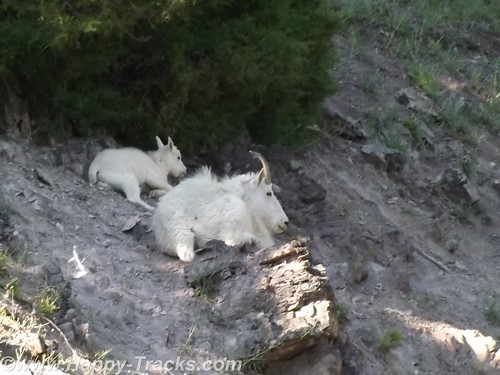
Saturday night summer with no reservations made it a bit difficult to find lodging. We looked first in Whitefish just outside the park’s entrance and eventually ended up in Kalispell about 15 miles away. We searched and eventually found overnight lodging at the Blue and White Motel (I wonder what the story behind that name might be?) where we were told they had two rooms available, one in the “old” building and one in the court. The “new” building probably dated back to the 1960s while the furnishings dated back to the early 1980s. We checked out both rooms and decided to take the one in the court. The carpet was old (as were the stains on it) but it seemed to be a bit better than the other choice. Supply and demand works, I guess. While the motel and the rooms would be prime candidates for refreshing, the place was filled to capacity. The desk clerk was a very pleasant woman with hair a shade of red that nature never used and a pleasant manner that showed she had been around since innkeepers tried to make their guests feel welcome instead of just being processed efficiently. The other guests were a mix of families with children, motorcyclists checking boxes on a bucket list and some longer-term residents who were probably working or going to school. As has become customary, they also had a breakfast bar of sorts that included toast and some prepacked pastries and coffee. Little bit different. 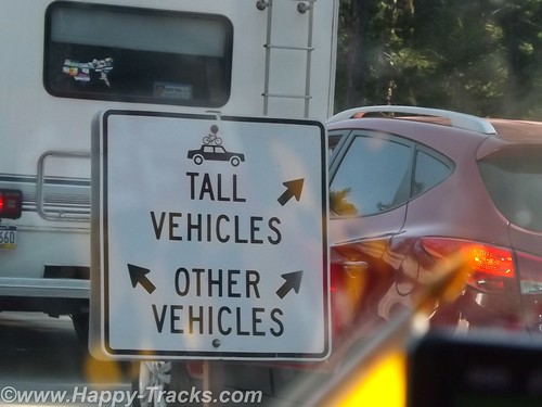
Glacier National Park is believed to have contained approximately 150 different glaciers in the mid-19th century and currently has 25 active glaciers. Current estimates say the last of the glaciers may be gone in the next decade.
We left Kalispell and went to the park. Our first stop was at the Apgar Visitors Center for an orientation. It was a busy place with tour groups forming up and leaving, groups coming in, one of the rangers preparing to give an informational talk involving a bear skin that she had put on display. 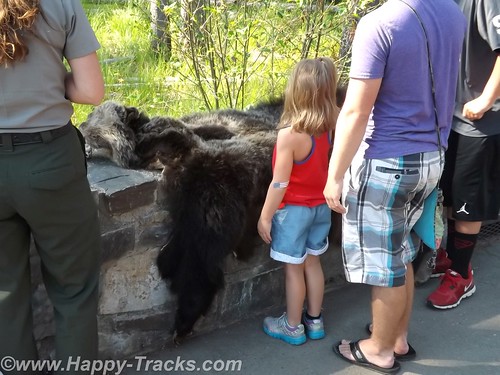
We got a map and oriented ourselves in preparation for the Going to the Sun Road journey through the park. As elsewhere, our orientation included reminders to beware of the animals and the traffic and to not block the roads.
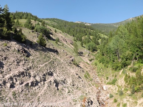
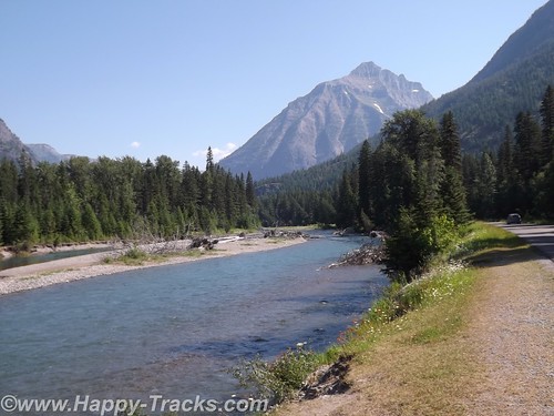
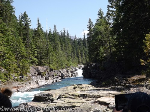
Going to the Sun Road passes Lake McDonald and along a glacial stream and up to the Going to the Sun Mountain and the glacier there. It is a scenic drive with views of the glacially-carved valleys and mountain sides and many streams cascading down to keep Lake McDonald filled. 
Although the park literature indicated many different animals to be seen in the park, our travels kept us primarily along the more trafficked roadway so we didn’t see many wild animals.
At our first stop just past the winter gate we were approached by another tourist (his accent was Asian perhaps?) seeking assistance. He was driving a rental car and had his paper map in hand but couldn’t locate himself on it. He really just wanted someone to orient him on his paper map. Where is the “You are here” dot? We got him oriented and on his way and had a chuckle at how its sometimes the simple things that make all the difference.
We stopped along the way for pictures of the lake and the glacial stream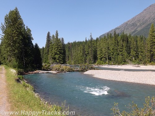
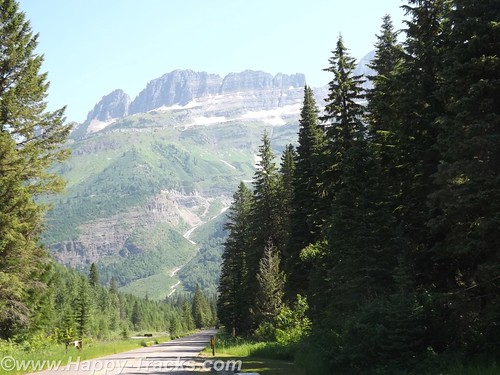
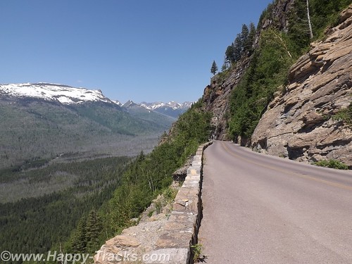
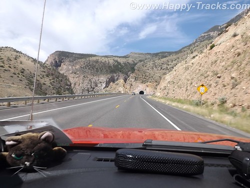
As the sides of the valley got steeper in our ascent, we passed through a couple of unusual tunnels in that the sides toward the valley had large openings to permit seeing the view.
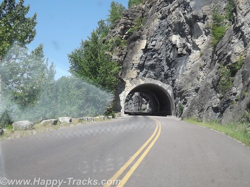
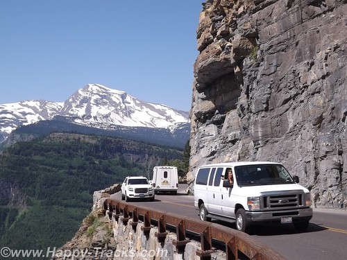
Going to the Sun Road does not allow vehicles longer than 21 feet or wider than 8 feet and does not allow towed vehicles due to the sharp curves/switchbacks and narrow roadways. In the picture above, the white dot in the very center of the picture is a van passing where we had just been.
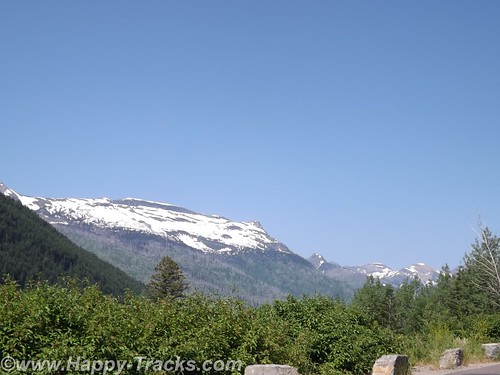
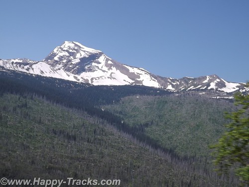
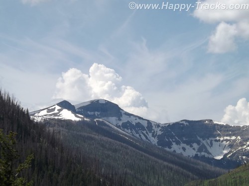
Our first encounter up close with snow and ice. The temperatures had us comfortable in our shorts and T-shirts.
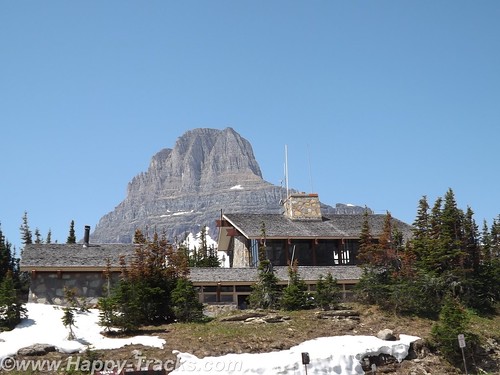
The road winds its way up to Logan Pass, the Continental Divide.
This trip was Betty’s first time crossing the Divide (in Yellowstone) although we would eventually cross at least 8 times before returning to Maryland. We posed for pictures by the sign and talked to two ladies there doing the same.
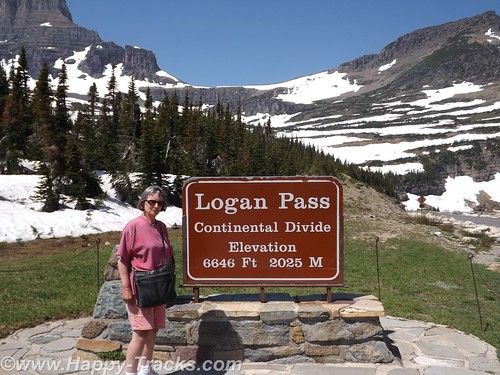
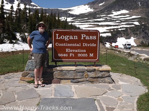
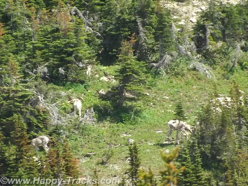
As we were walking away, the two ladies asked us to help identify the “white dots” on the hillside above us which turned out to be the only bighorn sheep we saw on the trip.
There is a rest area at Logan Pass which was fairly busy this day. There is a gift shop, restrooms and exhibits there but no restaurant and we were looking for lunch. We did have some food in the truck in the refrigerator so we had cheese sticks and crackers for a light lunch.
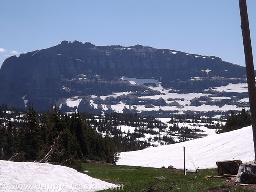
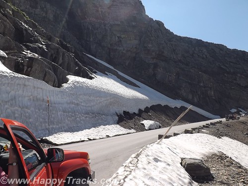
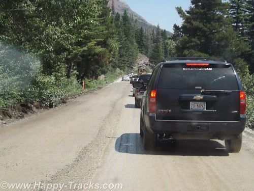
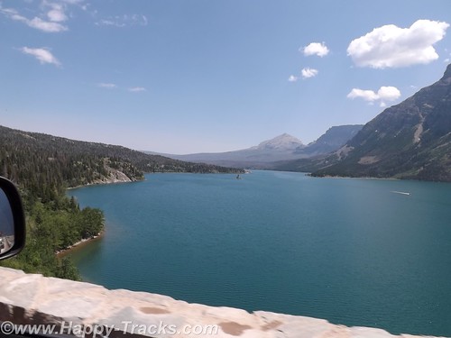
Shortly after leaving Logan Pass, we came upon some more road construction which narrowed us to one lane of dirt road and the accompanying delays which let us appreciate the scenery. The road passed beside Saint Mary Lake which is smaller than Lake McDonald.
We stopped at the St. Mary Visitor Center for a late lunch. Several of the menu items included huckleberries but we had more traditional fare.
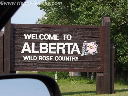
After our late lunch, we exited the park and turned north for the short ride into Canada.
Our first border crossing was at Carway. Usual questions about where we going, what we were going to do and what we were bringing with us. We had bear spray (which apparently is sometimes viewed as a weapon but was of no concern to the Customs Agent) and more than the permitted 200 (one carton) of cigarettes each but this also was not viewed as an issue so we were waved on through.
We found a room at a fairly new Comfort Inn in Lethbridge and went next door to a sports bar for munchies for dinner.
The next day, we would visit the TD Bank for Canadian cash continue on our way north.
You can see all of the pictures from this leg of the trip here.
We invite you to continue along with us and hope you enjoy the account!
Summer 2014: Alaska via the AlCan, Yellowstone National Park
Yellowstone National Park was established in 1872 by Act of Congress and signed by President Grant. It is widely thought to be the first national park in the world. The area was bypassed by the Lewis and Clark Expedition and exploration really started in the late 1860s. Initially, it was overseen by the US Army at Fort Yellowstone in the northern section of the park. Administration passed to the National Park Service following its establishment in 1917.
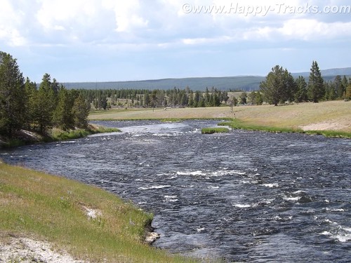
We left our cabin in Cody after breakfast and entered the park though the east entrance with plans to make a backward S and leave through the north entrance by day’s end.
On entering the park, we received our separate handout sheet advising against feeding the animals and telling us that wild animals were dangerous. It also cautioned us to stay in the car when animals were nearby. The road in took us around the shoreline of Yellowstone Lake and into Lake Village.
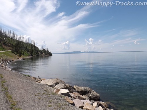
As we could first see the lake, we entered the area of the park where sulphur vents and you could smell it as soon as we entered the region. We stopped by the lake and took a few pictures then headed on towards Lake Village. On the way, there was a car stopped in the road for no apparent reason. As we got closer, we realize that they had stopped and gotten out of the car to take pictures of a bison in the field.
There was a pulloff nearby and we backed up to it and parked out of the road and took a picture of our own. We learned (and it would be reinforced throughout our trip) that when you see a car stopped, chances are someone has sighted a wild animal, even though the park literature reminds you frequently not to stop in the road.
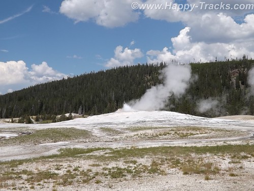
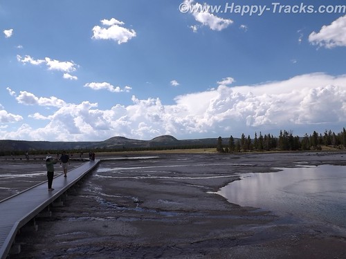
We continued on to Lake Village where we would find a commercial area (gas, food, restaurants) as well as a visitor center. The ranger at the visitor center gave us the latest updates for expected eruptions at Old Faithful, one of our “must do” sights.
Shortly after we passed the West Thumb Information Station area and turned to continue on the Grand Loop Road, we were waved down by a young man who had been bicycling. His girlfriend had fallen off her bike and needed assistance. He said she was shaken up and we volunteered to call for help. Punching the OnStar button, we soon were in contact with their personnel who patched us through to emergency services in the park. While we were doing that, another truck stopped. Luckily, it was being driven by an off duty EMT who was able to assess her condition and was drafted to transport her and her bike over to the West Thumb first aid station. We informed the emergency services folks of the resolution and went on our way. While we were glad to be of assistance, we breathed a sigh of relief as we realized we would still be able to make the next eruption of Old Faithful if we got on our way.
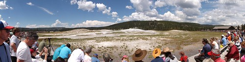
There was a crowd of people there, both for the geyser show and for the lodge, restaurant and shopping area. We found our spot on the viewing deck and waited for the show. As the time drew closer, more people crowded into the area.
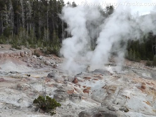
While we were waiting, we saw steam erupting from the other geysers in the area but still we waited for the most famous one. After several smaller spurts and steam, the big show came and we were suitably impressed.
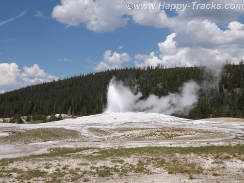
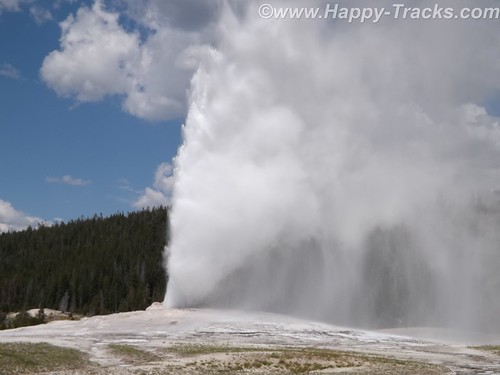
It is truly amazing to watch Mother Earth in action. We had seen pictures and video but its nothing like seeing it in person. One thing that no one ever mentioned was the sound and the noise. Anyone who has ever worked in a steam plant (such as a nuclear submarine) has nightmares about the sound of high velocity steam escaping. Wow.
After the show, we went into the Old Faithful Lodge for lunch and to visit the shops.
We continued on to the Grand Prismatic Spring. The parking area there is small and was very crowded with folks waiting for others to leave before being able to park. The hot spring is the largest in the US and the third largest in the world. First records of it appear in a trapper’s notes from the 1830s. The colors near the edges are the result of microbes in a mat around the mineral-rich water. The center blue area is sterile due to the heat and its color derives from its depth and purity.
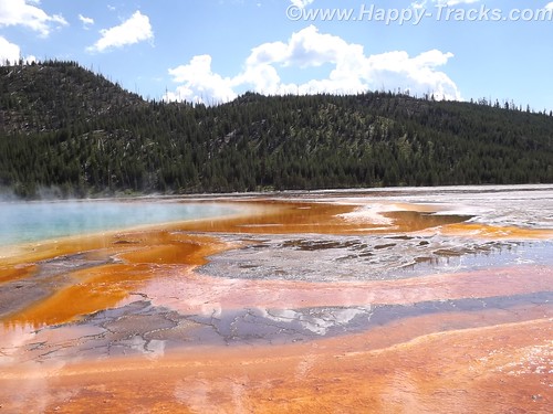
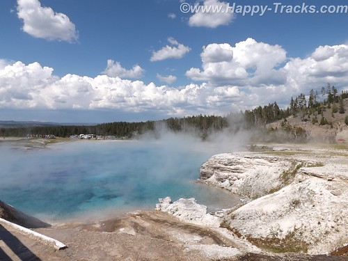
The microbial mat is extremely fragile and there are numerous warnings and prohibitions against walking on or otherwise disturbing the mat. While we were there, someone’s hat blew into the pool. Park personnel remove things like that with poles. On August 2, shortly after our visit, a tourist’s aerial drone mounted camera crashed into the pool. It’s still being investigated about how (or if) to remove it and the owner is facing charges.
Connecting the parking lot and the spring is a pathway that includes a walkway over an ice cold stream fed from the mountains. What a contrast.
That area is the Midway Geyser Basin and contains the dormant Excelsior Geyser as well.
We continued around our backwards S on the Grand Loop Road to visit Steamboat Geyser, the world’s tallest active geyser. It infrequently (and unpredictably) has a major eruption up to 300 feet in the air. It had been almost a year since its last major eruption. It has more frequent minor eruptions, including the day we were there.
But as we started back towards the truck, the skies let loose and it poured rain. We had umbrellas and windbreaker/rain jackets…back in the truck! So we half walked, half ran back.
We continued our ride towards the north entrance and saw the now telltale sign of cars stopped along the road. 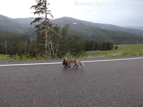
Animals? Sure enough, we saw this fox with something in its mouth coming along the road. We never were able to identify the prey in its mouth which appeared to be some sort of small mammal.
Traveling along, we again saw stopped cars, this time there were a number of them stopped in both lanes of the road. 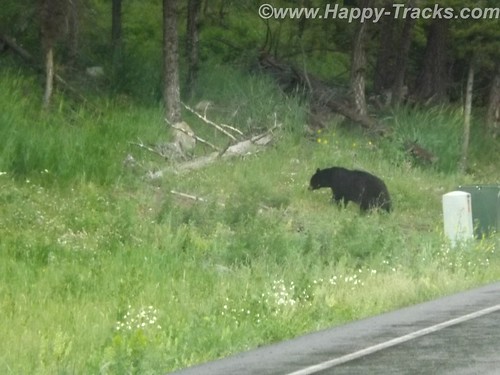
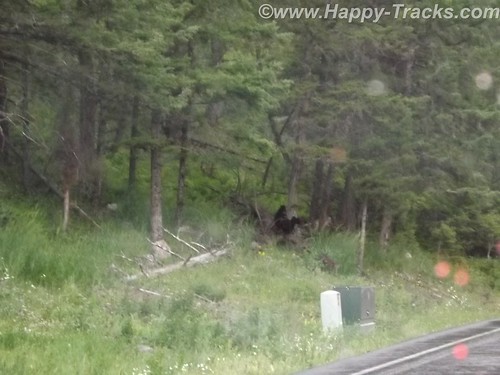
After a bit of sitting and waiting, we realized it was a black bear and three cubs working on crossing the road. Eventually, the adult bear crossed and the three cubs remained on the left side of the road. Then, to our absolute amazement, adults started getting out of their cars –with kids– and started walking up to where the bear and the cubs were on opposite sides of the road! Unbelievable! Finally some of the cars started moving by passing the parked and temporarily abandoned cars. When we were able to move on, the cubs remained on the left, the mother remained on the right and the humans kept on getting out and getting closer.
We stopped at Roosevelt Lodge and Cabins. This was the lodge used by President T. Roosevelt when he visited the area to hunt. There are also cabins, a restaurant and a small camping store there. We kept our comments about the bears and the tourists quiet as we weren’t sure how many of the patrons there had been part of the group. While paying for our purchases at the camping store, we got into a conversation with the clerk who was an older gentleman who had retired to this area from the New Bern area of NC.
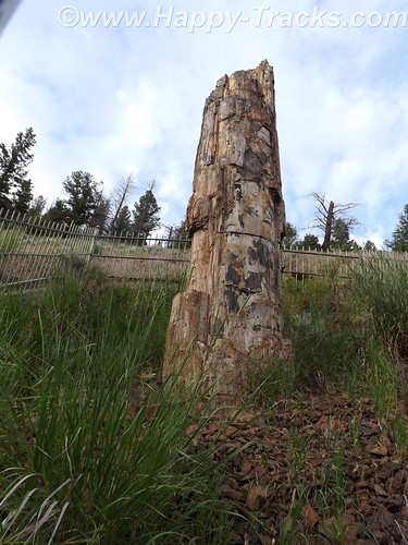
From there, we visited a petrified redwood tree that is the same as present-day redwoods in California, giving testament to a very different Yellowstone in the distant past.
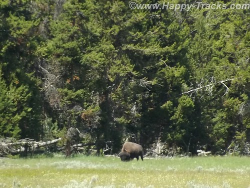
Our next wildlife sighting was another bison standing by himself in a grassy meadow. We found this one by ourselves without the aid of other cars.
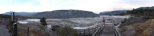
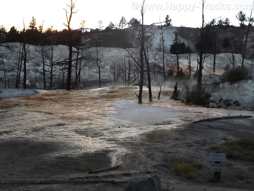
We next arrived at the Mammoth Hot Springs resort and campground at the site of the old Fort Yellowstone. The public buildings are reclaimed barracks and dining facilities. The springs are a series of cascading pools on a hill of travertine.
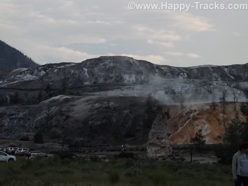
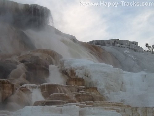
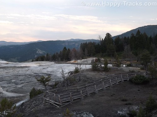
There is a roadway which winds up the hill and lets you look down on the pools and the historic district. These pools, still more hot springs, really give you a different view than the Prismatic Spring. There was a dormant hot spring cone, Liberty Cap, too.
Leaving the Mammoth Hot Springs, you wind down and behind the historic district and onto a winding road out of the park. Just as we reached the boundary, a herd of antelope was crossing the road along the stream bed. Approaching dusk prevents us getting more pictures.
As we exited the park, we followed the Yellowstone River through the canyon to Livingston MT where we found a motel around 11:00. The motel was a Best Western and had a covered garage with a keypad lock for parking which seemed unusual and we never did really figure out why. At first, we suspected the winter weather but it seemed to be the only motel in the area with that feature. It also had an indoor heated pool which our room’s door faced. The humidity outside the room was a reminder of the hot springs we had seen that day.
This is a longer than usual post but it also was a longer than usual day for us. While we don’t advise spending only a day when you get to visit Yellowstone, we proved you could actually see much of it in a day.
You can see all of the pictures from this leg of the trip here.
We invite you to continue along with us and hope you enjoy the account!
Summer 2014: Alaska via the AlCan, Mt. Rushmore and Crazy Horse Memorial in SD
On Wednesday morning, we left Wall and made our way through the edges of the South Dakota Badlands toward Mt. Rushmore. We stayed on the interstate although the scenic loop through the Badlands was only 43 miles. We hadn’t yet fully acclimated to the amount of freedom our schedule provided. We were still able to see the Badlands though.
The giant granite carving of Mt. Rushmore is truly an American icon as a monument to freedom and greatness that are close to our hearts. Informally, the sculpture there has become an icon of the Great American Roadtrip Vacation which is somewhat fitting. It turns out that Mt. Rushmore shares more than geography with Wall Drug and the Corn Palace. Mt. Rushmore’s sculpture was intended to encourage tourism and get more people to visit that part of our great country. (By the way, 70 years later its still working as evidenced by our stop and the crowds that accompanied us that day. Annually, nearly 2 million people visit the monument.)
Admission to Mt. Rushmore is free but there is a charge for parking in the multi-level parking structure. Your parking fee is a one-time payment valid for the entire calendar year for that vehicle though.
When initially conceived, the sculpture included Lewis & Clark; Bill Cody and Red Cloud, a Sioux Chief representing heroes of the west. To increase its appeal, a national focus was determined to include the four Presidents we see there today. Doane Robinson, a South Dakota historian, is credited with being the initial champion of the concept.
There are varying (but similar) stories on why each was chosen
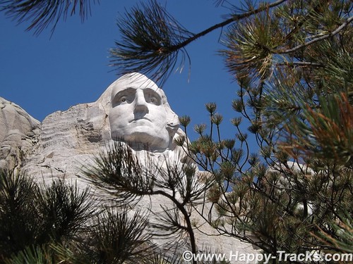
Washington: Birth of a nation and the struggle for independence
Jefferson: Expansion of a nation through the Louisiana Purchase and the belief of a government by the people
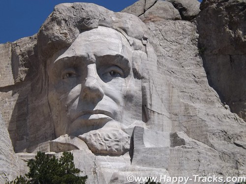
Lincoln: Preservation of the Union and Equality and Permanence
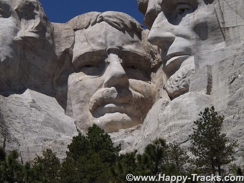
Roosevelt: Economic development of the USA, world prominence or the forward thinking of a National Parks system.
There was some thought of expanding the sculpture in 1937 to include Susan B. Anthony but the legislation precluded expansion, or scope creep. The original plans included sculpting from the waist up but construction stopped as it it is today in 1941. We also ran across at least one reference that Calvin Coolidge declared that the four chosen had to be party-balanced.
With all that background out of the way, I want to make sure to pass along that it is truly magnificent and breathtaking.
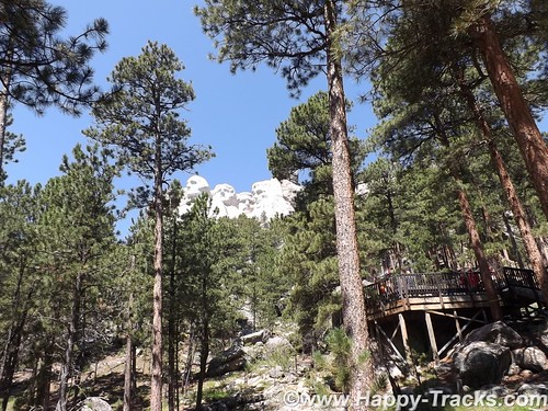
Beginning with the roadway in, the scenery is fantastic and there are ample opportunities to view the surrounding landscapes from various locations.
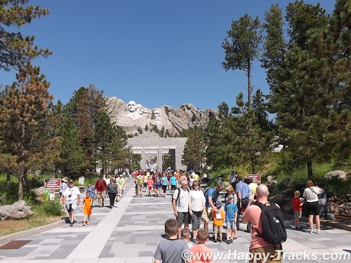
Once you’ve parked, you enter the National Monument by passing the gift shops, information booths, exhibits and eateries. Leaving there, you proceed along a majestic walkway adorned with flags from every state leading towards an amphitheater that allows you to just sit and stare or contemplate.
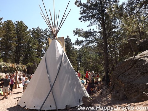
From there, you can walk along a path (handicap accessible) towards the base of the monument. Along this path, you can see a more natural surrounding and eventually reach a display that includes some teepee structures and an exhibit of a small Native American camp with music and a Ranger-provided talk.
From that point, you can look up at George Washington’s chin and proceed further along a trail in front of the base. I’m not certain of the official rating but that part of the trail, while still relatively easy walking seemed to not be accessible to some with handicaps.
This part of the trail seemed to provide a spot where you could view each President individually.
As the boardwalked trail becomes steeper, you eventually wind your way down to the artist’s studio where there are several displays including mockups of the initial sculpture. Outside there is an old generator and compressor setup that was used in the carving.
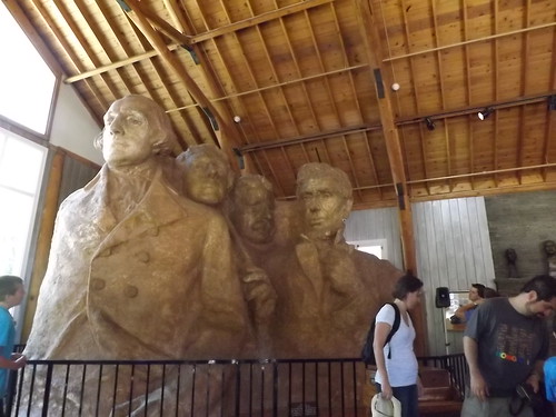
Surprising to us, there is a mockup of a Hall of Records, an archival room for documents relating to the construction of the monument. While not initially included, it has eventually been built and really exists behind President Lincoln’s head.

We climbed the uneven and steep (but solid) stone stairway back up to the entrance plaza were we lunched on bison burgers before checking the gift shop for postcards and continuing on our way to our next stop.
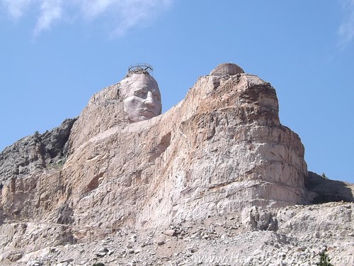
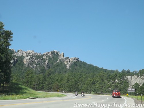
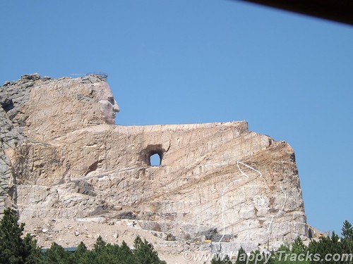
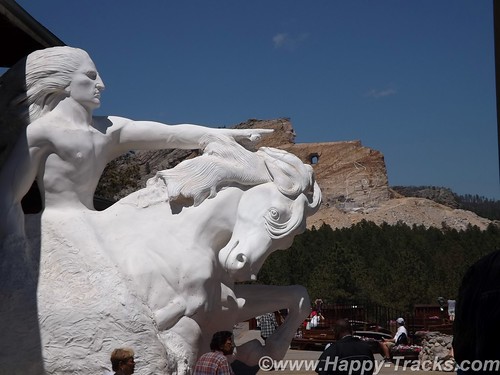
Just 16 miles away, on the other side of Harney Peak in the Black Hills National Forest is a memorial in progress, the pink-granite monument to Crazy Horse. The Crazy Horse monument is privately owned and financed and has refused government funding.
The Crazy Horse monument’s reluctant sculptor is Korczak Ziolkowski and his descendants. Ziolkowski won a prize in 1939 and was invited by Chief Henry Standing Bear to create a tribute to the North American Indians. Ziolkowski initially declined. Chief Standing Bear said, “My fellow chiefs and I would like the white man to know the red man has great heroes too.”
There was some disagreement about who the model for the sculpture should be and Crazy Horse was eventually chosen as he had a reputation for fairness and a dedication that shunned the limelight.
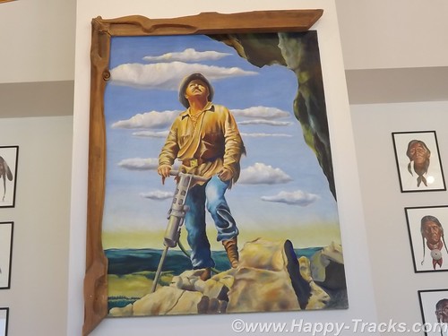
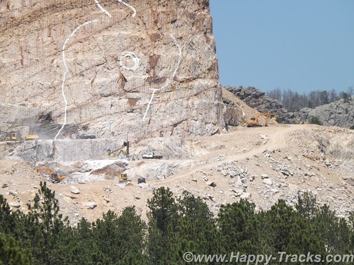
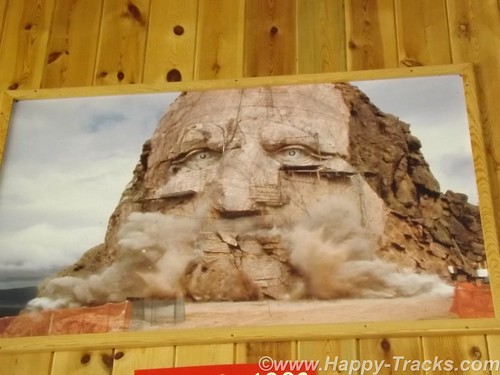
Ziolkowski had worked with Borglum on the final stages of Mt. Rushmore for a time. Conflicting stories appear as to whether he left because the work was done or because of a falling out. At any rate, in 1947, Ziolkowski had been convinced and returned to begin the work. The first blast was in June 1948. As he was working with limited funds, he was also using used equipment and with limited funding, he was often working by himself. He would tell stories of starting the compressor for the drills and beginning the long arduous ladder climb and hear the compressor chug to a halt before he had reached the top and was able to start working, necessitating the long climb down the mountain to restart the equipment and cimb back up.
According to our tour guide, Ziolkowski would work while he had funds and then would stop and do other things, including cutting timber from the property to sell. He also managed to buy up parcels of surrounding land and sometimes trade with the NPS to allow them to build contiguous parcels around Rushmore while he gathered contiguous parcels around the Crazy Horse Memorial.
This is the largest in-progress stone sculpture in the world. By way of comparison, the four Presidents’ sculpted heads (at 60 feet each) could all fit inside the horse’s head.
Mr. Ziolkowski knew the sculpture could not be completed in his lifetime but he took on the project anyway. To believe in a vision that you know you will not see completed and to sacrifice to make it happen is a strong story, especially in this day of instant gratification. He married in 1950 and they had 10 children, six of whom remain involved in the foundation and the sculpture today. He died in 1982. His wife, Ruth, ran the foundation until her death in May 2014.
When asked, Mrs. Z declined to provide an estimate of the expected cost of the monument, saying only that she expected the funds invested in the first 50 years was likely less than the cost remaining. She also expected that the timeline would still stretch for decades.
The Ziolkowski’s started a foundation which includes the museums and a scholarship fund, primarily for Native American students attending schools in South Dakota.
The annual visitation for the uncompleted monument is over 1 million and the grounds include a museum of Native American life as well as the sculptor’s home. Additionally, the site includes a shop where Native crafters display and sell their wares.
The first definable feature, the rider’s face, 26.67 meters (87ft 6in) high, was completed in 1998, in time for the 50th anniversary of the very first blast. Work subsequently began on the next phase – the horse’s head, 66.75 meters high. Although there is still no estimated completion date, Ruth never lost her faith that her husband’s vision would eventually be realized; she said her wish was to “live more years than possible because I would love to see it finished”.
Crazy Horse, who was one of the leading figures in the Native American defeat of General Custer at the battle of Little Bighorn in 1876, pointing towards his prairie heartland. “My lands are where my dead lie buried.”
We spent the night in Custer SD.
You can see all of the pictures from this leg of the trip here.
We invite you to continue along with us and hope you enjoy the account!
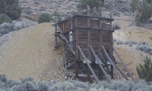
Desert Expedition III: Nevada – Post 6 – Goldfield, Tonopah, Manhattan, Belmont and Pine Creek Campground
Alas, Monday morning comes and folks have places to be, loved ones to see and commitments to be met. We bid adieu to the others but Gary, Ace and I stayed together with plans to see some more and hoped to make it to Great Basin National Park.
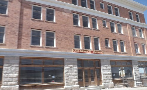
We left and headed back to Tonopah for re-provisioning. Along the way, we passed through Goldfield NV but didn’t stop. Goldfield is more recent town which grew from the discovery of gold in 1902. Mining until 1940, over $86 million was extracted. Much of the town was destroyed by a fire in 1923, although several buildings survived and remain today, notably the Goldfield Hotel, the Consolidated Mines Building (the communications center of the town until 1963), and the schoolhouse. Gold exploration still continues in and around the town today. The hotel is not currently open and some accounts describe it as haunted. There is an ongoing effort to restore many of the old buildings and build the tourist trade. You can find out more at Ghost Town Operations.com website.
Teddy Roosevelt visited Goldfield and there is a story that Wyatt Earpp came to Goldfield after the Gunfight at the OK Corral but there is little to support that. It is confirmed that his brother, Virgil, worked, lived and died in Goldfield although he is buried in Portland, Oregon.
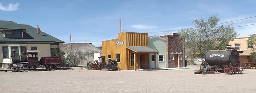
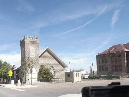
The school is the building in the right of the picture above.
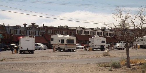
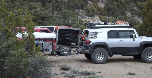
RV parking behind the casino in Tonopah.
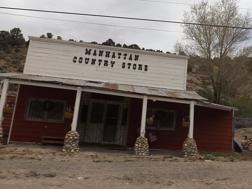
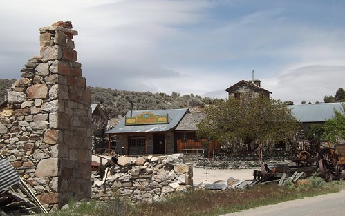
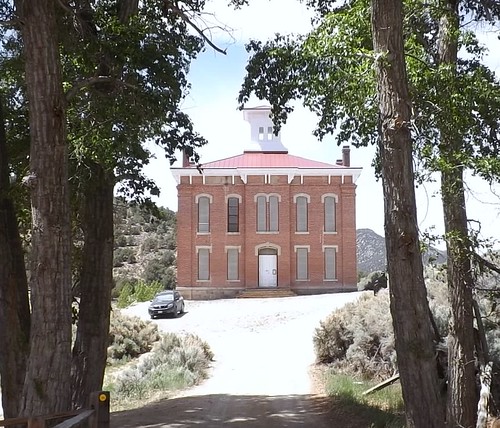
Continuing along to Manhattan, we find another town’s mainstreet which has obvously seen better days.
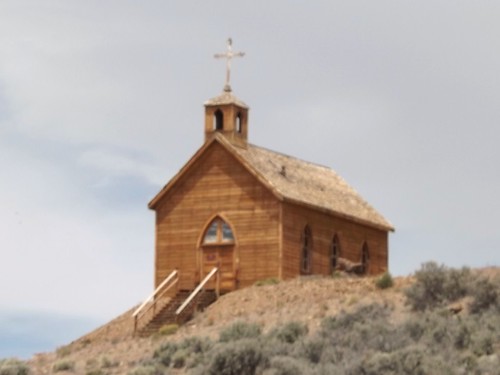
This church, which sets on a hill above Manhattan’s main street was orignially constructed in Belmont.

We stopped for lunch outside of town and then went on to Belmont, NV.

Although closed this day, there are still accommodations to be had at the old Combination Miining Co. building, including the Old Boots Saloon.
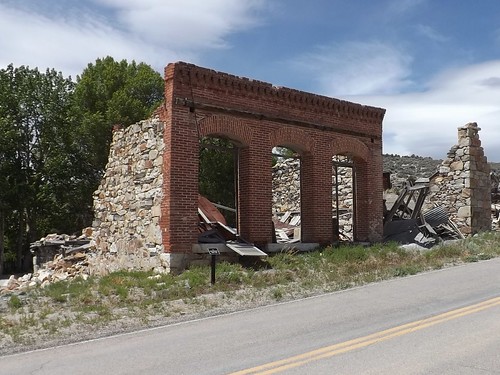
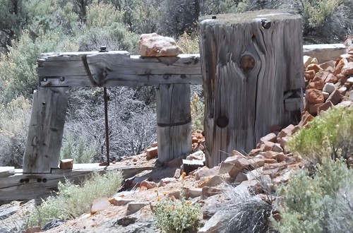
Remains of the bank.
Belmont is the site of a spring used by the Shoshone. In 1865, the discovery of silver ore led to a boom that eventually led to the buildup of a commercial center including schools, a post office, a newspaper and eventually becoming the county seat of Nye County from 1867 to 1905.
Belmont was known as a rowdy town with saloons, a red light district and various ethnic neighborhoods. Roughly $4 million was extracted from the shallow ore.
Courthouse from the days of County seat.
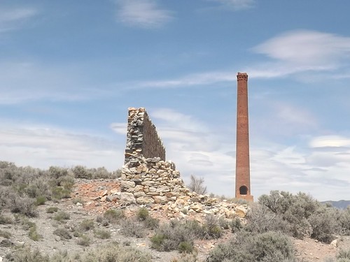
Remnants of the Combination Mining Mill in East Belmont.
We traveled further north and found a spot for the night in the Pine Creek Campground in the Toiyabe National Forest.
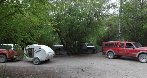

The weather forecasts were calling for cold, possible rain/sleet and this spot seemed fairly sheltered.
More photos from this leg of the trip.
If you’d like to be notified of new posts, use the Subscribe button in the upper left and provide your email. Your email will not be used for any other purpose!
January 26: Old Friends Touring Locally: Fort Washington — Who Knew?
 During our last visit with Russ and Father Steve, we had spied something on the eastern side of the Potomac while coming home from Mt. Vernon. A little web research identified Ft. Washington as our target.
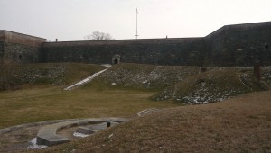
As it turns out, Ft. Washington is still a fort. After all these years of being so close, who knew? Today’s adventure would take us there to see close up. Fort Washington is under the care and ownership of the National Park Service.
Originally the location was home to the Digges estate. The Digges family were friends of George and Martha Washington. In fact, George celebrated his 43rd birthday here. It has been called Warburton Manor. The first military installation was called Ft. Warburton. The site is across the river and slightly upriver from Mt. Vernon. President George Washington suggested it be built. With perpendicular earthen walls, it stood 14 feet above the bottom of a ditch which surrounded the river side of the fort. It included a tower with six cannon overlooking the river. But Ft. Warburton lasted only 5 years.
In August 1814, British forces entered Washington through Bladensburg MD and burned the White House, Capitol and most other government buildings. The next day British warships sailed up the Potomac headed for Alexandria VA. Capt. Samuel Dyson feared Warburton would wind up in British hands so he evacuated and used the powder to destroy the fort. (You may note that Samuel Dyson is not a name you hear in discussions of early American heroes.)
James Monroe, acting Secretary of Defense, engaged Pierre L’Enfant (famous for the layout of Washington) within a month to build a replacement even as the threat diminished with the Treaty of Ghent being signed in December 1814 and the British defeat at the Battle of New Orleans in January 1815. L’Enfant was subsequently dismissed and replaced and the construction was completed in October 1824 at a cost of $426,000 (roughly the price of some of the larger homes in the nearby Ft. Washington community.
As the country moved closer to the Civil War, it became clear that Ft. Washington’s position guarding the capital and across the river from Virginia was more critical. At one time, the fort was under the command of Lt. George Washington Custis Lee, son of General Robert E. Lee. With the growing unrest, he resigned his commission and moved to Virginia. After Lee’s departure, forty Marines were assigned to defend Ft. Washington but were replaced in January 1861 a company of Army recruits. The day after Ft. Sumter fell, the Army’s 1st Artillery took over Ft. Washington. For a time, Ft. Washington stood as the only defense for Washington but was supplemented by a string of 68 enclosed forts and batteries encircling the city.
The fort served during the War of 1812, the American Civil War, the Spanish American War and into the 20th century as a potential defense during both World Wars before reverting to the Department of Interior.
The new fort was designed to serve as a link in the defense of the East Coast of the USA from Naval attack, not just the nation’s capital. During the Civil War, the development of armored ships and rifled cannon shifted the nature of warfare, allowing the ships to approach closer than wooden ships could and to fire rifled cannon which were capable of demolishing brick fortifications and with greater range.
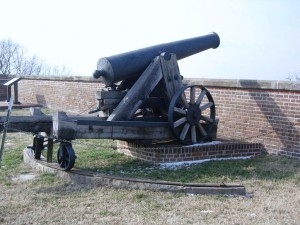
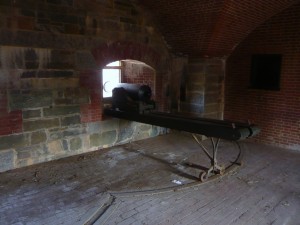
This 24 pounder cannon has an effective range of 1900 yards, almost double the distance to the Virginia shoreline. This is all that remains of the fort’s 1861 armament.
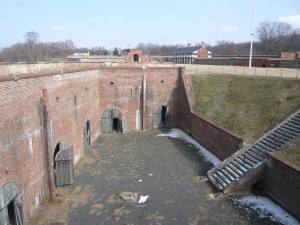
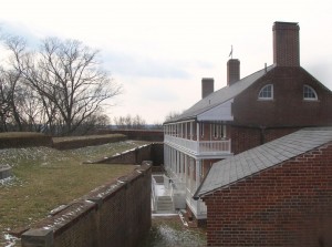
Fort Washington has evolved over the years and is not just one structure but several on the property that were built to meet the changes in strategy and technology. It is also one of only a handful of the seacoast fortifications still in their original form.
In 1872, the US Army turned the fort over to the Army engineers who constructed new gun positions. In 1896, new concrete batteries were built near the fort for Endicott-era guns, 10-inch rifles on disappearing carriages, 12 inch mortar batteries and 4 inch rifles. Land was purchased and similar batteries were built across on the Virginia side of the Potomac — Ft. Hunt.
In 1921, after the post was no longer needed, it became the headquarters of the 12th infantry. During WWII, the Adjutant General’s Officer Candidate School. was based there. In 1946 the fort was deactivated and became part of the National Park System so that it could be preserved historically and provide recreational opportunities. One Facebook friend says he attended a military school there (or near there) in 2005.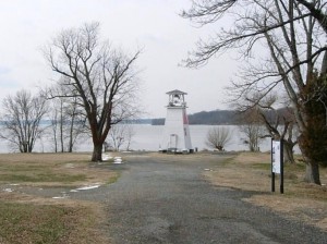
On the point there is also a navigational channel marker which has served as a fog warning.
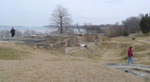
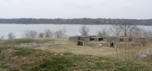
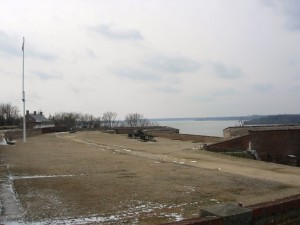
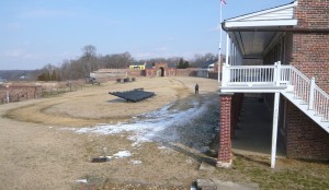
Our visit was on a cold but sunny day and we started our tour by driving through the park and taking the path down by the river. It’s obvious that the park is used by many nearby residents as a place for walking, bike riding and exercising the dogs.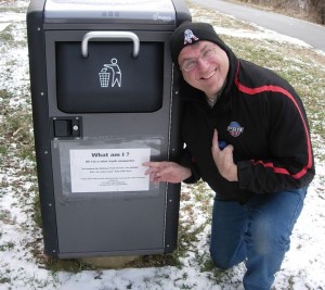
On leaving the car, we came across this trash can with a solar powered compactor.
The old light house/fog signal is small (even compared to 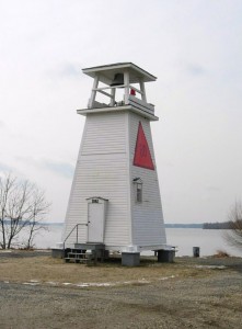 Massachusetts lighthouses), less than 30 feet high.
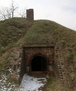
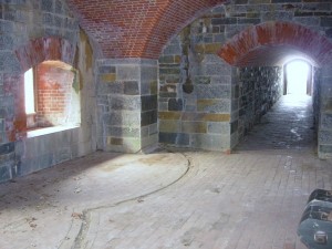
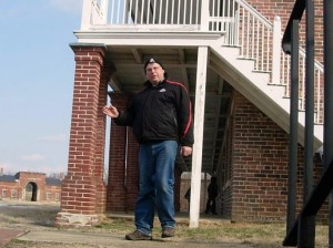
The area between the main fortification and the river has been used over the years for munitions storage, kitchens and later for mounting of cannons and other artillery. From this area is also the entrance called the sally port. Steve walked in this way but found that entrance locked.
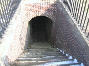
The stairway from the water battery inside the fort. Doors at the landing below provided protection and thus a sally port.
The stairway from the water batter outside the fort. Doors at the bottom and at the top (shown) provided additional security.
Mt. Vernon lies just beyond the tree-covered point on the right.
Looking upriver. The bridge in the distance is the Woodrow Wilson connecting MD to Alexandria VA via I95/495
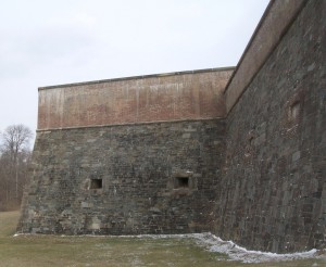
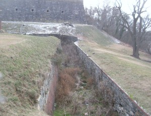
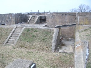
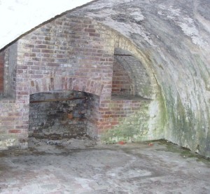
The fort is located on a high point at the juncture of the Potomac River and Piscataway Creek, slightly upriver from Mt. Vernon. This area is known as the Water Battery. In this area were several support facilities for the fort including the powder magazine, storehouse, saddlers shop, blacksmith, stables and the shot house. In the late 19th century, the area underwent major changes as platforms for four fifteen inch guns were added. Later, there were provisions for the Endicott guns. Guns located in this area could ricochet across the water (like skipping rocks) to more directly and accurately hit attacking ships. 
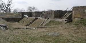
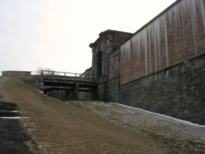
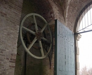
 Two sets of gates protected the main entrance. During renovations made in the 1840s, a drawbridge was added to further protect the entrance. A series of chains and counterweights provided for rapid closure in case of attack from the land side. Additionally, 13 guns provided protection. Gunrooms were built flanking the main entrance (or sally port) to aid in that protection.
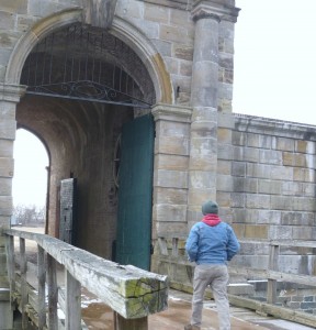
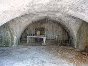
The main entrance or sally port from inside.
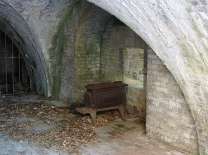
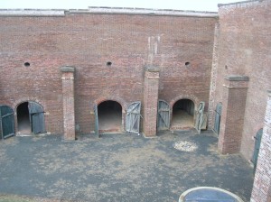 The northwest demi-bastion was designed to contain two levels of guns but only the upper row was installed. The lower level was used by laundresses who lived with their soldier husbands until better quarters were built later. The area was also used for storerooms.
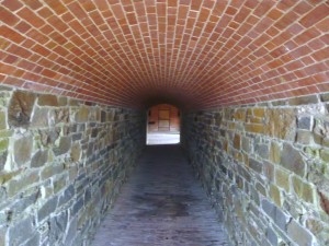
 Also part of the 1840s improvements was the addition of this protected passageway called a capionere which projected from the landside wall and included two levels of guns mounted on swivel tracks to facilitate aiming.
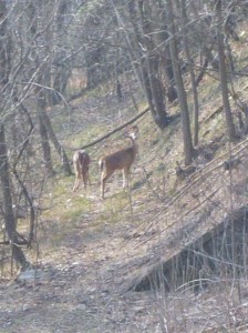
The capionere also provided a hidden point to keep an eye on the four-legged neighbors.
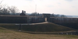
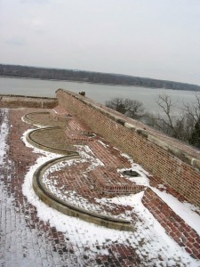
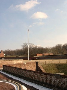
There was also a battery along the outer wall of the ditch surrounding the fort. This provided the capability to fire muskets against attackers who had entered the ditch as well as towards the river.
Postern gate, now sealed up
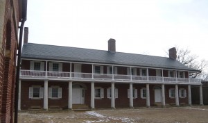
Officers quarters
Looking across to Enlisted quarters
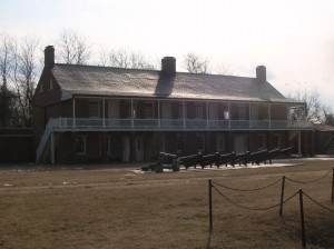
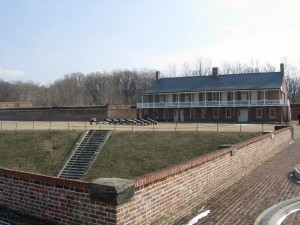
Another view across the main parade ground
Looking south across the parade ground from above the front gate. A shed (no longer there) at the far corner provided lookout and control capabilities for the Endicott era mines in the river.
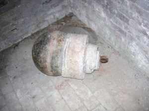
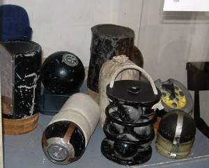
Part of the river mines system from the late 19th century.
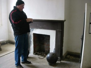
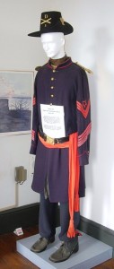
Father Steve with a cannonball in the guard shack.

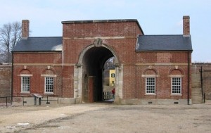
Exiting the fort, you see the visitor center in the yellow house on the hill. 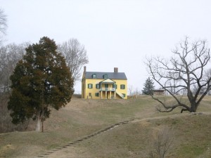 At some point, it was the commanding officers’ quarters but it is not clear during which era. The visitor center contains an audio-vsual presentation as well as some historical
 exhibits. It also contains the highly sought after (at least by Betty) gift shop! On this particular day, it also contained the first place with heat that we had entered since leaving the car.
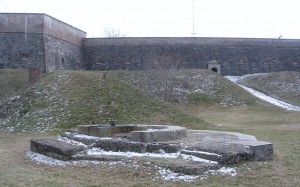
Outside the visitor center is the Battery Commander’s Center (the concrete tower) and Battery Decatur.
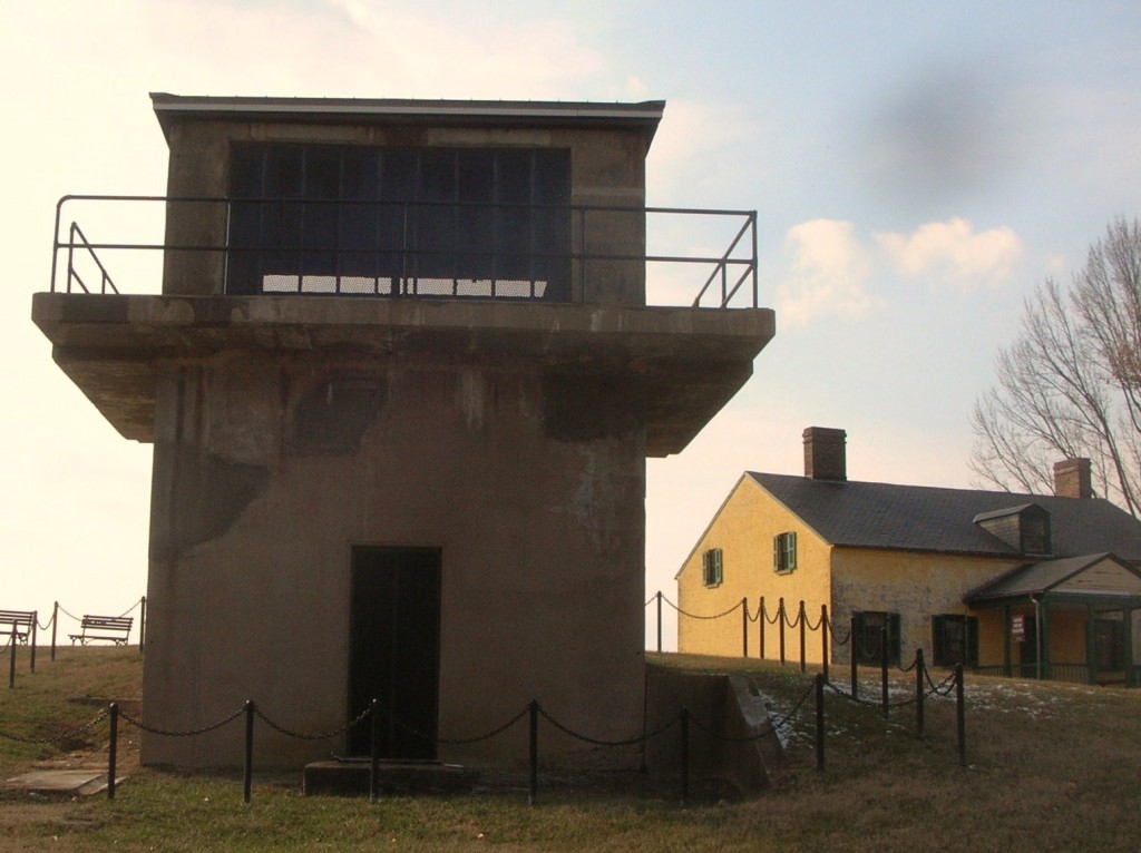
Battery Decatur was completed in 1891 and is made of reinforced concrete. It reflected the shift in defensive structures to rifled projectiles. On the top were mounted 10 inch guns which used the recoil energy to lower the gun out of sight for reloading. The guns had a range of about 7 miles.  The lower stories had storerooms for shot, powder and shells and cranes to lift the ordinance to the upper floor guns.
During WWI, the two guns of Battery Decatur were shipped to Fort Monroe Va enroute to use in France. Ft. Washington was garrisoned by the DC Coast Artillery and a number of military units were organized there. The fort was also used as a staging area for troops headed overseas.
Following that, the fort was occupied by the 3rd Battalion 12th Infantry. Its soldies participated in a number of state functions until 1939 when the 3rd Battalion was moved to Fort Myer near Arlington Cemetery. In ’39, the fort was transferred to the Department of Interior and was home to a Civilian Conservation Corps (CCC) barracks.
Following the US entry into WWII, Ft. Washington was returned again to the Department of War. Further expansion occurred with additional buildings for students and to provide support services for training military personnel. The Veterans Administration used part of the area and buildings as public housing.
In 1946, the fort was once transferred to the Department of Interior with may of the WWI and WWII era buildings removed. So far, it has remained a public park since.
After all the tramping around up and down stairs and hills and breathing all the fresh winter air, it was time for a relaxed meal. So it was over to Proud Mary’s at the Ft. Washington Marina.
 By the time we had finished our meal, it was time to head for home and resume the hotly-contested Uno championship.
Friends Playing Tourists in DC (Part 2.1)
Friday morning rolled around and not too early after a full night of Uno and Cape Codders but we were out and about after breakfast. Our goal for the day was the National Mall in DC. Since our last friends’ visit, there were a couple of new Monuments and Memorials as well as several we had never visited. One thing about DC is that there is always something else to see and do.
Our first stop was to be the new Dr. Martin Luther King, Jr. Memorial on the Mall adjacent to the Tidal Basin and the FDR Memorial and in line between the Jefferson Monument and the Lincoln Memorial. 

 We had visited before and the monument is truly impressive and somewhat emotional for me, at least. There was a young woman with her cameraman there from the Voice of America (VOA) broadcasters. She was interviewing visitors and asking folks to share their opinions and impressions of the man who is recognized largely for his work and stance on civil rights and his position on peace, including voicing objections to the Vietnam War.
This visit, we chose to participate in the Park Rangers tour/talk. He spoke a bit about King himself and also offered some information about the monument itself and some of the controversy that accompanies it.
The main rocks are made of pink shrimp granite, which we had never heard of before. First, it’s less pink than pink granite and was imported from China because pink shrimp granite is not available in this country. The carving of the likeness was also performed in China as
 the talent for this size statue is no longer readily available in the US.
There is also some controversy regarding the inscription on on one side of the large statue. The inscription appears as “I was a drum major for justice, peace and righteousness.” In context, King said “If I was anything, I was a drum major for justice, peace and righteousness.” The concern is that the shorter quote reflects an egotistical attitude that King didn’t have.


")

 The NPS store at the monument was closed for the day due to an upgrade of the computer software but we did get to peek in the window to see that the dedication engraving still shows the August 28, 2012 date. The dedication ceremonies were re-scheduled for October due to Hurricane Irene passing through the area.
We crossed the street and visited one of the oft-overlooked memorial on the Mall, the District of Columbia World War One Memorial. This commemorates those residents of the District who gave their lives in WWI. It’s made of white marble. Recently it gained attention on the floors of Congress when DC Delegate Eleanor Holmes Norton spoke in favor of preserving its original purpose rather than expanding its role to include others from WWI. One surprise (especially for late January) was blooming cherry trees! It’s been a mild winter but really!


 Daughter Ryan has been temping downtown lately and we had decided to have her join us for lunch.
  As we started heading that way, we passed by the Washington Monument. In truth, there aren’t many places you can go where you don’t see the Washington Monument. It’s temporarily closed though.

 We walked over to retrieve her from the secret confines of her latest assignment and then went to the Food Court at National Place. Steve and Russ got lunch from Five Guys, Betty and Keith chose Moe’s and Ryan got sushi. Nice lunch where
 everyone got to choose something different and we managed to meet the time constraints to get Ryan back to work on time and we continued on our touring after taking a little time to check out the Old Post Office building, Ben Franklin and Steve got his picture
  taken with the sign for the folks who did his most recent audit. (Just to be clear, that seemed to go well although he was waiting on a final disposition on some of his deductions.)
 We walked along Constitution Avenue and took a break at 14th Street and then continued to the Ellipse where we saw the Monument to the 2nd Infantry Division.
 Somehow that one hadn’t shown up in our travels or conversation before.
We crossed over to the Lockkeeper’s House for the old Washington City Canal at the corner of 16th and Constitution.


 Speaking of things we’ve not seen nor heard mentioned, did you know there is a Monument to the signers of the Declaration of Independence?
It’s located along Constitution across from 18th and between the Lockkeeper’s House and the Vietnam Memorial.


 We continued on the Mall but that’s subject for another post.
Former Sailors? Old Sailors? Long-time Friends: Playing tourists (Part 1)
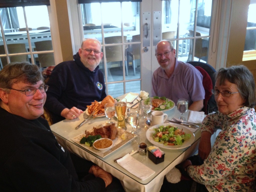
The year was 19…well, it was some time ago. Russ, Steve and Keith were roommates and attending the same Navy school in the wilds of the Adirondacks when we all met Betty who was also a student at the same school at the same time. As you know, Betty and Keith eventually married and we’ve more or less stayed in touch or maybe gotten back in touch. On a pretty regular basis, the four of us get together to play tourist and catch up. It’s a great time. While I’ll not share the details of the conversations, Happy-Tracks is going to offer you the chance to tag along as we play tourist right here in the DC and Baltimore areas.
We’ll start on Thursday. Steve arrives via airplane at BWI-Thurgood Marshall. We used the occasion to conduct a little test of Maryland’s newish InterCounty Connector toll road. The results are in. It takes about the same time to get from our house to/from BWI whether you take the toll road or Warfield Road to Clarksville. By the way, a similar comparison test showed about the same time to get to/from work whether using the toll ICC or the non-toll Beltway. Oh well.
As Steve’s plane arrived in early afternoon, we stopped for lunch. At his request, we stopped at ChickFilA in Germantown.
On to the house. Russ arrived and we had a traditional eastern Eurpoean meal of sausage, chops, mushrooms and potatoes served with homemade mead (honeywine) which had been brewed by Ryan. Good hearty meal with good friends. After dinner, we moved on to Cape Codders and the Championship of Uno. The evening passed with good conversations until the early hours.