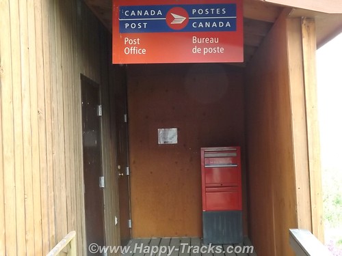
After breakfast, we visited the tourist center in Dawson Creek in the Northern Alberta Railway museum which is part of the old train station. In addition to the usual fare of souvenirs, brochures and information, of particular value was a listing of the various facilities along the Alaska Highway showing lodging, restaurants and fuel locations all on one sheet of paper.
We used an annual publication called the Milepost. This guide has been published annually since 1949 and is considered the definitive guide to the AlCan. The guide, in addition to advertising content, contains a milepost by milepost guide book for the major highways throughout this part of Canada and for Alaska. Its layout is logical but is sometimes difficult to follow along as you are sometimes required to read from bottom to top to match your travels. The single page sheet from the visitor center at Dawson Creek allowed a quick glance to determine the information that the Milepost would provide over several pages, once you found them.
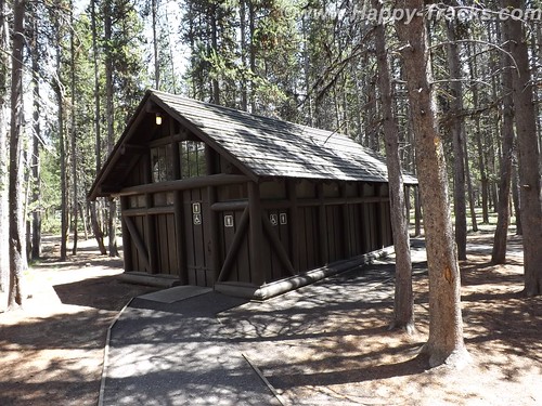
We had noticed signs outside this and other buildings that indicated “Muster Area” and asked what that meant. Unlike most places in the States, its fairly common in Canada to identify a spot for building occupants to muster (meet) in the event they have been evacuated from the building. I remember our work offices had designated places for the workers to meet in case of evacuation but it was a place you were supposed to know rather than being marked. The designated area seems like it could be useful in quickly determining whether everyone had made it safely out.
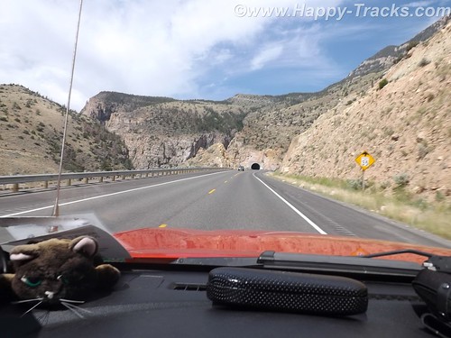
We were finally on our way on the Alaska Highway.
About 20 miles on, we found a marked section of the old highway. We turned to go that way and it was a bit more rustic. 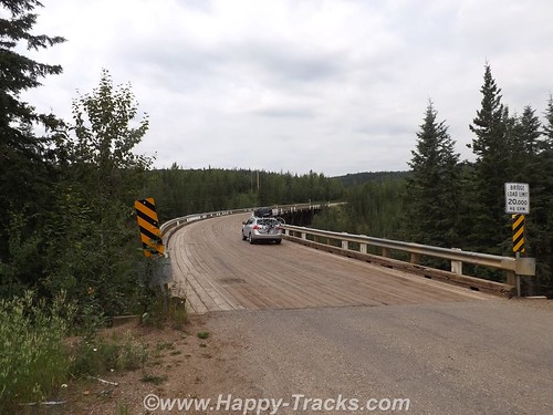
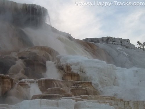
It happened this section included the old Kiskatinaw Curved Bridge. The original bridge was built of wooden timber and this was the last timber bridge still in use on the old highway. It also is unusual in that it is curved about 9* in its 540 ft. length. Because of its timber construction it is limited in capacity to 25 tons which meant that heavy trucks were forced to ford the river rather than cross the bridge.
With the expanding oil and gas industry, this became more of an issue and a re-routed road and new bridge were built in 1978.
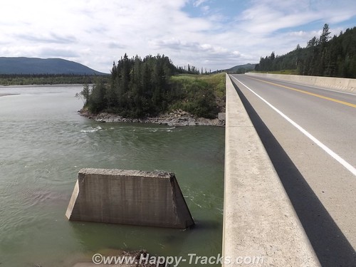
Further along we crossed the Peace River Bridge which is the longest water span on the Alaska Highway. It opened in 1958 and replaces the Peace River Suspension Bridge which collapsed dramatically in 1957. If you want to more about the collapse, see here. The “new” bridge is metal-decked.
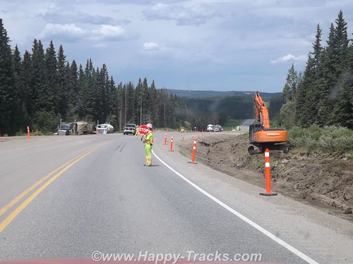
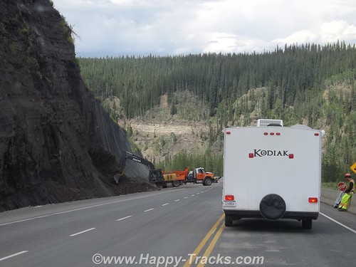
In general, the road is in good repair but there are sections where that is not the case. Summer is also construction season. Any significant repairs are done during the summer rather than during the cold season when frozen ground and frigid air temperatures prevent effective repairs.
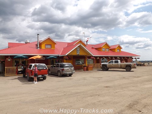
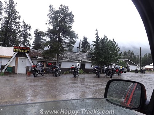
We had lunch at the Pink Inn which has been there for the last 50 years. It is open 24 hours a day and includes fuel, lodging and a restaurant. The restaurant has a cook on duty through the evening meal. After that, there are sandwiches and some serve yourself type foods through the night. Most of the menu was burgers and steaks type meals. We discovered that menus outside the cities tended towards hearty meals and large portions. This meets the tastes of most of the clientele — truck drivers, workers in the oil and gas industry or lumbering. It also offsets the relatively high prices which comes, in part, from the high transportation costs.
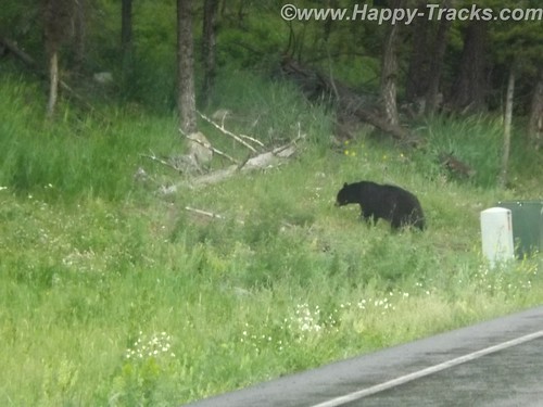
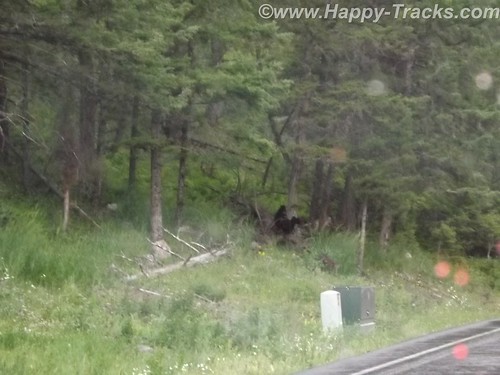
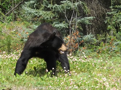
Shortly after the lunch, we saw our first black bear alongside the road.
Further along, we stopped to allow clearing of some fallen rocks.
We passed by a natural gas processing facility. As part of the natural gas production, sulfur is removed and recovered. This processing plant pipes the sulfur across the road but due to the harsh environment and constant movement of the ground in a freeze/thaw cycle the sulfur pipe runs above the road.
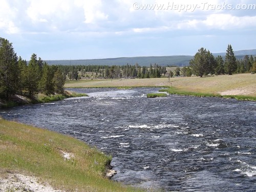
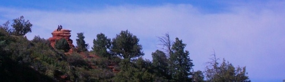
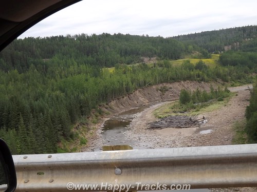
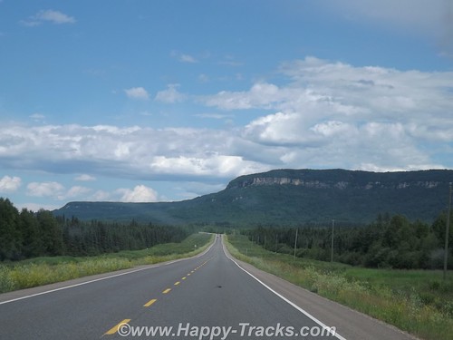
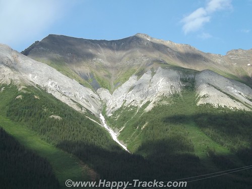
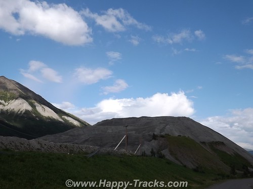
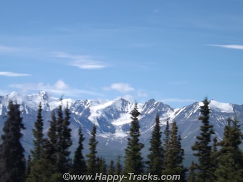
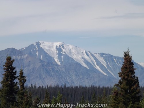
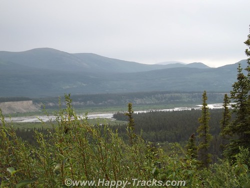
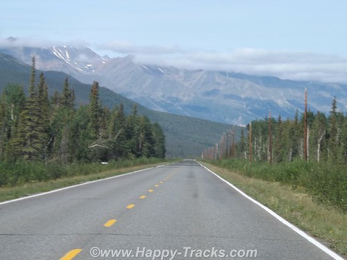
The wild countryside just rolled off mile after mile of gorgeous scenery in the form of forests and mountaintop.
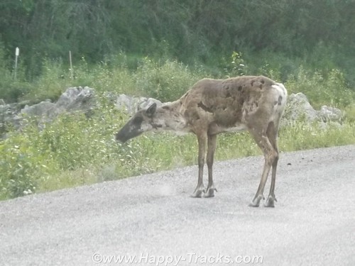
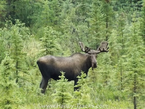
We saw a young elk on the roadway which stayed around for several pictures but he wasn’t looking his best for his photographic debut as his coat was moulting.
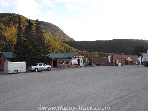
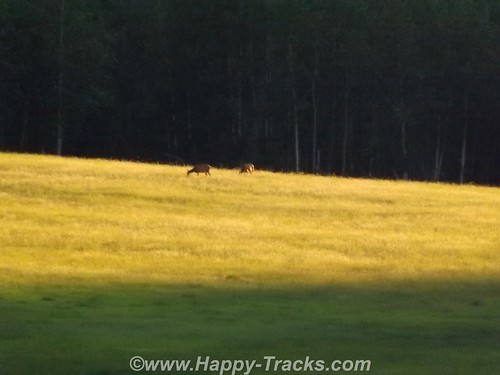
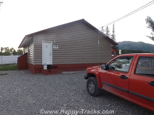
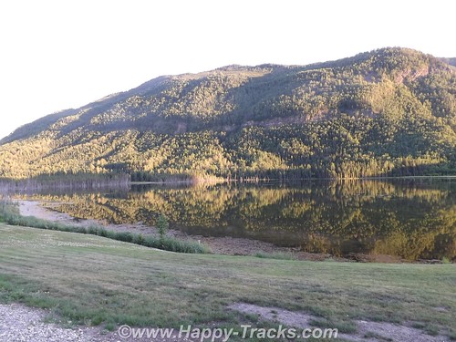
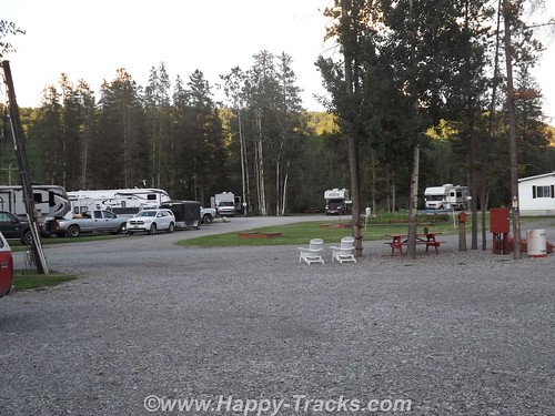
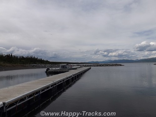
Our first overnight stay was at the Toad River Lodge at MP 422. We had “only” traveled 405 miles today along the highway but the historic mileposts are still used even though rerouting has shaved some miles off the route. Like most of these roadhouses, Toad River Lodge had fuel, a restaurant, lodging and a campground. There was also an airstrip. The front desk is not manned around the clock so there is a sign telling late arriving guests just to take a key for an unlocked available room and settle up in the morning. Toad River Lodge has multiple cabins facing the water and a terrific view of a field where we saw several elk at a distance which we were told are residents.

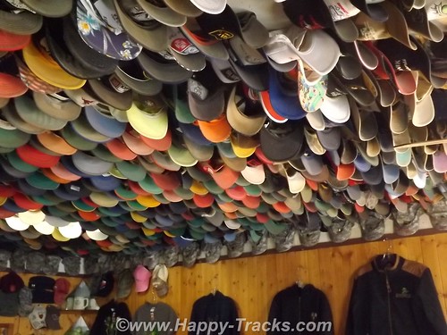
Toad River is also noted for its display of caps which are nailed to the ceiling in the restaurant. According to the story, in 1979 the Lodge was owned by a pair who liked to play practical jokes on each other. When one had left the room and left his cap on a table, he returned to find it nailed to the ceiling. It caught on. Along one edge is a row of military camouflage caps.
Great scenery and a comfortable bed.
After a hearty breakfast, we were off again the next morning.
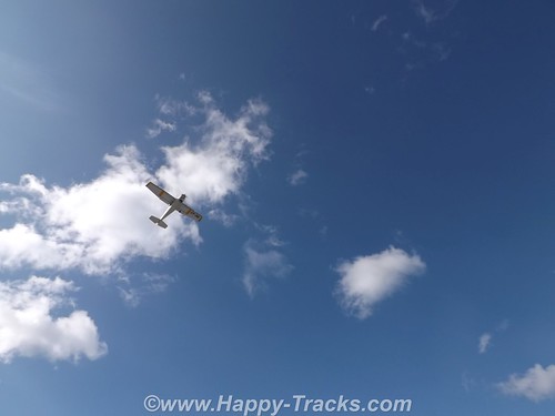
 In Muncho Lake Provincial Park, we noticed four people turning a small bush plane around on the gravel and waited to watch it take off.
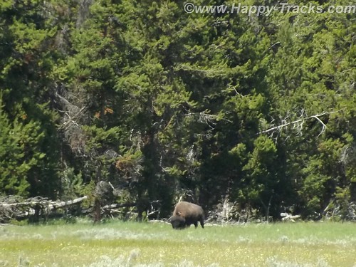
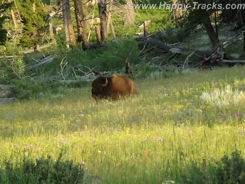
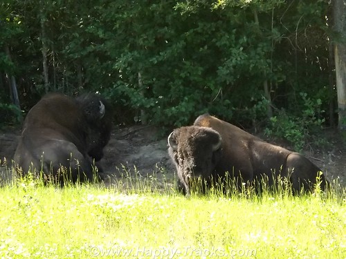
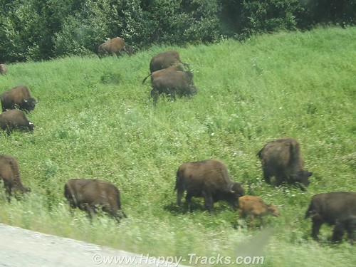
We passed a couple of bison alongside the road before our morning break.
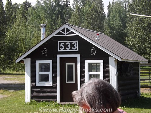
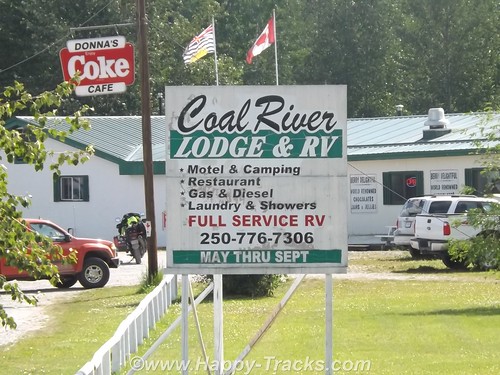
We stopped at MP 533 at the Coal River Lodge. The bridge over the Coal River is relatively new. We had hoped to find a spot where Mom and Dad had taken a picture on their trip but it turned out being the wrong spot. We did however find the piers which had supported the old bridge. (By the way, if you’ve got some money to invest and always wanted to live in BC, the Coal River Lodge and RV park is available for $575K.)
We continued along and crossed the Laird River bridge. Through the park, we also sighted a small herd of bison and a pair of black bear along the highway.
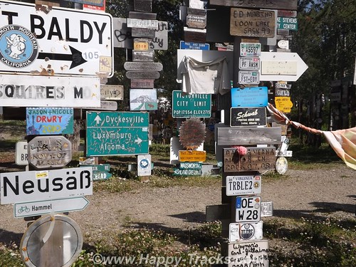
Our next significant town was Watson Lake. Watson Lake is known for the signpost village. It got its start in 1942. While working on the AlCan Highway near Lower Post, BC, Private Carl K. Lindley from Company D, 341st Army of Engineers was injured and taken to the Army Aid Station in Watson Lake to recuperate. During that time Carl’s commanding officer got him to repair and repaint the directional post. While Carl was carrying out this task he decided to add his home town sign of DANVILLE, ILLINOIS. Carl was known as the homesick, lonesome soldier and he was aware of the tradition that he started and what is now known as the World Famous Signpost Forest. It may be worthy of note that the most expensive gas we bought was in Watson Lake.
We fueled up both the truck and our stomachs here. The place we stopped (across from the signpost village) had construction going on (new sidewalks, etc) and the cafeteria was located in the back of the store next to the laundromat. Concrete floors and steel commercial building walls and a very limited menu contributed to the depressing atmosphere and made us question what we had gotten into as it seemed to be more and more rustic as we went along.
We took a detour just outside Watson Lake and turned south to Jade City and the ghost town of Cassiar, appropriately enough on the Cassiar Highway.
Jade City is a series of commercial enterprises which includes a lodge with cabins, a jade store, a demonstration of the jade finishing process, a First Nations art store and a parking spot for RVs. There is a restaurant but its currently closed and there is no fuel available here. Cassiar is the site of an asbestos mine which has closed and is now an environmental cleanup site. You can see evidence of some of the buildings there but the main town site is closed off with a fence and posted no trespassing.
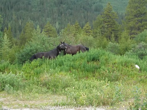
You can also see the remains of an airstrip which served the town. Asbestos and jade are both found in the same type of rock which explains the proximity of the jade operations. Jade City’s population is less than a dozen including the summer seasonal workers. Cassiar’s population appears to be 3 horses which run loose.
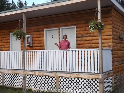
The cabins here are in a row of rooms sharing a bathroom. You do have to go outside onto the porch to get to the bathroom and there are 5 rooms sharing it. This night, we were the only overnight guests so there was never a line. Jade City does have a significant mosquito population, the worst we had encountered so far.
The next morning was foggy and it had rained overnight. We drove back north to return to the AlCan just a few miles west of Watson Lake.
Along the Cassiar Highway, we first saw bicyclists. They were headed north but we don’t know whether they had come from Prince Rupert BC (on the coast) or from further south and inland.
We stopped for breakfast (as there was no food, just coffee — thankfully — at Jade City) at Rancheria. Like the others, this included fuel, restaurant and lodging. A group of 5 motorcyclists had stopped also and one of their group ordered the mega-breakfast. We didn’t see it come out of the kitchen but it included eggs, several meats, pancakes, toast, and potatoes. Based on the large quantity of food in the regular breakfasts, it should have been impressive.
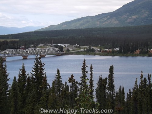
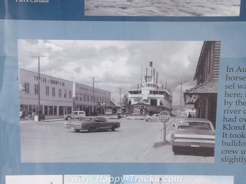
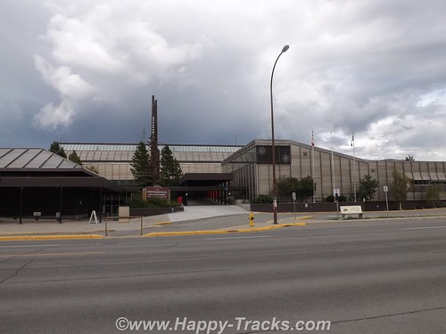
By the time we reached Teslin in Yukon Territory, the rain had let up and we had good weather and good visibility into Whitehorse, the first real town since we’d left Dawson Creek. The town is between the highway and the river. We stayed in the Best Western downtown and it was a step up from where we’d been. We walked around town a bit including down by the river where we saw the sternwheeler S.S. Klondike.
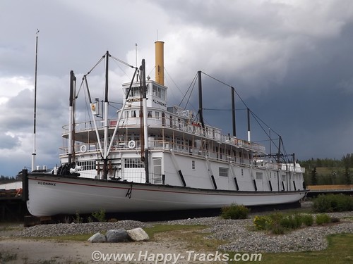
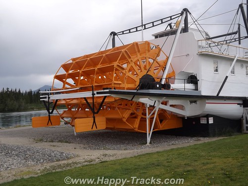
Until 1950, the Klondike, a shallow-draft ship had been an important link in the movement of freight and passengers until the highway diminished its importance. The ship sat dry-docked for several years after its last run upriver but was eventually sold to the government which would include it in the riverfront park as an exhibit. The ship was moved from the drydock to its display place by skidding it up the street on a bed of dampened soap flakes!
Whitehorse is the legislative capital of the Yukon Territories and was visited by the author, Jack London, before he wrote his famous books and short story about the Yukon and the cold.
One of our most interesting conversations was with an employee of the hotel who was sweeping the sidewalks out front along the street. He had some interesting comments on the states of Colorado and Washington legalizing marijuana and wondering how they would play out as he believed it to be a sign of diminished ambition and he had some concerns about fetal development. There was also some discussion about differences in gun laws between his country and ours. He talked about how our Congress and President seem to be ineffective in getting the work done. His knowledge of USA geography identified Maryland as being close to Nova Scotia, not what we usually think but from thousands of miles away, they really aren’t that far apart. He followed US news through the internet. Interesting conversation from an “outsider’s viewpoint”.
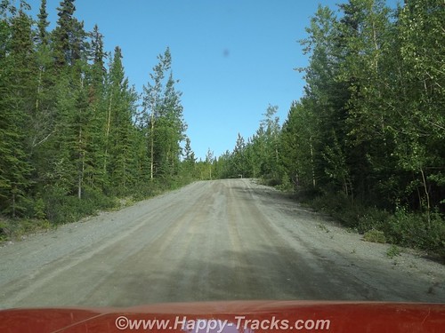
The next morning, well-rested, we passed by the Whitehorse Airport which is served by Yukon Air and Air Canada with scheduled service. We took another stretch of the old highway just past Whitehorse. This section was relatively smooth dirt and gravel but we imagined it could be a real mess when wet.
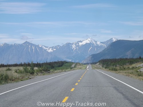
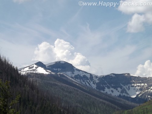
We continued on through breathtaking scenery toward the Kluane Mountains. At the edge of the Kluane National Park and Reserve, we passed though the tiny crossroads of Haines Junction which we would visit again on our way home. Historically, this area was an outpost for the RCMP who required gold rushers to have enough supplies to get to the gold fields.
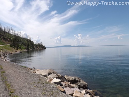
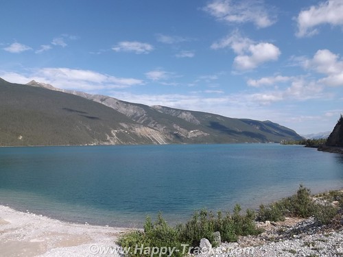
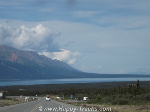
We got our first glimpse of the aqua blue waters of Kluane Lake from Boutillier Summit, the second highest point on the highway between Whitehorse and Fairbanks. The south end of the lake was once the drainage south to the Gulf of Alaska but approximately 300-400 years ago, Kaskawulsh Glacier closed off that end of the lake, resulting in a rise of 40 feet in the lake’s level. Eventually, the lake’s drainage shifted to flow north and west to the Bering Sea. You can still see traces of the beaches up the hillside.
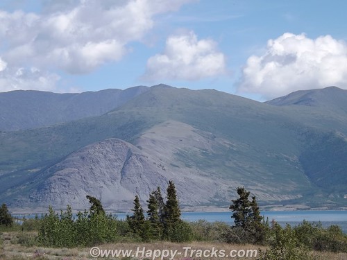
The road continues along the lake shore with views of the mountains on both sides of the lake. Our goal for this day was Destruction Bay about 40 miles up the lake. Destruction Bay is one of the towns that traces its history back to the highway construction. The name traces to a storm that destroyed homes and supplies staged here. It continued as one of the 100 mile stations that were spaced along the route to provide infrastructure for the trucks traveling along the highway.
We had a shorter day, only traveling 170 miles as the spacing between stops didn’t work that well for traveling on. We used the early stop to do some on-foot exploring of the lakeshore and the village. We got checked in at Talbot Arm and went for a walk after we got settled.
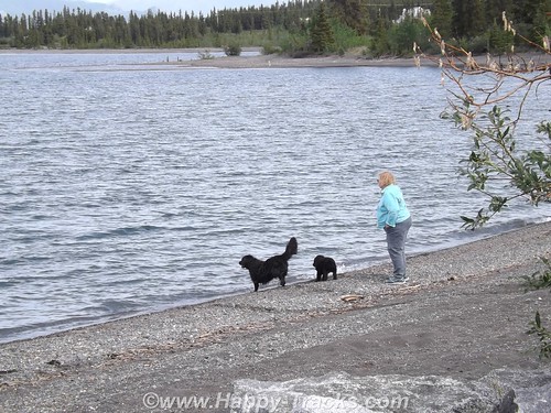
There were some docks and a couple of boats tied up as well as on trailers. We saw a couple of dogs exercising their human by having her throw some things which they promptly returned for her to throw again. The views of the mountains on the far side of the lake were breathtaking.
I’d been wearing an old t-shirt from back in the days when work used to send me to Austin Texas once in a while. That shirt opened a few conversations including one with these two bike riders who said they’d ridden their bicycles up from Texas since early summer. Probably should have taken more time to find out some more details from them. Apparently they camped along the shore that night as we saw them come up and start riding north while we were eating breakfast the next morning. We thought we had a long trip in the truck, its hard to even imagine riding a bicycle that far. 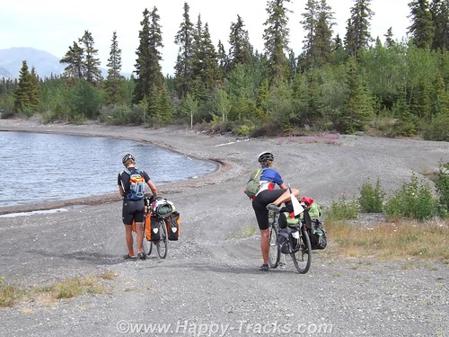
Wandering about town a little more, we found the post office and the public pool. We also passed by the medical clinic and the fire station on our way to the school.
Up by the highway was a pavilion (somewhat overgrown) that had some informational signs (I think the term is interpretive) and commemoration of the 50th anniversary of the highway.
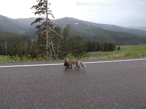
The next morning after we passed the bicyclists, we saw a moose on the side of the road but too late (we thought) to get his picture as we passed. I made a u-turn and headed back on the off chance that maybe we could get another glimpse. I think he was used to working with tourists as he waited for us and just posed waiting for me. We snapped off a few pics before he decided he’d had enough and moved off into the trees.
We started encountering more and more of the undulating pavement called frost heave. As we understand, the road is built on a base that includes permafrost which will thaw and melt under the roadway. It looks to be a full-time job to keep up with the roads although the major rework is limited somewhat to summer months.
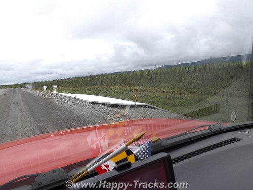
This picture shows a research project designed to help deal with the frost heave by equalizing the temperatures of the road bed. As we neared the end of the this stretch of construction, we felt the telltale rumble of a flat tire.
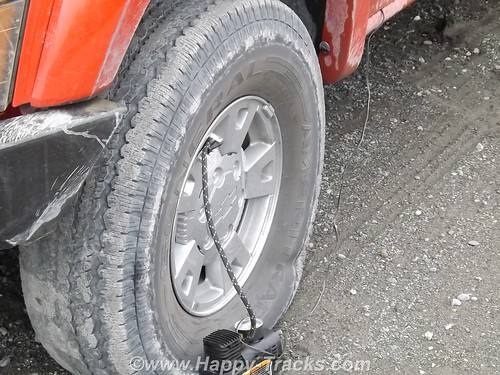
We hooked the pump to it to get us to a better spot for changing since the leak seemed to be definite but slow. While we were letting it fill, some of the construction crew stopped and told us the next settlement was just around the curve and which shop did tire repairs. They also told us where to find the owner if he wasn’t in the shop when we got there. As it turned out, the leak was slow enough to let us make it to the shop where we found a nice flat piece of concrete to jack it up and dig out one of the spares. As it turned out, the tire was not repairable but we had a second spare to go the rest of the way (we hoped) with us.
The next major point of interest was the Canadian Customs station which was about 20 miles before the border and then the border itself. While we were expecting there to be some space between the Customs stations, we were a bit surprised that there was this much “unpatrolled” distance between the two.
The US Customs station was just a few hundred feet past the border. We had some of Mom’s pictures that we had hoped to re-create but the Customs Agent told us that this facility was new and that the Customs Station in the 1950s had been 90 miles up the road in Tok.
Another 3 miles north and we were back into the rain as we pulled into the Border City Lodge. Typical lodge along the highway but it seemed the shelves were nearly empty, but there was a special for lunch and we both had the navy bean and ham soup. Maybe its because it had been so long since we’d had it but it was great and served with a half sandwich. The lady working the diner section told us that they had changed management this year so inventory was down. They had some beautiful animal skins, including a black bear, mounted on the walls.
We continued north to Tok where the Customs station had once been. That site is now the State Police station. There is a very modern Visitors Center with information on much of Alaska for whichever direction you leave the crossroads town. There are several gas stations, restaurants and a pretty extensive gift shop.
There is also a large (but closed) motel at the main corner. It seems that this had until recently been a major stop for the cruise line tours. Weather frequently interfered with the tour stops and the cruise lines picked a different spot. This worked to our advantage indirectly as the restaurant at the Golden Bear where we stayed now had the chef from the cruise lines motel. We had the best Mexican dinner!
The Golden Bear also had a speaker each night, one of the Iditerod drivers who had placed just a couple of years before. That night they also had a tour bus stopping in so we skipped the meet and greet.
The bridge over the Tanana is in at least one of Mom’s and Dad’s pictures but we couldn’t find the exact spot where they took this picture, probably because the highway had been rerouted in its modernization but we did get some pictures nearby.
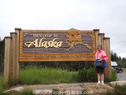
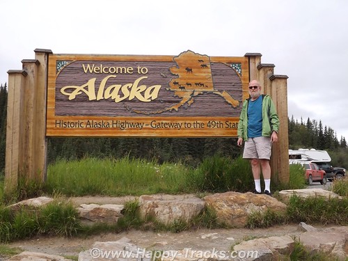
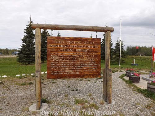
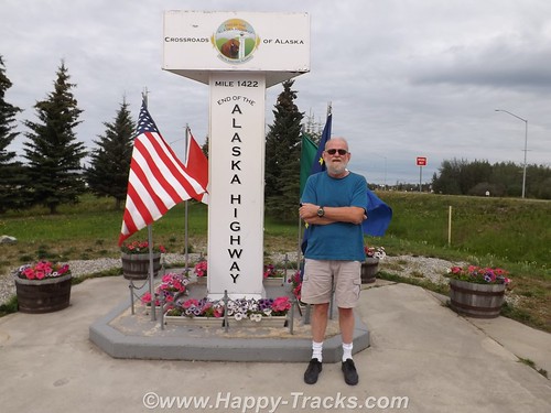
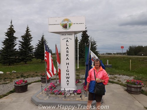
Twenty miles later, we were in Delta Junction at the intersection with the Richardson Highway. We had reached the end of the Alaska Highway! The spot is marked by another milepost similar to the one 1422 miles away in Dawson Creek.
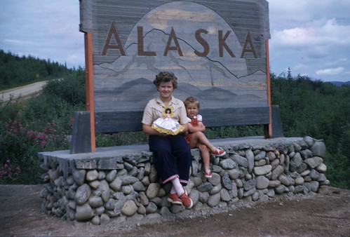
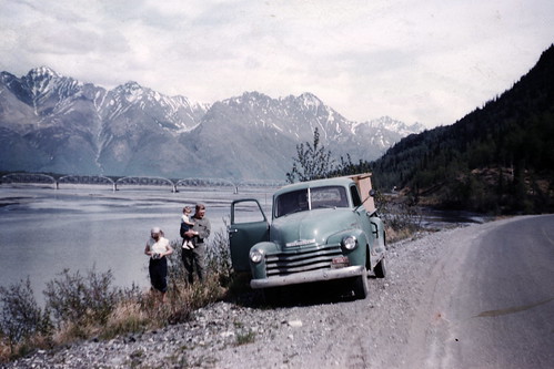
The story of the Alaska Highway from its origins in 1942 as a means to get military support to the Alaska territory to today as primary transport link for tourists and commerce is a long one, almost as long as the highway itself. We decided to make the trip because Mom and Dad and my sisters, Bonnie and Faith had made that trip 60 some years ago pulling that Spartan trailer behind the Packard heading north and behind the Chevy pickup heading south. The highway doesn’t follow quite the same route, its all paved now but some of the places are basically unchanged.
You can see all of the pictures from this leg of the trip here.
We invite you to continue along with us and hope you enjoy the account!