After a good night’s rest in Anchor Point, we loaded up and headed back into Homer.
We had one recommendation but went instead to Maura’s Cafe and Deli in the old part of Homer. They looked to be doing a great business and we believe in the old adage to eat where the locals eat.
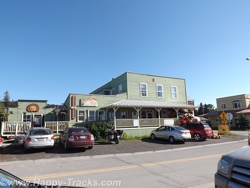
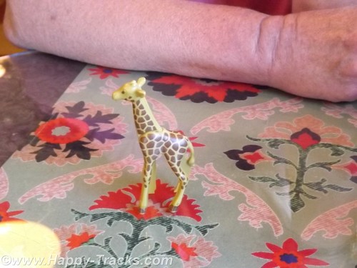
When we went inside, there was a line to order and no seats to be had. By the time we got to place our order a couple of tables had emptied out. We both ordered the quiche and were given a plastic giraffe to take to the table with us instead of a number.
As we waited, it became clear the morning rush had been a good one and they were running out of things. We enjoyed our meal and went out to explore.
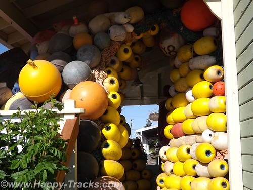
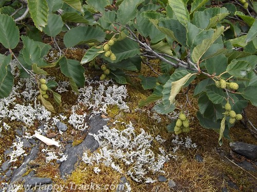
There was an interesting tableau of buoys on the porch of the store next door.
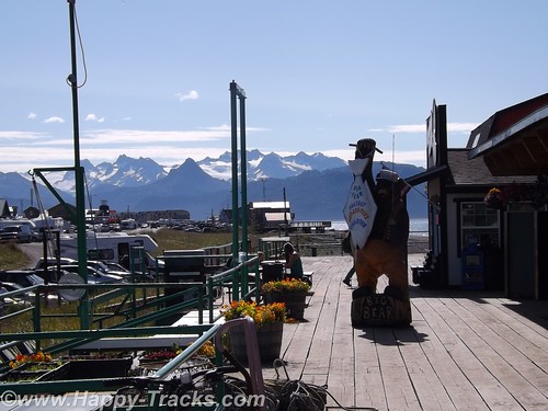
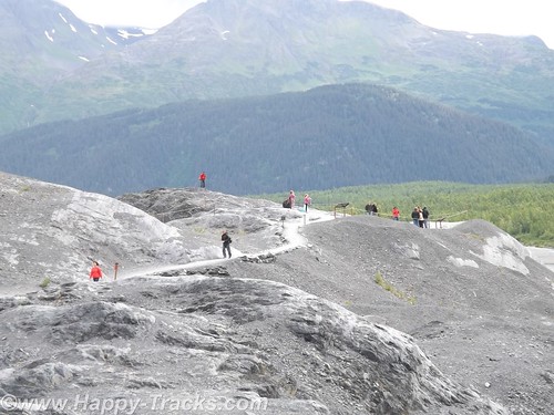
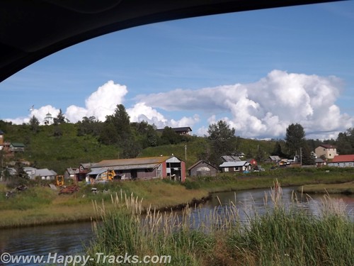
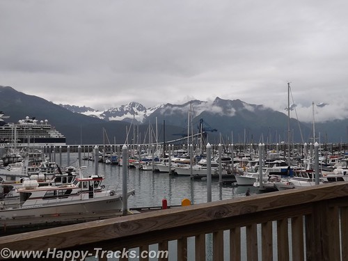
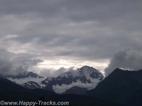
Then we followed the road down to the beach and on out to the Homer Spit. The Homer Spit is 4.5 miles of land sticking out into Cook Inlet and home to both deep water on one side and shallow water on the other. The theories to its origins differ with one suggesting that the Spit is the result of glacial movement and one suggesting that it’s the buildup of sand deposited by the comings and goings of tide and wave action over millennia.
The spit includes a fishing lagoon which is stocked each spring from the nearby salmon hatchery.
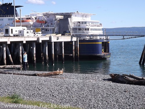
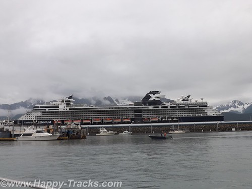
On this particular summer Sunday, the Spit was packed with tourists (just like us) in all manner of vehicles from compact cars and bicycles to huge RVs. At the water end, the M/V Kennicott, part of the Alaska Marine Highway System (ferries operated by the state) was loading. We stopped to watch for a while and then noticed the birds. In this case, the birds were bald eagles. In total we probably saw 4 of them.
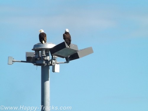
Among other things, Homer is known as the home of the Bald Eagle Lady, Jean Keene. Ms. Keene had been feeding the eagles for years before the town passed an ordinance making it illegal to feed them. One renowned photo of Keene shows her sitting on the ground and feeding 24 of the birds clustered around her. Homer’s ordinance, passed in 2006, granted a reprieve for Keene who had been feeding the birds for 25 years at that time. The reprieve was only to last until 2010 but Ms. Keene passed in 2009.
The eagles, in such abundance, were said to be a nuisance by appearing threatening to humans as well as small dogs and other birds. ABC News reported in 2007 that any close up picture you had seen of a bald eagle was likely taken in Homer. Their presence contributes to the tourism in Homer, even in the winter.
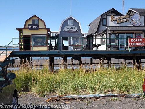
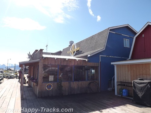
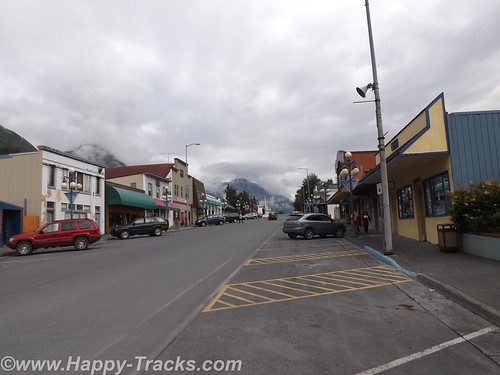
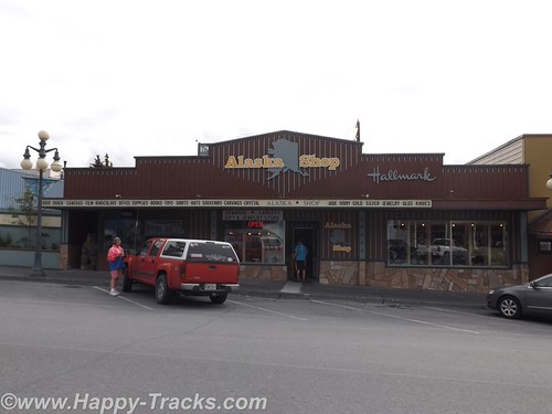
After watching the eagles and the ferry load for a bit, we headed back towards town and stopped at one of several collections of small shops built on stilts above the ground. The shops were an eclectic mix of tour offices (go fishing, climb the visible but distant glaciers, boat tours, etc.) and restaurants and shops of all descriptions. The wares varied from Made in China fare to high end art piece carvings of all sorts.
We stopped in one shop which sold antiques and curiosities and talked with the shopkeeper. One item he had was an “electrician’s knife”. It was the same style of knife I have in my toolbox with a single sharp blade and a screwdriver that I had since my days in Uncle Sam’s Underwater Canoe Club. If I didn’t already have mine, I would have bought it ($10) on general principle.
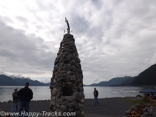
There is also a Seafarer’s Memorial to those lost at sea but we didn’t see it, only found out about it in our research to write this piece. It’s not particularly tall and is on the edge of a parking lot which was filled with campers and vans the day we were there.

Feeling that we had seen most of what we wanted to see in Homer and on the spit, we turned inland and generally north headed back towards Anchorage.
Since there is largely one road in and the same road out, we repeated the same beautiful scenery along the coast and stopped in Soldotna for a late lunch/early dinner at Buckets Sports Grill. The halibut sandwich and clam chowder were just the thing to power us on our way.
We passed through the Funny River fishing region again. There seemed to be more folks out on the riverbanks than there had been the day before but still couldn’t tell if anyone was catching or what they were catching. Traffic was moving well but was a bit heavier through here.
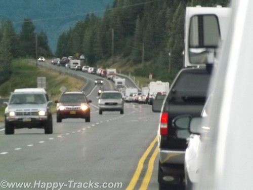
After we passed the Alyeska Resort area, traffic was noticeably heavier and very soon came to a complete stop. At first we theorized an accident up ahead (and there may have been but we never saw signs of it) but it seemed to just be heavy volume of weekend travelers headed home on Sunday evening plus the squeeze from two lanes to one as we squeezed between the mountains and the water as it moved along again as the alternate roads became available going into town.
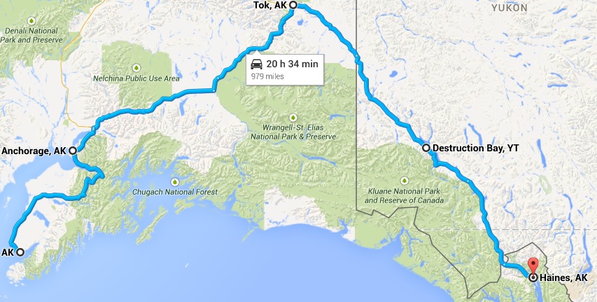
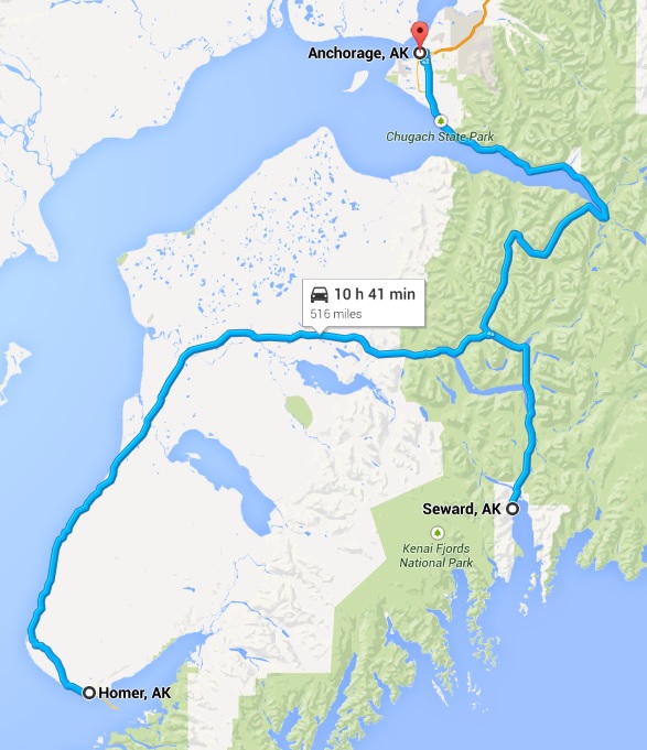
This Sunday in Homer marked the halfway point. We had been gone from home 21 days on what was to turn out to be a 42 day trip. We were also as far from home as we were going to be. Google maps shows Homer to be 4,469 miles from home and we had driven 6,581 miles following a different route through the continental US and numerous side trips.
We got on the phone and booked a room at the Golden Lion Best Western in Anchorage. It was time to call it a night.
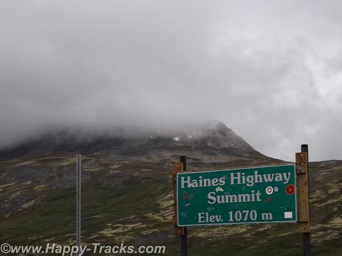
When we started planning out this trip, we had picked a number of “backup” locations in the vicinity of the Wrangell-St. Elias National Park in case we hadn’t seen them earlier, places like mines and glaciers. With plans to possibly pass through that area, it made sense to book passage on the ferry from Haines to see the Inland Passage. We needed to be in Haines on the ferry on Friday morning or stay another week.
The combination of the reservation plus having seen mines and glaciers and the realization that several of the sites in Wrangell-St. Elias would be rough and slow road in a drive in and then reverse and drive back out the same road lead us to decide to skip Wrangell and concentrate on making our way to Haines, some 975 miles from Anchorage via the roads.
On Monday morning, we started making our way towards Tok via AK-1. This was a different route than when we had left Tok. The scenery was beautiful and the skies were clear, unlike when we had first gone from Fairbanks to Anchorage.
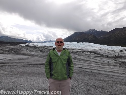
Traveling this way, the roads were more hilly and curved and along the way, we would pass by the Matanuska Glacier. The Matanuska Glacier was described as a “drive-up” glacier, unlike Exit Glacier where one has to climb the hillside to reach the glacier itself.
Betty describes the side trip to Matanuska as “chasing butterflies”, a phenomenon that was really one of the highlights of this trip. Without a firm agenda or schedule to meet, we were able to chase a butterfly off on a side trip. Matanuska is a valley glacier meaning that it is lower in elevation and occupies the land between two hills or mountains.
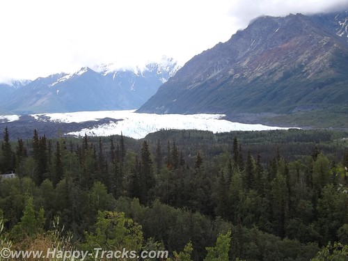
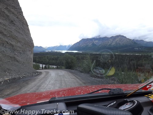
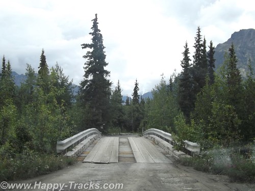
We allowed a half hour or so to make the trip to the drive up glacier just since we were so close. From our vantage point on the highway, you could see the Matanuska Glacier below us in the valley. There was a winding dirt road off the highway to get down to it. We crossed over a narrow high bridge of planks and steel. You continued along until a house and store where you bought your tickets.
From there, you passed through a gate and then it was about a mile to the toe (foot?) of the glacier. We pulled up in the parking area with the other vehicles and started making our way across the black and wet moraine to the glacier. We walked for a ways before realizing there was a marked path on the other side of the water and walked back towards the truck to reach the path. We later discovered the path started from the other end of the parking lot.
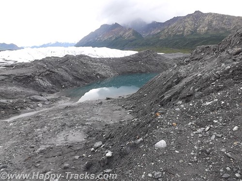
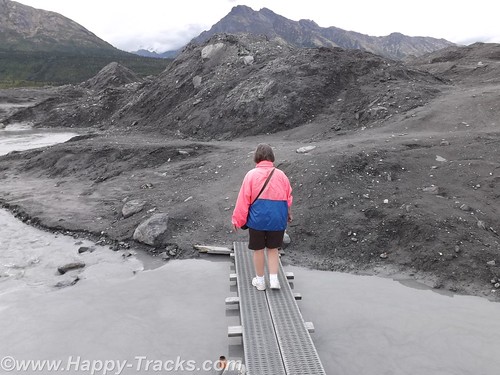
The way out included planks over some of the wetter and trickier areas. There was a group with a guide who were on their way farther out into the middle area of the glacier with their ice spikes. We stopped for a few pictures along the edge and then began making our way back. A family that looked to include Grandma, Mom and Dad, and the kids met us coming the other way. The passing on the planks required some coordination but we safely passed.
About two hours after we had taken the turn on to the dirt road, we were once again on our towards Tok where we stayed again at the Golden Bear Lodge. We have discovered since being home several versions of the origins of the name Tok. Several conflicting sources exist but there is a reference to it being known at Tok as early as 1901. It does represent the junction of the Alaska Highway and a cut-off which allows lower 48 travelers to reach Anchorage and Valdez without proceeding further north to Delta Junction.
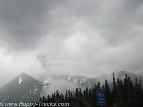
We left the following morning for Canada, crossing into the Yukon Territory and stopping for lunch at Destruction Bay. We continued south past Kluane Lake and took the turn in Haines Junction where we continued through beautiful scenery. This stretch of road is particularly desolate, though in good repair.
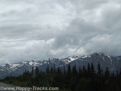
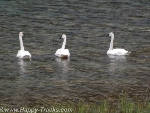
The highlights of this stretch include more mountaintop glaciers, a couple of airstrips and a trio of trumpeter swans alongside the Haines Highway. We also noted several signs advising that snow plows might be in your lane so beware!
About 7:00 that night, we reached the Customs station at the border back in to the US. It looked deserted but we sat and in a few minutes the agent came out of the building. He was friendly and chatty. We hadn’t seen a car in the last 80 miles or so and figured he spent a bit of time by himself unless he walked over to the Canadian side and talked to their agents. He remarked that he didn’t see too many Maryland plates up that way. He also said he didn’t see many from his home state either. We asked where that was and he told us Hawaii. He had the opportunity to come to this station as a temporary summer assignment but assured us he would be back home before winter hit.
Before we left, he gave us the brochure for Haines including a list of lodging. On that road, that’s the only place you could possibly be going. We wished him well and went on our way.
You can see all of the pictures from this leg of the trip here.
We invite you to continue along with us and hope you enjoy the account!
Monthly Archives: October 2014
Summer 2014: Alaska via the AlCan; Exit Glacier to Homer
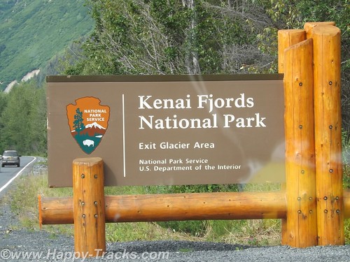
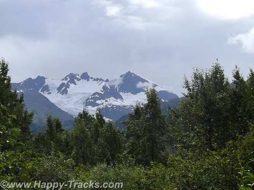
Our National Park system was established near the turn of the 20th century. We’ve come to learn that many of our country’s national parks are considerably newer than that. For example, the Kenai Fjords National Monument was established in 1978 by Executive Order of President Jimmy Carter. The Kenai Fjords National Park was established in 1980 with the Alaska National Interest Lands Conservation Act. Within the Kenai Fjords National Park is Exit Glacier. The name came from a newspaper story describing the first recorded passage across the Harding Icefield saying those crossing the icefield would soon be leaving via the “exit glacier”.
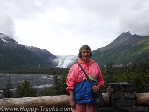
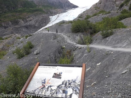
To access the Exit Glacier, we drove along a spur road off the Seward Highway for about 2 miles to the visitor center and a parking lot. There was a pulloff along the way which offered a view of the foot of the glacier and the stream flowing from there towards Resurrection Bay. Along this road were several tour guides both for the glacier and for kayak and other nature tours.
In the pulloff (posted with no camping signs), one visitor had a popup tent camper setup and appeared to be taking pictures perhaps for an advertisement or story layout of some sort.
On the drive in, we passed signs marking the recession of the glacier as this current ice age plays out. The Ranger Station area includes a parking area including space for RV and bus parking which also took the overflow from the car parking area. It was a sunny and warm Saturday so there were many cars in the lot. The building includes some interpretive displays as well as a small shopping area along with the ever-present warning to beware of the bears and not to feed the wildlife. Ranger tours are available every couple of hours as well as a mid-day presentation at the visitor center.
We opted to walk on our own. Parts of the trail are ADA accessible. The accessible parts are relatively flat (and paved with asphalt or crushed gravel). That part of the trail goes to the rocky streambed at the foot of the glacier.
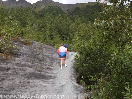
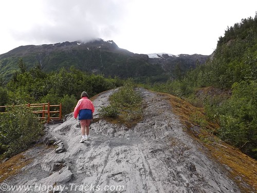
The trail also proceeds upward toward the glacier itself. Fairly easy walk if you’re in good health and there are places to step off and rest if that suits you. In several places the trail narrows so that you have to alternate for folks going up and down. There were a number of families on the trail from kid strollers to folks older than us. A bit more than halfway up the hill is a marker for where the edge of the glacier was in 1998. A half mile or more behind us was the marker for the 1980 edge.
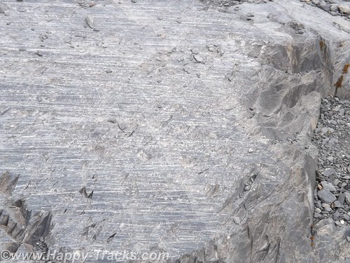
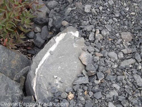
Along the way, you could see the drag marks in the rocks where the glacier had been moving. The rocks showed layers of lighter colored rock formed by mineral-laden steam pushed up from below which solidifies.
As the glacier recedes, moss and lichens take hold in the rock and slowly break it down to form soil. As the soil increases, smaller plants take root until eventually trees take root in the small crevasses.
While it was warm and sunny out, as you stood by the glacier you could feel the effects of the breeze blowing across miles of ice. Our light jackets felt good.
The glacial ice has a blue cast to it. We learned this is because the other colors of light are absorbed by the ice.
We meandered back down the hill and out onto the rocky streambed. The rocks were mainly rounded and varied in size from golfballs to softballs.
We stopped to look for postcards before making our way back to the truck and started driving north and west across the peninsula to head south.
We re-traced our route for about 30 miles before turning west. We stopped for lunch at another roadhouse that was doing a pretty good business. We sat at the counter and one of our dining companions ordered a beer with her lunch. First the server had to go find someone else to take her order (we don’t know if it was an age or training thing but the Alaskans seem to take alcohol more seriously than some other jurisdictions we’ve visited). Then the different server asked to see ID from the woman. She showed them her drivers license. After the server left, she remarked to us how they always ask for ID even though she told us she was 60. According to her, Alaska will mark your drivers license if you are convicted of DUI. She didn’t know whether that would prevent them from serving or just trigger a request for keys or a designated driver. Interesting. By the way, the burgers were very good.
As we continued on, we passed over a winding river that was full of fisherman even if not full of fish. We passed by the Funny River (another interesting name).
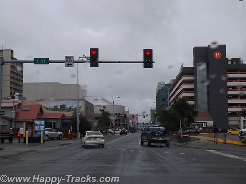
By the time we reached Soldotna, it was time to stretch our legs and grab a coffee. From the main road through town, Soldotna is a typical small crossroads town. Several motels, a couple of small shopping centers and restaurants along the main drive through town. Soldotna is sometimes referred to as red and green city as it boasts the only traffic lights (which create a bit of a jam) we’d seen since we got out of Anchorage!
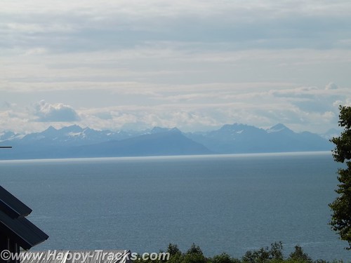
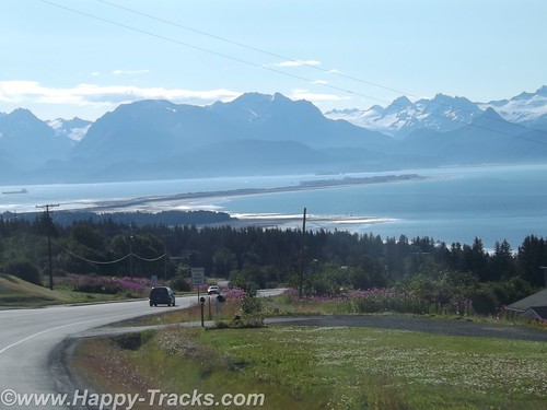
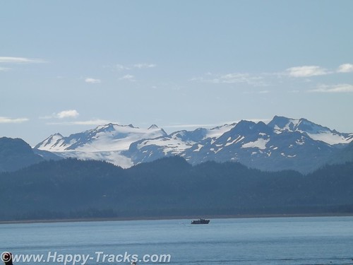
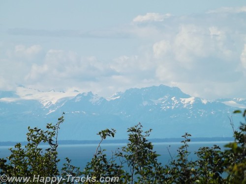
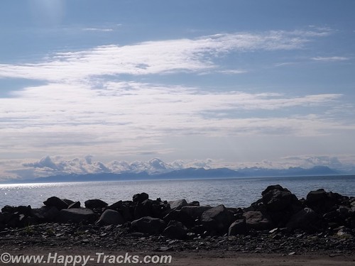
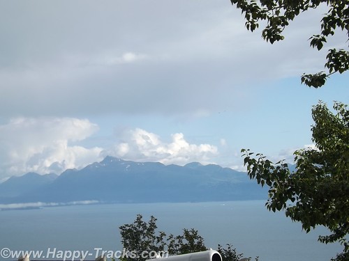
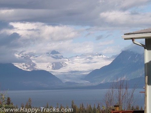
We’re approaching the western side of the peninsula and the highway runs parallel to the shore and along a high bluff. This gives us a great view across Cook Inlet to the line of the Chigmit Mountains, part of the Aleutian Range which stretches into the Aleutian Islands alongside the Bering Sea and northern Pacific Ocean. The view includes the highest point in the Aleutians, Redoubt Volcano (10,197 feet), and Iliamna Volcano (10,016 feet) which are part of the Aleutian trench of the Pacific Ring of Fire volcanoes.
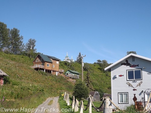
There are a number of B&Bs and vacation homes perched on the bluff with this gorgeous view. Also along the bluff is the The Transfiguration of Our Lord Russian Orthodox Church at Ninilchik.
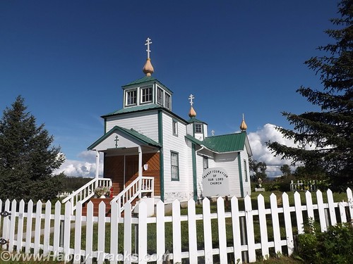
Ninilchik’s original settlers were Russians who migrated from Kodiak Island in 1847 before the sale of Alaska to the USA. Various sources indicate that the settlers chose to stay because it was too much effort to move back to Russia. The culture is still very definitely old Russian. Ninilchik is a popular tourist destination with halibut fishing and clams below the tide line. The Alaskan earthquake of 1964 caused part of the village to drop in elevation. Much of the town is now on the land (east) side of the highway.
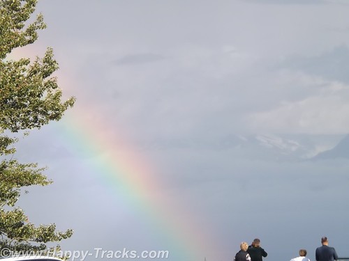
We continued on towards Homer. There is a scenic pulloff before the bluff descends above the town. We sighted a double rainbow and some more great scenery.
We went into town to secure lodging for the night. This task is easier said than done. We checked the chain motel (all full). We went to the Driftwood Inn which has cabins, RV park and lodge rooms but only the RV park had vacancies. The staff there was VERY, VERY helpful in trying to find us a room even making the calls for us. Apparently the Chamber of Commerce or Visitors Bureau maintains a website with listings of the various lodging which is updated with available rooms. The only place listed as having anything available was a B&B on past town. They called but only got voicemail. They left a message on our behalf and we decided to drive on out so we would be nearer should a room be available. We arrived at the B&B but still no callback. We went to the door but no one answered there either. We finally were able to talk to the innkeepers on the phone but they indicated they had rooms but only rented with a 3 night minimum. They did have a great view but we were off again.
We called down the list the folks at Driftwood gave us and finally got hold of cabins in Anchor Point (about 12 miles back up the road). The woman on the phone said she still had a cabin for one night available. I offered my credit card to hold it but she told us it wasn’t needed. She’d meet us there. OK, I guess. She gave us directions but we took the wrong turn. (Seems there’s two intersections with the highway and North Fork Road.) We called again and she corrected our way. We eventually reached the Sleepy Bear Cabins and got checked in. Sleepy Bear Cabins has 4 cabins and a couple of RV spots.
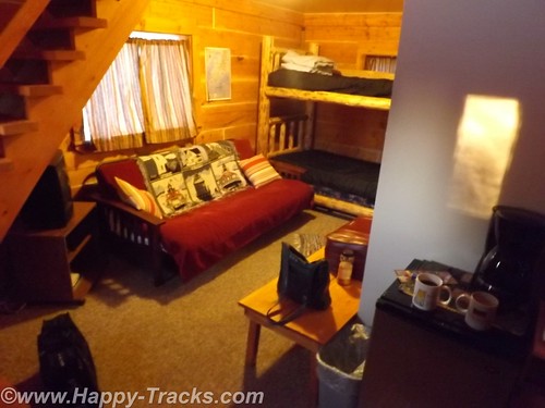
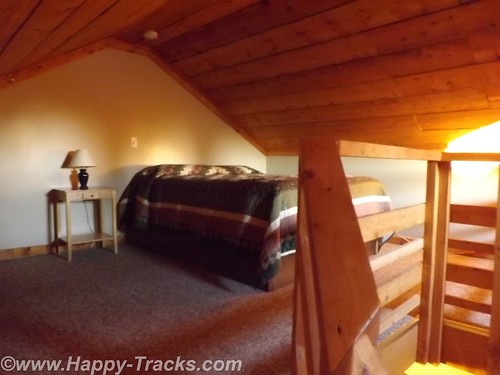
Our cabin would sleep 6 or so people, 2 on the futon downstairs, 2 on the bunkbeds downstairs and 2 in a double bed in the loft. We opted to sleep upstairs but had to remember to duck for the low ceilings and the really low ceiling over the stairs.
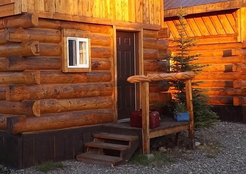
Our cabin was of logs and had some interesting fish carvings in a line for the small stoop rails.
There were no restaurants in the vicinity open so we had sandwiches from the refrigerator in the truck. This was only the second time we had to rely on our own supplies for a meal.
A good night’s sleep and we would try Homer again on Sunday.
You can see all of the pictures from this leg of the trip here.
We invite you to continue along with us and hope you enjoy the account!
Summer 2014: Alaska via the AlCan; Anchorage to Seward
We started our morning in Anchorage with breakfast and then off to the Hood Canal adjacent to Ted Stevens International Airport to view the seaplanes.
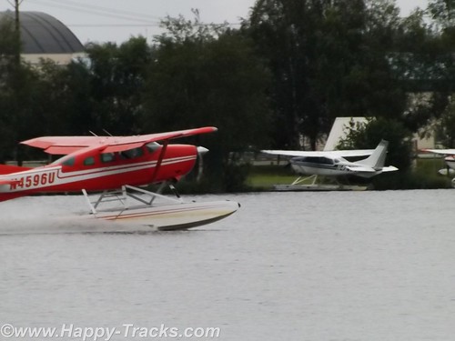
Alaska is a vast state but not dense in roadways. This is a combination of the great distances involved, the harsh environment and the mountainous (in many places) geography. Given the abundance of lakes and rivers, seaplanes are a natural choice for transportation throughout the state.
Scattered around the lake end of the canal are floating docks and numerous seaplanes tied alongside. There were multiple signs advertising tours. After waiting just a little while, we saw a seaplane landing and another taking off. The morning traffic was getting started. Many of the planes are also used for freight and passenger service. According to our reading, over 500 flights per day use the Hood Canal.
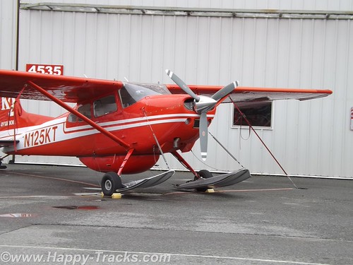
We were also able to travel around the hangars area where the planes were stored and we saw that many of the seaplanes can switch out their floats for skis or for wheels and tires. Our driving about even took us to a couple of places where auto traffic was required to yield the right of way to airplane traffic. The area also allowed us to see some of the Alaska Airlines planes taxiing to and from the terminal.
We were a bit surprised that we were able to travel about as freely as we were with no checkpoints.
The clouds turned to sporadic rain and we headed into downtown Anchorage.
We arrived at the edge of Knik Arm of the Cook Inlet just before 10:00 when the Oscar Anderson House Museum was scheduled to open. Parking was scarce but we pulled up behind a Subaru Outback with Alaska plates. There was a young couple waiting nearby. After a few minutes, the young man approached and asked if we happened to have jumper cables. Do we have jumper cables? Remember we’ve told you earlier we had two spare tires, 5 extra gallons of gas, a winch, enough recovery gear to get us through on our adventure, not to mention two suitcases of clothing, a tool box, a stocked refrigerator and multiple thermos jugs of coffee. As it turned out, we also had an emergency jumpstart pack, a set of jumper cables and an extra car battery, just in case. So, yes, we had jumper cables which started his car quickly. They called the motor club to cancel their request for help and after they left we had a laugh at the tourists from Maryland being better prepared than the “locals” in their adventure mobile.
Oscar Andersen House Museum is recognized as the first wooden framed house built in Anchorage. Mr. Anderson purchased the land it was built on (across the street from its current location) in the 1915 auction that subdivided the city into lots following its selection as the the terminus for the railroad into interior Alaska. Prior to 1915, a tent city had grown up with attendant water and sanitation problems to house the workers who arrived to build the railroad and help harvest the interior bounty.
Mr. Anderson was a Swedish immigrant who had been in Seattle since 1900. Following the US purchase of Alaska from the Russians, he joined the many who made their way north to seek their fortune. He was a butcher by trade and established the Ship Creek Meat Co. on Anchorage’s 4th Street. He was also involved in other entreprenuerial efforts which helped the city (which eventually has become Alaska’s largest) to achieve permanence.
After buying the land in 1915, he hired two Swedish carpenters to build the house and sent for his family (wife and daughter) to come from Seattle. They arrived in October but the family lived in the tent city until December but were in the house by Christmas. (Swedish Christmas traditionally begins the celebration on Dec. 13 but it wasn’t clear exactly when the family moved in.)
Today the house is listed on the National Register of Historic Places and belongs to the City of Anchorage after being donated by the Anderson family. In many other areas, the house might not be thought of as unique but instead as a typical turn of the 20th century home with a parlor, dining room, large kitchen and a mud room off the back. Upstairs are three bedrooms and a bath that was plumbed in later. It is furnished with period furniture and accessories. Its place on the National Register and the fact that it is the only historic house museum in Anchorage makes it worth taking the time to check out. Unfortunately, we got no pictures. As memory serves, it may have been because the camera was due for a battery change when we got distracted by the car battery outside. I’ve linked their website here . If you go and get pictures, share them with us, okay?
Our next stop was the Alaska Native Medical Center Gift Shop. Betty had found out about this place on the ‘net before we left home. The gift shop has many items that are handcrafted by Alaska Natives which we found to be somewhat scarce in our travels and the proceeds contribute to the Alaska Native community at the medical center and a scholarship fund in addition to providing support for the crafters. The wares included jewelry and art pieces. It also included hand carved pieces of ivory. Per Federal law, new marine mammal ivory may be carved only by Alaska Natives and sold only after it has been carved. Old ivory can be carved by non-Natives. Fossilized mammoth ivory may be used by Alaska Natives and non-Natives alike. We had a conversation there with one of the clerks who also cautioned us that marine mammal products could not be taken into Canada (even if just passing through). Items like that would best be purchased and then mailed home. Our discussion with the clerk also included her horror story of trying to get through Canadian customs on a camping trip. Apparently, their customs agent had made up his/her mind that residents of Alaska going camping in the wilds of Canada would have a gun packed away somewhere no matter what they said and so they were required to completely unpack all of their camping gear from the truck to satisfy the agent. I guess we were lucky in that the border crossings were always uneventful. We did enjoy looking around the shop and recommend it as a place to include on your visit.
Our next stop took us back into downtown Anchorage for lunch at Humpy’s where we had salmon chowder and a salmon salad plate. Yum!
After lunch we pulled out of Anchorage on our way eventually to Seward but we were anxious to get to Bird Point on the Turnigan arm to witness the tidal bore. A tidal bore is a wave that occurs when the tide moves through a narrow opening such as the Turnigan arm. The tidal bore can be quite spectacular, even to the point of creating a surfable wave several feet in height. It varies based on the strength and height of the tide.
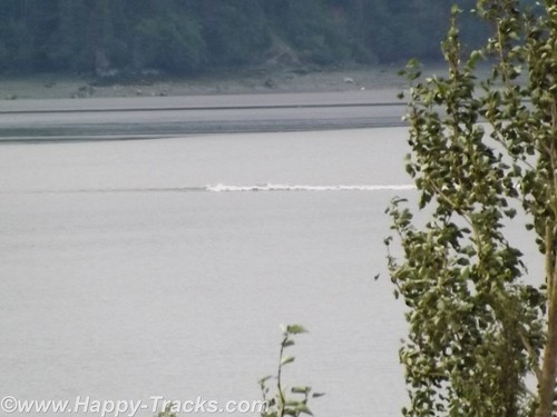
We knew the moon wasn’t right for a huge wave but had read stories and wanted to see it for ourselves. We stopped at Bird Point where a park viewing stand is built for just this purpose. We watched as little by little more sandbars and beach were exposed and then we saw the tide had turned and the water was coming back in a wave. I’ll apologize for my video skills (and the lack thereof) and share this short unedited clip to show you what we saw.
Its really very much like a wave hitting the beach in the ocean or gulf at very slow speed.
After we got back into the truck and headed on along the arm, we passed some Stand Up Paddlers (SUP) attempting to surf on the wave but not having much luck at staying on.
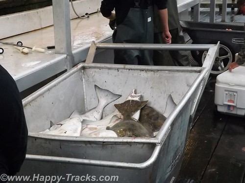
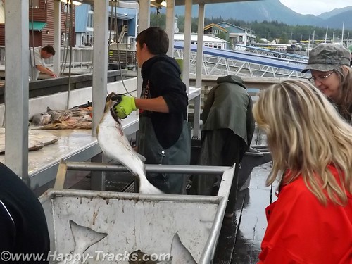
We continued south another 100 miles to the docks area at Seward AK. The docks were very busy with people all about. There were numerous boats tied to the pier as well as many cars/trucks with empty boat trailers in the lots. There was also a cruise ship tied to the pier.
We saw the fishing boats come in and unload their catch and we got to see the cruise ship gather its passengers and go.
While eating dinner, we overheard one woman talking to her young boys about how big the cruise ship was. We did manage to keep our mouths shut when she told them that the cruise ship was even more massive because 90% of it is underwater. I think someone has mixed their icebergs and cruise ships!
Our hotel was adjacent to the docks and appeared to be one of the facilities built to accommodate the cruise ship passengers when they come ashore.
The next morning, we wandered into the downtown area of Seward. During the Gold Rush of the 1890s, Seward became a drop off point for the miners headed inland due to the ice free harbor of Resurrection Bay. In 1903, a group of speculators began building a railroad from Seward inland but it went bust. But the roadbed for the rails became a trail headed inland from Seward to Iditarod, now known for the Iditarod Dogsled races.
The town itself has a central business district a couple of blocks long with old storefronts now being given over to pubs and a couple of standing hotels. Much of the housing in the surrounding blocks appears to be seasonal, renting out to tourists for the fishing season. We found a pretty good souvenir shop which specialized in Alaska-made (not Alaska Native made) goods which probably does a pretty good business.
 On the waterfront, there is a park with a cairn marking mile 0 of the Iditarod and the Alaska SeaLife Center, Alaska’s only aquarium and ocean wildlife rescue center. Although we passed by, we chose to skip it and try to see our wildlife in a more natural setting.
We rolled out of Seward heading north with our sights set on Exit Glacier.
You can see all of the pictures from this leg of the trip here.
We invite you to continue along with us and hope you enjoy the account!
Summer 2014: Alaska via the AlCan; Hatcher Pass, Independence Mine and Anchorage
We left Grizzly Bear Lodge heading south towards Anchorage. Our plan included stopping at Independence Gold Mine State Historical Park and then go on to Anchorage for the night.
Grizzly Bear Lodge had a general store but no restaurant so we stopped at one of the first places we saw which was a small diner next to a service station. It wasn’t very busy and we were the only customers when we arrived. There were two ladies sitting at the counter. We took our seats and perused the menu. Not being especially hungry, Betty ordered the bowl of oatmeal from one of the ladies at the counter.
A couple of minutes later she came back out of the kitchen and asked whether Betty wanted raisins and cinnamon in her oatmeal. A short time after that, a young man walked in and from the conversation he was apparently a new employee. The discussion at the counter included how he was getting to and from work and furnishing his living quarters. Another group of 3 or 4 came in and took another table. Eventually, the young man brought our food and the bowl of oatmeal was HUGE! We have smaller serving dishes at our house! While we were eating, the woman who had taken our order left after making some friendly comment to the young man about him learning to wait tables.
We had eaten our fill and were getting ready to go when the cook came out of the kitchen to find out if Betty hadn’t liked the oatmeal since she had eaten so little. She told the cook that it was good but there was just too much. We thanked them and went on our way.
Other than the question from the cook, this was typical of the roadside cafes in the less populated areas in Alaska and in western Canada as well. Food was filling and often of the comfort food variety but quantities seemed better suited for lumberjacks than for a couple of retired tourists. Prices were higher than we’re used to seeing but this can be attributed to remote locations and differences in currency sometimes but the higher prices are accompanied by larger quantities. It was really a task to try to find a “light” meal. Back to the road.
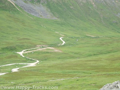
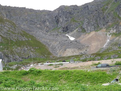
About 80 miles out of Anchorage, Betty noticed that there was a road that went directly to Independence Mine that looked to shave 30 miles or more off our route. So we made the turn onto Hatcher Pass Road at Willow to take the direct shorter route. It was a narrower paved two lane road. We were hoping to make the morning tour which began in 30 minutes and it looked to be about 20 miles.
The road got narrower. There was no longer a painted line down the center as there just wasn’t enough room to give both sides a full lane and a stripe. The turns got a little sharper and more frequent and the pavement got a little rougher. And then about 10 miles in, the pavement stopped, the road crossed over to the other side of Willow Creek and the scenery got a little more rustic.
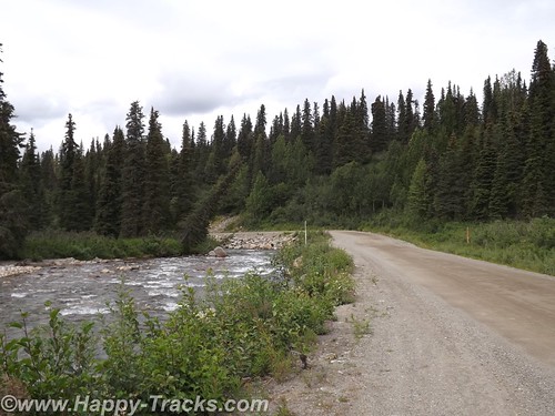
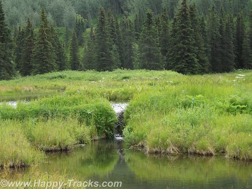
The dirt road included a few more rocks and we were alternating driving through woods and beside beaver ponds.
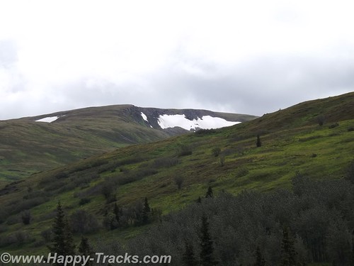
The scenery started to change and we were seeing mountain meadows and the road was climbing. We saw a couple of small tailings piles next to holes in the hills. (A tailings pile is the dirt and rocks extracted from a mine that do not contain ore. It is usually just dumped outside the hole.) The road had degraded to a two track and we were starting to see a few more cars coming the other way which require that one or the other of us stop to let the other one pass.
We came to split in the road and one way went to some small older buildings that were either an older mine or a farm/ranch. The other way climbed again. We climbed. We also passed two joggers seemingly miles from anywhere.
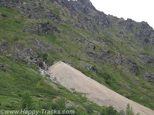
As we climbed again, we passed some modern industrial type buildings inside a fence. While we saw no activity, it was clear that it hadn’t been long since there had been.
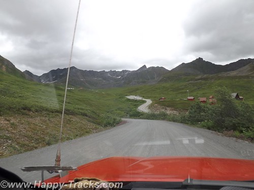
As we crossed the next hill (and felt a certain kinship with Heidi) the descent started and it was steep. We could see the end of our road, and look there, its a paved road leading up to the Independence Mine State Park! Its only been two hours since we started down this shortcut. But it was a ride we both enjoyed through some beautiful country.
There were times before we started this trip when I thought seriously about taking the car instead of the truck. Up to now, there had been no need for four wheel drive and the roads had not required the clearance and the car gets several MPG more than the truck and is reasonably comfortable but we wouldn’t have attempted unknown roads like this in the car and we really enjoyed the detour.
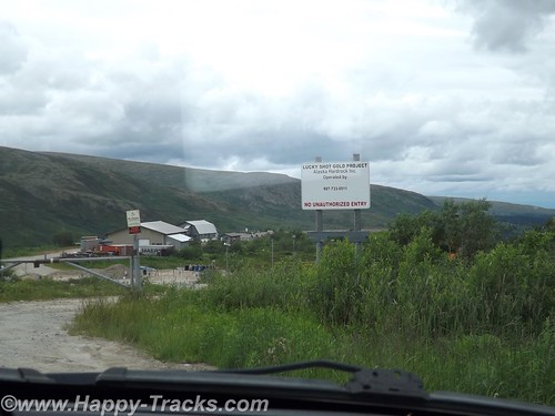
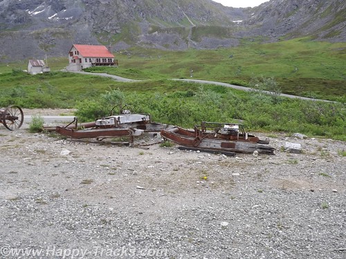
Independence Mine State Park is a closed gold mine. The modern buildings we had seen on the other side of the hill operates out of the same vein when it operates.
The Independence Mine was at its heyday of operations during the 1930s. Mining operations tapered off and stopped during World War II when gold mining was not considered an essential activity.
Robert Lee Hatcher discovered and staked the first lode gold claim in the Willow Creek Valley in September 1906, and others soon followed. But lode mining was expensive for an individual operator; it required elaborate tunnels and heavy equipment, so companies merged to pool resources and reduce expenses.
What is now called Independence Mine was once two mines: The Alaska Free Gold (Martin) Mine on Skyscraper Mountain, and Independence Mine on Granite Mountain. In 1938 the two were bought together under one company, the Alaska-Pacific Consolidated Mining Company (APC). With a block of 83 mining claims, APC became the largest producer in the Willow Creek Mining District. The claims covered more than 1,350 acres and included 27 structures. In its peak year, 1941, APC employed 204 men, blasted nearly a dozen miles of tunnels, and produced 34,416 ounces of gold worth $1,204,560; today $17,208,000. Twenty-two families lived in nearby Boomtown, with eight children attending the Territorial School in the new bunkhouse.
By 1942, the United States had entered World War II, and the War Production Board designated gold mining as nonessential to the war effort. Gold mining throughout the United States came to a halt, but Independence Mine continued to operate because of the presence of sheelite. Sheelite occurs in some of the quartz veins along with gold, and was a source of tungsten, a strategic metal. But because Independence Mine’s scheelite production was low, the exemption was short-lived. In 1943, Independence Mine was ordered to close.
The wartime ban was lifted in 1946, but gold mining was slow to recover. After the war, gold could be sold only to the U.S. government at a fixed rate of $35 per ounce. Postwar inflation raged, and gold mining became an unprofitable venture. Finally, in January of 1951, after mining nearly 6 million dollars’ worth of gold, Independence Mine was closed by APC, and a chapter of Alaska’s gold mining history came to an end. In 1974, Independence Mine was entered into the National Register of Historic Places, a list of cultural resources significant to American history. In the late 1970’s, 271 acres of land were donated to the Alaska Division of Parks & Outdoor Recreation for establishment of Independence Mine State Historical Park. On January 16, 1980, title to the acreage was transferred to the State of Alaska. From http://dnr.alaska.gov/parks/units/indmine.htm
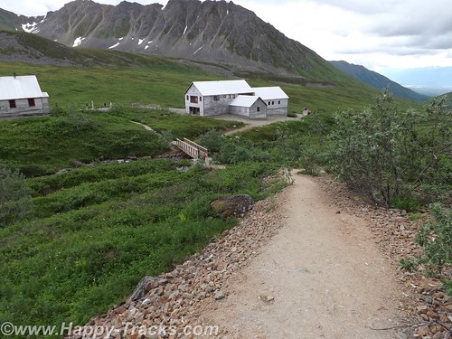
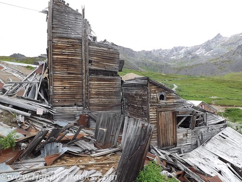
The park is working on restoration of the buildings there. The Superintendent’s house is now the visitor center. Its a large two story house with some historical displays.
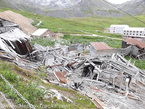
Originally, the men who worked the mines were housed in two story dormitory-style buildings (seen in the picture above). There were separate buildings to support the mine’s operations such as machine shops and tool sheds.
There was a blacksmith’s shop and administrative buildings such as a payroll and assayer’s office as well as a commissary and a dining hall (seen in the picture below).
Other buildings included buildings containing apartments for managers and their families. Over time, the working men brought their families and the mine permitted them to build their own quarters on mine land.
We learned something interesting about miners’ workshifts. After many years of watching movies where the men line up at the beginning of shift and walk in together and then all walk out together, we hadn’t noticed how the two groups never seemed to pass each other. The miners worked 10 hour shifts. At the end of the shift was the time for any blasting after everyone had gotten out. The two hour wait before the next shift went in was supposed to allow the gases and dust from the blast to settle before sending the workers in again.
Some of the buildings are used now for park support activities and a couple are in the middle of renovation/restoration.
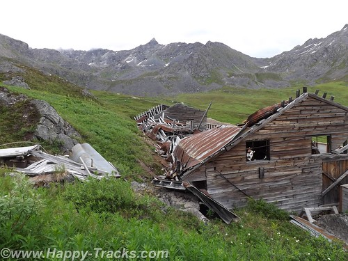
Some are completely collapsed and awaiting extensive work. There was a display in the superintendent’s house on the differences in preservation, restoration and reconstruction. The park is charged with determining the best course for each building to maintain historical accuracy for the park. Although isolated, it should be noted that the mining buildings had electricity and running water even in the 1930s.
We left for Anchorage, passing between Palmer and Wasilla so we didn’t see any famous people, or at least weren’t aware of them if we did passed by.
Our first stop in Anchorage was the visitors center where we got recommendations for dinner and ended up at Crush, a wine bar where Keith had the elk and pork meatloaf with vegetable stuffing. It was quite tasty.
We also visited Oomingmak, a co-op store for hand-crafted quivit items. The co-op is owned by 250 Native Alaskan women spread throughout the state. Quivit is the downy-soft underwool shed from a muskox. We recommend a stop by the store whether or not you intend to buy anything. Their website is at http://www.qiviut.com/ We did ask the clerk there for recommendations of things to see while in the area and one of his recommendations was Hatcher Pass.
We stayed at the Super 8 in Anchorage near the airport. We apparently got the last available room but there were a couple of problems with it. For example, when we went in, it was obvious the bathroom had not been cleaned so we went back to the front desk. The desk clerk told us he was the only one on duty at the time so he would go clean it while we waited in the lobby. He did. After we went to the room, the toilet wouldn’t flush down so back we went to the front desk. With the proper equipment, we cleared that one up ourselves but then the elevator seemed to be having issues. Luckily we were only on the third floor. After the initial issues, the room was great and we spent a peaceful night.
You can see all of the pictures from this leg of the trip here.
We invite you to continue along with us and hope you enjoy the account!
Summer 2014: Alaska via the AlCan, Denali National Park
On leaving Fairbanks, we gave some consideration to traveling north up the Dalton Highway towards the Arctic Circle or even as far as the Arctic Ocean but it came down to making a choice between either of those and having to cut out a day or even two to somewhere else as we had reservations on the weekly ferry ride from Haines in about a week. The side trip just wasn’t worth it so we headed to our next planned destination, Denali National Park.
Denali National Park and Preserve dates back to 1917 when Congress approved the creation of McKinley National Park. While its most famous feature is the tallest mountain in the US, the park and preserve includes 6 million acres of wild country with a single ribbon of road through it. But first we have to get there!
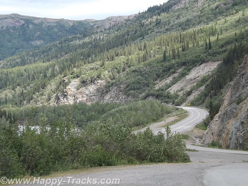
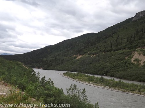
The ride from Fairbanks to Denali started out alternating between relatively flat with mountains in the distance or else riding along higher up with the scenery falling away to either side of the road. We crossed over the Nenana River where there was an old tug boat pulled up along the shore which had pulled freight up and down the river.
Eventually the road begins the dip into a canyon following the course of the Nenana Creek. We encountered more construction both for roads and bridges. The road construction had a pilot car for a length of unpaved road but the short bridges were controlled by a flagman or a portable traffic light.
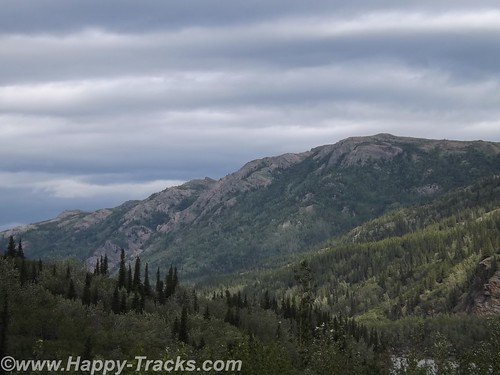
The skies were partly cloudy which resulted in light patterns on the landscape for additional texture.
Just before we got to the road into Denali, there was a village of hotels, cabins, resorts, stores, and outfitters catering to the tourist trade. They all looked to be doing a good business this day.
Charles Sheldon, a gentleman hunter from Vermont and others lobbied Congress for nearly a decade before persuading them to create Mt. McKinley National Park in 1917. In 1921, Harry Karstens, an outdoorsman and dog musher was hired as the first park superintendent. Gold miners and others in Fairbanks and nearby called the icy granite mountain Mt. McKinley. Sheldon referred to it as “the mountain” or Denali, the Athabascan name meaning the high one. Mt. McKinley is now officially 20,237 feet above sea level, the highest in North America. This figure is 83 feet shorter than the 1952 number (which would have been when my folks were in the area.) There is this interesting article on Discovery.com which talks about why the differences.
Along with the wild landscape there were also animals in the area that were to be protected. Specifically, the Dall sheep in the area were being aggressively killed by market hunters. Per the stories we were told there, the market hunters would kill the sheep they needed to market and would also kill the other sheep around and leave them to rot to limit their competitors ability to provide meat. The National Park and Preserve designation was a small step in providing some control over that situation.
Arriving at the park entrance, the roadway goes to the campgrounds and also to the visitors center. From the visitors center, there are options for interior transportation. There are guided tour buses which travel into the interior of the park and various shuttles to different points within the park.
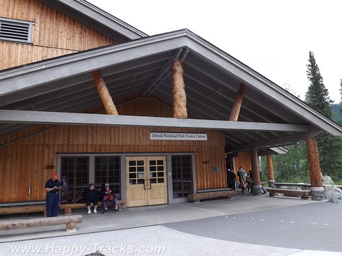
We went directly to the visitors center. This is the spot to get acclimated and find out about the various accommodations for getting around. The visitors center also has a small cafeteria and a gift shop. The 85 mile road through the park has access limited to the tour buses and the campers’ shuttles. There are also flight-seeing tours from nearby Talkeetna that take you around, some even land to let you walk around.
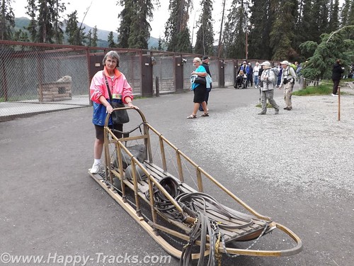
We chose to take the short shuttle to the Sled Dog Kennels. The dogs are working animals at the park providing access to remote areas and support for working and research parties even during the winter months. More about the kennels here.
The bus (similar to school buses) takes you on the 10 minute ride (or it could be except for the stops for road construction) to the kennels. During the summer months, rangers and the dogs demonstrate a working team. Before the demonstrations in the summer, you get a chance to visit with and pet the dogs. Visits and petting are opportunities year round but the demonstrations are summer months only.
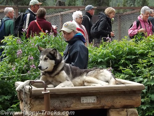
We were surprised to learn that the dogs are controlled by voice command only. For some reason, we had always thought there were reins or similar like larger draft animals.
Each position in the dog team has a specific purpose and different dogs are better suited for each position. Nearest the sled is the wheel dog. The wheel dogs are the strongest and provide momentum to get the sled up on the surface and moving (like getting a boat up on plane).
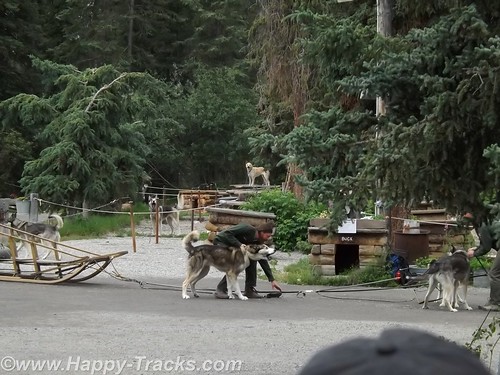
In front of the wheel dog is the swing dog. The swing dog provides power but is also trained to swing out on a turn, rather than follow directly in the tracks of the lead dog. The lead dog responds to voice control to turn, go or stop. The dog team may include up to 12 dogs depending on the load and course to be run.
The dogs typically have a 9 year life on the sleds with an average 14 year life span. That link above even talks about adopting retired dogs.
As an aside, we saw the tourist couple we met at LARS in Fairbanks and said hello.
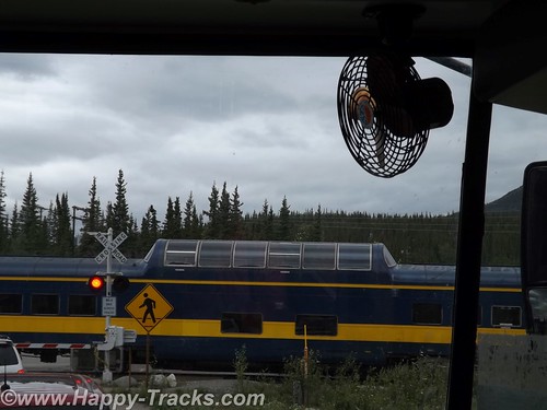
We rode back to the visitors center and decided to take one of the shuttle buses for a brief ride around to the campgrounds. It became more clear that many of the tourists in the park are camping or hiking parts of the large park. While on the shuttle, we stopped at the train crossing to let the Alaska Railroad Denali route train go by. Many tourists will board the train for the ride between Anchorage and Denali with a stop in Talkeetna for more of the beautiful scenery.
We didn’t really appreciate just how big the park and preserve are. We were unable to see Mt. McKinley from the visitors’ center. We were actually surprised that we asked several of the non-NPS workers which direction the Mountain was and they didn’t know. We’ve since learned Mt. McKinley is about 80 miles southwest from the visitors’ center.
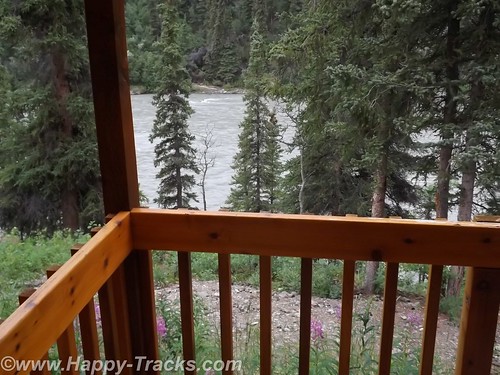
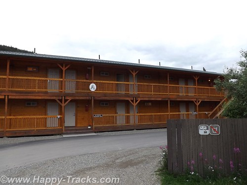
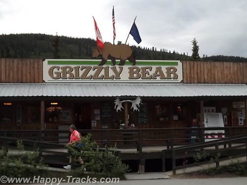
After several hours at the park, we headed out for our accommodations which had been recommended by a fellow on ExpeditionPortal forums. Healy Denali Grizzly Bear Cedar Lodge is just a few miles south of the park entrance (although our GPS directions sent us north instead). The Grizzly Bear Cedar Lodge is away from the cluster of hotels in the village outside the gate and has RV sites, a small general store, a laundromat and a gift shop. The Cedar Lodge itself is set on the banks of the Nenana River. Its not as expensive as the village but doesn’t have all the shops and entertainment within walking distance.
We did get a recommendation for the restaurant just a bit further south, 229 Parks. The food was a more local produce with many non-fried food choices. We had the salmon and the crabcakes and would recommend both the restaurant and lodge to visitors to the area provided you have transportation with you.
The next morning, we headed south towards Anchorage. We still hadn’t seen Mt. McKinley but there were supposed to be several points along the road where we could see it, weather permitting. As we drove along, we saw fog and clouds where Mt. McKinley should be but we never saw the place where we could get out weather permits and thus left Alaska without seeing the Mountain.
You can see all of the pictures and 2 more short videos from this leg of the trip here.
We invite you to continue along with us and hope you enjoy the account!