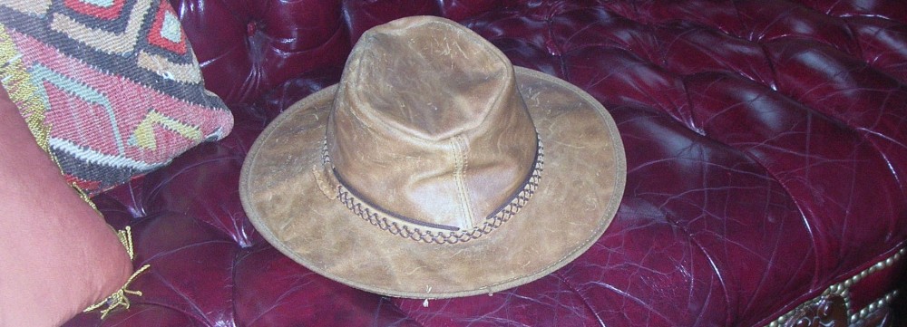
A young and skinny Theodore Roosevelt, Jr. made his way to the North Dakota from New York in 1883 to hunt bison. His time and experiences there shaped his perspective and the national conservation policy for decades to come. He was traveling to a place where he was an unknown and would not likely be warmly welcomed as he was an outsider, an Easterner and a “city slicker” to boot.
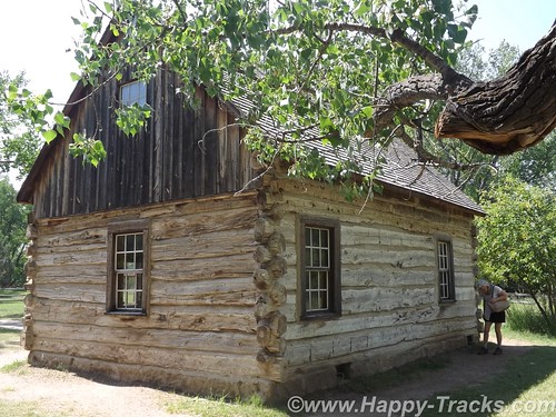
During his hunting trip, he expressed an interest in cattle ranching and eventually made an investment in that endeavor. In that year, the men who tended the cattle investment also built the Maltese Cross Cabin. Roosevelt’s investment of $14,000 (more than his annual salary at the time) was seen as an admission ticket to a different way of life in the wide open spaces. Dakota-grown cattle were seen as a solid investment partly because of the variety of grazing foods available and also because of the efforts of the Marquis de Morès to establish a meat packing industry to packing the meat in the Dakota territory and ship the meat in refrigerated rail cars to the markets in the east.
Roosevelt suffered double personal tragedies in February of 1884 when both his mother and his wife died the same day. The tragedy struck him hard (as to be expected) and he returned to his Dakota cabin for a period of mourning and introspection. He wrote a book about his hunting exploits and becoming a cattleman and expanded his holdings. He threw himself into his cattle raising business, becoming president of the Cattleman’s Association and stepping out to make peace with his neighbor, the Marquis, who was in jail on charges of murder. He also expanded his land holdings to include the Elkhorn Ranch.
Despite his personal warnings about overgrazing the territory, he also expanded his herds. In 1885, thieves stole his boat and he gave chase with two others eventually capturing the thieves downriver. He chose to walk the thieves back to authorities in Dickinson. The story is told in some places that he did so for the reward money or that he did so because they deserved a trial. In either event, his multiday walk to Dickinson with the perpetrators added to his reputation and helped dispel the view that he was a soft Easterner.
The seasons of 1886-1887 would prove disastrous to the cattle industry in Medora and eventually the town itself. The summer was brutally hot and dry with temperatures reaching 125F. Then after the grasses had been so devastated by the heat, the winter was equally extreme with temperatures as low as -41F. The cattle starved or froze that winter.
Although Roosevelt had been hit hard financially, he had grown tremendously in the eyes of the locals and eventually the nation. His embrace of the cowboy life contributed to his formation of the Rough Riders which brought him fame during the Spanish-American War and his experiences with the cattle contributed to his beliefs in conservation and management of our natural resources which carried into his Presidency. Although he would not return often or for long periods after 1887, the experiences shaped his actions later.
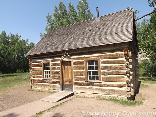
During Roosevelt’s presidency, the Maltese Cross cabin was exhibited at the World’s Fair in St. Louis, MO and at the Lewis and Clark Centennial Exposition in Portland, OR. Later it was moved to the state fairgrounds in Fargo, ND and then eventually to the state capitol grounds in Bismarck where it remained for 50 years. In 1959, the cabin was relocated to its present site and renovated. The most recent preservation work occurred in 2000.
Fellow travelers onboard the SS Matanuska, the ferry we rode along the Inland Passage recommended that we include the North Dakota Badlands as part of our journey east as they are indeed different than the South Dakota Badlands.
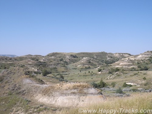
Theodore Roosevelt National Park is really three geographically separated areas of badlands in western North Dakota. The park covers 110 square miles of land in three sections: the North Unit, the South Unit, and the Elkhorn Ranch Unit.
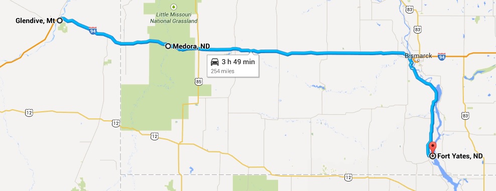
We visited only the park’s larger South Unit which lies alongside Interstate 94 near Medora, North Dakota. The smaller North Unit is situated about 80 mi (130 km) north of the South Unit, on U.S. Highway 85, just south of Watford City, North Dakota. Roosevelt’s Elkhorn Ranch is located between the North and South units, approximately 20 mi (32 km) west of US 85 and Fairfield, North Dakota. The Little Missouri River flows through all three units of the park. The Maah Daah Hey Trail connects all three units.
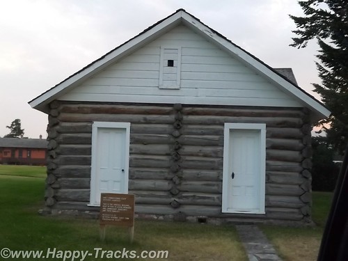
We started our visit in Medora at the South Unit Visitor Center. Located outside the visitor center is Roosevelt’s Maltese Cross cabin. The cabin has been expanded since its original building to include an upper half story and additional rooms on the main floor.
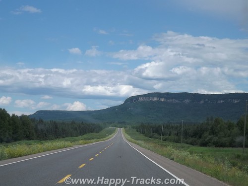
From there, we drove along East River Road alongside the Little Missouri River through the buttes. The topography of the North Dakota badlands seems almost to rise above the surrounding landscape while the South Dakota badlands seem to drop down into valleys and canyons below the surrounding landscape.
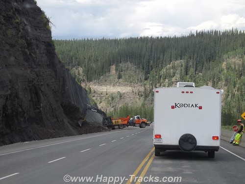
Generally the road was paved although we were stopped early on for construction ahead and the wait for a pilot car to guide us through the single lane in the dirt.

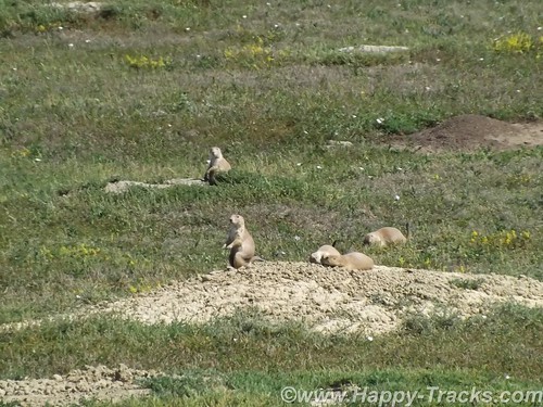
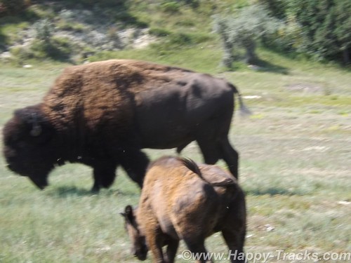
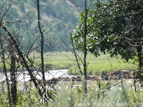
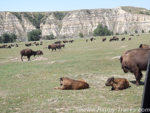
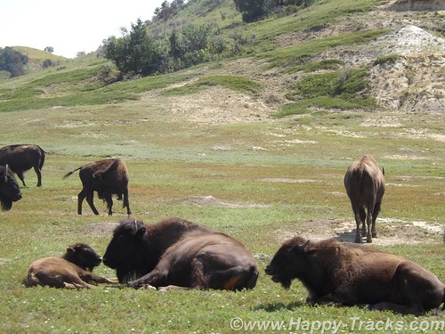
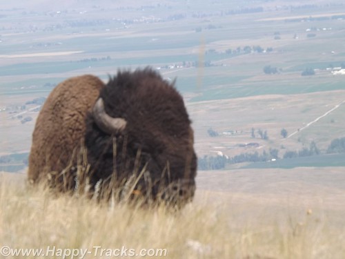
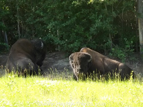
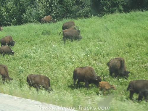
In our first stop, we were in the prairie dog area and they showed up for a few pictures. As we moved on again, we wound down to the waters edge and very soon were stopped for a view of the bison alongside the road.
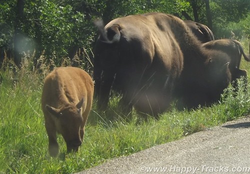
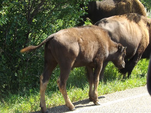
As we continued on, we were stopped further along by more bison along both sides of the road and in the road itself. There were several calves in the group and the interest at this particular spot seemed to include the water alongside the left side of the road. There were probably about 6 cars stopped to wait and it seemed almost as if the bison were playing.
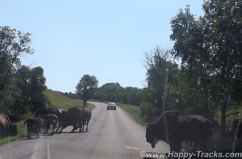
Three or four would be in the road and would finally start to move off to one side but before the first car could move, one or two more bison would come from the side. As they would move on, a couple would come from the other side of the road. Eventually, we would move on to more scenery.
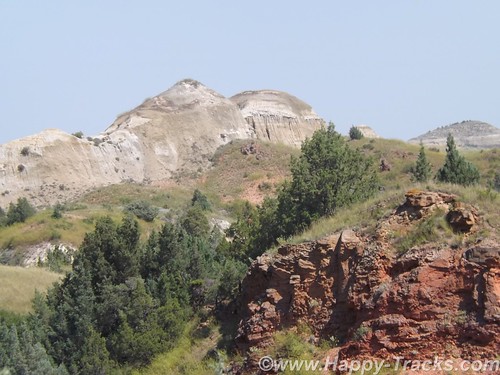
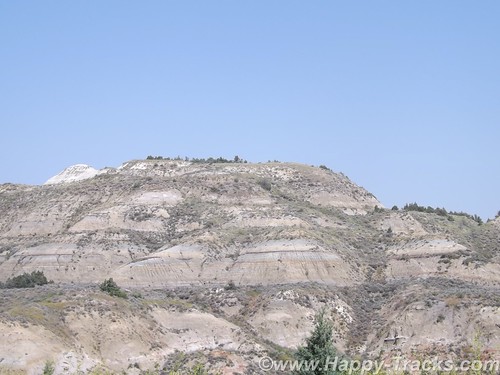
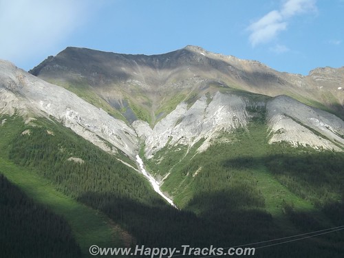
The earth showed the layers of different colors. The reds reflecting the iron content, the grays of granite-based soils, the blacks and browns of the thin layer of topsoil. There are veins of black coal. Fires in the veins of coal over the years have baked the sand and clay to a substance much like a clay brick in appearance and hardness which helps to hold the buttes and spires in place even as the lower, softer soil is eroded through the action of wind and water.
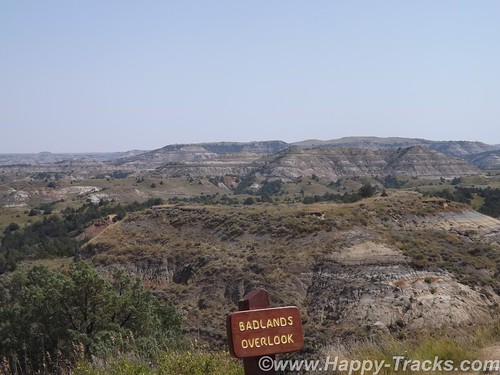
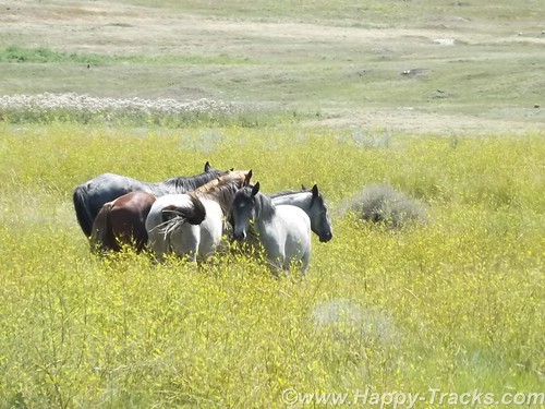
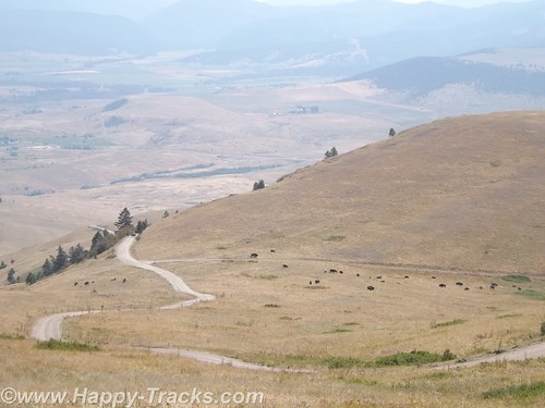
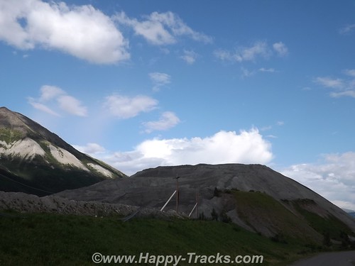
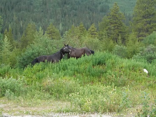
The road is a 36 miles long scenic loop which climbs and dips through all kinds of scenery as well as passing near recreation areas and hiking trails. Near one of the overlooks, we saw a quartet of horses off in a field. Chances are they were feral (of domesticated breed yet born in the wild). Towards the end, it drops again down near the river and a field where bison and prairie dogs seem to rule. The field, of several acres, included some dust wallows where the bison rolled around. You could also see that the older larger bison ruled, often causing the younger smaller ones to leave as they saw the large ones coming.
We circled on back to the visitors center where we got involved in conversation with other travelers. One was from northern Virginia and was just making their way west for this trip. Another was an old sub sailor who had served on the Nathaniel Greene and was meeting his former shipmate in the campgrounds later.
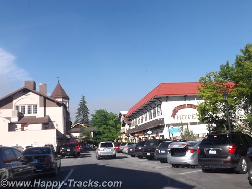
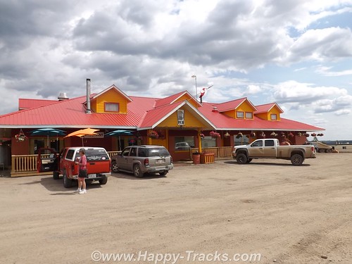
We went into Medora in search of a meal and to peruse the shops and then continue on our way to Ft. Yates for a night on the reservation.
You can see all of the pictures from this leg of the trip here.
We invite you to continue along with us and hope you enjoy the account!
Don’t forget the trip calendar we put together at CafePress. We think it turned out pretty well and would make a great holiday gift. 
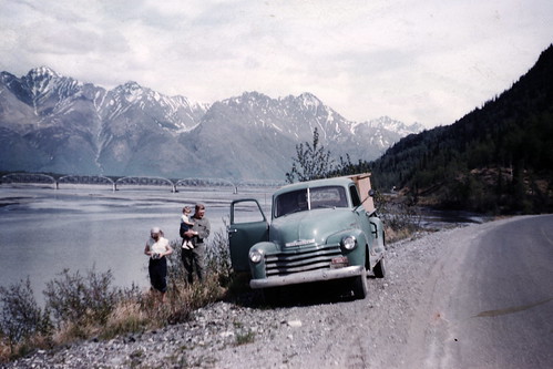
Tag Archives: bison
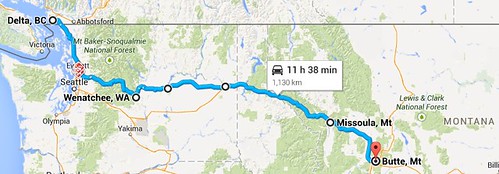
Summer 2014: Alaska via the AlCan; US Border to Butte, Montana
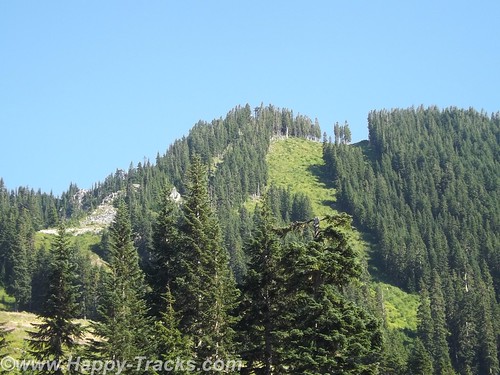
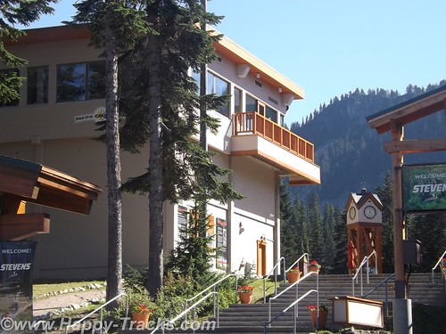
We started heading southeast from Everett and into Mt. Baker-Snoqualmie National Forest and eventually climbing up to Stevens Pass. There was a ski lodge resort there that appeared to be open all year, even when there was no snow, but it had closed for the day before we arrived and took a break in their parking lots. We saw bicyclists coming up and over from the east side. I admire their stamina and determination but didn’t share their interest in bicycling the area.
As we started down the east side of the pass, we were starting to see smoke from wildfires but didn’t know exactly where they were. As we exited the National Forest, we entered Leavenworth, a small Alpine town like several in the area. A tourist town, maybe winter ski area but busy as we drove through.
Our friend, Pattie, told us she had stopped in one of those towns several years before and left a dollar bill which would be tacked to the wall with a note indicating Fuquay-Varina where they lived at the time. The town she visited may or may not have been Leavenworth but it was typical of the area.
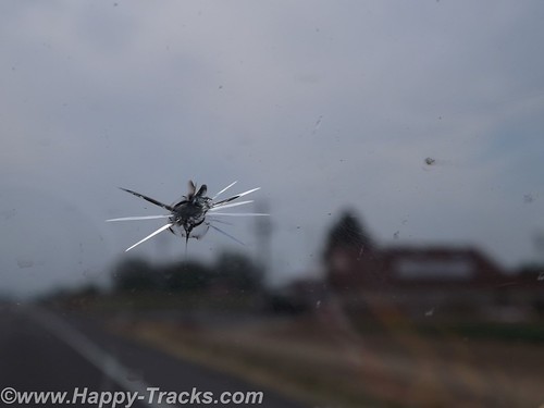
On new pavement, we were passed by a truck headed west and managed to catch a rock from him with our windshield. After the warnings of rocky roads and potential damage in Canada and Alaska, it was somewhat ironic that we did get the crack on fresh smooth pavement in Washington.
We drove on to Wenatchee and stopped for the night in the first place we found available, Inn at the River. The smoke was now very noticeable and it was hot as it would be for the next couple of days. We crossed the river to find our lodging but it took a bit to find the river from the inn as it was on the other side of the freeway and the railroad tracks. We overheard someone at the desk talking about having to be careful in choosing route to Seattle due to the fires and the smoke. Many of the hotel guests were firefighters.
Inn at the River sits across the street from Valley Mall. We went in to replenish the vitamin supply at a GNC store and then had dinner at Shari’s Restaurant and Pies. Shari’s is a chain similar in concept to Denny’s, Perkins, etc. We had eaten one in Bangor for the sub reunion as it was across the street from the hotel where we stayed there. The food was good and the pastry looked tempting but we passed.
We continued east towards Spokane through miles and miles of relatively flat land given to orchard agriculture. Through much of the area, the crops were identified by signs alongside the road. It helped us see the variety of crops and helped with the “What’s that?” questions that always seem to arise as we go through farm country.
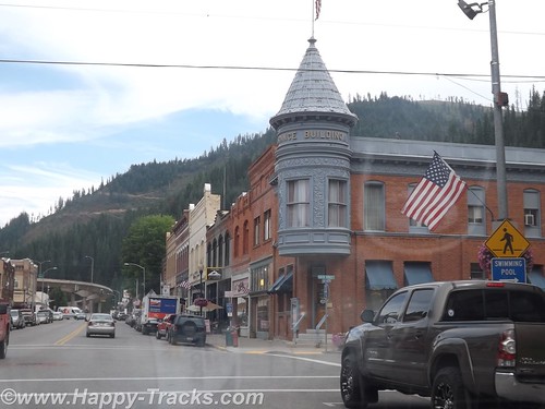
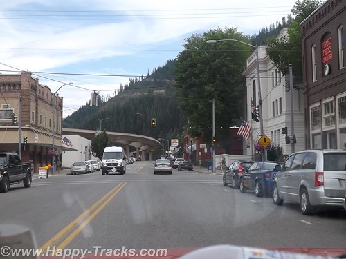
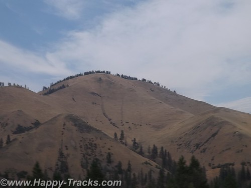
We dropped down and picked up Interstate 90 into Idaho and stopped for lunch in Wallace. Wallace is in a pass with mountains on both sides with the interstate highway squeezing through. Wallace turned out to be about 4 blocks wide, all on the same side of the interstate.
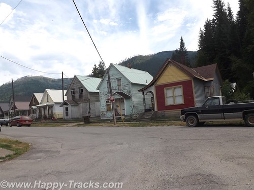
Wallace had been a silver mining town and the restaurant where we stopped for lunch had a gift shop with silver jewelry on display. The restaurant was pretty quiet with the hostess/waitress/cook all being the same person.
There was an accordion festival scheduled for the coming weekend. Wallace also has a brothel museum but we didn’t find out about it until after we had already left. There were numerous references to bicycle races as Wallace is a major stop on several annual cross-country races.
As we left town, the entrance and exit ramps overlapped each other at different elevations in order to fit it all in.
We continued to Missoula, Montana where we discovered that ZZ Top was playing that night. Lodging was filled for most of the chains near town with concert-goers but we did manage to find a place for the night.
In 1877, construction began on Ft. Missoula, destined to become home to the 25th Infantry Regiment, one of four companies known as the Buffalo Soldiers formed after the Civil War with Black Soldiers serving under white officers. The 25th was one of the first called into action when the Spanish American War broke out in 1898 serving bravely in the Philippines and Cuba but was reassigned to other posts after the war. During WWI and WWII, the site was used to inter Italian aliens and later Japanese persons. The site has been used for training, for prison and holding cells and was eventually decommissioned in 2001. Much of the original post’s land is under the control of the Interior and Agriculture departments as well as the Missoula County which uses it as an historical museum.
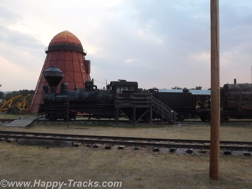
The historical park includes displays of trains from the steam era as well as sawmills equipment of the type used to build the original fort.
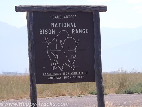
The next morning, we headed north to Dixon Montana and the National Bison Range (NBR), under the direction of the US Fish and Wildlife Service. The NBR was established in 1908 as a home for the dwindling bison herds in this country. Bison are believed to have once numbered in the tens of millions but were down to about 100 by the late 1800s. Bison were found in all the states except Hawaii. Settlement and irresponsible hunting dwindled the numbers extensively so that the initial herd was in the low hundreds when the 18,000 acre reserve was established. The original herd released in 1909 was purchased by the American Bison Society and donated. This is not the only herd still found in North America (as evidenced by some of earlier parts of our travels) but this herd was established expressly for preservation.
Bison herds in the Mission Valley date back to the late 1800’s when a Pend d’Oreille man of the Flathead Reservation returned home from the plains of eastern Montana with four bison calves. The herd quickly grew to 13 animals. At that point, partners Michel Pablo and Charles Allard bought the herd. The Pablo-Allard herd thrived in the Mission Valley’s open grasslands. It became one of the largest private bison herds at the time when bison were most threatened with extinction. However, when it was announced the Flathead Indian Reservation would be opened for homesteading in 1910, surviving partner Pablo began making arrangements to rid himself of his herd. The US Government declined to purchase the bison so Pablo sold them to Canada.
Just after this, the American Bison Society pushed the US government to set aside land to protect and conserve the American bison. The National Bison Range was one such area. And after its establishment, the American public pitched in to provide funds to purchase bison to place on the new Refuge. The American Bison Society, under the direction of William Hornaday, solicited donations throughout the country. Over $10,000 was raised, enough to purchase 34 bison from the Conrad herd. Located in Kalispell, Montana, these bison were descended from the famous Pablo/Allard herd. To supplement this, Alicia Conrad added two of her finest animals to the effort. The Refuge also received one bison from Charles Goodnight of Texas and three from the Corbin herd in New Hampshire. These 40 animals, all donated to the Refuge and coming from private herds, form the nucleus of 300-400 bison roaming the Range today. from http://www.fws.gov/refuge/National_Bison_Range/about.html
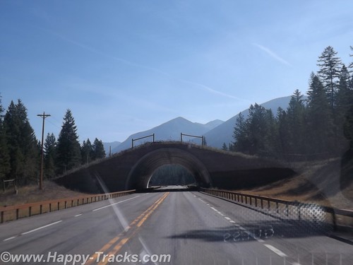
Before arriving at the visitor center, we passed under a land bridge which had been constructed over the highway. The land bridges allow animals to cross without being endangered/bothered by the traffic.
We entered NBR through the visitors’ center which had much information about the bison including a display about a white bison which had been part of the herd which has since died. There was another white bison born on a bison farm in Connecticut in 2012. The white bison holds particular spiritual significance to the American Indians. The rare white bison made news coverage at the time and draws crowds to see it. We also learned the difference in antlers and horns on animals. Antlers are shed on a regular basis but horns are permanent, perhaps this is one of those things we “should” have known but it was new knowledge for us.
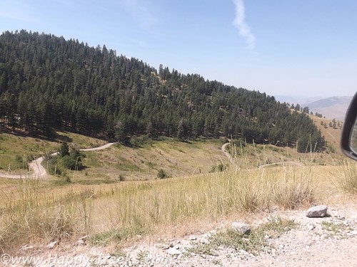
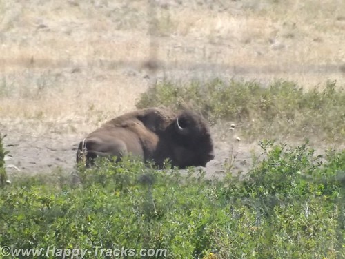
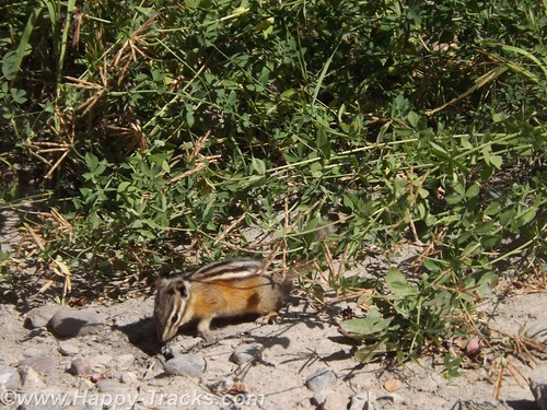
The NBR has a dirt road that winds through and covers a range in elevation of 2600 feet above the visitor center. There is a shorter track which covers less distance and elevation for larger vehicles like buses or large RVs. We took the longer winding route and saw bison, pronghorns, mule deer and a chipmunk. The dirt and gravel road would be easily traversed in a standard sedan.
After leaving the NBR, we got back onto I90 heading towards Butte, MT. Just outside the gate is a small general store and café but it wasn’t open the day we were there.
You can see all of the pictures from this leg of the trip here.
We invite you to continue along with us and hope you enjoy the account!
Don’t forget the trip calendar we put together at CafePress.
Summer 2014: Alaska via the AlCan
After breakfast, we visited the tourist center in Dawson Creek in the Northern Alberta Railway museum which is part of the old train station. In addition to the usual fare of souvenirs, brochures and information, of particular value was a listing of the various facilities along the Alaska Highway showing lodging, restaurants and fuel locations all on one sheet of paper.
We used an annual publication called the Milepost. This guide has been published annually since 1949 and is considered the definitive guide to the AlCan. The guide, in addition to advertising content, contains a milepost by milepost guide book for the major highways throughout this part of Canada and for Alaska. Its layout is logical but is sometimes difficult to follow along as you are sometimes required to read from bottom to top to match your travels. The single page sheet from the visitor center at Dawson Creek allowed a quick glance to determine the information that the Milepost would provide over several pages, once you found them.
We had noticed signs outside this and other buildings that indicated “Muster Area” and asked what that meant. Unlike most places in the States, its fairly common in Canada to identify a spot for building occupants to muster (meet) in the event they have been evacuated from the building. I remember our work offices had designated places for the workers to meet in case of evacuation but it was a place you were supposed to know rather than being marked. The designated area seems like it could be useful in quickly determining whether everyone had made it safely out.
We were finally on our way on the Alaska Highway.
About 20 miles on, we found a marked section of the old highway. We turned to go that way and it was a bit more rustic. 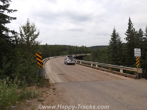
It happened this section included the old Kiskatinaw Curved Bridge. The original bridge was built of wooden timber and this was the last timber bridge still in use on the old highway. It also is unusual in that it is curved about 9* in its 540 ft. length. Because of its timber construction it is limited in capacity to 25 tons which meant that heavy trucks were forced to ford the river rather than cross the bridge.
With the expanding oil and gas industry, this became more of an issue and a re-routed road and new bridge were built in 1978.
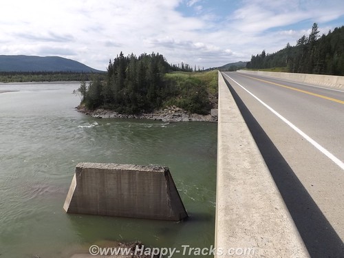
Further along we crossed the Peace River Bridge which is the longest water span on the Alaska Highway. It opened in 1958 and replaces the Peace River Suspension Bridge which collapsed dramatically in 1957. If you want to more about the collapse, see here. The “new” bridge is metal-decked.
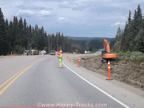
In general, the road is in good repair but there are sections where that is not the case. Summer is also construction season. Any significant repairs are done during the summer rather than during the cold season when frozen ground and frigid air temperatures prevent effective repairs.
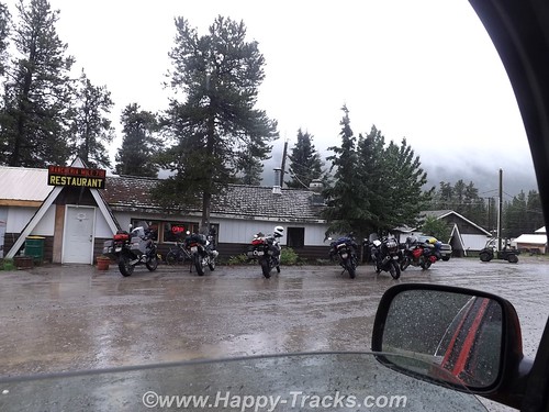
We had lunch at the Pink Inn which has been there for the last 50 years. It is open 24 hours a day and includes fuel, lodging and a restaurant. The restaurant has a cook on duty through the evening meal. After that, there are sandwiches and some serve yourself type foods through the night. Most of the menu was burgers and steaks type meals. We discovered that menus outside the cities tended towards hearty meals and large portions. This meets the tastes of most of the clientele — truck drivers, workers in the oil and gas industry or lumbering. It also offsets the relatively high prices which comes, in part, from the high transportation costs.
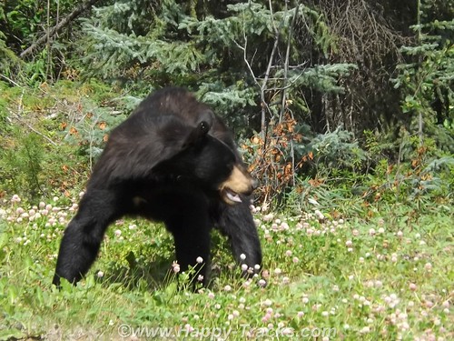
Shortly after the lunch, we saw our first black bear alongside the road.
Further along, we stopped to allow clearing of some fallen rocks.
We passed by a natural gas processing facility. As part of the natural gas production, sulfur is removed and recovered. This processing plant pipes the sulfur across the road but due to the harsh environment and constant movement of the ground in a freeze/thaw cycle the sulfur pipe runs above the road.
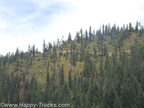
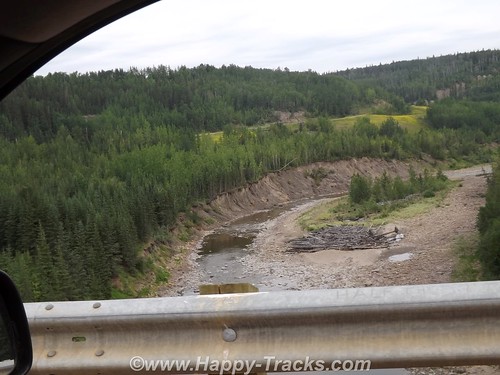
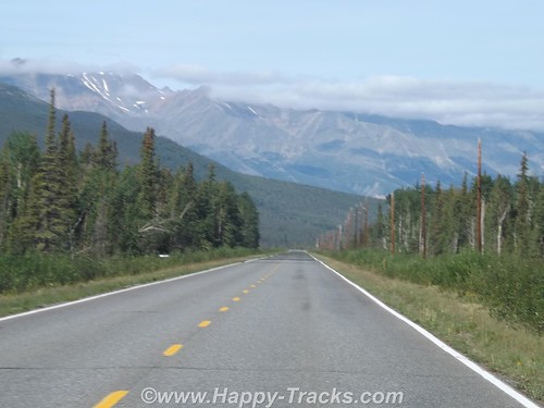
The wild countryside just rolled off mile after mile of gorgeous scenery in the form of forests and mountaintop.
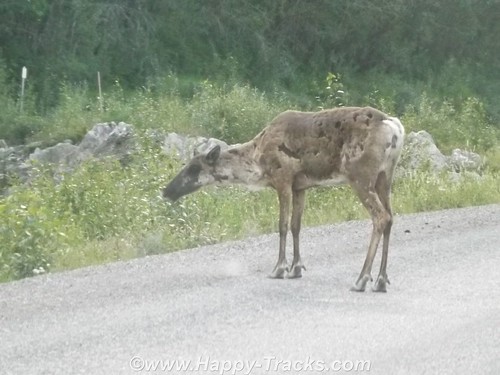
We saw a young elk on the roadway which stayed around for several pictures but he wasn’t looking his best for his photographic debut as his coat was moulting.
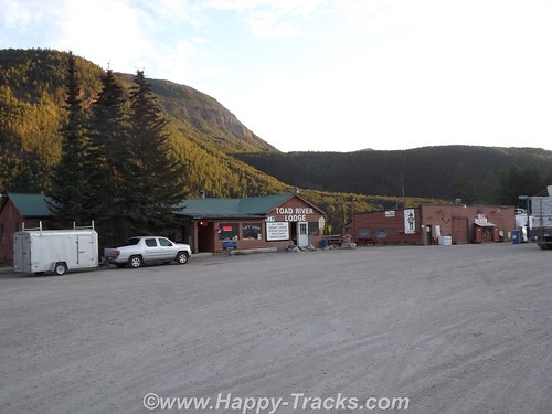
Our first overnight stay was at the Toad River Lodge at MP 422. We had “only” traveled 405 miles today along the highway but the historic mileposts are still used even though rerouting has shaved some miles off the route. Like most of these roadhouses, Toad River Lodge had fuel, a restaurant, lodging and a campground. There was also an airstrip. The front desk is not manned around the clock so there is a sign telling late arriving guests just to take a key for an unlocked available room and settle up in the morning. Toad River Lodge has multiple cabins facing the water and a terrific view of a field where we saw several elk at a distance which we were told are residents.

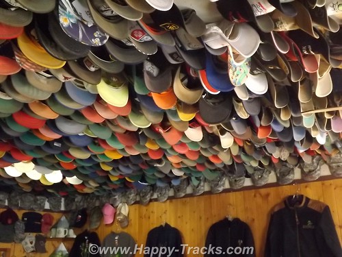
Toad River is also noted for its display of caps which are nailed to the ceiling in the restaurant. According to the story, in 1979 the Lodge was owned by a pair who liked to play practical jokes on each other. When one had left the room and left his cap on a table, he returned to find it nailed to the ceiling. It caught on. Along one edge is a row of military camouflage caps.
Great scenery and a comfortable bed.
After a hearty breakfast, we were off again the next morning.
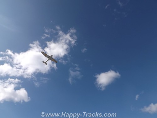
 In Muncho Lake Provincial Park, we noticed four people turning a small bush plane around on the gravel and waited to watch it take off.
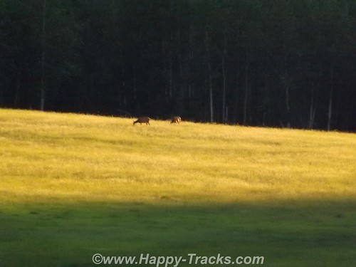
We passed a couple of bison alongside the road before our morning break.
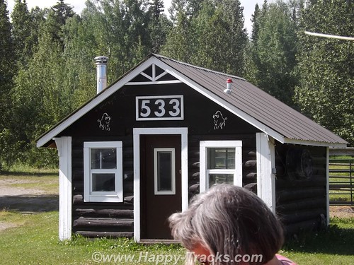
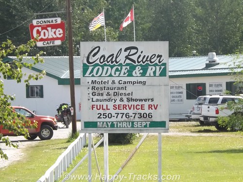
We stopped at MP 533 at the Coal River Lodge. The bridge over the Coal River is relatively new. We had hoped to find a spot where Mom and Dad had taken a picture on their trip but it turned out being the wrong spot. We did however find the piers which had supported the old bridge. (By the way, if you’ve got some money to invest and always wanted to live in BC, the Coal River Lodge and RV park is available for $575K.)
We continued along and crossed the Laird River bridge. Through the park, we also sighted a small herd of bison and a pair of black bear along the highway.
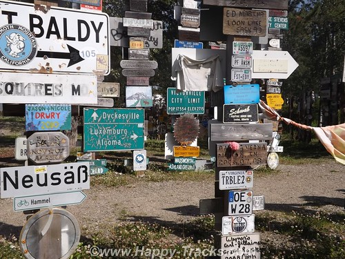
Our next significant town was Watson Lake. Watson Lake is known for the signpost village. It got its start in 1942. While working on the AlCan Highway near Lower Post, BC, Private Carl K. Lindley from Company D, 341st Army of Engineers was injured and taken to the Army Aid Station in Watson Lake to recuperate. During that time Carl’s commanding officer got him to repair and repaint the directional post. While Carl was carrying out this task he decided to add his home town sign of DANVILLE, ILLINOIS. Carl was known as the homesick, lonesome soldier and he was aware of the tradition that he started and what is now known as the World Famous Signpost Forest. It may be worthy of note that the most expensive gas we bought was in Watson Lake.
We fueled up both the truck and our stomachs here. The place we stopped (across from the signpost village) had construction going on (new sidewalks, etc) and the cafeteria was located in the back of the store next to the laundromat. Concrete floors and steel commercial building walls and a very limited menu contributed to the depressing atmosphere and made us question what we had gotten into as it seemed to be more and more rustic as we went along.
We took a detour just outside Watson Lake and turned south to Jade City and the ghost town of Cassiar, appropriately enough on the Cassiar Highway.
Jade City is a series of commercial enterprises which includes a lodge with cabins, a jade store, a demonstration of the jade finishing process, a First Nations art store and a parking spot for RVs. There is a restaurant but its currently closed and there is no fuel available here. Cassiar is the site of an asbestos mine which has closed and is now an environmental cleanup site. You can see evidence of some of the buildings there but the main town site is closed off with a fence and posted no trespassing.
You can also see the remains of an airstrip which served the town. Asbestos and jade are both found in the same type of rock which explains the proximity of the jade operations. Jade City’s population is less than a dozen including the summer seasonal workers. Cassiar’s population appears to be 3 horses which run loose.
The cabins here are in a row of rooms sharing a bathroom. You do have to go outside onto the porch to get to the bathroom and there are 5 rooms sharing it. This night, we were the only overnight guests so there was never a line. Jade City does have a significant mosquito population, the worst we had encountered so far.
The next morning was foggy and it had rained overnight. We drove back north to return to the AlCan just a few miles west of Watson Lake.
Along the Cassiar Highway, we first saw bicyclists. They were headed north but we don’t know whether they had come from Prince Rupert BC (on the coast) or from further south and inland.
We stopped for breakfast (as there was no food, just coffee — thankfully — at Jade City) at Rancheria. Like the others, this included fuel, restaurant and lodging. A group of 5 motorcyclists had stopped also and one of their group ordered the mega-breakfast. We didn’t see it come out of the kitchen but it included eggs, several meats, pancakes, toast, and potatoes. Based on the large quantity of food in the regular breakfasts, it should have been impressive.
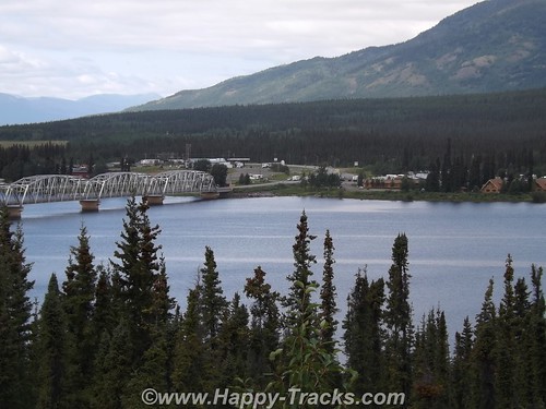
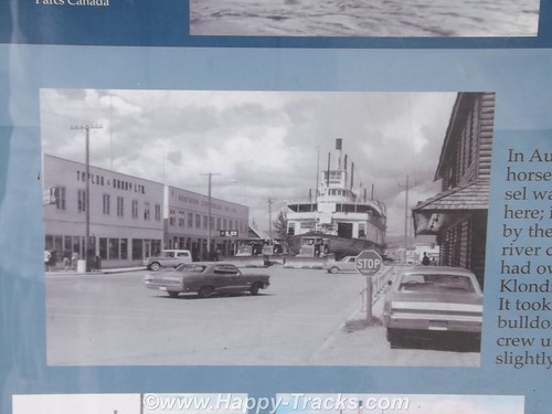
By the time we reached Teslin in Yukon Territory, the rain had let up and we had good weather and good visibility into Whitehorse, the first real town since we’d left Dawson Creek. The town is between the highway and the river. We stayed in the Best Western downtown and it was a step up from where we’d been. We walked around town a bit including down by the river where we saw the sternwheeler S.S. Klondike.
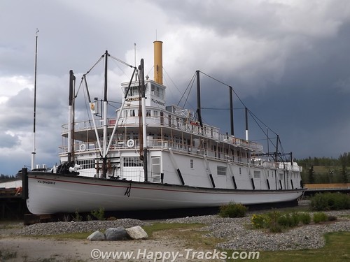
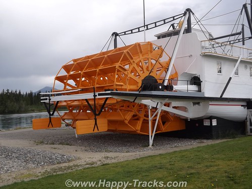
Until 1950, the Klondike, a shallow-draft ship had been an important link in the movement of freight and passengers until the highway diminished its importance. The ship sat dry-docked for several years after its last run upriver but was eventually sold to the government which would include it in the riverfront park as an exhibit. The ship was moved from the drydock to its display place by skidding it up the street on a bed of dampened soap flakes!
Whitehorse is the legislative capital of the Yukon Territories and was visited by the author, Jack London, before he wrote his famous books and short story about the Yukon and the cold.
One of our most interesting conversations was with an employee of the hotel who was sweeping the sidewalks out front along the street. He had some interesting comments on the states of Colorado and Washington legalizing marijuana and wondering how they would play out as he believed it to be a sign of diminished ambition and he had some concerns about fetal development. There was also some discussion about differences in gun laws between his country and ours. He talked about how our Congress and President seem to be ineffective in getting the work done. His knowledge of USA geography identified Maryland as being close to Nova Scotia, not what we usually think but from thousands of miles away, they really aren’t that far apart. He followed US news through the internet. Interesting conversation from an “outsider’s viewpoint”.
The next morning, well-rested, we passed by the Whitehorse Airport which is served by Yukon Air and Air Canada with scheduled service. We took another stretch of the old highway just past Whitehorse. This section was relatively smooth dirt and gravel but we imagined it could be a real mess when wet.
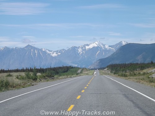
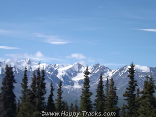
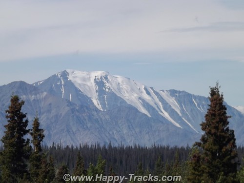
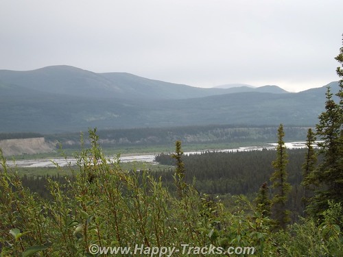
We continued on through breathtaking scenery toward the Kluane Mountains. At the edge of the Kluane National Park and Reserve, we passed though the tiny crossroads of Haines Junction which we would visit again on our way home. Historically, this area was an outpost for the RCMP who required gold rushers to have enough supplies to get to the gold fields.
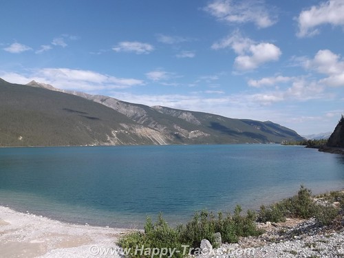
We got our first glimpse of the aqua blue waters of Kluane Lake from Boutillier Summit, the second highest point on the highway between Whitehorse and Fairbanks. The south end of the lake was once the drainage south to the Gulf of Alaska but approximately 300-400 years ago, Kaskawulsh Glacier closed off that end of the lake, resulting in a rise of 40 feet in the lake’s level. Eventually, the lake’s drainage shifted to flow north and west to the Bering Sea. You can still see traces of the beaches up the hillside.
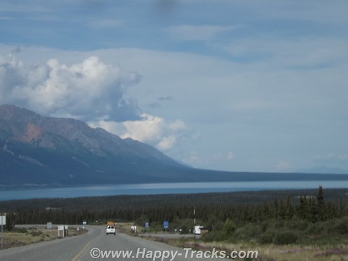
The road continues along the lake shore with views of the mountains on both sides of the lake. Our goal for this day was Destruction Bay about 40 miles up the lake. Destruction Bay is one of the towns that traces its history back to the highway construction. The name traces to a storm that destroyed homes and supplies staged here. It continued as one of the 100 mile stations that were spaced along the route to provide infrastructure for the trucks traveling along the highway.
We had a shorter day, only traveling 170 miles as the spacing between stops didn’t work that well for traveling on. We used the early stop to do some on-foot exploring of the lakeshore and the village. We got checked in at Talbot Arm and went for a walk after we got settled.
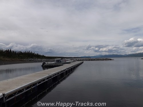
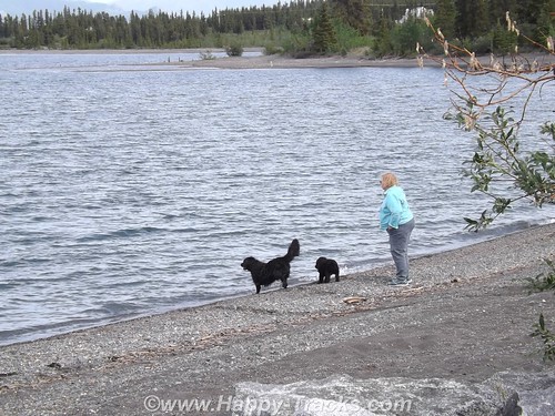
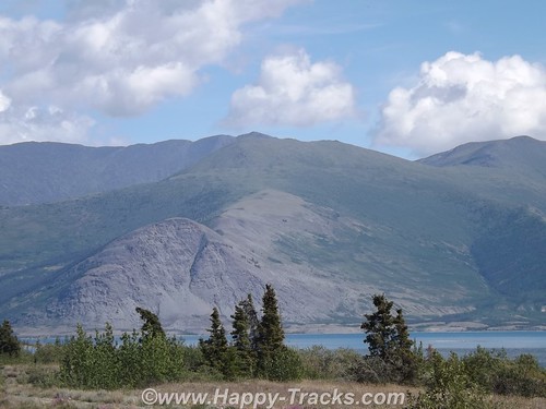
There were some docks and a couple of boats tied up as well as on trailers. We saw a couple of dogs exercising their human by having her throw some things which they promptly returned for her to throw again. The views of the mountains on the far side of the lake were breathtaking.
I’d been wearing an old t-shirt from back in the days when work used to send me to Austin Texas once in a while. That shirt opened a few conversations including one with these two bike riders who said they’d ridden their bicycles up from Texas since early summer. Probably should have taken more time to find out some more details from them. Apparently they camped along the shore that night as we saw them come up and start riding north while we were eating breakfast the next morning. We thought we had a long trip in the truck, its hard to even imagine riding a bicycle that far. 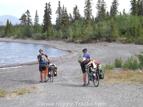
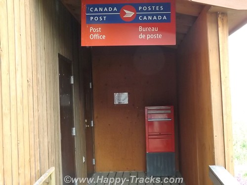
Wandering about town a little more, we found the post office and the public pool. We also passed by the medical clinic and the fire station on our way to the school.
Up by the highway was a pavilion (somewhat overgrown) that had some informational signs (I think the term is interpretive) and commemoration of the 50th anniversary of the highway.
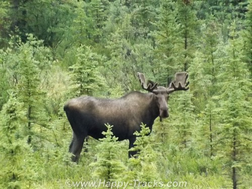
The next morning after we passed the bicyclists, we saw a moose on the side of the road but too late (we thought) to get his picture as we passed. I made a u-turn and headed back on the off chance that maybe we could get another glimpse. I think he was used to working with tourists as he waited for us and just posed waiting for me. We snapped off a few pics before he decided he’d had enough and moved off into the trees.
We started encountering more and more of the undulating pavement called frost heave. As we understand, the road is built on a base that includes permafrost which will thaw and melt under the roadway. It looks to be a full-time job to keep up with the roads although the major rework is limited somewhat to summer months.
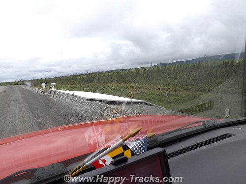
This picture shows a research project designed to help deal with the frost heave by equalizing the temperatures of the road bed. As we neared the end of the this stretch of construction, we felt the telltale rumble of a flat tire.
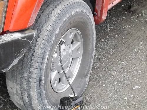
We hooked the pump to it to get us to a better spot for changing since the leak seemed to be definite but slow. While we were letting it fill, some of the construction crew stopped and told us the next settlement was just around the curve and which shop did tire repairs. They also told us where to find the owner if he wasn’t in the shop when we got there. As it turned out, the leak was slow enough to let us make it to the shop where we found a nice flat piece of concrete to jack it up and dig out one of the spares. As it turned out, the tire was not repairable but we had a second spare to go the rest of the way (we hoped) with us.
The next major point of interest was the Canadian Customs station which was about 20 miles before the border and then the border itself. While we were expecting there to be some space between the Customs stations, we were a bit surprised that there was this much “unpatrolled” distance between the two.
The US Customs station was just a few hundred feet past the border. We had some of Mom’s pictures that we had hoped to re-create but the Customs Agent told us that this facility was new and that the Customs Station in the 1950s had been 90 miles up the road in Tok.
Another 3 miles north and we were back into the rain as we pulled into the Border City Lodge. Typical lodge along the highway but it seemed the shelves were nearly empty, but there was a special for lunch and we both had the navy bean and ham soup. Maybe its because it had been so long since we’d had it but it was great and served with a half sandwich. The lady working the diner section told us that they had changed management this year so inventory was down. They had some beautiful animal skins, including a black bear, mounted on the walls.
We continued north to Tok where the Customs station had once been. That site is now the State Police station. There is a very modern Visitors Center with information on much of Alaska for whichever direction you leave the crossroads town. There are several gas stations, restaurants and a pretty extensive gift shop.
There is also a large (but closed) motel at the main corner. It seems that this had until recently been a major stop for the cruise line tours. Weather frequently interfered with the tour stops and the cruise lines picked a different spot. This worked to our advantage indirectly as the restaurant at the Golden Bear where we stayed now had the chef from the cruise lines motel. We had the best Mexican dinner!
The Golden Bear also had a speaker each night, one of the Iditerod drivers who had placed just a couple of years before. That night they also had a tour bus stopping in so we skipped the meet and greet.
The bridge over the Tanana is in at least one of Mom’s and Dad’s pictures but we couldn’t find the exact spot where they took this picture, probably because the highway had been rerouted in its modernization but we did get some pictures nearby.
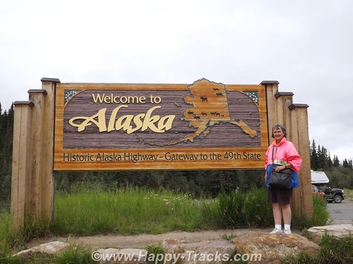
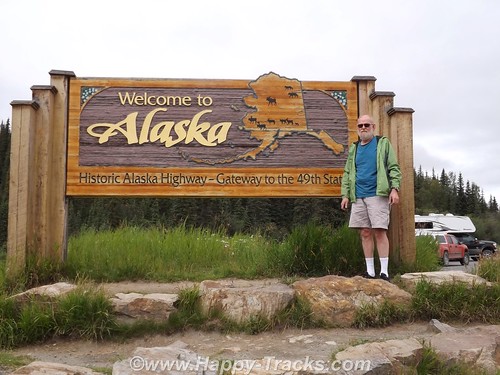
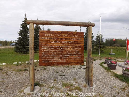
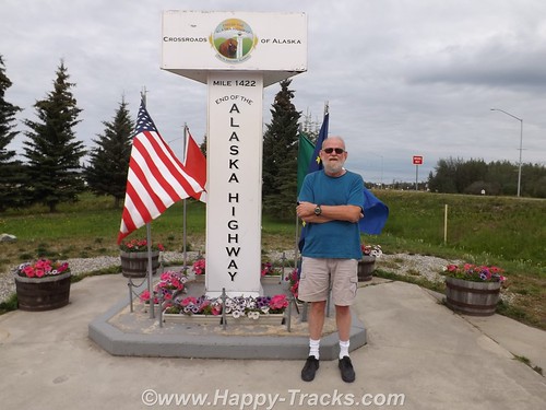
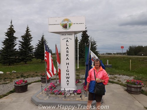
Twenty miles later, we were in Delta Junction at the intersection with the Richardson Highway. We had reached the end of the Alaska Highway! The spot is marked by another milepost similar to the one 1422 miles away in Dawson Creek.
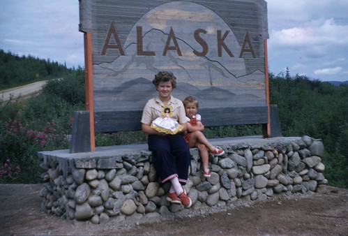
The story of the Alaska Highway from its origins in 1942 as a means to get military support to the Alaska territory to today as primary transport link for tourists and commerce is a long one, almost as long as the highway itself. We decided to make the trip because Mom and Dad and my sisters, Bonnie and Faith had made that trip 60 some years ago pulling that Spartan trailer behind the Packard heading north and behind the Chevy pickup heading south. The highway doesn’t follow quite the same route, its all paved now but some of the places are basically unchanged.
You can see all of the pictures from this leg of the trip here.
We invite you to continue along with us and hope you enjoy the account!
Summer 2014: Alaska via the AlCan, Yellowstone National Park
Yellowstone National Park was established in 1872 by Act of Congress and signed by President Grant. It is widely thought to be the first national park in the world. The area was bypassed by the Lewis and Clark Expedition and exploration really started in the late 1860s. Initially, it was overseen by the US Army at Fort Yellowstone in the northern section of the park. Administration passed to the National Park Service following its establishment in 1917.
We left our cabin in Cody after breakfast and entered the park though the east entrance with plans to make a backward S and leave through the north entrance by day’s end.
On entering the park, we received our separate handout sheet advising against feeding the animals and telling us that wild animals were dangerous. It also cautioned us to stay in the car when animals were nearby. The road in took us around the shoreline of Yellowstone Lake and into Lake Village.
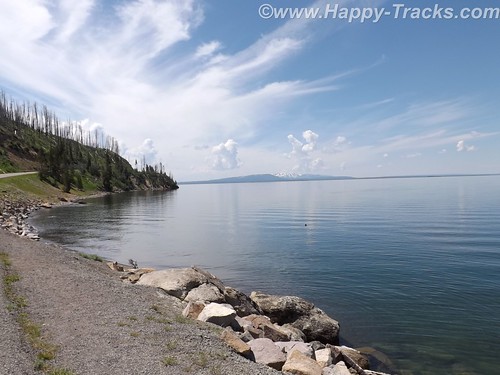
As we could first see the lake, we entered the area of the park where sulphur vents and you could smell it as soon as we entered the region. We stopped by the lake and took a few pictures then headed on towards Lake Village. On the way, there was a car stopped in the road for no apparent reason. As we got closer, we realize that they had stopped and gotten out of the car to take pictures of a bison in the field.
There was a pulloff nearby and we backed up to it and parked out of the road and took a picture of our own. We learned (and it would be reinforced throughout our trip) that when you see a car stopped, chances are someone has sighted a wild animal, even though the park literature reminds you frequently not to stop in the road.
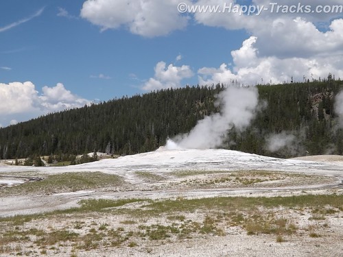
We continued on to Lake Village where we would find a commercial area (gas, food, restaurants) as well as a visitor center. The ranger at the visitor center gave us the latest updates for expected eruptions at Old Faithful, one of our “must do” sights.
Shortly after we passed the West Thumb Information Station area and turned to continue on the Grand Loop Road, we were waved down by a young man who had been bicycling. His girlfriend had fallen off her bike and needed assistance. He said she was shaken up and we volunteered to call for help. Punching the OnStar button, we soon were in contact with their personnel who patched us through to emergency services in the park. While we were doing that, another truck stopped. Luckily, it was being driven by an off duty EMT who was able to assess her condition and was drafted to transport her and her bike over to the West Thumb first aid station. We informed the emergency services folks of the resolution and went on our way. While we were glad to be of assistance, we breathed a sigh of relief as we realized we would still be able to make the next eruption of Old Faithful if we got on our way.
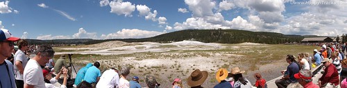
There was a crowd of people there, both for the geyser show and for the lodge, restaurant and shopping area. We found our spot on the viewing deck and waited for the show. As the time drew closer, more people crowded into the area.
While we were waiting, we saw steam erupting from the other geysers in the area but still we waited for the most famous one. After several smaller spurts and steam, the big show came and we were suitably impressed.
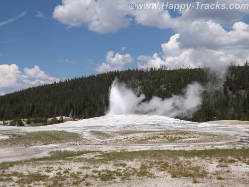
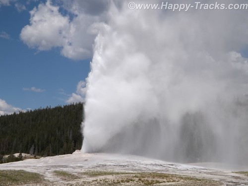
It is truly amazing to watch Mother Earth in action. We had seen pictures and video but its nothing like seeing it in person. One thing that no one ever mentioned was the sound and the noise. Anyone who has ever worked in a steam plant (such as a nuclear submarine) has nightmares about the sound of high velocity steam escaping. Wow.
After the show, we went into the Old Faithful Lodge for lunch and to visit the shops.
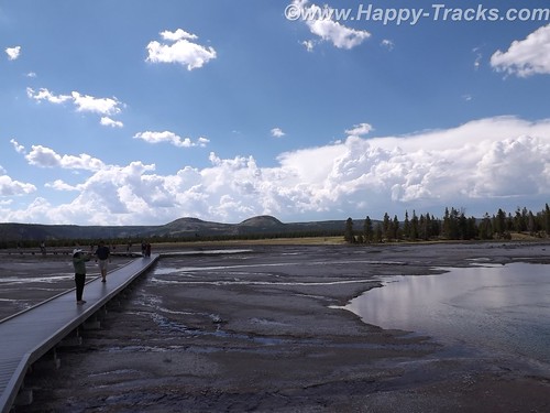
We continued on to the Grand Prismatic Spring. The parking area there is small and was very crowded with folks waiting for others to leave before being able to park. The hot spring is the largest in the US and the third largest in the world. First records of it appear in a trapper’s notes from the 1830s. The colors near the edges are the result of microbes in a mat around the mineral-rich water. The center blue area is sterile due to the heat and its color derives from its depth and purity.
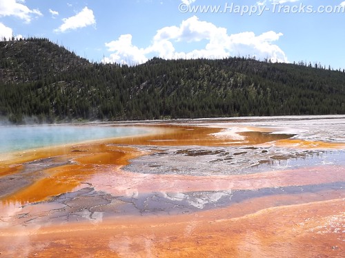
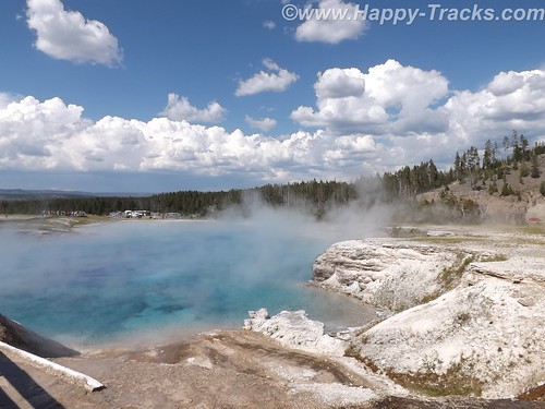
The microbial mat is extremely fragile and there are numerous warnings and prohibitions against walking on or otherwise disturbing the mat. While we were there, someone’s hat blew into the pool. Park personnel remove things like that with poles. On August 2, shortly after our visit, a tourist’s aerial drone mounted camera crashed into the pool. It’s still being investigated about how (or if) to remove it and the owner is facing charges.
Connecting the parking lot and the spring is a pathway that includes a walkway over an ice cold stream fed from the mountains. What a contrast.
That area is the Midway Geyser Basin and contains the dormant Excelsior Geyser as well.
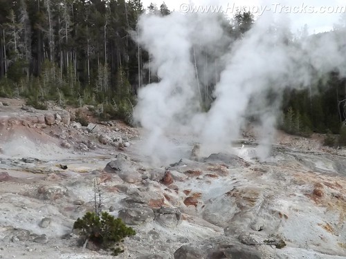
We continued around our backwards S on the Grand Loop Road to visit Steamboat Geyser, the world’s tallest active geyser. It infrequently (and unpredictably) has a major eruption up to 300 feet in the air. It had been almost a year since its last major eruption. It has more frequent minor eruptions, including the day we were there.
But as we started back towards the truck, the skies let loose and it poured rain. We had umbrellas and windbreaker/rain jackets…back in the truck! So we half walked, half ran back.
We continued our ride towards the north entrance and saw the now telltale sign of cars stopped along the road. 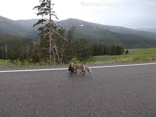
Animals? Sure enough, we saw this fox with something in its mouth coming along the road. We never were able to identify the prey in its mouth which appeared to be some sort of small mammal.
Traveling along, we again saw stopped cars, this time there were a number of them stopped in both lanes of the road. 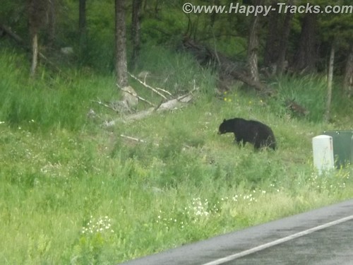
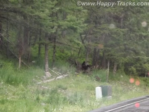
After a bit of sitting and waiting, we realized it was a black bear and three cubs working on crossing the road. Eventually, the adult bear crossed and the three cubs remained on the left side of the road. Then, to our absolute amazement, adults started getting out of their cars –with kids– and started walking up to where the bear and the cubs were on opposite sides of the road! Unbelievable! Finally some of the cars started moving by passing the parked and temporarily abandoned cars. When we were able to move on, the cubs remained on the left, the mother remained on the right and the humans kept on getting out and getting closer.
We stopped at Roosevelt Lodge and Cabins. This was the lodge used by President T. Roosevelt when he visited the area to hunt. There are also cabins, a restaurant and a small camping store there. We kept our comments about the bears and the tourists quiet as we weren’t sure how many of the patrons there had been part of the group. While paying for our purchases at the camping store, we got into a conversation with the clerk who was an older gentleman who had retired to this area from the New Bern area of NC.
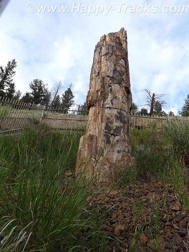
From there, we visited a petrified redwood tree that is the same as present-day redwoods in California, giving testament to a very different Yellowstone in the distant past.
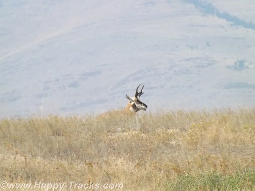
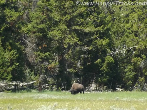
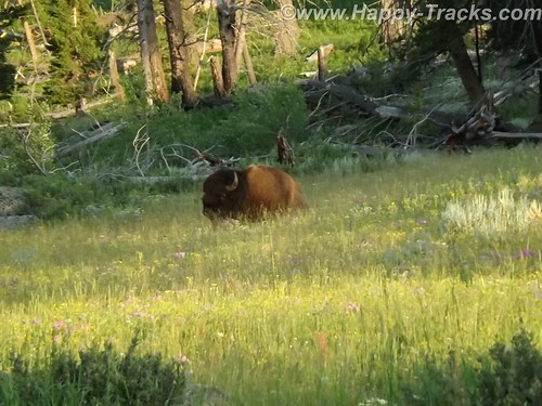
Our next wildlife sighting was another bison standing by himself in a grassy meadow. We found this one by ourselves without the aid of other cars.
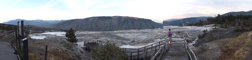
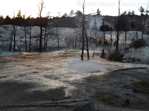
We next arrived at the Mammoth Hot Springs resort and campground at the site of the old Fort Yellowstone. The public buildings are reclaimed barracks and dining facilities. The springs are a series of cascading pools on a hill of travertine.
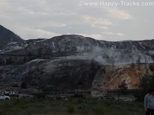
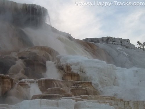
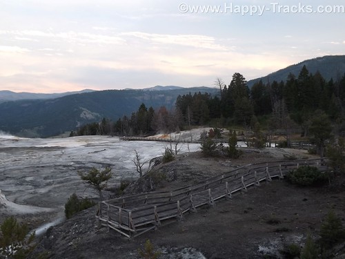
There is a roadway which winds up the hill and lets you look down on the pools and the historic district. These pools, still more hot springs, really give you a different view than the Prismatic Spring. There was a dormant hot spring cone, Liberty Cap, too.
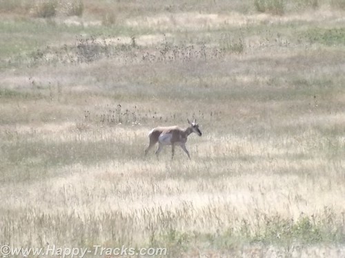
Leaving the Mammoth Hot Springs, you wind down and behind the historic district and onto a winding road out of the park. Just as we reached the boundary, a herd of antelope was crossing the road along the stream bed. Approaching dusk prevents us getting more pictures.
As we exited the park, we followed the Yellowstone River through the canyon to Livingston MT where we found a motel around 11:00. The motel was a Best Western and had a covered garage with a keypad lock for parking which seemed unusual and we never did really figure out why. At first, we suspected the winter weather but it seemed to be the only motel in the area with that feature. It also had an indoor heated pool which our room’s door faced. The humidity outside the room was a reminder of the hot springs we had seen that day.
This is a longer than usual post but it also was a longer than usual day for us. While we don’t advise spending only a day when you get to visit Yellowstone, we proved you could actually see much of it in a day.
You can see all of the pictures from this leg of the trip here.
We invite you to continue along with us and hope you enjoy the account!