On leaving Fairbanks, we gave some consideration to traveling north up the Dalton Highway towards the Arctic Circle or even as far as the Arctic Ocean but it came down to making a choice between either of those and having to cut out a day or even two to somewhere else as we had reservations on the weekly ferry ride from Haines in about a week. The side trip just wasn’t worth it so we headed to our next planned destination, Denali National Park.
Denali National Park and Preserve dates back to 1917 when Congress approved the creation of McKinley National Park. While its most famous feature is the tallest mountain in the US, the park and preserve includes 6 million acres of wild country with a single ribbon of road through it. But first we have to get there!
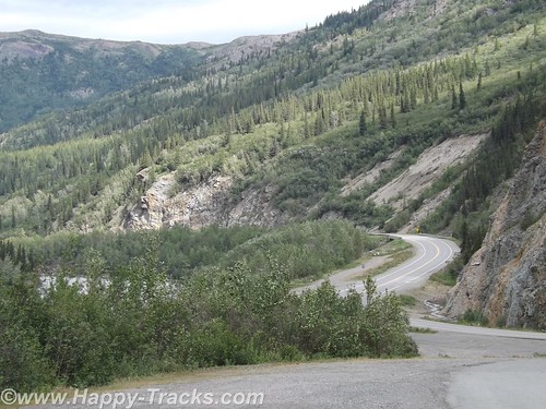
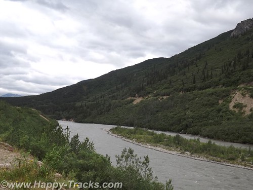
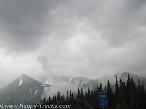
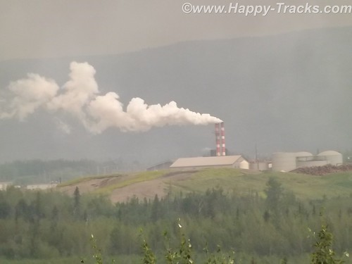
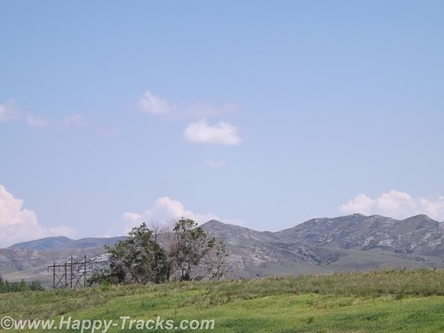
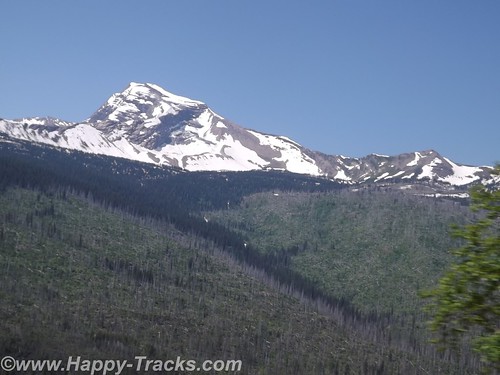
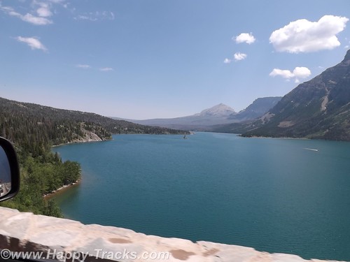
The ride from Fairbanks to Denali started out alternating between relatively flat with mountains in the distance or else riding along higher up with the scenery falling away to either side of the road. We crossed over the Nenana River where there was an old tug boat pulled up along the shore which had pulled freight up and down the river.
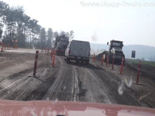
Eventually the road begins the dip into a canyon following the course of the Nenana Creek. We encountered more construction both for roads and bridges. The road construction had a pilot car for a length of unpaved road but the short bridges were controlled by a flagman or a portable traffic light.
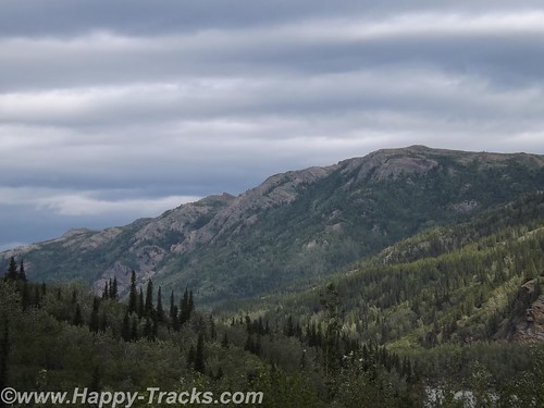
The skies were partly cloudy which resulted in light patterns on the landscape for additional texture.
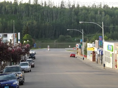
Just before we got to the road into Denali, there was a village of hotels, cabins, resorts, stores, and outfitters catering to the tourist trade. They all looked to be doing a good business this day.
Charles Sheldon, a gentleman hunter from Vermont and others lobbied Congress for nearly a decade before persuading them to create Mt. McKinley National Park in 1917. In 1921, Harry Karstens, an outdoorsman and dog musher was hired as the first park superintendent. Gold miners and others in Fairbanks and nearby called the icy granite mountain Mt. McKinley. Sheldon referred to it as “the mountain” or Denali, the Athabascan name meaning the high one. Mt. McKinley is now officially 20,237 feet above sea level, the highest in North America. This figure is 83 feet shorter than the 1952 number (which would have been when my folks were in the area.) There is this interesting article on Discovery.com which talks about why the differences.
Along with the wild landscape there were also animals in the area that were to be protected. Specifically, the Dall sheep in the area were being aggressively killed by market hunters. Per the stories we were told there, the market hunters would kill the sheep they needed to market and would also kill the other sheep around and leave them to rot to limit their competitors ability to provide meat. The National Park and Preserve designation was a small step in providing some control over that situation.
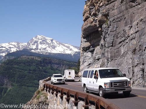
Arriving at the park entrance, the roadway goes to the campgrounds and also to the visitors center. From the visitors center, there are options for interior transportation. There are guided tour buses which travel into the interior of the park and various shuttles to different points within the park.
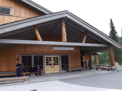
We went directly to the visitors center. This is the spot to get acclimated and find out about the various accommodations for getting around. The visitors center also has a small cafeteria and a gift shop. The 85 mile road through the park has access limited to the tour buses and the campers’ shuttles. There are also flight-seeing tours from nearby Talkeetna that take you around, some even land to let you walk around.
We chose to take the short shuttle to the Sled Dog Kennels. The dogs are working animals at the park providing access to remote areas and support for working and research parties even during the winter months. More about the kennels here.
The bus (similar to school buses) takes you on the 10 minute ride (or it could be except for the stops for road construction) to the kennels. During the summer months, rangers and the dogs demonstrate a working team. Before the demonstrations in the summer, you get a chance to visit with and pet the dogs. Visits and petting are opportunities year round but the demonstrations are summer months only.
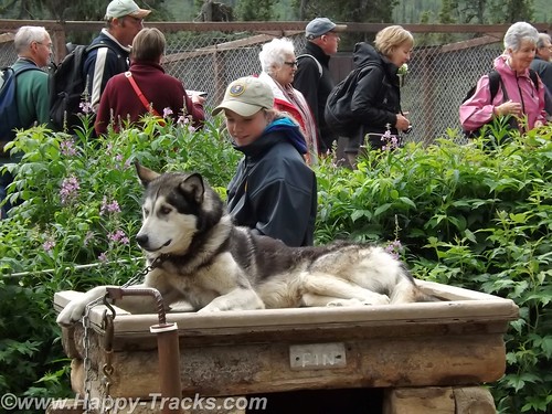
We were surprised to learn that the dogs are controlled by voice command only. For some reason, we had always thought there were reins or similar like larger draft animals.
Each position in the dog team has a specific purpose and different dogs are better suited for each position. Nearest the sled is the wheel dog. The wheel dogs are the strongest and provide momentum to get the sled up on the surface and moving (like getting a boat up on plane).
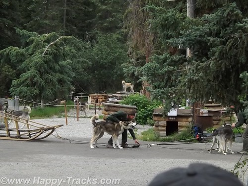
In front of the wheel dog is the swing dog. The swing dog provides power but is also trained to swing out on a turn, rather than follow directly in the tracks of the lead dog. The lead dog responds to voice control to turn, go or stop. The dog team may include up to 12 dogs depending on the load and course to be run.
The dogs typically have a 9 year life on the sleds with an average 14 year life span. That link above even talks about adopting retired dogs.
As an aside, we saw the tourist couple we met at LARS in Fairbanks and said hello.
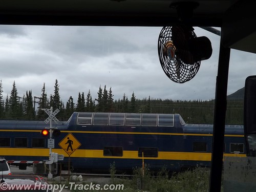
We rode back to the visitors center and decided to take one of the shuttle buses for a brief ride around to the campgrounds. It became more clear that many of the tourists in the park are camping or hiking parts of the large park. While on the shuttle, we stopped at the train crossing to let the Alaska Railroad Denali route train go by. Many tourists will board the train for the ride between Anchorage and Denali with a stop in Talkeetna for more of the beautiful scenery.
We didn’t really appreciate just how big the park and preserve are. We were unable to see Mt. McKinley from the visitors’ center. We were actually surprised that we asked several of the non-NPS workers which direction the Mountain was and they didn’t know. We’ve since learned Mt. McKinley is about 80 miles southwest from the visitors’ center.
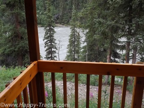
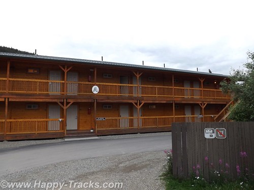
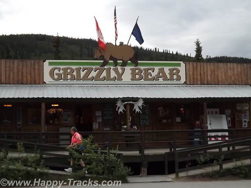
After several hours at the park, we headed out for our accommodations which had been recommended by a fellow on ExpeditionPortal forums. Healy Denali Grizzly Bear Cedar Lodge is just a few miles south of the park entrance (although our GPS directions sent us north instead). The Grizzly Bear Cedar Lodge is away from the cluster of hotels in the village outside the gate and has RV sites, a small general store, a laundromat and a gift shop. The Cedar Lodge itself is set on the banks of the Nenana River. Its not as expensive as the village but doesn’t have all the shops and entertainment within walking distance.
We did get a recommendation for the restaurant just a bit further south, 229 Parks. The food was a more local produce with many non-fried food choices. We had the salmon and the crabcakes and would recommend both the restaurant and lodge to visitors to the area provided you have transportation with you.
The next morning, we headed south towards Anchorage. We still hadn’t seen Mt. McKinley but there were supposed to be several points along the road where we could see it, weather permitting. As we drove along, we saw fog and clouds where Mt. McKinley should be but we never saw the place where we could get out weather permits and thus left Alaska without seeing the Mountain.
You can see all of the pictures and 2 more short videos from this leg of the trip here.
We invite you to continue along with us and hope you enjoy the account!
Tag Archives: GPS
Summer 2014: Alaska via the AlCan, Alberta
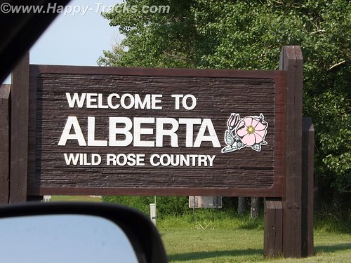
We crossed the border at Carway and proceeded to Lethbridge for the night. We still needed to convert US or obtain Canadian cash. That turned out to be relatively painless as we just used our own bank’s ATM card at the TD Bank ABM. We knew we would incur a service charge from one or both banks and that the conversion would be factored into what was removed from the account. Sounds complicated but it really was as simple as the ATM withdrawal at home. For those of us used to US currency, Canadian currency looks strange. It has a window of transparent film where you can see through it. Canadians have also abandoned the use of the penny. All our cash purchases were rounded to the nearest 5 cents. One dollar (loonie) and two dollars (toonie) are coins rather than bills.
If one were to map out a route from Lethbridge to the start of the AlCan Highway, your route would most likely take you to Calgary, then to Edmonton and then northwest along Route 43, a modern highway, to Grand Prairie and then to Dawson Creek and the beginning of the AlCan (generally now called the Alaska Highway). We chose instead to continue north from Edmonton to Athabasca, then west-ish to Grand Prairie because this would more closely follow the 1950s routing of the highway and its approach, as Route 43 didn’t exist.
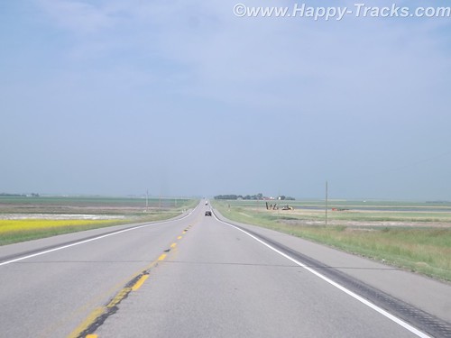
From Lethbridge north past Edmonton, the highway itself was fairly modern divided 4 lane affair. It was of modern state highway standards generally. The route took us through farmland and around the perimeter of most towns.
We did take the opportunity to try out a Tim Horton’s for our morning break. We’d heard a lot about Tim Horton’s and wanted to try for ourselves. We decided their coffee was okay and their pastries were very good. To each his own, I suppose. Since returning home, we’ve heard a lot more about Tim Horton’s because of acquisition talks by Burger King.
There was the occasional rest area such as this one in Bowden that incorporated the town park, a playground, a picnic area and camping facilities including showers in the restrooms. It was seasonally open and there was a petition to sign to keep the facility open. Apparently budget considerations at the Provincial level had the residents concerned.
We went around the edge of Calgary which appeared to be a modern city from our vantage point with mid- and highrise buildings rising up from the relatively flat prairie.
As we passed Edmonton, we passed through city traffic and turned north towards Athabasca. Athabasca is a small (population <3000 in 2011) town whose importance dates back to the days of the fur trade when it was known as Athabasca Landing and marked one end of the Athabasca-Edmonton trail which connected the waters of Athabasca River (flows north) and the North Saskatchewan River which flowed into Hudson's Bay. 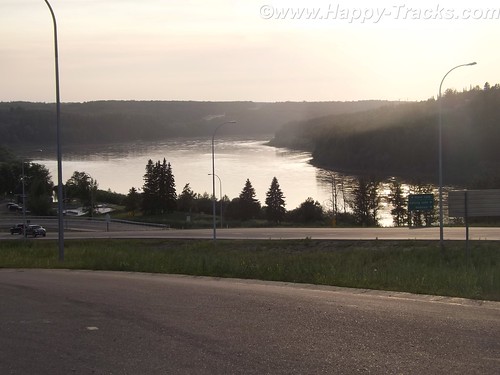
It lies along Highway 2 which connected the AlCan to points east. Eventually it was to be a railroad stop but the reality had it as a terminus where trains pulled in from the east and then pulled back out to the east. Trains to Athabasca had locomotives on both ends as there was no roundhouse or other turnaround point. Eventually the railroad stopped running to Athabasca and its economy was ruled by its crossroads location and tourism for the river.
Today its economy still depends on tourism but the proximity to the Athabasca tar sands oil fields are driving an economic boom. On the edge of town sit two new and chain hotels, a Super 8 and a Comfort Inn whose business is in providing lodging for the workers supporting the oil operations. The oil industry is probably also responsible for a resurgence of the tourism and the restoration of the old train station as a tourist center. We couldn’t find figures for the size of the transient/temporary population.
The Super 8 (while new and 3 stories tall) has adjacent construction which appears to be an expansion. The desk clerk was a younger blonde woman with an accent. In conversation, she revealed she was from Ecuador and that her brother worked in the Embassy in Washington DC so she was familiar with our home territory.
The economic boom has also fed other salaries as well. The local A&W had a Help Wanted sign advertising a starting salary of $14/hour.
The town grid may be large but the developed streets are numbered 47 through 57. As we came to see in many of the small (and larger) towns, flowers were in profuse bloom along the streets and hanging from the lamp posts.
We ate at the 49th Street Restaurant which had Greek food, seafood and more generic fare (quite tasty and reasonably priced). There were probably three other tables in use while we were there, one by what appeared and sounded to be Asian businessmen, possibly related to the oil exploration.
Across the street was the Athabasca United Church of Canada, a traditionally older church. We also found the Ukranian Orthodox Church of St. Peter and St. Paul. We were surprised at the density of churches (at least 10 in town) for its population.
Over the course of our trip, we would send out 37 postcards to our daughter, not counting other recipients. You do remember postcards, don’t you? So we set about to find appropriate stamps and a card. In a town this small, the post office should be easy, right? It was smack dab in the center of town. But our GPS labeled it as being on the opposite side of the street in either an empty lot or the boarded-up movie theater. We finally asked directions and were pointed to the modern brick building across the street. You know, the only one with a flag flying outside. We bought our stamps and were given the requisite Par Avion/Airmail stamps for international mail and then set out to find a card. We were referred to the dollar store –which had no cards but did have plastic hangers for our clothes drying experiment — the drug store which had greeting cards but no postcards and finally to the tourist center which did indeed have only one postcard of the centennial celebration in 2011 but it was free.
We mailed our postcard and headed out of town, headed west.
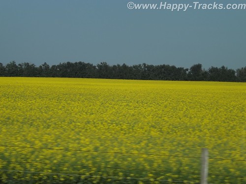
The highway is called the Northern Wood and Water Route. We passed through several small towns and also noted this industrial facility which we never really identified. We’re thinking it may be the Tolko OSB plant which makes construction products. More signs of a growing economy? The fields here and before we got to Athabasca were bright yellow and we think the crop was canola.
We stopped in Slave Lake for gas and lunch. At the gas station, we filled one of the 5 gallon cans we’d brought along in case we got stuck along the way. (We never used it.) The town is older and off the main road with signs pointed toward the lake, which is Little Slave Lake. The town had 5 or 6 motels and we ate at an A&W restaurant, something you don’t see much of in the States these days. Their root beer is as good as it ever was, I think. Our box of chicken came with French and English translations. It appeared to be a resort town and we never found the park at the lakefront.
We started noticing different road signs like “Important Intersection” and we met a truck with a “wide load” that appeared to be a two car garage coming at us. A lot of the signs were graphics instead of words, like a fisherman for the lake access or someone reading a book for the library or a water slide amusement park. One of my favorites (which took me a bit to figure out) was the two cars beside each other in a green circle to indicate a passing zone.
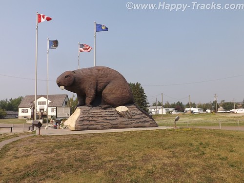
One of the little towns we pass through is Beaverlodge which has this huge statue of a Beaver which was built to mark the town name as well as pay tribute to the industrious beaver, which was the earliest distinctive symbol of Canada (per the sign posted next to the beaver.)
We came upon some one lane roads through construction, which seems to be a regular occurrence throughout our trip and during the summer months.
Eventually we cross into British Columbia and reach Dawson Creek, the southern and eastern end of the AlCan Highway — Mile 0. Note that it is now called the Alaska Highway officially but I will continue to use AlCan.
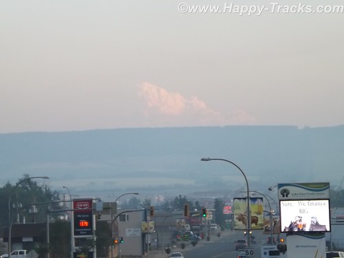
At Dawson Creek, we became aware of the smoke in the area. Forest fires were burning further south in British Columbia. We would see ash on the truck the next morning.
From a sign marking the 50th Anniversary of the Highway’s construction:
In the early hours of March 9, 1942, the first troop trains of the United States Army Corps of Engineers arrived in Dawson Creek to begin construction of the 2450 kilometre (1,523 mile) Alaska Highway. Overnight Dawson Creek was transformed from a small agricultural community of 500 into a bustling terminus for troops and supplies. At peak construction the population swelled to 10,000. Tent cities sprang up in farmers’ fields to help house the massive influx. The Northern Alberta Railway Station, the “end of steel”, became a centre of activity and sometimes, temporary home for thousands of military and civilian workers, may of who arrived with little knowledge of road building — or subzero temperatures.
During construction Dawson Creek served as a clearing house for supplies and equipment, as well as workers. In the spring of 1942 some 600 carloads of tractors, bulldozers, fuel and supplies arrived by rail from Edmonton for dispersal to construction camps along the route north.
Though the highway was completed in record time, it was not without its mishaps. One of the worst tragedies occurred in Dawson Creek in February 1943 when 60,000 cases of dynamite exploded in the centre of town, injuring many but miraculously, taking only five lives. The explosion leveled an entire city block and changed the face of Dawson Creek forever.
The modern city of Dawson Creek is rooted in those frenetic, exciting years of road construction. Though agriculture remains the driving economic force in the region, the transportation links forged through muckeg, ice and snow continue to play a major role.
The Mile 0 Post
The Traffic Circle located at the intersection of Alaska Avenue and 8th Street marks the designated Mile 0 of the Alaska Highway. A plain four-foot post once marked the site. In 1946, when this was hit by a car, a new Mile 0 Post was designed and moved to the centre of Dawson Creek where it stands today. The Mile 0 Cairn in Northern Alberta Railway Park was erected in the late 1950s to replace the original post that marked the “true” beginning of the highway north.
We took pictures of us by the cairn and talked to motorcyclists who were marking the occasion of their trip.
We also got a picture of the Milepost in the center of town, just as my mother did when they passed this way.
Tomorrow, we start on the AlCan.
You can see all of the pictures from this leg of the trip here.
We invite you to continue along with us and hope you enjoy the account!
Summer 2014: Alaska via the AlCan, Glacier National Park
Glacier National Park is located primarily in Montana and is the country’s 10th NP being signed into law in 1910 by Pres. Taft. In 1932, the US and Canada governments formed the first International Peace Park by coordinating on the management of Waterton Park and Glacier National Park to form Waterton-Glacier International Peace Park, sharing management strategies on protecting the waters, plants and animals.
Our route allowed for the more scenic route rather than the most direct which took us to Three Forks where we stopped at the Wheat Montana store.
Wheat Montana is a combination grain elevator, bakery and restaurant with a gas station and convenience store. I suppose having the grain right on site conveys an image of freshness. The bakery certainly smelled tasty! We continued on through Helena and then up to the southeast of the park, then along the scenic Route 2 and eventually over to Kalispell.
We stopped for lunch in Helena. When we came out of the restaurant, the gentleman who had sat across the aisle from us inside started up a conversation. He told us he was traveling to visit relatives and was telling us he was from a small town in Canada near Edmonton and told us about a bridge that we should make a point to see. 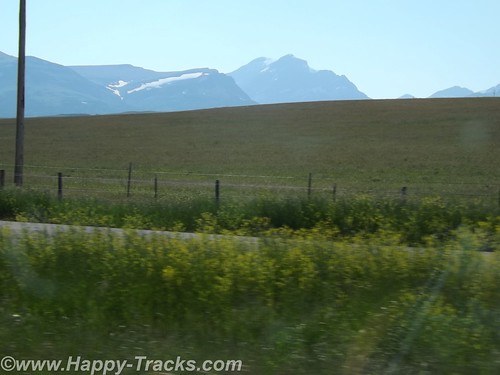
We had set the GPS to take us to Glacier National Park. It led us to Browning on the Reservation where we stopped to figure a more precise destination. While we were checking the paper maps, a man drove up and parked next to us to use the air hose. He had a young girl in the truck with him. It was very hot and the youngster was making her case for getting an ice cream or cold drink inside the store but she was unsuccessful. The man started a conversation with us and recommended that we plan our stop to include a place called Goat Lick Creek where the goats come on a regular frequency. He said that you could often see 40 or more goats with their kids there. We found his spot and a few goats but not in the numbers he had suggested. The goats and other animals frequent this spot to lick the clay and get the minerals. We appreciated his recommendation as it was a place we would have flown right on past with no notice. 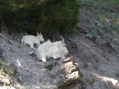
Saturday night summer with no reservations made it a bit difficult to find lodging. We looked first in Whitefish just outside the park’s entrance and eventually ended up in Kalispell about 15 miles away. We searched and eventually found overnight lodging at the Blue and White Motel (I wonder what the story behind that name might be?) where we were told they had two rooms available, one in the “old” building and one in the court. The “new” building probably dated back to the 1960s while the furnishings dated back to the early 1980s. We checked out both rooms and decided to take the one in the court. The carpet was old (as were the stains on it) but it seemed to be a bit better than the other choice. Supply and demand works, I guess. While the motel and the rooms would be prime candidates for refreshing, the place was filled to capacity. The desk clerk was a very pleasant woman with hair a shade of red that nature never used and a pleasant manner that showed she had been around since innkeepers tried to make their guests feel welcome instead of just being processed efficiently. The other guests were a mix of families with children, motorcyclists checking boxes on a bucket list and some longer-term residents who were probably working or going to school. As has become customary, they also had a breakfast bar of sorts that included toast and some prepacked pastries and coffee. Little bit different. 
Glacier National Park is believed to have contained approximately 150 different glaciers in the mid-19th century and currently has 25 active glaciers. Current estimates say the last of the glaciers may be gone in the next decade.
We left Kalispell and went to the park. Our first stop was at the Apgar Visitors Center for an orientation. It was a busy place with tour groups forming up and leaving, groups coming in, one of the rangers preparing to give an informational talk involving a bear skin that she had put on display. 
We got a map and oriented ourselves in preparation for the Going to the Sun Road journey through the park. As elsewhere, our orientation included reminders to beware of the animals and the traffic and to not block the roads.
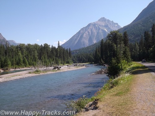
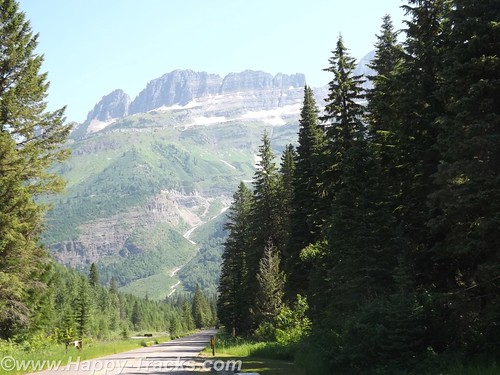
Going to the Sun Road passes Lake McDonald and along a glacial stream and up to the Going to the Sun Mountain and the glacier there. It is a scenic drive with views of the glacially-carved valleys and mountain sides and many streams cascading down to keep Lake McDonald filled. 
Although the park literature indicated many different animals to be seen in the park, our travels kept us primarily along the more trafficked roadway so we didn’t see many wild animals.
At our first stop just past the winter gate we were approached by another tourist (his accent was Asian perhaps?) seeking assistance. He was driving a rental car and had his paper map in hand but couldn’t locate himself on it. He really just wanted someone to orient him on his paper map. Where is the “You are here” dot? We got him oriented and on his way and had a chuckle at how its sometimes the simple things that make all the difference.
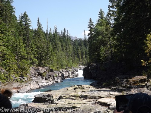
We stopped along the way for pictures of the lake and the glacial stream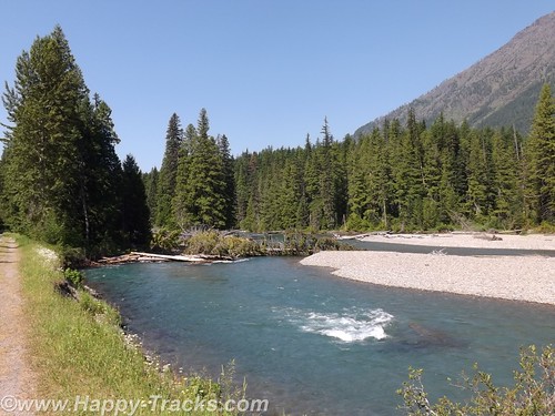
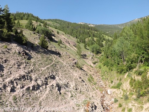
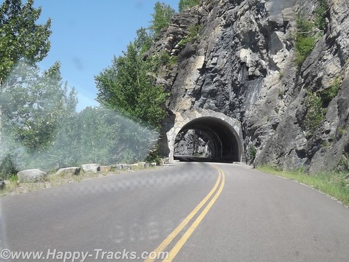
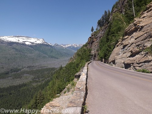
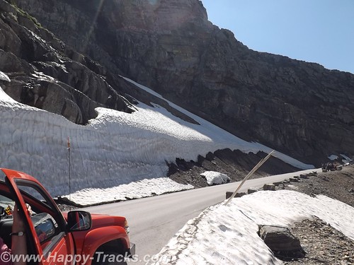
As the sides of the valley got steeper in our ascent, we passed through a couple of unusual tunnels in that the sides toward the valley had large openings to permit seeing the view.
Going to the Sun Road does not allow vehicles longer than 21 feet or wider than 8 feet and does not allow towed vehicles due to the sharp curves/switchbacks and narrow roadways. In the picture above, the white dot in the very center of the picture is a van passing where we had just been.
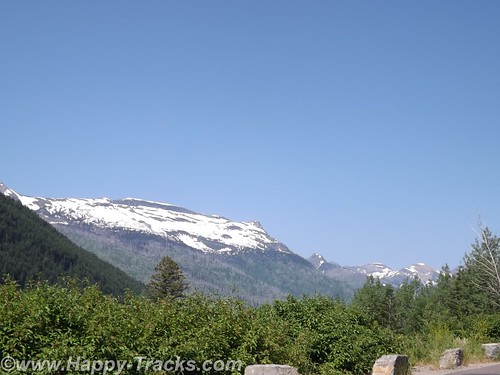
Our first encounter up close with snow and ice. The temperatures had us comfortable in our shorts and T-shirts.
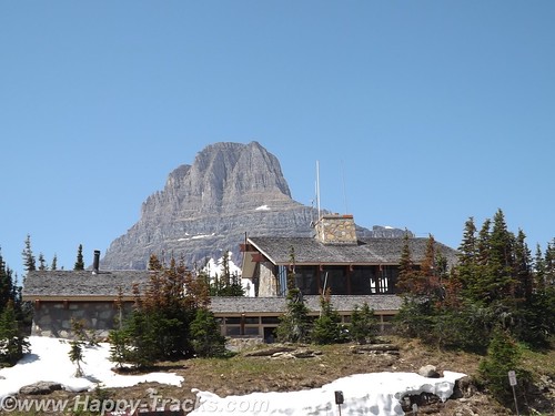
The road winds its way up to Logan Pass, the Continental Divide.
This trip was Betty’s first time crossing the Divide (in Yellowstone) although we would eventually cross at least 8 times before returning to Maryland. We posed for pictures by the sign and talked to two ladies there doing the same.
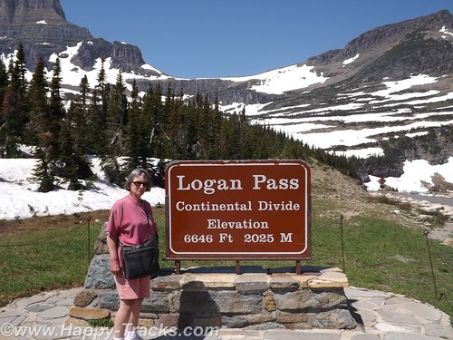
As we were walking away, the two ladies asked us to help identify the “white dots” on the hillside above us which turned out to be the only bighorn sheep we saw on the trip.
There is a rest area at Logan Pass which was fairly busy this day. There is a gift shop, restrooms and exhibits there but no restaurant and we were looking for lunch. We did have some food in the truck in the refrigerator so we had cheese sticks and crackers for a light lunch.
Shortly after leaving Logan Pass, we came upon some more road construction which narrowed us to one lane of dirt road and the accompanying delays which let us appreciate the scenery. The road passed beside Saint Mary Lake which is smaller than Lake McDonald.
We stopped at the St. Mary Visitor Center for a late lunch. Several of the menu items included huckleberries but we had more traditional fare.
After our late lunch, we exited the park and turned north for the short ride into Canada.
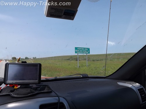
Our first border crossing was at Carway. Usual questions about where we going, what we were going to do and what we were bringing with us. We had bear spray (which apparently is sometimes viewed as a weapon but was of no concern to the Customs Agent) and more than the permitted 200 (one carton) of cigarettes each but this also was not viewed as an issue so we were waved on through.
We found a room at a fairly new Comfort Inn in Lethbridge and went next door to a sports bar for munchies for dinner.
The next day, we would visit the TD Bank for Canadian cash continue on our way north.
You can see all of the pictures from this leg of the trip here.
We invite you to continue along with us and hope you enjoy the account!
Desert Expedition III: Nevada – Post 1 – Zooming Across Country
In June 2012, Scott B. over at Expedition Portal starting discussing a third Desert Expedition for early summer 2013. The early planning just talked about a trip to visit ghost towns in Nevada. Several jumped in with possible locations to include and some early commit-ers saying they were in as well as a couple of the “regulars” who had taken part in DE 1 and/or DE2.
In January 2013, my plans to retire in March were firming up so I committed to joining in. Good thing I did as Scott capped off the list shortly thereafter. I said goodbye to my employer and officemates in March and started getting ready.
The roadways indicate that this was a trip for the truck and I decided to take the Little Guy as the truck bed, at 5 feet, is too short for me to sleep in except in emergencies. As provisioning stops would be few and widespread, I had to add capacity for water and fuel. While I probably overdid, I carried about 20 gallons of water and 10 gallons of gasoline in containers. I also carried my Edgestar refrigerator/freezer (works on AC or DC); tools; recovery gear; clothing; and some food with plans to restock and finish loadout with perishables before we met up in Cedar City, Utah. Also included in my packing was my SPOT messenger which allows me to check in with a select group of family and friends with my progress even when cellphone service isn’t an option.
The trip by the numbers:
- 5482 miles driveway to driveway.
- 14 days (all good).
- 2 blown tires (neither were mine but both went to the same guy).
- Gas: 306 gallons. High price $4.199; low was $3.599.
- Motel nights 4.
- Bottles of water consumed by me 22.
- Post cards sent home 8.
- Animals: Fish (too many to count in a couple of springs and stock tanks); Reptiles – lizards only (no snakes); Mammals – horses (wild and domestic); donkey; jack rabbits; dog; cattle; pronghorn antelope; 1 dead field mouse.
- Extra-terrestrials (none confirmed but I can come up with no other explanation for the knot on my head and walking into a tree in a broad daylight outside the Little Ale’ Inn).
- Good fellow travelers 7 human, 1 canine. Jerks in our party – 0.
- Pictures taken 1312. (Don’t worry I won’t try to share them all).
I left home Friday morning, May 17th. We were supposed to meet on Tuesday morning and I figured on a nice  leisurely trip out of about 4 days putting me in town on Monday sometime. I planned to get at least part, if not all, the way across Illinois the first day. I had a bit of adrenaline going as well as the uncertainty of how far I’d feel like driving on subsequent days so I got all the way across Illinois and decided to try to get out of range of St. Louis morning traffic.
  Using the GPS, I started looking for a Comfort Inn around midnight and got directed to an empty lot. (So much for recently updating the GPS maps!) By that time, I was pretty beat and stopped for gas and a walkaround and then noticed a Walmart at that exit. (Walmart has a general policy — there are exceptions — of allowing RVs, even little ones, to spend the night in their parking lots.) I stopped in and picked up a pan I had not gotten at home and checked to make sure they allowed for overnights. So back out to the edge of the parking lot and a couple of hours of sleep in the Little Guy.
 I woke up before sunrise and got rolling again across Missouri. My route took me on the outskirts of Kansas City in the early morning. Topeka, Kansas was later in the day and looked like it might be more picturesque as it is the capital of the state. While I passed within sight of the capitol building, it was covered in scaffolding for a renovation project. So onward to the wide open plains. Totally different from any part of the country I had seen before and breathtaking. To tell the truth, it was breathtaking the first couple of hundred miles but got repetitive after that.
Scooting across Kansas, there was a couple pulling a Scamp or Casita trailer that seemed to be stopping at the same rest areas. One time, I would pull in as they pulled out and then later they would pull in as I pulled out. We did eventually talk when we reached the Colorado welcome stop. They winter in Florida and were on their way to sons near Ft. Collins for the summer. We spent some time comparing notes on trailers and came to the conclusion that theirs is more livable but in a world of $4.00/gallon gasoline, mine was preferable for towing.
While in Kansas, I saw the occasional pump jack in addition 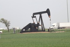 to wind farms. I guess that Kansas is covering their bets on two different sides of the energy issue. Also in Kansas, I heard reports
 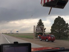 of nasty weather which always seemed to be about 40 miles behind me. In a couple of days, the devastating tornado in Moore, OK would hit. I pulled out of the Colorado Welcome Station as the rains hit. I drove out of the rain and back into the sunshine pretty soon but was seeing clouds on the peaks around Denver. Seemed like a good time for gas, so I pulled into a rundown looking truckstop. The gas pumps wouldn’t accept my credit card and I assumed it was related to the seedy look of the station and paid cash. Several declined purchases later, I called the credit card company. You know that ad where the couple is thrilled that the Bank has stopped their card from being fraudulently used in a foreign country? Its not all smiles when you’re trying to use your card and find that your bank (or credit union) decides that buying gas on a cross country trip is “suspicious activity”. Just 20 minutes on hold and we can get this all taken care of. Sheesh!
 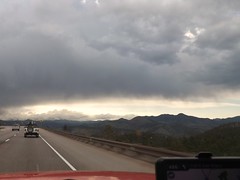 .
.
Buying gas proved to be a good idea as the trek up the mountains and through the pass was sucking down some fuel. As I neared Vail, we added precipitation into the mix and it was sticking.
It was close to dark, I didn’t know what the roads or the weather had in store for me and my efforts to find a motel that night before hadn’t turned out well so I holed up in the Comfort Inn in Eagle CO for the night. A hot shower and comfy bed sure felt good. It had been a long day (or two). I figured I had about 450 miles to go before Monday night so I was in good shape.
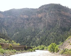
Sunday morning found me paralleling and in sight of the Colorado River for a while. The engineering of stacking an Interstate Highway on top of the river and squeezing the railroad tracks in there as well impressed me. And don’t forget to squeeze in a parking lot and river access, too!
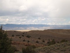
As I moved into Utah, things didn’t really level out but the slopes seemed to be gentle and the views longer. The weather was still mixed but mostly good driving weather.
And what does every 4×4 driver think of when they think of Utah? Moab, of course. So here I am, easily a day ahead of schedule within 30 miles of 4×4 Mecca. So what do I do?
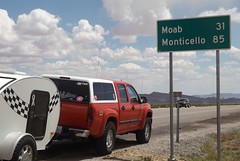
I take the safe way out. No one knows quite where I am, I don’t really know my way around and I have this great trip in front of me. So, Moab is close but oh, so far away. Something else to stay on the “to do” list for now.
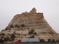
The views are breathtaking but the locals have seen them before. I got an earful at this rest area after driving through a construction zone at the speed limit (65) for holding up these nice folks…but in spite of me, they still had time to stop and catch the view at the rest area?
I pulled into Cedar City on Sunday afternoon a full day ahead of my schedule. Luckily my motel had a room available but not the room I had reserved for Monday night. It was fine by me. I sorted the stuff in the truck, did some shopping/provisioning and filled my gas and water jugs. I even got my walk in while doing some sightseeing.
Cedar City has an extensive Veterans Memorial Park which I enjoyed. I was surprised to find water running in the rain gutters along the road. I figured it to be waterline maintenance or such but later figured it was the runoff from lawnsprinklers which seemed to be running everywhere with no particular concern for missing the grass.
Cedar City also has an “historic” downtown Main Street which includes a drugstore complete with old-fashioned soda fountain in the old Sheep Association building. Take note of the bronze statues of historic figures on the sidewalks. Similar idea to the OBX Pegasus statues and DC’s donkeys and elephants but classier.
More photos from this leg of the trip.
If you’d like to be notified of new posts, use the Subscribe button in the upper left and provide your email. Your email will not be used for any other purpose!
A Different Beach and An Anniversary
Thursday April 26 found us traveling around Currituck County and Corolla at the northern end of the Outer Banks. It also marked the occasion of our 32nd wedding anniversary. Congratulations to us!
 We were staying at the Hampton Inn in Corolla. It’s located beachfront and we were in a “partial view” room. Partial view means you are on the side of the building.
 Currently, Hampton Inn has vacant land on both sides so it’s really a pretty good view of undeveloped Outer Banks with low scrub growth, the dune line and the water. Since the National Audubon Society decided (after years of paying the lower conservation area tax rate) that the land donated to them had no value as conservation, they decided a couple of years ago to sell it off for future development and $25 million. Seems a little underhanded to me as they were suing to shut down public access to much of the Cape Hatteras National Seashore Recreation Area just 20-30 miles south but there was apparently nothing illegal about the transaction. The development called Pine Island will fill in the area to the north and south of the Hampton soon as construction is currently underway.
After breakfast, we decided to head to the beach for a walk. The Hampton has a boardwalk over the dunes and we headed that way then north along the shore. It was a glorious day. We appreciated our jackets and met another couple walking along the shore. We continued as far the first few houses. Individual homes had boardwalks over the dune line. 


 As the wind moves the sand, the boardwalks get covered and homeowners build new ones, sometimes on top of the old one! It makes for an interesting sight with the double decker boardwalk with the lower level being only a few feet below the new one.
In our investigations, we had discovered there was another shipwreck sometimes visible next to the dune line in Corolla. Since our adventures last year, we have sort of “gotten into” finding the wrecks on the Outer Banks. With the shifts in sand due to the storms and just routine erosion by wind and water, what’s visible today may be buried tomorrow and vice versa.
Armed with an address for the house in front of the wreckage, we drove to Corolla where the Metropolis site is marked with an historic marker alongside Hwy. 12. We also discovered that Corolla has no on street parking. It looked like we would park n the shopping center and walk the half mile to the beach but we discovered a public access (including vehicle) at the end of the street. Carefully reading the sign, we discover that Currituck County allows driving on the beach from October 1 to April 30! Score! We drive the truck over the ramp to discover the beach is pretty much hard pack, similar to the beach at Daytona. While I wouldn’t recommend it in 2wd, it’s potentially doable.
The description we’d seen of the Metropolis indicated it was visible depending on the tides, erosion and the amount of digging the kids (primarily) had done on the beach and sometimes gave off the aroma of turpentine (pine). From the marker, we learned it was a steamer that had wrecked in 1878 and lost 85 lives. As a result of the tragedy, changes were made in the Coast Guard policies regarding beach rescue. We walked around a bit and took a few pictures and decided to drive along and see what the beaches there were like.


 The hard pack continued north all the way to the fence which separates the “4wd area” at the north edge of Corolla. The fence is primarily to keep the wild ponies out of town. There is a walk through gate (unlocked) with enough of a turn to keep the horses from walking through. There is a also a drive through gate which is locked and limited to “authorized vehicles” only. We took a couple of pictures and headed back south. The beach was pretty sparsely populated. We did see one or two other vehicles with a fisherman and all his gear and some tracks from earlier in the day. We headed back south just a short distance to the first off ramp which came out by the Corolla Lighthouse and turned north into the 4wd area.


The local news is abuzz with the Currituck County Commission considering adding a fee for a permit for the 4wd area beaches. In the past year, the tour companies which conduct the wild horse tours getting attention due to the amount of traffic they generate in the residential areas as well as a number fo folks not giving the horses the distance the rules require. On past trips, we had seen a few of the horses but always back behind the dunes in the residential areas. On this trip, we saw the horse on the beach. We were seeing more horses than we ever had seen anywhere and they were all on the beach. By the time we had gone north to the Virginia state line and back, we counted 44! For the most part, they were in groups of 5 or 6 but there was one by itself. We just couldn’t believe it. 44 horses sighted over a period of around two hours!


 The one horse by itself was at the foot of the dunes and eating the sea oat plants. I guess this is near the embodiment of the question: What am I supposed to do if I see an endangered animal eating an endangered plant? Neither comes under the category of endangered but both are protected.
One group of 3 or 4 were in the dunes next to another discovery for us, a life saving station! We had visited several on the Hatteras and Ocracoke Islands but not one that far north. It turns out that this one, Wash Woods, had been in service until the 1950s and was restored in 1999. It is currently in use as the Twiddy Real Estate office for the area. Parked outside was a neat bus that had been restored as well for touring the 4wd area.


As we came off the beach, we were in search of the deli where we had those terrific sandwiches on an earlier trip with friends Donna and Mike. We found the building but it was obviously in the process of changing tenants. Across the parking lot was the OBX Deli and Cheesesteaks which we hoped was the same establishment in a new location. As it turned out, it was another new business with a phenomenal selection of fudge and other candies but the deli sandwich was nothing special. It was good but disappointing after psyching ourselves up for the other place.
After lunch, we ventured over to the shops around the lighthouse for a couple of souvenirs and then went back onto the beach to see where we came out if we headed south. We continued south past the Hampton and the houses of Pine Island. Just offshore, maybe 20 years, we discovered a previously unknown to us piece of wreckage sticking up out of the water.  There were three pieces to it, 2 looked as if they could have been most anything, but the third was definitely machinery. It was shaped somewhat like an engine connecting rod (its the part that moves up and down and transmits the rotational motion of an engine’s crankshaft to up and down motion of a piston). I did a little internet research afterwards and found another reference to its existence but no help with identification. A gentleman walking along the beach also pointed out that there was a piece of wood further along the beach that could easily be wreckage as well. So we continued along to find a strong straight piece of wood with the rusty iron spikes common to the wrecks to be found in this area.
We continued along into Duck. The beaches in Duck are also open to drive but there is no public access from the town. It appears the only accesses are on private property or from the beach, as we entered and exited. As we got into Duck, the sand was softer and I was beginning to regret not lowering the tire pressure more when we had entered the beach. The beach also was getting narrower as it got softer so we turned around within sight of the Research Pier.
We traveled back north and exited the beach where we had entered in Corolla. We treated the truck to a full tank and went back to the hotel with plans for dinner at the Rt. 12 Steak and Seafood. As we were standing outside the doors, we ran into one of those fellows who is able to see the virtually invisible mark our family carries that apparently says “Talk to me”. He proceeded to share that business in America should be conducted more standing by the tailgate of a pickup truck than in an office or over the exchange of documents. After telling us how he had just worked out the details of the plumbing for his construction there, he launched into his political leanings and his opinion of the current occupant of the White House. Not generally a conversation one gets into with someone you just saw (but haven’t yet met) but apparently it worked for him.
Dinner was Shrimp Aristotle and Broiled shrimp. The Shrimp Aristotle was a combination of a cheesy garlic sauce with olives and was quite tasty. The broiled shrimp also pleased the palate. The vegetable medley (green beans, tomato and carrots) was just a bit too close to raw for our tastes but complemented the meal well. After dinner, we walked the shops which were mostly closed and then headed back to the Hampton and eventually to bed where the day’s activities in the sunshine and fresh air lead to a peaceful sleep.
Important numbers from today:
44 horses
32 years
3 new to us shipwrecks
1 new life saving station.
1 new beach where we could ride and enjoy the sights.
Halloween at the Beach: Part 5 – Have to head home
Although its been great fun, it must come to an end.
Monday morning we woke up relatively early and were checked out and on the move about 9:00. We stopped in Kill Devil Hills to fill the truck. The Shell station had an interesting layout. There were 6 or 8 pumps on 3 or 4 parallel islands. Traffic was so that everyone came in from the same side of the corner and then went to the islands. Cash or credit didn’t matter, just pump and go. With the traffic pattern, everyone went out by passing the cashier sitting in a drive up booth. The lines were orderly and not having to prepay cut the lines and time to accomplish your business and move along.
We decided to follow the GPS to see what way they would send us around or through Norfolk this time. The routing got us off the 168 toll road expressway and on a surface street that took us into Virginia Beach via the Centerville Parkway. This was a new one to us. We got onto I64 a few miles before the Hampton tunnel.
Our next stop was lunch at Pierce’s Pitt BBQ in Lightfoot near Williamsburg. That’s a frequent stop for us as the food is good, the prices reasonable and the in and out relatively easy.
Although it threatened rain, it never hit us and we made good time to the Springfield interchange about 4:30. Traffic wasn’t as bad as we figured and the new configuration for the I66 interchange kept the backup limited to the right two lanes allowing us to continue on to slow at the Tyson’s Corner construction. With two of us, we were able to use the HOV lanes on I270 and made it home about 5:30 which was ahead of the trick or treaters.
This trip and the one in the spring are highlights for me and recharging the internal batteries. Unfortunately, Tuesday meant back to work.
Halloween at the Beach Part 4: Tying Up Loose Ends
Sunday the skies were sunny but the wind was still whipping albeit with less force than on Saturday and the temps were in the 50s. Janet and Bruce called from the Diamond Shoals where we joined them for breakfast before they headed for home. (Jeremy and Rosemary had left earlier.) After farewell wishes for a safe journey, Betty and Keith decided to go back to Ocracoke to further the pursuit of known shipwrecks.
The ferry was just finishing loading and we were the last car onboard. The ride over was less exciting than either trip the day before. As happens seemingly too often, Keith was mistaken for someone else and we were approached by fellow travelers who believed Keith was an old high school chum but it lead to a friendly conversation included a look at the strangers wind screen contraption made from 2×2’s about 6 feet long with silt fence stretched between to block the blowing sand. He indicated it worked fairly well on the sand but still allowed too much wind to keep really warm.
We entered the beach at the northern most Ocracoke ramp and turned towards the north point. The island has grown since last spring with this area covering more territory. The texture was the hard damp sand we had seen on the southern end on Saturday. We scoped it out then turned south towards a wreck believed to be about ½ mile north of the  Ocracoke Pony Pens. At the GPS-designated point, we noted nothing indicative of a shipwreck although we were adjacent to an area of dunes that had been replenished since Irene.
  The beach was relatively narrow here and we found we were very very close to the highway as well.
We turned back to the ramp and headed into the town of Ocracoke for quick trip to the welcome center gift shop and then off to Ramp 72 to try once again for the shipwreck noted to be there. Since today’s weather was better, we were able (willing) to walk  across the dunes to search. We never made it to the west side shore of the point but sighted something n the marshgrass but we weren’t prepared to walk/wade to get close up.
There was more loose sand making small dunes and large ripples on this section of the beach so that staying back from the water resembled a roller coaster.

 We turned north on the beach to check for more shipwrecks and condition of the shore. There were a few fishermen and others enjoying the beach. We even saw a couple of folks trying to surf but the waves weren’t really cooperating.


As we passed Ramp 67, there was no indication that there was not another ramp ahead but we eventually reached the end of the open to vehicles part of the beach and turned around to leave at Ramp 67.
There was one more shipwreck indicated on Ocracoke Island just north of the pony pens so we stopped at the crossover there. Several of the ponies were out in the pen so we walked over and took a few pictures. We also learned a few things that made the Ocracoke ponies unique including two fewer vertebrae than other horses, fewer ribs and denser bones.
 We then headed up the beach on foot in search of one more but it eluded us as well. Total for our long weekend had us finding two confirmed sightings on Hatteras Island and one maybe on Ocracoke. It later occurred to us that several previous trips had a goal which we had not met because of ferry schedules or darkness or hunger but this time, without trying, we had managed to cover ALL of the drivable ocean side of Ocracoke Island!
We caught the ferry back to Hatteras. We had ridden the ferry 4 times this weekend and not ridden the same one twice. This time we were onboard the Chicamacomico which was pictured on the postcard back to the folks at home.
 One place we had missed in our travels that is always part of our trip was a ride out to the point and past the Cape Hatteras Light. The approach by the campground and where Ramps 43 and 44 meet the pavement was underwater as we had learned before arriving. It’s on National Park Service property but for some reason doesn’t drain and hasn’t for a while. One can’t help but think it contributes to the mosquito population that plagued the island after Hurricane Irene. This beach had obviously had more traffic than any other beach we had been to this weekend. We drove out to the point and around but would have needed to drive across water if we hadn’t turned back. We made our way back to the pavement and off to dinner.
Dinner was at Rusty’s, one of our favorites and tonight didn’t disappoint. Broiled bay scallops for Betty and a Caribbean-spiced snapper for Keith followed by New York style cheesecake (not too dry) and with a light glaze on the plate of raspberry and mango gels with coffee for a near-perfect finish for the meal and our weekend.
We aired up the tires on the truck and made fresh coffee to fill the thermos bottles for the trip home and we were set after returning to shower and off to bed. We head home on Monday.
Halloween at the Beach: Part 3 Visiting the Moonscape
Saturday morning we headed over to the Red Drum for a headlight and a tire gage as I discovered the digital gage in the console had a dead battery. While there, I met Mr. John Couch of OBPA and internet fame. He is president of the OBPA, one of the organizations fighting to maintain access for pedestrians, sportsmen and other folks who use the Cape Hatteras National Seashore Recreation Area for recreation. In conversations with Rob Schonk, the principal in the Robert and Jean Schonk Foundation, Rob recommended that I make the time to make Mr. Couch’s acquaintance. After installing the new headlight, we headed to Frisco and Wave Hopper to gather Bruce, Jeremy and Rosemary for some time on the beach.
 We headed over to Ocracoke in spite of the weather forecast. The day was to be windy and the forecast was accurate on that account. The predicted rain held off however. The wind was strong off the sound and made the landing of the ferry somewhat exciting with the captain using the pilings to bounce his way into the slip.
We headed to Howard’s Pub, one of our favorite lunch spots. Bruce had the chowder, Betty had grilled shrimp, Keith had marinated tuna steak, Jeremy had the tuna steak sandwich and Rosemary had the grilled tuna salad. The food was excellent as usual. After lunch, we headed into town to do a little shopping and found our way to Mermaid’s Folly and Craftsmen Paradise on Howard Street. It was a successful trip. Everyone found something to their liking and connected on some items which we couldn’t find.
Next we headed for the beach, more particularly the South Point. It was a surreal sort of moonscape actually having been flattened with only the occasional small dune still there. The wet sand was pretty hard requiring the four wheel drive rarely. Looking over the inlet to Portsmouth Island you could see shafts of sunlight coming through.
The loose sand was blowing across the hard wet sand making interesting patterns and beginning to form ridges and small dunes. 


As we headed back towards the ramp off the beach, we noticed a pair in a pickup that seemed to be making more downward progress than forward. It was a pair of fisherman whose four wheel drive was malfunctioning. After lending them a shovel which wasn’t enough to get them out, a tug on our towstrap got them back over to the hard surface and on their way. As we got to the ramp, Bruce saw Jeremy and Rosemary headed up the ramp and began to follow them off the beach and back towards the ferry on Highway 12. Keith and Betty lost sight of him but decided that was the direction he was headed. Of course, Keith and Betty also had Jeremy and Rosemary in the rearview mirror. After failing to see Bruce, we gave him a call to inform him that he was lost as we did not know where he was. It turns out that Bruce was following a different dark-colored F150. But as it was getting time to head back to Hatteras Island, it worked out for the best.
We commented earlier about the difficulties getting the ferry into the dock but the weather  had worsened and the docking of the ferry to take us back was quite a spectacle. One gets torn between fascination with the difficulty in putting the ferry where it belongs and admiration to the captain for doing so in spite of the conditions. At one point, the ferry was perpendicular to the slip and hard against all three pilings and the engines roaring at near full throttle with little effect. Eventually the ferry came into the slip and we pulled out only a few minutes after our scheduled 5:30 departure. We found out Sunday that the ferry had stopped running with the 6:30 departure Saturday evening. Had we stayed on Ocracoke for dinner, we may have stayed the night or whenever the schedule resumed.

The five of us had dinner at Diamond Shoals Restaurant in Buxton and bade our farewells to our friends. Across the street to our hotel and the nightly computer checks, tv, shower and bed.
Halloween at the Beach: Part 2 Hunting for Shipwrecks and the Aftermath of Irene
Friday, Betty and Keith had breakfast at the Hatteras Island Inn (formerly the Comfort Inn) and then set about our day which included a stop at the Really, Really Free Market in Salvo. Friends at home had filled two storage containers with needed and requested items. We had a piece of carpet and some clothing to contribute as well. The carpet remnant, we were told, was being set aside for a local 80 year old woman who had been through this ordeal without insurance and was putting things at home back together.
Betty and Keith had set out to locate some of the many shipwrecks for which we had found GPS coordinates. After finding one last spring, that seemed like it would make for fun.
 As we headed north from Salvo, we took a bit more time to check off the main highway for remaining damage. The KOA campground was open for business. They had cleared the portion near the ocean and were working their way back toward the highway. The camping cabins (basically shell sheds with built-in bunk beds) looked to be basically undamaged but had been floated off their footings. The ones that appeared undamaged had water damage to worry
  about but were structurally sound. The bathhouses all had siding taken away to allow drying out.
The Chicomacomico Lifesaving Station was closed. Reports on the interwebs had indicated there was much cleanup to be done as well as resetting on footers.
 We drove again over the new bridge and stopped to get some pictures by walking through the dune line to the beach and coming around. The speed with which the current moved through the inlet was impressive. I’ve tried to get some pictures but am not sure they really convey the current. It makes one wonder how much more the inlet will open in the unfortified sections with time.


 We stopped at the Coquina Beach day use area to see if we could find the remains of the shipwreck there. Like most of the wrecks, changing sand profiles will expose or cover from season to season. We didn’t find it this time.
Next we headed further north to Nags Head for lunch. Having heard so much about Sam and Omie’s across from the new pier. They were busy and we had about a 20 minute wait. The food was good, the clientele and food were local as well. Betty had the mushroom and crab soup and an order of onion rings. Keith had the scallop cake Sam-wich, think crab cakes make with scallop bits. If we lived nearby, they would be on our regular rotation for lunch but don’t qualify for driving 50 miles just to eat there. Good and repeatable but not a special treat to work for. When we came out, it had started to rain lightly.
We turned south again to the Bodie Island Lighthouse. Bodie Island Light was/is under a major renovation. When the funding ran out, they took down the scaffolding until more funding allows them to continue the work. The light is removed from the structure for now and will be replaced when the renovations resume.
 Next stop is the Oregon Inlet fishing pier. During Irene, all the fishing boats left for less exposed locations. The flooding damaged the piers which delayed the reopening and return of the fleet. Now with new piers installed, life appears to be near normal again.
Before leaving home, we had entered the GPS coordinates for several known shipwrecks which are sometimes visible from the beach. As we passed Salvo, we noted three showed on our track as being nearby. We entered the beach access ramp 23. The GPS coordinates revealed three near to the ramp. The first was just as you entered the beach.  According to the coordinates, we were literally right on top of it. If the coordinates were correct, this particular wreck wasn’t visible at this time but there were two others in the vicinity. As we drove north on the beach, we saw what looked like it could be a buoy that had blown up on the beach similar to one we had seen on a past trip to Carova. As we got closer, we realized that we had found the remains of a sidewheeler that had wrecked on the beach in 1862.
 It was just offshore, inside the breakers. The pieces we saw were iron and probably the remains of part of the propulsion machinery. We were 1 for 4.
We moved further down the island and decided that timing was such we could probably hit the shopping area at the ferry landing and move on to another wreck site that we had seen last spring. The remains of an unidentified ship, probably a schooner, can be found at the end of Flambeau Road in Hatteras Village. We parked and walked over the low dune line on a boardwalk. Considerably more of the wreck was visible than had been in either of our spring visits. 
 We then joined Jeremy and Rosemary, Bruce, and Janet for dinner at the rented house, Wave Hopper. As we pulled in the carport, we noticed a nail lying on the concrete. As we looked around, we noticed a few more, and then a few more. By the time we had arrived at the top floor, we had picked up easily two dozen or more ranging from roofing nails to siding nails to 10 penny galvanized nails. Apparently a roofer had been doing some patchwork after the hurricane and been less than meticulous about picking up loose nails. To the best of our knowledge, no one’s tires helped us pick them up. Our delicious dinner was a cooperative effort on their part and included salad, red potatoes and individual shrimp and scallop casseroles. Accompanying our dinner was a Chilean grape merlot which had been bottled by Jeremy. For dessert, Rosemary had made a sweet potato pie. We enjoyed our meal and some fine company afterwards.
We headed for the hotel around 9:30. It’s about a 6 mile drive and midway we met a Dare County Sheriff’s Deputy coming the other way. Just as we pull even with him, he flashes the blue lights and pulls a u-turn after we pass. Assuming he is responding to an emergency call, we slow down and move over to let him pass but he just stays right behind us with the blues flashing. We pull over and turn on the interior lights while waiting for him to walk up and introduce himself and state his business. It turns out we have blown a headlight and he is concerned for our safety since the local deer population has been rather active. In fact, we had observed a pack of raccoons the previous night.
After asking where we were going and where we had been, he advises us of an auto parts store near our hotel and asks if I’d had anything to drink. I honestly replied that I’d had a glass of wine with dinner several hours earlier. He asks for my license and goes back to his car. When he returns, he has the mobile breathalyzer and asks for a sample. He goes back to the car and returns a few minutes later and informs me that I’m not impaired. While a number of things pass through my mind, the only thing out of my mouth (thankfully the filter was working) was thank you and have a good night.
We head back to the hotel, check email, and get ready for bed.
Visiting Relatives at Prescott
In preparing for our travels to Arizona, we contacted Keith’s cousin, Elaine and her family to see if we could get together sometime as we hadn’t seen each other in several years. After a conference, we decided that schedules and logistics made Prescott a good halfway point and with good food and entertainment for both the young and not-so-young kids.
We started our day as we had all of them since arriving in Arizona, by sleeping in and then having breakfast at the hotel. We got into the car and headed down the interstate for Prescott. By the way, the “locals” pronounce it PRES-cot with the emphasis on the first syllable.
The ride along and from the interstate was desert and rock formations and pretty typical for what we’d been seeing. As we neared town, the landscape changed to a more typical suburban landscape with strip malls and the standard chain stores with a Walgreens, RiteAid or CVS on virtually every corner.
Prescott central was built around a square with the courthouse in the center and the US Post Office and Federal Courthouse right across the street. Since we arrived before we were scheduled to meet Elaine and family, we spent a little time checking out the square and downtown.  We found the timeline in the concrete sidewalk particularly interesting. It traced the history of Arizona for the past 200 or so years. The timeline only covered that part of Arizona’s history since that is the history of Arizona as territory and state. Quite a contrast to Maryland’s Lord Baltimore and the Calverts from the 17th century. I wonder if their fourth graders appreciate that there is less state history to be covered?

Erected in 1907, this statue is considered one of the finest equestrian sculptures in the U.S. and honors members of the First U.S. Volunteer Cavalry of Teddy Roosevelt’s Rough Riders who gathered at the plaza on May 4, 1898, before heading to San Antonio at the onset of the Spanish-American War.

Federal Courthouse and US Post Office
 The courthouse has been rebuilt several times, most recently in 1916. The entire downtown area has a history of extensive fires and rebuilding. It’s listed on the American Register of Historic Places. Barry Goldwater (remember him?) announced his candidacy for President from the courthouse steps in 1964.
One of the more unusual statues depicts a cowboy and his horse with the cowboy lying on the ground with his bedroll.
The courthouse plaza is well-used during the midday by joggers and walkers as well as those folks just having a seat and watching the world go on by.
 This gallery wins kudos from us in the category of Clever Names that Fit.
 We were to meet at the Palace in Whiskey Row.
On a summer night in 1900, this block was totally destroyed by fire. The liquor was removed and carried across the street as they fought the fire. The story is that the firefighters dumped water on the fire then crossed the street to sample the liquids they’d saved. Within a few days of the fire, new construction was underway in brick and masonry. Most of the buildings on this block were constructed between the fall of 1900 and 1905. Most of the color and stories of Prescott originated in this one block landmark that still celebrates that fact that it once hosted over 40 saloons.
 We were waiting on the street when Elaine and family arrived. We directed them to the parking garage where we had parked and waited until they returned on foot. Along with Elaine were her husband Frank and their daughter Brenda with her four children, Erin, Eric, Ethan, and Emily. Brian and Kathy and their son were unable to join us this time. We had a nice lunch at the Palace where one of the descendants of Wyatt Earpp was walking around visiting. We didn’t get a picture with him though. I have a
  word or two for those of you who pause at the thought of four children aged 3 to 11 at lunch. Whatever Brenda is doing to raise those four, she is darned well doing right. The children were well-behaved and polite and watched out for each other. If these four are typical of today’s generation of young children, there is hope for the world. When we went walking around after lunch, the kids were where they belonged and said they’d be and considerate of each other and those around them.
 After a leisurely lunch where we had a nice visit, we walked around downtown Prescott and checked out the specialty stores. Keith bought a hat appropriate for touring and cooler weather. Frank bought ice cream for all who wanted one.

 Frank and Keith were sitting on a streetside bench outside the pet supply store when a lady and her dog walked by. Apparently the dog was a lap dog and Frank’s lap looked good as the dog just jumped right up and made herself at home. It was a surprise and was good for a smile from all. Eventually our visit time came to a close and it was time to say goodbye so we walked back to the cars (Frank and Elaine had just bought a new one and it had DVD players for the passengers. Nice VW van.)
  We posed for a picture or two then headed back towards home and hotel.
Betty and Keith had a light dinner at CoCo’s in Flagstaff. It had been recommended by another airplane passenger on the way from Baltimore. The soup and sandwich were tasty and hit the spot. After that, we crossed the street back to the hotel for emails, postcards, showers and to bed.
 Another good day!