Summer 2014: Alaska via the AlCan; Little Big Horn National Monument

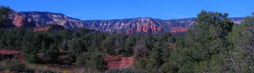
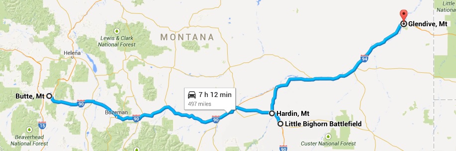
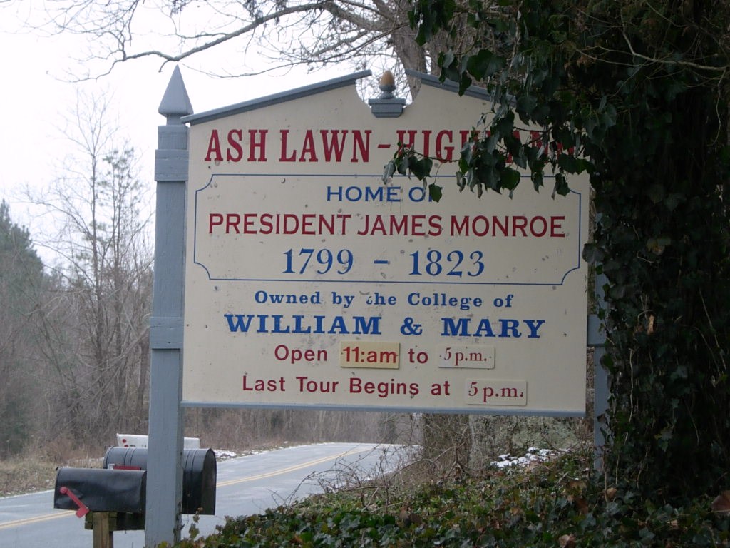
Little Big Horn National Monument sets in south central Montana far away from any large cities. We stayed overnight in Hardin, MT about 16 miles away on the edge of the Crow Agency land.
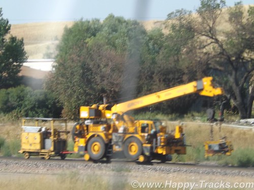
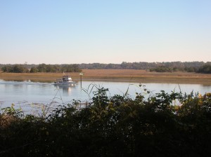
Paralleling (roughly) the highway between Hardin and the monument is a railroad track which might not generally be notable but this particular day there was a convoy of track maintenance equipment on the move and we got a couple of pictures since we usually see this type of equipment waiting to go rather than moving down the track.
DSCF8992
Little Big Horn National Monument memorializes the U.S. Army’s 7th Cavalry and the Sioux and Cheyenne in a famous battle. During the course of our visit, we heard about the actual battle as well as some perspective on how the battle came to be.
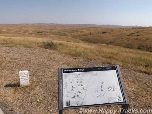
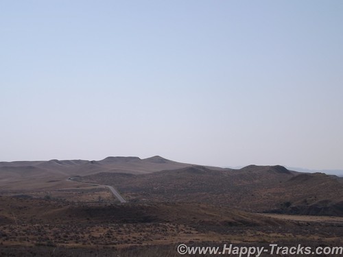
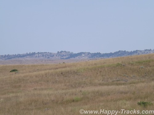
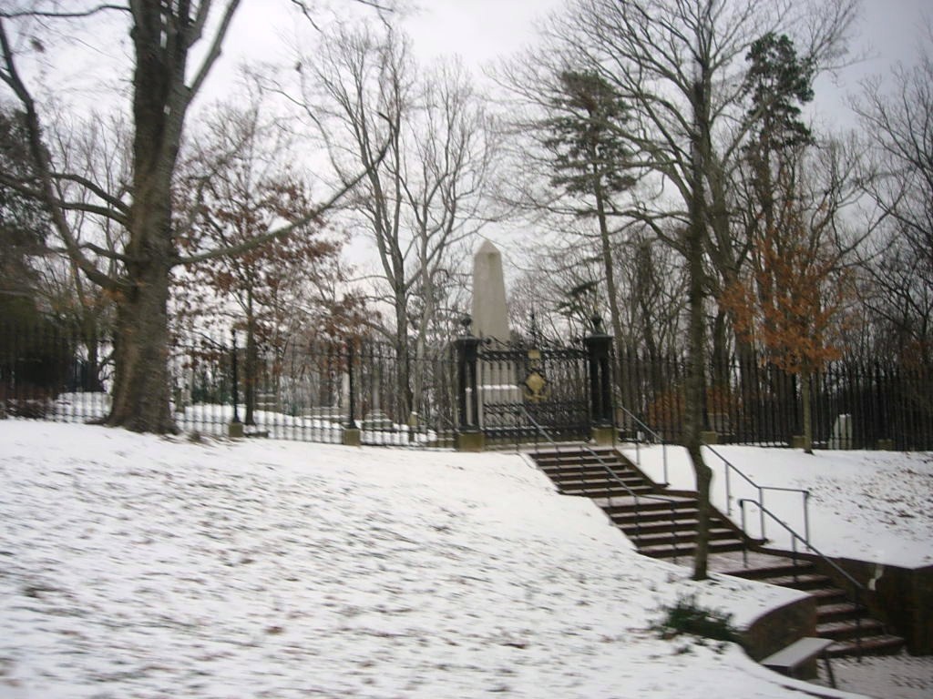
For the most part, the battlefield is just the landscape. There are markers, a road, the visitors’ center and a veterans’ cemetery. It is a place where quiet introspection and retrospection is possible.
lbhmap
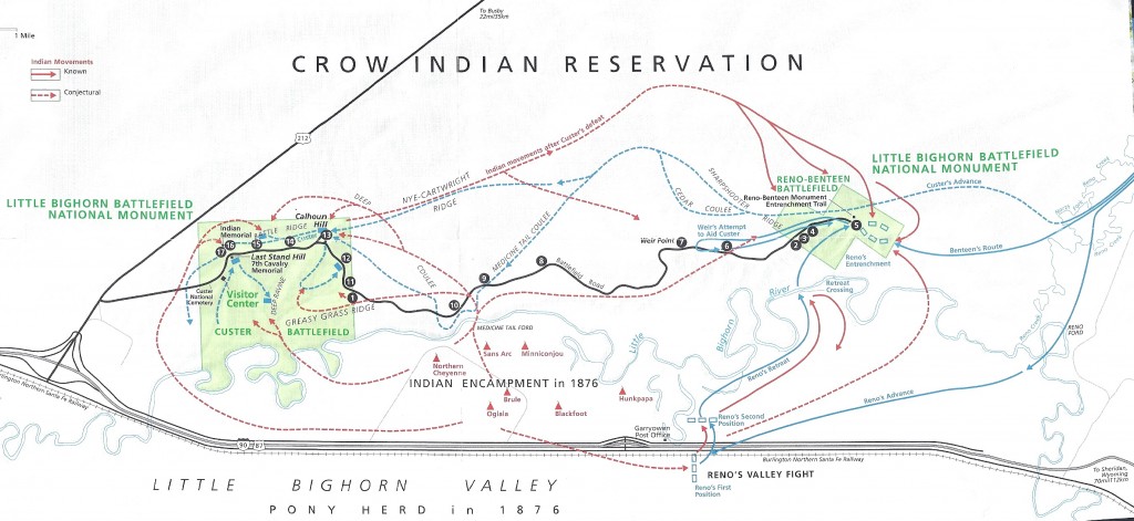
The map above is from the NPS information sheet. I suggest you enlarge it in a separate window or tab for reference.
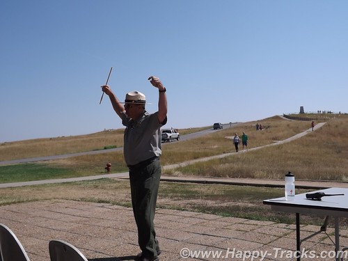
At our hotel the night before, one of the other guests told us about the interpretive ranger presentation and recommended we attend. Ranger Interpreter Adelson gave quite an animated presentation of the battle. So animated that at the conclusion, he needed to sit down and recuperate a bit before fielding questions. Very impressive.
DSCF9012
The Battle of the Little Bighorn was fought in a landscape of ridges, steep bluffs, and ravines of the Little Bighorn River. The combatants were warriors of the Lakota Sioux, Northern Cheyenne, and Arapaho tribes, battling men of the 7th Regiment of the U.S. Cavalry. The Battle of the Little Bighorn has come to symbolize the clash of two vastly dissimilar cultures: the buffalo/horse culture of the northern plains tribes, and the highly industrial/agricultural based culture of the U.S. This battle was not an isolated soldier versus warrior confrontation, but part of a much larger strategic campaign designed to force the capitulation of the nonreservation Lakota and Cheyenne.
In 1868, many, but not all, Lakota leaders agreed to a treaty, known as the Fort Laramie Treaty that created a large reservation in the western half of present day South Dakota and required that they give up their nomadic life and settle into a stationary life, dependent on Government-supplied subsidies. The stationary life on the reservation would have the added benefit of avoiding conflict with other tribes in the region, with settlers, and with railroad surveys. Lakota leaders such as Sitting Bull and Crazy Horse rejected the reservation system as did many roving bands of hunters and warriors and felt no obligation to conform to the treaty restrictions, or to limit their hunting to the land assigned by the treaty. Their sporadic forays off the set aside lands brought them into conflict with settlers and enemy tribes outside the treaty boundaries.
DSCF9003
Tension escalated in 1874, when Lt. Col. Custer was ordered to make an exploration of the Black Hills inside the boundary of the Great Sioux Reservation. He was to map the area including identifying a suitable site for a future military post. During the expedition, professional geologists discovered deposits of gold. Word of the discovery of mineral wealth caused an invasion of miners and entrepreneurs to the Black Hills in direct violation of the treaty of 1868. The government made attempts to keep the settlers out of the Black Hills but that was unsuccessful. The U.S. negotiated with the Lakota to purchase the Black Hills, but the offered price was rejected by the Lakota as the land was sacred to the Indians. The climax came in the winter of 1875, when the Commissioner of Indian Affairs issued an ultimatum requiring all Sioux to report to a reservation by January 31, 1876. The deadline came with virtually no response from the Indians, and matters were handed to the military.
DSCF9005
General Philip Sheridan, commander of the Military Division of the Missouri, devised a strategy that committed several thousand troops to find and to engage the Lakota and Cheyenne, who now were considered “hostile”, with the goal of forcing their return to the Great Sioux Reservation. The campaign was set in motion in March, 1876, when the Montana column, a 450 man force of combined cavalry and infantry commanded by Colonel John Gibbon, marched out of Fort Ellis near Bozeman, Montana. A second force, numbering about 1,000 cavalry and infantry and commanded by General George Crook, was launched during the last week of May, from Fort Fetterman in central Wyoming. In the middle of May, a third force, under the command of General Alfred Terry, marched from Fort Abraham Lincoln, Bismarck, Dakota Territory, with a command comprised of 879 men. The bulk of this force was the 7th Cavalry, commanded by Lt. Col. George Armstrong Custer.
It was expected that any one of these three forces would be able to deal with the 800-1,500 warriors they likely were to encounter. The three commands of Gibbon, Crook, and Terry were not expected to launch a coordinated attack on a specific Indian village at a known location. Inadequate, slow, and often unpredictable communications hampered the army’s coordination of its expeditionary forces. Furthermore, it must be remembered that their nomadic hunting put the Sioux and their Cheyenne allies constantly on the move. No officer or scout could be certain how long a village might remain stationary, or which direction the tribe might choose to go in search of food, water, and grazing areas for their horses.
The tribes had come together for a variety of reasons. The well watered region of the Powder, Rosebud, Bighorn, and Yellowstone rivers was a productive hunting ground. The tribes regularly gathered in large numbers during the spring to celebrate their annual sun dance ceremony. The sun dance ceremony had occurred about two weeks earlier near present day Lame Deer, Montana. During the ceremony, Sitting Bull received a vision of soldiers falling upside down into his village. He prophesied there soon would be a great victory for his people.
DSCF8996
On the morning of June 25, the camp was ripe with rumors about soldiers on the other side of the Wolf Mountains, 15 miles to the east, yet few people paid any attention. In the words of Low Dog, an Oglala Sioux, “I did not think anyone would come and attack us so strong as we were.”
On June 22, General Terry decided to detach Custer and his 7th Cavalry to make a wide flanking march and approach the Indians from the east and south. Custer was to act as the hammer, and prevent the Lakota and their Cheyenne allies from slipping away and scattering, a common fear expressed by government and military authorities. General Terry and Colonel Gibbon, with infantry and cavalry, would approach from the north to act as a blocking force or anvil in support of Custer’s far ranging movements toward the headwaters of the Tongue and Little Bighorn Rivers. The Indians, who were thought to be camped somewhere along the Little Bighorn River, “would be so completely enclosed as to make their escape virtually impossible”.
DSCF9014
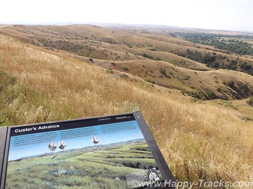
On the evening of June 24, Custer established a night camp twenty-five miles east of where the battle would take place on June 25-26. The Crow and Arikara scouts were sent ahead, seeking actionable intelligence about the direction and location of the combining Lakota and Cheyenne. The returning scouts reported that the trail indicated the village turned west toward the Little Bighorn River and was encamped about twenty-five miles west of the June 24 camp. Custer ordered a night march that followed the route that the village took as it crossed to the Little Bighorn River valley. Early on the morning of June 25, the 7th Cavalry Regiment was positioned near the Wolf Mountains about twelve miles from the Lakota/Cheyenne encampment along the Little Bighorn River. Today, historians estimate the village numbered 8,000, with a warrior force of 1,500-1,800 men. Custer’s initial plan had been to conceal his regiment in the Wolf Mountains through June 25th, which would allow his Crow and Arikara scouts time to locate the Sioux and Cheyenne village. Custer then planned to make a night march, and launch an attack at dawn on June 26; however, the scouts reported the regiment’s presence had been detected by Lakota or Cheyenne warriors. Custer, judging the element of surprise to have been lost, feared the inhabitants would attack or scatter into the rugged landscape, causing the failure of the Army’s campaign. Custer ordered an immediate advance to engage the village and its warrior force.
At the Wolf Mountain location, Custer ordered a division of the regiment into four segments: the pack train with ammunition and supplies, a three company force (125) commanded by Captain Frederick Benteen, a three company force (140) commanded by Major Marcus Reno and a five company force (210) commanded by Custer. Benteen was ordered to march southwest, on a left oblique, with the objective of locating any Indians, “pitch into anything” he found, and send word to Custer. Custer and Reno’s advance placed them in proximity to the village, but still out of view. When it was reported that the village was scattering, Custer ordered Reno to lead his 140 man battalion, plus the Arikara scouts, and to “pitch into what was ahead” with the assurance that he would “be supported by the whole outfit”.
The Lakota and Cheyenne village lay in the broad river valley bottom, just west of the Little Bighorn River.
DSCF8999
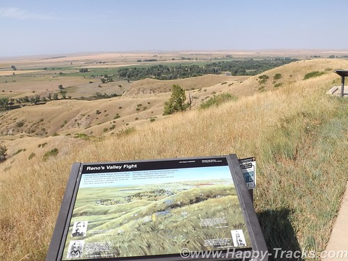
As instructed by his commanding officer, Reno crossed the river about two miles south of the village and began advancing downstream toward its southern end. Though initially surprised, the warriors quickly rushed to fend off Reno’s assault. Reno halted his command, dismounted his troops and formed them into a skirmish line which began firing at the warriors who were advancing from the village. Mounted warriors pressed their attack against Reno’s skirmish line and soon endangered his left flank. Reno withdrew to a stand of timber beside the river, which offered better protection. Eventually, Reno ordered a second retreat, this time to the bluffs east of the river. The Sioux and Cheyenne, likening the pursuit of retreating troops to a buffalo hunt, rode down the troopers. Soldiers at the rear of Reno’s fleeing command incurred heavy casualties as warriors galloped alongside the fleeing troops and shot them at close range, or pulled them out of their saddles onto the ground.
Reno’s now shattered command recrossed the Little Bighorn River and struggled up steep bluffs to regroup atop high ground to the east of the valley fight. Benteen had found no evidence of Indians or their movement to the south, and had returned to the main column. He arrived on the bluffs in time to meet Reno’s demoralized survivors. A messenger from Custer previously had delivered a written communication to Benteen that stated, “Come on. Big Village. Be Quick. Bring Packs. P.S. Bring Packs.” An effort was made to locate Custer after heavy gunfire was heard downstream. Led by Captain Weir’s D Company, troops moved north in an attempt establish communication with Custer.
Assembling on a high promontory (Weir Point) a mile and a half north of Reno’s position, the troops could see clouds of dust and gun smoke covering the battlefield. Large numbers of warriors approaching from that direction forced the cavalry to withdraw to Reno Hill where the Indians held them under siege from the afternoon of June 25, until dusk on June 26. On the evening of June 26, the entire village began to move to the south.
The next day the combined forces of Terry and Gibbon arrived in the valley bottom where the village had been encamped. The badly battered and defeated remnant of the 7th Cavalry was now relieved. Scouting parties, advancing ahead of General Terry’s command, discovered the dead, naked, and mutilated bodies of Custer’s command on the ridges east of the river. Exactly what happened to Custer’s command never will be fully known. From Indian accounts, archeological finds, and positions of bodies, historians can piece together the Custer portion of the battle, but not with absolute certainty.
DSCF8998
It is known that, after ordering Reno to charge the village, Custer rode northward along the bluffs until he reached a broad coulee known as Medicine Tail Coulee, a natural route leading down to the river and the village. Archeological finds indicate some skirmishing occurred at Medicine Tail ford. For reasons not fully understood, the troops fell back and assembled on Calhoun Hill, a terrain feature on Battle Ridge. The warriors, after forcing Major Reno to retreat, now began to converge on Custer’s maneuvering command as it forged north along what, today, is called Custer or Battle Ridge.
Dismounting at the southern end of the ridge, companies C and L appear to have put up stiff resistance before being overwhelmed. Company I perished on the east side of the ridge in a large group, the survivors rushing toward the hill at the northwest end of the long ridge. Company E may have attempted to drive warriors from the deep ravines on the west side of the ridge, before being consumed in fire and smoke in one of the very ravines they were trying to clear. Company F may have tried to fire at warriors on the flats below the National Cemetery before being driven to the Last Stand Site.
About 40 to 50 men of the original 210 were cornered on the hill where the monument now stands. Hundreds of Lakota and Cheyenne warriors surrounded them. Toward the end of the fight, the soldiers killed their horses and used their bodies as defensive shielding. In the end, the warriors quickly rushed to the top of the hill, cutting, clubbing, and stabbing the last of the wounded. Superior numbers and overwhelming firepower brought the Custer portion of the Battle of the Little Bighorn to a close.
The battle was a momentary victory for the Sioux and Cheyenne. General Phil Sheridan now had the leverage to put more troops in the field. Lakota Sioux hunting grounds were invaded by powerful Army expeditionary forces, determined to pacify the Northern Plains and to confine the Lakota and Cheyenne to reservations. Most of the declared “hostiles” had surrendered within one year of the fight, and the Black Hills were taken by the U.S. without compensation.
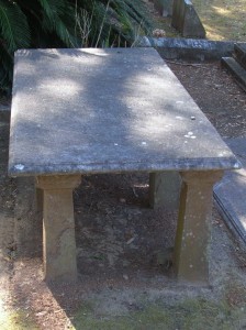
General Custer has often been portrayed as arrogant and somewhat foolish for starting the attack and maybe he was. We were somewhat shocked to overhear a woman telling the child with her to put back the Custer souvenir “You don’t want that. He’s an asshole.” . In the War of Northern Aggression/War Between the States/Civil War (mixed audience here), he was noted for fighting against the odds and winning. His widow was given the table used to sign the surrender papers as testament to his role in ending the war militarily. The National Park Service has a discussion of General Custer’s military career here. There is also a discussion of Chief Sitting Bull here.
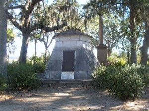
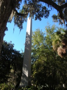
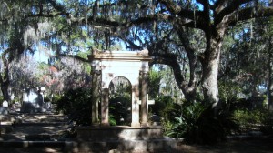
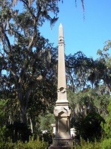
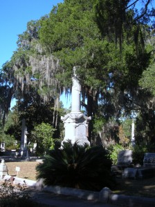
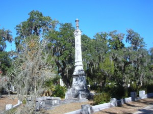
In 1879, the Little Bighorn Battlefield was designated a national cemetery administered by the War Department. In 1881, a memorial was erected on Last Stand Hill, over the mass grave of the Seventh Cavalry soldiers, U.S. Indian Scouts, and other personnel killed in battle. In 1940, jurisdiction of the battlefield was transferred to the National Park Service. These early interpretations honored only the U.S. Army’s perspective, with headstones marking where each fell.
The essential irony of the Battle of the Little Bighorn is that the victors lost their nomadic way of life after their victory. Unlike Custer’s command, the fallen Lakota and Cheyenne warriors were removed by their families, and “buried” in the Native American tradition, in teepees or tree-scaffolds nearby in the Little Bighorn Valley. The story of the battle from the Native American perspective was largely told through the oral tradition.
In 1991, the U. S. Congress changed the name of the battlefield and ordered the construction of an Indian Memorial. DSCF9009
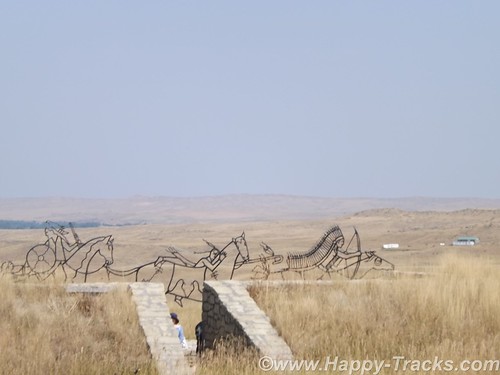
In 1996, the National Park Service – guided by the Little Bighorn Battlefield National Monument Advisory Committee, made up of members from the Indian nations involved in the battle, historians, artists and landscape architects – conducted a national design competition. In 1997 a winning design was selected.
Note the term Indian. Its used a lot out here rather than Native Americans or individual nation names. It’s not my intent to offend.

  • 7 December 1886: The site was proclaimed National Cemetery of Custer’s Battlefield Reservation to include burials of other campaigns and wars. The name has been shortened to “Custer National Cemetery”.
  • 5 November 1887: Battle of Crow Agency, three miles north of Custer battlefield
  • 14 April 1926: Reno-Benteen Battlefield was added
  • 1 July 1940: The site was transferred from the United States Department of War to the National Park Service
  • 22 March 1946: The site was redesignated “Custer Battlefield National Monument”.
  • 15 October 1966: The site was listed on the National Register of Historic Places.[4]
  • 11 August 1983: A wildfire destroyed dense thorn scrub which over the years had seeded itself about and covered the site.[5] This allowed archaeologists access to the site.
  • 1984, 1985: Archaeological digging on site.
  • 10 December 1991: The site was renamed Little Bighorn Battlefield National Monument by a law signed by President George H. W. Bush

DSCF9016
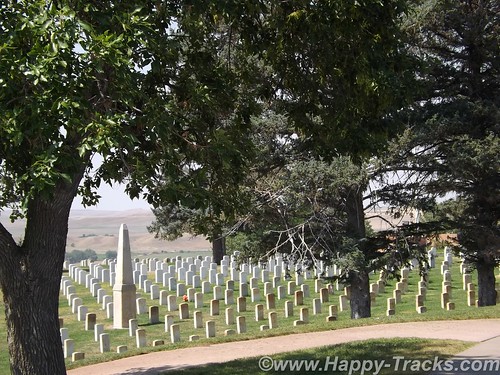
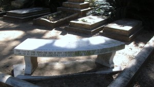
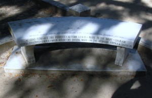
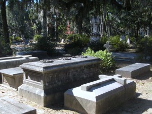
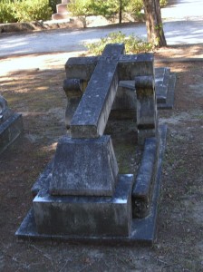
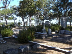
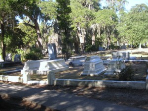
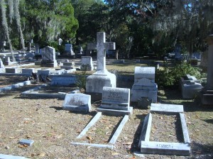
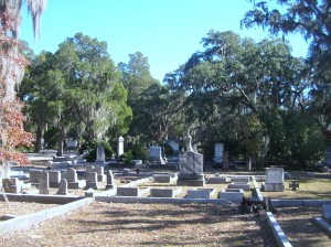
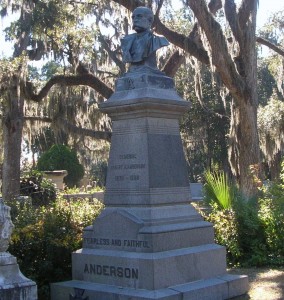
Custer National Cemetery is located at the National Monument grounds. These veterans are from later wars. They stopped accepting new internees in 1978 due to space constraints.
Here are a couple of other Battlefield maps. Open in another tab/window From Smithsonian Magazine
From Mohican Press
You can see all of the pictures from this leg of the trip here.
We invite you to continue along with us and hope you enjoy the account!
butte2glendivemap
Don’t forget the trip calendar we put together at CafePress. We think it turned out pretty well and would make a great holiday gift. calendar

Summer 2014: Alaska via the AlCan, Maryland to South Dakota

Sunday, July 6th had finally arrived. It was time to begin the big adventure. As it was the third day of the 4th of July holiday weekend, we had thoughts of getting an early start to avoid the leaving Washington traffic. It was probably a good idea but…we pulled out of the driveway at 11:15. It was still morning but hardly qualified as an early start. Thankfully, traffic was not particularly heavy as we headed west on I70 out of Frederick but by the time we reached Breezewood, PA (our usual entry point to the PA Turnpike), the usual weekend stop and go stretched for a couple of miles. It was a good time for lunch. When we came back out, it was apparent that the route onto the turnpike would be a grind but that traffic going west on Hwy 30 was very light. In our first “let’s see where this goes” move, we headed west on 30 and joined up with the turnpike in Bedford.
DSCF6088
DSCF6089
This part of the trip is one we’ve done several times over the years while Ryan was at college so our focus was on covering miles. We stopped the first night in Fremont IN where we discovered (quite by accident) that hotel nightly rates are sometimes negotiable. Keith hadn’t engaged the filters and said “ouch” when told what the rate was. The desk clerk asked what we had expected to pay and lowered the rate. Hmmm, might come in handy to know that later.
We did manage to get a slightly earlier start on Monday at 10:00 although we were now in Central time zone. We’re still making miles and decide to skip the RV/Motorhome Hall of Fame in Elkhart IN.
Stopping for gas, we start a conversation with a gentleman from Nokesville VA. He seemed a little surprised we knew where Nokesville was. He’s probably my age, maybe a little older. He and his wife were traveling west with his inlaws in a motorhome towing a Jeep. Their trip was to celebrate an 80th birthday for one of the inlaws. Wanderlust doesn’t give up easily, I guess.
Continuing on I90, we manage to make Chicago in time to decide that there are some places where traffic is a constant and that’s not a good thing. While there was likely a better way to get past it, we follow I90 which leads us right through the construction zones downtown. But we did see the Willis Tower (formerly Sears Tower) and the glass-floored viewing platforms (from the ground, not up close and personal).
DSCF6095
I90 takes us past Janesville, also known as the hometown of 2012 VP candidate, Rep Paul Ryan. We also pass the state capital, Madison.
North of Madison and just before I90 and I94 part ways, we pass Camp Douglas, the location for Mill Bluff State Park. During WWI, the site was chosen as a permanent training center in part because of the terrain, such as the stone pillars seen in the picture. DSCF9198During the Cuban Missile Crisis, a black bear caused the nuclear-armed bombers to scramble. You can read more about that here.
We also saw a weather front moving across rather dramatically. The rain never really materialized for us. DSCF6097
We cross the Mississippi into Minnesota and eventually arrive in Rochester MN, home of the world-renowned Mayo Clinic. We stayed in the suburbs next to the fairgrounds and had a view of the Rochester skyline.
DSCF6110
Our hotel was a shuttle stop for multiple shuttles running in to the Clinic each day. While we expected that to be somewhat depressing as folks who are visiting the Clinic are often seriously, even life-threateningly ill but the mood seemed pretty upbeat. Also, our hotel featured a bronze Viking sculpture in the lobby.
DSCF6111
DSCF6120
The fairgrounds also had a water tower sculpture of a corn cob which reminded us of the Peachoid in Gaffney SC.
An even earlier start on Tuesday morning as we continued west on I90. Farms dotted the landscape and we passed numerous power-generating windmills.
DSCF6150
DSCF6167 While it may be commonplace to those in those areas, we were surprised to see the railroad crossing style arms for blocking off the highway during blizzard conditions.
DSCF6155
Although the temperature was well into the mid 80s, the humidity was low and the continuing breeze kept things pleasant, even bordering on cool.
We crossed into South Dakota on our way to the Corn Palace in Mitchell. The Corn Palace was mentioned to us as a possible stop when I had called the Credit Card company. When she was a child, her family trip across this part of the country included a stop at the Corn Palace which she had specifically remembered from that childhood trip.
The Corn Palace is located in the center of Mitchell (right next to City Hall). Its original purpose was partly to be a tourist attraction decorated with corn cob and husk murals. It also used as an auditorium, a sports venue, the High School Prom and other civic functions.
DSCF6176
DSCF6184
DSCF6189
After a short visit to the Corn Palace (where the murals are being redone for the coming year), we were back onto I90 and headed towards the Missouri River. This crossing marked a first for both of us.
DSCF6200
South Dakota marks their rest areas with a rather unique concrete structure recognizing the teepees of the Native Americans.
DSCF6210
The landscape seems to stretch forever with a gentle roll as we get closer to the SD Badlands.
DSCF6218
We continued towards another tourist attraction, the Wall Drug complex in Wall SD. Wall Drug is and was first a drug store/pharmacy for the people of Wall SD. It was purchased in 1929 and has a become a popular tourist attraction and example of the power of marketing, initiated with giving away free ice water. See more of the history here. It is now a complex of shopping and a landmark from the early days of automotive travel.
DSCF6226
DSCF6229

After a piece of pie and 5 cents cups of coffee, we stopped in Wall for the night.
You can see all of the pictures from this leg of the trip here.

We invite you to continue along with us and hope you enjoy the account!

January 27: Old Friends Touring DC: Navy Memorial and National Portrait Gallery

A rare treat for the Old Friends weekend, we were able to tour on Sunday as well. Today included breakfast, church and then a trip to downtown DC to visit the Navy Memorial (site of the Lone Sailor) and the National Portrait Gallery.

Our first stop after finding parking (which was free on the street where we were since it was Sunday), was a walking trip through Judiciary Square where we found these two gents deeply absorbed in an impromptu chess game. They didn’t include a timer. Russ pointed out that the board was also set wrong, not something to be noticed by the casual observer.
DSCN7906
Our primary stop was just around the corner on Pennsylvania Avenue at the Navy Memorial. Best known for the statue of the Lone Sailor out front, there are exhibits and a theater inside. 2012 was celebrated as the Year of the Chief.
DSCN7908This centerpiece hangs in the center of the spiral staircase leading down to the main exhibit floor. This one is beautifully made of wood with the woodgrain showing as the gold color with painted silver for the shield. This is a replica of the traditional Chief Petty Officer’s collar device, the fouled anchor.
DSCN7909

DSCN7910

Chief Petty Officer uniforms

I’ll take a moment to apologize here for the quality of some of the pictures that follow. The lighting showed a glare on several of the displays. Normally, I’d reject those pictures but I believe the Navy Memorial needs to be shared a bit more and I’ll compromise the picture quality to give you a better idea what’s there.

DSCN7911

Memorial plaque for submarine sailors of WWII

DSCN7912

Multiple memorial plaques provided in exchange for donations. There were a number of displays similar to this one.

DSCN7916

The Senior Enlisted Sailor in the Navy is the Master Chief Petty Officer of the Navy (MCPON). This display pays tribute to those who have served in this capacity. Of the 13 men who have served as MCPON, three were submarine-qualified (James Herdt 1998-2002; Terry Scott 2002-2006; and Rick West 2008-2012)

DSCN7915

DSCN7917
DSCN7918
DSCN7919The Navy Memorial maintains a log that allows sailors or their families to enter pertinent data about the sailor as part of the memorial. Their goal is to include all Navy Sea Service Vets. Father Steve was looking things over but decided to complete the entry back at Chateau Pierre.

DSCN7920

Signalmen and spotters served in good weather and bad.

DSCN7922

The Memorial includes a library of books (fiction and non-fiction) about the Navy and its sailors and also by some of the sailors.

DSCN7924

A piece of the USS Arizona, bombed and sunk in the attack on Pearl Harbor.

DSCN7928

The display included portraits of Presidents who had served in the Navy. This one is John Kennedy. Also included were Lyndon Johnson, Richard Nixon, Gerald Ford, Jimmy Carter and George H.W. Bush.

DSCN7921P1060139

DSCN7923

DSCN7934

The Ship’s Store

DSCN7929

The Navy Memorial maintains a log of sea service veterans. This poster reminds us that sea service veterans are all around us and asks to help. Visit their website at www.NavyMemorial.org

P1060135

Statue depicts “The Kiss”, subject of a famous Life magazine cover at the end of WWII.

P1060136There are a number of scale models of Navy ships on display.
P1060134P1060137

P1060138
P1060141
P1060142
P1060147
P1060140

P1060133

The Lone Sailor

P1060150

The Lone Sailor with friends

P1060151

The compass in the Memorial Plaza.

P1060148
After visiting the Navy Memorial we headed over to visit the National Portrait Gallery. The National Portrait Gallery is part of the Smithsonian Institution and is dedicated to the display of portraits of persons who have made significant contributions to American history and culture. There is an extensive display of Presidential portraiture including a wire sculpture of President George H.W. Bush pitching horseshoes. The American Art Museum (which shares the building) included exhibits displaying the national parks and other persons in our history. There was an exhibit depicting Amelia Earhart and artifacts from the US Patent Office.

We highly recommend that you take the time to visit. While you’re there, allow time to take in the atrium in the center courtyard shown in the pictures below.

P1060152

The water in this picture is no more than a quarter to half inch deep. Although it appears to be much deeper.

We chose to grab lunch in the atrium. There were a number of folks who seemed to be just enjoying the opportunity to relax and read or study in the pleasant temperatures and the sunshine coming through the glass roof. It sure beat the cold outside.

DSCN7937After we left the Portrait Gallery, it was time for Russ to hit the road south while Father Steve, Betty and Keith headed back to Germantown.

Father Steve left on Monday via BWI where he experienced his unusual luck at finding delayed flights but arrived safely back at home, albeit a bit later than planned.

It was another great weekend with great friends, exploring the sights right here in our own backyard.

January 25: Old Friends Touring Monticello

Steve and Russ were two of Keith’s roommates when we were at the Navy’s training facility in New York. Although our paths diverged quite a bit afterwards, it was an intense time in our lives and the friendship that really got its roots there has continued and deepened through the years. At least once per year, we try to get together and visit with each other and to play tourist somewhere. For point of reference, Betty and Keith met while Steve, Russ and he were roommates.

On January 24, the website for Thomas Jefferson’s home in the hills near Charlottesville VA indicated that they had closed early due to the inclement weather but to check back for the schedule for the next DSCN2868 day. At sometime after 9:00 am on Friday, January 25 the website indicated they would be open normal hours so we loaded up with hopes of seeing Monticello and maybe even Monroe’s Ash Lawn and Madison’s Montpelier. The forecast was calling for the possibility of light snow in the early evening.

Not in any particular hurry to get there, we meandered a bit and considered getting lunch on the way but decided to wait until after our tour and pulled into the nearly deserted parking lot about 1:00. It appears the flurries and cold had discouraged many less hearty souls from the hilltop this afternoon. We went inside the cluster of buildings and bought our tickets for the 1:30 tour. After we purchased our tickets, we were told that would be the last tour this day as they would be closing early today because of the weather. When I had last toured Monticello (a time best measured as a couple of decades rather than a specific number of years), tickets were purchased at booths similar to those seen at a fair rather than the complex of steel and cedar with brick walkways. DSCN2869 Since our tour was departing soon, we decided to skip past the gift shop and theater DSCN2870 DSCN2917 but went into the museum to await the shuttle. The museum exhibit was themed more around the lives and times of the others living at Monticello, including the slaves of his era and later occupants. Outside the museum was a life-sized bronze statue of our third President and we all took the time to speak with him one-on-one.DSCN7810 DSCN7811 We boarded the bus and Jefferson watched us head up the hill. He’d be there when we returned.
P1050996
We rode in the shuttle bus up to the main house and you could feel it getting colder and the snow flurries came more frequently.
DSCN2905

P1050998

Perpetual tourists. Seemingly oblivious to the cold but cameras in hand…

"Y'all take your time looking around out there. We're waiting on another bus but I'm closing this door."

“Y’all take your time looking around out there. We’re waiting on another bus but I’m closing this door.”

DSCN7789

The low square structure at the corner is a cistern for saving rainwater.

DSCN7804

Jefferson’s library and personal quarters from the outside. The openings along the ground under the floor level allowed for warming fires to support the plants he grew.

P1060005

Guest rooms occupied the rooms to the left in this picture and a tea room was to the right (rear). While Jefferson was ahead of his time in many regards, the accessible ramp is a more recent addition.

Our tour began on the first floor inside but the cameras had to be put away there due to copyright and ownership issues on some of the loaned display items. I suggest you visit the website here where more detailed discussions and pictures can be found.
The first room we visited was the main entry which included a view of the large one-week clock which Jefferson had built as well as artifacts from the Lewis and Clark Expedition into the Louisiana Purchase.
We moved into the family’s quarters seeing Jefferson’s library and hothouse which was heated in part by fires under the brick floor. We curved across the backside of the house and into the dining area with bright paint which seemed a cross between sunflowers and marigolds. Continuing around to the opposite front corner of the house, we viewed a guestroom and then moved down a narrow stairway to what would be service areas of the house, generally used by the servants and working folks rather than house guests.

DSCN7794

This bottle-sized dumb waiter allowed sending wine directly from the wine cellar to the butler’s pantry off the dining room.

DSCN2891
DSCN2883 DSCN2884 DSCN2889 DSCN2890 DSCN2893 DSCN2894 DSCN2895 P1060006 P1060007 P1060008 P1060009

DSCN7792

The 7 day clock upstairs is operated by these weights but the length is too much to be fully contained on one floor so the end of the weights goes into the cellar.

DSCN2892

This passage leads from the cellar south to the outside.

DSCN2880

One of the cisterns. Because of periodic shortages of water, Mr. Jefferson installed 4 at strategic locations to catch rainwater from the house and walkways. Each of the four potentially held 3,800 gallons.

DSCN2882

These were single rooms that were used as a study or quiet place by Jefferson and his guests.

DSCN7797

The more famous views of the house were actually the back. The white sheeting covering the columns is to protect renovation/restoration work in progress.

DSCN7800

The fish pond is covered in ice. Fish caught in neighboring streams were kept alive until needed for the table.

DSCN7805

The view to the south

P1060020

The Garden Pavilion, favored by Jefferson as a quiet and peaceful place to read in the cool of the evening, was toppled by several windstorms following his death and was restored in 1984.

P1060018

The south pavilion was called the “outchamber” by Jefferson. Thomas and Martha originally lived in this. The lower story was at first a kitchen until it was later converted to a laundry (1808). In about 1818, the laundry was moved to the North Pavilion as it was closer to a natural spring.

DSCN7807

Under the walkway leading to the South Pavilion were several rooms which included a dairy (where milk was stored and butter made) and quarters for the enslaved workers who worked in and around the house.

DSCN2909

Under the walkway leading to the South Pavilion were numerous rooms

DSCN7799

North Pavilion

DSCN7806 DSCN7808
Our tour guide graciously led us to the back of the house and invited us to look around but told us the last shuttle down the hill would be leaving soon. On the way down the hill back out to the visitors center, we were given a brief stop by the Jefferson family graveyard. DSCN2911

When we reached the visitors’ center, everything was locked up so no gift shop or looking around a bit further. It was back to the car to move along so they could close the gates.

In fairness to the folks at Monticello, we need to relate a bit more of the story. Yes, their website had said they would be open regular hours and the forecast was for slippery roads coming down off the hill but that was the same forecast they had when they announced they would be open all day. No one was rude but you could sense that the folks who worked there were concerned about getting safely home and we were what stood between them and being on their way. When we got home, we sent an email expressing a concern that the daily update of the website could stand a reevaluation of policy. They agreed and said they would be looking into that. They also sent us a set of tickets to be used for another day and a nice book from their gift shop. It’s often said that the true measure of customer service and graciousness is how you handle an issue, rather than a perfect record of never having an issue. They handled the recovery well.

After we left Monticello, we drove over to see nearby Ash Lawn, the estate of President John Monroe, owned and operated by his alma mater, the College of William and Mary. Alas, they were also closed due to the weather but we did manage to get a couple of pictures.

DSCN2922

Bit of trivia, Virginia’s governor now serves for one five year term.

DSCN2918 DSCN2919 We’ll have to save Ash Lawn for another day. Perhaps an earlier start will get us to Montpelier as well.

And so we headed for home but we had skipped lunch and were all getting a bit hungry. In the course of seeking a restaurant that suited all, it became known that Father Steve HAD NEVER EATEN AT A WAFFLE HOUSE!!! So we remedied that.

DSCN7813

There’s something very, very wrong with this sign. Do you know what it is?

photo1After food, it really was back to the house with a stop at Wawa (somewhere else Steve had never been).

The Uno Championshp Series continued well into the night!

November 26: Bonaventure Cemetery, Savannah and a “Made in the USA” find

The cover photo for the book (and later movie) Midnight in the Garden of Good and Evil featured a sculpture known as the Bird Girl and located in Bonaventure Cemetery near Savannah in Thunderbolt GA. As it turns out, the sculpture’s role in the book was primarily only a symbol of the cemetery but it stirred up enough tourist traffic in the cemetery to warrant its movement to the Telfair Museum of Art in Savannah.

The Bonaventure Cemetery is located next to a creek leading from the Savannah River to the Atlantic Ocean via Wassaw Sound. Its setting includes a waterfront view of the Intracoastal Waterway and massive oak trees dripping Spanish moss. We parked near the water and were greeted by a fisherman who cheerfully asked where we were from. Whether the out of state plates on the car or the likelihood that anyone in that area was a tourist clued him in is anyone’s guess.

DSCN7622DSCN7659DSCN7661

DSCN7619

Is this a china berry tree?

DSCN7623DSCN7624

DSCN7626

Among the more famous persons buried in Bonaventure is Johnny Mercer

DSCN7627

DSCN7639

Many of the graves have a cross built into the vault top. It is believed that at least part of the reason for this is to prevent the grave from being used for voo doo rituals.

DSCN7628DSCN7625DSCN7630DSCN7631DSCN7632DSCN7633DSCN7634DSCN7635DSCN7636DSCN7637DSCN7638DSCN7640DSCN7641DSCN7642DSCN7643DSCN7644DSCN7645DSCN7646DSCN7647DSCN7648DSCN7649DSCN7652DSCN7654DSCN7658DSCN7660DSCN7664DSCN7665DSCN7666DSCN7667
DSCN7668After our walking tour through the cemetery, we returned to the HGI and had lunch at Carey Hilliard’s. Carey Hilliard’s had been a staple for us when we lived in Summerville SC and they still make some mighty fine onion rings and sweet tea. I’ve seen some online reviews that weren’t overly impressed but we cleaned our plates and will be back sometime somewhere.

Our next stop was a short (well, we expected it to be shorter than it was) trip to Walthourville GA to find Lawn Chairs USA.

Trying to find their store/factory was a bit of trick however. There are no street numbers on the building. There is no sign of any kind on the building. Luckily, I had looked it up on Google Maps and found the picture below which helped us identify it.

LawnChairUSA manufactures the style of folding lawn chair that our parents used. Most amazingly is that the frame and webbing is made right here in their factory in southeast Georgia. Their prices are similar to the ones you may find in KMart (only in the summer) made in China. If you’ve sat in these chairs, you already know they are more comfortable than the umbrella type chairs you commonly see. Lawn Chair USA. sells chairs and webbing but shipping is a little high in comparison to the price of the chairs. You can also visit them directly in Walthourville GA and save the cost of shipping. We managed to fill the car trunk and then headed northeast back towards Savannah through several smaller towns.

Dinner tonight was once again at the Atlanta Bread Company. Betty had the Roasted Organic Butternut Squash soup. Keith opted for the Turkey Berry Brie on Asiago Foccaccia served with made-from-scratch Stuffing. Both were excellent choices.

Friends Playing Tourists: Smithsonian Museum of Natural History (Part 4)

The Uno Championship was complete and bragging rights go to the visiting team. The cranberry juice was getting low and thoughts of work and paychecks led Russ to pack his truck and head for home on Sunday morning.  Steve checked Mass times and got a ride to services. After church, we stopped by Taco Bell for lunch (it was Sunday, Chick-Fil-A was closed ;)) When he got back we made plans to head for today’s destination, Smithsonian’s National Museum of Natural History. 

In making our preparations, we called Ryan to join us. She agreed to meet us there with her friend, Steve. After circling like vultures for a couple of rounds, we managed to find on-street parking on Constitution Avenue and so entered through the older entrance.

The Museum of Natural History is probably best-known for the Hope diamond, the dinosaurs, and the mastadon. We saw all those things…and then some. In center court, the display includes the mastadon.

Next we went into the geology and fossils section.


Although our pictures didn’t turn out so well, there was an extensive exhibit on the Chilean Miners’ rescue. You can see more of it at this link. Steve and Keith agreed that mining should not be our profession as our bulk would not fit into the rescue capsule.

An unusual exhibit for the Smithsonian is an exhibit called Butterfly Garden. It includes a walk through garden where you can mix and mingle with the butterflies. There’s more at the link.

Steve made a quick run into the Skeletons and Mummies Exhibit. 

We met up in the mammals exhibit before a stop at the gift shops on the way out just before closing time.

Following our afternoon at the museum, dinner was in order. We decided to try the Burmese fare at Mandalay in Silver Spring. Burmese was a new experience for us although Ryan and Steve had eaten there before. It was quite tasty and the service was good with reasonable pricing and only a short wait for our party of five.

Our long weekend with friends was drawing to a close. We settled in at home for the evening without Uno or cranberry juice.

Monday morning was a slightly earlier rising but we did manage to sleep in. Monday brought us to breakfast and then to ferry Steve toward the airport and back home.

It was a great weekend with great friends. We had played tourist and played cards and built a few more memories. When do we get to do it again?

Friends Playing Tourists in DC: A Tribute to Our Military Heroes (Part 2.2)

From the Declaration monument, we made our way to one of the newer and more well-known memorials, the World War II Memorial. It is both striking in its design (even with the water drained for the cold weather as it is now) and awe-inspiring in its sobriety. It is also very popular at all times of year.

The World War II Memorial honors the service of sixteen million members of the Armed Forces of the United States of America, the support of countless millions on the home front, and the ultimate sacrifice of 405,399 Americans.  On May 29, 2004, a four-day “grand reunion” of veterans on the National Mall culminated in the dedication of this tribute to the legacy of “The Greatest Generation.” See more at the official website.

It is situated between the Washington and Lincoln adjacent to the Reflecting Pool. This was the first time that Steve and Russ had been to see it.

The Memorial includes granite columns for each of the states, districts and territories that sent their sons and daughters to fight.

Connecting the granite columns are bronze ropes just as the country was bound together in a common purpose. (More than a few lament the passing of these binds while rejoicing that their cause has ended.)

At opposite ends of the circle are soaring pavilions to signify the two major fronts of the war, the Atlantic (sea, land and air)  and the Pacific (sea, land and air).In the center of the circle are pools of water (during normally warmer months). At various spots are bronze bas-reliefs and engraved granite recalling significant events or thoughts of the period.One of my favorite parts of this Memorial is the wall of over 4,000 gold stars commemorating those who were casualties or missing after the war. (We didn’t get a picture of them.)

Our next stop was the Korean War Veterans Memorial, located southeast of the Lincoln Memorial on the National Mall. The Memorial commemorates the many who died (USA 54,246 United Nations 628,833), went missing (USA 8,177 UN 470,267), captured (USA 7,140 UN 92,970), and wounded (USA 103,284 UN 1,064,453) for a country of people they never knew.

The Memorial contains 19 larger-than-life figures are made from stainless steel and are depicted marching next to a wall of polished granite where a multitude of faces look on. There is something haunting in the sculpture as well as the faces etched and reflections. The visit to the Korean Veterans Memorial was a first for the guys.

Our next stop was the Iwo Jima Memorial.

“The United States Marine Corps War Memorial stands as a symbol of this grateful nation’s esteem for the honored dead of the U.S. Marine Corps. While the statue depicts one of the most famous incidents of World War II, the memorial is dedicated to all Marines who have given their lives in the defense of the United States since 1775. ” You can read more about the Memorial at the official website.

The Pentagon September 11 Memorial opened on September 11, 2008 to honor the memory of the 184 people who died in the attack there on September 11, 2001 both on the ground and onboard the airplane.

The Memorial is located on the rounds of the Pentagon complex and not easily reached. The options include taking the Yellow or Blue Line Metro to Pentagon Station and then walking around to the opposite side of the complex or driving and parking on the opposite side of I-395 (although 5 handicap parking spaces are available next to the Memorial). There is also a walking tunnel under 395 from near the Pentagon City Mall. I believe that there is also a drop off for tour buses nearby so the “difficulty” and long walk is only if you’re traveling on your own.

For each person who died there, there is a bench rising from the ground on one end and suspended in the air on the other. Below each bench is a pool of moving water. On the end of the bench, the name of the person is engraved. You can tell whether the person was inside the Pentagon or onboard the airplane from which end of the bench with their name is anchored in the earth and which end is elevated. If the anchored end is closer to the building, they were inside the Pentagon. If the anchored end is away from the building, they were onboard the airplane.

The benches are arranged based on the year of birth of the person. The younger children onboard the airplane are closer to the entrance. Thankfully, there are also fewer of them in that area. If more than one member of a family died during the attack, family names are listed in the reflecting pool under the bench, in addition to the separate benches that have been created for each individual. A wall along the edge of the Memorial begins at a height of 3 inches and rises to a height of 71 inches, the ages of the youngest and oldest victim of the attack, and approximately 85 paperbark maple trees are planted on the memorial grounds.

Former Sailors? Old Sailors? Long-time Friends: Playing tourists (Part 1)

The year was 19…well, it was some time ago. Russ, Steve and Keith were roommates and attending the same Navy school in the wilds of the Adirondacks when we all met Betty who was also a student at the same school at the same time. As you know, Betty and Keith eventually married and we’ve more or less stayed in touch or maybe gotten back in touch. On a pretty regular basis, the four of us get together to play tourist and catch up. It’s a great time. While I’ll not share the details of the conversations, Happy-Tracks is going to offer you the chance to tag along as we play tourist right here in the DC and Baltimore areas.

We’ll start on Thursday. Steve arrives via airplane at BWI-Thurgood Marshall. We used the occasion to conduct a little test of Maryland’s newish InterCounty Connector toll road. The results are in. It takes about the same time to get from our house to/from BWI whether you take the toll road or Warfield Road to Clarksville. By the way, a similar comparison test showed about the same time to get to/from work whether using the toll ICC or the non-toll Beltway. Oh well.

As Steve’s plane arrived in early afternoon, we stopped for lunch. At his request, we stopped at ChickFilA in Germantown.

On to the house. Russ arrived and we had a traditional eastern Eurpoean meal of sausage, chops, mushrooms and potatoes served with homemade mead (honeywine) which had been brewed by Ryan. Good hearty meal with good friends. After dinner, we moved on to Cape Codders and the Championship of Uno. The evening passed with good conversations until the early hours.


Visiting Relatives at Prescott

In preparing for our travels to Arizona, we contacted Keith’s cousin, Elaine and her family to see if we could get together sometime as we hadn’t seen each other in several years. After a conference, we decided that schedules and logistics made Prescott a good halfway point and with good food and entertainment for both the young and not-so-young kids.

We started our day as we had all of them since arriving in Arizona, by sleeping in and then having breakfast at the hotel. We got into the car and headed down the interstate for Prescott. By the way, the “locals” pronounce it PRES-cot with the emphasis on the first syllable.

The ride along and from the interstate was desert and rock formations and pretty typical for what we’d been seeing. As we neared town, the landscape changed to a more typical suburban landscape with strip malls and the standard chain stores with a Walgreens, RiteAid or CVS on virtually every corner.

Prescott central was built around a square with the courthouse in the center and the US Post Office and Federal Courthouse right across the street. Since we arrived before we were scheduled to meet Elaine and family, we spent a little time checking out the square and downtown. We found the timeline in the concrete sidewalk particularly interesting. It traced the history of Arizona for the past 200 or so years. The timeline only covered that part of Arizona’s history since that is the history of Arizona as territory and state. Quite a contrast to Maryland’s Lord Baltimore and the Calverts from the 17th century. I wonder if their fourth graders appreciate that there is less state history to be covered?

Erected in 1907, this statue is considered one of the finest equestrian sculptures in the U.S. and honors members of the First U.S. Volunteer Cavalry of Teddy Roosevelt’s Rough Riders who gathered at the plaza on May 4, 1898, before heading to San Antonio at the onset of the Spanish-American War.

Federal Courthouse and US Post Office

The courthouse has been rebuilt several times, most recently in 1916. The entire downtown area has a history of extensive fires and rebuilding. It’s listed on the American Register of Historic Places. Barry Goldwater (remember him?) announced his candidacy for President from the courthouse steps in 1964.

One of the more unusual statues depicts a cowboy and his horse with the cowboy lying on the ground with his bedroll.

The courthouse plaza is well-used during the midday by joggers and walkers as well as those folks just having a seat and watching the world go on by.

This gallery wins kudos from us in the category of Clever Names that Fit.

We were to meet at the Palace in Whiskey Row.

On a summer night in 1900, this block was totally destroyed by fire. The liquor was removed and carried across the street as they fought the fire. The story is that the firefighters dumped water on the fire then crossed the street to sample the liquids they’d saved. Within a few days of the fire, new construction was underway in brick and masonry. Most of the buildings on this block were constructed between the fall of 1900 and 1905.  Most of the color and stories of Prescott originated in this one block landmark that still celebrates that fact that it once hosted over 40 saloons.

We were waiting on the street when Elaine and family arrived. We directed them to the parking garage where we had parked and waited until they returned on foot. Along with Elaine were her husband Frank and their daughter Brenda with her four children, Erin, Eric, Ethan, and Emily. Brian and Kathy and their son were unable to join us this time. We had a nice lunch at the Palace where one of the descendants of Wyatt Earpp was walking around visiting. We didn’t get a picture with him though. I have a word or two for those of you who pause at the thought of four children aged 3 to 11 at lunch. Whatever Brenda is doing to raise those four, she is darned well doing right. The children were well-behaved and polite and watched out for each other. If these four are typical of today’s generation of young children, there is hope for the world. When we went walking around after lunch, the kids were where they belonged and said they’d be and considerate of each other and those around them.

After a leisurely lunch where we had a nice visit, we walked around downtown Prescott and checked out the specialty stores. Keith bought a hat appropriate for touring and cooler weather. Frank bought ice cream for all who wanted one.

Frank and Keith were sitting on a streetside bench outside the pet supply store when a lady and her dog walked by. Apparently the dog was a lap dog and Frank’s lap looked good as the dog just jumped right up and made herself at home. It was a surprise and was good for a smile from all. Eventually our visit time came to a close and it was time to say goodbye so we walked back to the cars (Frank and Elaine had just bought a new one and it had DVD players for the passengers. Nice VW van.)  We posed for a picture or two then headed back towards home and hotel.

Betty and Keith had a light dinner at CoCo’s in Flagstaff. It had been recommended by another airplane passenger on the way from Baltimore. The soup and sandwich were tasty and hit the spot. After that, we crossed the street back to the hotel for emails, postcards, showers and to bed.

Another good day!