We pulled into Prince Rupert 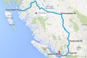 from the ferry and waited in line for Customs. Since this was the end of the line for the ferry, the Customs station was busy with the whole ship trying to get through Customs at the same time. As we left the ship in 6 lines, we merged into 3 to pass. All told, it really moved along rather quickly. We drove out of the Customs gate and up into the fog to make the drive into Prince Rupert. We had called ahead to the Prince Rupert Hotel and made arrangements for two nights stay.
The next morning we set out to find Totem Park. Our map showed it to be a short walk away. Our map didn’t show the change in elevation though. Totem Park could be reached following a trail which looked to be little used and a bit overgrown. Luckily, a lady passed by walking her dogs and told us we could also take the public path between these houses to get there.
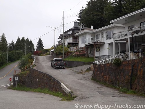
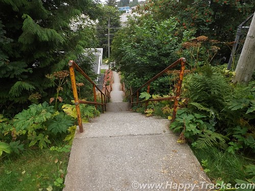
The public path was stairs. The stairs climbed up the 10 feet or so to reach the houses’ front yards and then continued up above their second stories and then still continued higher. I would estimate the climb was near 45 degrees and rose 100 feet in about 200. Then the stairs ended and the path climbed just a bit further. We finally reached the top after availing ourselves of several opportunities to stop and admire the view off the bluff and out to the harbor.
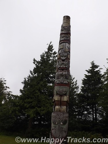
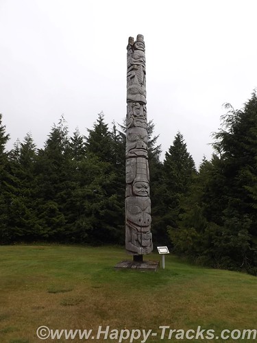
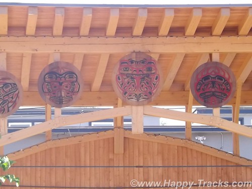
There are only three totems in Totem Park. You can see where there were two more that are no longer there. These totems are reproductions of authentic ones created by First Nations people.
We had thought there must be some universal code in totems and had tried to decipher but it just wasn’t to be. It starts with the totems having different purposes. Some are to celebrate a life, some are to commemorate an event, some are to give praise and some are to condemn or shame such as the one in Valdez meant to shame Exxon for wrongs no made right. Individual figures on the totem can also have meanings such as the frog meaning prosperity. As in other art, there is no universal key of this always means that.

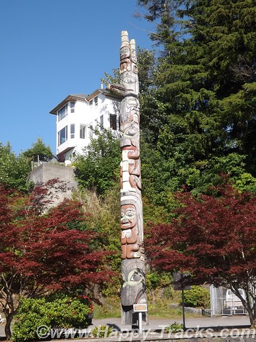
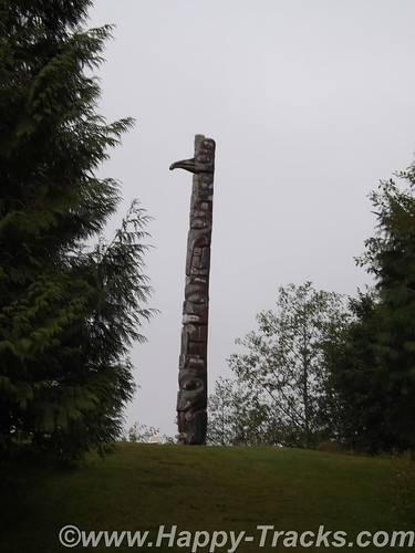
We walked down a different way than we had come up to see more of town. There were a couple of other totems standing by themselves and we also found two by city hall.
After setting on the ferry for 40 hours and the short drive to the hotel while powering our DC refrigerator, we had to jump start the truck this morning. We had been running the refrigerator off the truck battery rather than the spare battery we brought along and had used in Anchorage to jumpstart the stranded motorists. The spare battery started the truck instantly and we recharged the battery as we made our way to our next attraction.
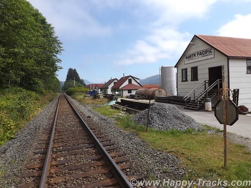
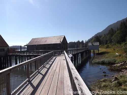
The maps and list of attractions listed the North Pacific Cannery and North Pacific Historic Fishing Village out past Port Edward. Since we had seen the cannery at Haines, we opted to go to the fishing village instead. The paved road led us toward the mouth of the Skeena River and we passed the cannery museum but then found only what looked to be private property as the road became a driveway. We carefully retraced our path but still found nothing other than the cannery museum so we went there instead.
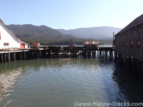
The cannery is built out over the water, probably to protect the buildings from bears and also to facilitate cleanups.
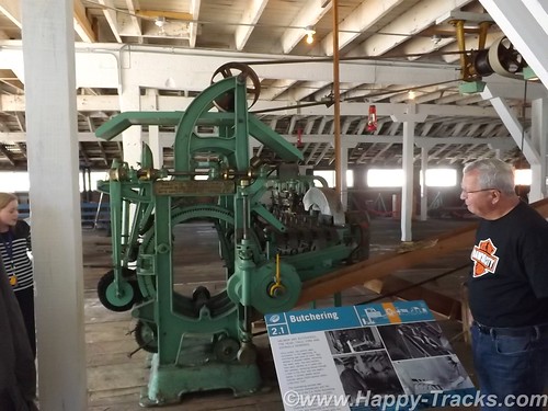
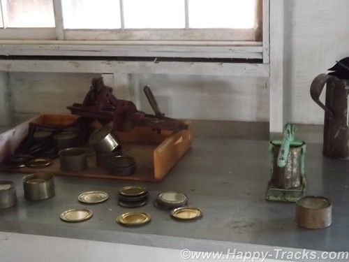
This cannery had a collection of much of the canning equipment, some from this facility and some from other locations. The tour guide described the process of making the cans from sheets of metal. This began several weeks before the fishing season so that there was an inventory of cans available to process the catch. The salmon was placed in the cans and the lids were attached and went through a heating and cooling process much like someone would can things at home. Finally the cans would be sealed with lead and a label would be placed on the cans.
According to the guide, all the salmon that was canned here was the same and just had different labels placed on the cans. Marketing secrets of the salmon industry. The museum also had much of the equipment for the more modern vacuum-packed lead-free method of canning.
The cannery took the fish from the boats, cleaned them and then canned. Manual labor was a large part of the processing. Some of the steps required strength, some required dexterity while others just required labor. The jobs tended to be done by ethnic groups based on what we might refer to as stereotypes today. Asian women tended to do this job, First Nations men did that job and so forth.
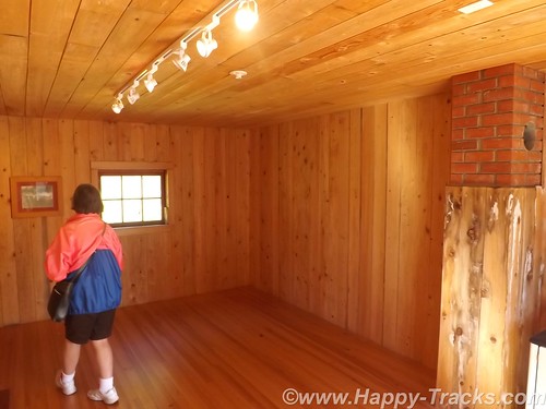
The dock included cabins that were used to house the workers during their temporary employment stints. These also tended to be segregated by ethnic groups. These were in varying states of restoration and preservation, too. This turned out to be the historic fishing village we had sought.
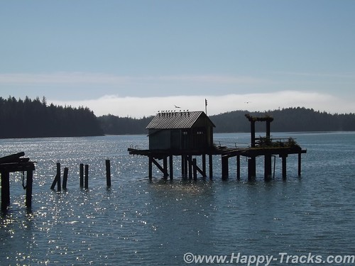
Separated from the processing building and the housing were the fuel storage tanks and pumps. There were also some administrative buildings for the cannery company.
The train tracks run between the cannery and the road for shipping the finished product. The displays also include a rather extensive model railroad and items from the time of the cannery’s productive days which was founded in 1888 and was in seasonal operation until 1968, the longest running cannery in BC.
We tried to find Canadian post card stamps while in Prince Rupert but the long weekend holiday had the post office closed.
We did find a great lunch at the Captain’s Table restaurant above the train museum park and with a great view of the water in Prince Rupert. We enjoyed it enough that we had lunch and dinner there.
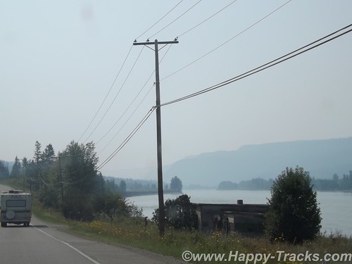
We left Prince Rupert on the Monday of a long holiday and the three day weekend had other vehicles on the road heading home but it only got heavy as we came to traffic lights or bridges. Rt. 16, Yellowhead Highway, roughly parallels the Skeena River and stayed along it all the way into Prince George, 450 miles away. This was a long day for us and the weather had gotten hot (98*).
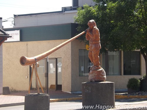
We stopped for lunch in Smithers at the Riverhouse Restaurant and then took a short detour down Main Street to see the Alpine Village which included an Alpenhorn player in the median of Main Street and a decorated bandstand.
As we continued on, we became more aware of smoke in the air from the wildfires that were ongoing. When we arrived in Prince George, it turned out that many of the hotel rooms were taken by firefighters who had been brought in from other areas to help with that effort.
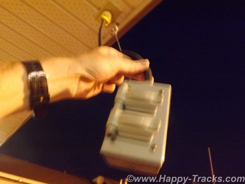
The hotel in Prince George was the first we had seen electrical outlets hanging outside the first floor overhang for winter vehicle heaters and chargers. We also discovered that all the “Do not back in” signs were to limit the exhaust from idling cars entering into the motel rooms. The misalignment of the front wheels on the truck had finally gotten to the other front tire so Keith replaced it while Betty went in search of postcards.
Some of our research includes checking out the postcard racks to see what local attractions are included there. Sometimes it helps, sometimes not so much. In the office of the hotel, Betty got involved in conversation with the desk clerk. She was born in Germany and had settled here with her husband several years ago after spending several years working here during the summers. She asked where we were headed and was disappointed that we would not be visiting Banff and Lake Louise. Betty told her we were feeling we had seen a lot of great scenery already and were headed to Vancouver to see a Canadian city instead. She did have some tips for our coming travels though, including recommendations for sights and a hotel in Vancouver.
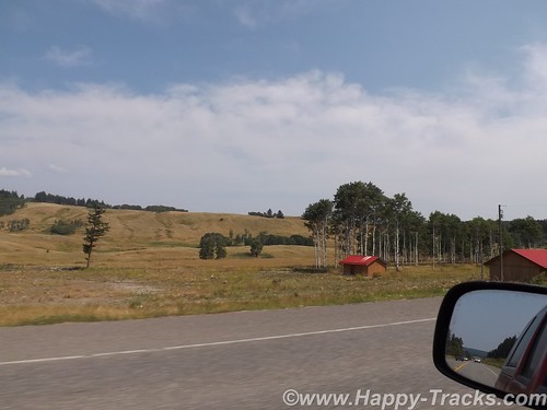
We left Price George headed south on Rt. 97, the Cariiboo Highway. Towns (settlements?) along the way were 150 Mile House and 100 Mile House named for the way stations along the way from frontier days.

Generally, the scenery looked arid but there were signs of forestry in the lumber yards and pulp mills along the way. There was also a cairn erected to commemorate Ft. Alexandria, the last Northwest Fur trading outpost west of the Rockies.
The area had been the site of mining operations in the past and when we next checked into the news, we discovered that a tailings pond had broken in Williams Lake and was in danger of polluting the drinking water and fishing waters with the toxic mess left over from the mining operations. That story was still breaking as we left the area.
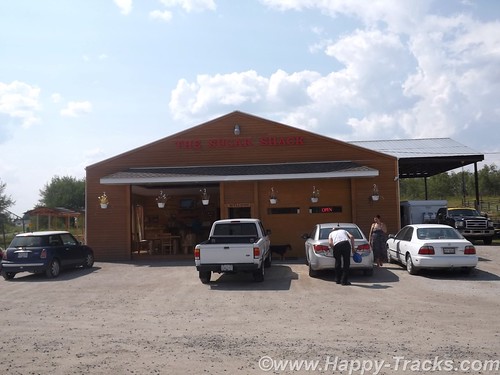
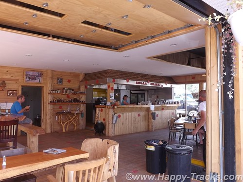
We stopped for lunch at The Sugar Shack, a side of the road eatery that looked to be in a building that could just as easily have been a large two car garage made from logs, complete with rollup doors. The special that day (and probably most days) was a Canadian delicacy, poutine. Originating in Quebec, poutine is a fast food dish sold in “greasy spoons” and roadside food wagons, made with French fries, topped with a light brown gravy-like sauce and cheese curds. (Can’t you just feel your arteries clog just reading that?) Easily large enough to be a meal by itself, it came as a side order to a brisket sandwich. They were also pushing maple sugar products but we passed on those.
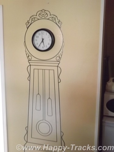
We continued on to Cache Creek for the night. When we pulled into town shortly before sunset, the thermometer was at 104! The room’s air conditioner got a workout but it quickly cooled to a more reasonable temperature after the sun went down. The room décor included a mural surrounding the clock on the wall, a large flower in the bathroom and a mesh drape hanging over the bed. As it was Monday night, the crowds had dissipated with only a couple of the other rooms being taken in the small motel.
We went to the post office the next morning to get stamps for a couple of remaining postcards. The post office was tucked on a ledge into a little space between the Old Cariboo Road, a creek and a high bluff of rock. We left Cache Creek on the Trans-Canada Highway (Route 1) heading towards Frasier Canyon.
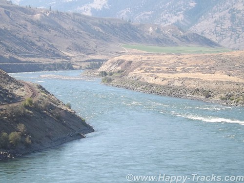
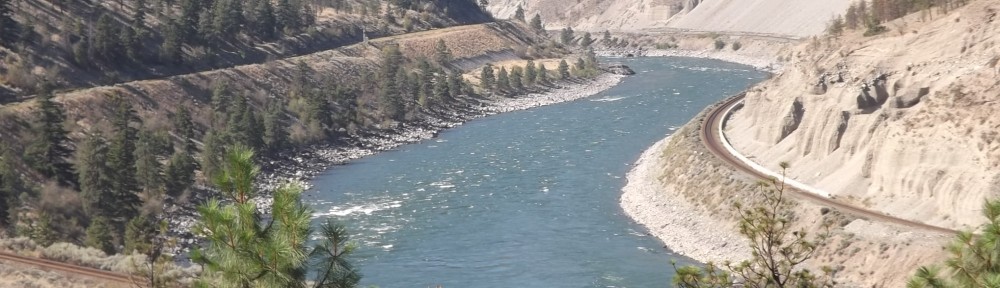
The scenery through Fraser Canyon was beautiful with the river leading the way. The landscape was greener than the day before.
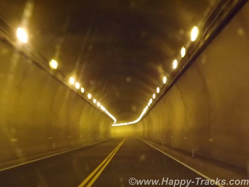
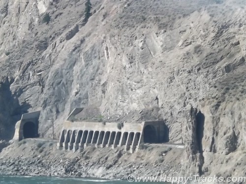
There are 7 tunnels built on the high banks of the river to allow the Trans-Canada highway to pass next to the rock bluffs and the railroad tracks.
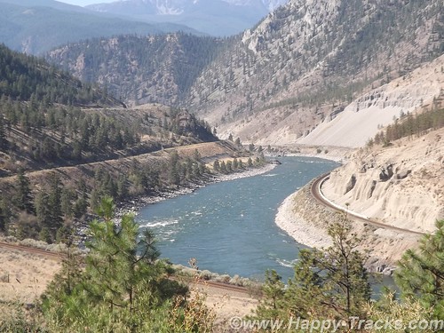
One unusual thing here is that there are single railroad tracks on each side of the river. One set of tracks was built by the US government and one set was built by the Canadians. Each was asserting their presence and ownership of the territory and not cooperating at all. The US trains ran on one side of the river both north and south, the Canadian trains ran on the other side of the river both north and south. It’s only been in the last 15 years that agreement was finally reached to allow cooperation so one set of tracks is used for northbound and one set is used for southbound, increasing the efficiency for both.
We noted that the steep drop offs from the highway are protected by guardrails in only some areas but not others. While we aren’t certain, it seemed that the places where a vehicle going off the road and hindering rail traffic was a concern, there was a rail. Where going off the highway did not endanger the tracks below, there was no rail. Hmmm.
The Fraser Canyon is popular tourist territory with water activities like rafting and fishing and the mountains on either side hosting winter snow activities along with hiking and climbing.
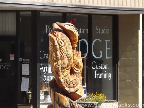
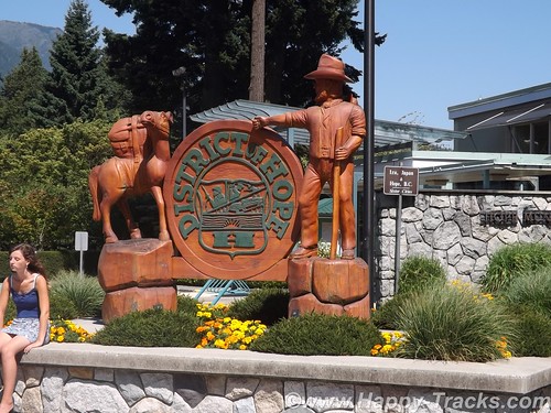
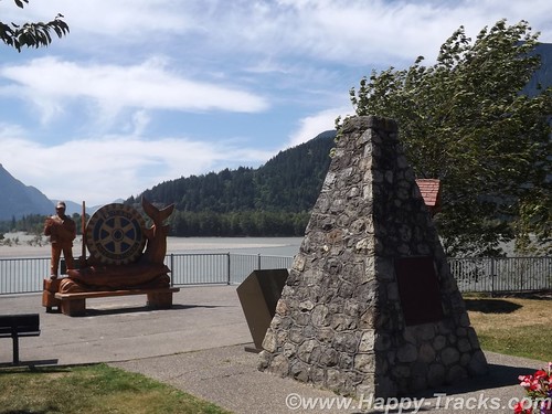
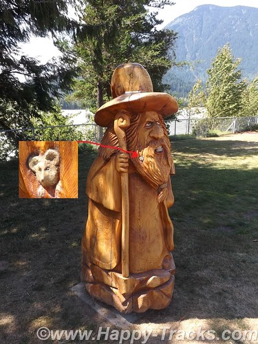
The canyon narrowed down to funnel us past the city of Hope where we took a break for lunch. Hope is a scenic little town with the river banks and an abundance of carved wood statues.
The statues are carved where the tree grew with the root structure. One story we read said that the trees were falling victim to blight and the chainsaw carvings were seen as a way to make use of the dying trees. Other chainsaw carvings were commissioned works. One of my favorites was the troll with the mouse in his beard.
Shortly after passing out of Hope, we turned west through farmland backing to low mountains and made our way toward Vancouver.
You can see all of the pictures from this leg of the trip here.
We invite you to continue along with us and hope you enjoy the account!
Happy-Tracks.com
Where shall we go next? (formerly BRandK)