Summer 2014: Alaska via the AlCan; Flight 93 Memorial and Home Again, Wrap Up

We are often given to rushing the last part of the trip wherever we go. A trip to visit family In Florida will sometimes turn into a marathon one day ride home. A trip to the beach will find us looking at each other late in the evening and saying “let’s just go on home” and arriving at midnight. Aware of this tendency, we tried not to do it this time. One consequence of that behavior is that we often don’t visit the places closer to home while telling ourselves we’ll visit as a day trip from home and then keep putting it off until later.
DSCF9218
This time, prompted by pictures shared by our friend Tra Maslar, we stopped instead of driving past the Flight 93 Memorial in Stony Creek township, 2 miles north of Shanksville PA. We stopped for lunch in Shanksville and then followed the signs to the Memorial.
DSCF9213
Being recent history, most of us remember where we were and what we were doing when Flight 93 crashed on September 11, 2001. Briefly, of the four aircraft hijacked by terrorists on September 11, Flight 93 is the only one that did not reach its intended target, presumed to be the US Capitol building in Washington, DC. Several passengers and crew members made telephone calls aboard the flight and learned about the attacks on the World Trade Center and the Pentagon. The passengers decided to mount an assault against the hijackers and wrest control of the aircraft to prevent it reaching its target. While successful, all 44 people onboard (including the four hijackers) died in the process.
DSCF9215
We have visited the memorials at WTC and Pentagon sites. Flight 93 crashed in a field in the countryside. The memorial itself is predominantly built but the supporting structures (visitor center and grounds) are still under construction. Since our visit, a fire at the NPS administration building has destroyed the flag that flew over the Capitol that day but most of the remainder of the memorial collection is safe.
DSCF9217
Each of the 40 heroes are named on one of the white stones at the right above. Looking at the site from this vantage point, you are looking along the path the airplane took as it crashed and went along the ground, stopping near the boulder shown in the picture below.
DSCF9221
DSCF9222
Although it’s been 13 years, the memorial still tugs at some tender spots and memories of that awful day. The memorial is a fitting tribute to those 40 brave men and women who sacrificed themselves for others.
OH2MD_map

11,704 driven miles later, we are home. Looking forward to sleeping in our own bed. We appreciate how truly blessed we are to live in such a beautiful place and to have the time, money and health to make this trip together.

  • We live in a great and beautiful country. Get out there and see it while you can.
  • Schedules and reservations have their advantages but the spontaneity of driving until you’re ready to stop will lead to some worthwhile surprises. If things aren’t going according to plan, revise the plan instead of spinning up. It may work out even better than planned.
  • It was a surprise to us how many places have WiFi. Although of varying quality, its often free. Some places don’t have food nearby but have WiFi.
  • Cell phone coverage is pretty good even in sparsely populated areas but the cost of using your phone internationally can be steep. Surprisingly, the OnStar phone in the truck was the lowest per minute price while in Canada although it was high-priced for US usage.
  • Most hotels are non-smoking these days but it was surprising to us how many of the large chains had smoking rooms.
  • People are friendly. If you take the time to talk to them or make yourself open to conversation (in some cases that means a willing listener), its easy to be part of a conversation even when you don’t know anybody. Everyone has a story if you’re willing to listen to it.
  • Preparing for the unexpected is a plus. Two spare tires are not too many. Two batteries are not too many. A refrigerator/freezer with some food comes in handy.
  • A suitcase full of clothes for all kinds of weather proved to be superfluous.
  • I still think that tollroads need to have an option for pay as you go with cash.
  • A supply of cash is handy but using a credit card with the credit union making the conversions can be economical.
  • Hotels may vacuum daily and wipe down the horizontal surfaces but the carpets need to be cleaned (shampooed) once in a while.
  • Take the time to poke around the small town off the interstate even if you’re just stopping for gas or food.
  • We stop about every 2 hours and get out, even for a few minutes. We both feel better at the end of the day.
  • It bears repeating – Get out there and enjoy it now.

You can see all of the pictures from this leg of the trip here.
Don’t forget the trip calendar we put together at CafePress. We think it turned out pretty well and would make a great holiday gift. calendar
Thanks for following along and your comments. We hope its been worth your time.
Where shall we go next?

Summer 2014: Alaska via the AlCan; ND Badlands and Teddy Roosevelt NP

A young and skinny Theodore Roosevelt, Jr. made his way to the North Dakota from New York in 1883 to hunt bison. His time and experiences there shaped his perspective and the national conservation policy for decades to come. He was traveling to a place where he was an unknown and would not likely be warmly welcomed as he was an outsider, an Easterner and a “city slicker” to boot.
DSCF9067
During his hunting trip, he expressed an interest in cattle ranching and eventually made an investment in that endeavor. In that year, the men who tended the cattle investment also built the Maltese Cross Cabin. Roosevelt’s investment of $14,000 (more than his annual salary at the time) was seen as an admission ticket to a different way of life in the wide open spaces. Dakota-grown cattle were seen as a solid investment partly because of the variety of grazing foods available and also because of the efforts of the Marquis de Morès to establish a meat packing industry to packing the meat in the Dakota territory and ship the meat in refrigerated rail cars to the markets in the east.
DSCF9122
DSCF9025
Roosevelt suffered double personal tragedies in February of 1884 when both his mother and his wife died the same day. The tragedy struck him hard (as to be expected) and he returned to his Dakota cabin for a period of mourning and introspection. He wrote a book about his hunting exploits and becoming a cattleman and expanded his holdings. He threw himself into his cattle raising business, becoming president of the Cattleman’s Association and stepping out to make peace with his neighbor, the Marquis, who was in jail on charges of murder. He also expanded his land holdings to include the Elkhorn Ranch.
Despite his personal warnings about overgrazing the territory, he also expanded his herds. In 1885, thieves stole his boat and he gave chase with two others eventually capturing the thieves downriver. He chose to walk the thieves back to authorities in Dickinson. The story is told in some places that he did so for the reward money or that he did so because they deserved a trial. In either event, his multiday walk to Dickinson with the perpetrators added to his reputation and helped dispel the view that he was a soft Easterner.
The seasons of 1886-1887 would prove disastrous to the cattle industry in Medora and eventually the town itself. The summer was brutally hot and dry with temperatures reaching 125F. Then after the grasses had been so devastated by the heat, the winter was equally extreme with temperatures as low as -41F. The cattle starved or froze that winter.
Although Roosevelt had been hit hard financially, he had grown tremendously in the eyes of the locals and eventually the nation. His embrace of the cowboy life contributed to his formation of the Rough Riders which brought him fame during the Spanish-American War and his experiences with the cattle contributed to his beliefs in conservation and management of our natural resources which carried into his Presidency. Although he would not return often or for long periods after 1887, the experiences shaped his actions later.
DSCF9123
During Roosevelt’s presidency, the Maltese Cross cabin was exhibited at the World’s Fair in St. Louis, MO and at the Lewis and Clark Centennial Exposition in Portland, OR. Later it was moved to the state fairgrounds in Fargo, ND and then eventually to the state capitol grounds in Bismarck where it remained for 50 years. In 1959, the cabin was relocated to its present site and renovated. The most recent preservation work occurred in 2000.
Fellow travelers onboard the SS Matanuska, the ferry we rode along the Inland Passage recommended that we include the North Dakota Badlands as part of our journey east as they are indeed different than the South Dakota Badlands.
glendive2ftyates_map
Theodore Roosevelt National Park is really three geographically separated areas of badlands in western North Dakota. The park covers 110 square miles of land in three sections: the North Unit, the South Unit, and the Elkhorn Ranch Unit.
We visited only the park’s larger South Unit which lies alongside Interstate 94 near Medora, North Dakota. The smaller North Unit is situated about 80 mi (130 km) north of the South Unit, on U.S. Highway 85, just south of Watford City, North Dakota. Roosevelt’s Elkhorn Ranch is located between the North and South units, approximately 20 mi (32 km) west of US 85 and Fairfield, North Dakota. The Little Missouri River flows through all three units of the park. The Maah Daah Hey Trail connects all three units.
We started our visit in Medora at the South Unit Visitor Center. Located outside the visitor center is Roosevelt’s Maltese Cross cabin. The cabin has been expanded since its original building to include an upper half story and additional rooms on the main floor.
DSCF9117
From there, we drove along East River Road alongside the Little Missouri River through the buttes. The topography of the North Dakota badlands seems almost to rise above the surrounding landscape while the South Dakota badlands seem to drop down into valleys and canyons below the surrounding landscape.
Generally the road was paved although we were stopped early on for construction ahead and the wait for a pilot car to guide us through the single lane in the dirt.
DSCF9057
DSCF9052
In our first stop, we were in the prairie dog area and they showed up for a few pictures. As we moved on again, we wound down to the waters edge and very soon were stopped for a view of the bison alongside the road.
As we continued on, we were stopped further along by more bison along both sides of the road and in the road itself. There were several calves in the group and the interest at this particular spot seemed to include the water alongside the left side of the road. There were probably about 6 cars stopped to wait and it seemed almost as if the bison were playing.
DSCF9070
DSCF9071
DSCF9072
Three or four would be in the road and would finally start to move off to one side but before the first car could move, one or two more bison would come from the side. As they would move on, a couple would come from the other side of the road. Eventually, we would move on to more scenery.
DSCF9084
DSCF9090
The earth showed the layers of different colors. The reds reflecting the iron content, the grays of granite-based soils, the blacks and browns of the thin layer of topsoil. There are veins of black coal. Fires in the veins of coal over the years have baked the sand and clay to a substance much like a clay brick in appearance and hardness which helps to hold the buttes and spires in place even as the lower, softer soil is eroded through the action of wind and water.
DSCF9098
DSCF9103
The road is a 36 miles long scenic loop which climbs and dips through all kinds of scenery as well as passing near recreation areas and hiking trails. Near one of the overlooks, we saw a quartet of horses off in a field. Chances are they were feral (of domesticated breed yet born in the wild). Towards the end, it drops again down near the river and a field where bison and prairie dogs seem to rule. The field, of several acres, included some dust wallows where the bison rolled around. You could also see that the older larger bison ruled, often causing the younger smaller ones to leave as they saw the large ones coming.
DSCF9115
DSCF9116
We circled on back to the visitors center where we got involved in conversation with other travelers. One was from northern Virginia and was just making their way west for this trip. Another was an old sub sailor who had served on the Nathaniel Greene and was meeting his former shipmate in the campgrounds later.
We went into Medora in search of a meal and to peruse the shops and then continue on our way to Ft. Yates for a night on the reservation.
You can see all of the pictures from this leg of the trip here.
We invite you to continue along with us and hope you enjoy the account!
Don’t forget the trip calendar we put together at CafePress. We think it turned out pretty well and would make a great holiday gift. calendar

Summer 2014: Alaska via the AlCan; Butte Montana

Butte, Montana is a city of about 35,000 these days and is the fifth largest city in Montana. Its history revolves around the mining industry and was a boomtown during the early 20th century with all the stages of development from camp, to boomtown and mature city. It shifted to a town of historic preservation and environmental cleanup. Butte is unlike other mining towns in that the mining operations are woven within the fabric of the city itself.
DSCF8905
We arrived from Missoula and stopped on the west side of town for fuel. We knew we wanted to see the Mining Museum so we spun the GPS roulette wheel and decided to take a ride by to see if they were still open. I call it the GPS roulette wheel because sometimes the route the GPS gives may not be that workable. In this particular case, it routed us via Bluebird Trail, or the back way, into the World Museum of Mining. A bluebird could follow the trail easily but it was a bit rugged for us, just a dirt road with deep ruts that wandered up and down a few low hills past some unused equipment and a dog that seemed interested in chasing the interlopers away.
DSCF8881
The road had cross ruts and was among the worst roads of the entire trip. It did lead us up to the paved parking lot of the World Museum of Mining’s paved parking lot (which was closed for the day) and onto the city streets of the Montana Tech of the University of Montana campus and thus into downtown Butte.
DSCF8735
We found and checked into our motel for the night. As we had seen in several other places, some of our fellow guests were motorcyclists which made for an interesting show the next morning as we sat eating the complimentary breakfast. They were loading up and carrying a fair amount of luggage with them. Each piece had a particular place and set of tie-downs leading to an interesting game of 3D Tetris as they loaded up. One of our fellow diners was also taken by the show and remarked how she used to ride a scooter to the market and had her own adventures tying down a watermelon. She also shared that she was a widow who had learned the value of duct tape for a myriad of uses after her husband’s passing.
DSCF8897
We left and headed back to the World Museum of Mining (using the smoother paved way through town).
The World Museum of Mining was established in 1963 and one of the few in the world built on the top of an actual mineyard, the Orphan Girl Mine. The Orphan Girl operated from 1875 to 1956, an exceptionally long time for any mine to operate and speaks to the richness of the ore there. Over the course of its life, the Orphan Girl was a copper/zinc/gold/silver mine and very profitable for Anaconda Copper Mining Company and providing employment for its workers and supporting the Butte economy.
The World Museum of Mining is open daily from April to October and gives underground tours of the mine, also something of a rarity. The Hell Roarin’ Gulch town located on the property is composed of actual buildings from the boomtown days and authentic memorabilia. The town can be toured on your own or with a guide.
DSCF8754
The website, HauntedHouses.com, lists the World Museum and Hell Roarin’ Gulch as sites of sightings of visitors from the past who haven’t crossed over. (We did see some international tourists but none that we determined to be paranormal.) It is believed that some buildings moved from other sites or displays from other locations may have attachments that came with the physical building or object.
The Museum exhibits include geology and mineral exhibits in addition to furnishings of the day.
DSCF8816
Hell Roarin’ Gulch buildings continue to be restored with the Orphan Girl head frame being restored in 2006. There are currently 15 buildings and include a couple of churches, a school, post office, various stores and professional offices.
DSCF8786
DSCF8798
One of the buildings is Peterson’s Sauerkraut Factory. The operation used steam operated equipment to cut and core the cabbage and then it was moved by hand into barrels for aging. Peterson with his brother and their wives operated the factory for 50 years beginning in 1883 and produced over 350 barrels of sauerkraut per year at 400 pounds per barrel which he delivered throughout the area.
DSCF8814
DSCF8812
Doc Ironsides, the dentist, was a traveler and would set up in different towns or at different mines. Some of his equipment was on display in the office. The foot operated drill seems barbaric, to say the least.
DSCF8770
DSCF8776
The largest and fanciest building was the mine superintendent’s home.
DSCF8836
We left the World Museum of Mining through the campus and returned to the downtown area to the Copper King Mansion built for and by William Andrews Clark beginning in 1884. Construction was completed in 1888.
DSCF8968
Mr. Clark was born in Connellsville, Pennsylvania in 1839. He worked his father’s farm until he was 14 and then went away to school, attending law school in Iowa. He taught school in Missouri in 1859 and 1860. In 1861, he joined the Army of the Confederacy but deserted in 1862 to pursue mining. With a couple of successful claims, he decided he would do better providing support to the miners and took advantage of the laws of supply and demand to increase his fortunes. He bought a team of horses and a wagon and sold supplies to the miners and later began making loans based on the potential value of mining claims. At one time, his income was reported at $17 Million per month!
DSCF8912
Clark was rich enough that he built (and financed) his own railroad. His business interests stretched east to New Jersey. He pursued his interest in politics, and served as President of Montana’s two constitutional conventions. He served in the US Senate from 1901 to 1907.
Perhaps his greatest legacy to Butte was that he built the beloved Columbia Gardens, a 68-acre playground and amusement park for the young at heart of Butte and the region. Thursdays were set aside to transport children for free to the Columbia Gardens on his electric trolley system. Other charitable efforts of Clark include a Girl Scout camp in New York state named for his daughter Andree. He also funded the Paul Clark Home, an orphanage in Butte that provided sanctuary for the sick and the indigent, and the YWCA home in Los Angeles for homeless girls and their mothers.
After his death, Columbia Gardens operated until 1973 did not pass to the people of the town as some said Clark had indicated it would. The Anaconda Mining Company wanted to rid itself of the maintenance burden (as the park was deteriorating) and to mine the land. While the matter of ownership and intent was tied up in bureaucracy and lawyers, fire struck and the Columbia Gardens was destroyed.
It should also be noted that Mr. Clark was instrumental in the founding of Las Vegas, selling off 2000 acres as lots and making a significant fortune in the process. He is the Clark for whom Clark County Nevada is named. Following his stint as US Senator, Mr. Clark moved to New York City until his death in 1925.
One unique feature of the mansion is a custom made shower that sprays water from around a complete circle and the top. The guide told us that it had some issues with keeping an even temperature from all the spray heads but that it worked as designed.
DSCF8913
On the top floor is a ballroom for entertaining, complete with a pipe organ. Unfortunately, Mr. Clark’s design was ahead of its time. Playing the organ generated such a loud sound that it literally knocked over furniture in the room and was only played once!

After Clark and his second wife passed on, the mansion was inherited by Clark’s son. The mansion was sold to an outside person, who sold all the existing furniture that was in the mansion. After becoming this owner’s private residence, the mansion was eventually sold to the Catholic Church and it became a home for the town’s Catholic nuns, who turned part of the top floor into a chapel, in the rooms off the ballroom area. The nuns didn’t appreciate the fresco which was painted on the ceiling of the master bedroom, so they painted over it. The mansion was put back on the market when the nuns moved out some years later, and stood vacant for 3 years.
The new owners started at once to clean out the cob-webs and dust, and began to renovate the mansion to its former glory. While the owners were able to buy back some of the original antiques owned by the Clark family, many other antiques similar to the ones which existed in that era were purchased.
DSCF8925
In an effort to preserve the history of Butte as well as restore the mansion, the new owner collected pieces from church buildings being destroyed and developed a collection of stained glass as well as church vestments and furniture which occupies another room on the top floor.
DSCF8935
Also the owner loved to have collections, which today are still here on display, including dolls, hats, toys, clocks, demitasse cups and steins.
DSCF8941
DSCF8951
To raise some money, this owner opened up a restaurant in the main dining room which she ran for many years. The mansion has stayed in the family since then.
DSCF8966
The staircase includes these wooden carvings representing each of the states (at the time) in flora and fauna.
The Copper King Mansion operates today as a B&B and also gives tours to visitors. Much of the tour is devoted to the restoration of the mansion.
DSCF8979
After the Copper King Mansion, our next stop was the Historic Dumas Brothel. It operated as a brothel from 1890 to 1982 for the purpose of catering to the predominantly male population associated with the mining industry. At one time, it had hidden alleyways and tunnels to permit rapid egress in the event of a police raid.
The brothel boasts 42 rooms ranging from barebones to opulent. Its current ownership saved it from tax sale in 2012 and is attempting to save and restore it. They finance this effort in part by giving tours and operating a store. We dropped by with the intent of seeing the tour but were turned away as the tour guide hadn’t come in that day and the backup was out the door on the way to his other job. We just got a glimpse of the outside and the front rooms and had to leave. It strikes me that the only car parked in the area other than ours was a black Cadillac. There’s a bit more info and some photos at http://www.thedumasbrothel.com
In a dramatic shift of focus, we also saw the statue “Our Lady of the Rockies”, a 90 foot statue erected in honor of mothers everywhere. The statue sets atop the Continental Divide at an elevation of 8500 feet, which is 3500 feet above Butte.
DSCF8738
The statue’s genesis was in a promise made by Bob O’Bill who promised to erect a statue of the Virgin Mary if his wife recovered from cancer. His wife did recover and the project grew with input from others. The statue is lit by night and a bus tour goes from the town to the statue twice per day during the summer. There is also talk of a tram to ride to the top but expansion plans for access have been challenged by property owners in the area with concerns about the potential traffic.
We didn’t ride up close but we did get a chance to see the statue from below.
There are many more pictures from the World Museum of Mining and the Copper King Mansion here.
We invite you to continue along with us and hope you enjoy the account!
Don’t forget the trip calendar we put together at CafePress. We think it turned out pretty well and would make a great holiday gift. calendar

Summer 2014: Alaska via the AlCan; US Border to Butte, Montana

amapborder_butte
We started heading southeast from Everett and into Mt. Baker-Snoqualmie National Forest and eventually climbing up to Stevens Pass. There was a ski lodge resort there that appeared to be open all year, even when there was no snow, but it had closed for the day before we arrived and took a break in their parking lots. We saw bicyclists coming up and over from the east side. I admire their stamina and determination but didn’t share their interest in bicycling the area.
DSCF8623
DSCF8625
As we started down the east side of the pass, we were starting to see smoke from wildfires but didn’t know exactly where they were. As we exited the National Forest, we entered Leavenworth, a small Alpine town like several in the area. A tourist town, maybe winter ski area but busy as we drove through.
DSCF8629
DSCF8631
Our friend, Pattie, told us she had stopped in one of those towns several years before and left a dollar bill which would be tacked to the wall with a note indicating Fuquay-Varina where they lived at the time. The town she visited may or may not have been Leavenworth but it was typical of the area.
DSCF8634
DSCF8638
On new pavement, we were passed by a truck headed west and managed to catch a rock from him with our windshield. After the warnings of rocky roads and potential damage in Canada and Alaska, it was somewhat ironic that we did get the crack on fresh smooth pavement in Washington.
We drove on to Wenatchee and stopped for the night in the first place we found available, Inn at the River. The smoke was now very noticeable and it was hot as it would be for the next couple of days. We crossed the river to find our lodging but it took a bit to find the river from the inn as it was on the other side of the freeway and the railroad tracks. We overheard someone at the desk talking about having to be careful in choosing route to Seattle due to the fires and the smoke. Many of the hotel guests were firefighters.
Inn at the River sits across the street from Valley Mall. We went in to replenish the vitamin supply at a GNC store and then had dinner at Shari’s Restaurant and Pies. Shari’s is a chain similar in concept to Denny’s, Perkins, etc. We had eaten one in Bangor for the sub reunion as it was across the street from the hotel where we stayed there. The food was good and the pastry looked tempting but we passed.
We continued east towards Spokane through miles and miles of relatively flat land given to orchard agriculture. Through much of the area, the crops were identified by signs alongside the road. It helped us see the variety of crops and helped with the “What’s that?” questions that always seem to arise as we go through farm country.
We dropped down and picked up Interstate 90 into Idaho and stopped for lunch in Wallace. Wallace is in a pass with mountains on both sides with the interstate highway squeezing through. Wallace turned out to be about 4 blocks wide, all on the same side of the interstate.
DSCF8641
Wallace had been a silver mining town and the restaurant where we stopped for lunch had a gift shop with silver jewelry on display. The restaurant was pretty quiet with the hostess/waitress/cook all being the same person.
DSCF8643
There was an accordion festival scheduled for the coming weekend. Wallace also has a brothel museum but we didn’t find out about it until after we had already left. There were numerous references to bicycle races as Wallace is a major stop on several annual cross-country races.
DSCF8647
DSCF8650
As we left town, the entrance and exit ramps overlapped each other at different elevations in order to fit it all in.
We continued to Missoula, Montana where we discovered that ZZ Top was playing that night. Lodging was filled for most of the chains near town with concert-goers but we did manage to find a place for the night.
DSCF8653
DSCF8662
In 1877, construction began on Ft. Missoula, destined to become home to the 25th Infantry Regiment, one of four companies known as the Buffalo Soldiers formed after the Civil War with Black Soldiers serving under white officers. The 25th was one of the first called into action when the Spanish American War broke out in 1898 serving bravely in the Philippines and Cuba but was reassigned to other posts after the war. During WWI and WWII, the site was used to inter Italian aliens and later Japanese persons. The site has been used for training, for prison and holding cells and was eventually decommissioned in 2001. Much of the original post’s land is under the control of the Interior and Agriculture departments as well as the Missoula County which uses it as an historical museum.
DSCF8656
The historical park includes displays of trains from the steam era as well as sawmills equipment of the type used to build the original fort.
DSCF8676
The next morning, we headed north to Dixon Montana and the National Bison Range (NBR), under the direction of the US Fish and Wildlife Service. The NBR was established in 1908 as a home for the dwindling bison herds in this country. Bison are believed to have once numbered in the tens of millions but were down to about 100 by the late 1800s. Bison were found in all the states except Hawaii. Settlement and irresponsible hunting dwindled the numbers extensively so that the initial herd was in the low hundreds when the 18,000 acre reserve was established. The original herd released in 1909 was purchased by the American Bison Society and donated. This is not the only herd still found in North America (as evidenced by some of earlier parts of our travels) but this herd was established expressly for preservation.

Bison herds in the Mission Valley date back to the late 1800’s when a Pend d’Oreille man of the Flathead Reservation returned home from the plains of eastern Montana with four bison calves. The herd quickly grew to 13 animals. At that point, partners Michel Pablo and Charles Allard bought the herd. The Pablo-Allard herd thrived in the Mission Valley’s open grasslands. It became one of the largest private bison herds at the time when bison were most threatened with extinction. However, when it was announced the Flathead Indian Reservation would be opened for homesteading in 1910, surviving partner Pablo began making arrangements to rid himself of his herd. The US Government declined to purchase the bison so Pablo sold them to Canada.
Just after this, the American Bison Society pushed the US government to set aside land to protect and conserve the American bison. The National Bison Range was one such area. And after its establishment, the American public pitched in to provide funds to purchase bison to place on the new Refuge. The American Bison Society, under the direction of William Hornaday, solicited donations throughout the country. Over $10,000 was raised, enough to purchase 34 bison from the Conrad herd. Located in Kalispell, Montana, these bison were descended from the famous Pablo/Allard herd. To supplement this, Alicia Conrad added two of her finest animals to the effort. The Refuge also received one bison from Charles Goodnight of Texas and three from the Corbin herd in New Hampshire. These 40 animals, all donated to the Refuge and coming from private herds, form the nucleus of 300-400 bison roaming the Range today. from http://www.fws.gov/refuge/National_Bison_Range/about.html

DSCF8675
Before arriving at the visitor center, we passed under a land bridge which had been constructed over the highway. The land bridges allow animals to cross without being endangered/bothered by the traffic.
We entered NBR through the visitors’ center which had much information about the bison including a display about a white bison which had been part of the herd which has since died. There was another white bison born on a bison farm in Connecticut in 2012. The white bison holds particular spiritual significance to the American Indians. The rare white bison made news coverage at the time and draws crowds to see it. We also learned the difference in antlers and horns on animals. Antlers are shed on a regular basis but horns are permanent, perhaps this is one of those things we “should” have known but it was new knowledge for us.
DSCF8679
DSCF8694
The NBR has a dirt road that winds through and covers a range in elevation of 2600 feet above the visitor center. There is a shorter track which covers less distance and elevation for larger vehicles like buses or large RVs. We took the longer winding route and saw bison, pronghorns, mule deer and a chipmunk. The dirt and gravel road would be easily traversed in a standard sedan.
DSCF8691
DSCF8692
DSCF8700
DSCF8709
DSCF8723
DSCF8728

After leaving the NBR, we got back onto I90 heading towards Butte, MT. Just outside the gate is a small general store and café but it wasn’t open the day we were there.
You can see all of the pictures from this leg of the trip here.
We invite you to continue along with us and hope you enjoy the account!
Don’t forget the trip calendar we put together at CafePress.
calendar

Summer 2014: Alaska via the AlCan; Vancouver BC

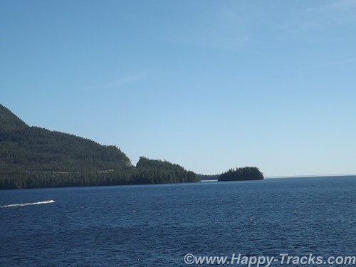
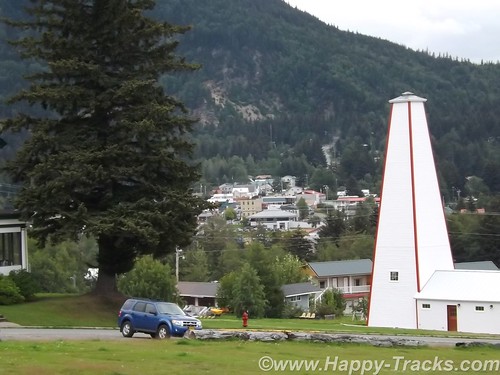
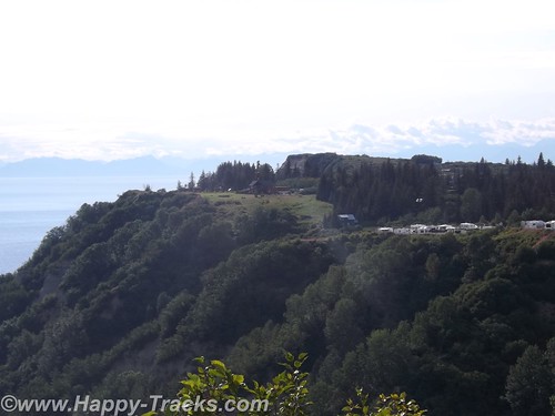
Our destination for the next couple of days is Vancouver, the city, not the island. The city has a population of over 600,000 with the greater Vancouver area topping out at over 2.4 million people. That makes it third most populous in Canada and most populous in western Canada. It’s also one of the most ethnically and linguistically diverse with over 52% of its population having a language other than English as their primary language. Vancouver was also the site of the 2010 Winter Olympics and 2010 Winter Paralympics and many structures from those events remain today.
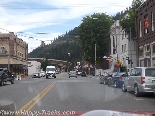
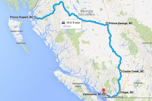
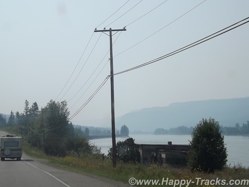
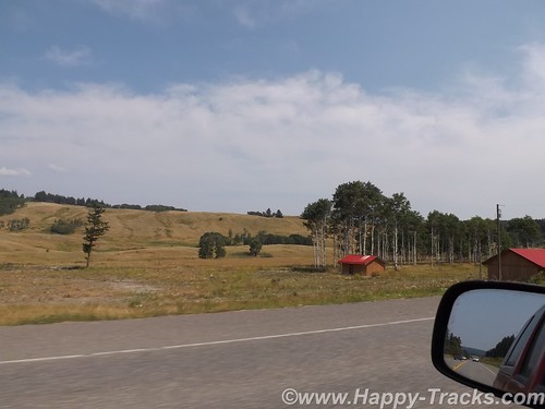
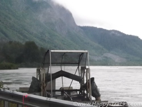
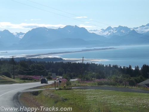
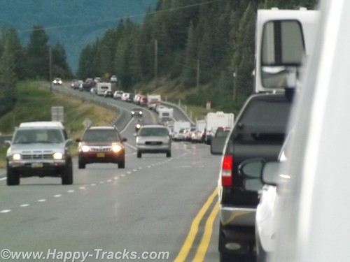
The journey west took us through farmland and the increasing signs of suburbia with housing developments and shopping centers until we were obviously into the edges of Vancouver, complete with summer road construction. The freeway added and subtracted lanes while increasing the density of orange construction barriers until we were funneled onto the Port Mann bridge and into town.
DSCF8466

Just a moment to vent my feelings on toll roads and bridges. The Port Mann bridge over the Fraser River on Canada’s Route 1 is a toll bridge. Toll bridges are not unusual and not unexpected. For the traveler though, it is a bit of a surprise to find the toll is collected only remotely. There are no toll takers. There are signs telling you to log on to the internet, so in addition to watching for disappearing lanes around those construction cones and the guy with the trailer who seemingly is unaware of just how long that truck-trailer combo that he wants to put in your lane NOW really is, drivers need to take note of a website address so that they can log on (hopefully later) to pay the toll and avoid the administrative add-on charge for mailing you a bill. Really? There is a way to avoid this and that would involve pre-registering your license number and setting up an account to automatically charge the vehicle’s owner for crossing over. In fairness, this may be part of a network of tolls rather than a one-off for this one bridge but even EZPass seems a significant improvement over this system. Either the NAFTA countries need to adopt a universally accepted system such as EZPass (are you listening Florida and Texas?) or there should be a requirement that an option for just stopping at a manned tollbooth and handing over cash needs to exist. If that’s too much expense and trouble, then maybe a toll isn’t the best way to go.
We did manage to note the relatively simple internet address and supplied a credit card number to yet another potentially-hacked website to enable the identity thieves.

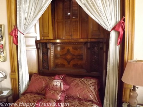
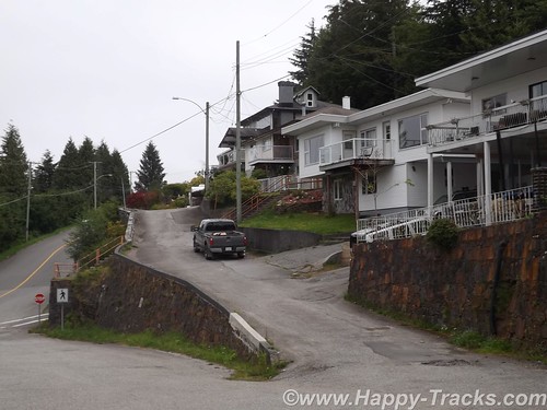
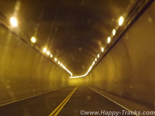
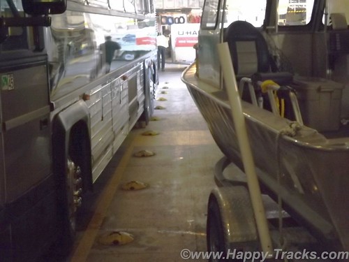
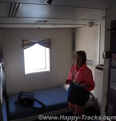
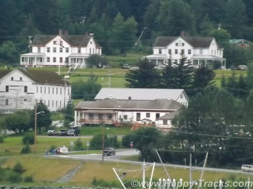
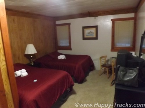
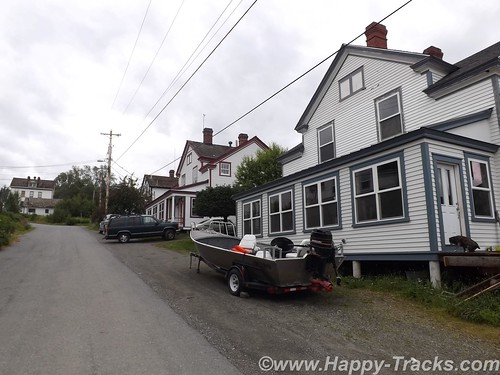
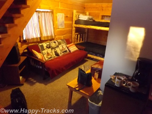
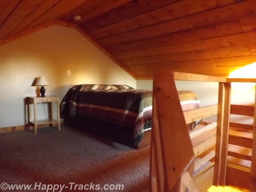
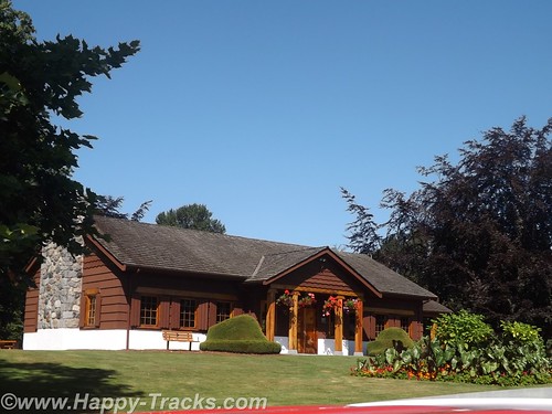
Armed with our research and the recommendations from the desk clerk in Prince George, we made our way into town and secured lodging at the Sandman Hotel. The Sandman is next to the former Olympic stadium near the harbor. Underground parking is available but it was a tight fit for the truck. Luckily we didn’t plan for much in and out so got parked in a space that just barely had enough vertical room for us.
DSCF8498
As the picture shows, it was only inches. Our room was cozy but nicely furnished and with something of a view.
DSCF8468
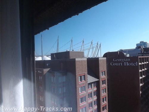
On the harbor side of our hotel, you could see the BC Arena, formerly used in the 2010 Winter Olympics. The athletes’ village was primarily located across the Cambie Street Bridge over False Creek.
DSCF8478
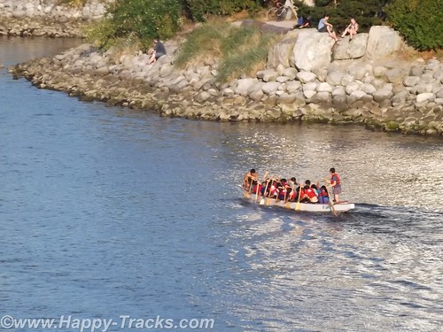
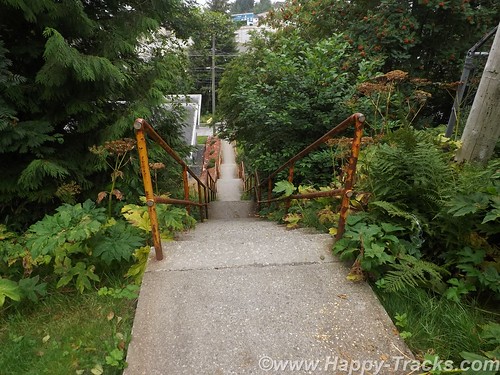
There were sidewalks and stairways to facilitate getting down to the water’s edge. As we crossed over late on this sunny afternoon, there were rowers, skaters, runners and bikers as well as dog walkers and families shuffling along. As we descended and ascended the long stairways from the bridges to the water, we were passed (and re-passed) by the same runners heading up and down. There are a couple of parks right along the water’s edge and the athlete’s village is primarily apartments and condos now with terrific views in an urban landscape.
DSCF8481
DSCF8486
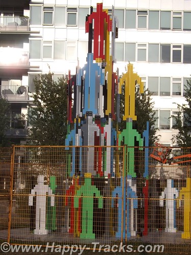
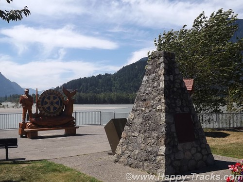
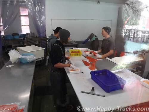
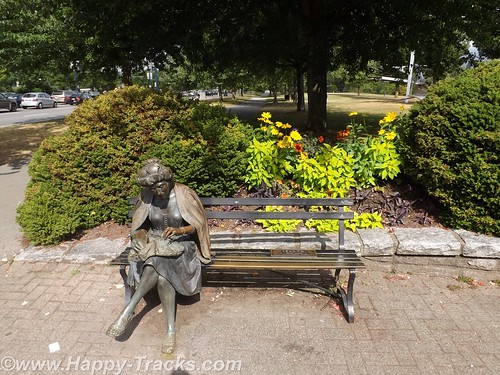
Here we saw the first of several large sculptures on display, the human pyramid. Our dinner was delicious salmon.
We set out the next morning for Stanley Park on foot. We had seen enough of Vancouver traffic the day before to know it would be more pleasant to walk it and the weather was suitable for it. We packed the pedometer in a pocket. We started walking on W. Georgia Street which would end at the park entrance.
DSCF8504
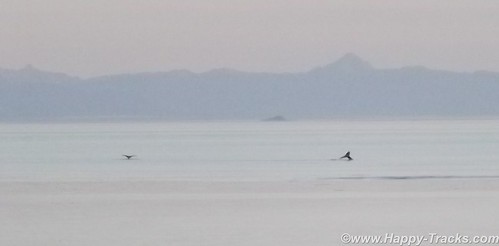
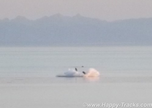
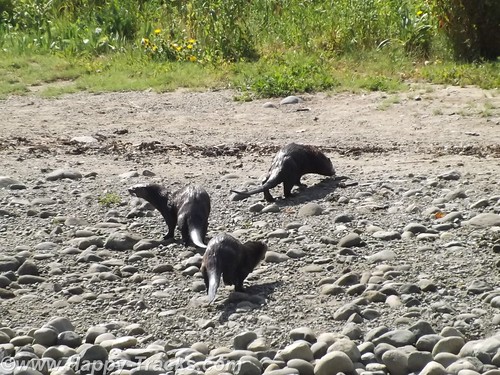
The sidewalks were busy but not crowded as we made the 1.5 mile walk to the park’s entrance. Along the way were several smaller public areas with flowers in bloom either provided by the town or by the condominium buildings. As we entered Stanley Park, the way curved around to the right with walkways, bikeways and roads for traffic. We stopped on the first bridge to watch four sea otters at play which came out on the stony shoreline as we watched.
DSCF8514
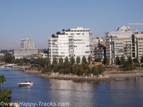
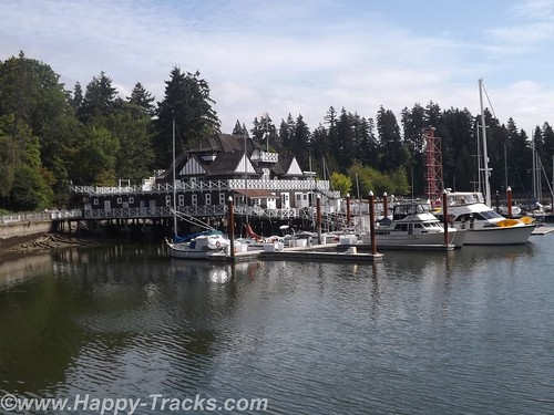
The path then continued around to the Vancouver Rowing Club. The Rowing Club is an athletic club with activities in rugby, hockey, rowing and yachting. The facility included an eatery and dock space with a view of the harbor and the near skyline.
DSCF8506
As we entered Stanley Park, there was some construction which seemed to be geared towards modifying the area where one could join a buggy tour of the park.
DSCF8518
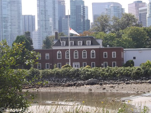
On the walk around, the next sight is HMCS Discovery, a Royal Canadian Navy Reserve division and shore facility. Created during World War II, Discovery was used for recruitment and training, and provided almost 8,000 personnel during the war. Discovery continued in its training role following the war, and also serves as headquarters for several Reserve and Cadet units.
The stone frigate takes its name from HMS Discovery, the ship used by George Vancouver to chart most of North America’s north-western coast. Originally based at the Stanley Park Barracks, in 1944 the Discovery moved to its current location on Deadman’s Island, in Coal Harbour, adjacent to Stanley Park.
DSCF8522
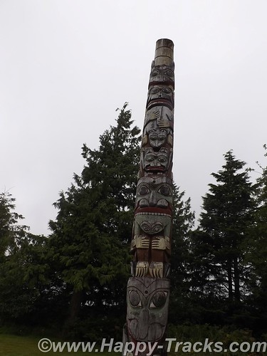
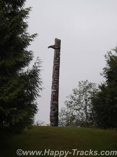
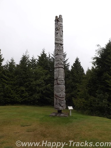
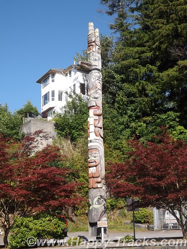
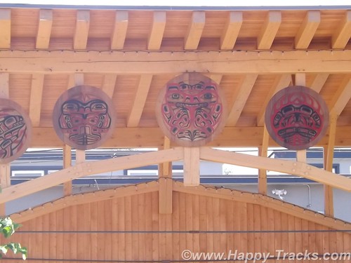
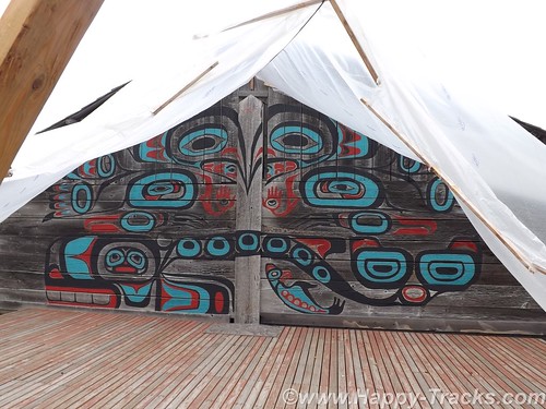
We next crossed the road to head inland toward the totem display. The nine totem poles at Brockton Point are BC’s most visited tourist attraction.
DSCF8526
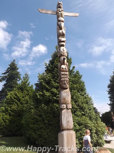
The collection started at Lumberman’s Arch in the 1920s, when the Park Board bought four totems from Vancouver Island’s Alert Bay. More purchased totems came from Haida Gwaii (Queen Charlotte Islands) and the BC central coast Rivers Inlet, to celebrate the 1936 Golden Jubilee, the 50th anniversary of Vancouver. In the mid-1960s, the totem poles were moved to Brockton Point area of Stanley Park.
DSCF8530
DSCF8529
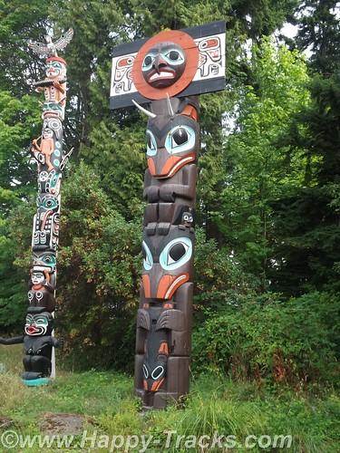
The Skedans Mortuary Pole is a replica as the original was returned home to Haida Gwaii. This pole represents the chief’s hereditary crests and held his remains in a small compartment at the top. Other poles are a house pole representing the family of the owner, another reflects a village tribe’s origins and lore. Still others are to honor a particular event in a person’s or village’s life.
DSCF8543
In the late 1980s, the remaining totem poles were sent to various museums for preservation and the Park Board commissioned and loaned replacement totems. The ninth and most recent totem pole, carved by Robert Yelton of the Squamish Nation, was added to Brockton Point in 2009.
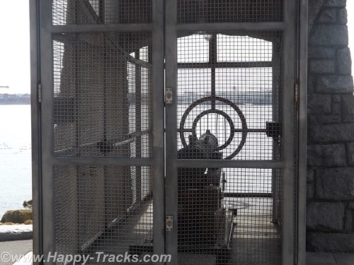
Continuing along the walk, we came upon the 9 O’clock Gun which is still fired every day at 9:00 pm to permit synchronizing clocks. The gun has been used in the past to alert fishermen of the closing of fishing time at 6:00 pm on Sundays. After being stolen and held for ransom by University of British Columbia students as a charity fundraiser, the gun has been enclosed by an iron cage. It also has its own Twitter account which tweets “boom” each evening at 2100 hours. Although the gun has only an electrically detonated black powder charge, in the past it has had pebbles thrown into the barrel which led to moving the Esso fuel barge anchored in the harbor and previously in line with the barrel.
DSCF8552
DSCF8558
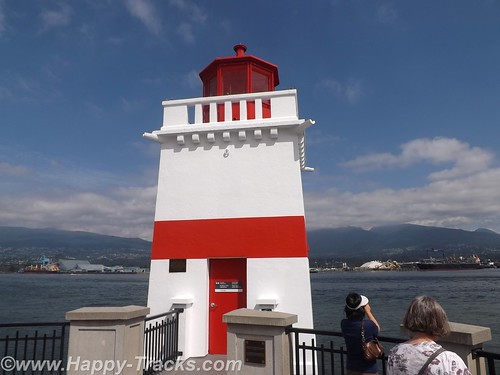
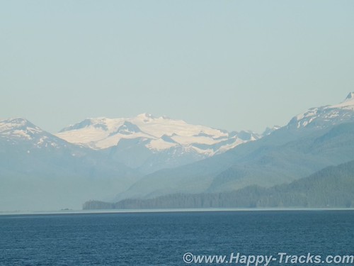
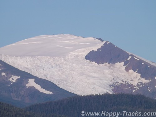
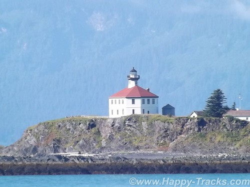
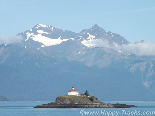
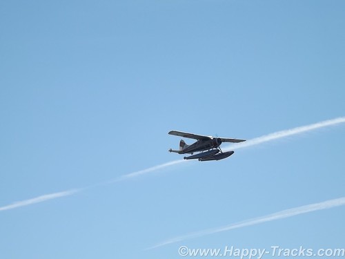
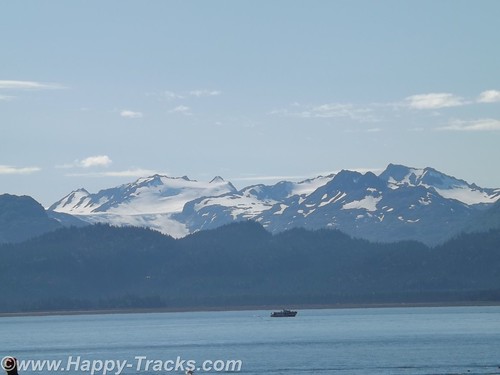
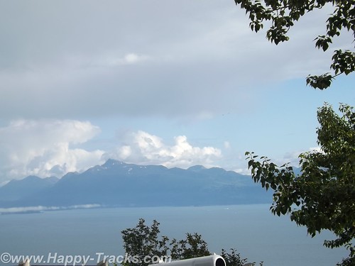
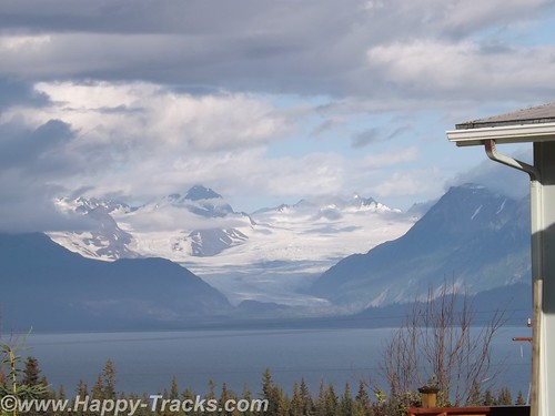
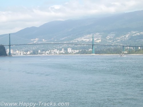
The seawall walk continues around Brockton Point to the harbor light. From the seawall, we can see much activity in the harbor including the sea planes and the Lions Gate bridge headed north across the harbor entrance. We can see snow-capped mountains in the near distance.
DSCF8560
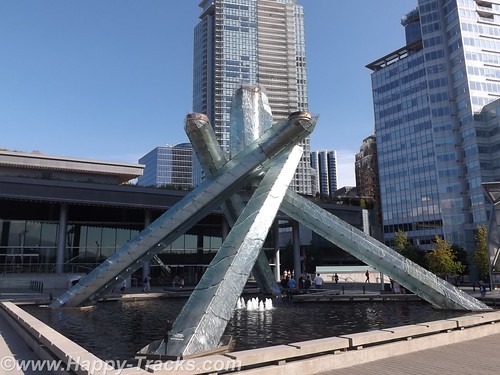
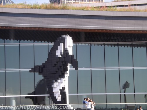
We walked back to our hotel as we needed a rest after our 7 mile hike. Next we went to the harbor’s edge to visit the Olympic Cauldron site. It’s been moved to an open plaza near the City Centre and overlooking the water. We also saw the Lego whale marking the cruise ship landing. We think it’s part of the giant sculpture display in Vancouver.
DSCF8576
DSCF8578
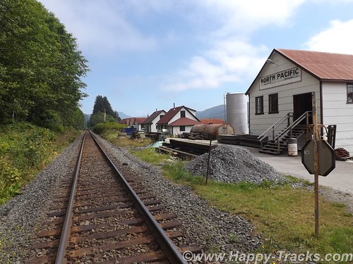
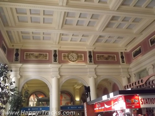
This takes us through the older part of town and to the old train station. It’s no longer in use for trains but has been partially restored and displays several paintings of the north country.
DSCF8603
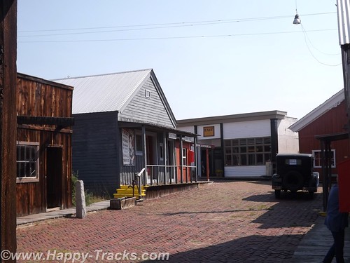
The original part of Vancouver is called Gastown. Here the streets are much narrower and the shops are crowded into smaller spaces.
Gastown was Vancouver’s first downtown core and is named after “Gassy” Jack Deighton, a Yorkshire seaman, steamboat captain and barkeep who arrived in 1867 to open the area’s first saloon. The town soon prospered as the site of Hastings Mill sawmill, seaport, and quickly became a general center of trade and commerce on Burrard Inlet as well as a rough-and-rowdy resort for off-work loggers and fishermen as well as the crews and captains of the many sailing ships which came to Gastown or Moodyville, on the north side of the inlet (which was a dry town) to load logs and timber. The Canadian Pacific Railway terminated on piles on the shore parallel to Water Street in 1886.
This low-lying swampy area eventually filled in with bridges and dumping of refuse. In 1886, the town was incorporated as the City of Vancouver. It fell victim to the “Great Vancouver Fire” that same year, losing all but two of its buildings. The area was completely rebuilt and continued to thrive.
Gastown found new life as the center of the city’s wholesale produce distribution until the Great Depression in the 1930s. It also was center of the city’s drinking life (there were 300 licensed establishments the twelve-block area of the former Granville, B.I.) After the Depression Gastown was a largely forgotten neighborhood of the larger city and fell into decline and disrepair until the 1960s. It was a continuation of the Skid Road area with cheap beer parlors, flophouse hotels, and loggers’ hiring halls.
In the 1960s, citizens became concerned with preserving Gastown’s distinctive and historic architecture, which like the nearby Chinatown and Strathcona were scheduled to be demolished to build a major freeway into the city’s downtown. A campaign led by businessmen and property owners as well as the counterculture and associated political protestors, pressured the provincial government to declare the area a historical site in 1971, protecting its heritage buildings to this day. A riot between the hippies and the police in 1971 over marijuana has gone into legend. The Gastown was designated a National Historic Site of Canada in 2009.
DSCF8609
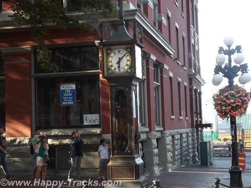
Gastown was served by a central steam system for heating and other purposes. But it wasn’t until 1977 that Raymond Saunders’ first steam clock was built to solve the issue of a steam vent in a popular sidewalk for the renovated Gastown district of Vancouver. At first glance, one supposes it to be much older, after all, it is steam driven. Wikipedia has an explanation of its workings including micro switches and electric motors here .

The pedometer said we’d walked over 10 miles today.

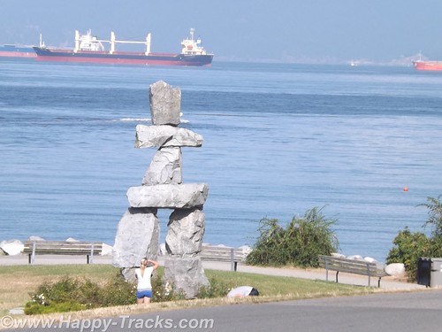
The next morning had us back in the truck (after jump starting it since the fridge had been running a couple of days off the main battery in very warm temps even in the underground garage) and making a final pass around town. We passed Sunset Beach Park with its giant sculptures including a whale’s ribcage, the rock Inuit and the outsized engagement rings. (The Inuit was used as a symbol/mascot for the 2010 Olympics and historically by the Natives to point the way to the hunting grounds.)
DSCF8614
We turned inland and drove through a neighborhood of one and two story houses and the occasional low-rise condo building to make our way to Granville Island and past the flats of the industrial areas with their warehouses, docks and casinos heading towards the border.
DSCF8616
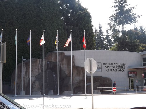
While still in the Vancouver metropolitan area, we arrived at the border crossing. On the border itself is a Peace Arch built in 1921 to celebrate the Treaty of Ghent which ended the War of 1812. The arch is in an international park and flies the US and Canada flags.
DSCF8617
The approach to the border crossing was a bit different than others we had used, partly due to the volume of traffic crossing there. The cars and trucks moved as a group from spot to spot along the way rather than idling along in a continuous line. This system was devised to cut down on the air pollution of the idling engines.
DSCF8618
Our pass through US Customs and back into home territory was routine with the standard questions of where we’d been, how long we’d been there and what we were bringing in with us.
DSCF8619
You can see all of the pictures from this leg of the trip here.
We invite you to continue along with us and hope you enjoy the account!
calendar

Summer 2014: Alaska via the AlCan; Prince Rupert to Vancouver

We pulled into Prince Rupert amapPrinceRupert-Vancouverfrom the ferry and waited in line for Customs. Since this was the end of the line for the ferry, the Customs station was busy with the whole ship trying to get through Customs at the same time. As we left the ship in 6 lines, we merged into 3 to pass. All told, it really moved along rather quickly. We drove out of the Customs gate and up into the fog to make the drive into Prince Rupert. We had called ahead to the Prince Rupert Hotel and made arrangements for two nights stay.
The next morning we set out to find Totem Park. Our map showed it to be a short walk away. Our map didn’t show the change in elevation though. Totem Park could be reached following a trail which looked to be little used and a bit overgrown. Luckily, a lady passed by walking her dogs and told us we could also take the public path between these houses to get there.
DSCF8296
DSCF8300
The public path was stairs. The stairs climbed up the 10 feet or so to reach the houses’ front yards and then continued up above their second stories and then still continued higher. I would estimate the climb was near 45 degrees and rose 100 feet in about 200. Then the stairs ended and the path climbed just a bit further. We finally reached the top after availing ourselves of several opportunities to stop and admire the view off the bluff and out to the harbor.
DSCF8304
DSCF8307
DSCF8308
There are only three totems in Totem Park. You can see where there were two more that are no longer there. These totems are reproductions of authentic ones created by First Nations people.
We had thought there must be some universal code in totems and had tried to decipher but it just wasn’t to be. It starts with the totems having different purposes. Some are to celebrate a life, some are to commemorate an event, some are to give praise and some are to condemn or shame such as the one in Valdez meant to shame Exxon for wrongs no made right. Individual figures on the totem can also have meanings such as the frog meaning prosperity. As in other art, there is no universal key of this always means that.
DSCF8335DSCF8337
We walked down a different way than we had come up to see more of town. There were a couple of other totems standing by themselves and we also found two by city hall.
After setting on the ferry for 40 hours and the short drive to the hotel while powering our DC refrigerator, we had to jump start the truck this morning. We had been running the refrigerator off the truck battery rather than the spare battery we brought along and had used in Anchorage to jumpstart the stranded motorists. The spare battery started the truck instantly and we recharged the battery as we made our way to our next attraction.
DSCF8311
The maps and list of attractions listed the North Pacific Cannery and North Pacific Historic Fishing Village out past Port Edward. Since we had seen the cannery at Haines, we opted to go to the fishing village instead. The paved road led us toward the mouth of the Skeena River and we passed the cannery museum but then found only what looked to be private property as the road became a driveway. We carefully retraced our path but still found nothing other than the cannery museum so we went there instead.
DSCF8330
The cannery is built out over the water, probably to protect the buildings from bears and also to facilitate cleanups.
DSCF8323
This cannery had a collection of much of the canning equipment, some from this facility and some from other locations. The tour guide described the process of making the cans from sheets of metal. This began several weeks before the fishing season so that there was an inventory of cans available to process the catch. The salmon was placed in the cans and the lids were attached and went through a heating and cooling process much like someone would can things at home. Finally the cans would be sealed with lead and a label would be placed on the cans.
DSCF8320
According to the guide, all the salmon that was canned here was the same and just had different labels placed on the cans. Marketing secrets of the salmon industry. The museum also had much of the equipment for the more modern vacuum-packed lead-free method of canning.
The cannery took the fish from the boats, cleaned them and then canned. Manual labor was a large part of the processing. Some of the steps required strength, some required dexterity while others just required labor. The jobs tended to be done by ethnic groups based on what we might refer to as stereotypes today. Asian women tended to do this job, First Nations men did that job and so forth.
DSCF8324
DSCF8326
The dock included cabins that were used to house the workers during their temporary employment stints. These also tended to be segregated by ethnic groups. These were in varying states of restoration and preservation, too. This turned out to be the historic fishing village we had sought.
DSCF8328
Separated from the processing building and the housing were the fuel storage tanks and pumps. There were also some administrative buildings for the cannery company.
The train tracks run between the cannery and the road for shipping the finished product. The displays also include a rather extensive model railroad and items from the time of the cannery’s productive days which was founded in 1888 and was in seasonal operation until 1968, the longest running cannery in BC.
We tried to find Canadian post card stamps while in Prince Rupert but the long weekend holiday had the post office closed.
We did find a great lunch at the Captain’s Table restaurant above the train museum park and with a great view of the water in Prince Rupert. We enjoyed it enough that we had lunch and dinner there.
We left Prince Rupert on the Monday of a long holiday and the three day weekend had other vehicles on the road heading home but it only got heavy as we came to traffic lights or bridges. Rt. 16, Yellowhead Highway, roughly parallels the Skeena River and stayed along it all the way into Prince George, 450 miles away. This was a long day for us and the weather had gotten hot (98*).
We stopped for lunch in Smithers at the Riverhouse Restaurant and then took a short detour down Main Street to see the Alpine Village which included an Alpenhorn player in the median of Main Street and a decorated bandstand.
DSCF8350
DSCF8354
DSCF8358
As we continued on, we became more aware of smoke in the air from the wildfires that were ongoing. When we arrived in Prince George, it turned out that many of the hotel rooms were taken by firefighters who had been brought in from other areas to help with that effort.
DSCF8357
The hotel in Prince George was the first we had seen electrical outlets hanging outside the first floor overhang for winter vehicle heaters and chargers. We also discovered that all the “Do not back in” signs were to limit the exhaust from idling cars entering into the motel rooms. The misalignment of the front wheels on the truck had finally gotten to the other front tire so Keith replaced it while Betty went in search of postcards.
Some of our research includes checking out the postcard racks to see what local attractions are included there. Sometimes it helps, sometimes not so much. In the office of the hotel, Betty got involved in conversation with the desk clerk. She was born in Germany and had settled here with her husband several years ago after spending several years working here during the summers. She asked where we were headed and was disappointed that we would not be visiting Banff and Lake Louise. Betty told her we were feeling we had seen a lot of great scenery already and were headed to Vancouver to see a Canadian city instead. She did have some tips for our coming travels though, including recommendations for sights and a hotel in Vancouver.
We left Price George headed south on Rt. 97, the Cariiboo Highway. Towns (settlements?) along the way were 150 Mile House and 100 Mile House named for the way stations along the way from frontier days.
DSCF8360
Generally, the scenery looked arid but there were signs of forestry in the lumber yards and pulp mills along the way. There was also a cairn erected to commemorate Ft. Alexandria, the last Northwest Fur trading outpost west of the Rockies.
DSCF8363
The area had been the site of mining operations in the past and when we next checked into the news, we discovered that a tailings pond had broken in Williams Lake and was in danger of polluting the drinking water and fishing waters with the toxic mess left over from the mining operations. That story was still breaking as we left the area.
DSCF8372
DSCF8373
We stopped for lunch at The Sugar Shack, a side of the road eatery that looked to be in a building that could just as easily have been a large two car garage made from logs, complete with rollup doors. The special that day (and probably most days) was a Canadian delicacy, poutine. Originating in Quebec, poutine is a fast food dish sold in “greasy spoons” and roadside food wagons, made with French fries, topped with a light brown gravy-like sauce and cheese curds. (Can’t you just feel your arteries clog just reading that?) Easily large enough to be a meal by itself, it came as a side order to a brisket sandwich. They were also pushing maple sugar products but we passed on those.
DSCF8368
DSCF8378
We continued on to Cache Creek for the night. When we pulled into town shortly before sunset, the thermometer was at 104! The room’s air conditioner got a workout but it quickly cooled to a more reasonable temperature after the sun went down. The room décor included a mural surrounding the clock on the wall, a large flower in the bathroom and a mesh drape hanging over the bed. As it was Monday night, the crowds had dissipated with only a couple of the other rooms being taken in the small motel.
DSCF8379
We went to the post office the next morning to get stamps for a couple of remaining postcards. The post office was tucked on a ledge into a little space between the Old Cariboo Road, a creek and a high bluff of rock. We left Cache Creek on the Trans-Canada Highway (Route 1) heading towards Frasier Canyon.
DSCF8385
DSCF8396
The scenery through Fraser Canyon was beautiful with the river leading the way. The landscape was greener than the day before.
DSCF8420
There are 7 tunnels built on the high banks of the river to allow the Trans-Canada highway to pass next to the rock bluffs and the railroad tracks.
DSCF8402
One unusual thing here is that there are single railroad tracks on each side of the river. One set of tracks was built by the US government and one set was built by the Canadians. Each was asserting their presence and ownership of the territory and not cooperating at all. The US trains ran on one side of the river both north and south, the Canadian trains ran on the other side of the river both north and south. It’s only been in the last 15 years that agreement was finally reached to allow cooperation so one set of tracks is used for northbound and one set is used for southbound, increasing the efficiency for both.
We noted that the steep drop offs from the highway are protected by guardrails in only some areas but not others. While we aren’t certain, it seemed that the places where a vehicle going off the road and hindering rail traffic was a concern, there was a rail. Where going off the highway did not endanger the tracks below, there was no rail. Hmmm.
The Fraser Canyon is popular tourist territory with water activities like rafting and fishing and the mountains on either side hosting winter snow activities along with hiking and climbing.
DSCF8426
DSCF8439
The canyon narrowed down to funnel us past the city of Hope where we took a break for lunch. Hope is a scenic little town with the river banks and an abundance of carved wood statues.
DSCF8453
The statues are carved where the tree grew with the root structure. One story we read said that the trees were falling victim to blight and the chainsaw carvings were seen as a way to make use of the dying trees. Other chainsaw carvings were commissioned works. One of my favorites was the troll with the mouse in his beard.
sDSCF8464
Shortly after passing out of Hope, we turned west through farmland backing to low mountains and made our way toward Vancouver.
You can see all of the pictures from this leg of the trip here.
We invite you to continue along with us and hope you enjoy the account!

Summer 2014: Alaska via the AlCan; Inland Passage via Ferry

In looking carefully at a map of Alaska, one first notices the size of the state and its coastline and how much vast space with no roads. In the interior, the distances are covered by bush and float planes like we saw in Anchorage. This works on the rugged coast between the islands but is remarkably inefficient in moving freight or if you want to use a vehicle to proceed beyond the landing spot.
amapHaines-PrinceRupert
In 1948, three Haines residents Steve Homer, Ray and Gustav Gelotte, purchased a surplus US Navy landing craft and began providing ferry service for up to 14 cars with very crude provisions for passengers. After a couple of years, it proved to be economically unsuccessful and was subsequently purchased by the Alaska territorial government. The service proved useful and was expanded with bigger and better vessels and more towns served. As we mentioned in the Haines posting, the distance by water between Haines and Skagway are only 20 miles apart by water but hundreds of miles distant by car. Other cities in Alaska, including Juneau, the capital, are totally unreachable except by boat or plane.
The Alaska Marine Highway System over the ensuing decades now transports folks, vehicles and freight over the broad range from Bellingham, Washington over 3500 miles to Dutch Harbor, Alaska in the Aleutian Islands.
As I was working on our itinerary, I had us in the Wrangell-St. Elias area with plans to go down towards Washington and the ferry seemed to be a perfect way to give us a break from the drive, fuel and hotel costs and let us see the Inland Passage. My haste didn’t allow me to see that there was no direct road route to Haines for our trip, another case of serendipitous planning taking us to a particularly enjoyable part of our journey.
DSCF8087
Our ferry ride took us about 475 miles by water in 39 hours to cover what would have been 915 miles by highway over perhaps 3 days. Had we driven to Prince Rupert, we would have seen some parts of British Columbia that we didn’t but we would have missed the Inland Passage and all its beautiful sights. You do miss things in the truck as you’re making miles and watching for signposts and directions. You also miss some of the conversations and people watching opportunities.
DSCF8263
We drove onboard on a ramp which took us down to a lower level of the ship or the car deck. The car deck held all manner of vehicles. There were passenger cars and pickups like ours. There were tour buses and motorcycles. There were huge RVs, both motorhomes and fifth wheel campers. There was a truck pulling a boat on a trailer and there were the trailer halves of tractor trailers that were traveling unaccompanied and maneuvered about by tractors at their embarking and disembarking ports.
DSCF7872
While at Homer, we had seen the MV Kennicott loading but it had a vehicle elevator and turntable for ports that don’t have facilities for the ramps. The car decks are secured and not accessible to passengers while underway. Folks traveling with pets bedded them down in the vehicle and went down to check when we pulled into port.
After securing the truck, we went upstairs to the purser’s desk for our cabin assignment and keys. We had reserved an outside cabin but some folks had plans to stay in the common areas or even to pitch a tent on the upper level sundeck (which has heat lamps under the roof).
DSCF8074
DSCF8135
DSCF8068
The three bunk outer cabin has an upper and lower bunk on one bulkhead and a single lower bunk at right angles and against the outer bulkhead with a square window above. There is also a fold down desk in one corner. There was a small head with a shower stall, a sink and a toilet angled into the corner. While usable, it required a bit of thought about what you intended to do in figuring the way you entered.
DSCF8131
The deck above the cabins has a forward observation deck with comfortable chairs and a panoramic view. There is even a small kids’ play area and some tables for games and cards.
DSCF8102
Immediately aft of the observation lounge is a bar and lounge which sometimes has a musical performer. Over the course of our trip, we only saw a few folks here. Continuing aft, the line for the cafeteria runs along the starboard side and the cafeteria was open all day except for an hour before each meal change. Overnight, sandwich service rather than hot meals were available. Aft of the cafeteria’s serving line was a dining area that was open around the clock.
DSCF8109
Each deck also had an open area on the stern. There were two or three areas on the outer decks where smoking was permitted at times.
DSCF8229
Our route included four stops before our final destination of Prince Rupert BC.
DSCF8157
Our first stop was at the ferry docks outside of Juneau. The dock is located north of the main part of town in Auke Bay like the dock in Haines so we didn’t really see the town. We were in port a couple of hours and there were vans waiting at the dock to take folks into town for a tour. We chose to stay near the dock and enjoy the warm sunshine.
Juneau was established in 1880 by Joe Juneau and Richard Harris. They discovered gold in nearby Gold Creek. The mine eventually became the largest operating mine of its kind and operated from 1880 to 1944. The capital was moved to Juneau in 1906 from Sitka. Points of interest besides the mine include the Mendenhall Glacier and the Capitol Building which is trimmed in Tokeen marble mined in SE Alaska.
DSCF8173
DSCF8177
After we left Juneau, we threaded our way south towards Ketchikan. Late in the afternoon, we made our way to the observation lounge where we were delighted to see whales out in front of us. There was a tour group in the observation lounge at the same time and the group would call out when one was sighted making it easier to spot them. We also saw seals on a chunk of ice and boats fishing.
DSCF8197
DSCF8196
DSCF8203
Later, we had a conversation with one of the crewmen whose job includes steering the ship. He told us that the whales were humpback whales and orcas. Environmental concerns force the ship to slow or change course to avoid them, at times even coming to a dead stop when there are just too many whales to safely proceed. He told us that the ships sonar setup allowed them to see and identify the whales even underwater. He also told us of watching a humpback whale on the sonar once that was being pursued by orcas but that the humpback is able to dive deeper and more steeply and escape the orcas if the water is deep enough.
DSCF8219
The scenery throughout our trip continued to be breathtaking and the sunset over the mountains and on the water was captivating.
DSCF8222
Another conversation we had with fellow travelers gave us tips for our return trip home. This particular couple had traveled part of the AlCan as we had but their trip had taken them further north into Yukon Territory and on the Top of the World highway. He shared that their trip had been over less friendly roads and had probably more closely resembled the conditions found by my family in their trips over the AlCan in the early 1950s. These folks were from North Dakota and asked about our route home. They recommended that we consider the North Dakota Badlands on our return route. We took their recommendation and were glad that we did.
DSCF8223
Our conversation with the woman working the cash register for the cafeteria line told us a bit about their jobs as well. The crew, depending on the route and ship assigned, may leave home and stay onboard for 2 weeks. When they reach the end of their two weeks, they have two weeks off before repeating the cycle. Depending on the job, they work 12 hours per day, perhaps split into 2-6 hour shifts.
We retreated to our cabin for the night and slept well, only waking when we pulled into our stops in Petersburg and Wrangell during the night. From our cabin window, we could see buildings that looked like they belonged on a pier, some type of warehouse or terminal and bright lights in the darkness.
DSCF8226
DSCF8112
The next morning, we were back walking around on deck watching the scenery roll by. As we approached Ketchikan we saw several lighthouses and even a USCG helicopter land at one of them. We pulled into a busier port at Ketchikan than we had been seeing.
DSCF8120
DSCF8236
DSCF8276
DSCF8260
The Tongass Narrows, the waterway leading to the town’s docks, was in use by fishing boats and working boats of all sorts. This was also the channel that served as the local seaplane strip. On the opposite side of the channel from town was an elevated airport on Gravina Island. The airport is connected to town by a small ferry which takes about 7 minutes to cross from side to side. You may remember the Tongass Narrows and Gravina Island as the “Bridge to Nowhere” which gained notoriety as an earmark in the 2005 Federal budget. Perhaps I should also ask whether you remember Federal budgets and appropriations bills as opposed to “continuing resolutions”? Gravina Island has only 50 residents and the bridge (at an estimated cost of almost $400 million) was labeled as a particularly egregious example of government waste in the form of pork barrel spending. Proponents of the bridge said it was not just for the benefit of the 50 residents but to allow development of Gravina Island.
DSCF8280
Our stop in Ketchikan was scheduled for 4 hours to allow the ship to take on diesel fuel to continue our trip into Prince Rupert. Since we had been unable to find postcards since leaving Haines, we disembarked and went into the commercial area near the dock. We tried a hotel and a restaurant and finally found the postcard at an A&P (Alaska and Proud) grocery store.
DSCF8264
We went back onboard for lunch and asked the purser about mailing our postcard. She told us that it wouldn’t go out until after the ship went back north the following week but told us the post office was at the edge of the ferry dock parking lot so we went back ashore to the post office.
Leaving Ketchikan, we stayed within the Tongass Narrows for some time and got to enjoy some inland scenery from the water.
DSCF8285
DSCF8287
DSCF8288
We were going to be landing in Prince Rupert around midnight and didn’t have reservations. We overheard some folks talking about driving on to Prince George as they expected it to be hard to find rooms in Prince Rupert. Prince George is 9 hours from Prince Rupert and while the fog would surely dissipate as you left the coast, it didn’t seem like a palatable alternative to us. The purser did have a list of hotels in Prince Rupert though with phone numbers. One of our fellow passengers was a German woman who was traveling without a vehicle and she was also trying to make arrangements for lodging but the language was creating a barrier for her getting recommendations. It wasn’t clear about how to get from the docks to the hotels and she was getting frustrated. We did share that the list was available and gave her one. We didn’t see her again and hoped she made a connection that was suitable.
We pulled into Prince Rupert in a heavy fog and the line at Customs was slow as the whole ship unloaded at once. We passed through relatively quickly (considering the line) and found a room just a couple of miles away at the downtown area of Prince Rupert.
You can see all of the pictures from this leg of the trip here.
We invite you to continue along with us and hope you enjoy the account!


Summer 2014: Alaska via the AlCan; Haines, Ft. Seward

Leaving the Customs station (Pleasant Camp Border Crossing) with a brochure from the Hawaiian Customs Agent, we continued alongside the Chilkat Inlet towards Haines. Primary task for us at the moment is finding lodging for the next two nights and its about 7:30 pm. Waiting until this late to start finding lodging hasn’t worked out well for us in the past.
DSCF7982
We find a place to pull over and make some calls and see this contraption. It looks sort of like a paddle wheel or even an automated fish catching device. We later find that its a device mounted by the state to help count the salmon population.
The first place (a BNB) we called had nothing available for the two nights we needed. We tried a second call and connected with a woman who said she could accommodate us at the Ft. Seward Lodge although she wasn’t at the lodge but could meet us there in the half hour we needed to get there. She said she had to put her child down to sleep for the night and would meet us there.
DSCF7997
We drove through the edge of Haines and arrived outside the office door to find it locked and apparently no one around. We waited a bit and then called again and the call went to voice mail. We finally saw someone going out that looked like they might work there. It turned out the young lady did work there but had also had issues with getting someone to answer the phone. She did tell us another phone number to try though which also went to voice mail. After waiting this long, we were certainly tempted to go somewhere else but there didn’t seem to be any where else to go. Eventually, the owner showed up and checked us into our room.
DSCF7986
The Ft. Seward Lodge building had been the PX when the post was still active. This particular building had housed the exchange, a barber shop, soda fountain, bar and the bowling alley. The long wing containing our room had once been the bowling alley.
Haines, Ft. Seward, and Port Chilkoot history is like many of the towns in Alaska ranging over the Native population, the US acquisition, the gold rushes, fishing and the tourism industry.
The Tlingit Indians established the first permanent settlements around 8,000 years ago. The area is relatively temperate, has abundant food resources and geographically provides a portage opportunity to connect the Chilkoot and Chilkat Inlets. The Tlingits established trade with other groups and became wealthy. They also are recognized as the artists of some of the finest indigenous creations.
DSCF8019
White settlement came in 1881 with the Presbyterian mission. Shortly after came salmon canneries, mines and the construction of Ft. Seward by the US Army. Due to ongoing border dispute with Canada, the US built Ft. Seward as a demonstration of might and resolve and encompassed 4,000 acres which had been deeded over from the Presbyterian church in 1902. The docks were first to be built to bring in supplies and construction materials. Italian stone masons were imported to build the granite foundations for the post and master carpenters from the lower states gave Ft. Seward style that exceeded most rudimentary construction of that era. The first contingent of soldiers arrived in late 1904 and Ft. Seward became regimental headquarters for Alaska. Ft. Seward was renamed Chilkoot Barracks in 1922.
Over the next two decades, the Army dismantled other Frontier-era forts around Alaska so that Chilkoot Barracks was the only Army post in Alaska. During World War II, Chilkoot Barracks became an induction and rest center for soldiers arriving in Alaska to form the new posts and bases needed to support the war effort.
Like many military bases, Chilkoot Barracks provided an anchor for the town’s economy during its operation but in 1946, the Army declared it surplus in favor of more strategic locations in interior Alaska. A group of WWII veterans decided to buy the surplus post and continue to operate it as a cooperative. The cooperative failed but several of the veterans established small businesses that survived serving tourists and passengers from the small cruise ships that used the old Army dock. With the infrastructure to support the post (fire department, utilities, etc), the city of Port Chilkoot was formed and merged with the Main St. area to become the city of Haines in 1970.
DSCF7988
The scenery had changed when we looked outside the next morning. A cruise ship (relatively small) now sat at the pier. I say relatively small as it was smaller than what we had seen in Seward and smaller than the ones we saw cruising down the far side of the Chilkoot Inlet making their way to and from Skagway (20 miles away by boat, hundreds of miles by car including traveling into the Yukon Territory). We happened to hit cruise ship day in Haines when most of the shops would be open.
DSCF7983
Haines only allows one ship per week to dock. Previously some of the larger ships had been thought to be more detrimental to the local ecology than they needed so the good folks of Haines sent them away and now the larger and more numerous ships land at Skagway instead.
DSCF7991
We went for a ride around Haines looking for breakfast and happened upon the Chilkat Bakery and Restaurant which looked to be popular with the locals and a little far off the beaten path for the cruisers. As we paid our tab, we asked the owner how late they were open and she answered and said she’d stay open as long as we were there by closing time. We ended up there again for dinner but well before closing time.
DSCF8006
We went back to the Lodge to park the truck and then began our walking tour of Ft. Seward. We walked up the hill of Soapsuds Alley which had been married enlisted housing and many of the wives had taken in laundry to supplement incomes. As we topped the hill, we worked our way around the parade ground counter clockwise with our first stop being the old hospital, now home to the Alaska Indian Arts which seeks to preserve the arts including carving. The non-profit foundation provides workspace for the carvers as well as preparing pieces on commission. The tour included the workshop where a totem was being carved.
DSCF8007
DSCF8012
Historically, the hospital provided medical care for the Army personnel and their dependents but regulations allowed the doctors to supplement their incomes by taking patients from the surrounding area.
DSCF8018
We continued walking around the parade ground. Along the upper and longer side, the houses had been officer and senior personnel quarters which were larger and more grandiose than those on Soapsuds Alley. The far end (third side of the rectangle) had what had been the commanding officer’s quarters and the headquarters building which were large enough that they now were in use as a hotel. Filling out the third side was the firehouse with its tower to allow the hoses to dry after use without freezing.
DSCF8023
The fourth (lower) side of the parade grounds had a large enlisted barracks building which is currently undergoing work to preserve and return it to its 1940s configuration. The granite foundation to another large barracks building sets next to the first barracks building. The second building had been destroyed by fire in 1981.
DSCF8025
DSCF8033
The cruise ship being in port increased the population for the day and the weekend would bring the Southeast Alaska State Fair to Haines so preparations were underway. The parade ground at Fort Seward was being prepped.
DSCF8028
With a population just over 2500 in the 2010 Census, Haines has perhaps the highest percentage of residents involved in the artistic professions and is dubbed the arts capital of Alaska. One artist we kept running into (and met setting up his shop on the parade grounds for the fair) is Tresham Gregg. Mr. Gregg’s works are largely wood sculpture although we also found several of his designs in leather belts (made in China). He apparently owns/runs several full-time shops in Haines.
DSCF8031
We opted for a late lunch at the Fireweed Cafe which was also popular with the cruise ship crowd. We took seats at the bar and both had salmon dishes. Also seated at the bar were a couple of honeymooners from the ship and another couple from Vancouver who were spending the summer at the RV park next to the town docks. Their conversation mentioned tales of the park, including a guest who hadn’t realized that the inlet was saltwater and had been using it for washing up. They also shared that their older teen daughter had gone over to Skagway on the “fast” (passenger only) ferry as there was just too much small town laidback-ness to keep her occupied. Fresh salmon makes for a good lunch, by the way.
DSCF8050
After lunch, it was back to the truck to find what lay beyond our walking limits. On the Chilkat Inlet side of the peninsula is the Haines Packing Company located at what may be the oldest cannery site in Alaska. The operation was modernized in 2007 and primarily freezes, packs and ships fresh salmon with no canning taking place there anymore. The property is open to tour (self-guided) and lets one see the historic setting as well as a modern machine cleaning operation if your timing is lucky. There is also (of course) a gift shop with handcrafts from the proprietor and others and you could buy salmon and have it shipped most anywhere.
DSCF8035
You are separated from the processing operation by windows so I was pleased to learn that I could take pictures without the glass glare by pressing the lens of the camera up to the glass. (I did learn later that doesn’t work when you have two widely spaced layers of glass.)
DSCF8045
DSCF8046
We went back into Haines and checked out several of the shops and the museum. We skipped the Hammer Museum. In retrospect, that may not have been such a great idea. The shops ran the gamut from imported plastic stuff that said Alaska on it to expensive handmade jewelry and carvings, not necessarily Alaska-made. The museum, actually the Sheldon Museum and Cultural Center, was small but contained several interesting exhibits in its small space. The Sheldon Family, who had been prominent citizens of Haines in the early 20th century, donated much of the museum’s initial collections.
We headed back to the Chilkat Bakery and Restaurant for dinner (well before closing time) and had excellent Thai food for dinner.
DSCF8061
An early start the next morning was in our plans so we headed back to the Lodge for the evening where we watched the cruise ship’s intricate routine of casting off and getting underway. The main dock sticks out perpendicular to the shore. The ship is longer than the dock is wide so the bow and stern lines went to standalone bollards. A crewmember was dispatched in a small rowboat to each bollard where he climbed up the ladder to let the lines go and then climbed back down the ladder to go to the other one and repeat the performance. In this day of machinery and automation, it seemed somehow quaint to require this procedure. After loosing the lines, the ship backed away from the dock and turned its bow south and away.
DSCF8062
The lodge owner was on the deck as we watched the cruise ship prepare to depart and shared her story of coming to Haines from Montana to marry her husband who ran a heli-skiing business. Heli-skiing refers to carrying skiers to the top of the slopes and then letting them ski down from there, places they couldn’t reach other ways. The lodge fit into that by ensuring their winter customers and friends had accommodations for their winter adventures.
She ran the bar and the lodge and told us a bit about why it was difficult to find help and run a restaurant in the lodge. Primarily, she attributed it to an inability to estimate the seating at a particular meal and the difficulty in obtaining fresh produce when much had to be pre-ordered and shipped from the lower 48.
DSCF8065
Early the next morning, we made our way to the ferry (Alaska Marine Highway System) landing to line up for loading for the trip south.
You can see all of the pictures from this leg of the trip here.
We invite you to continue along with us and hope you enjoy the account!

Summer 2014: Alaska via the AlCan; Homer to Haines

After a good night’s rest in Anchor Point, we loaded up and headed back into Homer.
DSCF7861
We had one recommendation but went instead to Maura’s Cafe and Deli in the old part of Homer. They looked to be doing a great business and we believe in the old adage to eat where the locals eat.
DSCF7868
When we went inside, there was a line to order and no seats to be had. By the time we got to place our order a couple of tables had emptied out. We both ordered the quiche and were given a plastic giraffe to take to the table with us instead of a number.
DSCF7862
As we waited, it became clear the morning rush had been a good one and they were running out of things. We enjoyed our meal and went out to explore.
DSCF7870
There was an interesting tableau of buoys on the porch of the store next door.
Then we followed the road down to the beach and on out to the Homer Spit. The Homer Spit is 4.5 miles of land sticking out into Cook Inlet and home to both deep water on one side and shallow water on the other. The theories to its origins differ with one suggesting that the Spit is the result of glacial movement and one suggesting that it’s the buildup of sand deposited by the comings and goings of tide and wave action over millennia.
The spit includes a fishing lagoon which is stocked each spring from the nearby salmon hatchery.
DSCF7872
On this particular summer Sunday, the Spit was packed with tourists (just like us) in all manner of vehicles from compact cars and bicycles to huge RVs. At the water end, the M/V Kennicott, part of the Alaska Marine Highway System (ferries operated by the state) was loading. We stopped to watch for a while and then noticed the birds. In this case, the birds were bald eagles. In total we probably saw 4 of them.
DSCF7875
Among other things, Homer is known as the home of the Bald Eagle Lady, Jean Keene. Ms. Keene had been feeding the eagles for years before the town passed an ordinance making it illegal to feed them. One renowned photo of Keene shows her sitting on the ground and feeding 24 of the birds clustered around her. Homer’s ordinance, passed in 2006, granted a reprieve for Keene who had been feeding the birds for 25 years at that time. The reprieve was only to last until 2010 but Ms. Keene passed in 2009.
The eagles, in such abundance, were said to be a nuisance by appearing threatening to humans as well as small dogs and other birds. ABC News reported in 2007 that any close up picture you had seen of a bald eagle was likely taken in Homer. Their presence contributes to the tourism in Homer, even in the winter.
DSCF7888
After watching the eagles and the ferry load for a bit, we headed back towards town and stopped at one of several collections of small shops built on stilts above the ground. The shops were an eclectic mix of tour offices (go fishing, climb the visible but distant glaciers, boat tours, etc.) and restaurants and shops of all descriptions. The wares varied from Made in China fare to high end art piece carvings of all sorts.
DSCF7890
We stopped in one shop which sold antiques and curiosities and talked with the shopkeeper. One item he had was an “electrician’s knife”. It was the same style of knife I have in my toolbox with a single sharp blade and a screwdriver that I had since my days in Uncle Sam’s Underwater Canoe Club. If I didn’t already have mine, I would have bought it ($10) on general principle.
DSCF7895
There is also a Seafarer’s Memorial to those lost at sea but we didn’t see it, only found out about it in our research to write this piece. It’s not particularly tall and is on the edge of a parking lot which was filled with campers and vans the day we were there.
DSCF7899
DSCF7897
Feeling that we had seen most of what we wanted to see in Homer and on the spit, we turned inland and generally north headed back towards Anchorage.
DSCF7880
Since there is largely one road in and the same road out, we repeated the same beautiful scenery along the coast and stopped in Soldotna for a late lunch/early dinner at Buckets Sports Grill. The halibut sandwich and clam chowder were just the thing to power us on our way.
We passed through the Funny River fishing region again. There seemed to be more folks out on the riverbanks than there had been the day before but still couldn’t tell if anyone was catching or what they were catching. Traffic was moving well but was a bit heavier through here.
After we passed the Alyeska Resort area, traffic was noticeably heavier and very soon came to a complete stop. At first we theorized an accident up ahead (and there may have been but we never saw signs of it) but it seemed to just be heavy volume of weekend travelers headed home on Sunday evening plus the squeeze from two lanes to one as we squeezed between the mountains and the water as it moved along again as the alternate roads became available going into town.
DSCF7904
This Sunday in Homer marked the halfway point. We had been gone from home 21 days on what was to turn out to be a 42 day trip. We were also as far from home as we were going to be. Google maps shows Homer to be 4,469 miles from home and we had driven 6,581 miles following a different route through the continental US and numerous side trips.
We got on the phone and booked a room at the Golden Lion Best Western in Anchorage. It was time to call it a night.
When we started planning out this trip, we had picked a number of “backup” locations in the vicinity of the Wrangell-St. Elias National Park in case we hadn’t seen them earlier, places like mines and glaciers. With plans to possibly pass through that area, it made sense to book passage on the ferry from Haines to see the Inland Passage. We needed to be in Haines on the ferry on Friday morning or stay another week.
The combination of the reservation plus having seen mines and glaciers and the realization that several of the sites in Wrangell-St. Elias would be rough and slow road in a drive in and then reverse and drive back out the same road lead us to decide to skip Wrangell and concentrate on making our way to Haines, some 975 miles from Anchorage via the roads.
DSCF7906
On Monday morning, we started making our way towards Tok via AK-1. This was a different route than when we had left Tok. The scenery was beautiful and the skies were clear, unlike when we had first gone from Fairbanks to Anchorage.
Traveling this way, the roads were more hilly and curved and along the way, we would pass by the Matanuska Glacier. The Matanuska Glacier was described as a “drive-up” glacier, unlike Exit Glacier where one has to climb the hillside to reach the glacier itself.
DSCF7911
Betty describes the side trip to Matanuska as “chasing butterflies”, a phenomenon that was really one of the highlights of this trip. Without a firm agenda or schedule to meet, we were able to chase a butterfly off on a side trip. Matanuska is a valley glacier meaning that it is lower in elevation and occupies the land between two hills or mountains.
DSCF7915
DSCF7919
We allowed a half hour or so to make the trip to the drive up glacier just since we were so close. From our vantage point on the highway, you could see the Matanuska Glacier below us in the valley. There was a winding dirt road off the highway to get down to it. We crossed over a narrow high bridge of planks and steel. You continued along until a house and store where you bought your tickets.
DSCF7922
From there, you passed through a gate and then it was about a mile to the toe (foot?) of the glacier. We pulled up in the parking area with the other vehicles and started making our way across the black and wet moraine to the glacier. We walked for a ways before realizing there was a marked path on the other side of the water and walked back towards the truck to reach the path. We later discovered the path started from the other end of the parking lot.
DSCF7930
The way out included planks over some of the wetter and trickier areas. There was a group with a guide who were on their way farther out into the middle area of the glacier with their ice spikes. We stopped for a few pictures along the edge and then began making our way back. A family that looked to include Grandma, Mom and Dad, and the kids met us coming the other way. The passing on the planks required some coordination but we safely passed.
DSCF7952
DSCF7942
About two hours after we had taken the turn on to the dirt road, we were once again on our towards Tok where we stayed again at the Golden Bear Lodge. We have discovered since being home several versions of the origins of the name Tok. Several conflicting sources exist but there is a reference to it being known at Tok as early as 1901. It does represent the junction of the Alaska Highway and a cut-off which allows lower 48 travelers to reach Anchorage and Valdez without proceeding further north to Delta Junction.
DSCF7959
We left the following morning for Canada, crossing into the Yukon Territory and stopping for lunch at Destruction Bay. We continued south past Kluane Lake and took the turn in Haines Junction where we continued through beautiful scenery. This stretch of road is particularly desolate, though in good repair.
DSCF7965
DSCF7970
DSCF7972
DSCF7973
The highlights of this stretch include more mountaintop glaciers, a couple of airstrips and a trio of trumpeter swans alongside the Haines Highway. We also noted several signs advising that snow plows might be in your lane so beware!
About 7:00 that night, we reached the Customs station at the border back in to the US. It looked deserted but we sat and in a few minutes the agent came out of the building. He was friendly and chatty. We hadn’t seen a car in the last 80 miles or so and figured he spent a bit of time by himself unless he walked over to the Canadian side and talked to their agents. He remarked that he didn’t see too many Maryland plates up that way. He also said he didn’t see many from his home state either. We asked where that was and he told us Hawaii. He had the opportunity to come to this station as a temporary summer assignment but assured us he would be back home before winter hit.
Before we left, he gave us the brochure for Haines including a list of lodging. On that road, that’s the only place you could possibly be going. We wished him well and went on our way.
amapHomer2Haines
You can see all of the pictures from this leg of the trip here.
We invite you to continue along with us and hope you enjoy the account!


Summer 2014: Alaska via the AlCan; Exit Glacier to Homer

DSCF7713
Our National Park system was established near the turn of the 20th century. We’ve come to learn that many of our country’s national parks are considerably newer than that. For example, the Kenai Fjords National Monument was established in 1978 by Executive Order of President Jimmy Carter. The Kenai Fjords National Park was established in 1980 with the Alaska National Interest Lands Conservation Act. Within the Kenai Fjords National Park is Exit Glacier. The name came from a newspaper story describing the first recorded passage across the Harding Icefield saying those crossing the icefield would soon be leaving via the “exit glacier”.
DSCF7711
To access the Exit Glacier, we drove along a spur road off the Seward Highway for about 2 miles to the visitor center and a parking lot. There was a pulloff along the way which offered a view of the foot of the glacier and the stream flowing from there towards Resurrection Bay. Along this road were several tour guides both for the glacier and for kayak and other nature tours.
In the pulloff (posted with no camping signs), one visitor had a popup tent camper setup and appeared to be taking pictures perhaps for an advertisement or story layout of some sort.
On the drive in, we passed signs marking the recession of the glacier as this current ice age plays out. The Ranger Station area includes a parking area including space for RV and bus parking which also took the overflow from the car parking area. It was a sunny and warm Saturday so there were many cars in the lot. The building includes some interpretive displays as well as a small shopping area along with the ever-present warning to beware of the bears and not to feed the wildlife. Ranger tours are available every couple of hours as well as a mid-day presentation at the visitor center.
We opted to walk on our own. Parts of the trail are ADA accessible. The accessible parts are relatively flat (and paved with asphalt or crushed gravel). That part of the trail goes to the rocky streambed at the foot of the glacier.
DSCF7721
DSCF7722
DSCF7724
DSCF7748
The trail also proceeds upward toward the glacier itself. Fairly easy walk if you’re in good health and there are places to step off and rest if that suits you. In several places the trail narrows so that you have to alternate for folks going up and down. There were a number of families on the trail from kid strollers to folks older than us. A bit more than halfway up the hill is a marker for where the edge of the glacier was in 1998. A half mile or more behind us was the marker for the 1980 edge.
DSCF7757
Along the way, you could see the drag marks in the rocks where the glacier had been moving. The rocks showed layers of lighter colored rock formed by mineral-laden steam pushed up from below which solidifies.
DSCF7750
DSCF7753
As the glacier recedes, moss and lichens take hold in the rock and slowly break it down to form soil. As the soil increases, smaller plants take root until eventually trees take root in the small crevasses.
DSCF7759
While it was warm and sunny out, as you stood by the glacier you could feel the effects of the breeze blowing across miles of ice. Our light jackets felt good.
DSCF7740
The glacial ice has a blue cast to it. We learned this is because the other colors of light are absorbed by the ice.
We meandered back down the hill and out onto the rocky streambed. The rocks were mainly rounded and varied in size from golfballs to softballs.
DSCF7771
We stopped to look for postcards before making our way back to the truck and started driving north and west across the peninsula to head south.
We re-traced our route for about 30 miles before turning west. We stopped for lunch at another roadhouse that was doing a pretty good business. We sat at the counter and one of our dining companions ordered a beer with her lunch. First the server had to go find someone else to take her order (we don’t know if it was an age or training thing but the Alaskans seem to take alcohol more seriously than some other jurisdictions we’ve visited). Then the different server asked to see ID from the woman. She showed them her drivers license. After the server left, she remarked to us how they always ask for ID even though she told us she was 60. According to her, Alaska will mark your drivers license if you are convicted of DUI. She didn’t know whether that would prevent them from serving or just trigger a request for keys or a designated driver. Interesting. By the way, the burgers were very good.
As we continued on, we passed over a winding river that was full of fisherman even if not full of fish. We passed by the Funny River (another interesting name).
By the time we reached Soldotna, it was time to stretch our legs and grab a coffee. From the main road through town, Soldotna is a typical small crossroads town. Several motels, a couple of small shopping centers and restaurants along the main drive through town. Soldotna is sometimes referred to as red and green city as it boasts the only traffic lights (which create a bit of a jam) we’d seen since we got out of Anchorage!
DSCF7786
We’re approaching the western side of the peninsula and the highway runs parallel to the shore and along a high bluff. This gives us a great view across Cook Inlet to the line of the Chigmit Mountains, part of the Aleutian Range which stretches into the Aleutian Islands alongside the Bering Sea and northern Pacific Ocean. The view includes the highest point in the Aleutians, Redoubt Volcano (10,197 feet), and Iliamna Volcano (10,016 feet) which are part of the Aleutian trench of the Pacific Ring of Fire volcanoes.
DSCF7790
There are a number of B&Bs and vacation homes perched on the bluff with this gorgeous view. Also along the bluff is the The Transfiguration of Our Lord Russian Orthodox Church at Ninilchik.
DSCF7791
Ninilchik’s original settlers were Russians who migrated from Kodiak Island in 1847 before the sale of Alaska to the USA. Various sources indicate that the settlers chose to stay because it was too much effort to move back to Russia. The culture is still very definitely old Russian. Ninilchik is a popular tourist destination with halibut fishing and clams below the tide line. The Alaskan earthquake of 1964 caused part of the village to drop in elevation. Much of the town is now on the land (east) side of the highway.
DSCF7803
DSCF7807
DSCF7808
We continued on towards Homer. There is a scenic pulloff before the bluff descends above the town. We sighted a double rainbow and some more great scenery.
DSCF7830
DSCF7822
DSCF7827
We went into town to secure lodging for the night. This task is easier said than done. We checked the chain motel (all full). We went to the Driftwood Inn which has cabins, RV park and lodge rooms but only the RV park had vacancies. The staff there was VERY, VERY helpful in trying to find us a room even making the calls for us. Apparently the Chamber of Commerce or Visitors Bureau maintains a website with listings of the various lodging which is updated with available rooms. The only place listed as having anything available was a B&B on past town. They called but only got voicemail. They left a message on our behalf and we decided to drive on out so we would be nearer should a room be available. We arrived at the B&B but still no callback. We went to the door but no one answered there either. We finally were able to talk to the innkeepers on the phone but they indicated they had rooms but only rented with a 3 night minimum. They did have a great view but we were off again.
DSCF7834
We called down the list the folks at Driftwood gave us and finally got hold of cabins in Anchor Point (about 12 miles back up the road). The woman on the phone said she still had a cabin for one night available. I offered my credit card to hold it but she told us it wasn’t needed. She’d meet us there. OK, I guess. She gave us directions but we took the wrong turn. (Seems there’s two intersections with the highway and North Fork Road.) We called again and she corrected our way. We eventually reached the Sleepy Bear Cabins and got checked in. Sleepy Bear Cabins has 4 cabins and a couple of RV spots.
DSCF7837
DSCF7839
Our cabin would sleep 6 or so people, 2 on the futon downstairs, 2 on the bunkbeds downstairs and 2 in a double bed in the loft. We opted to sleep upstairs but had to remember to duck for the low ceilings and the really low ceiling over the stairs.
DSCF7836
Our cabin was of logs and had some interesting fish carvings in a line for the small stoop rails.
There were no restaurants in the vicinity open so we had sandwiches from the refrigerator in the truck. This was only the second time we had to rely on our own supplies for a meal.
A good night’s sleep and we would try Homer again on Sunday.
You can see all of the pictures from this leg of the trip here.
We invite you to continue along with us and hope you enjoy the account!