Airplanes with a View: Headed Home

We’d reached the last day of our vacation. As the pattern had been set, we slept in and had breakfast at the hotel and then checked out.

The trip back to the Flagstaff airport was uneventful but it’s always a surprise to check into a small airport. The distance from the rental car return to the plane itself was a couple of hundred feet at best. We arrived a couple of hours early as is the norm for larger airports. The flight before ours hadn’t yet departed so we had a bit of time to kill.

We stopped into the coffee shop and had coffee but it was served in a mug instead of the usual styrofoam. Security lines were at most 3 deep. Did I say lines? I mean the security line singular. Our Dash 8 sat on the tarmac waiting for us. After we checked in through security, it was surprising to see that one had to leave the secure area to go to the restroom. But getting back was no big deal.

Seat assignments were a bit unusual. Seats were assigned sequentially. Keith was in 6F, Betty was in 7A. It was a short flight but just seemed unusual. Both had window seats but they were in different rows on opposite sides of the plane but that’s not very far apart in a Dash 8!

Seated next to Keith was a woman with a European accent. She saw him taking pictures out the window and asked if he would snap a couple for her. He obliged and probably took about as many with her iPhone as with his camera. You’ll see the results from his camera below.

We changed planes in Phoenix to another Airbus for the crowded flight to BWI. Current protocols for flights cross country involve selling food from a center aisle cart which starts up front in business/first class and those in the last few rows are limited to whatever wasn’t sold to the front half of the plane. We ended up with the snack packs but it got us home.

When we arrived in Baltimore, it was raining lightly and late in the evening. We got home around midnight after retrieving the car from long term parking tired but satisfied that this trip of a lifetime had been rewarding.

Ratings wise, the bed at our house was a world better than the one in the hotel but after a certain time in life, that is to be expected.

Stone Dwellers and Copper Mines

Our goal for the day was Jerome and Montezuma Castle as they had been recommended as must see spots. We started our day as we had all of them since arriving in Arizona, by sleeping in and then having breakfast at the hotel. We got into the car and headed down the interstate in part because it seemed to be the most direct route and partially because we had only gone that route in the dark.

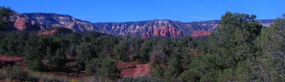
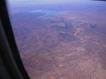
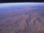
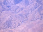
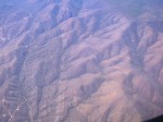
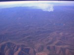
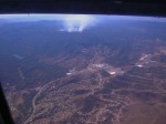
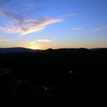
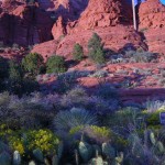
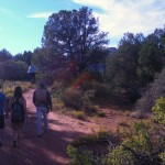
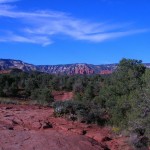
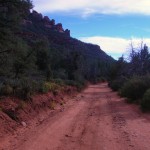
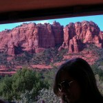
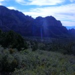
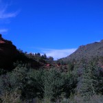
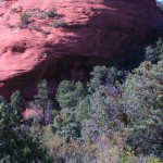
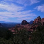
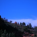
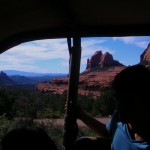
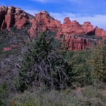
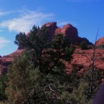
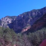
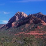
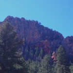
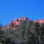
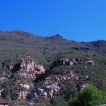
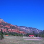
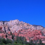
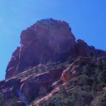
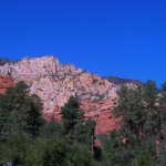
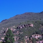
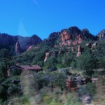
The scenery is terrific even at 70 mph but we decided to stop at a scenic view to get a closer look. There were a couple of other groups there including one that was talking to a woman who had a collection of Native American jewelry spread on a cloth on the ground and seemed to be selling it. We briefly glanced at her wares but since nothing particularly caught our eye, we moved on south toward Montezuma Castle National Monument.

Montezuma Castle has nothing to do with Montezuma and was never a castle. It was given that name by early Europeans who mistakenly believed it to be connected to him and it resembled the high stone structures of Europe. In reality, Montezuma Castle is a cliff dwelling structure built and occupied by the Sinagua people. It is located alongside the Beaver Creek which allowed them to farm the area.

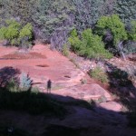
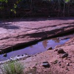
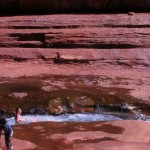
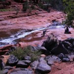
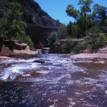
Although the Sinagua lived there for 300 years, they disappeared in the 1400s with no sure conclusion as to where they went or why. Hopi legend indicates the Sinagua may have joined them on the mesas to the northeast. Beaver Creek is fairly tame in our pictures but the dry bed spread for quite some distance and made it clear that flooding was not unheard of.

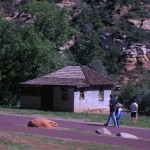
The monument operations and facilities are run by the National Park Service so our pass allowed us to enter with no charge. There is a small gift shop where we bought postcards and prickly pear jelly (prickly pear was recommended by cousin Brenda). The exit from Interstate 17 leads past a new casino soon to open.

Our next destination was Jerome, located high on top of Cleopatra Hill (5,200 feet) between Prescott and Flagstaff. Once known as the wickedest town in the west, Jerome was a copper mining camp, growing from a settlement of tents to a roaring mining community. Four disastrous fires destroyed large sections of the town during its early history.

Founded in 1876, Jerome was once the fourth largest city in the Arizona Territory. The population peaked at 15,000 in the 1920’s. The Depression of the 1930’s slowed the mining operation and the claim went to Phelps Dodge, who holds the claim today. World War II brought increased demand for copper, but after the war, demand slowed. Dependent on the copper market, Phelps Dodge Mine closed in 1953. The remaining 50 to 100 hardy souls promoted the town as a historic ghost town. In 1967 Jerome was designated a National Historic District by the federal government. Today Jerome is a thriving tourist and artist community with a population of about 450.

Jerome sits above what was the largest copper mine in Arizona and produced 3 million pounds of copper per month. Men and women from all over the world made their way to Arizona to find work and maybe a new way of life. Today the mines are silent, and Jerome has become the largest ghost town in America.

Jerome’s personality has changed dramatically in the past 30 years.  It includes a modicum of artists, craft people, musicians, writers, hermits, bed and breakfast owners, and fallen-down building landlords.

The Douglas Mansion has been an eye-catching landmark in Jerome since 1916, when James S. Douglas built it on the hill just above his Little Daisy Mine.

Douglas designed the house as a hotel for mining officials and investors as well as for his own family. It featured a wine cellar, billiard room, marble shower, steam heat, and, much ahead of its time, a central vacuum system. Douglas was most proud of the fact that the house was constructed of adobe bricks that were made on the site.

He also built the Little Daisy Hotel near the mine as a dormitory for the miners. The concrete structure still stands.

This former home is now a museum devoted to history of the Jerome area and the Douglas family and is open Thursday to Monday each week as a state park. Unfortunately, our visit occurred on Tuesday.

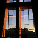
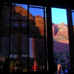
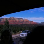
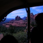
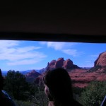
Our touring included a visit to the headshaft of the Audrey mine, separately open by the Jerome Historical Society.   After looking around here a bit, we headed back into town where we visited several galleries (where the view out the window was as impressive as some of the pieces they had for sale).

For lunch, we visited an English Kitchen barbecue where we were told told that only the brisket was available at this hour. While we enjoy barbecue, brisket isn’t usually our first choice but theirs was excellent. Glad we decided to go that way.

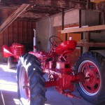
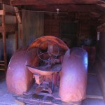
After lunch we walked along the next higher street past the firestation (where they had a beautifully restored 1928 Dodge firetruck tucked inside the garage) and then climbed the stairs again to the next higher street. After we got home, Keith’s nephew advised us that we should have checked out the haunted hotel which we never even saw. A little more wandering on the streets and we headed back to the car and back down the hill. (There was a really nice looking 1948 Ford F1 pickup with a for sale sign but we decided that someone back home would have issues if we sent another email saying “Dad bought a truck” while on vacation.)

The Firetruck

Before we got back to the interstate, we noted on the map that the Tuzigoot National Monument was nearby and with daylight left, we wanted to check it out as well. Betty had traveled to this area years before and remembered touring dwellings that you could walk through, not just view from a distance as we had done at Montezuma Castle earlier in the day. Perhaps Tuzigoot was that place?  The historic site name derives from Apache term for “crooked water” Pronunciations: TOO-zi-goot

Tuzigoot was a pueblo village constructed by the Sinaguas (the same people as at Montezuma Castle) and was one of 50 pueblo villages in the Verde Valley. Like Montezuma Castle, it had apparently been occupied from 1125 to 1425.

Being built on a pueblo, the structures were less vertical and more horizontal but served similar purposes with storage and preparation areas near dwelling sections. It was built with consideration for security from invaders with many entrances coming from the roof and a view of anyone who might approach. There were approximately 110 rooms. One factor that struck us as odd was that apparently children who died were buried within the confines of the dwellings while the elderly were buried outside of the village. The only explanatory bit we got of that was a desire to keep the spirit of the children with the family.

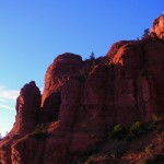
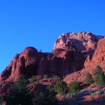
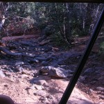
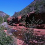
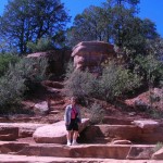
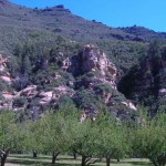
Evidence exists of farming efforts including redirection of the water for irrigation purposes. The climb was more gentle and the view of the surrounding valley was excellent. There were cautions to stay on the pathways to minimize damage. One particular sign which somehow escaped our camera advised visitors to stay on the path with a picture of a rattlesnake. We had to wonder if that meant that the rattlesnakes would stay off the path!

It is not known why the Sinagua left the area. Some clues that they joined the Hopi to the northeast exists but it is non-conclusive.

We left Tuzigoot and headed back to the interstate and towards Flagstaff. Just before dark, we stopped at a McDonald’s for a coffee break. We discovered that we only would get the senior discount on coffee if we specifically asked for it. We had been getting the discount earlier in our trip without mentioning it. While we appreciate it and can understand the desire to avoid offending those who didn’t wish to be identified as seniors, a little consistency would make it easier on us “old people”.

We returned to Flagstaff and once again went to CoCo’s for dinner but we went for something a bit more filling than the soup and salad of the night before. The food was excellent and we recommend it if you are in the area.

Visiting Relatives at Prescott

In preparing for our travels to Arizona, we contacted Keith’s cousin, Elaine and her family to see if we could get together sometime as we hadn’t seen each other in several years. After a conference, we decided that schedules and logistics made Prescott a good halfway point and with good food and entertainment for both the young and not-so-young kids.

We started our day as we had all of them since arriving in Arizona, by sleeping in and then having breakfast at the hotel. We got into the car and headed down the interstate for Prescott. By the way, the “locals” pronounce it PRES-cot with the emphasis on the first syllable.

The ride along and from the interstate was desert and rock formations and pretty typical for what we’d been seeing. As we neared town, the landscape changed to a more typical suburban landscape with strip malls and the standard chain stores with a Walgreens, RiteAid or CVS on virtually every corner.

Prescott central was built around a square with the courthouse in the center and the US Post Office and Federal Courthouse right across the street. Since we arrived before we were scheduled to meet Elaine and family, we spent a little time checking out the square and downtown. We found the timeline in the concrete sidewalk particularly interesting. It traced the history of Arizona for the past 200 or so years. The timeline only covered that part of Arizona’s history since that is the history of Arizona as territory and state. Quite a contrast to Maryland’s Lord Baltimore and the Calverts from the 17th century. I wonder if their fourth graders appreciate that there is less state history to be covered?

Erected in 1907, this statue is considered one of the finest equestrian sculptures in the U.S. and honors members of the First U.S. Volunteer Cavalry of Teddy Roosevelt’s Rough Riders who gathered at the plaza on May 4, 1898, before heading to San Antonio at the onset of the Spanish-American War.

Federal Courthouse and US Post Office

The courthouse has been rebuilt several times, most recently in 1916. The entire downtown area has a history of extensive fires and rebuilding. It’s listed on the American Register of Historic Places. Barry Goldwater (remember him?) announced his candidacy for President from the courthouse steps in 1964.

One of the more unusual statues depicts a cowboy and his horse with the cowboy lying on the ground with his bedroll.

The courthouse plaza is well-used during the midday by joggers and walkers as well as those folks just having a seat and watching the world go on by.

This gallery wins kudos from us in the category of Clever Names that Fit.

We were to meet at the Palace in Whiskey Row.

On a summer night in 1900, this block was totally destroyed by fire. The liquor was removed and carried across the street as they fought the fire. The story is that the firefighters dumped water on the fire then crossed the street to sample the liquids they’d saved. Within a few days of the fire, new construction was underway in brick and masonry. Most of the buildings on this block were constructed between the fall of 1900 and 1905.  Most of the color and stories of Prescott originated in this one block landmark that still celebrates that fact that it once hosted over 40 saloons.

We were waiting on the street when Elaine and family arrived. We directed them to the parking garage where we had parked and waited until they returned on foot. Along with Elaine were her husband Frank and their daughter Brenda with her four children, Erin, Eric, Ethan, and Emily. Brian and Kathy and their son were unable to join us this time. We had a nice lunch at the Palace where one of the descendants of Wyatt Earpp was walking around visiting. We didn’t get a picture with him though. I have a word or two for those of you who pause at the thought of four children aged 3 to 11 at lunch. Whatever Brenda is doing to raise those four, she is darned well doing right. The children were well-behaved and polite and watched out for each other. If these four are typical of today’s generation of young children, there is hope for the world. When we went walking around after lunch, the kids were where they belonged and said they’d be and considerate of each other and those around them.

After a leisurely lunch where we had a nice visit, we walked around downtown Prescott and checked out the specialty stores. Keith bought a hat appropriate for touring and cooler weather. Frank bought ice cream for all who wanted one.

Frank and Keith were sitting on a streetside bench outside the pet supply store when a lady and her dog walked by. Apparently the dog was a lap dog and Frank’s lap looked good as the dog just jumped right up and made herself at home. It was a surprise and was good for a smile from all. Eventually our visit time came to a close and it was time to say goodbye so we walked back to the cars (Frank and Elaine had just bought a new one and it had DVD players for the passengers. Nice VW van.)  We posed for a picture or two then headed back towards home and hotel.

Betty and Keith had a light dinner at CoCo’s in Flagstaff. It had been recommended by another airplane passenger on the way from Baltimore. The soup and sandwich were tasty and hit the spot. After that, we crossed the street back to the hotel for emails, postcards, showers and to bed.

Another good day!

Turquoise and Red Rocks

Sunday was to include a scenic detour, shopping, a water slide, some insight into a question that had been on my mind for quite a while and finished up the day with the full moon rising as we left a fascinating church structure. Still enjoying sleeping in a bit in the morning and breakfast just down the hall in the hotel lobby.

We swung by the Flagstaff WalMart to pick up a few supplies and then headed for Sedona. Since we were on vacation, it really wasn’t that big a deal when we missed our exit on the way, although the one we took looked familiar. We ended up winding through a residential area where the houses were set into the trees and looked like a combination of retirement cottages and weekend getaways. From a sheer directions standpoint, I think the Garmin could have gotten us back on the right track without quite as extensive a tour but it was a pleasant diversion to somewhere we hadn’t seen before.

Rt. 89A takes one through Oak Creek Canyon and delivers some scenic forest and water views.

Also along this stretch of 89A is a bridge across a gully known as Hoel’s Wash. Adjacent to Hoel’s Wash is Hoels Indian Shop and Rental Cabins.  The open sign was lit so we stopped and went in. The merchandise was all Indian-themed and Mr. Hoel was very knowledgeable about his merchandise and his artists. We probably spent the better part of an hour looking at EVERYTHING and we found the piece that was “it”. Mr. Hoel wrapped it up and we were once again on our way. (It was a ring by Greg Lewis but I have no pictures. It was a gift for our daughter.)

Next along the way is Slide Rock Park, a joint venture between the US Forest Service and Arizona State Parks. Originally the Pendley Homestead, the park is a 43-acre historic apple farm located in Oak Creek Canyon. Frank L. Pendley, having arrived in the canyon in 1907, formally acquired the land under the Homestead Act in 1910. Due to his pioneering innovation, he succeeded where others failed by establishing a unique irrigation system still in use by the park today. This allowed Pendley to plant his first apple orchard in 1912, beginning the pattern of agricultural development that has dominated the site since that time. Pendley also grew garden produce and kept some livestock. Historically significant because of early efforts at agriculture and the 1930’s addition of guest cottages (no longer used). Recreationally, its significance is tied to the natural water chute and slide.

There were a number of families and small groups enjoying the park during our visit. Only one family seemed to be actually in the water and on the slide though. The rest were enjoying the sun and the view as we were.

We spent some time enjoying the warm sunshine and then trekked back to our rented car to head into Sedona. The midday ride was a bit faster-paced than yesterday’s but not rushed at all. As we had scoped out the town somewhat, we quickly recognized that an on-street parking spot would work and lucked into finding one in the first block or so. We had some time and wandered about trying to find just the right spot for a light lunch.  The Canyon Breeze is relatively open in a food-court sort of way and we chose tacos. My experience with tacos had always been either the crunchy corn shells or a soft flour more like a burrito. These were flour but with some crunch. A bit lighter and a good flavor. They hit the spot quite well.  

After we finished lunch, we made our way a few doors down to await our scheduled Jeep tour ride.

There were four of us scheduled to make the ride and the other two were being retrieved by our driver down the road a ways. We watched as other groups met with their drivers and departed. And then other groups would come along and depart with their driver. It was about to become an issue worth inquiring about when a red Jeep TJ pulled in off the main road and our driver, who introduced himself as Mike (I think), came to collect us. It turns out we had added another pair to the mix and there would be 6 of us plus our guide. Our tour was with the Red Rock Western Jeep Tours. It appears there are at least 6 tour companies in town specializing in this type of tour. Most of them use Jeep Wranglers of the YJ or TJ variety for those of you who know the difference. What they all share is modifications that include a higher canopy and additional seating in the rear area. In theory, the one we rode could carry 7 passengers plus the driver but it would be snug. The added seats were smooth and narrow so you really needed to cinch down on the seatbelt to stay in place when the going got rough.

 Our tour started going through town on our way to the Red Rock District of the Coconino National Forest. We passed through several traffic circles (or as they call them in Maryland — traffic calming devices!) We passed the house formerly owned by one of my personal favorites, Lucille Ball. A domineering and impressive structure with covered balcony porches overlooking the red rock landscape and the town of Sedona. This took us out Schnebly Road, named for one of the founders of the town. According to guide (and I add the appropriate disclaimer as all tour guides seem to have a blurry line between historical accuracy and delivering a good line, a practice commonly known by storytellers everywhere as not letting the facts ruin a good story) the town was to be named after the nearby Oak Creek Canyon but instead was named after one of the Schnebly brothers’ wives. Her death and the death of their only child within a few years lead to the Schneblys abandoning the area. 
Schnebly Road is typical US Forest Service (USFS) roadway, hard packed dirt and rock with gravel (of varying sizes up to softball size) which climbed up to our viewpoint.  Our guide went out of his way to communicate the full feeling of the early stagecoach. (Translation: It was an uncomfortably rough ride, especially when combined with the seats described above.)  This part actually surprised me. As most of the readers here would know, I recreationally travel/drive a 4×4 truck just to reach some otherwise inaccessible spots. I have often wondered why more folks didn’t share the interest and I wonder if their experience is with tour companies like this whose primary objective is to get the tour group from one spot to another on a schedule rather than to enjoy the journey. For example, traversing the same route, we would have lowered air pressure in tires to make it easier to negotiate the rocks and to make the ride more comfortable. Additionally we would have slowed down well below the 25 mph speed limit. In doing so, we would also have easily taken 6-8 hours to see the same sights that we were shown in 4 hours.


Old Bear Wallow
Climb this early stagecoach route along Schnebly Hill Road through Bear Wallow Canyon just below the Mogollon Rim to enjoy STUNNING VIEWS of Sedona and Oak Creek Canyon 2000 Feet below. Step onto Munds Wagon or Huckaby Trail and hear stories of Sedona’s early pioneer days. The 2-hour tour features a 4×4 excursion along the scenic volcanic Mogollon Rim Trail among the world’s largest continuous stand of Ponderosa Pines.
Canyons & Cowboys
Your Red Rock Western Guide takes you through a scenic wonderland surrounded by seven majestic canyons into historic Dry Creek Basin. Relive early cowboy days with tales of MURDER AND MOONSHINE at the old “Van Derin” cabin, a focal point of your tour, permitted ONLY to select jeep tour companies.
The murder at the Van Derin cabin was never solved although it was suspected that robbery was the motive. Mike, being a good storyteller made it an engaging story, of course. The difficult-to-reach cabin could be much easier to reach if one were to approach from the opposite direction. In the middle of the last decade, that property was developed as an expensive country club with houses on the golf course. The economic bust of the last few years stopped that development after only a couple of memberships and houses were sold.
Final thoughts on the Jeep Tour: They took us to places we would not have gone nor found in the rental car. We got to see some of the surrounding area close up and heard local color stories that we would not have otherwise heard. I’m glad we went and it was money well-spent. I recommend that you take one at least once but that you keep in mind that this is not necessarily what your wacky friends who play with their 4x4s do when they go riding on the weekend.
One more location we got to visit was the Chapel of the Holy Cross.
Built on a twin pinnacled spur about 250 feet high, jutting out of a thousand foot red rock wall, “solid as the Rock of Peter” the building of the Chapel was completed in April 1956. Just the physical construction was a physical miracle, overcoming difficult conditions to construct this chapel.
As before with the Watchtower, we arrived just before closing time for the day and it was located high up on the hill with a long winding ramp to the front doors. But the view was worth it! The wall behind the altar is made of glass with a floor to (very high) ceiling cross. The wall at the opposite end is also largely glass with the exception of two floor to ceiling doors. Around the perimeter the 14 Stations of the Cross were identified by Roman numerals formed from what appeared to be iron railroad spikes. Very dramatic! The pews were backless wooden benches and a woven tapestry hung on each of the side walls.  We’ve included a few pictures and invite you to visit the website (link above).
We finished the day with a last pass through the streets of Sedona and found a nice bar and grill, The Open Range. Looked like they enjoyed a brisk business and a nice view but since we were there after dark, the view was invisible. After finishing our dinner, we returned to Flagstaff via the Interstate and called it a night.

Unexpected Road Like a Malaria Germ and into Sedona

When we told friends that we would be staying in Flagstaff, several recommended that we include Sedona in our plans. When we mentioned we were including Sedona in our plans, the recommendation was to avoid the Interstate and make sure we took the scenic Hwy 89A. When we told the GPS we wanted to get from Flagstaff to Sedona, our plotted route sent us along scenic 89A.

We left Williams and headed back towards Flagstaff. We planned to go on one of the Jeep tours into the Red Rock country around Sedona on Sunday so decided to drive down and check out the area a little bit rather than just booking over the phone or internet.

The roadway started out as a two lane paved road moving through rural area actually passing by Fort Tuthill, a recreational campground associated with Luke AFB.

Then the road started to get a bit more scenic and um, interesting.

The speed limit decreased and the yellow road warning signs showed what appeared to be more correctly identified as u-turns.  If you drive in the mountains much, you are familiar with switchbacks. Although we didn’t get a picture of it, the path on our GPS map screen looked all squiggly, doubling back on itself and reminded of the line from the CW McCall song, Wolf Creek Pass.

Well, from there on down it just wasn’t real purdy: it was hairpin county and switchback city. One of ’em looked like a can full’a worms; another one looked like malaria germs. Right in the middle of the whole damn show was a real nice tunnel, now wouldn’t you know?  (Bill Fries, Chip Davis)

-CW McCall “Wolf Creek Pass”

The ride took us alongside the Oak Creek. As local schools were beginning a one or two week fall break, the several campgrounds along the creek and in the canyon were full. Traffic was not especially heavy although there were enough cars around to require close attention but we moved along at a reasonable rate.

Along the creek, there were a mixture of private residences, small commercial establishments (shops, B&Bs, eateries) and USFS campgrounds.

As we passed some of the more popular businesses like an outside ice cream stand, traffic got a bit heavier and slowed down with more traffic in both directions. About a mile or so outside of Sedona, it was bumper-to-bumper and essentially stopped. It was a pace that would rival the Beltway and 95 North interchange on a Friday afternoon…but on a much smaller scale that didn’t last as long. As we crept along we enjoyed the scenery and the deep red color of the rocks that the area is known for.

As we cruised (crept?) into Sedona, the landscape went from forest to citystreet in a very short stretch of 500-1000 feet. This main street was wide and pedestrian friendly with lots of on-street parking and numerous signs to off street public parking.  Wide sidewalks separated the street from one and two story storefronts. The storefronts were an eclectic mix of touristy shops, restaurants, tour operators, artistic galleries and mixed retail. It was almost as much fun to walk along remembering pre-Mall Main St as it was to investigate the shops and watch the people along the way.

We planned to make arrangements for a Jeep tour of the surrounding area the next day and wanted to look at some turquoise jewelry. We had done some research on the internet and there were some shops that had looked interesting but the jewelry wasn’t quite what we seeking. We did run into some very helpful and some very persistent shopkeepers but it just wasn’t “it”. So we bought no jewelry that day.

We did however make arrangements for our Jeep tour. We had wanted to take the Soldiers Pass tour but it was full up (and at 8:00 am) so we booked a combined tour for tomorrow afternoon which combined Old Bear Wallow and the Cowboys and Canyons tour.

It had gotten dark and it was time for dinner. There were plenty of restaurants to choose from and varied in their fare from typical pub fare, various barbeques, Thai, vegetarian and southwestern. We chose the Oaxaca Restaurant for some traditional southwestern/Mexican fare which was quite tasty. The margaritas were pretty good as well.

After dinner, we made our way back to the car and chose to make our way back to the hotel via the interstate rather than run the gauntlet of campgrounds along Oak Creek Canyon. After preparing a couple of postcards, we turned in for the night.

Up in the Air and a Nod to Route 66

Saturday morning and sleeping late still works for us. Breakfast bar fare and then off for the day. We followed the I40 route to Williams and then turned north towards Tusayan and our helicopter ride. A scenic and uncrowded drive which surprised us a bit as we figured Saturday would bring a few more fellow traveler/tourists out.

Each helicopter can carry up to 7 passengers in addition to the pilot. While you’re checking in (or making the reservation), you stand on a square in the floor which is a subtly disguised scale as each chopper also has a weight limit. They use the weight somewhat to distribute passengers within the chopper. So Betty was given the option of riding upfront while Keith was relegated to the back. The other passengers were two women who were together and two men who were traveling on their (probably) rented Harleys.

As we prepared to board we met our pilot, Brice. He asked the general questions like “Where are you from?” It turns out he has family in Frostburg Maryland. I’m guessing there aren’t a lot of jobs for helicopter pilots in Maryland unless one is actively in the military. Then each group of two got a picture taken with Brice in front of the chopper (which would be printed and waiting for you to buy as we returned from our flight).

Brice then explained to all of us how the seatbelts worked and explained that we needed to attach our inflatable life jackets to our belts since we would be flying over water. We have since decided that IF the helicopter was to go down and IF Brice was able to actually put it in the water and IF we survived, we should definitely consider a reward for him because the water sure was a very small percentage of the available area. But then, he never did tell us how to inflate them. On to our flight…

We loaded up. Four in the back (Betty, Keith and the two guys), the two women plus pilot in front. We wore earphones with a sound-activated mike attached.

The airspace over the Grand Canyon is tightly controlled to enable the helicopters to provide the tours while maintaining empty and quiet airspace at most of the popular viewing areas. So rather than taking the most direct route, we flew over the Kaibab National Forest for quite a few miles to get past the tourists at the Mather Point and flew into the Canyon just west of the Watchtower. The same thrill that welled up when we walked to the Grand Canyon was there again as we heard Brice announce “welcome to the Grand Canyon” and saw it from this perspective.

Words don’t it justice and the pictures can’t accurately convey just how massive and Grand it really is but we’ll turn it over to the pictures to tell the story.


We passed over the confluence of the Little Colorado River and the Colorado River. The Colorado was a muddy brown from all the runoff of recent rains and snows upriver. The Little Colorado River, which drains the Painted Desert, is a vibrant aquamarine color. It was amazing how there seemed to be no mixing, the Little Colorado was aqua and the Colorado was brown but it was a distinct line where the two came together.

Our flight path included a pass over the North Rim where there was snow on the ground in many places. Brice told us of a controlled burn in the 80s that targeted 2500 acres that got out of control and burned some 14,000 plus acres. You could still see signs of it. Too soon our flight ended and we came back in over the Grand Canyon airport and a return to the terminal where we were given the opportunity to purchase several items including the picture they had taken before takeoff as well as a DVD of the helicopter’s in-flight camera with audio provided courtesy of our digital microphones. Alas, there was a malfunction in our recording but we bought the picture and some very special red plastic helicopter pens to share with family and friends.

We had seen the sign for the Grand Canyon Post Office in Tusayan the day before and decided to stop by there to mail some postcards before departing the area. The Post Office is in the back left corner of the General Store and Trading Post and was closed because it was Saturday, but the General Store was open!

We next headed south on 64 to Williams. Williams is at the intersection of I-40 and 64. It is also the southern terminus of the Grand Canyon railway. Before the interstates came through, it was at the crossroads of the famous Route 66. Today, the train, an interstate exit and the tourist trade seem to be its primary sources of support. Of course, gasoline prices at 50 cents more than we saw anywhere else may help the local economy as well.

After a refill on the coffee cups, we bid our farewell to Williams and headed east on I40 back towards Flagstaff.

As it was still relatively early in the afternoon, we mapped our path to Sedona following recommendations from the ExpeditionPortal and the Garmin. But that’s another entry.


Pictures Can’t Do It Justice or An Incredible Hole in the Ground

Despite the time change, we weren’t up at the crack of dawn on Friday, October 7. We rolled out after a good night’s sleep and took advantage of the included Comfort Inn breakfast bar, looked at the maps and decided we were off to the Grand Canyon today. As we went outside, we saw that the occasional snowflake we had seen on Thursday night had turned into a definite “trace” with white covering the elevated surfaces. (That night’s TV weather report confirmed they had gotten a record amount of snow since the previous record was “none”.)  We got into the Avenger, plugged in the GPS and headed out.

We plugged in a route to Tusayan, AZ, the location of the airport where the helicopter tours were based with thoughts of taking the flight today for an overview and then exploring on the ground based on what we saw. The GPS route was a bit different than the one we had drawn on the map. The GPS sent us west on I40 towards Williams where we would head north on State Rt. 64. First surprise came on the Interstate where we discovered the speed limit was 75 mph. While the DC Beltway traffic sometimes eggs you on to those speeds to avoid being run over, in the wide open spaces this seemed to be a comfortable speed. I was pleased by how well the Avenger held those speeds using the cruise control without a lot of shifting. Knowing the car was available with both a 4 cylinder and a 6 cylinder, I made a mental note to check which ours had later.

The I40 route was sparsely traveled at that time. While we saw other vehicles, they were well spaced and traffic was not an issue. An occasional glance at the rearview mirrors, we saw the San Francisco mountain peaks with their white dusting of snow and realized the view of the moment might actually be behind us.

Along Rt. 64

When we got to Williams (for the tiny town, there were several interstate exits), we turned to head north on 64. Rt. 64 is a relatively straight two lane highway passing through a couple of small settlements on its way to the gates into the Grand Canyon National Park. It rises and falls a bit and slows as it passes the intersections.

We arrived in Tusayan at the Grand Canyon airport. Internet research led us to Maverick Helicopters to arrange for their Canyon Spirit Tour. We had investigated booking in advance but hadn’t really been comfortable with the cancellation policy, i.e., it wasn’t clear what would happen if they decided to cancel for weather or other reasons. When we arrived, we found they had only single seats available on Friday’s flight but we made reservations for Saturday to both be on the same chopper at 12:30. Flexible plans are great so we decided to head into the Canyon at ground level after a quick stop at Tusayan McDonald’s for coffee.

Line at the gate

As we pulled up to the gate, there were several lanes open, including one marked for those with passes which had no line. We weren’t sure at the time that we qualified for the pass lane with our Senior National Access pass but we did. The going rate into the park is $25.00 per car load. Our Senior pass was obtained a couple of years ago for $10 at Olympia National Park and has proven to be a real bargain, allowing up to 4 people in on the pass where individual admission is charged, a car load where admission is charged per car and even offers discounted campground fees at National Monument, National Forest and National Park campgrounds. If you qualify, buy one. If you don’t yet qualify, go for the annual pass at $80. See http://www.nps.gov/findapark/passes.htm

After we passed through the gate, we drove around to the parking area at Mather Point (Elev. 7120 ft.) As we walked from the car to the viewing point, I was literally speechless!

Breathtaking!

I had seen pictures, I had heard from others but nothing captured the scale and beauty. As I posted on Facebook that evening, “Wow. Just wow.”  With that in mind, I’m going to let the pictures say it. You can get a larger picture by clicking on the smaller version here.

Rock Squirrel identified by white spots on his back. This little guy was checking to see who would ignore the "Do not feed the wildlife" sign.

Storm over on the North Rim

Next was lunch at Market Plaza. The deli had a selection of soups and sandwiches. While all looked tempting, the marble rye bread drug us both towards some type of sandwich and they were yummy. The store also had basic supplies for campers and hikers as well as souvenirs and such. There was pretty stuff but nothing more than a postcard or two really captured our fancy.

After lunch, it was back to the car for a short ride over to the Hotels on the Rim. Although we drove, there was a free shuttle within the park which would certainly come in handy during times of higher volume.  The views were again breathtaking and are shown (as well as can be) in the photos. Verkamp’s Visitor Center had some displays of the history of the park as a National Park and the obligatory souvenir shop.

Hopi House

Several historical businesses and structures are in this area of the Park. One of the more distinctive-appearing is the Hopi House, originally constructed to provide living quarters and a stage/backdrop  for the Hopi people who provided entertainment and educational demonstrations for the tourists at the 1930’s era El Tovar Lodge. Mary Colter was the architect responsible for the Hopi House, Lookout Studio, Bright Angel Lodge and The Watchtower (which we see later in the day). There are several lodges located here including El Tovar Lodge, Cokachina Lodge, Thunderbird Lodge  and Bright Angel Lodge which function as lodging for guests of the Park but have long waiting lists for reservations.

El Tovar Lodge

Also located along the rim here are two studios Lookout Studio and Kolb Studio, both built on the edge of the rim to blend into the canyon face. The Bright Angel Trailhead is also located here but we were not up for the hike this day although the temperatures were only in the 70s and not the 100+ temps seen by hikers in the summer months.

Looking down to the lower observation platform at Lookout Studio built into the rim


In the very center of this picture, down in the canyon are some unidentified buildings. We haven’t been able to discover the story behind them.

This is also the area where the famous mule rides down into and back up out of the canyon originate. We also declined the opportunity to participate in this activity.

  • Mule ride staging area

The Mule Pens

Checking the map, we saw Desert View Drive would take us around the South Rim and to the East Entrance to the park. A quick comparison showed it was approximately the same distance as returning the way we had come and gave us some different perspectives.

As we moved along, we came to realize that this would also take us past another Mary Colter structure, The Watchtower. We got our distances a bit wrong however and we came to the conclusion that we wouldn’t make it to the Watchtower in time to climb it before closing time of 6:00. Oh well, we’re on vacation where schedules are flexible. We’ll drive on and look at it from the outside anyway. As we approached the parking lot, the sign showed a 7:00 pm closing, not 6:00 as the brochure had indicated. We had time to make it but it would be cutting it close so let’s climb the tower first and then look around outside.

The Watchtower is not intended as a reproduction or restoration of a particular structure but was constructed in 1932 for tourists to view and provide a rest stop. The structure does remind of towers found in the southwest which were generally used as storage silos.

Access is via an internal circular, narrow and uneven stairway. It was a bit of a stretch for us to hurry up three flights of stirs to the top before closing time to enjoy the view. This rushing uphill before closing would repeat itself in the days to come.

The Watchtower built on the rim

After our run up and back down the Watchtower, we left the East Entrance of the Park and headed east to Cameron and south on US 89. Dinner was after we got to Flagstaff in the IHOP near our hotel.

Tomorrow, we see the Canyon from the air!

Maryland to Arizona!

Welcome. This is the first post to this blog of our travels — even though I anticipate there will be posts with earlier dates as we consolidate our other posts and pictures in one spot.

So anyway, this is the beginning of our trip to see the Grand Canyon. All the research was done via internet, friends’ recommendations and especially the good folks over at ExpeditionPortal.com.

Through the assistance of online travel sites, we booked two seats on USAirways from BWI to Flagstaff. We procured six nights’ lodging at the Comfort Inn and rented a car from Alamo (a 2011 Dodge Avenger).

At BWI, an attempt to send a text message lead to the discovery that my cellphone (later diagnosed as a defective SIM card) had died. Our choice of aisle seating was not available so we both got a center seat, one on each side of the plane. On the bright side, we both got separate seatmates who contributed to the recommendations of what to see and do on the trip.

Our one firm goal was to see the Grand Canyon as Keith never had and Betty had not in a number of years.

Keith suffers (literally) from most air travel as the available space continues to contract. Theoretically, I supposed I should be able to bend my legs differently but the knee is the only joint between my ankle and hip. A great destination generally cures the problems soon enough.

Our flight from Baltimore to Phoenix was onboard an Airbus 319, standard 3 seats on each side. How anyone who has flown on one and still marvel at me in a submarine is a wonder. Submarines are MUCH roomier and more comfortable.

The flight from Phoenix to Flagstaff was a Havilland-8. Wings above the fuselage, 2 seats on either side of the aisle, total capacity about 40 and a big prop on each side. We walked across the tarmac (when’s the last time you did that?!) and up the steps which folded up into the plane so you could still see the steps inside. The props spun up and we sat and sat. Then the props spun to a stop and the stairs folded back to the ground. From inside the airport, two men came on board and asked for two passengers who de-planed and they closed the ladder and we were off again. The flight attendant explained that she had never heard of this happening but the two passengers had some discrepancy in the check against the “do not fly” list. It was apparently an issue with their birthdates matching something although they had flown to get to the airport on another USAirways flight. Does this make you feel secure?

Although it was dark, we would later discover that the wings over configuration made for great sight seeing. Relatively comfortable seating, too.

We arrived at our hotel around midnight (eastern). 9:00 local and asked for directions to an open eatery. The deskclerk suggested the local Denny’s and asked us to pick her up an order of fries to go. We walked to Denny’s, had dinner and brought back the fries, then headed for bedtime.

Picture is at Flagstaff Airport of Havilland-8