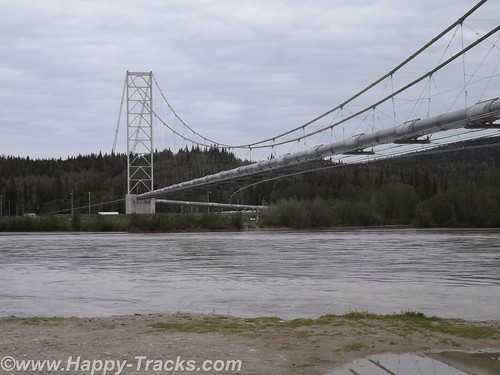
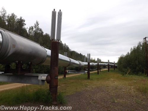
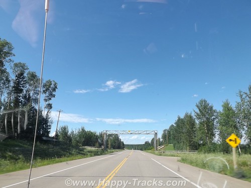
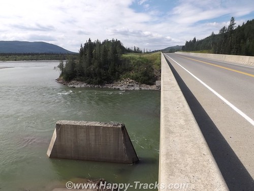
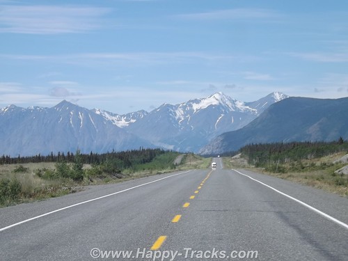
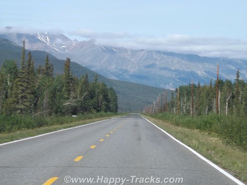
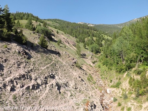
Continuing north from Delta Junction toward Fairbanks, we crossed the Tanana River and got our first glimpse of the Alaskan Oil Pipeline where it crossed the river near the road.
The pipeline is 48 inches in diameter, 800 miles long and crosses three mountain ranges and over 500 rivers and streams.
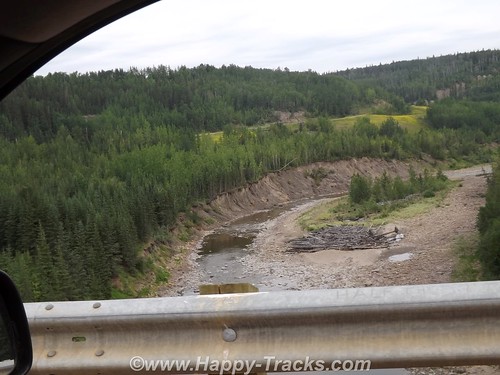
Most of the major river crossings for the pipeline have the pipeline buried under the river bottom but the power of the current and the silt here create major scouring of the river bottom. The scouring could eventually expose the buried pipeline and lead to damage. The pipeline is built to withstand an earthquake up to 7.5 and cold down to 60 below. The pipeline includes zigzags in its course to allow for some shock absorption as well as thermal expansion. The supports are built to transfer heat away and thus prevent melting of the frozen ground beneath the towers.
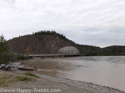
The bridge over the Tanana is the second longest along the pipeline at 1200 feet. This crossing over the Tanana River is the first place you see the pipeline in the ride up the AlCan towards Fairbanks.
Special consideration was given to the wildlife along the pipeline’s course to minimize the impact of the pipeline. Those considerations include the tower designs as well as lengths where the pipeline remains below ground to allow for uninterrupted crossings by the wildlife.
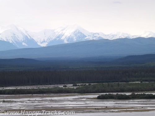
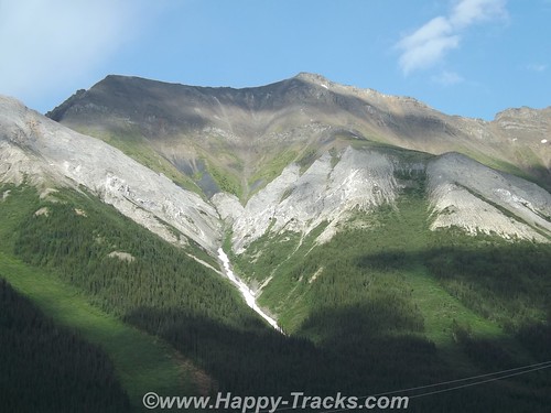
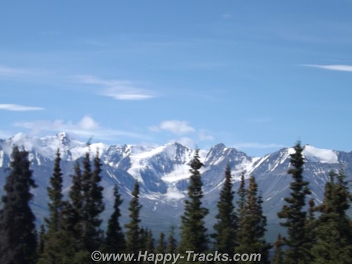
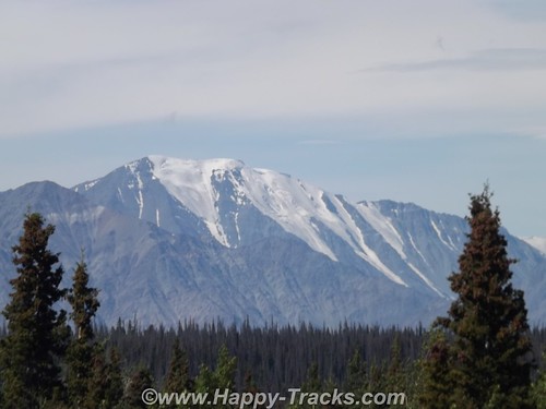
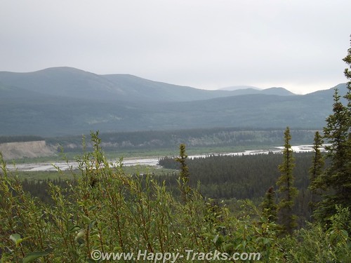
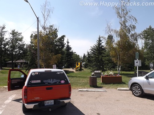
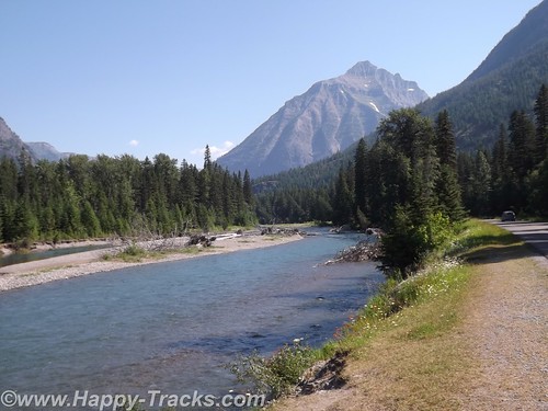
The scenery heading into Fairbanks includes mountains in the distance but more consistent snow cover than we’d seen earlier. Our first stop in Fairbanks was another viewing point of the pipeline with an informational display. You can also see where the pipeline goes underground here.
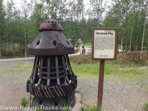
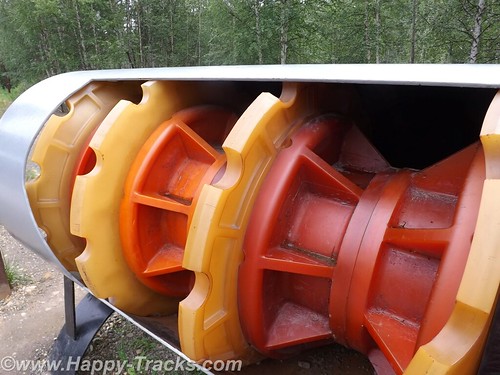
They regularly measure the flow through the pipeline to determine ways they can improve efficiency. One of the steps they employ is to periodically clean the pipes of accumulated sludge using a pipeline inspection gauges or “pig”. A pig is essentially a phenolic plug that travels along and cleans the insides of the pipe.
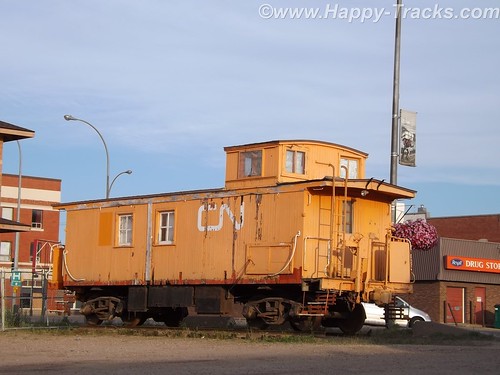
Fairbanks grew out of a trading post on the Chena River established around 1901 with the landing of the river boat Lavalle Young. The discovery of gold in the hills north of town in 1902 assured its success. By 1907, railroads had largely replaced the riverboats.
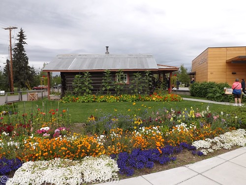
We went into Fairbanks itself with the first stop at the Visitors Center on the banks of the Chena River. On the grounds there is an original cabin from early Fairbanks (pre-1910), still in its original location. The cabin is small, in part to minimize the heating needs while still providing adequate living space for a kitchen, sitting area and sleeping space. It is worth noting that by 1910, Fairbanks had limited electric and telephone service in place.

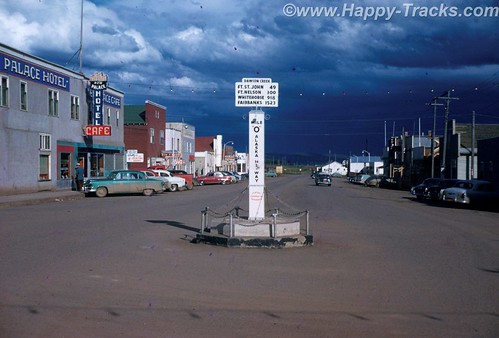
In downtown Fairbanks, there is another marker for the Alaska Highway at 1523 miles. Since much of the military traffic on the highway during WWII was destined for the military bases there, some measure the highway from Dawson Creek to Fairbanks.
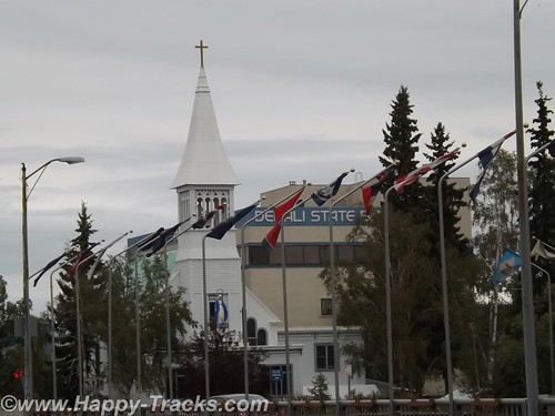
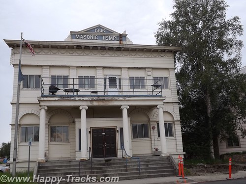
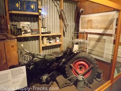
Several historic buildings remain in downtown, including the Oddfellows Hall, formerly a bath house and health clinic and the Masonic Lodge nearby. Located in the old Oddfellows Hall building is the Alaska Mining Hall of Fame Foundation museum. Admission is by donation. The museum is still getting itself organized but holds memorabilia of the mining industry including some very clear explanations of the different methods of mining used. There is also a gift shop and display devoted to the Iditarod dog sled race.
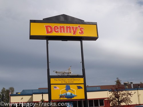
We checked into our motel and grabbed dinner at the Denny’s located next door. This particular Denny’s has the distinction of being the northernmost Denny’s in the world!
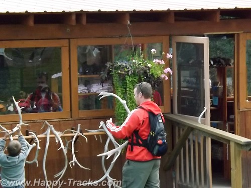
The University of Alaska Fairbanks (UAF) campus was near our lodgings. Just a couple of miles further down the road is the Large Animal Research Station (LARS) specializing in high latitude biology, particularly muskox and caribou. LARS is open for tours and we availed ourselves.
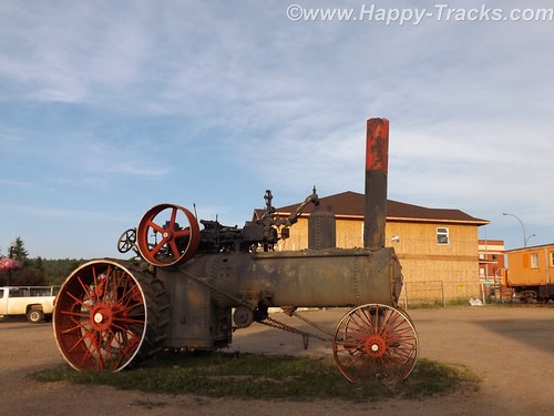
The LARS tours are run by University personnel who are specialists in the animals. They also have a small gift shop, a picnic area and some vintage farm equipment. We watched a family whose children were absolutely fascinated with the antler collection and the old tractors while we waited for our tour to begin.
The day we were there, they also had mosquitoes. Betty has always been something of a magnet for mosquitoes which has detracted from the enjoyment of many outside activities. Today we tried the Off! Clip-on Fan and it worked. While we stood talking to another couple who were also touring (they were in a big 5th wheel camper), you could see the difference in the swatting. It was noticeable enough the lady asked what Betty was using. The Off! fan is available in a drug and discount stores including Home Depot and we recommend it! They last about 12 hours of use but seal when you turn them off so you can use it for up to two weeks after initially opening the refill.
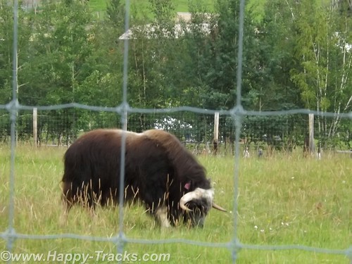
Muskox have horns that loop down similar to a water buffalo although not as long. Muskox also have wool which they shed (no need for shearing) that is among the softest stuff in the world. A hat or scarf made of quivit will make cashmere seem coarse. Unlike many wools, quivit does not shrink. We would visit a shop in Anchorage where handmade items were available for shopping.
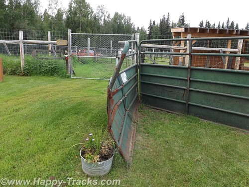
Muskox have very thick skulls and generally will defend their territory or herd by butting heads. LARS has a gate that shows just how much force is available through that thick skull. In the wild, muskox will defend the herd by backing into a circle, heads out, with the youngsters in the circle. A tightly packed circle of muskox is a formidable force.
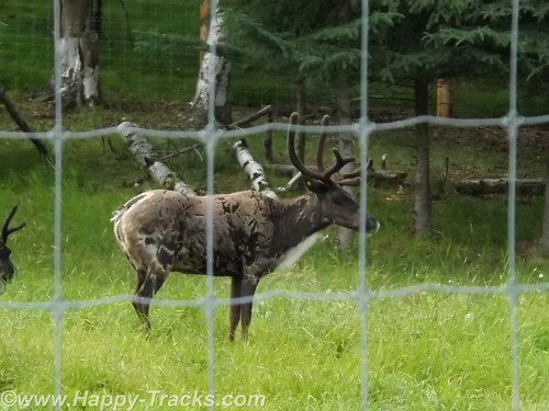
LARS also has caribou which are very similar to reindeer. In fact, according to the guide, the principle difference in a caribou and a reindeer is that reindeer are domesticated. She actually raised the question whether their caribou still qualified since they were penned.
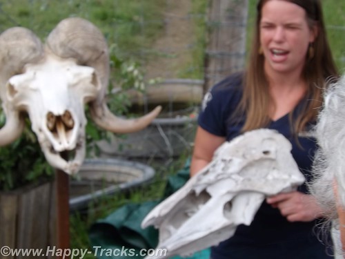
We also learned the difference in horns and antlers (which you may have already known). Antlers grow each year and are shed while horns are permanent.
The farm is staffed year round to care for the animals and the property. On site, there are several buildings ranging from the old barn to a modern quarters for the caretakers.
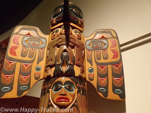
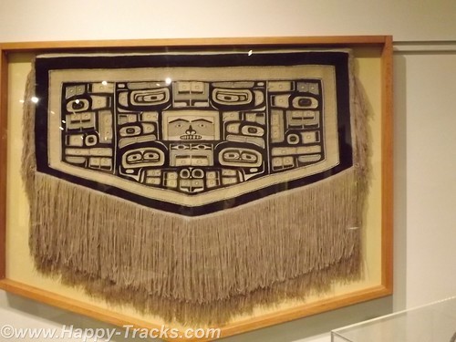
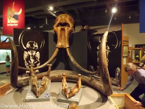
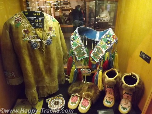
Next we went to visit the main campus of UAF and the Museum of the North. The exterior of the building resembles the overlapping plates of the ground. It shares some similarity to the iconic shape of the Sidney Opera House.
The Museum displays are divided geographically and to coincide with the four main groups of Native Alaskans. As we walked into the main exhibit room, we saw the only grizzly (brown) bear we would see on the trip.
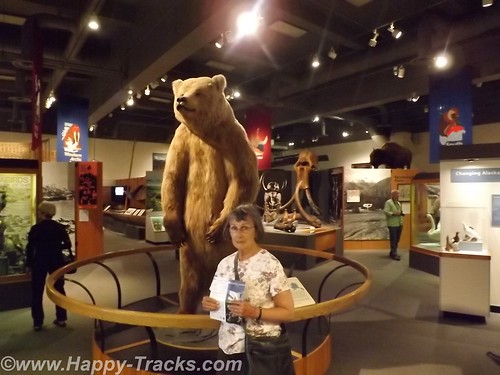
There were exhibits of archaeological significance like the fossilized mammoth and of cultural significance like the totems and clothing. There were also exhibits of the historical events such as the gold rush and the oil exploration.
There was also an exhibit dedicated to the Japanese occupation of the Aleutians during WWII and the relocation/interment of those persons of Japanese ancestry during that period.
The museum had a gift shop with a wide array of items from kids plastic toys to hand-crafted display items. As befitting a museum, it included books and some household and kitchen goods with thematic decorations.
On the grounds, was the restoration of the Russian blockhouse which dates back to the Russian ownership of the territory. The blockhouse was part of the fort when the Russians were primarily trapping for pelts.
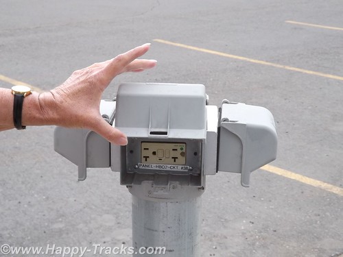
One other item we noticed was the electrical outlets in the parking area. I suppose when the winter temperatures plummet, plugging your car’s block or battery heaters may be the only hope you have of restarting the car for the trip home.
We headed back to the hotel for the night. The next morning we shared a conversation with one of the many motorcyclists we had encountered on our trip. This particular gentleman (around our age) was hanging around the hotel because he had fallen off his bike and had a spine compression injury which left him feeling unsafe and uncomfortable making the trip home on his bike. He had checked into the costs of shipping his bike back to Seattle and it was to be about $500. One of the others in his group had suffered some sort of cardiovascular attack and he was waiting to find his prognosis and plans. Perhaps they could share the cost of the freight back home.
You can see all of the pictures from this leg of the trip here.
We invite you to continue along with us and hope you enjoy the account!
Monthly Archives: September 2014
Summer 2014: Alaska via the AlCan
After breakfast, we visited the tourist center in Dawson Creek in the Northern Alberta Railway museum which is part of the old train station. In addition to the usual fare of souvenirs, brochures and information, of particular value was a listing of the various facilities along the Alaska Highway showing lodging, restaurants and fuel locations all on one sheet of paper.
We used an annual publication called the Milepost. This guide has been published annually since 1949 and is considered the definitive guide to the AlCan. The guide, in addition to advertising content, contains a milepost by milepost guide book for the major highways throughout this part of Canada and for Alaska. Its layout is logical but is sometimes difficult to follow along as you are sometimes required to read from bottom to top to match your travels. The single page sheet from the visitor center at Dawson Creek allowed a quick glance to determine the information that the Milepost would provide over several pages, once you found them.
We had noticed signs outside this and other buildings that indicated “Muster Area” and asked what that meant. Unlike most places in the States, its fairly common in Canada to identify a spot for building occupants to muster (meet) in the event they have been evacuated from the building. I remember our work offices had designated places for the workers to meet in case of evacuation but it was a place you were supposed to know rather than being marked. The designated area seems like it could be useful in quickly determining whether everyone had made it safely out.
We were finally on our way on the Alaska Highway.
About 20 miles on, we found a marked section of the old highway. We turned to go that way and it was a bit more rustic. 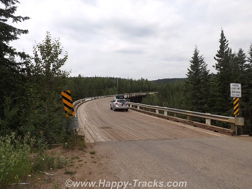
It happened this section included the old Kiskatinaw Curved Bridge. The original bridge was built of wooden timber and this was the last timber bridge still in use on the old highway. It also is unusual in that it is curved about 9* in its 540 ft. length. Because of its timber construction it is limited in capacity to 25 tons which meant that heavy trucks were forced to ford the river rather than cross the bridge.
With the expanding oil and gas industry, this became more of an issue and a re-routed road and new bridge were built in 1978.
Further along we crossed the Peace River Bridge which is the longest water span on the Alaska Highway. It opened in 1958 and replaces the Peace River Suspension Bridge which collapsed dramatically in 1957. If you want to more about the collapse, see here. The “new” bridge is metal-decked.
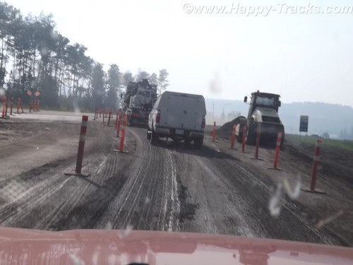
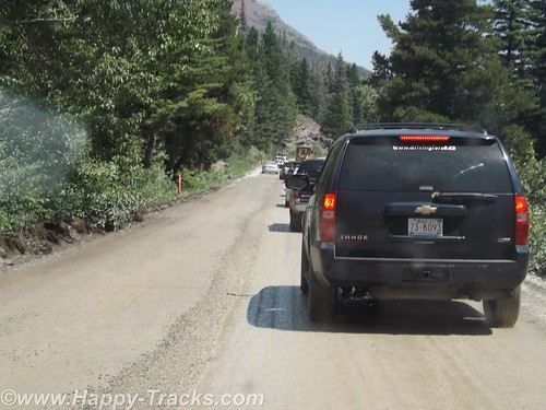
In general, the road is in good repair but there are sections where that is not the case. Summer is also construction season. Any significant repairs are done during the summer rather than during the cold season when frozen ground and frigid air temperatures prevent effective repairs.
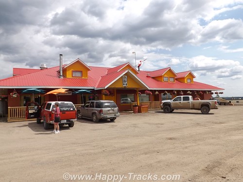
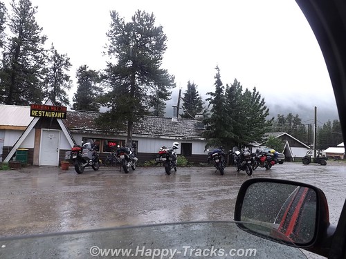
We had lunch at the Pink Inn which has been there for the last 50 years. It is open 24 hours a day and includes fuel, lodging and a restaurant. The restaurant has a cook on duty through the evening meal. After that, there are sandwiches and some serve yourself type foods through the night. Most of the menu was burgers and steaks type meals. We discovered that menus outside the cities tended towards hearty meals and large portions. This meets the tastes of most of the clientele — truck drivers, workers in the oil and gas industry or lumbering. It also offsets the relatively high prices which comes, in part, from the high transportation costs.
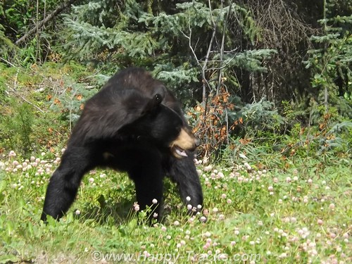
Shortly after the lunch, we saw our first black bear alongside the road.
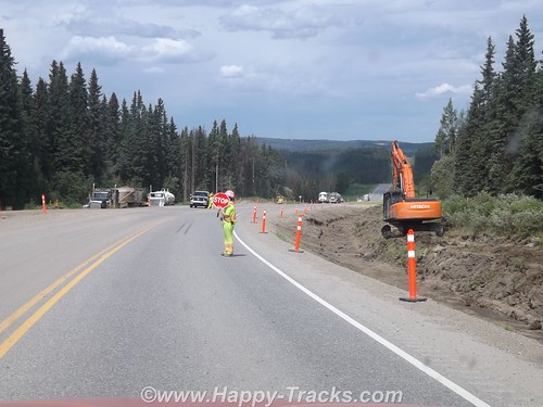
Further along, we stopped to allow clearing of some fallen rocks.
We passed by a natural gas processing facility. As part of the natural gas production, sulfur is removed and recovered. This processing plant pipes the sulfur across the road but due to the harsh environment and constant movement of the ground in a freeze/thaw cycle the sulfur pipe runs above the road.
The wild countryside just rolled off mile after mile of gorgeous scenery in the form of forests and mountaintop.
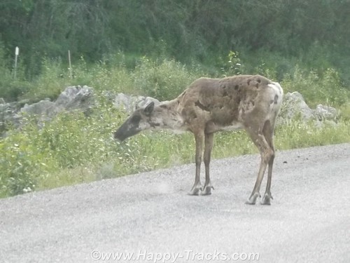
We saw a young elk on the roadway which stayed around for several pictures but he wasn’t looking his best for his photographic debut as his coat was moulting.
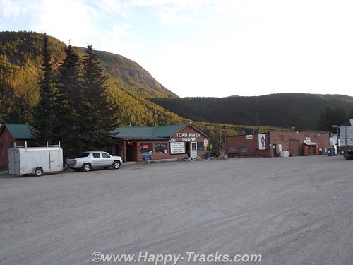
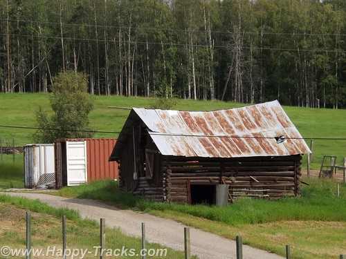
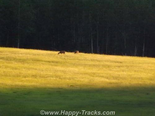
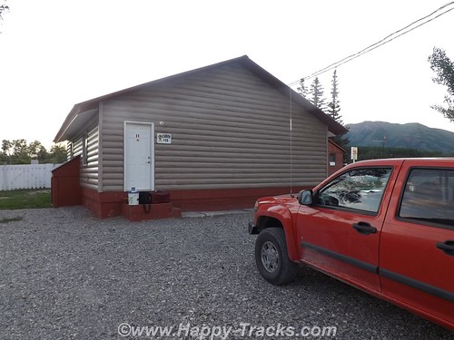
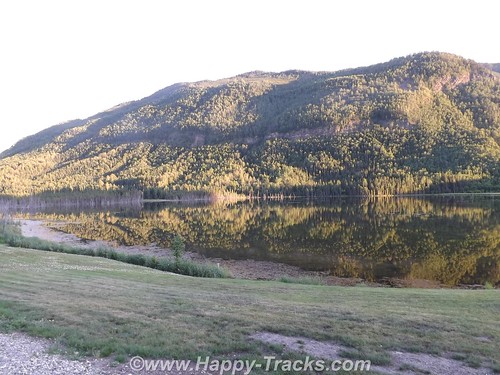
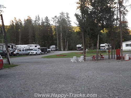
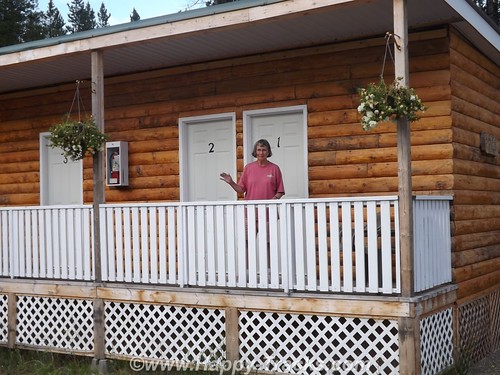
Our first overnight stay was at the Toad River Lodge at MP 422. We had “only” traveled 405 miles today along the highway but the historic mileposts are still used even though rerouting has shaved some miles off the route. Like most of these roadhouses, Toad River Lodge had fuel, a restaurant, lodging and a campground. There was also an airstrip. The front desk is not manned around the clock so there is a sign telling late arriving guests just to take a key for an unlocked available room and settle up in the morning. Toad River Lodge has multiple cabins facing the water and a terrific view of a field where we saw several elk at a distance which we were told are residents.

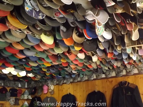
Toad River is also noted for its display of caps which are nailed to the ceiling in the restaurant. According to the story, in 1979 the Lodge was owned by a pair who liked to play practical jokes on each other. When one had left the room and left his cap on a table, he returned to find it nailed to the ceiling. It caught on. Along one edge is a row of military camouflage caps.
Great scenery and a comfortable bed.
After a hearty breakfast, we were off again the next morning.
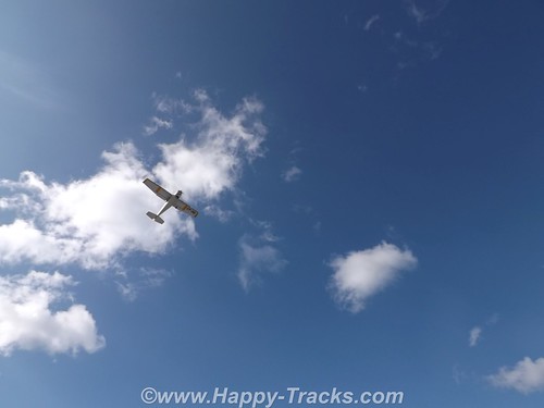
 In Muncho Lake Provincial Park, we noticed four people turning a small bush plane around on the gravel and waited to watch it take off.
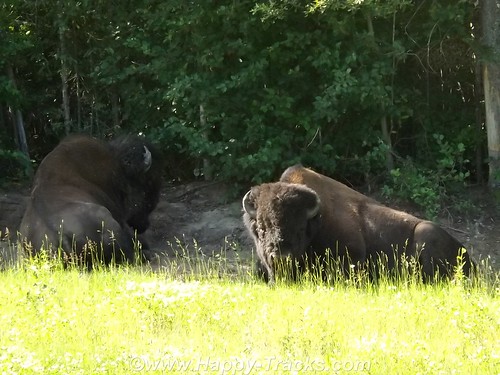
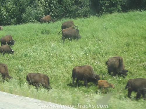
We passed a couple of bison alongside the road before our morning break.
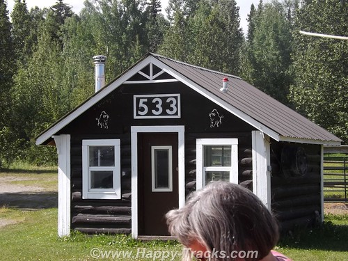
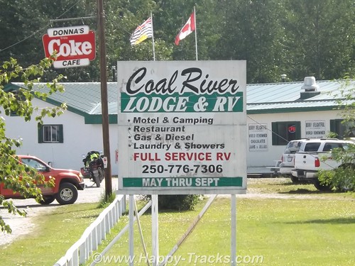
We stopped at MP 533 at the Coal River Lodge. The bridge over the Coal River is relatively new. We had hoped to find a spot where Mom and Dad had taken a picture on their trip but it turned out being the wrong spot. We did however find the piers which had supported the old bridge. (By the way, if you’ve got some money to invest and always wanted to live in BC, the Coal River Lodge and RV park is available for $575K.)
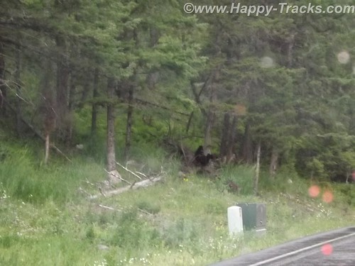
We continued along and crossed the Laird River bridge. Through the park, we also sighted a small herd of bison and a pair of black bear along the highway.
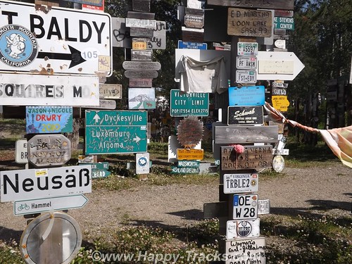
Our next significant town was Watson Lake. Watson Lake is known for the signpost village. It got its start in 1942. While working on the AlCan Highway near Lower Post, BC, Private Carl K. Lindley from Company D, 341st Army of Engineers was injured and taken to the Army Aid Station in Watson Lake to recuperate. During that time Carl’s commanding officer got him to repair and repaint the directional post. While Carl was carrying out this task he decided to add his home town sign of DANVILLE, ILLINOIS. Carl was known as the homesick, lonesome soldier and he was aware of the tradition that he started and what is now known as the World Famous Signpost Forest. It may be worthy of note that the most expensive gas we bought was in Watson Lake.
We fueled up both the truck and our stomachs here. The place we stopped (across from the signpost village) had construction going on (new sidewalks, etc) and the cafeteria was located in the back of the store next to the laundromat. Concrete floors and steel commercial building walls and a very limited menu contributed to the depressing atmosphere and made us question what we had gotten into as it seemed to be more and more rustic as we went along.
We took a detour just outside Watson Lake and turned south to Jade City and the ghost town of Cassiar, appropriately enough on the Cassiar Highway.
Jade City is a series of commercial enterprises which includes a lodge with cabins, a jade store, a demonstration of the jade finishing process, a First Nations art store and a parking spot for RVs. There is a restaurant but its currently closed and there is no fuel available here. Cassiar is the site of an asbestos mine which has closed and is now an environmental cleanup site. You can see evidence of some of the buildings there but the main town site is closed off with a fence and posted no trespassing.
You can also see the remains of an airstrip which served the town. Asbestos and jade are both found in the same type of rock which explains the proximity of the jade operations. Jade City’s population is less than a dozen including the summer seasonal workers. Cassiar’s population appears to be 3 horses which run loose.
The cabins here are in a row of rooms sharing a bathroom. You do have to go outside onto the porch to get to the bathroom and there are 5 rooms sharing it. This night, we were the only overnight guests so there was never a line. Jade City does have a significant mosquito population, the worst we had encountered so far.
The next morning was foggy and it had rained overnight. We drove back north to return to the AlCan just a few miles west of Watson Lake.
Along the Cassiar Highway, we first saw bicyclists. They were headed north but we don’t know whether they had come from Prince Rupert BC (on the coast) or from further south and inland.
We stopped for breakfast (as there was no food, just coffee — thankfully — at Jade City) at Rancheria. Like the others, this included fuel, restaurant and lodging. A group of 5 motorcyclists had stopped also and one of their group ordered the mega-breakfast. We didn’t see it come out of the kitchen but it included eggs, several meats, pancakes, toast, and potatoes. Based on the large quantity of food in the regular breakfasts, it should have been impressive.
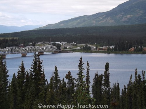
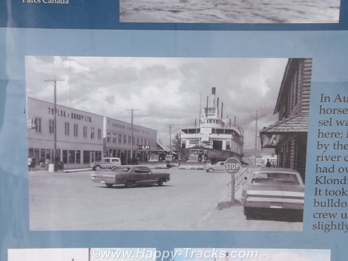
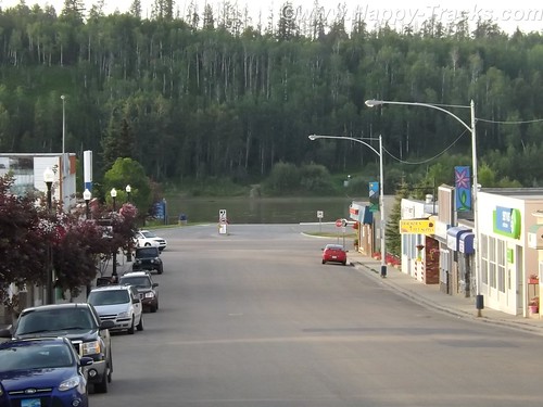
By the time we reached Teslin in Yukon Territory, the rain had let up and we had good weather and good visibility into Whitehorse, the first real town since we’d left Dawson Creek. The town is between the highway and the river. We stayed in the Best Western downtown and it was a step up from where we’d been. We walked around town a bit including down by the river where we saw the sternwheeler S.S. Klondike.
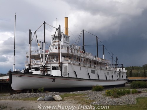
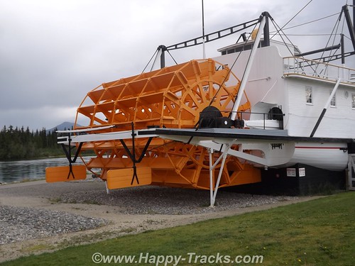
Until 1950, the Klondike, a shallow-draft ship had been an important link in the movement of freight and passengers until the highway diminished its importance. The ship sat dry-docked for several years after its last run upriver but was eventually sold to the government which would include it in the riverfront park as an exhibit. The ship was moved from the drydock to its display place by skidding it up the street on a bed of dampened soap flakes!
Whitehorse is the legislative capital of the Yukon Territories and was visited by the author, Jack London, before he wrote his famous books and short story about the Yukon and the cold.
One of our most interesting conversations was with an employee of the hotel who was sweeping the sidewalks out front along the street. He had some interesting comments on the states of Colorado and Washington legalizing marijuana and wondering how they would play out as he believed it to be a sign of diminished ambition and he had some concerns about fetal development. There was also some discussion about differences in gun laws between his country and ours. He talked about how our Congress and President seem to be ineffective in getting the work done. His knowledge of USA geography identified Maryland as being close to Nova Scotia, not what we usually think but from thousands of miles away, they really aren’t that far apart. He followed US news through the internet. Interesting conversation from an “outsider’s viewpoint”.
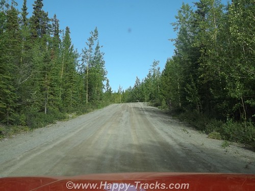
The next morning, well-rested, we passed by the Whitehorse Airport which is served by Yukon Air and Air Canada with scheduled service. We took another stretch of the old highway just past Whitehorse. This section was relatively smooth dirt and gravel but we imagined it could be a real mess when wet.
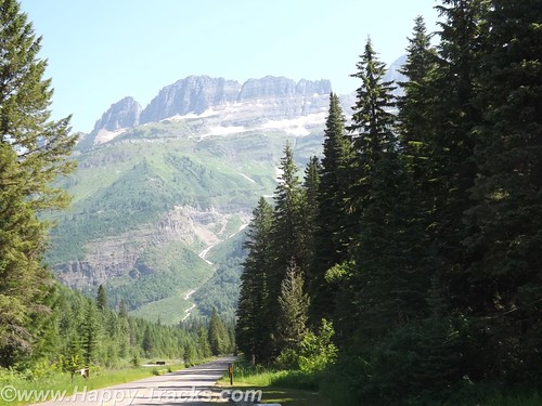
We continued on through breathtaking scenery toward the Kluane Mountains. At the edge of the Kluane National Park and Reserve, we passed though the tiny crossroads of Haines Junction which we would visit again on our way home. Historically, this area was an outpost for the RCMP who required gold rushers to have enough supplies to get to the gold fields.
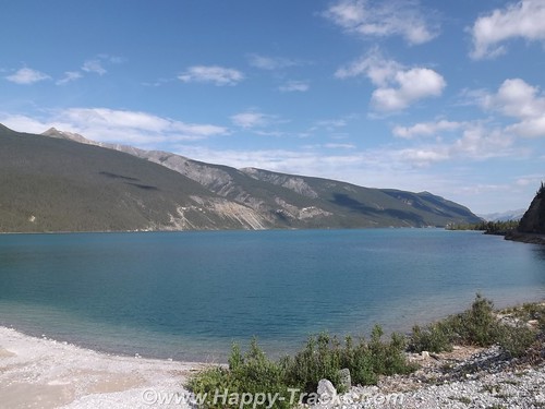
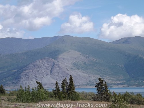
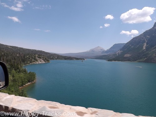
We got our first glimpse of the aqua blue waters of Kluane Lake from Boutillier Summit, the second highest point on the highway between Whitehorse and Fairbanks. The south end of the lake was once the drainage south to the Gulf of Alaska but approximately 300-400 years ago, Kaskawulsh Glacier closed off that end of the lake, resulting in a rise of 40 feet in the lake’s level. Eventually, the lake’s drainage shifted to flow north and west to the Bering Sea. You can still see traces of the beaches up the hillside.
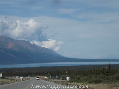
The road continues along the lake shore with views of the mountains on both sides of the lake. Our goal for this day was Destruction Bay about 40 miles up the lake. Destruction Bay is one of the towns that traces its history back to the highway construction. The name traces to a storm that destroyed homes and supplies staged here. It continued as one of the 100 mile stations that were spaced along the route to provide infrastructure for the trucks traveling along the highway.
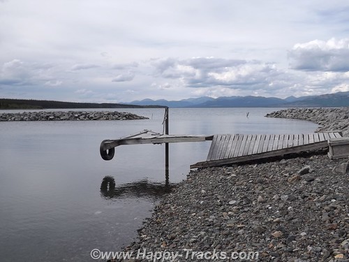
We had a shorter day, only traveling 170 miles as the spacing between stops didn’t work that well for traveling on. We used the early stop to do some on-foot exploring of the lakeshore and the village. We got checked in at Talbot Arm and went for a walk after we got settled.
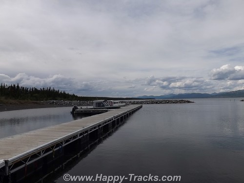
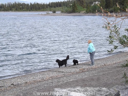
There were some docks and a couple of boats tied up as well as on trailers. We saw a couple of dogs exercising their human by having her throw some things which they promptly returned for her to throw again. The views of the mountains on the far side of the lake were breathtaking.
I’d been wearing an old t-shirt from back in the days when work used to send me to Austin Texas once in a while. That shirt opened a few conversations including one with these two bike riders who said they’d ridden their bicycles up from Texas since early summer. Probably should have taken more time to find out some more details from them. Apparently they camped along the shore that night as we saw them come up and start riding north while we were eating breakfast the next morning. We thought we had a long trip in the truck, its hard to even imagine riding a bicycle that far. 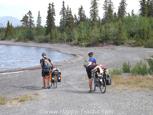
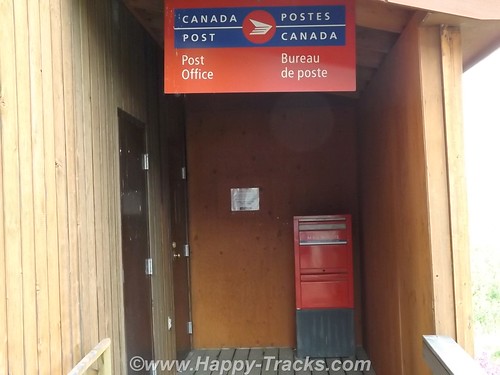
Wandering about town a little more, we found the post office and the public pool. We also passed by the medical clinic and the fire station on our way to the school.
Up by the highway was a pavilion (somewhat overgrown) that had some informational signs (I think the term is interpretive) and commemoration of the 50th anniversary of the highway.
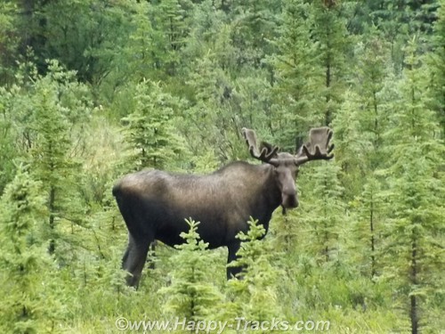
The next morning after we passed the bicyclists, we saw a moose on the side of the road but too late (we thought) to get his picture as we passed. I made a u-turn and headed back on the off chance that maybe we could get another glimpse. I think he was used to working with tourists as he waited for us and just posed waiting for me. We snapped off a few pics before he decided he’d had enough and moved off into the trees.
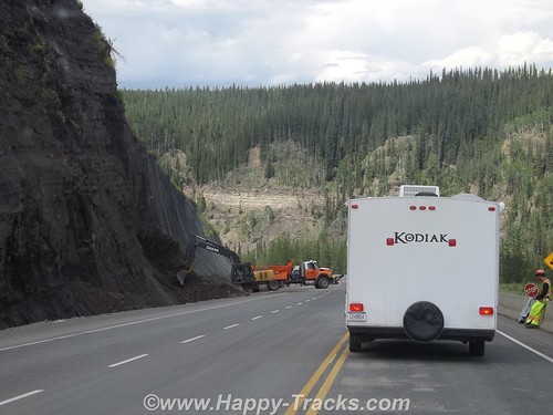
We started encountering more and more of the undulating pavement called frost heave. As we understand, the road is built on a base that includes permafrost which will thaw and melt under the roadway. It looks to be a full-time job to keep up with the roads although the major rework is limited somewhat to summer months.
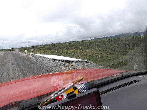
This picture shows a research project designed to help deal with the frost heave by equalizing the temperatures of the road bed. As we neared the end of the this stretch of construction, we felt the telltale rumble of a flat tire.
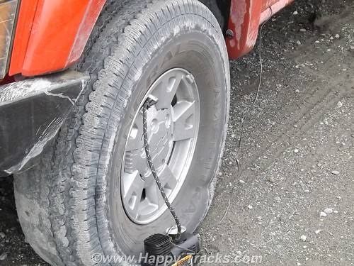
We hooked the pump to it to get us to a better spot for changing since the leak seemed to be definite but slow. While we were letting it fill, some of the construction crew stopped and told us the next settlement was just around the curve and which shop did tire repairs. They also told us where to find the owner if he wasn’t in the shop when we got there. As it turned out, the leak was slow enough to let us make it to the shop where we found a nice flat piece of concrete to jack it up and dig out one of the spares. As it turned out, the tire was not repairable but we had a second spare to go the rest of the way (we hoped) with us.
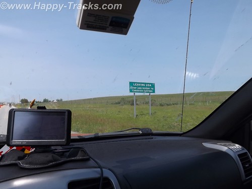
The next major point of interest was the Canadian Customs station which was about 20 miles before the border and then the border itself. While we were expecting there to be some space between the Customs stations, we were a bit surprised that there was this much “unpatrolled” distance between the two.
The US Customs station was just a few hundred feet past the border. We had some of Mom’s pictures that we had hoped to re-create but the Customs Agent told us that this facility was new and that the Customs Station in the 1950s had been 90 miles up the road in Tok.
Another 3 miles north and we were back into the rain as we pulled into the Border City Lodge. Typical lodge along the highway but it seemed the shelves were nearly empty, but there was a special for lunch and we both had the navy bean and ham soup. Maybe its because it had been so long since we’d had it but it was great and served with a half sandwich. The lady working the diner section told us that they had changed management this year so inventory was down. They had some beautiful animal skins, including a black bear, mounted on the walls.
We continued north to Tok where the Customs station had once been. That site is now the State Police station. There is a very modern Visitors Center with information on much of Alaska for whichever direction you leave the crossroads town. There are several gas stations, restaurants and a pretty extensive gift shop.
There is also a large (but closed) motel at the main corner. It seems that this had until recently been a major stop for the cruise line tours. Weather frequently interfered with the tour stops and the cruise lines picked a different spot. This worked to our advantage indirectly as the restaurant at the Golden Bear where we stayed now had the chef from the cruise lines motel. We had the best Mexican dinner!
The Golden Bear also had a speaker each night, one of the Iditerod drivers who had placed just a couple of years before. That night they also had a tour bus stopping in so we skipped the meet and greet.
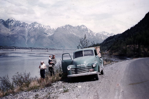
The bridge over the Tanana is in at least one of Mom’s and Dad’s pictures but we couldn’t find the exact spot where they took this picture, probably because the highway had been rerouted in its modernization but we did get some pictures nearby.
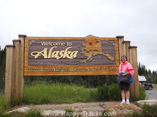
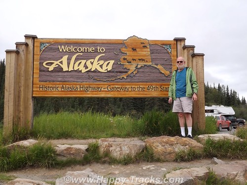
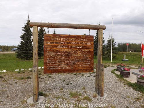
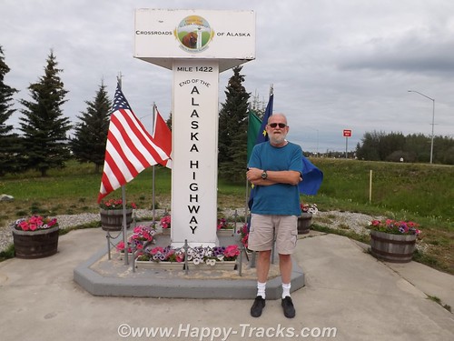
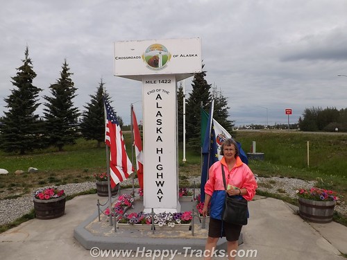
Twenty miles later, we were in Delta Junction at the intersection with the Richardson Highway. We had reached the end of the Alaska Highway! The spot is marked by another milepost similar to the one 1422 miles away in Dawson Creek.
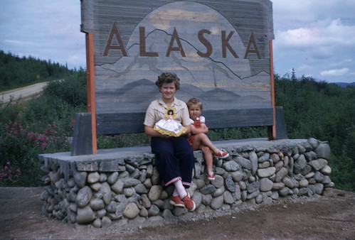
The story of the Alaska Highway from its origins in 1942 as a means to get military support to the Alaska territory to today as primary transport link for tourists and commerce is a long one, almost as long as the highway itself. We decided to make the trip because Mom and Dad and my sisters, Bonnie and Faith had made that trip 60 some years ago pulling that Spartan trailer behind the Packard heading north and behind the Chevy pickup heading south. The highway doesn’t follow quite the same route, its all paved now but some of the places are basically unchanged.
You can see all of the pictures from this leg of the trip here.
We invite you to continue along with us and hope you enjoy the account!
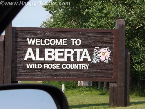
Summer 2014: Alaska via the AlCan, Alberta
We crossed the border at Carway and proceeded to Lethbridge for the night. We still needed to convert US or obtain Canadian cash. That turned out to be relatively painless as we just used our own bank’s ATM card at the TD Bank ABM. We knew we would incur a service charge from one or both banks and that the conversion would be factored into what was removed from the account. Sounds complicated but it really was as simple as the ATM withdrawal at home. For those of us used to US currency, Canadian currency looks strange. It has a window of transparent film where you can see through it. Canadians have also abandoned the use of the penny. All our cash purchases were rounded to the nearest 5 cents. One dollar (loonie) and two dollars (toonie) are coins rather than bills.
If one were to map out a route from Lethbridge to the start of the AlCan Highway, your route would most likely take you to Calgary, then to Edmonton and then northwest along Route 43, a modern highway, to Grand Prairie and then to Dawson Creek and the beginning of the AlCan (generally now called the Alaska Highway). We chose instead to continue north from Edmonton to Athabasca, then west-ish to Grand Prairie because this would more closely follow the 1950s routing of the highway and its approach, as Route 43 didn’t exist.
From Lethbridge north past Edmonton, the highway itself was fairly modern divided 4 lane affair. It was of modern state highway standards generally. The route took us through farmland and around the perimeter of most towns.
We did take the opportunity to try out a Tim Horton’s for our morning break. We’d heard a lot about Tim Horton’s and wanted to try for ourselves. We decided their coffee was okay and their pastries were very good. To each his own, I suppose. Since returning home, we’ve heard a lot more about Tim Horton’s because of acquisition talks by Burger King.
There was the occasional rest area such as this one in Bowden that incorporated the town park, a playground, a picnic area and camping facilities including showers in the restrooms. It was seasonally open and there was a petition to sign to keep the facility open. Apparently budget considerations at the Provincial level had the residents concerned.
We went around the edge of Calgary which appeared to be a modern city from our vantage point with mid- and highrise buildings rising up from the relatively flat prairie.
As we passed Edmonton, we passed through city traffic and turned north towards Athabasca. Athabasca is a small (population <3000 in 2011) town whose importance dates back to the days of the fur trade when it was known as Athabasca Landing and marked one end of the Athabasca-Edmonton trail which connected the waters of Athabasca River (flows north) and the North Saskatchewan River which flowed into Hudson's Bay. 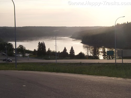
It lies along Highway 2 which connected the AlCan to points east. Eventually it was to be a railroad stop but the reality had it as a terminus where trains pulled in from the east and then pulled back out to the east. Trains to Athabasca had locomotives on both ends as there was no roundhouse or other turnaround point. Eventually the railroad stopped running to Athabasca and its economy was ruled by its crossroads location and tourism for the river.
Today its economy still depends on tourism but the proximity to the Athabasca tar sands oil fields are driving an economic boom. On the edge of town sit two new and chain hotels, a Super 8 and a Comfort Inn whose business is in providing lodging for the workers supporting the oil operations. The oil industry is probably also responsible for a resurgence of the tourism and the restoration of the old train station as a tourist center. We couldn’t find figures for the size of the transient/temporary population.
The Super 8 (while new and 3 stories tall) has adjacent construction which appears to be an expansion. The desk clerk was a younger blonde woman with an accent. In conversation, she revealed she was from Ecuador and that her brother worked in the Embassy in Washington DC so she was familiar with our home territory.
The economic boom has also fed other salaries as well. The local A&W had a Help Wanted sign advertising a starting salary of $14/hour.
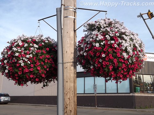
The town grid may be large but the developed streets are numbered 47 through 57. As we came to see in many of the small (and larger) towns, flowers were in profuse bloom along the streets and hanging from the lamp posts.
We ate at the 49th Street Restaurant which had Greek food, seafood and more generic fare (quite tasty and reasonably priced). There were probably three other tables in use while we were there, one by what appeared and sounded to be Asian businessmen, possibly related to the oil exploration.
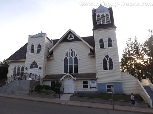
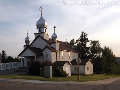
Across the street was the Athabasca United Church of Canada, a traditionally older church. We also found the Ukranian Orthodox Church of St. Peter and St. Paul. We were surprised at the density of churches (at least 10 in town) for its population.
Over the course of our trip, we would send out 37 postcards to our daughter, not counting other recipients. You do remember postcards, don’t you? So we set about to find appropriate stamps and a card. In a town this small, the post office should be easy, right? It was smack dab in the center of town. But our GPS labeled it as being on the opposite side of the street in either an empty lot or the boarded-up movie theater. We finally asked directions and were pointed to the modern brick building across the street. You know, the only one with a flag flying outside. We bought our stamps and were given the requisite Par Avion/Airmail stamps for international mail and then set out to find a card. We were referred to the dollar store –which had no cards but did have plastic hangers for our clothes drying experiment — the drug store which had greeting cards but no postcards and finally to the tourist center which did indeed have only one postcard of the centennial celebration in 2011 but it was free.
We mailed our postcard and headed out of town, headed west.
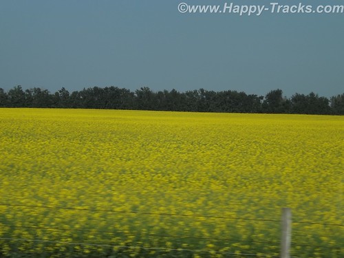
The highway is called the Northern Wood and Water Route. We passed through several small towns and also noted this industrial facility which we never really identified. We’re thinking it may be the Tolko OSB plant which makes construction products. More signs of a growing economy? The fields here and before we got to Athabasca were bright yellow and we think the crop was canola.
We stopped in Slave Lake for gas and lunch. At the gas station, we filled one of the 5 gallon cans we’d brought along in case we got stuck along the way. (We never used it.) The town is older and off the main road with signs pointed toward the lake, which is Little Slave Lake. The town had 5 or 6 motels and we ate at an A&W restaurant, something you don’t see much of in the States these days. Their root beer is as good as it ever was, I think. Our box of chicken came with French and English translations. It appeared to be a resort town and we never found the park at the lakefront.
We started noticing different road signs like “Important Intersection” and we met a truck with a “wide load” that appeared to be a two car garage coming at us. A lot of the signs were graphics instead of words, like a fisherman for the lake access or someone reading a book for the library or a water slide amusement park. One of my favorites (which took me a bit to figure out) was the two cars beside each other in a green circle to indicate a passing zone.
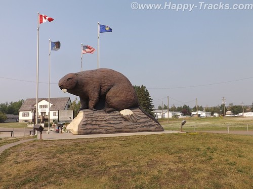
One of the little towns we pass through is Beaverlodge which has this huge statue of a Beaver which was built to mark the town name as well as pay tribute to the industrious beaver, which was the earliest distinctive symbol of Canada (per the sign posted next to the beaver.)
We came upon some one lane roads through construction, which seems to be a regular occurrence throughout our trip and during the summer months.
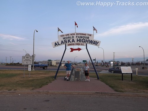
Eventually we cross into British Columbia and reach Dawson Creek, the southern and eastern end of the AlCan Highway — Mile 0. Note that it is now called the Alaska Highway officially but I will continue to use AlCan.
At Dawson Creek, we became aware of the smoke in the area. Forest fires were burning further south in British Columbia. We would see ash on the truck the next morning.
From a sign marking the 50th Anniversary of the Highway’s construction:
In the early hours of March 9, 1942, the first troop trains of the United States Army Corps of Engineers arrived in Dawson Creek to begin construction of the 2450 kilometre (1,523 mile) Alaska Highway. Overnight Dawson Creek was transformed from a small agricultural community of 500 into a bustling terminus for troops and supplies. At peak construction the population swelled to 10,000. Tent cities sprang up in farmers’ fields to help house the massive influx. The Northern Alberta Railway Station, the “end of steel”, became a centre of activity and sometimes, temporary home for thousands of military and civilian workers, may of who arrived with little knowledge of road building — or subzero temperatures.
During construction Dawson Creek served as a clearing house for supplies and equipment, as well as workers. In the spring of 1942 some 600 carloads of tractors, bulldozers, fuel and supplies arrived by rail from Edmonton for dispersal to construction camps along the route north.
Though the highway was completed in record time, it was not without its mishaps. One of the worst tragedies occurred in Dawson Creek in February 1943 when 60,000 cases of dynamite exploded in the centre of town, injuring many but miraculously, taking only five lives. The explosion leveled an entire city block and changed the face of Dawson Creek forever.
The modern city of Dawson Creek is rooted in those frenetic, exciting years of road construction. Though agriculture remains the driving economic force in the region, the transportation links forged through muckeg, ice and snow continue to play a major role.
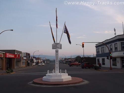
The Mile 0 Post
The Traffic Circle located at the intersection of Alaska Avenue and 8th Street marks the designated Mile 0 of the Alaska Highway. A plain four-foot post once marked the site. In 1946, when this was hit by a car, a new Mile 0 Post was designed and moved to the centre of Dawson Creek where it stands today. The Mile 0 Cairn in Northern Alberta Railway Park was erected in the late 1950s to replace the original post that marked the “true” beginning of the highway north.
We took pictures of us by the cairn and talked to motorcyclists who were marking the occasion of their trip.
We also got a picture of the Milepost in the center of town, just as my mother did when they passed this way.
Tomorrow, we start on the AlCan.
You can see all of the pictures from this leg of the trip here.
We invite you to continue along with us and hope you enjoy the account!
Summer 2014: Alaska via the AlCan, Glacier National Park
Glacier National Park is located primarily in Montana and is the country’s 10th NP being signed into law in 1910 by Pres. Taft. In 1932, the US and Canada governments formed the first International Peace Park by coordinating on the management of Waterton Park and Glacier National Park to form Waterton-Glacier International Peace Park, sharing management strategies on protecting the waters, plants and animals.
Our route allowed for the more scenic route rather than the most direct which took us to Three Forks where we stopped at the Wheat Montana store.
Wheat Montana is a combination grain elevator, bakery and restaurant with a gas station and convenience store. I suppose having the grain right on site conveys an image of freshness. The bakery certainly smelled tasty! We continued on through Helena and then up to the southeast of the park, then along the scenic Route 2 and eventually over to Kalispell.
We stopped for lunch in Helena. When we came out of the restaurant, the gentleman who had sat across the aisle from us inside started up a conversation. He told us he was traveling to visit relatives and was telling us he was from a small town in Canada near Edmonton and told us about a bridge that we should make a point to see. 
We had set the GPS to take us to Glacier National Park. It led us to Browning on the Reservation where we stopped to figure a more precise destination. While we were checking the paper maps, a man drove up and parked next to us to use the air hose. He had a young girl in the truck with him. It was very hot and the youngster was making her case for getting an ice cream or cold drink inside the store but she was unsuccessful. The man started a conversation with us and recommended that we plan our stop to include a place called Goat Lick Creek where the goats come on a regular frequency. He said that you could often see 40 or more goats with their kids there. We found his spot and a few goats but not in the numbers he had suggested. The goats and other animals frequent this spot to lick the clay and get the minerals. We appreciated his recommendation as it was a place we would have flown right on past with no notice. 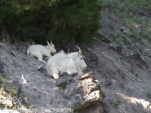
Saturday night summer with no reservations made it a bit difficult to find lodging. We looked first in Whitefish just outside the park’s entrance and eventually ended up in Kalispell about 15 miles away. We searched and eventually found overnight lodging at the Blue and White Motel (I wonder what the story behind that name might be?) where we were told they had two rooms available, one in the “old” building and one in the court. The “new” building probably dated back to the 1960s while the furnishings dated back to the early 1980s. We checked out both rooms and decided to take the one in the court. The carpet was old (as were the stains on it) but it seemed to be a bit better than the other choice. Supply and demand works, I guess. While the motel and the rooms would be prime candidates for refreshing, the place was filled to capacity. The desk clerk was a very pleasant woman with hair a shade of red that nature never used and a pleasant manner that showed she had been around since innkeepers tried to make their guests feel welcome instead of just being processed efficiently. The other guests were a mix of families with children, motorcyclists checking boxes on a bucket list and some longer-term residents who were probably working or going to school. As has become customary, they also had a breakfast bar of sorts that included toast and some prepacked pastries and coffee. Little bit different. 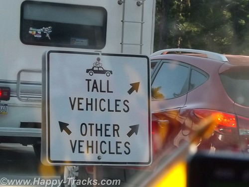
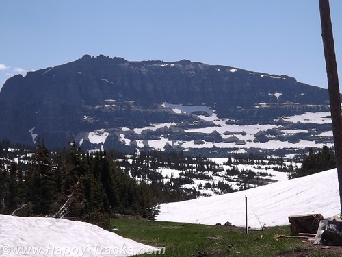
Glacier National Park is believed to have contained approximately 150 different glaciers in the mid-19th century and currently has 25 active glaciers. Current estimates say the last of the glaciers may be gone in the next decade.
We left Kalispell and went to the park. Our first stop was at the Apgar Visitors Center for an orientation. It was a busy place with tour groups forming up and leaving, groups coming in, one of the rangers preparing to give an informational talk involving a bear skin that she had put on display. 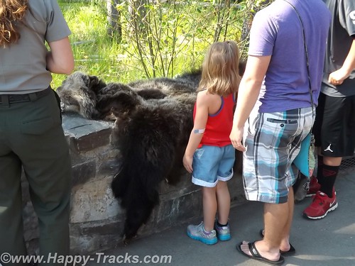
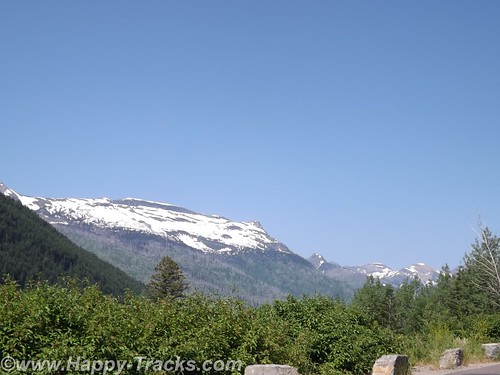
We got a map and oriented ourselves in preparation for the Going to the Sun Road journey through the park. As elsewhere, our orientation included reminders to beware of the animals and the traffic and to not block the roads.
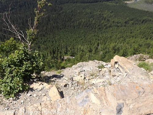
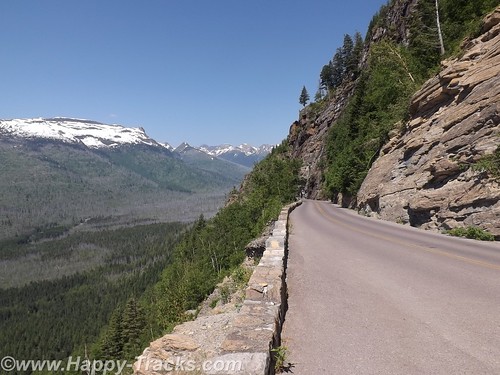
Going to the Sun Road passes Lake McDonald and along a glacial stream and up to the Going to the Sun Mountain and the glacier there. It is a scenic drive with views of the glacially-carved valleys and mountain sides and many streams cascading down to keep Lake McDonald filled. 
Although the park literature indicated many different animals to be seen in the park, our travels kept us primarily along the more trafficked roadway so we didn’t see many wild animals.
At our first stop just past the winter gate we were approached by another tourist (his accent was Asian perhaps?) seeking assistance. He was driving a rental car and had his paper map in hand but couldn’t locate himself on it. He really just wanted someone to orient him on his paper map. Where is the “You are here” dot? We got him oriented and on his way and had a chuckle at how its sometimes the simple things that make all the difference.
We stopped along the way for pictures of the lake and the glacial stream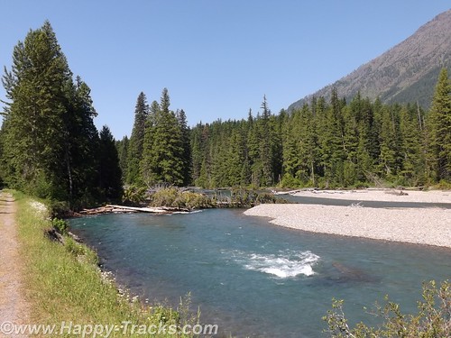
As the sides of the valley got steeper in our ascent, we passed through a couple of unusual tunnels in that the sides toward the valley had large openings to permit seeing the view.
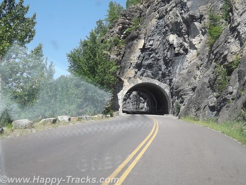
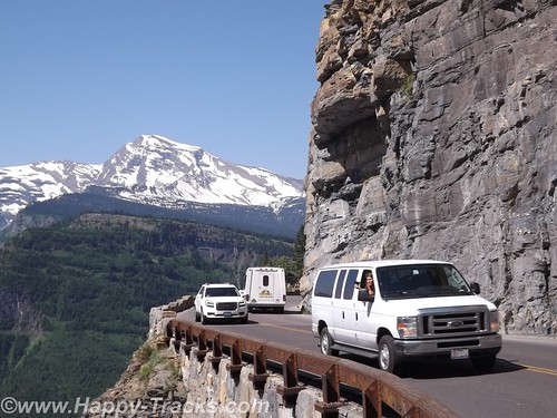
Going to the Sun Road does not allow vehicles longer than 21 feet or wider than 8 feet and does not allow towed vehicles due to the sharp curves/switchbacks and narrow roadways. In the picture above, the white dot in the very center of the picture is a van passing where we had just been.
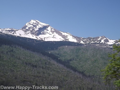
Our first encounter up close with snow and ice. The temperatures had us comfortable in our shorts and T-shirts.
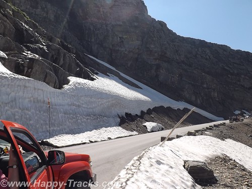
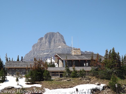
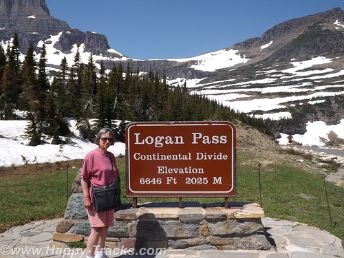
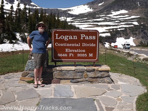
The road winds its way up to Logan Pass, the Continental Divide.
This trip was Betty’s first time crossing the Divide (in Yellowstone) although we would eventually cross at least 8 times before returning to Maryland. We posed for pictures by the sign and talked to two ladies there doing the same.
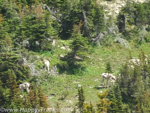
As we were walking away, the two ladies asked us to help identify the “white dots” on the hillside above us which turned out to be the only bighorn sheep we saw on the trip.
There is a rest area at Logan Pass which was fairly busy this day. There is a gift shop, restrooms and exhibits there but no restaurant and we were looking for lunch. We did have some food in the truck in the refrigerator so we had cheese sticks and crackers for a light lunch.
Shortly after leaving Logan Pass, we came upon some more road construction which narrowed us to one lane of dirt road and the accompanying delays which let us appreciate the scenery. The road passed beside Saint Mary Lake which is smaller than Lake McDonald.
We stopped at the St. Mary Visitor Center for a late lunch. Several of the menu items included huckleberries but we had more traditional fare.
After our late lunch, we exited the park and turned north for the short ride into Canada.
Our first border crossing was at Carway. Usual questions about where we going, what we were going to do and what we were bringing with us. We had bear spray (which apparently is sometimes viewed as a weapon but was of no concern to the Customs Agent) and more than the permitted 200 (one carton) of cigarettes each but this also was not viewed as an issue so we were waved on through.
We found a room at a fairly new Comfort Inn in Lethbridge and went next door to a sports bar for munchies for dinner.
The next day, we would visit the TD Bank for Canadian cash continue on our way north.
You can see all of the pictures from this leg of the trip here.
We invite you to continue along with us and hope you enjoy the account!
Summer 2014: Alaska via the AlCan, Yellowstone National Park
Yellowstone National Park was established in 1872 by Act of Congress and signed by President Grant. It is widely thought to be the first national park in the world. The area was bypassed by the Lewis and Clark Expedition and exploration really started in the late 1860s. Initially, it was overseen by the US Army at Fort Yellowstone in the northern section of the park. Administration passed to the National Park Service following its establishment in 1917.
We left our cabin in Cody after breakfast and entered the park though the east entrance with plans to make a backward S and leave through the north entrance by day’s end.
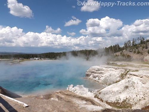
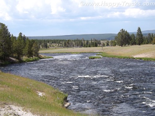
On entering the park, we received our separate handout sheet advising against feeding the animals and telling us that wild animals were dangerous. It also cautioned us to stay in the car when animals were nearby. The road in took us around the shoreline of Yellowstone Lake and into Lake Village.
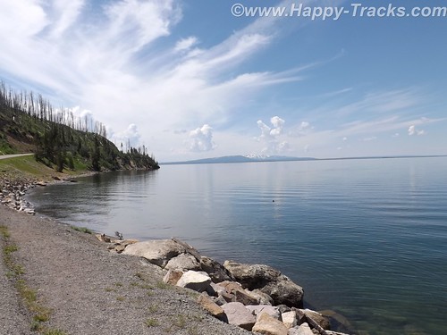
As we could first see the lake, we entered the area of the park where sulphur vents and you could smell it as soon as we entered the region. We stopped by the lake and took a few pictures then headed on towards Lake Village. On the way, there was a car stopped in the road for no apparent reason. As we got closer, we realize that they had stopped and gotten out of the car to take pictures of a bison in the field.
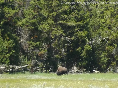
There was a pulloff nearby and we backed up to it and parked out of the road and took a picture of our own. We learned (and it would be reinforced throughout our trip) that when you see a car stopped, chances are someone has sighted a wild animal, even though the park literature reminds you frequently not to stop in the road.
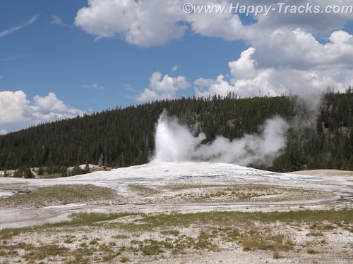
We continued on to Lake Village where we would find a commercial area (gas, food, restaurants) as well as a visitor center. The ranger at the visitor center gave us the latest updates for expected eruptions at Old Faithful, one of our “must do” sights.
Shortly after we passed the West Thumb Information Station area and turned to continue on the Grand Loop Road, we were waved down by a young man who had been bicycling. His girlfriend had fallen off her bike and needed assistance. He said she was shaken up and we volunteered to call for help. Punching the OnStar button, we soon were in contact with their personnel who patched us through to emergency services in the park. While we were doing that, another truck stopped. Luckily, it was being driven by an off duty EMT who was able to assess her condition and was drafted to transport her and her bike over to the West Thumb first aid station. We informed the emergency services folks of the resolution and went on our way. While we were glad to be of assistance, we breathed a sigh of relief as we realized we would still be able to make the next eruption of Old Faithful if we got on our way.
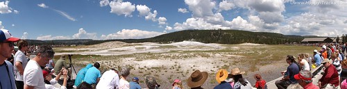
There was a crowd of people there, both for the geyser show and for the lodge, restaurant and shopping area. We found our spot on the viewing deck and waited for the show. As the time drew closer, more people crowded into the area.
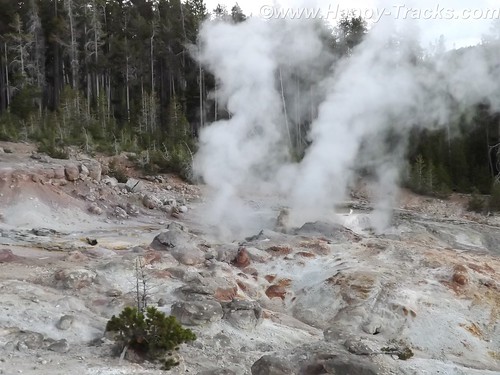
While we were waiting, we saw steam erupting from the other geysers in the area but still we waited for the most famous one. After several smaller spurts and steam, the big show came and we were suitably impressed.
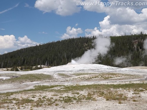
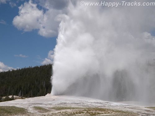
It is truly amazing to watch Mother Earth in action. We had seen pictures and video but its nothing like seeing it in person. One thing that no one ever mentioned was the sound and the noise. Anyone who has ever worked in a steam plant (such as a nuclear submarine) has nightmares about the sound of high velocity steam escaping. Wow.
After the show, we went into the Old Faithful Lodge for lunch and to visit the shops.
We continued on to the Grand Prismatic Spring. The parking area there is small and was very crowded with folks waiting for others to leave before being able to park. The hot spring is the largest in the US and the third largest in the world. First records of it appear in a trapper’s notes from the 1830s. The colors near the edges are the result of microbes in a mat around the mineral-rich water. The center blue area is sterile due to the heat and its color derives from its depth and purity.
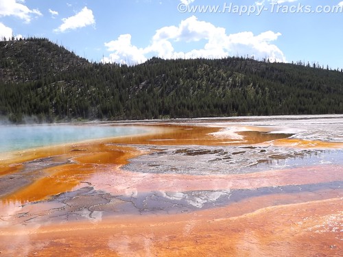
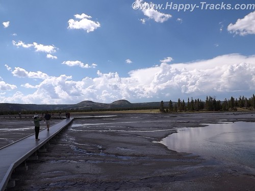
The microbial mat is extremely fragile and there are numerous warnings and prohibitions against walking on or otherwise disturbing the mat. While we were there, someone’s hat blew into the pool. Park personnel remove things like that with poles. On August 2, shortly after our visit, a tourist’s aerial drone mounted camera crashed into the pool. It’s still being investigated about how (or if) to remove it and the owner is facing charges.
Connecting the parking lot and the spring is a pathway that includes a walkway over an ice cold stream fed from the mountains. What a contrast.
That area is the Midway Geyser Basin and contains the dormant Excelsior Geyser as well.
We continued around our backwards S on the Grand Loop Road to visit Steamboat Geyser, the world’s tallest active geyser. It infrequently (and unpredictably) has a major eruption up to 300 feet in the air. It had been almost a year since its last major eruption. It has more frequent minor eruptions, including the day we were there.
But as we started back towards the truck, the skies let loose and it poured rain. We had umbrellas and windbreaker/rain jackets…back in the truck! So we half walked, half ran back.
We continued our ride towards the north entrance and saw the now telltale sign of cars stopped along the road. 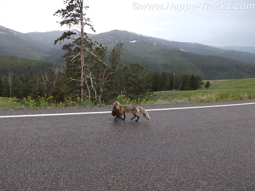
Animals? Sure enough, we saw this fox with something in its mouth coming along the road. We never were able to identify the prey in its mouth which appeared to be some sort of small mammal.
Traveling along, we again saw stopped cars, this time there were a number of them stopped in both lanes of the road. 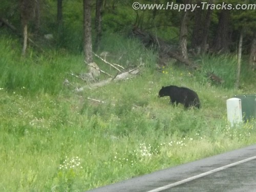
After a bit of sitting and waiting, we realized it was a black bear and three cubs working on crossing the road. Eventually, the adult bear crossed and the three cubs remained on the left side of the road. Then, to our absolute amazement, adults started getting out of their cars –with kids– and started walking up to where the bear and the cubs were on opposite sides of the road! Unbelievable! Finally some of the cars started moving by passing the parked and temporarily abandoned cars. When we were able to move on, the cubs remained on the left, the mother remained on the right and the humans kept on getting out and getting closer.
We stopped at Roosevelt Lodge and Cabins. This was the lodge used by President T. Roosevelt when he visited the area to hunt. There are also cabins, a restaurant and a small camping store there. We kept our comments about the bears and the tourists quiet as we weren’t sure how many of the patrons there had been part of the group. While paying for our purchases at the camping store, we got into a conversation with the clerk who was an older gentleman who had retired to this area from the New Bern area of NC.
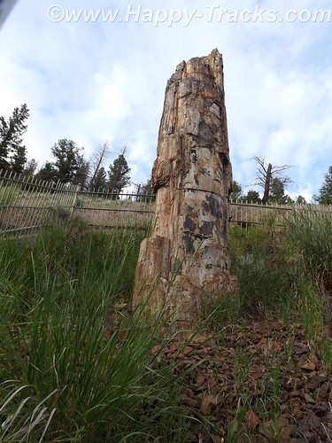
From there, we visited a petrified redwood tree that is the same as present-day redwoods in California, giving testament to a very different Yellowstone in the distant past.
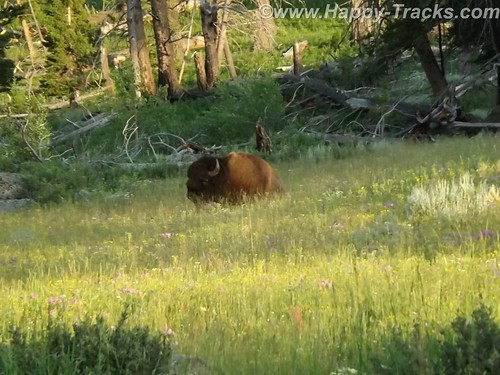
Our next wildlife sighting was another bison standing by himself in a grassy meadow. We found this one by ourselves without the aid of other cars.
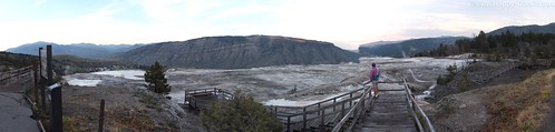
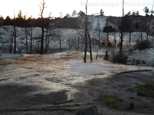
We next arrived at the Mammoth Hot Springs resort and campground at the site of the old Fort Yellowstone. The public buildings are reclaimed barracks and dining facilities. The springs are a series of cascading pools on a hill of travertine.
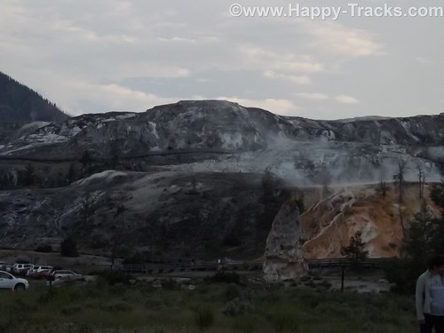
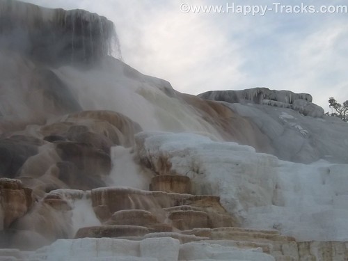
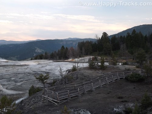
There is a roadway which winds up the hill and lets you look down on the pools and the historic district. These pools, still more hot springs, really give you a different view than the Prismatic Spring. There was a dormant hot spring cone, Liberty Cap, too.
Leaving the Mammoth Hot Springs, you wind down and behind the historic district and onto a winding road out of the park. Just as we reached the boundary, a herd of antelope was crossing the road along the stream bed. Approaching dusk prevents us getting more pictures.
As we exited the park, we followed the Yellowstone River through the canyon to Livingston MT where we found a motel around 11:00. The motel was a Best Western and had a covered garage with a keypad lock for parking which seemed unusual and we never did really figure out why. At first, we suspected the winter weather but it seemed to be the only motel in the area with that feature. It also had an indoor heated pool which our room’s door faced. The humidity outside the room was a reminder of the hot springs we had seen that day.
This is a longer than usual post but it also was a longer than usual day for us. While we don’t advise spending only a day when you get to visit Yellowstone, we proved you could actually see much of it in a day.
You can see all of the pictures from this leg of the trip here.
We invite you to continue along with us and hope you enjoy the account!
Summer 2014: Alaska via the AlCan, Custer SD to Cody WY via the Devils Tower
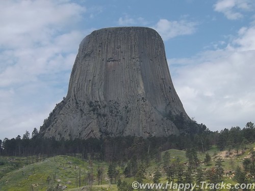
This day’s travel plans included trekking from Custer SD to Cody WY, our gateway to Yellowstone National Park. We were taking a non-direct route that would allow us to visit Devils Tower, America’s first national monument, created by President Theodore Roosevelt under the Antiquities Act in 1906. Devils Tower is also a sacred area for several of the Plains Tribes.
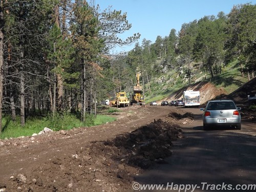
After breakfast and fuel, we hit the road. Route 16 took us through the Black Hills National Forest where the road quickly switched from pavement to dirt and gravel. Very shortly we encountered a stop for construction. Several times we stopped as there was only enough room for one lane of traffic. The pace allowed us to view the scenery and we weren’t in any particular hurry.
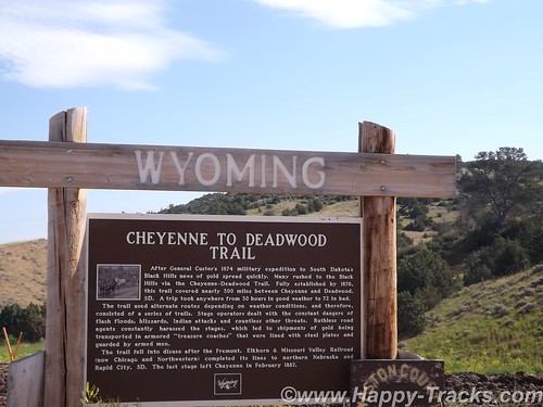
As we neared the National Forest boundary, the construction ended and the road switched back to pavement. Soon after, we crossed the state line into Wyoming and began our approach to Devils Tower.
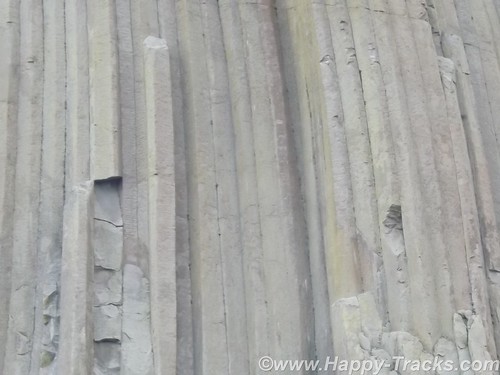
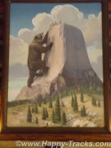
Devils Tower is a column of magma that likely never reached the surface and was later exposed by erosion. The Plains Tribes have varying stories in their lore as to the origins of the tower but they share that that column saved children from being eaten by a giant bear-like creature and that the columns are the results of the bear’s attempts to climb the column.
Devils Tower, which attracts about 400,000 tourists a year, is loaded with sacred meaning for about two dozen affiliated tribes of the northern Great Plains. According to their oral tradition, this is the place — historically known to many Indians as Bear’s Lodge/House/Tipi — where a sacred woman, White Buffalo Calf Woman, delivered the sacred bundle to the Lakota, Nakota, and Dakota nations (the three major Sioux subcultures or dialects). This is the place where White Buffalo Calf Woman taught the people how to perform the seven sacred ceremonies (prayer rituals). This is where White Buffalo Calf Woman taught the people how to live in a good way. She also gave them a sacred pipe, and before she left, she promised to return. And then she turned into a white buffalo.
We did see evidence of the sacred beliefs in the form of prayer ribbons and cloths at various places around the base.
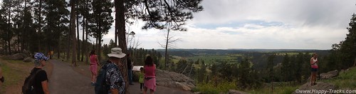
A walk around the base follows a paved path (1.3 miles in length). Wildlife sightings are common — including rattlesnakes– but we didn’t see any during our walk.
The column is a favored spot for climbers (permits required) and you can see –through an NPS telescope– some of the climbing anchor points up near the top.
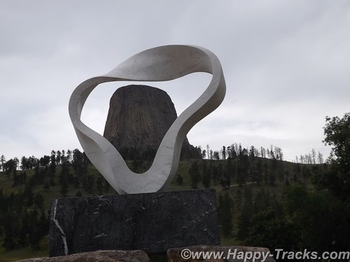
A sculpture was added near the picnic area adjacent to the campgrounds for the Tower’s centennial celebration. The sculpture is called Circle of Sacred Smoke, made by Junkyo Muto. The sculpture is one of seven “peace” sculptures to be donated internationally and calls to mind the sacred pipe.
After a walk around the column and a visit to the visitors center and gift shop, we headed out for our next destination and had lunch just outside the monument’s gate.
We got back onto I90 and headed to Sheridan where we exited and headed west through the Bighorn National Forest. A rapid increase in elevation as we climbed into and over the Bighorn Mountains via a series of switchbacks.
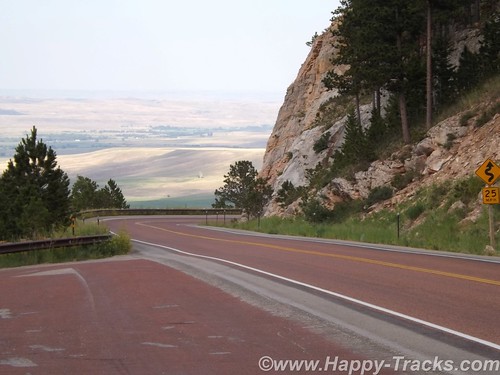
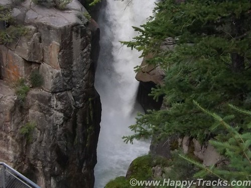
As we started down the far side, we stopped at Shell Falls. The Falls have a parking area and a series of viewing platforms. Interpretive signs explain that the water path that carries water from Shell Falls into the Gulf of Mexico. The stream follows a fault line until the water eventually reaches the Yellowstone River.
The road travels through the landscape and a series of small settlements and towns until you eventually reach Cody.
As with most of our trip, we arrived in Cody with no definite plans on where to stay. There is a Comfort Inn, a Holiday Inn and Buffalo Bill’s cabins on the main route. We stopped at the Comfort Inn. Although there were rooms available, the price was (considerably) higher than our budget allowed. As we balked, the desk clerk advised that there were lesser priced cabins available elsewhere but she was not able to give us details. She offered to call someone who could tell us though. Shortly, another lady appeared outside the hotel on a golf cart and offered to show us the Buffalo Bill’s cabins (which were available at about 2/3 the price). What have we got to lose? We followed along.
She took us to adjoining property and showed us a lovely little cabin which had furnishings equivalent to the Comfort Inn. We told her we’d take it and she gave us a ride to the office where we registered. On our ride, she told us she lived in her large RV just on the other side of that fence and came up to Wyoming every summer to work here. She and her husband wintered in Florida somewhere.
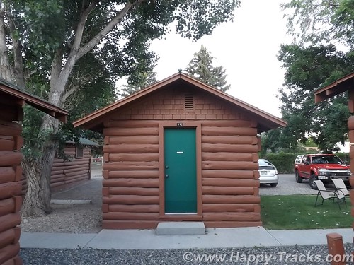
On the bed in the cabin was stuffed bison toy. A clever piece of marketing, the bison was available for sale in the gift shop or could be left. So the family walks in, the kids see the bison and immediately go to it. “Mom! Dad! I want to keep this.” I wonder how many they sell this way?

Our night in Cody was our first night after letting the bucket washer system work on our clothes. We decided that fewer clothes at a time would work better along with less detergent. We switched to a schedule of one set of outerwear and two sets of underthings and socks with less detergent.
Comfortable bed, good air conditioning and nice chairs to sit in on the lawn. A good night’s sleep to send us on our way.
You can see all of the pictures from this leg of the trip here.
We invite you to continue along with us and hope you enjoy the account!