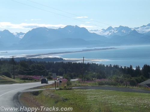
Leaving the Customs station (Pleasant Camp Border Crossing) with a brochure from the Hawaiian Customs Agent, we continued alongside the Chilkat Inlet towards Haines. Primary task for us at the moment is finding lodging for the next two nights and its about 7:30 pm. Waiting until this late to start finding lodging hasn’t worked out well for us in the past.
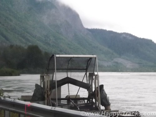
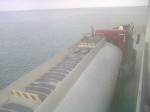
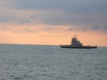
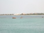
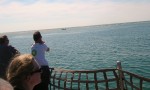
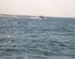
We find a place to pull over and make some calls and see this contraption. It looks sort of like a paddle wheel or even an automated fish catching device. We later find that its a device mounted by the state to help count the salmon population.
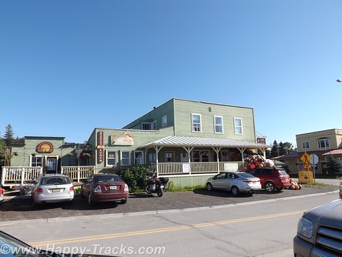
The first place (a BNB) we called had nothing available for the two nights we needed. We tried a second call and connected with a woman who said she could accommodate us at the Ft. Seward Lodge although she wasn’t at the lodge but could meet us there in the half hour we needed to get there. She said she had to put her child down to sleep for the night and would meet us there.
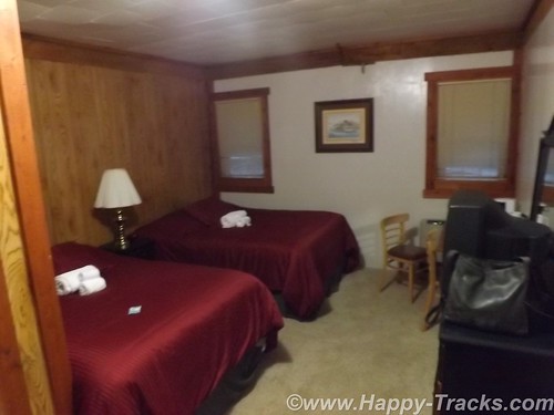
We drove through the edge of Haines and arrived outside the office door to find it locked and apparently no one around. We waited a bit and then called again and the call went to voice mail. We finally saw someone going out that looked like they might work there. It turned out the young lady did work there but had also had issues with getting someone to answer the phone. She did tell us another phone number to try though which also went to voice mail. After waiting this long, we were certainly tempted to go somewhere else but there didn’t seem to be any where else to go. Eventually, the owner showed up and checked us into our room.
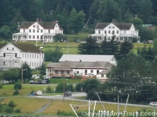
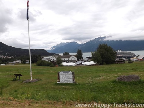
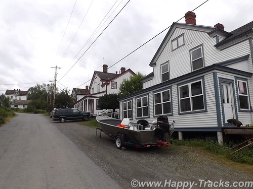
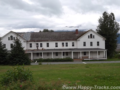
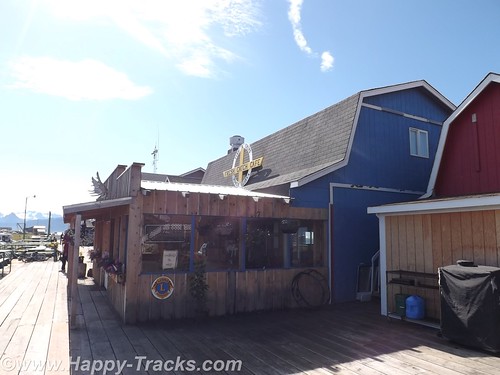
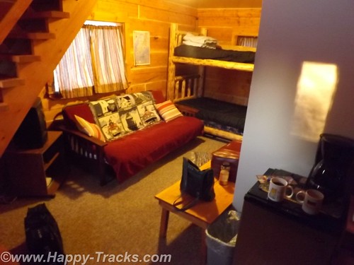
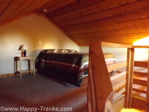
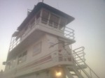
The Ft. Seward Lodge building had been the PX when the post was still active. This particular building had housed the exchange, a barber shop, soda fountain, bar and the bowling alley. The long wing containing our room had once been the bowling alley.
Haines, Ft. Seward, and Port Chilkoot history is like many of the towns in Alaska ranging over the Native population, the US acquisition, the gold rushes, fishing and the tourism industry.
The Tlingit Indians established the first permanent settlements around 8,000 years ago. The area is relatively temperate, has abundant food resources and geographically provides a portage opportunity to connect the Chilkoot and Chilkat Inlets. The Tlingits established trade with other groups and became wealthy. They also are recognized as the artists of some of the finest indigenous creations.
White settlement came in 1881 with the Presbyterian mission. Shortly after came salmon canneries, mines and the construction of Ft. Seward by the US Army. Due to ongoing border dispute with Canada, the US built Ft. Seward as a demonstration of might and resolve and encompassed 4,000 acres which had been deeded over from the Presbyterian church in 1902. The docks were first to be built to bring in supplies and construction materials. Italian stone masons were imported to build the granite foundations for the post and master carpenters from the lower states gave Ft. Seward style that exceeded most rudimentary construction of that era. The first contingent of soldiers arrived in late 1904 and Ft. Seward became regimental headquarters for Alaska. Ft. Seward was renamed Chilkoot Barracks in 1922.
Over the next two decades, the Army dismantled other Frontier-era forts around Alaska so that Chilkoot Barracks was the only Army post in Alaska. During World War II, Chilkoot Barracks became an induction and rest center for soldiers arriving in Alaska to form the new posts and bases needed to support the war effort.
Like many military bases, Chilkoot Barracks provided an anchor for the town’s economy during its operation but in 1946, the Army declared it surplus in favor of more strategic locations in interior Alaska. A group of WWII veterans decided to buy the surplus post and continue to operate it as a cooperative. The cooperative failed but several of the veterans established small businesses that survived serving tourists and passengers from the small cruise ships that used the old Army dock. With the infrastructure to support the post (fire department, utilities, etc), the city of Port Chilkoot was formed and merged with the Main St. area to become the city of Haines in 1970.
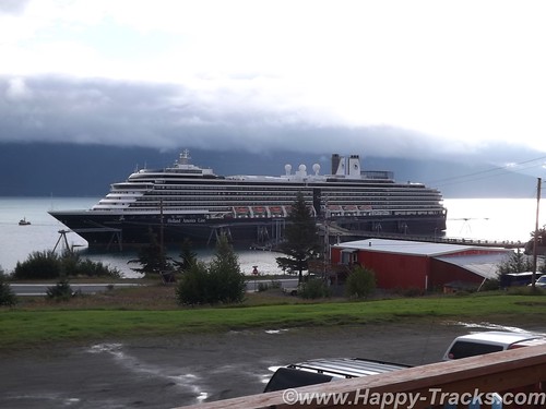
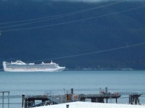
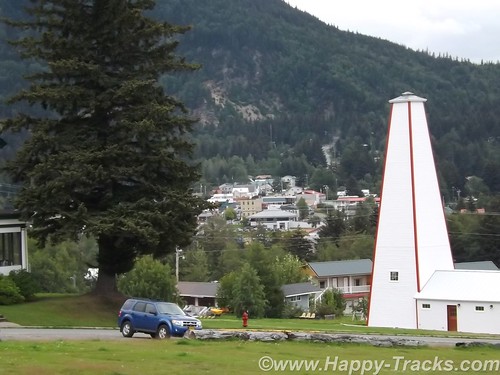
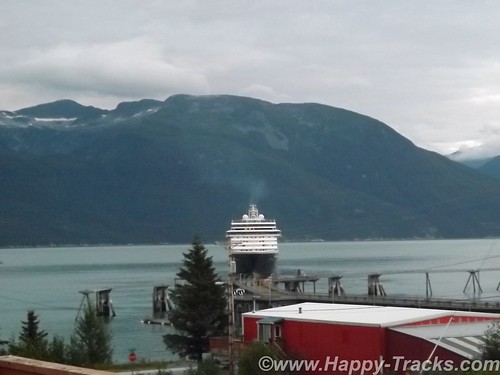
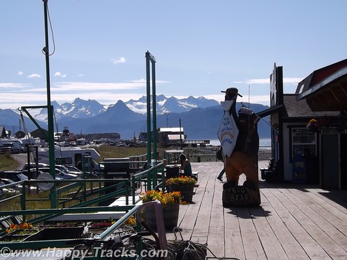
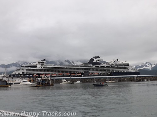
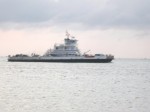
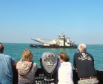
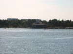
The scenery had changed when we looked outside the next morning. A cruise ship (relatively small) now sat at the pier. I say relatively small as it was smaller than what we had seen in Seward and smaller than the ones we saw cruising down the far side of the Chilkoot Inlet making their way to and from Skagway (20 miles away by boat, hundreds of miles by car including traveling into the Yukon Territory). We happened to hit cruise ship day in Haines when most of the shops would be open.
Haines only allows one ship per week to dock. Previously some of the larger ships had been thought to be more detrimental to the local ecology than they needed so the good folks of Haines sent them away and now the larger and more numerous ships land at Skagway instead.
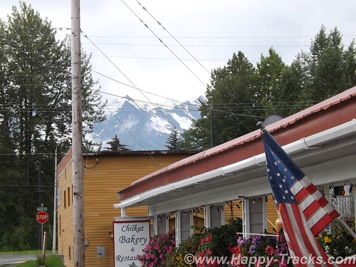
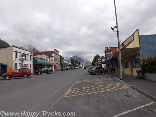
We went for a ride around Haines looking for breakfast and happened upon the Chilkat Bakery and Restaurant which looked to be popular with the locals and a little far off the beaten path for the cruisers. As we paid our tab, we asked the owner how late they were open and she answered and said she’d stay open as long as we were there by closing time. We ended up there again for dinner but well before closing time.
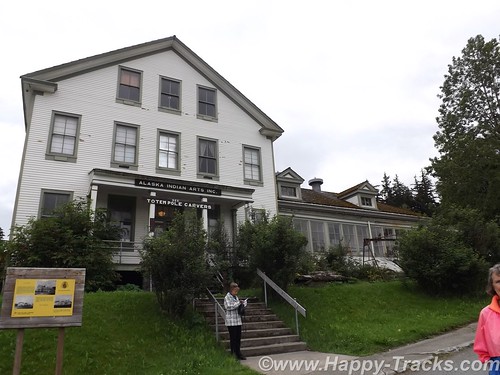
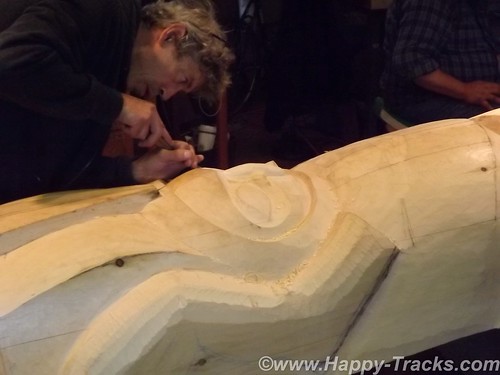
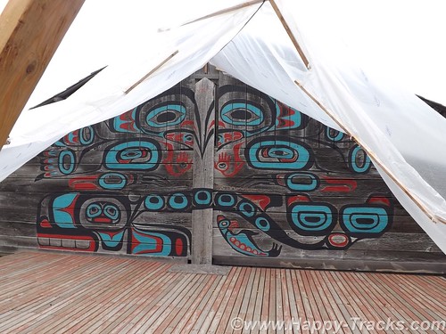
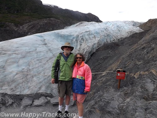
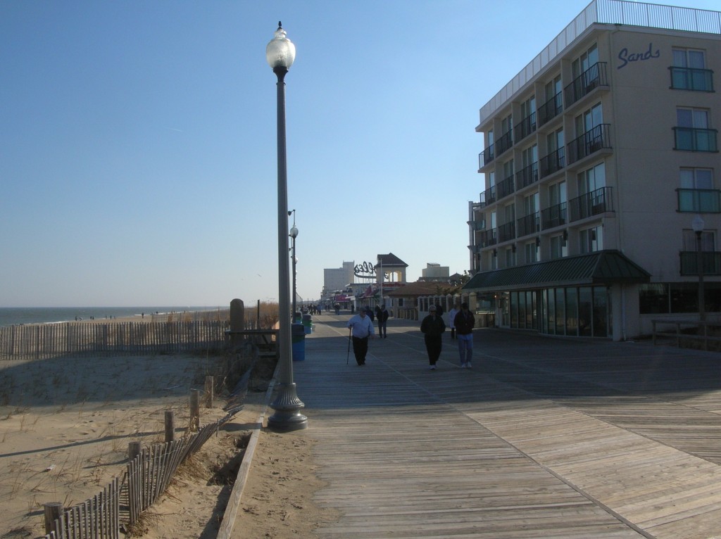
We went back to the Lodge to park the truck and then began our walking tour of Ft. Seward. We walked up the hill of Soapsuds Alley which had been married enlisted housing and many of the wives had taken in laundry to supplement incomes. As we topped the hill, we worked our way around the parade ground counter clockwise with our first stop being the old hospital, now home to the Alaska Indian Arts which seeks to preserve the arts including carving. The non-profit foundation provides workspace for the carvers as well as preparing pieces on commission. The tour included the workshop where a totem was being carved.
Historically, the hospital provided medical care for the Army personnel and their dependents but regulations allowed the doctors to supplement their incomes by taking patients from the surrounding area.
We continued walking around the parade ground. Along the upper and longer side, the houses had been officer and senior personnel quarters which were larger and more grandiose than those on Soapsuds Alley. The far end (third side of the rectangle) had what had been the commanding officer’s quarters and the headquarters building which were large enough that they now were in use as a hotel. Filling out the third side was the firehouse with its tower to allow the hoses to dry after use without freezing.
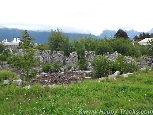
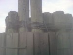
The fourth (lower) side of the parade grounds had a large enlisted barracks building which is currently undergoing work to preserve and return it to its 1940s configuration. The granite foundation to another large barracks building sets next to the first barracks building. The second building had been destroyed by fire in 1981.
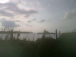
The cruise ship being in port increased the population for the day and the weekend would bring the Southeast Alaska State Fair to Haines so preparations were underway. The parade ground at Fort Seward was being prepped.
With a population just over 2500 in the 2010 Census, Haines has perhaps the highest percentage of residents involved in the artistic professions and is dubbed the arts capital of Alaska. One artist we kept running into (and met setting up his shop on the parade grounds for the fair) is Tresham Gregg. Mr. Gregg’s works are largely wood sculpture although we also found several of his designs in leather belts (made in China). He apparently owns/runs several full-time shops in Haines.
We opted for a late lunch at the Fireweed Cafe which was also popular with the cruise ship crowd. We took seats at the bar and both had salmon dishes. Also seated at the bar were a couple of honeymooners from the ship and another couple from Vancouver who were spending the summer at the RV park next to the town docks. Their conversation mentioned tales of the park, including a guest who hadn’t realized that the inlet was saltwater and had been using it for washing up. They also shared that their older teen daughter had gone over to Skagway on the “fast” (passenger only) ferry as there was just too much small town laidback-ness to keep her occupied. Fresh salmon makes for a good lunch, by the way.
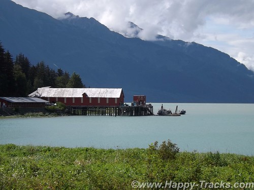
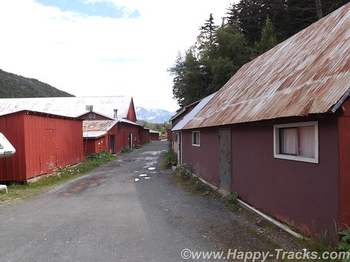
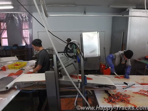
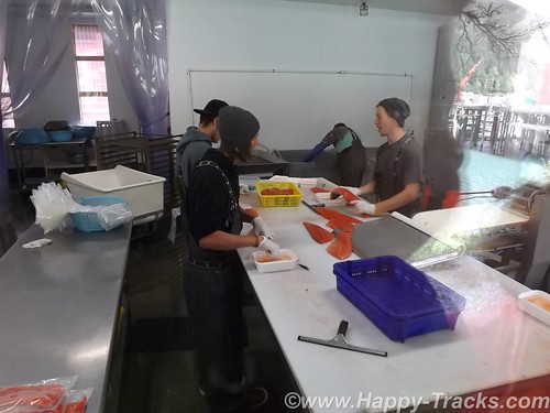
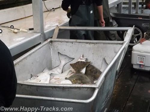
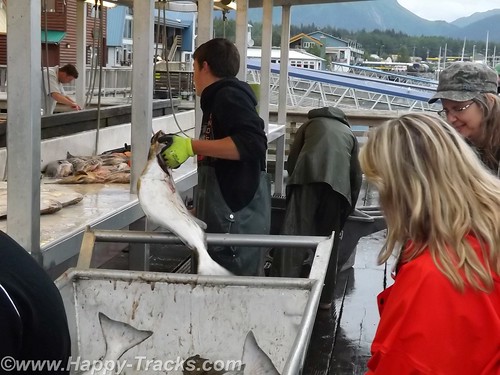
After lunch, it was back to the truck to find what lay beyond our walking limits. On the Chilkat Inlet side of the peninsula is the Haines Packing Company located at what may be the oldest cannery site in Alaska. The operation was modernized in 2007 and primarily freezes, packs and ships fresh salmon with no canning taking place there anymore. The property is open to tour (self-guided) and lets one see the historic setting as well as a modern machine cleaning operation if your timing is lucky. There is also (of course) a gift shop with handcrafts from the proprietor and others and you could buy salmon and have it shipped most anywhere.
You are separated from the processing operation by windows so I was pleased to learn that I could take pictures without the glass glare by pressing the lens of the camera up to the glass. (I did learn later that doesn’t work when you have two widely spaced layers of glass.)
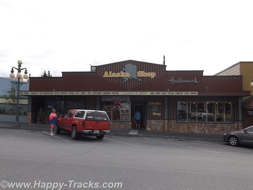
We went back into Haines and checked out several of the shops and the museum. We skipped the Hammer Museum. In retrospect, that may not have been such a great idea. The shops ran the gamut from imported plastic stuff that said Alaska on it to expensive handmade jewelry and carvings, not necessarily Alaska-made. The museum, actually the Sheldon Museum and Cultural Center, was small but contained several interesting exhibits in its small space. The Sheldon Family, who had been prominent citizens of Haines in the early 20th century, donated much of the museum’s initial collections.
We headed back to the Chilkat Bakery and Restaurant for dinner (well before closing time) and had excellent Thai food for dinner.
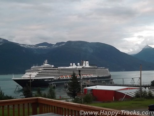
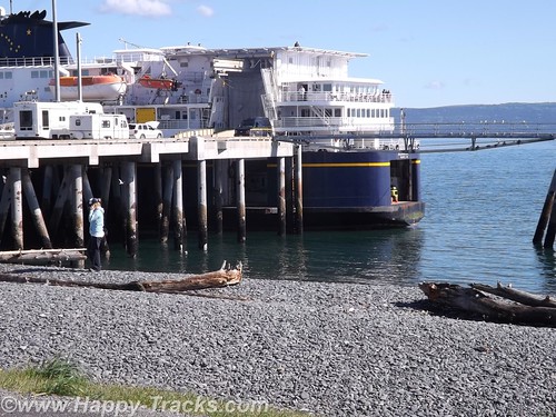
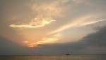
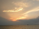
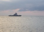
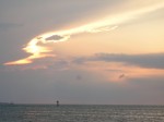
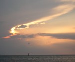
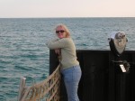
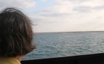
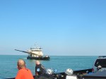
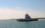
An early start the next morning was in our plans so we headed back to the Lodge for the evening where we watched the cruise ship’s intricate routine of casting off and getting underway. The main dock sticks out perpendicular to the shore. The ship is longer than the dock is wide so the bow and stern lines went to standalone bollards. A crewmember was dispatched in a small rowboat to each bollard where he climbed up the ladder to let the lines go and then climbed back down the ladder to go to the other one and repeat the performance. In this day of machinery and automation, it seemed somehow quaint to require this procedure. After loosing the lines, the ship backed away from the dock and turned its bow south and away.
The lodge owner was on the deck as we watched the cruise ship prepare to depart and shared her story of coming to Haines from Montana to marry her husband who ran a heli-skiing business. Heli-skiing refers to carrying skiers to the top of the slopes and then letting them ski down from there, places they couldn’t reach other ways. The lodge fit into that by ensuring their winter customers and friends had accommodations for their winter adventures.
She ran the bar and the lodge and told us a bit about why it was difficult to find help and run a restaurant in the lodge. Primarily, she attributed it to an inability to estimate the seating at a particular meal and the difficulty in obtaining fresh produce when much had to be pre-ordered and shipped from the lower 48.
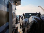
Early the next morning, we made our way to the ferry (Alaska Marine Highway System) landing to line up for loading for the trip south.
You can see all of the pictures from this leg of the trip here.
We invite you to continue along with us and hope you enjoy the account!
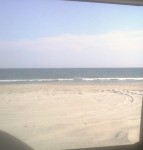
Tag Archives: beach
Summer 2014: Alaska via the AlCan; Homer to Haines
After a good night’s rest in Anchor Point, we loaded up and headed back into Homer.
We had one recommendation but went instead to Maura’s Cafe and Deli in the old part of Homer. They looked to be doing a great business and we believe in the old adage to eat where the locals eat.
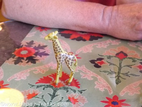
When we went inside, there was a line to order and no seats to be had. By the time we got to place our order a couple of tables had emptied out. We both ordered the quiche and were given a plastic giraffe to take to the table with us instead of a number.
As we waited, it became clear the morning rush had been a good one and they were running out of things. We enjoyed our meal and went out to explore.
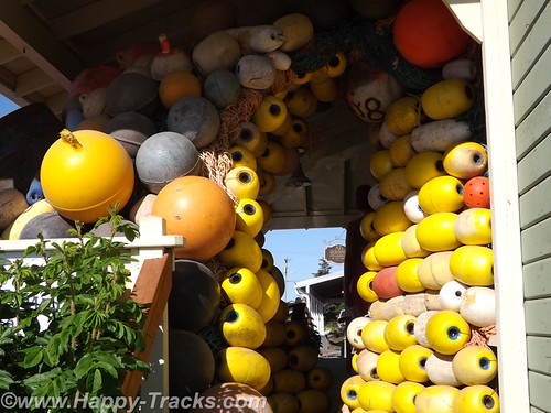
There was an interesting tableau of buoys on the porch of the store next door.
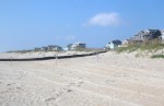
Then we followed the road down to the beach and on out to the Homer Spit. The Homer Spit is 4.5 miles of land sticking out into Cook Inlet and home to both deep water on one side and shallow water on the other. The theories to its origins differ with one suggesting that the Spit is the result of glacial movement and one suggesting that it’s the buildup of sand deposited by the comings and goings of tide and wave action over millennia.
The spit includes a fishing lagoon which is stocked each spring from the nearby salmon hatchery.
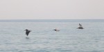
On this particular summer Sunday, the Spit was packed with tourists (just like us) in all manner of vehicles from compact cars and bicycles to huge RVs. At the water end, the M/V Kennicott, part of the Alaska Marine Highway System (ferries operated by the state) was loading. We stopped to watch for a while and then noticed the birds. In this case, the birds were bald eagles. In total we probably saw 4 of them.
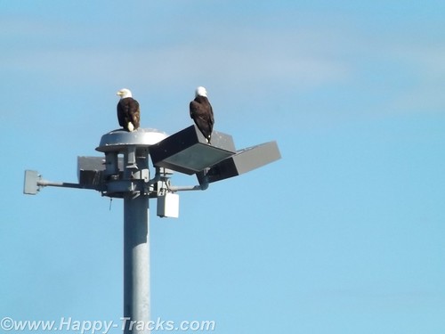
Among other things, Homer is known as the home of the Bald Eagle Lady, Jean Keene. Ms. Keene had been feeding the eagles for years before the town passed an ordinance making it illegal to feed them. One renowned photo of Keene shows her sitting on the ground and feeding 24 of the birds clustered around her. Homer’s ordinance, passed in 2006, granted a reprieve for Keene who had been feeding the birds for 25 years at that time. The reprieve was only to last until 2010 but Ms. Keene passed in 2009.
The eagles, in such abundance, were said to be a nuisance by appearing threatening to humans as well as small dogs and other birds. ABC News reported in 2007 that any close up picture you had seen of a bald eagle was likely taken in Homer. Their presence contributes to the tourism in Homer, even in the winter.
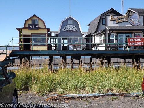
After watching the eagles and the ferry load for a bit, we headed back towards town and stopped at one of several collections of small shops built on stilts above the ground. The shops were an eclectic mix of tour offices (go fishing, climb the visible but distant glaciers, boat tours, etc.) and restaurants and shops of all descriptions. The wares varied from Made in China fare to high end art piece carvings of all sorts.
We stopped in one shop which sold antiques and curiosities and talked with the shopkeeper. One item he had was an “electrician’s knife”. It was the same style of knife I have in my toolbox with a single sharp blade and a screwdriver that I had since my days in Uncle Sam’s Underwater Canoe Club. If I didn’t already have mine, I would have bought it ($10) on general principle.
There is also a Seafarer’s Memorial to those lost at sea but we didn’t see it, only found out about it in our research to write this piece. It’s not particularly tall and is on the edge of a parking lot which was filled with campers and vans the day we were there.

Feeling that we had seen most of what we wanted to see in Homer and on the spit, we turned inland and generally north headed back towards Anchorage.
Since there is largely one road in and the same road out, we repeated the same beautiful scenery along the coast and stopped in Soldotna for a late lunch/early dinner at Buckets Sports Grill. The halibut sandwich and clam chowder were just the thing to power us on our way.
We passed through the Funny River fishing region again. There seemed to be more folks out on the riverbanks than there had been the day before but still couldn’t tell if anyone was catching or what they were catching. Traffic was moving well but was a bit heavier through here.
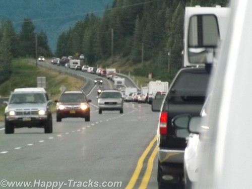
After we passed the Alyeska Resort area, traffic was noticeably heavier and very soon came to a complete stop. At first we theorized an accident up ahead (and there may have been but we never saw signs of it) but it seemed to just be heavy volume of weekend travelers headed home on Sunday evening plus the squeeze from two lanes to one as we squeezed between the mountains and the water as it moved along again as the alternate roads became available going into town.
This Sunday in Homer marked the halfway point. We had been gone from home 21 days on what was to turn out to be a 42 day trip. We were also as far from home as we were going to be. Google maps shows Homer to be 4,469 miles from home and we had driven 6,581 miles following a different route through the continental US and numerous side trips.
We got on the phone and booked a room at the Golden Lion Best Western in Anchorage. It was time to call it a night.
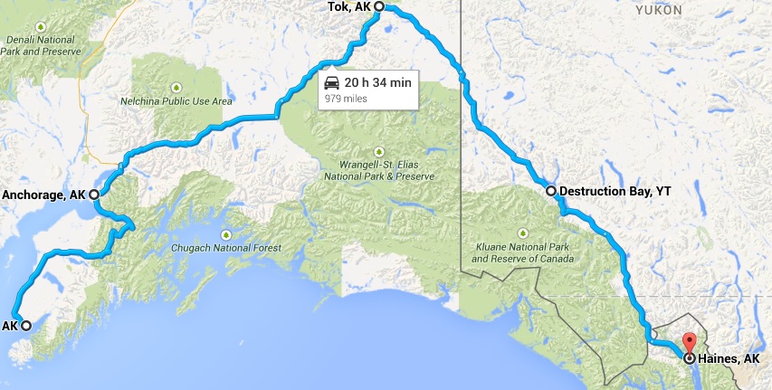
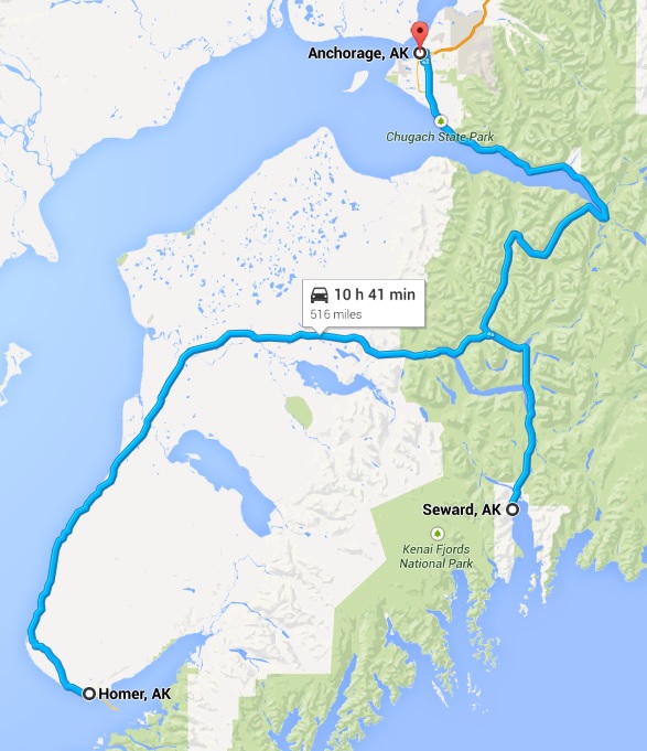
When we started planning out this trip, we had picked a number of “backup” locations in the vicinity of the Wrangell-St. Elias National Park in case we hadn’t seen them earlier, places like mines and glaciers. With plans to possibly pass through that area, it made sense to book passage on the ferry from Haines to see the Inland Passage. We needed to be in Haines on the ferry on Friday morning or stay another week.
The combination of the reservation plus having seen mines and glaciers and the realization that several of the sites in Wrangell-St. Elias would be rough and slow road in a drive in and then reverse and drive back out the same road lead us to decide to skip Wrangell and concentrate on making our way to Haines, some 975 miles from Anchorage via the roads.
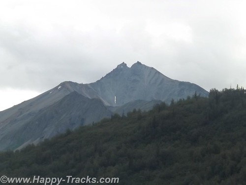
On Monday morning, we started making our way towards Tok via AK-1. This was a different route than when we had left Tok. The scenery was beautiful and the skies were clear, unlike when we had first gone from Fairbanks to Anchorage.
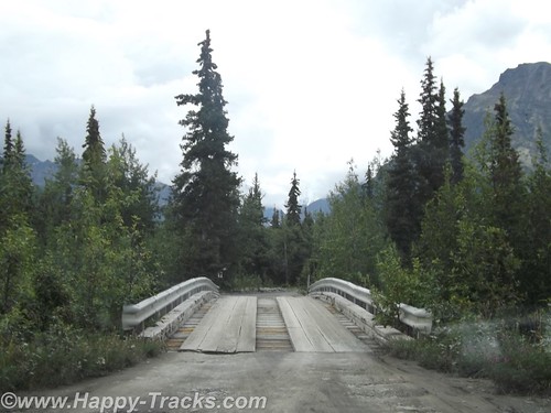
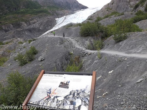
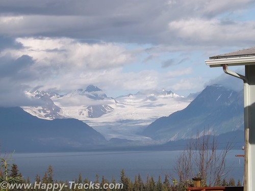
Traveling this way, the roads were more hilly and curved and along the way, we would pass by the Matanuska Glacier. The Matanuska Glacier was described as a “drive-up” glacier, unlike Exit Glacier where one has to climb the hillside to reach the glacier itself.
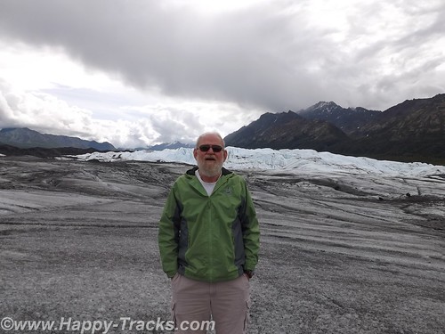
Betty describes the side trip to Matanuska as “chasing butterflies”, a phenomenon that was really one of the highlights of this trip. Without a firm agenda or schedule to meet, we were able to chase a butterfly off on a side trip. Matanuska is a valley glacier meaning that it is lower in elevation and occupies the land between two hills or mountains.
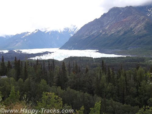
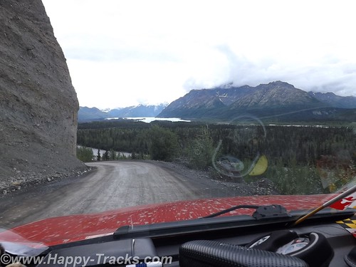
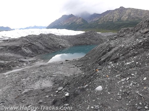
We allowed a half hour or so to make the trip to the drive up glacier just since we were so close. From our vantage point on the highway, you could see the Matanuska Glacier below us in the valley. There was a winding dirt road off the highway to get down to it. We crossed over a narrow high bridge of planks and steel. You continued along until a house and store where you bought your tickets.
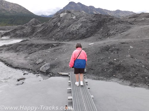
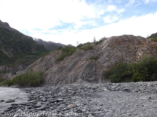
From there, you passed through a gate and then it was about a mile to the toe (foot?) of the glacier. We pulled up in the parking area with the other vehicles and started making our way across the black and wet moraine to the glacier. We walked for a ways before realizing there was a marked path on the other side of the water and walked back towards the truck to reach the path. We later discovered the path started from the other end of the parking lot.
The way out included planks over some of the wetter and trickier areas. There was a group with a guide who were on their way farther out into the middle area of the glacier with their ice spikes. We stopped for a few pictures along the edge and then began making our way back. A family that looked to include Grandma, Mom and Dad, and the kids met us coming the other way. The passing on the planks required some coordination but we safely passed.
About two hours after we had taken the turn on to the dirt road, we were once again on our towards Tok where we stayed again at the Golden Bear Lodge. We have discovered since being home several versions of the origins of the name Tok. Several conflicting sources exist but there is a reference to it being known at Tok as early as 1901. It does represent the junction of the Alaska Highway and a cut-off which allows lower 48 travelers to reach Anchorage and Valdez without proceeding further north to Delta Junction.
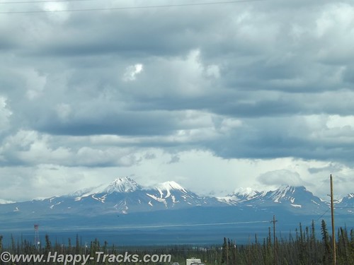
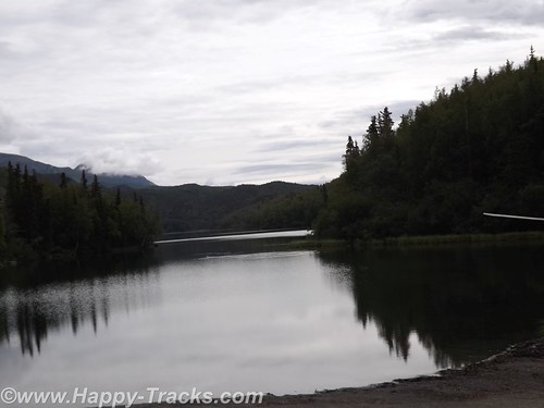
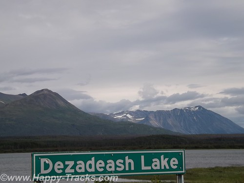
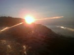
We left the following morning for Canada, crossing into the Yukon Territory and stopping for lunch at Destruction Bay. We continued south past Kluane Lake and took the turn in Haines Junction where we continued through beautiful scenery. This stretch of road is particularly desolate, though in good repair.
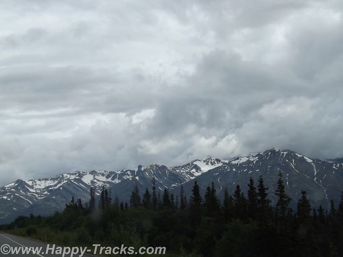
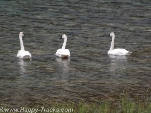
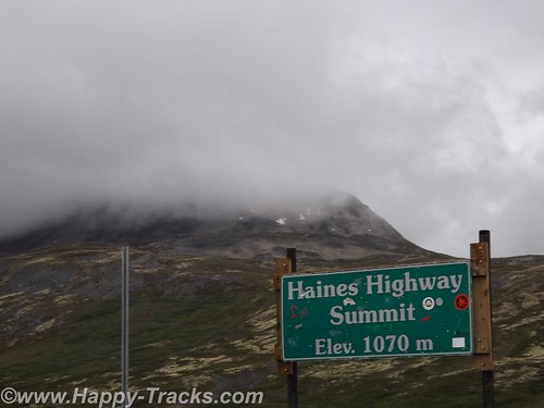
The highlights of this stretch include more mountaintop glaciers, a couple of airstrips and a trio of trumpeter swans alongside the Haines Highway. We also noted several signs advising that snow plows might be in your lane so beware!
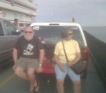
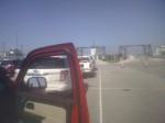
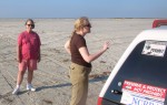
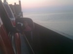
About 7:00 that night, we reached the Customs station at the border back in to the US. It looked deserted but we sat and in a few minutes the agent came out of the building. He was friendly and chatty. We hadn’t seen a car in the last 80 miles or so and figured he spent a bit of time by himself unless he walked over to the Canadian side and talked to their agents. He remarked that he didn’t see too many Maryland plates up that way. He also said he didn’t see many from his home state either. We asked where that was and he told us Hawaii. He had the opportunity to come to this station as a temporary summer assignment but assured us he would be back home before winter hit.
Before we left, he gave us the brochure for Haines including a list of lodging. On that road, that’s the only place you could possibly be going. We wished him well and went on our way.
You can see all of the pictures from this leg of the trip here.
We invite you to continue along with us and hope you enjoy the account!
Summer 2014: Alaska via the AlCan; Exit Glacier to Homer
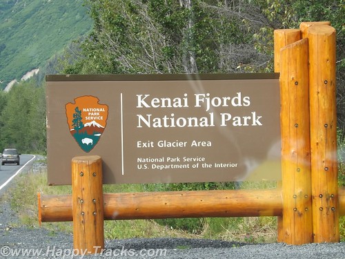
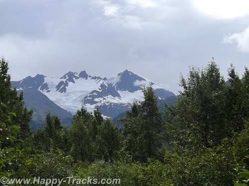
Our National Park system was established near the turn of the 20th century. We’ve come to learn that many of our country’s national parks are considerably newer than that. For example, the Kenai Fjords National Monument was established in 1978 by Executive Order of President Jimmy Carter. The Kenai Fjords National Park was established in 1980 with the Alaska National Interest Lands Conservation Act. Within the Kenai Fjords National Park is Exit Glacier. The name came from a newspaper story describing the first recorded passage across the Harding Icefield saying those crossing the icefield would soon be leaving via the “exit glacier”.
To access the Exit Glacier, we drove along a spur road off the Seward Highway for about 2 miles to the visitor center and a parking lot. There was a pulloff along the way which offered a view of the foot of the glacier and the stream flowing from there towards Resurrection Bay. Along this road were several tour guides both for the glacier and for kayak and other nature tours.
In the pulloff (posted with no camping signs), one visitor had a popup tent camper setup and appeared to be taking pictures perhaps for an advertisement or story layout of some sort.
On the drive in, we passed signs marking the recession of the glacier as this current ice age plays out. The Ranger Station area includes a parking area including space for RV and bus parking which also took the overflow from the car parking area. It was a sunny and warm Saturday so there were many cars in the lot. The building includes some interpretive displays as well as a small shopping area along with the ever-present warning to beware of the bears and not to feed the wildlife. Ranger tours are available every couple of hours as well as a mid-day presentation at the visitor center.
We opted to walk on our own. Parts of the trail are ADA accessible. The accessible parts are relatively flat (and paved with asphalt or crushed gravel). That part of the trail goes to the rocky streambed at the foot of the glacier.
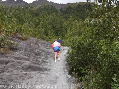
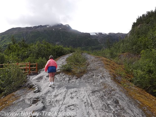
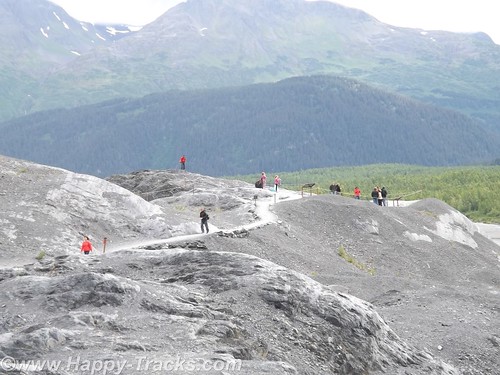
The trail also proceeds upward toward the glacier itself. Fairly easy walk if you’re in good health and there are places to step off and rest if that suits you. In several places the trail narrows so that you have to alternate for folks going up and down. There were a number of families on the trail from kid strollers to folks older than us. A bit more than halfway up the hill is a marker for where the edge of the glacier was in 1998. A half mile or more behind us was the marker for the 1980 edge.
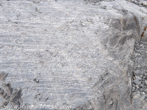
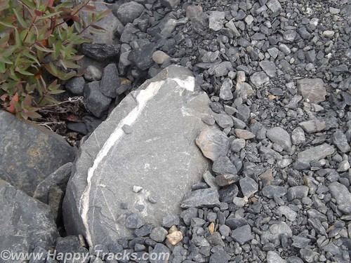
Along the way, you could see the drag marks in the rocks where the glacier had been moving. The rocks showed layers of lighter colored rock formed by mineral-laden steam pushed up from below which solidifies.
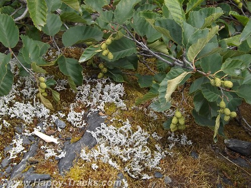
As the glacier recedes, moss and lichens take hold in the rock and slowly break it down to form soil. As the soil increases, smaller plants take root until eventually trees take root in the small crevasses.
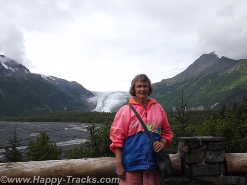
While it was warm and sunny out, as you stood by the glacier you could feel the effects of the breeze blowing across miles of ice. Our light jackets felt good.
The glacial ice has a blue cast to it. We learned this is because the other colors of light are absorbed by the ice.
We meandered back down the hill and out onto the rocky streambed. The rocks were mainly rounded and varied in size from golfballs to softballs.
We stopped to look for postcards before making our way back to the truck and started driving north and west across the peninsula to head south.
We re-traced our route for about 30 miles before turning west. We stopped for lunch at another roadhouse that was doing a pretty good business. We sat at the counter and one of our dining companions ordered a beer with her lunch. First the server had to go find someone else to take her order (we don’t know if it was an age or training thing but the Alaskans seem to take alcohol more seriously than some other jurisdictions we’ve visited). Then the different server asked to see ID from the woman. She showed them her drivers license. After the server left, she remarked to us how they always ask for ID even though she told us she was 60. According to her, Alaska will mark your drivers license if you are convicted of DUI. She didn’t know whether that would prevent them from serving or just trigger a request for keys or a designated driver. Interesting. By the way, the burgers were very good.
As we continued on, we passed over a winding river that was full of fisherman even if not full of fish. We passed by the Funny River (another interesting name).
By the time we reached Soldotna, it was time to stretch our legs and grab a coffee. From the main road through town, Soldotna is a typical small crossroads town. Several motels, a couple of small shopping centers and restaurants along the main drive through town. Soldotna is sometimes referred to as red and green city as it boasts the only traffic lights (which create a bit of a jam) we’d seen since we got out of Anchorage!
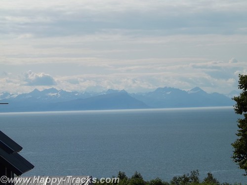
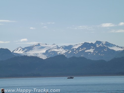
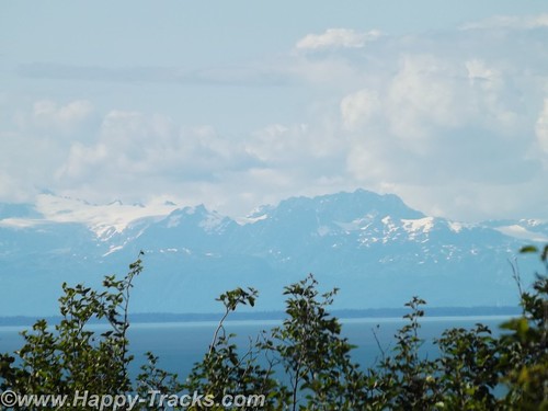
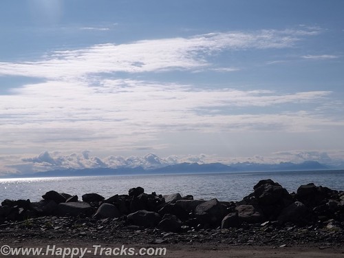
We’re approaching the western side of the peninsula and the highway runs parallel to the shore and along a high bluff. This gives us a great view across Cook Inlet to the line of the Chigmit Mountains, part of the Aleutian Range which stretches into the Aleutian Islands alongside the Bering Sea and northern Pacific Ocean. The view includes the highest point in the Aleutians, Redoubt Volcano (10,197 feet), and Iliamna Volcano (10,016 feet) which are part of the Aleutian trench of the Pacific Ring of Fire volcanoes.
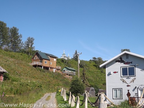
There are a number of B&Bs and vacation homes perched on the bluff with this gorgeous view. Also along the bluff is the The Transfiguration of Our Lord Russian Orthodox Church at Ninilchik.
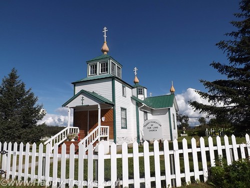
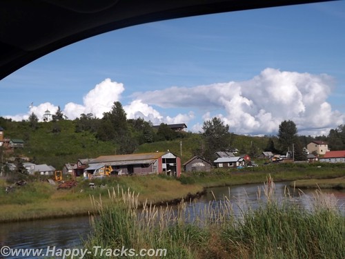
Ninilchik’s original settlers were Russians who migrated from Kodiak Island in 1847 before the sale of Alaska to the USA. Various sources indicate that the settlers chose to stay because it was too much effort to move back to Russia. The culture is still very definitely old Russian. Ninilchik is a popular tourist destination with halibut fishing and clams below the tide line. The Alaskan earthquake of 1964 caused part of the village to drop in elevation. Much of the town is now on the land (east) side of the highway.
We continued on towards Homer. There is a scenic pulloff before the bluff descends above the town. We sighted a double rainbow and some more great scenery.
We went into town to secure lodging for the night. This task is easier said than done. We checked the chain motel (all full). We went to the Driftwood Inn which has cabins, RV park and lodge rooms but only the RV park had vacancies. The staff there was VERY, VERY helpful in trying to find us a room even making the calls for us. Apparently the Chamber of Commerce or Visitors Bureau maintains a website with listings of the various lodging which is updated with available rooms. The only place listed as having anything available was a B&B on past town. They called but only got voicemail. They left a message on our behalf and we decided to drive on out so we would be nearer should a room be available. We arrived at the B&B but still no callback. We went to the door but no one answered there either. We finally were able to talk to the innkeepers on the phone but they indicated they had rooms but only rented with a 3 night minimum. They did have a great view but we were off again.
We called down the list the folks at Driftwood gave us and finally got hold of cabins in Anchor Point (about 12 miles back up the road). The woman on the phone said she still had a cabin for one night available. I offered my credit card to hold it but she told us it wasn’t needed. She’d meet us there. OK, I guess. She gave us directions but we took the wrong turn. (Seems there’s two intersections with the highway and North Fork Road.) We called again and she corrected our way. We eventually reached the Sleepy Bear Cabins and got checked in. Sleepy Bear Cabins has 4 cabins and a couple of RV spots.
Our cabin would sleep 6 or so people, 2 on the futon downstairs, 2 on the bunkbeds downstairs and 2 in a double bed in the loft. We opted to sleep upstairs but had to remember to duck for the low ceilings and the really low ceiling over the stairs.
Our cabin was of logs and had some interesting fish carvings in a line for the small stoop rails.
There were no restaurants in the vicinity open so we had sandwiches from the refrigerator in the truck. This was only the second time we had to rely on our own supplies for a meal.
A good night’s sleep and we would try Homer again on Sunday.
You can see all of the pictures from this leg of the trip here.
We invite you to continue along with us and hope you enjoy the account!
Summer 2014: Alaska via the AlCan; Anchorage to Seward
We started our morning in Anchorage with breakfast and then off to the Hood Canal adjacent to Ted Stevens International Airport to view the seaplanes.
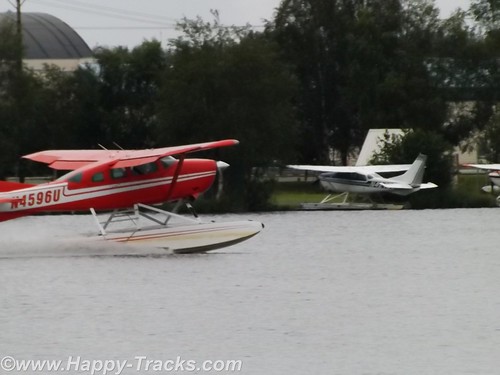
Alaska is a vast state but not dense in roadways. This is a combination of the great distances involved, the harsh environment and the mountainous (in many places) geography. Given the abundance of lakes and rivers, seaplanes are a natural choice for transportation throughout the state.
Scattered around the lake end of the canal are floating docks and numerous seaplanes tied alongside. There were multiple signs advertising tours. After waiting just a little while, we saw a seaplane landing and another taking off. The morning traffic was getting started. Many of the planes are also used for freight and passenger service. According to our reading, over 500 flights per day use the Hood Canal.
We were also able to travel around the hangars area where the planes were stored and we saw that many of the seaplanes can switch out their floats for skis or for wheels and tires. Our driving about even took us to a couple of places where auto traffic was required to yield the right of way to airplane traffic. The area also allowed us to see some of the Alaska Airlines planes taxiing to and from the terminal.
We were a bit surprised that we were able to travel about as freely as we were with no checkpoints.
The clouds turned to sporadic rain and we headed into downtown Anchorage.
We arrived at the edge of Knik Arm of the Cook Inlet just before 10:00 when the Oscar Anderson House Museum was scheduled to open. Parking was scarce but we pulled up behind a Subaru Outback with Alaska plates. There was a young couple waiting nearby. After a few minutes, the young man approached and asked if we happened to have jumper cables. Do we have jumper cables? Remember we’ve told you earlier we had two spare tires, 5 extra gallons of gas, a winch, enough recovery gear to get us through on our adventure, not to mention two suitcases of clothing, a tool box, a stocked refrigerator and multiple thermos jugs of coffee. As it turned out, we also had an emergency jumpstart pack, a set of jumper cables and an extra car battery, just in case. So, yes, we had jumper cables which started his car quickly. They called the motor club to cancel their request for help and after they left we had a laugh at the tourists from Maryland being better prepared than the “locals” in their adventure mobile.
Oscar Andersen House Museum is recognized as the first wooden framed house built in Anchorage. Mr. Anderson purchased the land it was built on (across the street from its current location) in the 1915 auction that subdivided the city into lots following its selection as the the terminus for the railroad into interior Alaska. Prior to 1915, a tent city had grown up with attendant water and sanitation problems to house the workers who arrived to build the railroad and help harvest the interior bounty.
Mr. Anderson was a Swedish immigrant who had been in Seattle since 1900. Following the US purchase of Alaska from the Russians, he joined the many who made their way north to seek their fortune. He was a butcher by trade and established the Ship Creek Meat Co. on Anchorage’s 4th Street. He was also involved in other entreprenuerial efforts which helped the city (which eventually has become Alaska’s largest) to achieve permanence.
After buying the land in 1915, he hired two Swedish carpenters to build the house and sent for his family (wife and daughter) to come from Seattle. They arrived in October but the family lived in the tent city until December but were in the house by Christmas. (Swedish Christmas traditionally begins the celebration on Dec. 13 but it wasn’t clear exactly when the family moved in.)
Today the house is listed on the National Register of Historic Places and belongs to the City of Anchorage after being donated by the Anderson family. In many other areas, the house might not be thought of as unique but instead as a typical turn of the 20th century home with a parlor, dining room, large kitchen and a mud room off the back. Upstairs are three bedrooms and a bath that was plumbed in later. It is furnished with period furniture and accessories. Its place on the National Register and the fact that it is the only historic house museum in Anchorage makes it worth taking the time to check out. Unfortunately, we got no pictures. As memory serves, it may have been because the camera was due for a battery change when we got distracted by the car battery outside. I’ve linked their website here . If you go and get pictures, share them with us, okay?
Our next stop was the Alaska Native Medical Center Gift Shop. Betty had found out about this place on the ‘net before we left home. The gift shop has many items that are handcrafted by Alaska Natives which we found to be somewhat scarce in our travels and the proceeds contribute to the Alaska Native community at the medical center and a scholarship fund in addition to providing support for the crafters. The wares included jewelry and art pieces. It also included hand carved pieces of ivory. Per Federal law, new marine mammal ivory may be carved only by Alaska Natives and sold only after it has been carved. Old ivory can be carved by non-Natives. Fossilized mammoth ivory may be used by Alaska Natives and non-Natives alike. We had a conversation there with one of the clerks who also cautioned us that marine mammal products could not be taken into Canada (even if just passing through). Items like that would best be purchased and then mailed home. Our discussion with the clerk also included her horror story of trying to get through Canadian customs on a camping trip. Apparently, their customs agent had made up his/her mind that residents of Alaska going camping in the wilds of Canada would have a gun packed away somewhere no matter what they said and so they were required to completely unpack all of their camping gear from the truck to satisfy the agent. I guess we were lucky in that the border crossings were always uneventful. We did enjoy looking around the shop and recommend it as a place to include on your visit.
Our next stop took us back into downtown Anchorage for lunch at Humpy’s where we had salmon chowder and a salmon salad plate. Yum!
After lunch we pulled out of Anchorage on our way eventually to Seward but we were anxious to get to Bird Point on the Turnigan arm to witness the tidal bore. A tidal bore is a wave that occurs when the tide moves through a narrow opening such as the Turnigan arm. The tidal bore can be quite spectacular, even to the point of creating a surfable wave several feet in height. It varies based on the strength and height of the tide.
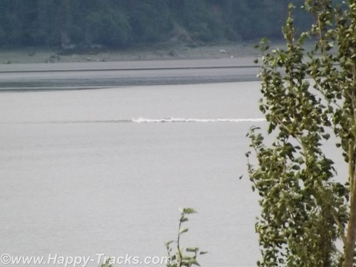
We knew the moon wasn’t right for a huge wave but had read stories and wanted to see it for ourselves. We stopped at Bird Point where a park viewing stand is built for just this purpose. We watched as little by little more sandbars and beach were exposed and then we saw the tide had turned and the water was coming back in a wave. I’ll apologize for my video skills (and the lack thereof) and share this short unedited clip to show you what we saw.
Its really very much like a wave hitting the beach in the ocean or gulf at very slow speed.
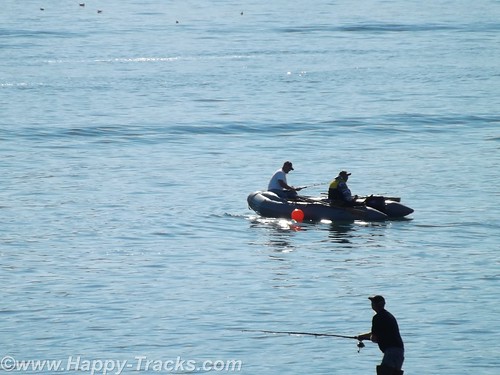
After we got back into the truck and headed on along the arm, we passed some Stand Up Paddlers (SUP) attempting to surf on the wave but not having much luck at staying on.
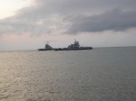
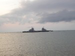
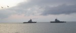
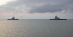
We continued south another 100 miles to the docks area at Seward AK. The docks were very busy with people all about. There were numerous boats tied to the pier as well as many cars/trucks with empty boat trailers in the lots. There was also a cruise ship tied to the pier.
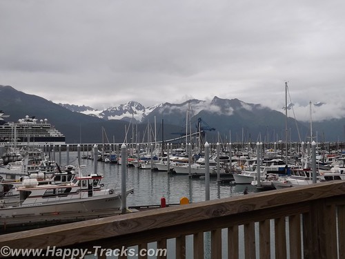
We saw the fishing boats come in and unload their catch and we got to see the cruise ship gather its passengers and go.
While eating dinner, we overheard one woman talking to her young boys about how big the cruise ship was. We did manage to keep our mouths shut when she told them that the cruise ship was even more massive because 90% of it is underwater. I think someone has mixed their icebergs and cruise ships!
Our hotel was adjacent to the docks and appeared to be one of the facilities built to accommodate the cruise ship passengers when they come ashore.
The next morning, we wandered into the downtown area of Seward. During the Gold Rush of the 1890s, Seward became a drop off point for the miners headed inland due to the ice free harbor of Resurrection Bay. In 1903, a group of speculators began building a railroad from Seward inland but it went bust. But the roadbed for the rails became a trail headed inland from Seward to Iditarod, now known for the Iditarod Dogsled races.
The town itself has a central business district a couple of blocks long with old storefronts now being given over to pubs and a couple of standing hotels. Much of the housing in the surrounding blocks appears to be seasonal, renting out to tourists for the fishing season. We found a pretty good souvenir shop which specialized in Alaska-made (not Alaska Native made) goods which probably does a pretty good business.
 On the waterfront, there is a park with a cairn marking mile 0 of the Iditarod and the Alaska SeaLife Center, Alaska’s only aquarium and ocean wildlife rescue center. Although we passed by, we chose to skip it and try to see our wildlife in a more natural setting.
We rolled out of Seward heading north with our sights set on Exit Glacier.
You can see all of the pictures from this leg of the trip here.
We invite you to continue along with us and hope you enjoy the account!
Boardwalks, Bunkers, Bungalows, Beaches, Birds and Bombs
The Delaware Beaches of Rehoboth, Lewes and Cape Henlopen
Our travels around this great country are multipurpose. One purpose is trying to decide where we want to live in our retirement. That quest led us to spend some time not far from home but new to us, the Delaware Beaches which includes for our purpose, Rehoboth Beach, Dewey Beach, Bethany Beach and Lewes. We’ve made two trips there so far and the pictures are from both trips.
 On our first trip over the long Presidents’ Day weekend, we stayed at the Hampton Inn on Coastal Hwy. It is a little less than 4 miles to the Boardwalk at Rehoboth Beach. Boardwalks are fairly common in the middle Atlantic Beaches from about Ocean City northward. Rehoboth’s is actually made of boards and is somewhat deserted in the middle of February. We walked around a bit (in the cold) and the carnival midway gameroom and several eateries including fries, hot dogs and the like. There are several hotels on the boardwalk (along with condos) that look to have a great view. Much of the area surrounding the boardwalk look to be houses that are rented for the week or the season. Driving north there are more extensive condo developments and a park leading past the Gordon Flats Wildlife area and into Cape Henlopen State Park.
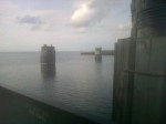
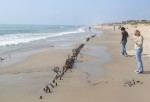
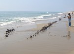
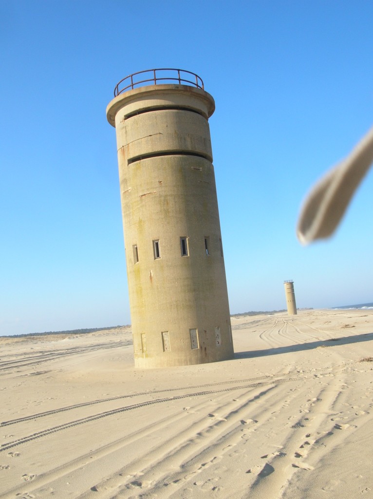 Walking along the beach, we found two of these. They aren’t lighthouses, the doors at the bottom are sealed and the openings higher up aren’t covered. We pondered and looked but came up with no answers yet. As we rode around later, we discovered there are more of them spread along the coast. There are three south of Dewey Beach and at least three further north before Lewes. One of the towers south of Dewey offered a clue in the form of a website link on a sign next to the highway. Save the Tower They’re WWII fire control towers, built to guard the entrance to the Delaware Bay.
The towers are open on top with a wide slit running halfway around the circumference. They were manned by lookouts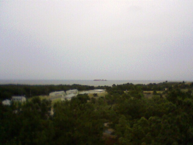
 and specialists who calculated the trajectory and angle of the artillery fire. Perhaps most amazing in this age is that the calculations didn’t have modern electronics (calculators, computers) to assist. A combination of the known distance between two towers and the height of the observation deck allowed the personnel to triangulate and located the precise location of a target and feed the necessary information to an armed battery. We couldn’t find information on how successful these efforts were as the towers at Henlopen weren’t tested in actual combat. More of the towers were erected (perhaps 1000) along the coastline as far north as Maine and New Hampshire. Many of them have been destroyed although a few remain, both on privately and publicly owned property.
One of the towers at Cape Henlopen has been repurposed by the Delaware Pilots Association to watch the Delaware Bay entrance and the ship traffic there. 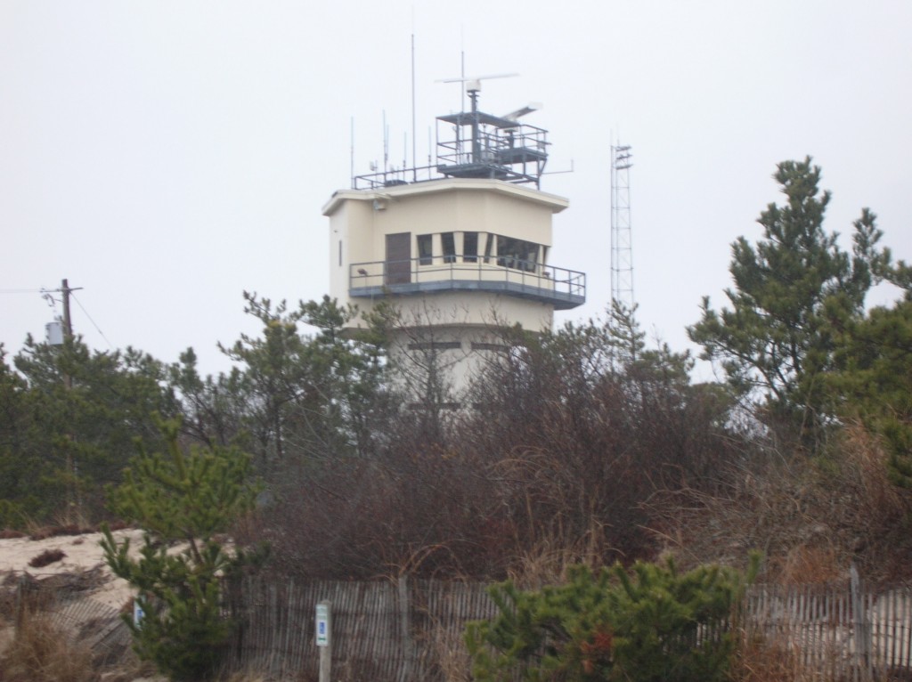 Also check out the Delaware Seashore Preservation Foundation.
For some reason the towers really captured our attention and we made a point to see as many of them as we could while we were there. It did seem that we were jinxed on trying to get pictures of the inside of one. When we visited in February (and they were closed), the battery in the camera died just before we tried to sneak an inside picture and again in July, the camera batteries died when we climbed the tower at Cape Henlopen State Park but we did get a couple of lower quality shots with the old cell phone.
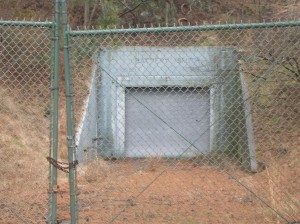 Within the confines of Cape Henlopen State Park are the remnants of Ft. Miles. Ft. Miles is about 5000 acres in size and was an active military installation from 1941 until 1996. There is an ongoing effort to preserve and restore much of the history of the post, originally constructed to help protect the oil depots and refineries as well as the port of Philadelphia during WWII. Luckily for the preservation-minded, the 261st Coastal Artillery was somewhat practiced at rust prevention techniques. The naturally-occurring sand dunes helped form protection for the underground bunkers for
  storage and personnel.
Strategic placement at the mouth of the Delaware Bay helped ensure the area’s involvement in US history dating back to the War of 1812. The town of Lewes is home to the Cannonball House. The Cannonball House is home to the Lewes Historical Society’s Maritime Museum and is famous in part because of the cannonball embedded in its stone foundation since the war of 1812. Across the street from the Cannonball House is the War of 1812 Park. The Park is the site for Lightship Overfalls and the Lewes Life Saving Station, both the subject of local preservation efforts. 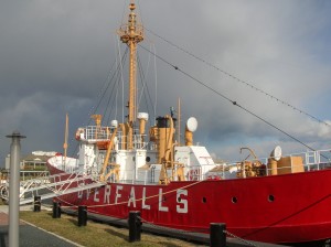 Lewes is also at one end of the Cape May-Lewes ferry run, connecting to the NJ peninsula. We didn’t make that trip this time around but had ridden the ferry back in the early 1980s.
We had contacted Deb Griffin , a local Realtor, and told her we were interested in visiting the area and were looking for some guidance. She agreed to guide for us and show us some houses while we were there. As its turned out, Deb has given us 3 days of her time in person (plus her prep time) and shown us a variety of homes in our price range and shown us some of the local color and significant spots. We haven’t yet decided just where the heck we’re going to wind up but certainly appreciate her combined goodwill ambassador and real estate/tour guide efforts. She’s also pointed us at some good restaurants in the area.
Three eateries stand out as being especially good for us among the locals.
We had dinner one evening at Henlopen City Oyster House. Their menu changes daily and has an abundance of seafood dishes, including a sampler of oysters on the half shell (which we didn’t try). Feeling a bit adventurous, I had the Day Boat Scallops which were a combo of broiled scallops with bacon, caramel and plantains. Absolutely delicious and served with potatoes and broccoli that evening.
Lunch one day was at Tout de Suite Patisserie at Paynter’s Mill in Milton. We opted for a light lunch although the bakery cases were filled with yummy- (and very rich) looking pastries and desserts. The soup and sandwich were quite the treat as well and worthy of a return visit.
We also grabbed a late lunch at the Pickled Pig Pub on the Coastal Hwy in Rehoboth and I’ll recommend the Cuban Press as being delicious and filling.
Of course, there is a variety of the expected chain eateries including Panera and IHOP. I think we will need to be careful of our eating or take up a more active lifestyle should the Rehoboth area win the decision for a retirement locale.
You can see all the pictures from the Delaware beaches by clicking the highlighted text.
November 25: Sometimes, you just gotta get away
It had been a long stretch. Work was busy and vacation time was tight. Some upcoming life changes showed over the horizon but not close enough. We had had it. We’ve got to get out of town and do something different.
Now that we’ve agreed on that, where do we go next? San Diego has been on the list for awhile but you’ve got to make reservations and flights are generally crowded and expensive this close to the holidays. Friends in Texas and along the east coast were due a visit and had been promised one for a while. How about Savannah? We liked it there and wanted to go back, its within driving distance and it should be warmer. Share Thanksgiving and the day after enjoying family and some of the rituals and then load up and leave town.
We pulled into Savannah on Saturday evening after an uneventful ride down I95 and made ourselves at home in the Hilton Garden Inn for several days. There was a wedding reception in the ground floor banquet room and the parking lot was crowded but that didn’t deter us.
Sunday dawned bright and clear. After breakfast at the local Atlanta Bread Co., we headed for Tybee Island. In our previous visit, we had briefly visited just the lighthouse area but wanted to see the rest of the island this time.
 As we headed out the causeway towards Tybee, we noticed a sign to Ft. Pulaski Nattional Monument and decided to check it out. Someone’s senior card allowed us to enter at no additional charge.
After entering the gate, we drove across a bridge over the old South channel into Savannah and wound our way to the visitors center and the parking lot.

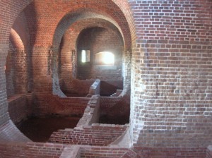
Like most of the forts from this era, the low walls surrounded a modified pentagon shape enclosure. Unlike the others we had seen, Ft. Pulaski was surrounded by a moat, complete with drawbridges. The Park Ranger giving our tour explained that the area outside the fort but within the moat (The Demilune) had never been part of the enclosed fort but had been used for kitchens and in later years for storage of ammunition. 


The inner walls showed the standard archways leading to the various rooms of the fort. The picture below replicates a set of barriers put up to help protect the inner rooms from ordnance landing inside the fort walls. The angled wood helped to move the ordnance from the structure and storage areas as well as giving additional strength to the walls.

One area showed a partial excavation so you could see the brick structure supporting the wooden floors between the walls. In its life, the fort had been used to garrison troops for the Civil War as well.
 This picture also shows the mortar used to fasten the bricks.
Tuck-pointing and repairing old mortar joints remains one of the team’s major focuses inside Fort Pulaski. In the 1930s the Civilian Conservation Corps (CCC) repaired crumbling mortar joints inside the fort using the latest technology, Portland cement, without knowing its damaging effects. However, Portland cement does not allow lime mortar to absorb and release moisture. Thus, the lime mortar is reduced to powder. The weakening mortar leads to cracking and flaking of historic bricks which threatens the overall integrity of the fort.
With more than 25 million bricks, the challenge of preservation and restoration involves removing the Portland cement and replacing it with more traditional lime mortar and natural cements.

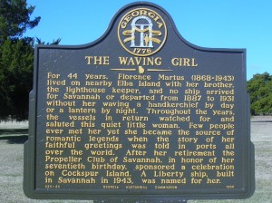 Adjacent to Ft. Pulaski is the lighthouse on Cockspur Island. Savannah history includes multiple references to the Waving Girl, who was known to all the sailors entering the Port of Savannah (but not for reasons that first come to mind of a girl and sailors!)

View from the wall


Old style drawbridge. The chain works for raising and lowering


View of Cockspur Island lighthouse from Old US 80 and the Lazaretto Creek Marina


Egret
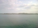
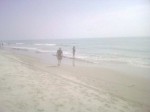
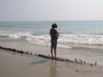
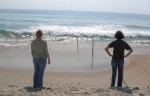
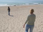
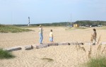
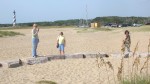
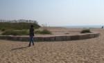
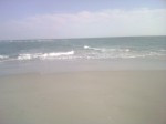
 After leaving Ft. Pulaski, we continued on to Tybee Island. As mentioned above, we had visited here before but stayed up in the vicinity of the lighthouse at the northern end. This time we headed to the extreme southern end of the island and parked the car to walk on the beach.

Manmade concrete jetty structure to protect the beach.
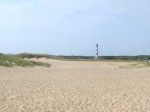
The beach here is very, very flat/gently sloping and has a low duneline as well. It would seem to the untrained mind (like mine) to be very vulnerable to wave action, particularly during storms. Along the beach in several places are jetties, a combination of the concrete structures seen above and huge rocks.

“Time to eat”. So we did!


Under the fishing pier
There is a concrete fishing pier and pavilion with vendors in the summer and its available for rent for special occasions. On this day it was pretty much deserted except for a few of us tourists.
We left via the boardwalk where there were condos/apartments and several businesses including a restaurant/pub with a a big sign saying “time to eat”. We ducked in for coffee and a snack (really good guacamole and empanadas) before making our way back to the car and the ride back to Savannah. They also provided paper-covered tables and crayons to ease the wait.

Sea-themed Christmas tree on the boardwalk


 By the time we got back to Savannah, it was well on its way to being dark. We headed down towards River St. Parking can be a little tricky but we headed to the public garage under Ellis Square. When we had last visited Savannah, there was a huge (and not attractive) aboveground garage but it was being torn down to be replaced by this underground garage and a rebuilt Ellis Square at street level complete with fountain. There are a couple of daytime pictures in the next couple of postings.
Our dual mission for the evening included dinner and securing something to bring home for Ryan and for the neighbor who watches the house and mail for us. The latter would be solved by a trip to Savannah’s Candy Kitchen for pralines! (If you don’t know what a praline is, you have my sympathy…let’s just say they could be the reason why God made pecans…or maybe pecan pie was the reason.) At any rate, they are a sinful delight made primarily of sugar and pecans. These are some of the best commercially available ones I’ve had. You can order them online at Savannah Candy Company.  Miss Edith’s were better to my way of thinking but she’s not around to make them anymore so these are a great substitute
Dinner was also a reprise location from a previous trip, the Riverhouse Restaurant. The plan was to save enough room for dessert but it didn’t work out that way. Their regular dinner menu is tempting and Betty ordered the Scallops Patricia but I was intrigued by the special salmon with an orange glaze. I just had to see how the orange went with the salmon. They were both delicious as were the pumpkin biscuits. When the waitress returned to ask about dessert, there wasn’t enough room.
Sated, we made our way out to walk along the riverfront. There was a huge freighter going by but the lighting didn’t work out for pictures. The stop to try was enough time for the panhandler to corner us with his palmetto frond rose and his pitch for a donation. We finally gave in and then went on out way back to the car. I couldn’t find the ticket to pay (but didn manage to find one from our last trip). The attendant asked when we had come in and based our charge on that rather than the daily maximum which was appreciated.
We cruised back towards the HGI for the night. There was something going on in the banquet rooms but not as well-attended as the wedding reception from the night before.
Off to bed in preparation for tomorrow’s travels.
Columbus Day: Starting off Ugly and Staying out of the rain

Monday, October 8:
The federal recognition of Christopher Columbus’ landing in the Caribbean occurs on a Monday making for a 3 day weekend for those whose work recognizes this as a holiday. We were lucky that both Ryan’s and Keith’s employers considered it a day off.
") We cleared the room and checked out. Had a few more things we wanted to see and we needed to get home. First stop was the Orange Blossom Cafe to procure a legendary Apple Ugly. Sweets for breakfast wasn’t really going to be enough so next stop was Diamond Shoals Restaurant for a real breakfast involving eggs and bacon and we were headed north.
We cleared the room and checked out. Had a few more things we wanted to see and we needed to get home. First stop was the Orange Blossom Cafe to procure a legendary Apple Ugly. Sweets for breakfast wasn’t really going to be enough so next stop was Diamond Shoals Restaurant for a real breakfast involving eggs and bacon and we were headed north.
.Today’s plans include a trip up to Carova at the northern end of the barrier islands to hopefully find the wild horses. Betty and Keith’s last trip had been particularly productive in that regard and we hoped to share with Ryan.
The ride up Hatteras Island was more scenic than it had been coming in (since it was daylight and sunny!). We got to see the parasails in Canadian Hole and stopped to take a look at the renovations at Bodie Island Light. ") After we got to Nags Head, we shifted over to the beach road to find some recognizable landmarks from Ryan’s last trip (1993?). We had stayed at the Sea Oatel then (long gone) and the Holiday Inn Express (still there) and had really enjoyed the Keeper’s Galley restaurant (also gone, now a Sushi place).
After we got to Nags Head, we shifted over to the beach road to find some recognizable landmarks from Ryan’s last trip (1993?). We had stayed at the Sea Oatel then (long gone) and the Holiday Inn Express (still there) and had really enjoyed the Keeper’s Galley restaurant (also gone, now a Sushi place).
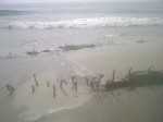
Somewhere along the way, it started to rain. When we got to Corolla, we took a short hop over to the beach access on  Albacore St. to visit another beached shipwreck we had discovered on a previous trip. We drove down a little ways to see what we’d come to see and then proceeded to go back the way we came.
A drift had built up on the Albacore Street ramp which had been no big deal on the way down to the beach but in going up the ramp, we found ourselves high-centered and blocking the ramp. We tried several ") things to get the truck loose and were in the process of digging as it appeared our only hope was to eliminate the sand drift that had high centered us. The winch didn’t help as it wasn’t functioning correctly and there was nothing to anchor to. (Note to self: Investigate pull pal.)
things to get the truck loose and were in the process of digging as it appeared our only hope was to eliminate the sand drift that had high centered us. The winch didn’t help as it wasn’t functioning correctly and there was nothing to anchor to. (Note to self: Investigate pull pal.)")
While we were digging, we saw a white pickup top the ramp and give us a short blast on the siren. In it were two young men who walked over and took a look and then told us they were headed down to the next ramp and would be back in a few to help get us out.
I continued digging while they circled around and came down the beach from another ramp. We hooked my tow strap to their truck and a gentle pull had us moving again.")
Recognizing the insignia on the truck as being Corolla Ocean Rescue I asked if there was a charge for the tow or even a suggested donation which they declined. Told me they were just doing their job of keeping the ramp clear for emergency use. Not quite sure I totally buy that but I sure appreciated their appearance and their help. Ryan noted the wardrobe of sweatsuits and bare feet.
Maybe they figured they’d have to haul this old guy to the hospital (or worse) if they let him keep digging. In any event, in my mind this is worthy of a shout out and much appreciated.
After we got down on the beach again, we headed north to the next ramp (why hadn’t I thought of that before getting stuck?) and headed back into Corolla for a restroom, place to change my wet jeans and maybe some lunch as the hour was advancing. We found it in the form of Dunkin Donuts.
We then headed on in the rain seeking the wild horses. We got a look at the Currituck Light as we drove by.")
We rode all the way up to the VA/NC line and saw none. OK, now what? Sometimes you see a few in the vicinity of the Post Office and Fire Department so we head over that way. More rain and no horses. Oh well, we tried. Time to throw in the towel and head for home.
")
")
") As we pull past the town hall building, Betty spies something over there in the woods. We back up and sure enough, there is ONE horse huddled under a tree to stay out of the rain. At least someone has sense to come in out of the rain. That was not someone inside the truck. We snap a couple of wet and blurry pics and head towards home.
As we pull past the town hall building, Betty spies something over there in the woods. We back up and sure enough, there is ONE horse huddled under a tree to stay out of the rain. At least someone has sense to come in out of the rain. That was not someone inside the truck. We snap a couple of wet and blurry pics and head towards home. 

") We do make a quick stop for a couple of souvenirs and for gas and we’re off. By the time we got to the Border Station in Moyock, it was pouring rain which made it fun to get in and out and to refill the tires to regular pressure. I will commend their coin-op air for tires as being one of the best I’ve run into, sufficient pressure to be effective and it runs long enough to get to all four tires.
We do make a quick stop for a couple of souvenirs and for gas and we’re off. By the time we got to the Border Station in Moyock, it was pouring rain which made it fun to get in and out and to refill the tires to regular pressure. I will commend their coin-op air for tires as being one of the best I’ve run into, sufficient pressure to be effective and it runs long enough to get to all four tires. ")
") Border Station is located on the VA/NC line with parts of the store in one state and part in the other. Some things are treated differently tax wise in one state over the other so the gas pumps are in VA and the cigarettes and fast food are in NC.
Border Station is located on the VA/NC line with parts of the store in one state and part in the other. Some things are treated differently tax wise in one state over the other so the gas pumps are in VA and the cigarettes and fast food are in NC.
Much less traffic and a much quicker trip home than it had been down. We stopped at a Waffle House in Newport News for dinner. Wish we had been earlier to allow for some sightseeing there or to hit up Pitts BBQ in Williamsburg but it didn’t work out that way. We made it home around 11:00. We didn’t get quite as much rest and relaxation as we usually do on our OBX runs but it was still an enjoyable trip where we got to see our favorite beach and some great friends.
Next time, we’ll plan a little longer stay.")
Catching a few sights
Sunday, October 7: Sunday morning found us meeting at the Diamond Shoals for breakfast and some entertaining conversations. After that, Bruce was off to other tasks for the day and the others headed in the general direction of Ocracoke with an intermediate stop in Hatteras Village.
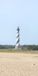
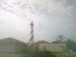
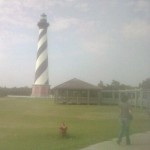
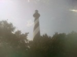
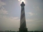
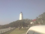
 No trip to the Outer Banks would be complete without a visit to the famous Hatteras Light.
 We visited the old lighthouse site and the circle of stones marking its location. From there, it was easy to see just how far they had to move the gigantic structure. We also went up to the current location and the ladies cruised the gift shop and the keeper’s house.
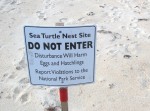
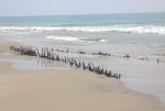
Betty and Keith have come to depend upon the Flambeau Rd.shipwreck to be our “go  to” example of a Graveyard of the Atlantic visual aid and it didn’t disappoint. While not as exposed as it had been during our last visit, there was a sufficient exposure to satisfy. Nearby, we found a lane prepared for an unhatched sea turtle nest.
From there, another peaceful ride on the ferry not unlike the day before followed by lunch at Howard’s Pub in Ocracoke. In our multiple crossings, Sarah pointed out that the ferries now each wore the colors of one of the colleges or universities in the NC State system.
We made it to Sarah’s ferry to the mainland with time to spare for a bit more conversation and promises to get back together soon.


 On our way back north, we stopped and explored the beach around the Hatteras landing including a trip down the Pole Rd to spend a little time watching the ferries and other traffic in the channel from the sound side. The shifts in the channel brought the marine traffic very close to the shore there and allowed for some fun pictures.
We left the Pole Rd and headed back to Avon where dinner was at Dirty Dick’s. Although we had tried, we didn’t manage to get Ryan tired of shrimp this trip. Hopefully we’ll get another chance in the future.
Back to our room at the Cape Pines for showers and an early bedtime after another great day on the Banks.
“Quick” Trip to Hatteras with Family and Friends
Friday, Oct. 5 Worked all day but kept going because I knew the beach was beckoning. We pulled away from Ryan’s place on schedule around 6:00. Destination: Three days in Cape Hatteras National Seashore Recreation Area. We’d made reservations at the Cape Pines Motel which had been recommended for years from folks staying there but was somehow never our chosen landing base camp. During the shoulder season, their office closes at 10:00 pm so we knew we’d need to call ahead to have them leave the light on for us.
We figured a slow trip but had no idea just how much traffic there could be on 95 on the Friday evening of a three day (for many) weekend. We’d managed to avoid that particular trap with planning before. About 9:00 (3 hours into the trip), we called Cape Pines from Stafford and told them we expected to get there around 2:00. They left us instructions for getting in and we were to come down Saturday morning and take care of the registration details. It turned out to be about 3:30. One of our longest times for that trip. But it was worth it!
We hoped to meet Ryan’s friend and former roommate Sarah in Ocracoke over the weekend and also our friend Bruce who would be staying at the Cape Pines.
Saturday, Oct. 6 : The alarm went off promptly at 8:00. Darn it! Using the cell phone alarm made it an unusual noise and not an automatic reach out and slap it so we were up.
It was a beautiful morning despite the rapidity with which it arrived. We got all checked in and then met Bruce over at Diamond Shoals for breakfast and headed towards Ocracoke to meet Sarah.
We had heard there was a bit of a backup on the Hatteras to Ocracoke ferry because of shoaling and the need to run smaller ferries at slower  speeds. During the day, departures are still every 30 minutes so the wait wasn’t that long. There were a couple of large vehicles (a motorhome towing a vehicle and a gasoline tanker) so we feared being delayed but turned out not to be a problem as the tanker was going later.
 The ferry was crowded and we slowed in a couple of spots to clear the dredge and the returning ferry in the narrow channel. It was a new experience for Ryan and we enjoyed the time in the sun. After disembarking at the northern end of Ocracoke, we headed to the south end of the island through the village to meet Sarah where the big ferry had dropped her as she left her car on the mainland.
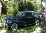
She reported the ride was pleasant but not well-suited for reading as she had just too much motion going on to be comfortable. We left the trucks and started walking the street. Our obligatory stop at Mermaid’s Folly was fruitful with a new skirt joining us. Bruce and Keith left the ladies to move the trucks from the one hour parking zone. We rejoined the ladies on Howard Street at the Village Craftsmen. Managed to spot an old graveyard inside someone’s yard. Also managed to spy a 1940 Buick looking all spiffy and well-preserved. Somehow, the ladies had managed to avoid seeing the dead snake in the road which was a good thing.
 It had been a while since breakfast and lunch was in order. We decided to try Dajio which had been recommended but never tried. We had been missing a treat. Various sandwiches and the bisque were delectable and just the right amount of food for our hungry group. For reference, the ladies room is apparently interesting as well. We spotted numerous rental golf carts and scooters and discussed those as ways to get about on the island.
We headed back to the trucks to go take care of the paying of the toll (or whatever you call the fee to drive on the beach now) and then off in the general direction of the beach with a  stop by the Ocracoke Lighthouse . and then to Keith’s favorite part of Ocracoke, Southpoint and the beaches.
There had been chatter in the truck about this and that but as we cleared the dune line, it got real quiet and then we heard from the backseat just one word, “Wow.” We rode down to the point and got out to walk about a bit. This is heaven. Pictures do a better job than words but don’t adequately capture it.
After a bit, we got back in the truck (with someone unknowingly leaving his “nice” flip flops setting on the front bumper) and drove north as far as the closure
  for a turtle nest and then back to the pavement by way of the airport and then north to the
  pony pens. Today there were a few out in the enclosure but none near to the observation platform.
Then it was back to the Hatteras Ferry where we shared the ride with the gasoline tanker we had seen earlier. The combination of its weight with the shoaling channel and the smaller ferry left us with empty spaces as the sun began to set.
Dinner was next on the agenda and Rusty’s was the place. A big breakfast and lunch left Betty and Keith not finishing but the sea air had awakened Ryan’s appetite. We’ll just leave it that Rusty’s crew did not disappoint and there were no empty plates!
Our next stop was the Hatteras Island Inn where Ryan and Sarah were staying the night. Worth mentioning is that the long-awaited freshening seems to have gotten started inside the rooms with fresh paint and a generally cheerier appearance. The planned improvements in amenities and outside freshening aren’t there yet but there’s hope. The ladies reported satisfaction with their accommodations when we met for breakfast next morning.
The remaining three of us headed to the Cape Pines and fairly quickly called it a night. Apparently little sleep and sea air brought the sandman quickly.
Getting An Ugly, Moving off the main roads
There seems to be a pattern to our visits to Buxton. We’ve done it a couple of times before and did again this time. We make the reservations with a day to be home before returning to work and then extend for the extra night. While it doesn’t allow for the day of rest from the trip before returning to work, the extra day of chillin’ at the shore tends to even it all out. The weather was warm and sunny and near perfect beach weather.
After telling the front desk we’d be here another night, we went to the much talked about Orange Blossom Bakery to finally taste the famous Apple Ugly. While I’ve heard lots of folks discuss them, I’ve never really heard anyone say exactly what they are. We were clued in at the party last night that it’s a deep-fried pastry with a sugar glaze that sounded a bit like what we would call an apple fritter. I think what actually convinced us to try them was a recommendation that their coffee was terrific! And sure enough, it was! We recommend the morning blend coffee when you go in for your apple ugly!
Much of the time in our visits has been spent going from place to place, primarily along the beach (when that was an option) or else along Hwy. 12. Recognizing that there was much of the villages that was not along the main highway, we did some exploring back into the residential areas. We started into Buxton Woods where we discovered the elementary school and a new residential facility (perhaps this is the one being built for teacher housing?). We also discovered some of the low hills that make Buxton one of the high spots on the island. We wandered on up to Brigand’s Bay and just beyond in the soundside residential areas.
We crossed over to the beach at Blly Mitchell (Ramp 49) where once again, we found the path along the beach limited to only one in and out with a retrace necessary. Heading further north, we stopped for lunch at the Atlantic Coast Cafe (again) by the Avon pier. Last night’s dinner was not a fluke, lunch was also quite good. We looked through the shop at the Avon pier and then moved north along the beach some more and stopped to see the Kinnakeet Life Saving station which has been undergoing restoration for a couple of years now. We went on past it to the sound side where we stopped to watch the windsurfers get underway. It looked a bit like this may have been the conclusion of a class where one of the surfers was doing his solo run. After watching them get going and snapping a few pics, we went into the residential area of Avon and stopped to see the sailboarders zipping back and forth.
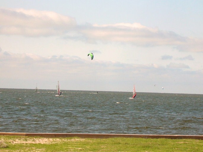
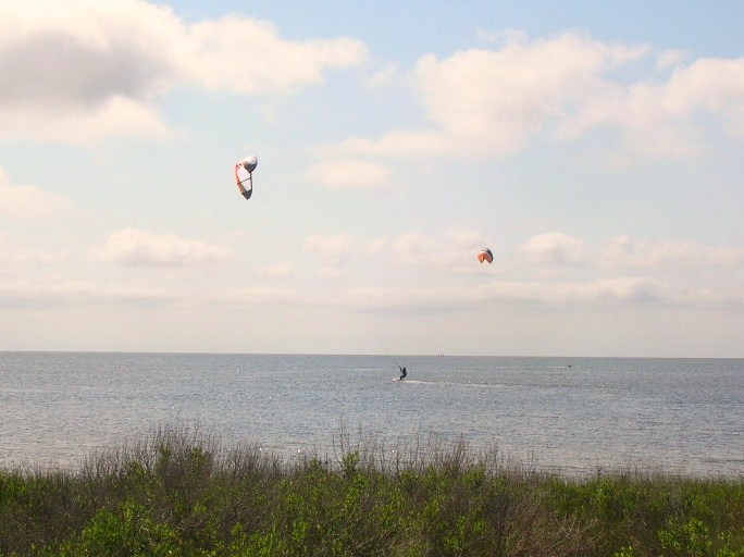
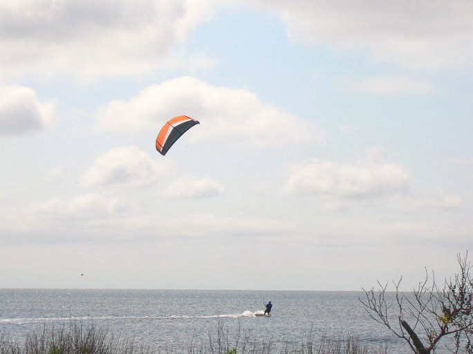
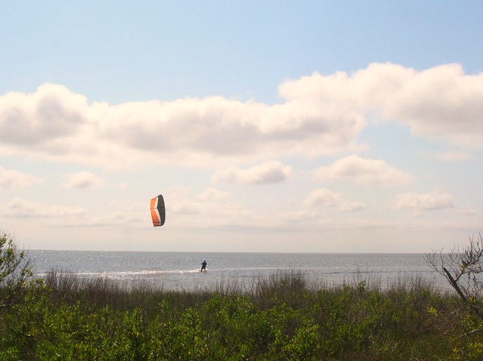
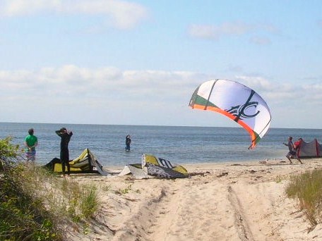
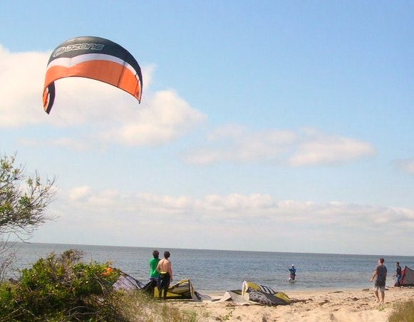
We spent some time catching up on the blog and pictures and then went to dinner at the Diamond Shoals where Betty had the Tomato Basil Crab Bisque with nice chunks of crab. Keith went for the salad bar with the gilled shrimp. We finished off with the high chocolate and peanut butter pie! The Diamond Shoals has added a sushi bar and done away with the aquariums. We had heard the large eel had died this past winter.
Back to the room. It appears there are about 5 rooms occupied tonight. We settled in to watch some tv and further typing and picture editing. Looks like we’re headed for home on Monday.