Desert Expedition III: Nevada – Post 7 — West to East – Nevada to Maryland and Home

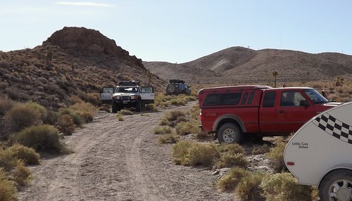
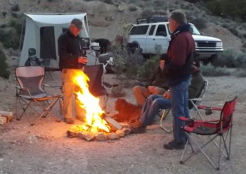
The air had turned cooler overnight and the wind had picked up as well. We hadn’t gotten the showers but there had been wind-driven sprinkles. Although we planned to go to Great Basin today, it didn’t look like a great day for being out and about. It was time to head home. Gary and Ace weren’t outside yet but they were both up as I’d heard them stirring around. I packed up and told them I was heading for home.
Ace gave me directions to hit Rt. 50 which should make for a scenic drive home. I was planning to take a bit more time headed east than I had taken going west.
DSCF1734
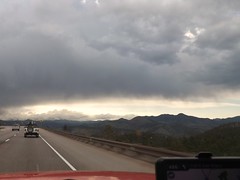
The last 5 miles to US 50 were windy and raining pretty hard. Maybe it would be better once I crossed the ridge.
DSCF1738
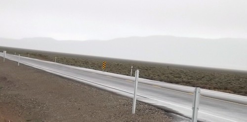
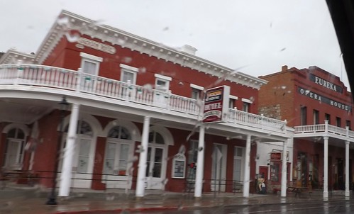
I drove on through the rain through Eureka and Ely with no signs of clearing.
DSCF1744
DSCF1748
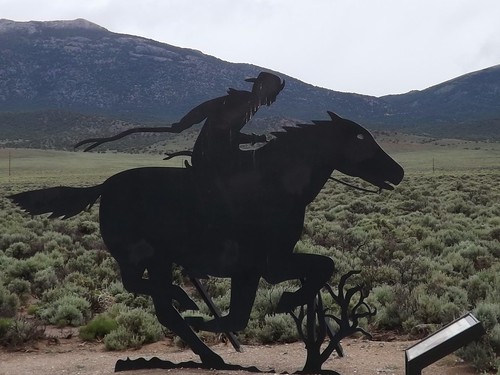
50 is called the Lincoln Highway and was built to connect the country’s east and west coasts. Parts of the Pony Express routes follow roughly the same lines.
DSCF1756
By the time I had reached I80 and the Utah state line, the weather had let up a bit so I decided to hit the Nevada Welcome Station on the way out of state. The woman working at the tourist info desk was a bounty of information. She asked where I was going and I told her I was headed for home after a week of ghost towns. I asked about non-camping accommodations as Betty and I had toyed with making a similar trip without the camping. She told me that in the small mining towns, upwards of 60% of the hotel rooms were occupied by workers at the mines or construction. Further south, where we had been it was closer to 40%. The point being that a trip such as ours without camping that you should make reservations before arriving. She also had two audio CDs provided by BLM for a car tour of the mining areas and the Pony Express routes.
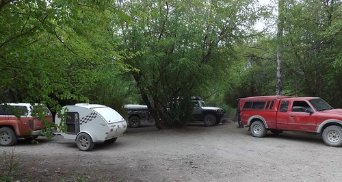
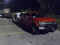
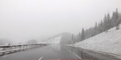
I hit the road and quickly was back into the rain. As I crossed over the Bonneville Salt Flats, I noticed another teardrop headed west.
DSCF1769
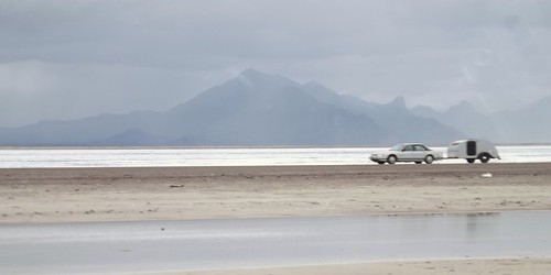
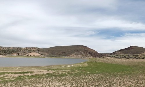
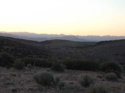
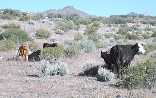
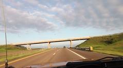
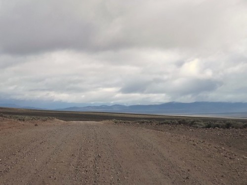
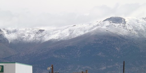
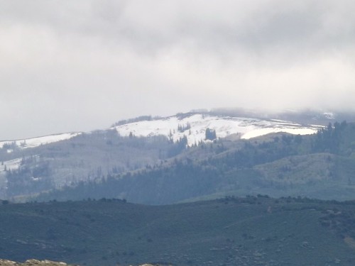
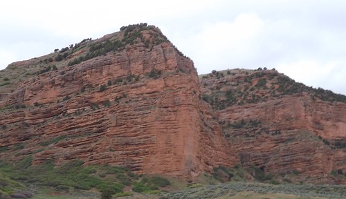
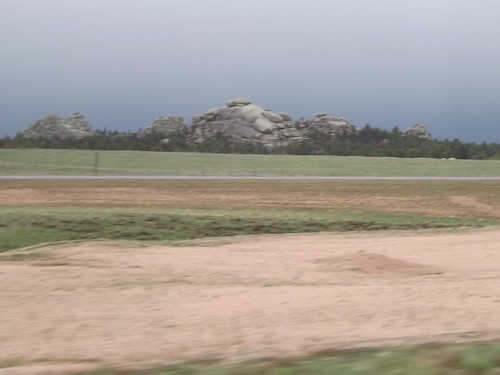
The scenery continued to be great, even though the rains continued.
DSCF1785
DSCF1788
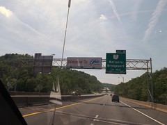
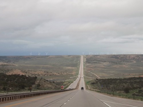
Crossing into Wyoming, the rains continued. Spending most of my life on the East Coast, I’m still taken aback when I see a road this long and straight.
DSCF1795
In Wyoming, I decided it was time to stop fighting the rain and check into a motel. A hot shower and a comfy bed worked wonders.
DSCF1807
The weather continued (sort of like on the trip west) to be unsettled. From the limited weather information, I had thoughts of possibly driving out of it eventually. Radio weather reports and severe warnings usually give the county affected. As a traveler, I’ll usually know what city I’m near but not always what county so word of Tornado Watches for XYZ County just meant somewhere nearby but could have been in front of me or behind me, who knows?
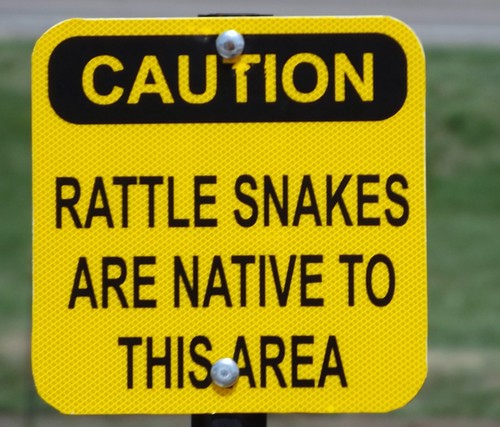
On the whole trip, I’ve mentioned that the only reptiles I saw were lizards. When I stopped at a Nebraska rest area, I’ll admit the thought that crossed my mind was “We’re going to argue natives versus tourists here?”
DSCF1826
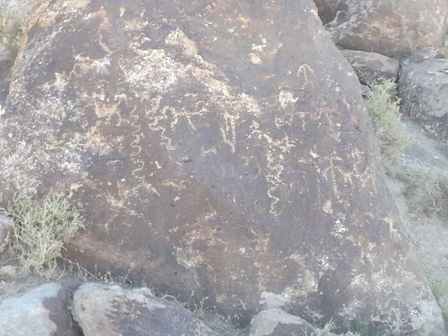
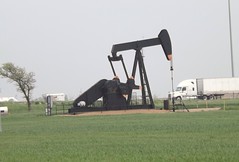
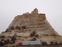
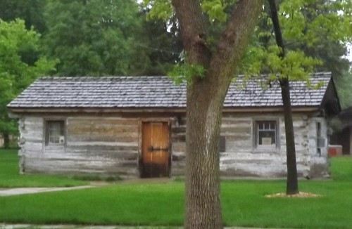
Nebraska does do well with the promoting local tourism though. Almost every exit had an 8×10 feet sign in color advising of tourist attractions at that or an upcoming exit. Not just “Historic Marker 500 feet”. That’s how I found this original Pony Express station when I had to stop for fuel.
DSCF1827
I kept seeing the heavy clouds and lightning and hearing reports of severe weather. Going through my mind was the notion that perhaps I would be in more danger if I stopped for the night than if I just kept going and was aware of what was going on around me. This kept me going until well after midnight and into Iowa where I pulled into a rest stop for some sleep in the Little Guy.
I did discover that Iowa rest stops along I80 all have free wifi!
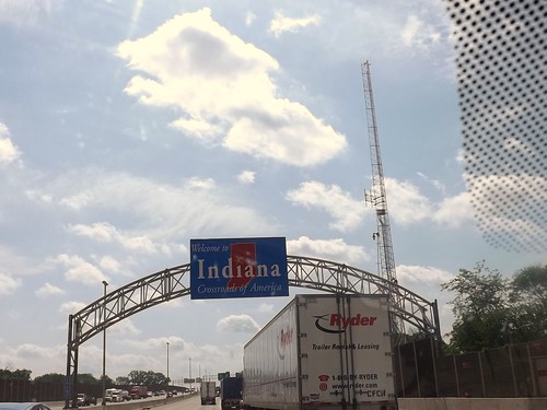
By the next morning, the sun was shining and it was an uneventful trip through Illinois, Indiana, Ohio, Pennsylvania and into Maryland and home!
DSCF1840
DSCF1845

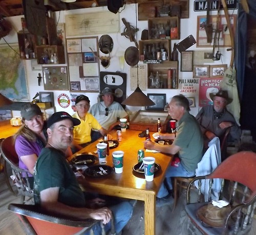
It was a great trip with some quality folks. I got to see things I’d never seen and learned more about the area. I also learned a few things about this type of travel (overlanding or travel camping) where you’re in a different place each night. I identified a few things that need adjustment to the truck, the trailer and the way I pack.

Where to next?

More photos from this leg of the trip.

If you’d like to be notified of new posts, use the Subscribe button in the upper left and provide your email. Your email will not be used for any other purpose!

Desert Expedition III: Nevada – Post 6 – Goldfield, Tonopah, Manhattan, Belmont and Pine Creek Campground

Alas, Monday morning comes and folks have places to be, loved ones to see and commitments to be met. We bid adieu to the others but Gary, Ace and I stayed together with plans to see some more and hoped to make it to Great Basin National Park.
We left and headed back to Tonopah for re-provisioning. Along the way, we passed through Goldfield NV but didn’t stop. Goldfield is more recent town which grew from the discovery of gold in 1902. Mining until 1940, over $86 million was extracted. Much of the town was destroyed by a fire in 1923, although several buildings survived and remain today, notably the Goldfield Hotel, the Consolidated Mines Building (the communications center of the town until 1963), and the schoolhouse. Gold exploration still continues in and around the town today. The hotel is not currently open and some accounts describe it as haunted. There is an ongoing effort to restore many of the old buildings and build the tourist trade. You can find out more at Ghost Town Operations.com website.
Teddy Roosevelt visited Goldfield and there is a story that Wyatt Earpp came to Goldfield after the Gunfight at the OK Corral but there is little to support that. It is confirmed that his brother, Virgil, worked, lived and died in Goldfield although he is buried in Portland, Oregon.
DSCF1616
DSCF1626
DSCF1622
The school is the building in the right of the picture above.
DSCF1639
RV parking behind the casino in Tonopah.
Continuing along to Manhattan, we find another town’s mainstreet which has obvously seen better days.
DSCF1646
This church, which sets on a hill above Manhattan’s main street was orignially constructed in Belmont.
DSCF1661
DSCF1662
DSCF1663
DSCF1672
We stopped for lunch outside of town and then went on to Belmont, NV.
DSCF1679
DSCF1681
Although closed this day, there are still accommodations to be had at the old Combination Miining Co. building, including the Old Boots Saloon.
DSCF1682
Remains of the bank.
Belmont is the site of a spring used by the Shoshone. In 1865, the discovery of silver ore led to a boom that eventually led to the buildup of a commercial center including schools, a post office, a newspaper and eventually becoming the county seat of Nye County from 1867 to 1905.
Belmont was known as a rowdy town with saloons, a red light district and various ethnic neighborhoods. Roughly $4 million was extracted from the shallow ore.
DSCF1690
Courthouse from the days of County seat.
DSCF1694
Remnants of the Combination Mining Mill in East Belmont.
DSCF1716
We traveled further north and found a spot for the night in the Pine Creek Campground in the Toiyabe National Forest.
DSCF1719
DSCF1725
The weather forecasts were calling for cold, possible rain/sleet and this spot seemed fairly sheltered.

More photos from this leg of the trip.

If you’d like to be notified of new posts, use the Subscribe button in the upper left and provide your email. Your email will not be used for any other purpose!

Desert Expedition III: Nevada – Post 5 – Silver Peak and Gold Point NV

Sunday we visited Silver Peak and Gold Point. These two fit the definition of a ghost town that is still alive but significantly less-populated than in their peak times.
To get to Silver Peak, we headed back in the direction of Tonopah and the highway. We turned off and stopped at a crossroads at Pearl Springs. In this location, the water supplies for several settlements branched out. We again found koi in the pool. This spot was marked as private property so our views were limited and we moved on.
DSCF1449
Signs warned of road construction on our way to Silver Peak. On the approach to SIlver Peak, we spotted a large lake with aqua/turquoise blue water, obviously showing the effects of chemical content. The lake and its surrounding activity are parts of the active lithium mining by Rockwood Lithium, taking place in the area.
DSCF1500
Silver Peak still has a post office along with the building that was formerly the post office. There are several commercial buildings, including a 6 unit motel along the center of the town, most of which have sale or lease signs in the window. As a note of comparison, there are photos on the web from 2000 that show many of these buildings having operating businesses.
DSCF1474
DSCF1480
DSCF1491
DSCF1482
We left Silver Peak en route to Gold Point. Along the way, Michael experienced his second blowout of the trip.
DSCF1501
While we had been in Tonopah on Saturday, Michael had attempted to replace the first blown tire but unfortunately found a merchant who believed that his role was to soak every customer once while you had the chance. This tire store in Tonopah is closed on weekends, there may be others where you would have a much better experience. Among the many other charges, a weekend callout fee was included in the $600 the merchant wanted to replace the first blown out tire. Michael declined and decided to chance it without a spare of his own but his luck didn’t carry him through. In the picture, you can plainly see the blown rear tire while everyone is working on the front. The thought process was to put the off-sized spare on the non-drive front and move the same size front to the rear to avoid excessive wear on the rear driveline. It seemed like a good idea at the time. As it worked out, the odd size tire interfered with the brakes operation and they wound up having to switch the tires back before Michael was able to move. We located another tire store across the line in California that would open on Sunday and had two tires in stock that combined cost less than the one in Tonopah. Michael spoke later of how the guy there was very thorough and customer-oriented. I don’t know the names of the two tire stores involved and don’t wish to mislead but advise the reader to proceed with caution if you’re in a similar situation.
While Michael went off to tend to tires, the rest of us went on to Gold Point with plans to meet up later that day. The meetup didn’t happen until the next morning. This is testimony as to why the longer range HAM radio has a place in desert traveling over the limited range CB radio. Enough about all that.
DSCF1509
Gold Point is a tourist destination with an active, though maybe limited, tourism industry to support the preservation of the town. Memorial Day weekend is designated as paranormal weekend and Labor Day weekend also has a theme which escapes me at the moment. As part of the festivities, there was a parade through town which included clowns, the transparent woman and even a unicycle rider.
DSCF1583
Gold Point’s preservation/restoration is a project largely credited to Sheriff Stone. To help raise funds for the restoration, several of the houses are available for rent on the weekends. Stone also prepares quite a spread for breakfast and dinner for a reasonable price. We decided to hang around for steak dinner.
DSCF1595
There are a number of old fire trucks on the property as well. I never quite got the connection unless its another hobby of a collector.
DSCF1508
DSCF1519
DSCF1546

For over 20 years now Walt and I, with many thousands of dollars from our own money from working, have been purchasing building materials and working on all the different cabins and buildings. It takes thousands of dollars to rebuild and preserve even a small old miner’s cabin, and we have 12, not to mention the other bigger buildings, so it’s been a slow process. Each year we find the price of wood products continues to climb.

It takes a lot of different materials to save a cabin. The only thing we generally do to the outside is put on a roof. We try not to put on any new wood unless absolutely necessary. Rolled asphalt roofing is usually applied first. Then as we get the extra money we put on the cedar shingles.

Inside is a little more complex. These 100 year old cabins and buildings were built without any framing like we build today. The walls are only as thick as the 1 x 12 inch board and bats that were used. We go in and strip the walls down to the original walls and then build a 2 x 4 frame inside. This stabilizes the cabin tremendously. We can then install the electrical wires, insulation, sheet rock, paint and/or old newspapers or old fashioned wall paper, carpet, curtains and finally furniture. From www.GoldPointGhostTown.com

DSCF1579
DSCF1592
We visited the open businesses including the saloon and the mercantile and got some hints for a spot to camp that night. We had an interesting discussion with one of the landowners/residents who told us a bit about what its like to live in a place like this. This particular resident has retired and stays in Gold Point mainly but also has a second home elsewhere. The resident specifically asked that details not get shared on the internet so you’re just going to have to visit and find out for yourself. 🙂
After our steak dinner, we wandered around a bit more.
I met a guy in the saloon who was asking about the Little Guy as he also had a teardrop trailer that he and his son had used in one of the parks for their vacation.
Eventually we decided to go find a camping spot away from the crowd. We eventually landed at a dry wash about half mile or so out of town after turning down several spots.
DSCF1605

More photos from this leg of the trip.

If you’d like to be notified of new posts, use the Subscribe button in the upper left and provide your email. Your email will not be used for any other purpose!

Desert Expedition III: Nevada – Post 4 – Kawich Range: Rachel, Bellehelen, Golden Bow, Silver Arrow, Tonopah

As we left Delamar, we said our good byes to Frenchie and headed towards pavement again, the circuituous route.
We headed along the powerline road where we saw new high line towers paralleling the old lines. The new towers had no wires though. A turnoff to the west took us into the dry lake bed where the soil (and its accompanying dust) turned nearly white. We came to a formation of rock that was nearly black (at least a few millimeters deep) which included petroglyphs.
DSCF1011
We eventually reached pavement at the Great Basin Highway and turned to head into Alamo. The gas station included a deli and really a complete grocery store so we stocked up fuel, aired up the tires, bought a few groceries, unloaded some trash and several of us had an ice cream treat before traveling on. It should be noted that they do not sell beer. We made another stop in Alamo to replenish that. We discussed heading down to a lakeside park for lunch but Martin had a better idea from a trip he’d made through the area some years back.
DSCF1018
Left to right, that’s Scott, Ace, Kyli, Keith, Gary, Michael, Martin and Sibastian in a photo taken by Laura.
We started down the Extraterrestrial Highway (NV 375) towards Rachel, NV. The top-secret Area 51 government base is near SR 375 and many travelers have reported UFO observations and other strange alien activity along this road. Such stories prompted the state to officially designate the route as the Extraterrestrial Highway in 1996. The small town of Rachel, located near the center of the highway, caters to tourists and UFO seekers with alien-themed businesses. Although the area receives some tourism due to alleged extraterrestrial activity, SR 375 remains a lightly traveled route. I have previously commented that we had no confirmed UFO or exraterrestrial sightings on our journey but I do have a scar (Scars are like tattoos with better stories!) on my temple where I supposedly walked into a tree in bright daylight for no apparent reason. Extraterrestrial abduction attempt gone bad? You be the judge.
When we got to Rachel, we stopped at the Little A’Le’ Inn for a look around and to grab lunch.
DSCF1031
Contiuig north along 375, we turned west through some BLM land towards Reveille area and the old Bellehelen mine site. Along with a newer (1940s?) abandoned wooden building, we found the remnants of older stacked stone structures and some smaller tailings piles.
DSCF1061
DSCF1078
DSCF1080
We also saw evidence of environmental monitoring in the area.
DSCF1083
The early mining methods used chemicals such as cyanide and others we know to be very dangerous (and long lasting) today and in our more enlightened state, we are taking the time to clean and monitor the contamination.
As it was getting on into the afternoon, we started looking for a place to set up camp for the night. We were aiming for something a bit better protected from the wind this night and found a flat spot on a hillside. Scott and Laura showed their culinary skills with Pizza and Brownies this night.
DSCF1087
In the hillside next to our campsite, we found this. Was it prepared as a home? A fallout shelter? Or just a way of protecting the mine?
DSCF1095
Up and off again the next morning at a leisurely pace befitting our vacation status.

This area shows generally on the maps as Reveille (or Old or New Reveille). We visited a couple of smaller mines that we didn’t discover the names for but we did see remnants of more of the stacked stone buildings and a bit of wildlife.
DSCF1136
DSCF1138
The name Reveille refers to the Reveille Mill which we found at a crossroads along with an empty corral.
DSCF1222
DSCF1223
Kyli enjoyed a cooling dip and playing with the koi.
DSCF1227
We found our next night’s lodgings down in the valley and among the greenery.
DSCF1234
Tonight was to be fajita night. Most of the fixings were supplied by Scott & Laura and Martin with the rest of us providing a little something. Thanks for some good eating!
Friday morning we were headed to an old ranch (Don’t remember the name but we thought we would find it empty.) As we approached we saw No Trespassing signs and signs of life so we turned around and headed in the direction of Golden Bow. To get there, we passed through (Bureau of Land Management (BLM) wild horse refuge and were not disappointed.
These two beauties stayed within sight and watched to make sure that all of us had the opportunity to take pictures and also that we left their area.
DSCF1269
DSCF1273
I saw a ram’s head in this rock formation although someone else said they saw a bird.
DSCF1277
DSCF1280
Although not as much left standing, there was more evidence of the town at Golden Bow.
DSCF1298
DSCF1309
Much of this area was originally mined in the late 19th and early 20th centuries. In the 1940s, much of the tailings piles were reprocessed with more efficient equipment and then again in the 1970s. Since that time, much of the work we see around has more to do with cleanup than mineral extraction.
Our next stop was Silver Arrow.
DSCF1336
DSCF1343
DSCF1348
Looking down a vertical mineshaft.
DSCF1356
Once again, we nosed around a bit and grabbed lunch. Silver Arrow is along the edge of restricted US Government space so we headed back out the way we had come in.
DSCF1389
DSCF1403
We headed towards Tonopah with some thoughts of eating at a restaurant and restocking. We visited the Mining Museum and displays. Betty also happened to catch me on the truck phone in a rare moment when we had signals and I was in the truck. Tried to talk her through some computer problems but she managed to work it out after I dropped signal.
DSCF1421DSCF1422
We decided to find camp rather than hang around town for dinner and then go looking in the dark.
We found a good spot on national forest land.
Turns out the Little Guy had some issues with the too stiff suspension and the rough roads. Spent a while cleaning up the mess from that but slept well.

More photos from this leg of the trip.

If you’d like to be notified of new posts, use the Subscribe button in the upper left and provide your email. Your email will not be used for any other purpose!

Desert Expedition III: Nevada – Post 3 – Helene Graveyard and Delamar NV

On Wednesday morning we headed in search of Delamar NV, a classic mining ghost town which saw its hey day in the 1890s. Gold was discovered there in 1889 and the original mines along with most of the major mines in the immediate area were purchased by Captain Joseph Raphael De Lamar for about $150,000. Some cursory research on the man shows he left his maritime interests and invested in mining claims. The one in Nevada paid off fairly well, producing over $13 million in gold.
Delamar at one time boasted a population of 1500 and amenities such as a hospital, an opera house and a central water system pumping water from a well some 12 miles away. Unfortunately, the gold in these hills was embedded in quartzite which lead to deadly silicosis when ground to dust as in the ore extraction process. One source said the population of Delamar included 400 widows at one point in time. The moniker “widow-maker” was apparently well-deserved. Remaining at Helene is a tailings pile from one excavation and a much-vandalized graveyard. Helene is on the way and just over the crest from Delamar.

DSCF0916
Gravestones are pretty much non-existent but the remaining decorative iron work is impressive in its detail and how well-preserved it remains.
DSCF0936
Moving on over the hill, we could see a lot more of the remains of the town and the mining and millng operations. It was obvious this had been a significant operation in its day.
DSCF0966
DSCF0980
DSCF0982
We decided we would spend the afternoon investigating further and stay in Delamar for the night.
DSCF0995
We found a clear level spot above the mill and along the roadway with enough room for all of us and we hoped some protection from the wind. It commanded a great view of the area.

During the night and early morning, I got quite ill. I’m not sure if it was the excitement, the altitude, something I ate or an allergy pill I’d decided to skip. Although my allergies are pretty mundane fare around home, I’ve discovered that I can be very allergic to rare flowering plants in Hawaiian volcanoes and possibly the Nevada desert. While I’ll spare the details, the morning found me worried about dehydration and seriously considering cancelling the remainder of the trip. As it turns out, I was somewhat weak the next day but after that one night, all seemed to be okay.
Frenchie, on the other hand, was not quite as lucky as he also got ill. He tied the symptoms to a medical issue he’d dealt with a month or so earlier and did leave the trip to visit medical pros to follow up. We heard from him later that he got home okay though. He was missed along the rest of the trip as he is quite an entertaining travel companion.

More photos from this leg of the trip.

If you’d like to be notified of new posts, use the Subscribe button in the upper left and provide your email. Your email will not be used for any other purpose!

Desert Expedition III: Nevada – Post 2 – Cedar City UT to Rainbow Canyon NV

On Tuesday morning, we were all to meet at Smith’s Market in Cedar City with some time planned to meet and greet and then get on the road.
Timing can be a relative thing but we did all eventually show up and get ready.
Along for the ride were: Scott B and his navigator, Laura in the recently repowered white Ranger; Sib (Sibastian who also is Scott’s father) in his white Ranger; Gary (gwittman) in his red Ranger; Michael (mjmcdowell) in his gray Ranger; Frenchie (Frechiexj) in his white Jeep JK; Martin (martinjmpr) in his maroon 4Runner; Ace (Ace Brown) in his silver FJCruiser with Kyla the golden retriever and Keith (4x4x4doors) in the orange Colorado.
We left Cedar City on UT56 and went off pavement before we got into Nevada. We eventually got into Echo Canyon State Park and found a spot next to the reservoir for lunch.
DSCF0811
Our next waypoint was Caliente, the first ghost town of our journey. This is probably a good spot to define exactly what is a ghost town. Many of us think of a place that is totally abandoned and derelict but Merriam-Webster includes towns whose population has significantly declined from previous levels due to the collapse of an industry or resource such as when a mine is closed. Detroit, Michigan would fit the part of the definition that includes a significant decline in population without being completely and totally abandoned. Caliente, Nevada (and several of our other stops) fit that significant decline defintion. Caliente gained its name from the nearby hot springs. The Union-Pacific Railroad came to town in 1905 and the train station, built in 1923, is built in the style of Spanish missions. Today it houses a museum and the town’s municipal offices and a library.
DSCF0823
After passing through Calienete, we veered left into Rainbow Canyon and followed the stream and the railroad tracks for a ways.
DSCF0833
DSCF0838
Climbing out of the canyon, CB radio traffic tells Michael that something doesn’t look right just as he discovers that he has a blowout.
DSCF0847
Replacing the tire turns into a group project with Scott providing his racing jack, Martin providing his four way lug wrench and various folks providing labor and advice. Ultimately, its clear the tire is toast and well-beyond repair and we’re back on our way.
We pass onto federally-owned and managed Bureau of Land Management (BLM) land. Different rules apply to passage and camping so ownership and management of the land is significant. We ride along a ridge road and see one other vehicle. Eventually we wind down into lower ground and start looking for a place to spend the night.
DSCF0876
This is range land and we happen upon some cattle and a stock tank and nearby clearing that had been used for camping before based on several fire rings in the clearing.
We set up camp for the night. Just before dark, we noticed four horses approaching with great interest. While they checked us out a bit, they decided to go on. Apparently our sheltered location was also used by the to bed down for the night.
DSCF0869
As we pulled out in the morning, the cattle followed for a while. One calf showed a particular interest in Martin’s 4Runner and ran after him for possibly a mile! There’s probably an off color joke that fits but I’ll refrain.
DSCF0889

More photos from this leg of the trip.

If you’d like to be notified of new posts, use the Subscribe button in the upper left and provide your email. Your email will not be used for any other purpose!

Desert Expedition III: Nevada – Post 1 – Zooming Across Country

In June 2012, Scott B. over at Expedition Portal starting discussing a third Desert Expedition for early summer 2013. The early planning just talked about a trip to visit ghost towns in Nevada. Several jumped in with possible locations to include and some early commit-ers saying they were in as well as a couple of the “regulars” who had taken part in DE 1 and/or DE2.

In January 2013, my plans to retire in March were firming up so I committed to joining in. Good thing I did as Scott capped off the list shortly thereafter. I said goodbye to my employer and officemates in March and started getting ready.

The roadways indicate that this was a trip for the truck and I decided to take the Little Guy as the truck bed, at 5 feet, is too short for me to sleep in except in emergencies. As provisioning stops would be few and widespread, I had to add capacity for water and fuel. While I probably overdid, I carried about 20 gallons of water and 10 gallons of gasoline in containers. I also carried my Edgestar refrigerator/freezer (works on AC or DC); tools; recovery gear; clothing; and some food with plans to restock and finish loadout with perishables before we met up in Cedar City, Utah. Also included in my packing was my SPOT messenger which allows me to check in with a select group of family and friends with my progress even when cellphone service isn’t an option.

The trip by the numbers:

  • 5482 miles driveway to driveway.
  • 14 days (all good).
  • 2 blown tires (neither were mine but both went to the same guy).
  • Gas: 306 gallons. High price $4.199; low was $3.599.
  • Motel nights 4.
  • Bottles of water consumed by me 22.
  • Post cards sent home 8.
  • Animals: Fish (too many to count in a couple of springs and stock tanks); Reptiles – lizards only (no snakes); Mammals – horses (wild and domestic); donkey; jack rabbits; dog; cattle; pronghorn antelope; 1 dead field mouse.
  • Extra-terrestrials (none confirmed but I can come up with no other explanation for the knot on my head and walking into a tree in a broad daylight outside the Little Ale’ Inn).
  • Good fellow travelers 7 human, 1 canine. Jerks in our party – 0.
  • Pictures taken 1312. (Don’t worry I won’t try to share them all).

I left home Friday morning, May 17th. We were supposed to meet on Tuesday morning and I figured on a nice DSCF0554 leisurely trip out of about 4 days putting me in town on Monday sometime. I planned to get at least part, if not all, the way across Illinois the first day. I had a bit of adrenaline going as well as the uncertainty of how far I’d feel like driving on subsequent days so I got all the way across Illinois and decided to try to get out of range of St. Louis morning traffic. DSCF0565 Using the GPS, I started looking for a Comfort Inn around midnight and got directed to an empty lot. (So much for recently updating the GPS maps!) By that time, I was pretty beat and stopped for gas and a walkaround and then noticed a Walmart at that exit. (Walmart has a general policy — there are exceptions — of allowing RVs, even little ones, to spend the night in their parking lots.) I stopped in and picked up a pan I had not gotten at home and checked to make sure they allowed for overnights. So back out to the edge of the parking lot and a couple of hours of sleep in the Little Guy.

DSCF0566 I woke up before sunrise and got rolling again across Missouri. My route took me on the outskirts of Kansas City in the early morning. Topeka, Kansas was later in the day and looked like it might be more picturesque as it is the capital of the state. While I passed within sight of the capitol building, it was covered in scaffolding for a renovation project. So onward to the wide open plains. Totally different from any part of the country I had seen before and breathtaking. To tell the truth, it was breathtaking the first couple of hundred miles but got repetitive after that.

Scooting across Kansas, there was a couple pulling a Scamp or Casita trailer that seemed to be stopping at the same rest areas. One time, I would pull in as they pulled out and then later they would pull in as I pulled out. We did eventually talk when we reached the Colorado welcome stop. They winter in Florida and were on their way to sons near Ft. Collins for the summer. We spent some time comparing notes on trailers and came to the conclusion that theirs is more livable but in a world of $4.00/gallon gasoline, mine was preferable for towing.

While in Kansas, I saw the occasional pump jack in addition DSCF0580 to wind farms. I guess that Kansas is covering their bets on two different sides of the energy issue. Also in Kansas, I heard reports DSCF0586 of nasty weather which always seemed to be about 40 miles behind me. In a couple of days, the devastating tornado in Moore, OK would hit. I pulled out of the Colorado Welcome Station as the rains hit. I drove out of the rain and back into the sunshine pretty soon but was seeing clouds on the peaks around Denver. Seemed like a good time for gas, so I pulled into a rundown looking truckstop. The gas pumps wouldn’t accept my credit card and I assumed it was related to the seedy look of the station and paid cash. Several declined purchases later, I called the credit card company. You know that ad where the couple is thrilled that the Bank has stopped their card from being fraudulently used in a foreign country? Its not all smiles when you’re trying to use your card and find that your bank (or credit union) decides that buying gas on a cross country trip is “suspicious activity”. Just 20 minutes on hold and we can get this all taken care of. Sheesh! DSCF0623.
Buying gas proved to be a good idea as the trek up the mountains and through the pass was sucking down some fuel. As I neared Vail, we added precipitation into the mix and it was sticking.
DSCF0642
It was close to dark, I didn’t know what the roads or the weather had in store for me and my efforts to find a motel that night before hadn’t turned out well so I holed up in the Comfort Inn in Eagle CO for the night. A hot shower and comfy bed sure felt good. It had been a long day (or two). I figured I had about 450 miles to go before Monday night so I was in good shape.

Sunday morning found me paralleling and in sight of the Colorado River for a while. The engineering of stacking an Interstate Highway on top of the river and squeezing the railroad tracks in there as well impressed me. And don’t forget to squeeze in a parking lot and river access, too!
DSCF0662
As I moved into Utah, things didn’t really level out but the slopes seemed to be gentle and the views longer. The weather was still mixed but mostly good driving weather.
DSCF0676

And what does every 4×4 driver think of when they think of Utah? Moab, of course. So here I am, easily a day ahead of schedule within 30 miles of 4×4 Mecca. So what do I do?
DSCF0704
I take the safe way out. No one knows quite where I am, I don’t really know my way around and I have this great trip in front of me. So, Moab is close but oh, so far away. Something else to stay on the “to do” list for now.
DSCF0722
The views are breathtaking but the locals have seen them before. I got an earful at this rest area after driving through a construction zone at the speed limit (65) for holding up these nice folks…but in spite of me, they still had time to stop and catch the view at the rest area?
I pulled into Cedar City on Sunday afternoon a full day ahead of my schedule. Luckily my motel had a room available but not the room I had reserved for Monday night. It was fine by me. I sorted the stuff in the truck, did some shopping/provisioning and filled my gas and water jugs. I even got my walk in while doing some sightseeing.
Cedar City has an extensive Veterans Memorial Park which I enjoyed. I was surprised to find water running in the rain gutters along the road. I figured it to be waterline maintenance or such but later figured it was the runoff from lawnsprinklers which seemed to be running everywhere with no particular concern for missing the grass.
Cedar City also has an “historic” downtown Main Street which includes a drugstore complete with old-fashioned soda fountain in the old Sheep Association building. Take note of the bronze statues of historic figures on the sidewalks. Similar idea to the OBX Pegasus statues and DC’s donkeys and elephants but classier.

More photos from this leg of the trip.

If you’d like to be notified of new posts, use the Subscribe button in the upper left and provide your email. Your email will not be used for any other purpose!