Our destination for the next couple of days is Vancouver, the city, not the island. The city has a population of over 600,000 with the greater Vancouver area topping out at over 2.4 million people. That makes it third most populous in Canada and most populous in western Canada. It’s also one of the most ethnically and linguistically diverse with over 52% of its population having a language other than English as their primary language. Vancouver was also the site of the 2010 Winter Olympics and 2010 Winter Paralympics and many structures from those events remain today.
The journey west took us through farmland and the increasing signs of suburbia with housing developments and shopping centers until we were obviously into the edges of Vancouver, complete with summer road construction. The freeway added and subtracted lanes while increasing the density of orange construction barriers until we were funneled onto the Port Mann bridge and into town.
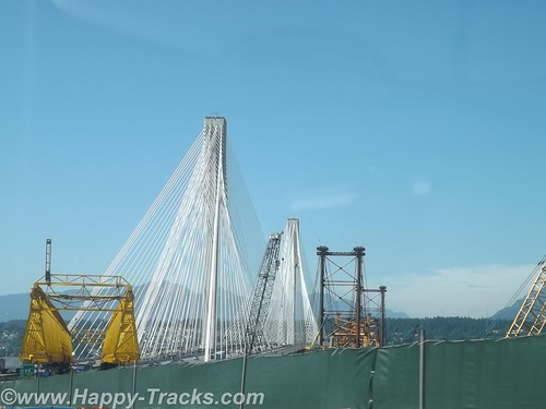
Just a moment to vent my feelings on toll roads and bridges. The Port Mann bridge over the Fraser River on Canada’s Route 1 is a toll bridge. Toll bridges are not unusual and not unexpected. For the traveler though, it is a bit of a surprise to find the toll is collected only remotely. There are no toll takers. There are signs telling you to log on to the internet, so in addition to watching for disappearing lanes around those construction cones and the guy with the trailer who seemingly is unaware of just how long that truck-trailer combo that he wants to put in your lane NOW really is, drivers need to take note of a website address so that they can log on (hopefully later) to pay the toll and avoid the administrative add-on charge for mailing you a bill. Really? There is a way to avoid this and that would involve pre-registering your license number and setting up an account to automatically charge the vehicle’s owner for crossing over. In fairness, this may be part of a network of tolls rather than a one-off for this one bridge but even EZPass seems a significant improvement over this system. Either the NAFTA countries need to adopt a universally accepted system such as EZPass (are you listening Florida and Texas?) or there should be a requirement that an option for just stopping at a manned tollbooth and handing over cash needs to exist. If that’s too much expense and trouble, then maybe a toll isn’t the best way to go.
We did manage to note the relatively simple internet address and supplied a credit card number to yet another potentially-hacked website to enable the identity thieves.
Armed with our research and the recommendations from the desk clerk in Prince George, we made our way into town and secured lodging at the Sandman Hotel. The Sandman is next to the former Olympic stadium near the harbor. Underground parking is available but it was a tight fit for the truck. Luckily we didn’t plan for much in and out so got parked in a space that just barely had enough vertical room for us.
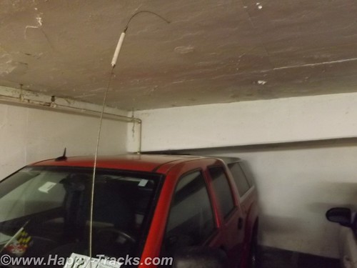
As the picture shows, it was only inches. Our room was cozy but nicely furnished and with something of a view.
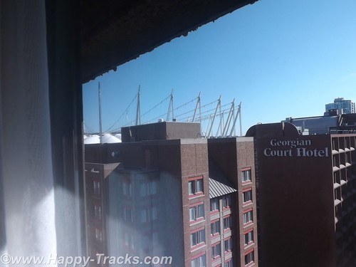
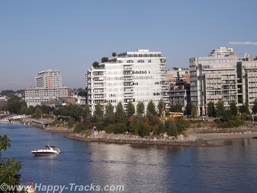
On the harbor side of our hotel, you could see the BC Arena, formerly used in the 2010 Winter Olympics. The athletes’ village was primarily located across the Cambie Street Bridge over False Creek.
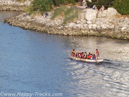
There were sidewalks and stairways to facilitate getting down to the water’s edge. As we crossed over late on this sunny afternoon, there were rowers, skaters, runners and bikers as well as dog walkers and families shuffling along. As we descended and ascended the long stairways from the bridges to the water, we were passed (and re-passed) by the same runners heading up and down. There are a couple of parks right along the water’s edge and the athlete’s village is primarily apartments and condos now with terrific views in an urban landscape.
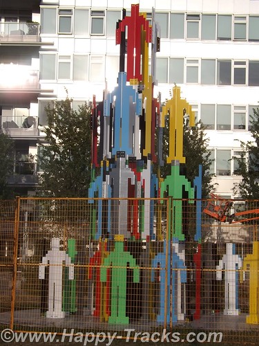
Here we saw the first of several large sculptures on display, the human pyramid. Our dinner was delicious salmon.
We set out the next morning for Stanley Park on foot. We had seen enough of Vancouver traffic the day before to know it would be more pleasant to walk it and the weather was suitable for it. We packed the pedometer in a pocket. We started walking on W. Georgia Street which would end at the park entrance.
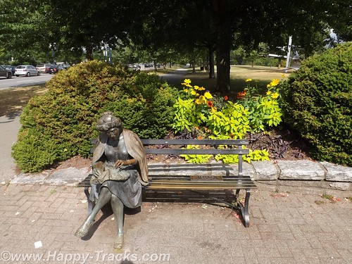
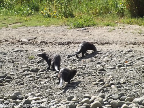
The sidewalks were busy but not crowded as we made the 1.5 mile walk to the park’s entrance. Along the way were several smaller public areas with flowers in bloom either provided by the town or by the condominium buildings. As we entered Stanley Park, the way curved around to the right with walkways, bikeways and roads for traffic. We stopped on the first bridge to watch four sea otters at play which came out on the stony shoreline as we watched.
The path then continued around to the Vancouver Rowing Club. The Rowing Club is an athletic club with activities in rugby, hockey, rowing and yachting. The facility included an eatery and dock space with a view of the harbor and the near skyline.
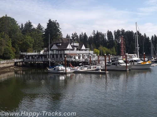
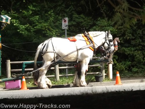
As we entered Stanley Park, there was some construction which seemed to be geared towards modifying the area where one could join a buggy tour of the park.
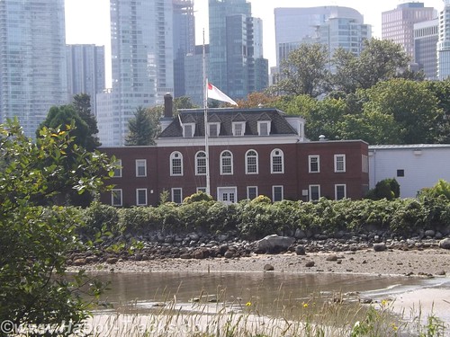
On the walk around, the next sight is HMCS Discovery, a Royal Canadian Navy Reserve division and shore facility. Created during World War II, Discovery was used for recruitment and training, and provided almost 8,000 personnel during the war. Discovery continued in its training role following the war, and also serves as headquarters for several Reserve and Cadet units.
The stone frigate takes its name from HMS Discovery, the ship used by George Vancouver to chart most of North America’s north-western coast. Originally based at the Stanley Park Barracks, in 1944 the Discovery moved to its current location on Deadman’s Island, in Coal Harbour, adjacent to Stanley Park.
We next crossed the road to head inland toward the totem display. The nine totem poles at Brockton Point are BC’s most visited tourist attraction.
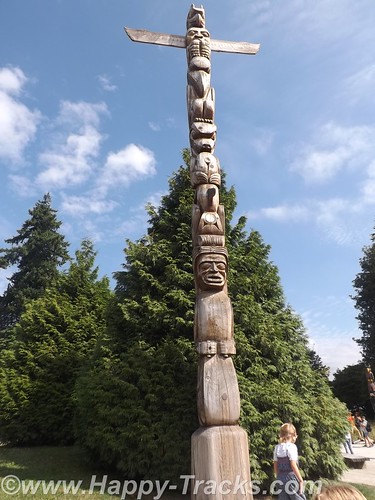
The collection started at Lumberman’s Arch in the 1920s, when the Park Board bought four totems from Vancouver Island’s Alert Bay. More purchased totems came from Haida Gwaii (Queen Charlotte Islands) and the BC central coast Rivers Inlet, to celebrate the 1936 Golden Jubilee, the 50th anniversary of Vancouver. In the mid-1960s, the totem poles were moved to Brockton Point area of Stanley Park.

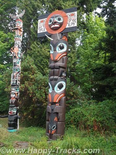
The Skedans Mortuary Pole is a replica as the original was returned home to Haida Gwaii. This pole represents the chief’s hereditary crests and held his remains in a small compartment at the top. Other poles are a house pole representing the family of the owner, another reflects a village tribe’s origins and lore. Still others are to honor a particular event in a person’s or village’s life.

In the late 1980s, the remaining totem poles were sent to various museums for preservation and the Park Board commissioned and loaned replacement totems. The ninth and most recent totem pole, carved by Robert Yelton of the Squamish Nation, was added to Brockton Point in 2009.
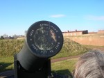
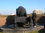
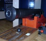
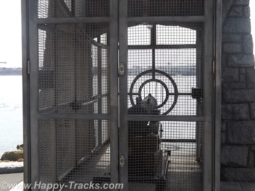
Continuing along the walk, we came upon the 9 O’clock Gun which is still fired every day at 9:00 pm to permit synchronizing clocks. The gun has been used in the past to alert fishermen of the closing of fishing time at 6:00 pm on Sundays. After being stolen and held for ransom by University of British Columbia students as a charity fundraiser, the gun has been enclosed by an iron cage. It also has its own Twitter account which tweets “boom” each evening at 2100 hours. Although the gun has only an electrically detonated black powder charge, in the past it has had pebbles thrown into the barrel which led to moving the Esso fuel barge anchored in the harbor and previously in line with the barrel.
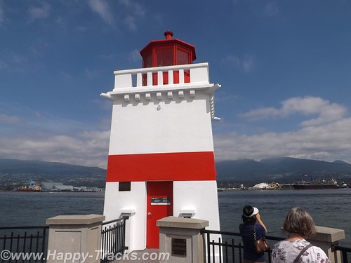
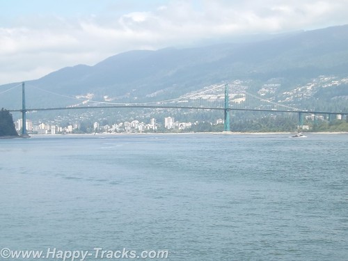
The seawall walk continues around Brockton Point to the harbor light. From the seawall, we can see much activity in the harbor including the sea planes and the Lions Gate bridge headed north across the harbor entrance. We can see snow-capped mountains in the near distance.
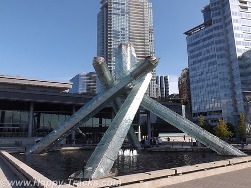
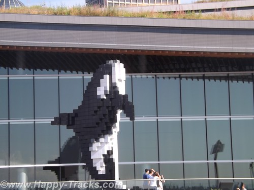
We walked back to our hotel as we needed a rest after our 7 mile hike. Next we went to the harbor’s edge to visit the Olympic Cauldron site. It’s been moved to an open plaza near the City Centre and overlooking the water. We also saw the Lego whale marking the cruise ship landing. We think it’s part of the giant sculpture display in Vancouver.
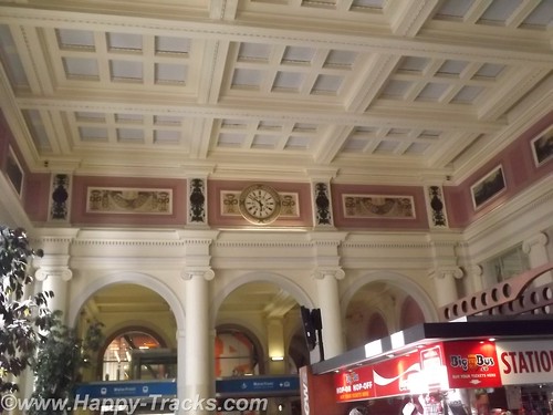
This takes us through the older part of town and to the old train station. It’s no longer in use for trains but has been partially restored and displays several paintings of the north country.
The original part of Vancouver is called Gastown. Here the streets are much narrower and the shops are crowded into smaller spaces.
Gastown was Vancouver’s first downtown core and is named after “Gassy” Jack Deighton, a Yorkshire seaman, steamboat captain and barkeep who arrived in 1867 to open the area’s first saloon. The town soon prospered as the site of Hastings Mill sawmill, seaport, and quickly became a general center of trade and commerce on Burrard Inlet as well as a rough-and-rowdy resort for off-work loggers and fishermen as well as the crews and captains of the many sailing ships which came to Gastown or Moodyville, on the north side of the inlet (which was a dry town) to load logs and timber. The Canadian Pacific Railway terminated on piles on the shore parallel to Water Street in 1886.
This low-lying swampy area eventually filled in with bridges and dumping of refuse. In 1886, the town was incorporated as the City of Vancouver. It fell victim to the “Great Vancouver Fire” that same year, losing all but two of its buildings. The area was completely rebuilt and continued to thrive.
Gastown found new life as the center of the city’s wholesale produce distribution until the Great Depression in the 1930s. It also was center of the city’s drinking life (there were 300 licensed establishments the twelve-block area of the former Granville, B.I.) After the Depression Gastown was a largely forgotten neighborhood of the larger city and fell into decline and disrepair until the 1960s. It was a continuation of the Skid Road area with cheap beer parlors, flophouse hotels, and loggers’ hiring halls.
In the 1960s, citizens became concerned with preserving Gastown’s distinctive and historic architecture, which like the nearby Chinatown and Strathcona were scheduled to be demolished to build a major freeway into the city’s downtown. A campaign led by businessmen and property owners as well as the counterculture and associated political protestors, pressured the provincial government to declare the area a historical site in 1971, protecting its heritage buildings to this day. A riot between the hippies and the police in 1971 over marijuana has gone into legend. The Gastown was designated a National Historic Site of Canada in 2009.
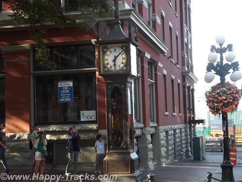
Gastown was served by a central steam system for heating and other purposes. But it wasn’t until 1977 that Raymond Saunders’ first steam clock was built to solve the issue of a steam vent in a popular sidewalk for the renovated Gastown district of Vancouver. At first glance, one supposes it to be much older, after all, it is steam driven. Wikipedia has an explanation of its workings including micro switches and electric motors here .
The pedometer said we’d walked over 10 miles today.
The next morning had us back in the truck (after jump starting it since the fridge had been running a couple of days off the main battery in very warm temps even in the underground garage) and making a final pass around town. We passed Sunset Beach Park with its giant sculptures including a whale’s ribcage, the rock Inuit and the outsized engagement rings. (The Inuit was used as a symbol/mascot for the 2010 Olympics and historically by the Natives to point the way to the hunting grounds.)
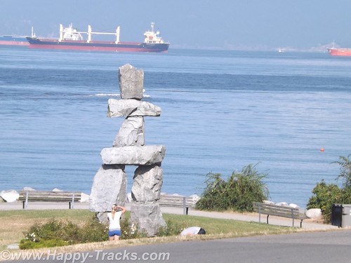
We turned inland and drove through a neighborhood of one and two story houses and the occasional low-rise condo building to make our way to Granville Island and past the flats of the industrial areas with their warehouses, docks and casinos heading towards the border.
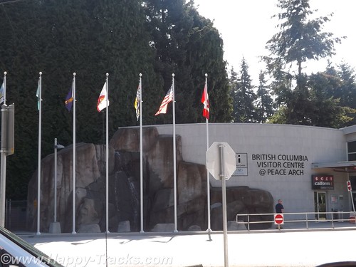
While still in the Vancouver metropolitan area, we arrived at the border crossing. On the border itself is a Peace Arch built in 1921 to celebrate the Treaty of Ghent which ended the War of 1812. The arch is in an international park and flies the US and Canada flags.
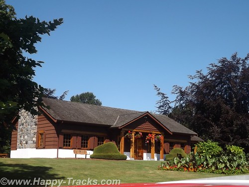
The approach to the border crossing was a bit different than others we had used, partly due to the volume of traffic crossing there. The cars and trucks moved as a group from spot to spot along the way rather than idling along in a continuous line. This system was devised to cut down on the air pollution of the idling engines.

Our pass through US Customs and back into home territory was routine with the standard questions of where we’d been, how long we’d been there and what we were bringing in with us.

You can see all of the pictures from this leg of the trip here.
We invite you to continue along with us and hope you enjoy the account!
