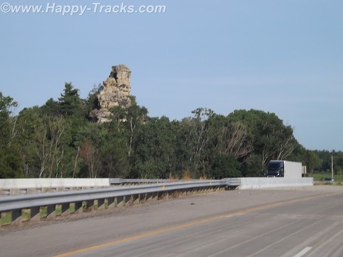
We left Medora and headed east on I-94 towards the Missouri River and Bismarck. We called a couple of hotels but found no rooms available without a reservation. Someone recommended the Prairie Knights Resort. Since it was about 50 miles off the highway, we called ahead to check on room availability. They told us they had plenty of rooms so there was no need to make a reservation. Mmmmmkay?
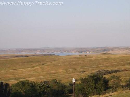
We drove south with the Missouri River to our left through a couple of very small settlements and passed the Ft. Lincoln State Park entrance. It really is 50 miles and there is virtually nothing until you reach the Prairie Knights Casino and Resort. Prairie Knights is a casino and lodge located on the Standing Rock Indian Reservation. It is operated by the Standing Rock Indian Tribe. The casino offers high stakes gaming options, along with 725 slot machines, blackjack, craps, among other games. The lodge portion of the casino consists of 200 guest rooms.
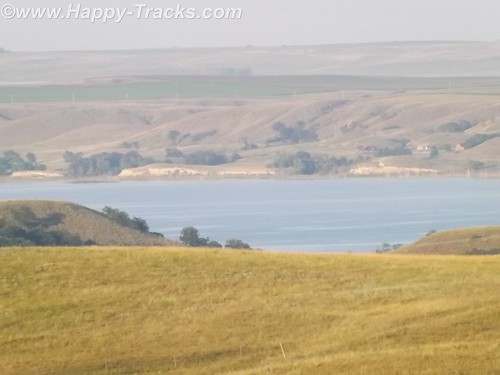
Once we finally get there, we see that they have a landing on the River, the lodge, a restaurant (buffet style), the casino and a small gas station with prices comparable to what we’d seen in Bismarck.
When we go to check in, the clerk asked if we were members of the Prairie Club. Uh, no. Before we get registered, they suggest we go into the casino and register. The registration is free but it knocks $25 off our room rate and gives us $10 to spend in the casino. We are now Prairie club members! We walk around a bit, get some dinner at the buffet and call it a night.
The next morning we head back north towards Mandan and the Ft. Lincoln State Park. Although we didn’t use them, it should be noted that the park has primitive and developed campgrounds and rental cabins near the riverbank. We didn’t go to those areas of the park to check them out. There are also hiking and biking trails.
The visitor center building contains a display that includes exhibits from the Lewis and Clark expedition and from the Mandan Indians who had a village there.
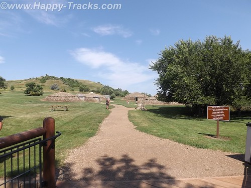
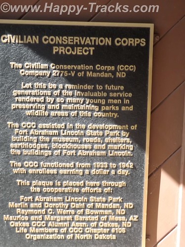
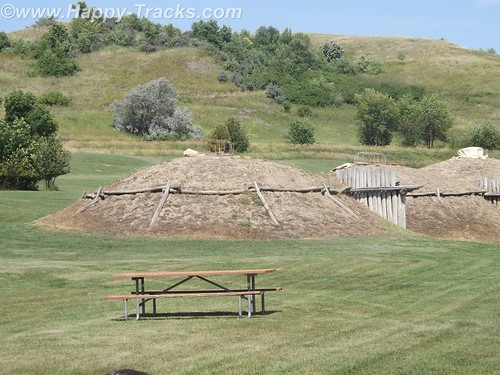
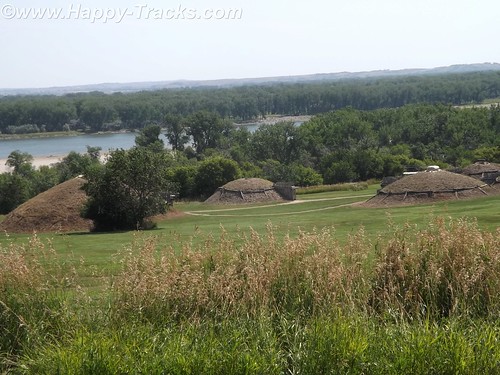
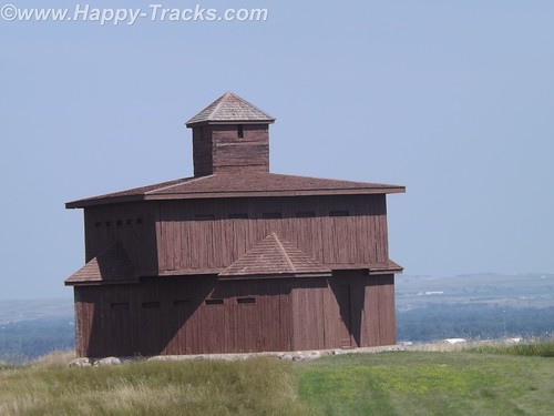
This is where the tour starts for the On-A-Slant Mandan Indian Village. Parts of the village have been the subject of archaeological research and some restoration. Their society was matriarchal with families dwelling in the same lodge including daughters and sons-in-law. The lodge would pass to the eldest daughter on the death of her mother.
The lodges were circular with a fire pit in the center, venting through a hole in the roof which could be covered in hides in times of bad weather. The lodges were also built into the earth with dirt and grass on the outside and over the roof which provided insulation from the temperature extremes. The guide told us of the lodges maintaining 60 degrees even in the coldest parts of winter and they were cool on this hot day when we visited. Generally, the lodge was entered from the side with a partition wall separating the entrance from the main room for weather and defenses. Sleeping pads were around the circumference.
The Mandans were stationary people with language similar to the Sioux. They grew crops and hunted animals while trading with the nomadic tribes. A typical Mandan village consisted of 12 to 100 of these dome-shaped lodges. Their oral traditions indicated they had once occupied the eastern North America.
Their villages were often stockaded for protection and they hosted many of the European explorers, including the Lewis and Clark Expedition and Prussian scientist Prince Maximillian.
In 1750 there were nine large Mandan villages, but recurrent epidemics of smallpox, pertussis (whooping cough), and other diseases introduced through colonization reduced the tribe to two villages by 1800. In 1837 another smallpox epidemic left only 100 to 150 Mandan survivors. Some of these accompanied the Hidatsa to a new settlement near Fort Berthold (northwest of Bismarck) in 1845; others followed later, as did members of the Arikara tribe. The Mandan, Hidatsa, and Arikara eventually became known as the Three Affiliated Tribes (also called the MHA Nation).
In the mid-20th century, the Three Affiliated Tribes lost a considerable portion of their reservation to the waters of Lake Sakakawea, which rose behind the newly built Garrison Dam. With the flooding of the river bottoms, on which had been the best agricultural land, many tribal members shifted from agriculture to ranching or off-reservation pursuits.
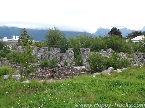
In the 1870s, at the same location where the Mandan tribe had established their village, a military post was built in June 1872 by two companies of the 6th U.S. Infantry under Lt. Col. Daniel Huston, Jr., as Fort McKeen, opposite Bismarck, Dakota Territory.
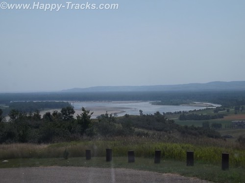
Standing today are two of the watchtowers that overlooked the juncture of the Heart and Missouri Rivers and the town of Bismarck.
The three-company infantry post’s name was changed to Fort Abraham Lincoln on November 19, 1872, and expanded to the south to include a cavalry post accommodating six companies. Among the 78 permanent wooden structures at Fort Lincoln were a post office, telegraph office, barracks for nine companies, seven officer’s quarters, six cavalry stables, a guardhouse, granary, quartermaster storehouse, bakery, hospital, laundress quarters, and log scouts’ quarters. Water was supplied to the fort by hauling it from Missouri River in wagons, while wood was supplied by contract.
By 1873, the 7th Cavalry moved into the fort to ensure the expansion of the Northern Pacific Railway. The first post commander of the expanded fort was Lieutenant Colonel George A. Custer, who held the position until his death in 1876.

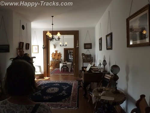
Several buildings remain at the post, including Custer’s restored (and furnished) house, the commissary (now the souvenir shop) and some stable and storage buildings.
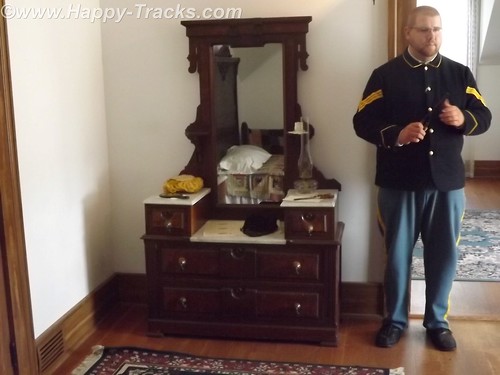
Custer’s house is open to guided tours. The tour is conducted by a man in period uniform in the role of one of Custer’s aides. The tour is alternately conducted by a woman who was in period dress. The setting is 1875 so the tour does not address the Colonel’s demise at Little Big Horn. Guests are shown through the house as arriving guests for a party to be given that evening by Colonel and “Mrs. Colonel” Custer.
The tour includes a discussion of some additions to the original house that were ordered by Col. Custer following fire damage as well as some entertainments provided to help make the rugged outpost more pleasant for Mrs. Colonel Custer.
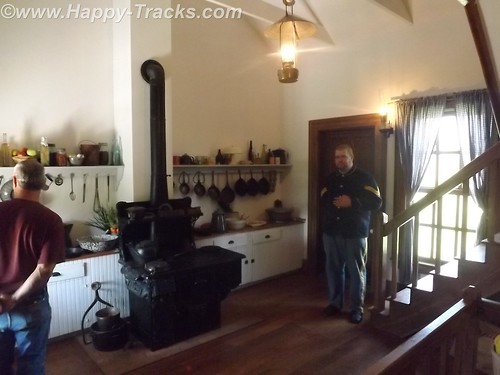
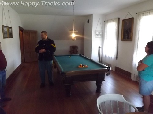
One point on the tour is the cellar where the Colonel’s pet wildcat was kept. We also toured the billiards room upstairs which served as something of an officer’s club.
As we returned from our visit to 1875, it was time to load up the truck and continue east to our next night in Fargo, ND. Our knowledge of Fargo was initially limited to the movie starring William H Macy which was somewhat gruesome. We were somewhat disappointed to find that the movie seemed to occupy a large part of the tourist industry with Woodchippers being the local drink at the bar and directions to go take pictures at the chipper in all the tourist literature. Fargo is the largest city in North Dakota at just over 113,000 people. Opposite Fargo and across the Red River of the North is Moorhead, Minnesota. The Fargo area is growing with much construction along both sides of the interstate with much of it devoted to housing, hotels and support of the petroleum industry. Some of the news stories and features of the area talk of the shortage of housing and the boom being fueled by petroleum.
After breakfast the next morning, we made tracks across Minnesota finally stopping in Hudson, Wisconsin just across Lake St. Croix from Minneapolis-St. Paul.
Hudson appears to be a small touristy town which is also a distant bedroom suburb of the twin cities. Our late lunch was in a small (but very friendly) pub style bar where we also called my nephew to see about meeting up with him as we passed near his home north of Chicago. We drove late that night, finally stopping in Loves Park, Illinois for the night.
We did connect with my nephew (whom I hadn’t seen in over 10 years) and met him for breakfast but didn’t get the opportunity to see his family due to other commitments and the short notice we had given them. Our visit was short but it was good to see him.
We continued on and spent the night in Maumee, Ohio.
You can see all of the pictures from this leg of the trip here.
We invite you to continue along with us and hope you enjoy the account!
Don’t forget the trip calendar we put together at CafePress. We think it turned out pretty well and would make a great holiday gift. 
Tag Archives: Museum
Summer 2014: Alaska via the AlCan; Haines, Ft. Seward
Leaving the Customs station (Pleasant Camp Border Crossing) with a brochure from the Hawaiian Customs Agent, we continued alongside the Chilkat Inlet towards Haines. Primary task for us at the moment is finding lodging for the next two nights and its about 7:30 pm. Waiting until this late to start finding lodging hasn’t worked out well for us in the past.
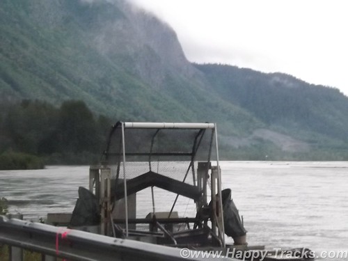
We find a place to pull over and make some calls and see this contraption. It looks sort of like a paddle wheel or even an automated fish catching device. We later find that its a device mounted by the state to help count the salmon population.
The first place (a BNB) we called had nothing available for the two nights we needed. We tried a second call and connected with a woman who said she could accommodate us at the Ft. Seward Lodge although she wasn’t at the lodge but could meet us there in the half hour we needed to get there. She said she had to put her child down to sleep for the night and would meet us there.
We drove through the edge of Haines and arrived outside the office door to find it locked and apparently no one around. We waited a bit and then called again and the call went to voice mail. We finally saw someone going out that looked like they might work there. It turned out the young lady did work there but had also had issues with getting someone to answer the phone. She did tell us another phone number to try though which also went to voice mail. After waiting this long, we were certainly tempted to go somewhere else but there didn’t seem to be any where else to go. Eventually, the owner showed up and checked us into our room.
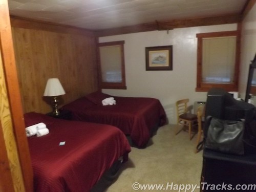
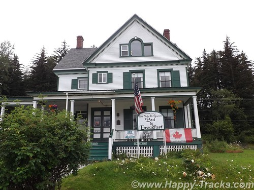
The Ft. Seward Lodge building had been the PX when the post was still active. This particular building had housed the exchange, a barber shop, soda fountain, bar and the bowling alley. The long wing containing our room had once been the bowling alley.
Haines, Ft. Seward, and Port Chilkoot history is like many of the towns in Alaska ranging over the Native population, the US acquisition, the gold rushes, fishing and the tourism industry.
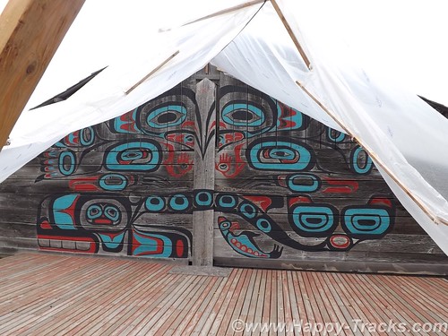
The Tlingit Indians established the first permanent settlements around 8,000 years ago. The area is relatively temperate, has abundant food resources and geographically provides a portage opportunity to connect the Chilkoot and Chilkat Inlets. The Tlingits established trade with other groups and became wealthy. They also are recognized as the artists of some of the finest indigenous creations.
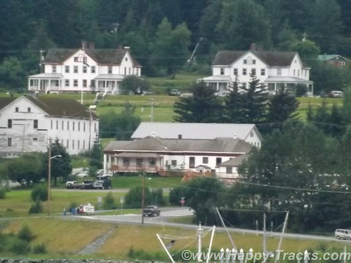
White settlement came in 1881 with the Presbyterian mission. Shortly after came salmon canneries, mines and the construction of Ft. Seward by the US Army. Due to ongoing border dispute with Canada, the US built Ft. Seward as a demonstration of might and resolve and encompassed 4,000 acres which had been deeded over from the Presbyterian church in 1902. The docks were first to be built to bring in supplies and construction materials. Italian stone masons were imported to build the granite foundations for the post and master carpenters from the lower states gave Ft. Seward style that exceeded most rudimentary construction of that era. The first contingent of soldiers arrived in late 1904 and Ft. Seward became regimental headquarters for Alaska. Ft. Seward was renamed Chilkoot Barracks in 1922.
Over the next two decades, the Army dismantled other Frontier-era forts around Alaska so that Chilkoot Barracks was the only Army post in Alaska. During World War II, Chilkoot Barracks became an induction and rest center for soldiers arriving in Alaska to form the new posts and bases needed to support the war effort.
Like many military bases, Chilkoot Barracks provided an anchor for the town’s economy during its operation but in 1946, the Army declared it surplus in favor of more strategic locations in interior Alaska. A group of WWII veterans decided to buy the surplus post and continue to operate it as a cooperative. The cooperative failed but several of the veterans established small businesses that survived serving tourists and passengers from the small cruise ships that used the old Army dock. With the infrastructure to support the post (fire department, utilities, etc), the city of Port Chilkoot was formed and merged with the Main St. area to become the city of Haines in 1970.
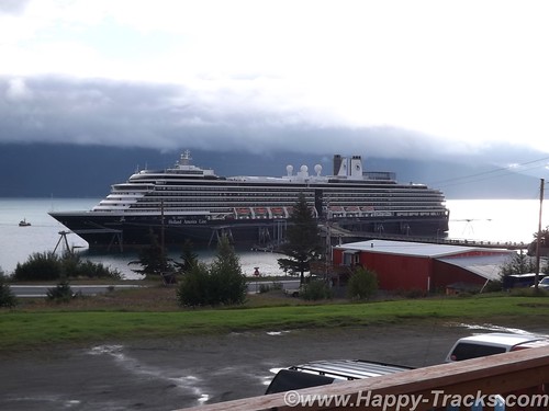
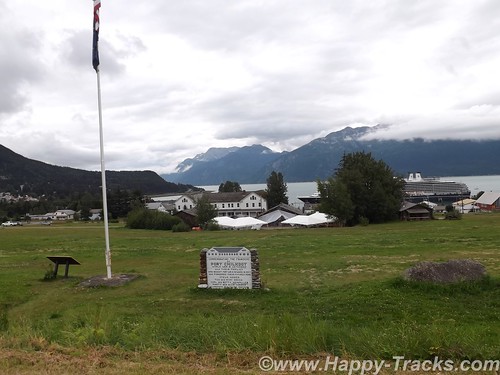
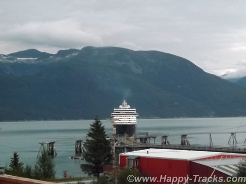
The scenery had changed when we looked outside the next morning. A cruise ship (relatively small) now sat at the pier. I say relatively small as it was smaller than what we had seen in Seward and smaller than the ones we saw cruising down the far side of the Chilkoot Inlet making their way to and from Skagway (20 miles away by boat, hundreds of miles by car including traveling into the Yukon Territory). We happened to hit cruise ship day in Haines when most of the shops would be open.
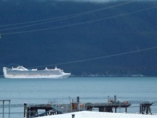
Haines only allows one ship per week to dock. Previously some of the larger ships had been thought to be more detrimental to the local ecology than they needed so the good folks of Haines sent them away and now the larger and more numerous ships land at Skagway instead.
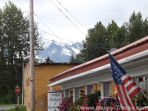
We went for a ride around Haines looking for breakfast and happened upon the Chilkat Bakery and Restaurant which looked to be popular with the locals and a little far off the beaten path for the cruisers. As we paid our tab, we asked the owner how late they were open and she answered and said she’d stay open as long as we were there by closing time. We ended up there again for dinner but well before closing time.
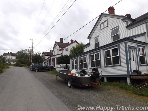
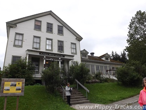
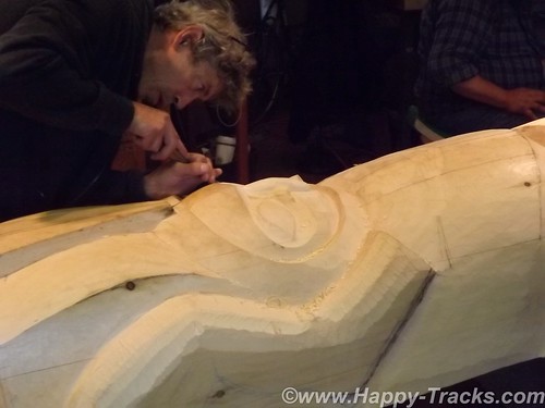
We went back to the Lodge to park the truck and then began our walking tour of Ft. Seward. We walked up the hill of Soapsuds Alley which had been married enlisted housing and many of the wives had taken in laundry to supplement incomes. As we topped the hill, we worked our way around the parade ground counter clockwise with our first stop being the old hospital, now home to the Alaska Indian Arts which seeks to preserve the arts including carving. The non-profit foundation provides workspace for the carvers as well as preparing pieces on commission. The tour included the workshop where a totem was being carved.
Historically, the hospital provided medical care for the Army personnel and their dependents but regulations allowed the doctors to supplement their incomes by taking patients from the surrounding area.
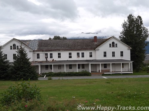
We continued walking around the parade ground. Along the upper and longer side, the houses had been officer and senior personnel quarters which were larger and more grandiose than those on Soapsuds Alley. The far end (third side of the rectangle) had what had been the commanding officer’s quarters and the headquarters building which were large enough that they now were in use as a hotel. Filling out the third side was the firehouse with its tower to allow the hoses to dry after use without freezing.
The fourth (lower) side of the parade grounds had a large enlisted barracks building which is currently undergoing work to preserve and return it to its 1940s configuration. The granite foundation to another large barracks building sets next to the first barracks building. The second building had been destroyed by fire in 1981.
The cruise ship being in port increased the population for the day and the weekend would bring the Southeast Alaska State Fair to Haines so preparations were underway. The parade ground at Fort Seward was being prepped.
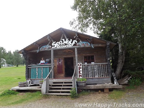
With a population just over 2500 in the 2010 Census, Haines has perhaps the highest percentage of residents involved in the artistic professions and is dubbed the arts capital of Alaska. One artist we kept running into (and met setting up his shop on the parade grounds for the fair) is Tresham Gregg. Mr. Gregg’s works are largely wood sculpture although we also found several of his designs in leather belts (made in China). He apparently owns/runs several full-time shops in Haines.
We opted for a late lunch at the Fireweed Cafe which was also popular with the cruise ship crowd. We took seats at the bar and both had salmon dishes. Also seated at the bar were a couple of honeymooners from the ship and another couple from Vancouver who were spending the summer at the RV park next to the town docks. Their conversation mentioned tales of the park, including a guest who hadn’t realized that the inlet was saltwater and had been using it for washing up. They also shared that their older teen daughter had gone over to Skagway on the “fast” (passenger only) ferry as there was just too much small town laidback-ness to keep her occupied. Fresh salmon makes for a good lunch, by the way.
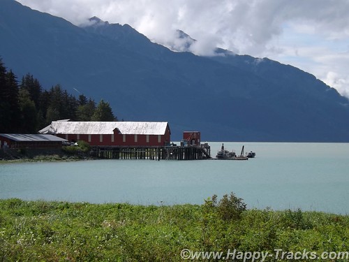
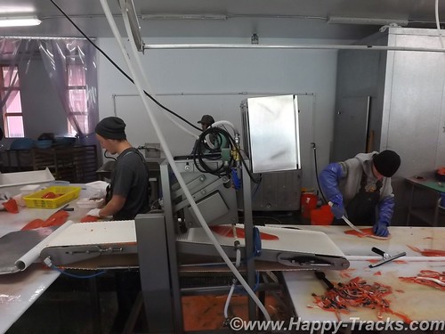
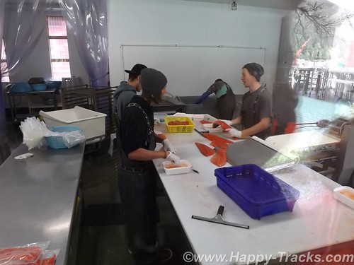
After lunch, it was back to the truck to find what lay beyond our walking limits. On the Chilkat Inlet side of the peninsula is the Haines Packing Company located at what may be the oldest cannery site in Alaska. The operation was modernized in 2007 and primarily freezes, packs and ships fresh salmon with no canning taking place there anymore. The property is open to tour (self-guided) and lets one see the historic setting as well as a modern machine cleaning operation if your timing is lucky. There is also (of course) a gift shop with handcrafts from the proprietor and others and you could buy salmon and have it shipped most anywhere.
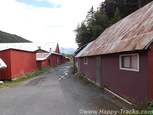
You are separated from the processing operation by windows so I was pleased to learn that I could take pictures without the glass glare by pressing the lens of the camera up to the glass. (I did learn later that doesn’t work when you have two widely spaced layers of glass.)
We went back into Haines and checked out several of the shops and the museum. We skipped the Hammer Museum. In retrospect, that may not have been such a great idea. The shops ran the gamut from imported plastic stuff that said Alaska on it to expensive handmade jewelry and carvings, not necessarily Alaska-made. The museum, actually the Sheldon Museum and Cultural Center, was small but contained several interesting exhibits in its small space. The Sheldon Family, who had been prominent citizens of Haines in the early 20th century, donated much of the museum’s initial collections.
We headed back to the Chilkat Bakery and Restaurant for dinner (well before closing time) and had excellent Thai food for dinner.
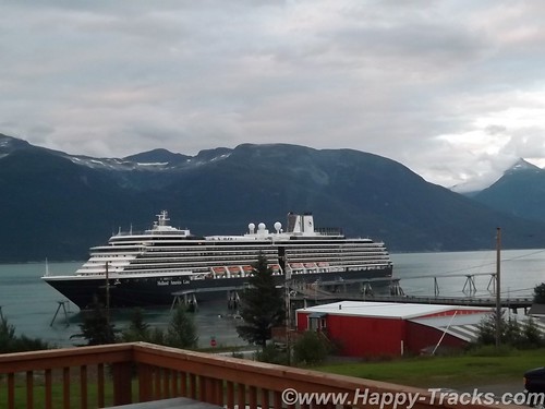
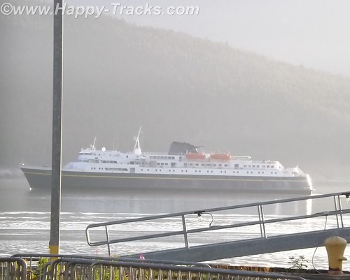
An early start the next morning was in our plans so we headed back to the Lodge for the evening where we watched the cruise ship’s intricate routine of casting off and getting underway. The main dock sticks out perpendicular to the shore. The ship is longer than the dock is wide so the bow and stern lines went to standalone bollards. A crewmember was dispatched in a small rowboat to each bollard where he climbed up the ladder to let the lines go and then climbed back down the ladder to go to the other one and repeat the performance. In this day of machinery and automation, it seemed somehow quaint to require this procedure. After loosing the lines, the ship backed away from the dock and turned its bow south and away.
The lodge owner was on the deck as we watched the cruise ship prepare to depart and shared her story of coming to Haines from Montana to marry her husband who ran a heli-skiing business. Heli-skiing refers to carrying skiers to the top of the slopes and then letting them ski down from there, places they couldn’t reach other ways. The lodge fit into that by ensuring their winter customers and friends had accommodations for their winter adventures.
She ran the bar and the lodge and told us a bit about why it was difficult to find help and run a restaurant in the lodge. Primarily, she attributed it to an inability to estimate the seating at a particular meal and the difficulty in obtaining fresh produce when much had to be pre-ordered and shipped from the lower 48.
Early the next morning, we made our way to the ferry (Alaska Marine Highway System) landing to line up for loading for the trip south.
You can see all of the pictures from this leg of the trip here.
We invite you to continue along with us and hope you enjoy the account!
Summer 2014: Alaska via the AlCan; Hatcher Pass, Independence Mine and Anchorage
We left Grizzly Bear Lodge heading south towards Anchorage. Our plan included stopping at Independence Gold Mine State Historical Park and then go on to Anchorage for the night.
Grizzly Bear Lodge had a general store but no restaurant so we stopped at one of the first places we saw which was a small diner next to a service station. It wasn’t very busy and we were the only customers when we arrived. There were two ladies sitting at the counter. We took our seats and perused the menu. Not being especially hungry, Betty ordered the bowl of oatmeal from one of the ladies at the counter.
A couple of minutes later she came back out of the kitchen and asked whether Betty wanted raisins and cinnamon in her oatmeal. A short time after that, a young man walked in and from the conversation he was apparently a new employee. The discussion at the counter included how he was getting to and from work and furnishing his living quarters. Another group of 3 or 4 came in and took another table. Eventually, the young man brought our food and the bowl of oatmeal was HUGE! We have smaller serving dishes at our house! While we were eating, the woman who had taken our order left after making some friendly comment to the young man about him learning to wait tables.
We had eaten our fill and were getting ready to go when the cook came out of the kitchen to find out if Betty hadn’t liked the oatmeal since she had eaten so little. She told the cook that it was good but there was just too much. We thanked them and went on our way.
Other than the question from the cook, this was typical of the roadside cafes in the less populated areas in Alaska and in western Canada as well. Food was filling and often of the comfort food variety but quantities seemed better suited for lumberjacks than for a couple of retired tourists. Prices were higher than we’re used to seeing but this can be attributed to remote locations and differences in currency sometimes but the higher prices are accompanied by larger quantities. It was really a task to try to find a “light” meal. Back to the road.
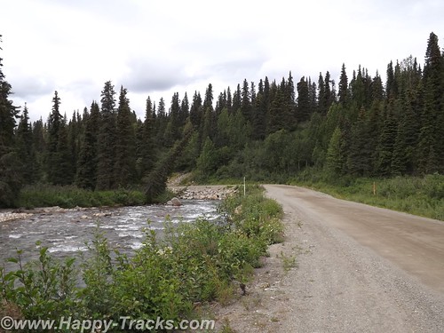
About 80 miles out of Anchorage, Betty noticed that there was a road that went directly to Independence Mine that looked to shave 30 miles or more off our route. So we made the turn onto Hatcher Pass Road at Willow to take the direct shorter route. It was a narrower paved two lane road. We were hoping to make the morning tour which began in 30 minutes and it looked to be about 20 miles.
The road got narrower. There was no longer a painted line down the center as there just wasn’t enough room to give both sides a full lane and a stripe. The turns got a little sharper and more frequent and the pavement got a little rougher. And then about 10 miles in, the pavement stopped, the road crossed over to the other side of Willow Creek and the scenery got a little more rustic.
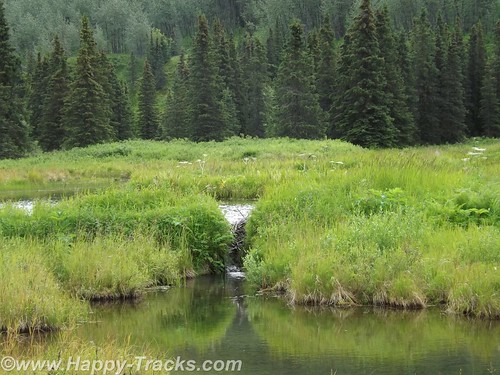
The dirt road included a few more rocks and we were alternating driving through woods and beside beaver ponds.
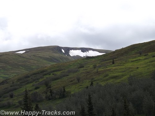
The scenery started to change and we were seeing mountain meadows and the road was climbing. We saw a couple of small tailings piles next to holes in the hills. (A tailings pile is the dirt and rocks extracted from a mine that do not contain ore. It is usually just dumped outside the hole.) The road had degraded to a two track and we were starting to see a few more cars coming the other way which require that one or the other of us stop to let the other one pass.
We came to split in the road and one way went to some small older buildings that were either an older mine or a farm/ranch. The other way climbed again. We climbed. We also passed two joggers seemingly miles from anywhere.
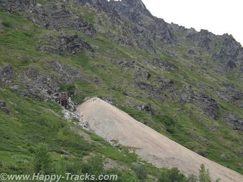
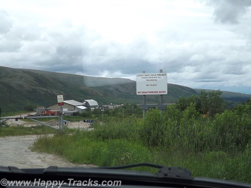
As we climbed again, we passed some modern industrial type buildings inside a fence. While we saw no activity, it was clear that it hadn’t been long since there had been.
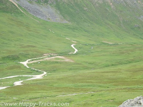
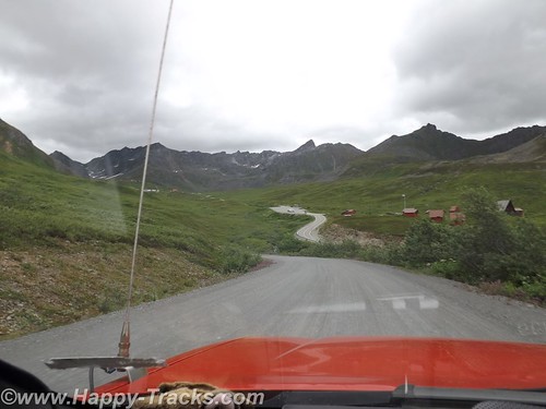
As we crossed the next hill (and felt a certain kinship with Heidi) the descent started and it was steep. We could see the end of our road, and look there, its a paved road leading up to the Independence Mine State Park! Its only been two hours since we started down this shortcut. But it was a ride we both enjoyed through some beautiful country.
There were times before we started this trip when I thought seriously about taking the car instead of the truck. Up to now, there had been no need for four wheel drive and the roads had not required the clearance and the car gets several MPG more than the truck and is reasonably comfortable but we wouldn’t have attempted unknown roads like this in the car and we really enjoyed the detour.
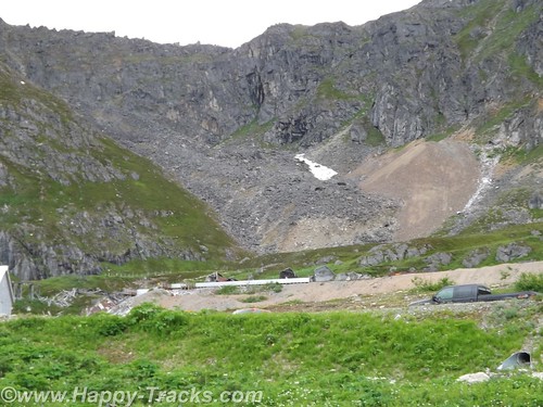
Independence Mine State Park is a closed gold mine. The modern buildings we had seen on the other side of the hill operates out of the same vein when it operates.
The Independence Mine was at its heyday of operations during the 1930s. Mining operations tapered off and stopped during World War II when gold mining was not considered an essential activity.
Robert Lee Hatcher discovered and staked the first lode gold claim in the Willow Creek Valley in September 1906, and others soon followed. But lode mining was expensive for an individual operator; it required elaborate tunnels and heavy equipment, so companies merged to pool resources and reduce expenses.
What is now called Independence Mine was once two mines: The Alaska Free Gold (Martin) Mine on Skyscraper Mountain, and Independence Mine on Granite Mountain. In 1938 the two were bought together under one company, the Alaska-Pacific Consolidated Mining Company (APC). With a block of 83 mining claims, APC became the largest producer in the Willow Creek Mining District. The claims covered more than 1,350 acres and included 27 structures. In its peak year, 1941, APC employed 204 men, blasted nearly a dozen miles of tunnels, and produced 34,416 ounces of gold worth $1,204,560; today $17,208,000. Twenty-two families lived in nearby Boomtown, with eight children attending the Territorial School in the new bunkhouse.
By 1942, the United States had entered World War II, and the War Production Board designated gold mining as nonessential to the war effort. Gold mining throughout the United States came to a halt, but Independence Mine continued to operate because of the presence of sheelite. Sheelite occurs in some of the quartz veins along with gold, and was a source of tungsten, a strategic metal. But because Independence Mine’s scheelite production was low, the exemption was short-lived. In 1943, Independence Mine was ordered to close.
The wartime ban was lifted in 1946, but gold mining was slow to recover. After the war, gold could be sold only to the U.S. government at a fixed rate of $35 per ounce. Postwar inflation raged, and gold mining became an unprofitable venture. Finally, in January of 1951, after mining nearly 6 million dollars’ worth of gold, Independence Mine was closed by APC, and a chapter of Alaska’s gold mining history came to an end. In 1974, Independence Mine was entered into the National Register of Historic Places, a list of cultural resources significant to American history. In the late 1970’s, 271 acres of land were donated to the Alaska Division of Parks & Outdoor Recreation for establishment of Independence Mine State Historical Park. On January 16, 1980, title to the acreage was transferred to the State of Alaska. From http://dnr.alaska.gov/parks/units/indmine.htm
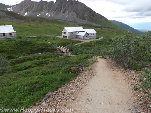
The park is working on restoration of the buildings there. The Superintendent’s house is now the visitor center. Its a large two story house with some historical displays.
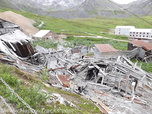
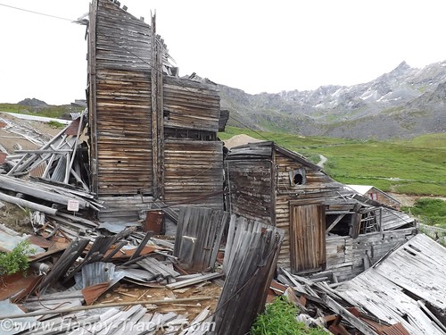
Originally, the men who worked the mines were housed in two story dormitory-style buildings (seen in the picture above). There were separate buildings to support the mine’s operations such as machine shops and tool sheds.
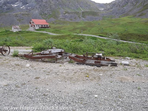
There was a blacksmith’s shop and administrative buildings such as a payroll and assayer’s office as well as a commissary and a dining hall (seen in the picture below).
Other buildings included buildings containing apartments for managers and their families. Over time, the working men brought their families and the mine permitted them to build their own quarters on mine land.
We learned something interesting about miners’ workshifts. After many years of watching movies where the men line up at the beginning of shift and walk in together and then all walk out together, we hadn’t noticed how the two groups never seemed to pass each other. The miners worked 10 hour shifts. At the end of the shift was the time for any blasting after everyone had gotten out. The two hour wait before the next shift went in was supposed to allow the gases and dust from the blast to settle before sending the workers in again.
Some of the buildings are used now for park support activities and a couple are in the middle of renovation/restoration.
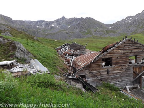
Some are completely collapsed and awaiting extensive work. There was a display in the superintendent’s house on the differences in preservation, restoration and reconstruction. The park is charged with determining the best course for each building to maintain historical accuracy for the park. Although isolated, it should be noted that the mining buildings had electricity and running water even in the 1930s.
We left for Anchorage, passing between Palmer and Wasilla so we didn’t see any famous people, or at least weren’t aware of them if we did passed by.
Our first stop in Anchorage was the visitors center where we got recommendations for dinner and ended up at Crush, a wine bar where Keith had the elk and pork meatloaf with vegetable stuffing. It was quite tasty.
We also visited Oomingmak, a co-op store for hand-crafted quivit items. The co-op is owned by 250 Native Alaskan women spread throughout the state. Quivit is the downy-soft underwool shed from a muskox. We recommend a stop by the store whether or not you intend to buy anything. Their website is at http://www.qiviut.com/ We did ask the clerk there for recommendations of things to see while in the area and one of his recommendations was Hatcher Pass.
We stayed at the Super 8 in Anchorage near the airport. We apparently got the last available room but there were a couple of problems with it. For example, when we went in, it was obvious the bathroom had not been cleaned so we went back to the front desk. The desk clerk told us he was the only one on duty at the time so he would go clean it while we waited in the lobby. He did. After we went to the room, the toilet wouldn’t flush down so back we went to the front desk. With the proper equipment, we cleared that one up ourselves but then the elevator seemed to be having issues. Luckily we were only on the third floor. After the initial issues, the room was great and we spent a peaceful night.
You can see all of the pictures from this leg of the trip here.
We invite you to continue along with us and hope you enjoy the account!
Summer 2014: Alaska via the AlCan, Fairbanks
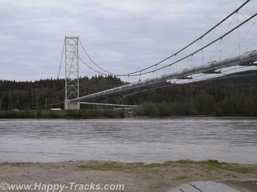
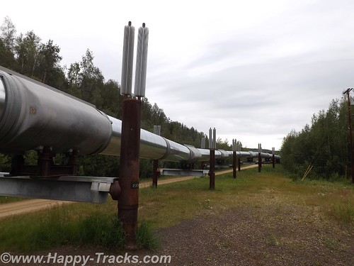
Continuing north from Delta Junction toward Fairbanks, we crossed the Tanana River and got our first glimpse of the Alaskan Oil Pipeline where it crossed the river near the road.
The pipeline is 48 inches in diameter, 800 miles long and crosses three mountain ranges and over 500 rivers and streams.
Most of the major river crossings for the pipeline have the pipeline buried under the river bottom but the power of the current and the silt here create major scouring of the river bottom. The scouring could eventually expose the buried pipeline and lead to damage. The pipeline is built to withstand an earthquake up to 7.5 and cold down to 60 below. The pipeline includes zigzags in its course to allow for some shock absorption as well as thermal expansion. The supports are built to transfer heat away and thus prevent melting of the frozen ground beneath the towers.
The bridge over the Tanana is the second longest along the pipeline at 1200 feet. This crossing over the Tanana River is the first place you see the pipeline in the ride up the AlCan towards Fairbanks.
Special consideration was given to the wildlife along the pipeline’s course to minimize the impact of the pipeline. Those considerations include the tower designs as well as lengths where the pipeline remains below ground to allow for uninterrupted crossings by the wildlife.
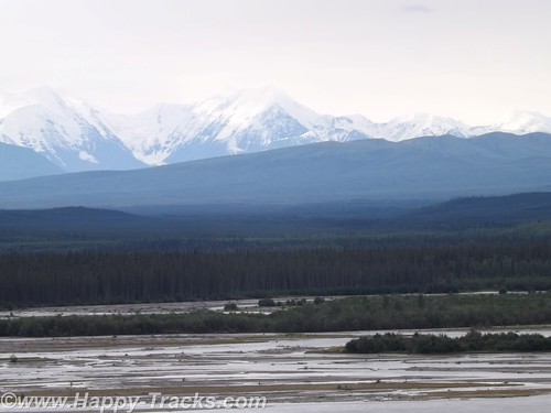
The scenery heading into Fairbanks includes mountains in the distance but more consistent snow cover than we’d seen earlier. Our first stop in Fairbanks was another viewing point of the pipeline with an informational display. You can also see where the pipeline goes underground here.
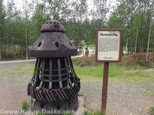
They regularly measure the flow through the pipeline to determine ways they can improve efficiency. One of the steps they employ is to periodically clean the pipes of accumulated sludge using a pipeline inspection gauges or “pig”. A pig is essentially a phenolic plug that travels along and cleans the insides of the pipe.
Fairbanks grew out of a trading post on the Chena River established around 1901 with the landing of the river boat Lavalle Young. The discovery of gold in the hills north of town in 1902 assured its success. By 1907, railroads had largely replaced the riverboats.
We went into Fairbanks itself with the first stop at the Visitors Center on the banks of the Chena River. On the grounds there is an original cabin from early Fairbanks (pre-1910), still in its original location. The cabin is small, in part to minimize the heating needs while still providing adequate living space for a kitchen, sitting area and sleeping space. It is worth noting that by 1910, Fairbanks had limited electric and telephone service in place.

In downtown Fairbanks, there is another marker for the Alaska Highway at 1523 miles. Since much of the military traffic on the highway during WWII was destined for the military bases there, some measure the highway from Dawson Creek to Fairbanks.
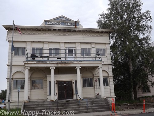
Several historic buildings remain in downtown, including the Oddfellows Hall, formerly a bath house and health clinic and the Masonic Lodge nearby. Located in the old Oddfellows Hall building is the Alaska Mining Hall of Fame Foundation museum. Admission is by donation. The museum is still getting itself organized but holds memorabilia of the mining industry including some very clear explanations of the different methods of mining used. There is also a gift shop and display devoted to the Iditarod dog sled race.
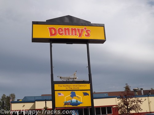
We checked into our motel and grabbed dinner at the Denny’s located next door. This particular Denny’s has the distinction of being the northernmost Denny’s in the world!
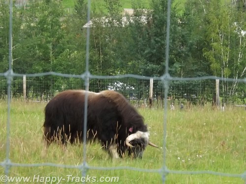
The University of Alaska Fairbanks (UAF) campus was near our lodgings. Just a couple of miles further down the road is the Large Animal Research Station (LARS) specializing in high latitude biology, particularly muskox and caribou. LARS is open for tours and we availed ourselves.
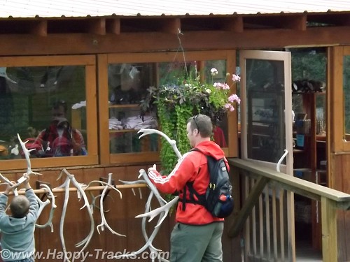
The LARS tours are run by University personnel who are specialists in the animals. They also have a small gift shop, a picnic area and some vintage farm equipment. We watched a family whose children were absolutely fascinated with the antler collection and the old tractors while we waited for our tour to begin.
The day we were there, they also had mosquitoes. Betty has always been something of a magnet for mosquitoes which has detracted from the enjoyment of many outside activities. Today we tried the Off! Clip-on Fan and it worked. While we stood talking to another couple who were also touring (they were in a big 5th wheel camper), you could see the difference in the swatting. It was noticeable enough the lady asked what Betty was using. The Off! fan is available in a drug and discount stores including Home Depot and we recommend it! They last about 12 hours of use but seal when you turn them off so you can use it for up to two weeks after initially opening the refill.
Muskox have horns that loop down similar to a water buffalo although not as long. Muskox also have wool which they shed (no need for shearing) that is among the softest stuff in the world. A hat or scarf made of quivit will make cashmere seem coarse. Unlike many wools, quivit does not shrink. We would visit a shop in Anchorage where handmade items were available for shopping.
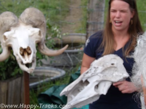
Muskox have very thick skulls and generally will defend their territory or herd by butting heads. LARS has a gate that shows just how much force is available through that thick skull. In the wild, muskox will defend the herd by backing into a circle, heads out, with the youngsters in the circle. A tightly packed circle of muskox is a formidable force.
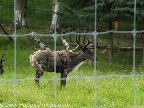
LARS also has caribou which are very similar to reindeer. In fact, according to the guide, the principle difference in a caribou and a reindeer is that reindeer are domesticated. She actually raised the question whether their caribou still qualified since they were penned.
We also learned the difference in horns and antlers (which you may have already known). Antlers grow each year and are shed while horns are permanent.
The farm is staffed year round to care for the animals and the property. On site, there are several buildings ranging from the old barn to a modern quarters for the caretakers.
Next we went to visit the main campus of UAF and the Museum of the North. The exterior of the building resembles the overlapping plates of the ground. It shares some similarity to the iconic shape of the Sidney Opera House.
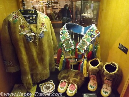
The Museum displays are divided geographically and to coincide with the four main groups of Native Alaskans. As we walked into the main exhibit room, we saw the only grizzly (brown) bear we would see on the trip.
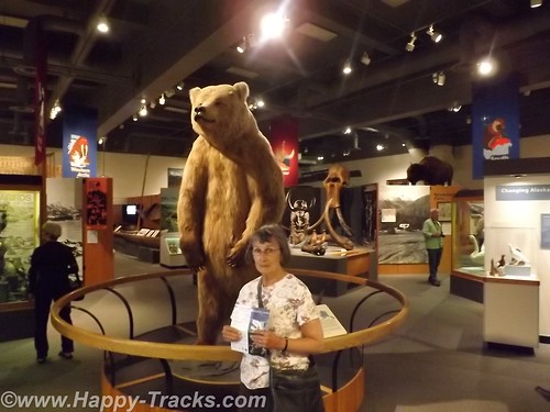
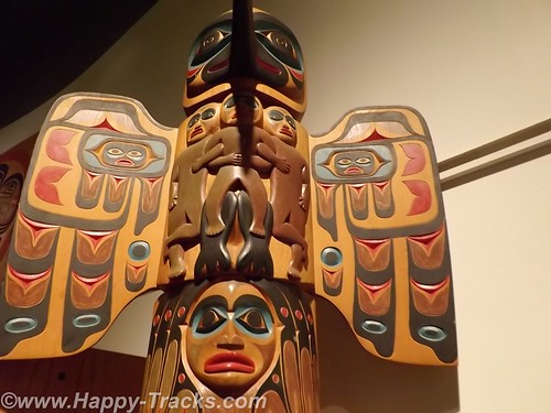
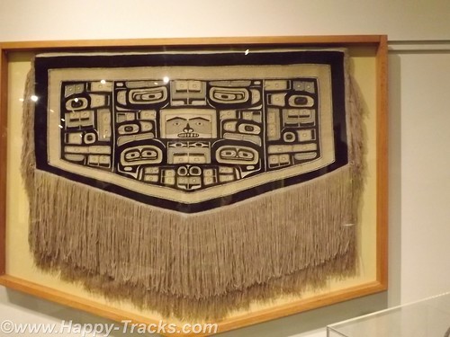
There were exhibits of archaeological significance like the fossilized mammoth and of cultural significance like the totems and clothing. There were also exhibits of the historical events such as the gold rush and the oil exploration.
There was also an exhibit dedicated to the Japanese occupation of the Aleutians during WWII and the relocation/interment of those persons of Japanese ancestry during that period.
The museum had a gift shop with a wide array of items from kids plastic toys to hand-crafted display items. As befitting a museum, it included books and some household and kitchen goods with thematic decorations.
On the grounds, was the restoration of the Russian blockhouse which dates back to the Russian ownership of the territory. The blockhouse was part of the fort when the Russians were primarily trapping for pelts.
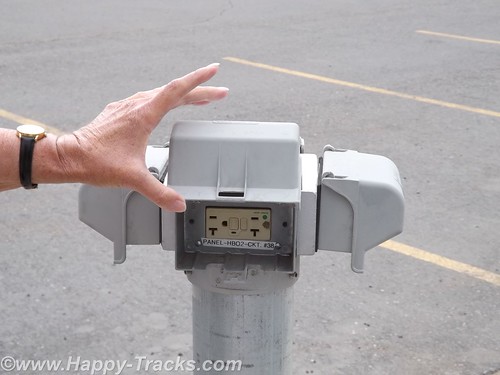
One other item we noticed was the electrical outlets in the parking area. I suppose when the winter temperatures plummet, plugging your car’s block or battery heaters may be the only hope you have of restarting the car for the trip home.
We headed back to the hotel for the night. The next morning we shared a conversation with one of the many motorcyclists we had encountered on our trip. This particular gentleman (around our age) was hanging around the hotel because he had fallen off his bike and had a spine compression injury which left him feeling unsafe and uncomfortable making the trip home on his bike. He had checked into the costs of shipping his bike back to Seattle and it was to be about $500. One of the others in his group had suffered some sort of cardiovascular attack and he was waiting to find his prognosis and plans. Perhaps they could share the cost of the freight back home.
You can see all of the pictures from this leg of the trip here.
We invite you to continue along with us and hope you enjoy the account!
Friends Playing Tourists: Smithsonian Museum of Natural History (Part 4)
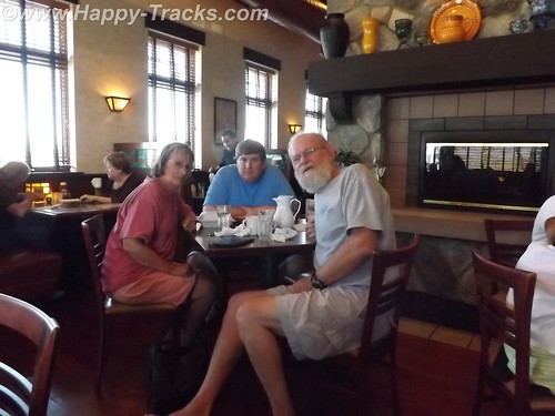
The Uno Championship was complete and bragging rights go to the visiting team. The cranberry juice was getting low and thoughts of work and paychecks led Russ to pack his truck and head for home on Sunday morning. Steve checked Mass times and got a ride to services. After church, we stopped by Taco Bell for lunch (it was Sunday, Chick-Fil-A was closed ;)) When he got back we made plans to head for today’s destination, Smithsonian’s National Museum of Natural History. 
In making our preparations, we called Ryan to join us. She agreed to meet us there with her friend, Steve. After circling like vultures for a couple of rounds, we managed to find on-street parking on Constitution Avenue and so entered through the older entrance.
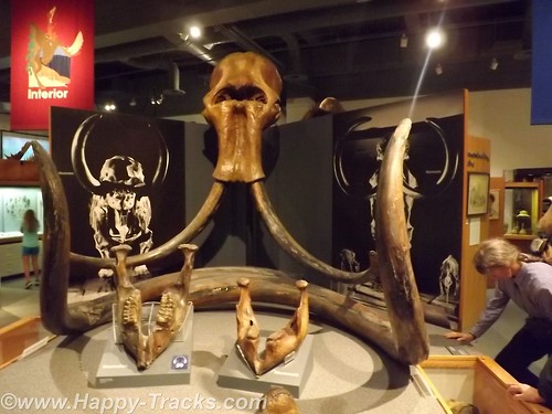
The Museum of Natural History is probably best-known for the Hope diamond, the dinosaurs, and the mastadon. We saw all those things…and then some. In center court, the display includes the mastadon.


 Next we went into the geology and fossils section.


")

 Although our pictures didn’t turn out so well, there was an extensive exhibit on the Chilean Miners’ rescue. You can see more of it at this link. Steve and Keith agreed that mining should not be our profession as our bulk would not fit into the rescue capsule.
An unusual exhibit for the Smithsonian is an exhibit called Butterfly Garden. It includes a walk through garden where you can mix and mingle with the butterflies. There’s more at the link.
 Steve made a quick run into the Skeletons and Mummies Exhibit.
 We met up in the mammals exhibit before a stop at the gift shops on the way out just before closing time.


 Following our afternoon at the museum, dinner was in order. We decided to try the Burmese fare at Mandalay in Silver Spring. Burmese was a new experience for us although Ryan and Steve had eaten there before. It was quite tasty and the service was good with reasonable pricing and only a short wait for our party of five.
Our long weekend with friends was drawing to a close. We settled in at home for the evening without Uno or cranberry juice.
Monday morning was a slightly earlier rising but we did manage to sleep in. Monday brought us to breakfast and then to ferry Steve toward the airport and back home.
It was a great weekend with great friends. We had played tourist and played cards and built a few more memories. When do we get to do it again?