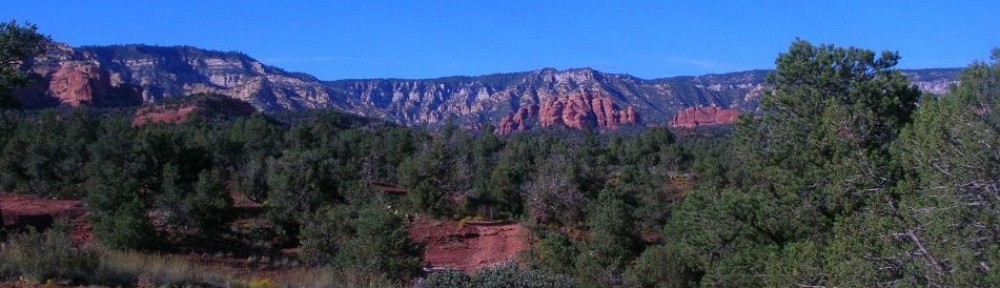
In looking carefully at a map of Alaska, one first notices the size of the state and its coastline and how much vast space with no roads. In the interior, the distances are covered by bush and float planes like we saw in Anchorage. This works on the rugged coast between the islands but is remarkably inefficient in moving freight or if you want to use a vehicle to proceed beyond the landing spot.
In 1948, three Haines residents Steve Homer, Ray and Gustav Gelotte, purchased a surplus US Navy landing craft and began providing ferry service for up to 14 cars with very crude provisions for passengers. After a couple of years, it proved to be economically unsuccessful and was subsequently purchased by the Alaska territorial government. The service proved useful and was expanded with bigger and better vessels and more towns served. As we mentioned in the Haines posting, the distance by water between Haines and Skagway are only 20 miles apart by water but hundreds of miles distant by car. Other cities in Alaska, including Juneau, the capital, are totally unreachable except by boat or plane.
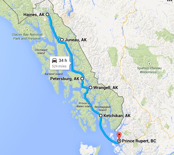
The Alaska Marine Highway System over the ensuing decades now transports folks, vehicles and freight over the broad range from Bellingham, Washington over 3500 miles to Dutch Harbor, Alaska in the Aleutian Islands.
As I was working on our itinerary, I had us in the Wrangell-St. Elias area with plans to go down towards Washington and the ferry seemed to be a perfect way to give us a break from the drive, fuel and hotel costs and let us see the Inland Passage. My haste didn’t allow me to see that there was no direct road route to Haines for our trip, another case of serendipitous planning taking us to a particularly enjoyable part of our journey.
Our ferry ride took us about 475 miles by water in 39 hours to cover what would have been 915 miles by highway over perhaps 3 days. Had we driven to Prince Rupert, we would have seen some parts of British Columbia that we didn’t but we would have missed the Inland Passage and all its beautiful sights. You do miss things in the truck as you’re making miles and watching for signposts and directions. You also miss some of the conversations and people watching opportunities.
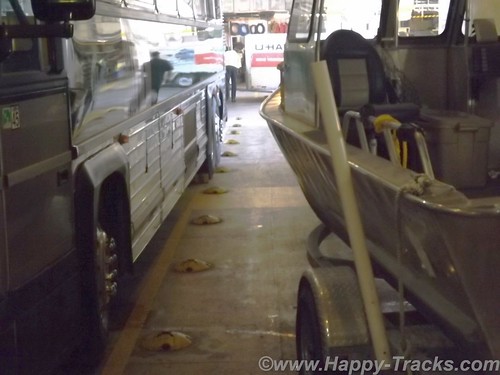
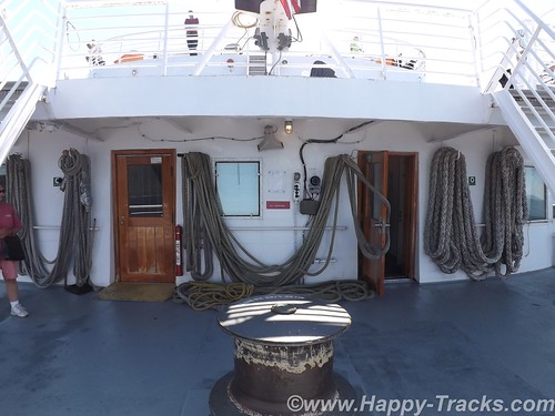
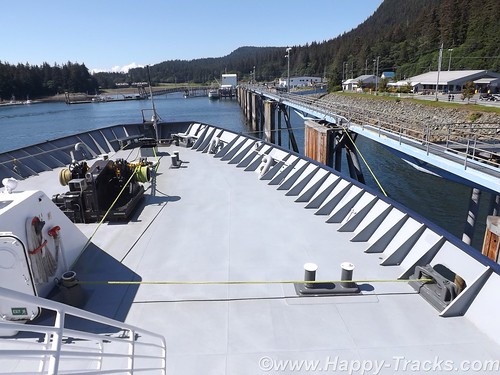
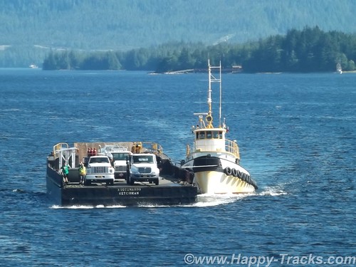
We drove onboard on a ramp which took us down to a lower level of the ship or the car deck. The car deck held all manner of vehicles. There were passenger cars and pickups like ours. There were tour buses and motorcycles. There were huge RVs, both motorhomes and fifth wheel campers. There was a truck pulling a boat on a trailer and there were the trailer halves of tractor trailers that were traveling unaccompanied and maneuvered about by tractors at their embarking and disembarking ports.
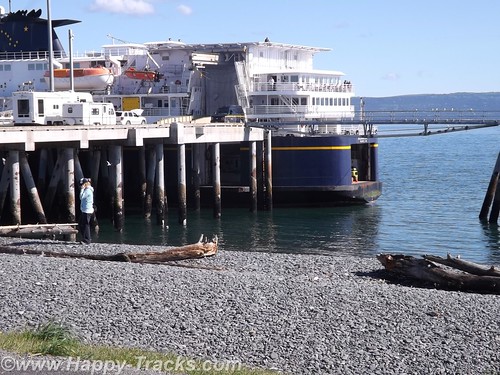
While at Homer, we had seen the MV Kennicott loading but it had a vehicle elevator and turntable for ports that don’t have facilities for the ramps. The car decks are secured and not accessible to passengers while underway. Folks traveling with pets bedded them down in the vehicle and went down to check when we pulled into port.
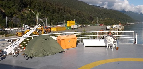
After securing the truck, we went upstairs to the purser’s desk for our cabin assignment and keys. We had reserved an outside cabin but some folks had plans to stay in the common areas or even to pitch a tent on the upper level sundeck (which has heat lamps under the roof).
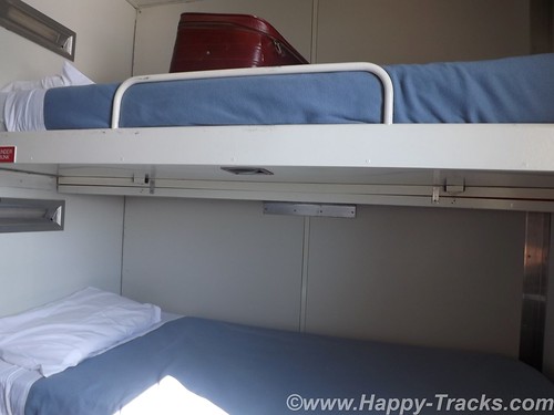
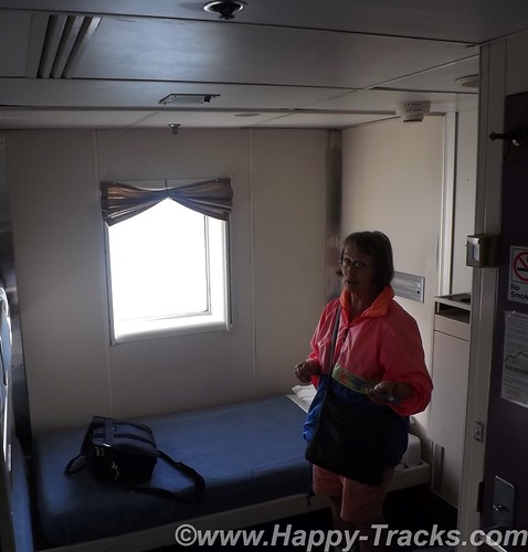
The three bunk outer cabin has an upper and lower bunk on one bulkhead and a single lower bunk at right angles and against the outer bulkhead with a square window above. There is also a fold down desk in one corner. There was a small head with a shower stall, a sink and a toilet angled into the corner. While usable, it required a bit of thought about what you intended to do in figuring the way you entered.
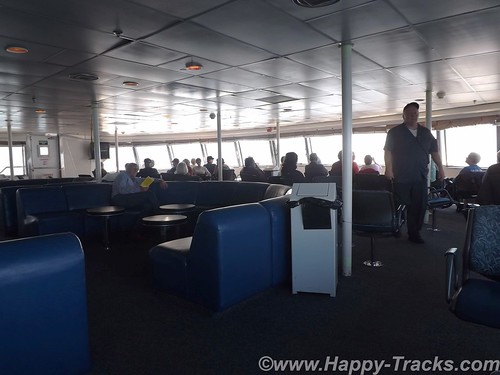
The deck above the cabins has a forward observation deck with comfortable chairs and a panoramic view. There is even a small kids’ play area and some tables for games and cards.
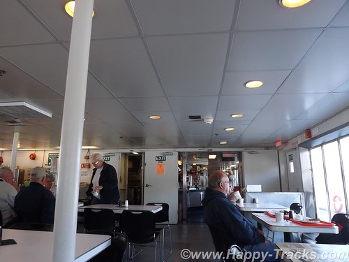
Immediately aft of the observation lounge is a bar and lounge which sometimes has a musical performer. Over the course of our trip, we only saw a few folks here. Continuing aft, the line for the cafeteria runs along the starboard side and the cafeteria was open all day except for an hour before each meal change. Overnight, sandwich service rather than hot meals were available. Aft of the cafeteria’s serving line was a dining area that was open around the clock.
Each deck also had an open area on the stern. There were two or three areas on the outer decks where smoking was permitted at times.
Our route included four stops before our final destination of Prince Rupert BC.
Our first stop was at the ferry docks outside of Juneau. The dock is located north of the main part of town in Auke Bay like the dock in Haines so we didn’t really see the town. We were in port a couple of hours and there were vans waiting at the dock to take folks into town for a tour. We chose to stay near the dock and enjoy the warm sunshine.
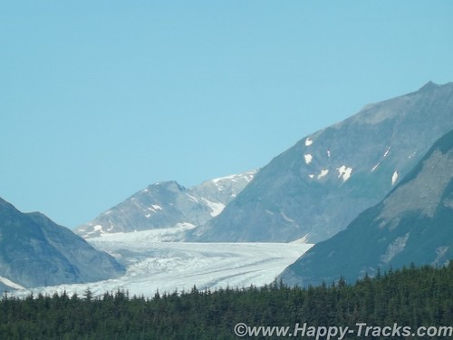
Juneau was established in 1880 by Joe Juneau and Richard Harris. They discovered gold in nearby Gold Creek. The mine eventually became the largest operating mine of its kind and operated from 1880 to 1944. The capital was moved to Juneau in 1906 from Sitka. Points of interest besides the mine include the Mendenhall Glacier and the Capitol Building which is trimmed in Tokeen marble mined in SE Alaska.
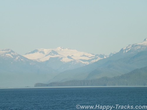
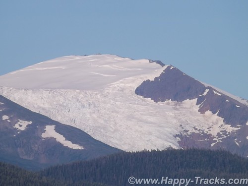
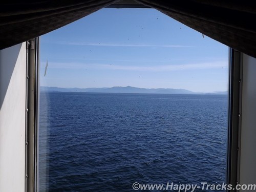
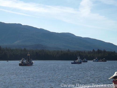
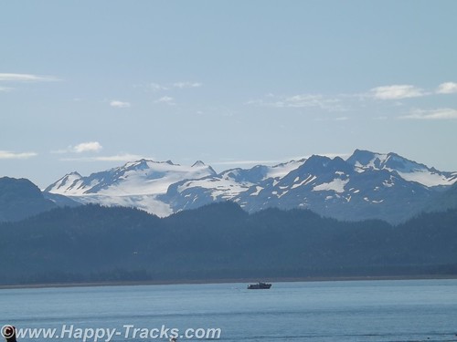
After we left Juneau, we threaded our way south towards Ketchikan. Late in the afternoon, we made our way to the observation lounge where we were delighted to see whales out in front of us. There was a tour group in the observation lounge at the same time and the group would call out when one was sighted making it easier to spot them. We also saw seals on a chunk of ice and boats fishing.
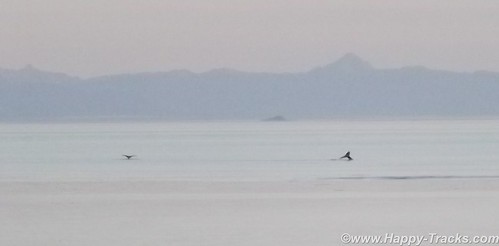
Later, we had a conversation with one of the crewmen whose job includes steering the ship. He told us that the whales were humpback whales and orcas. Environmental concerns force the ship to slow or change course to avoid them, at times even coming to a dead stop when there are just too many whales to safely proceed. He told us that the ships sonar setup allowed them to see and identify the whales even underwater. He also told us of watching a humpback whale on the sonar once that was being pursued by orcas but that the humpback is able to dive deeper and more steeply and escape the orcas if the water is deep enough.
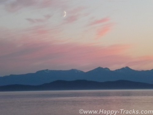
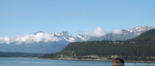
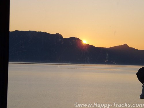
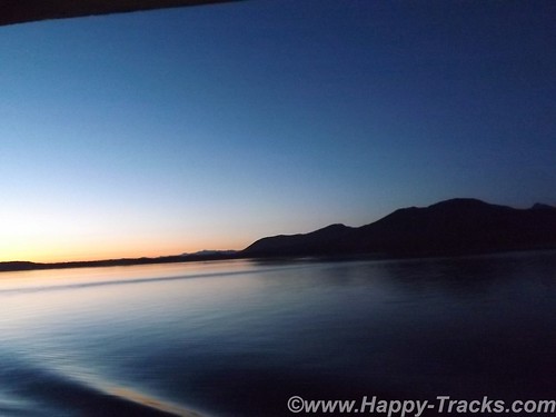
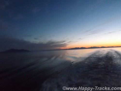
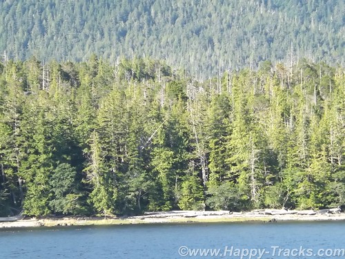
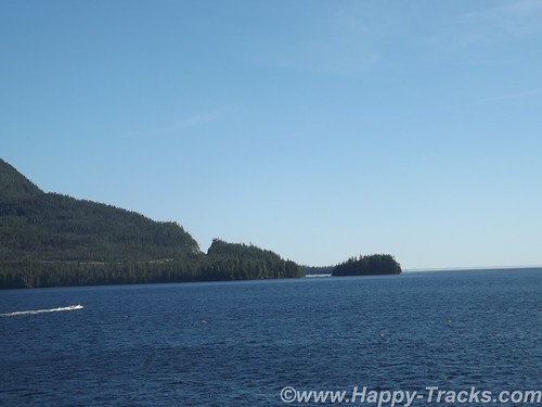
The scenery throughout our trip continued to be breathtaking and the sunset over the mountains and on the water was captivating.
Another conversation we had with fellow travelers gave us tips for our return trip home. This particular couple had traveled part of the AlCan as we had but their trip had taken them further north into Yukon Territory and on the Top of the World highway. He shared that their trip had been over less friendly roads and had probably more closely resembled the conditions found by my family in their trips over the AlCan in the early 1950s. These folks were from North Dakota and asked about our route home. They recommended that we consider the North Dakota Badlands on our return route. We took their recommendation and were glad that we did.
Our conversation with the woman working the cash register for the cafeteria line told us a bit about their jobs as well. The crew, depending on the route and ship assigned, may leave home and stay onboard for 2 weeks. When they reach the end of their two weeks, they have two weeks off before repeating the cycle. Depending on the job, they work 12 hours per day, perhaps split into 2-6 hour shifts.
We retreated to our cabin for the night and slept well, only waking when we pulled into our stops in Petersburg and Wrangell during the night. From our cabin window, we could see buildings that looked like they belonged on a pier, some type of warehouse or terminal and bright lights in the darkness.
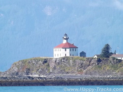
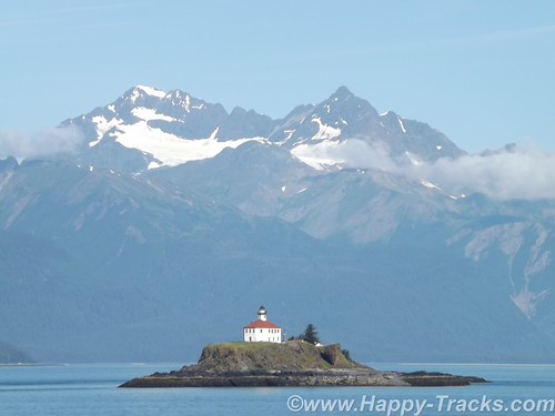
The next morning, we were back walking around on deck watching the scenery roll by. As we approached Ketchikan we saw several lighthouses and even a USCG helicopter land at one of them. We pulled into a busier port at Ketchikan than we had been seeing.
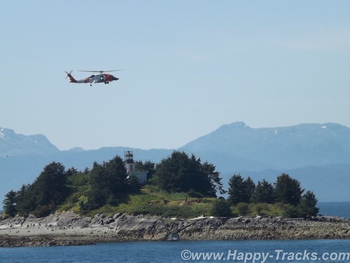
The Tongass Narrows, the waterway leading to the town’s docks, was in use by fishing boats and working boats of all sorts. This was also the channel that served as the local seaplane strip. On the opposite side of the channel from town was an elevated airport on Gravina Island. The airport is connected to town by a small ferry which takes about 7 minutes to cross from side to side. You may remember the Tongass Narrows and Gravina Island as the “Bridge to Nowhere” which gained notoriety as an earmark in the 2005 Federal budget. Perhaps I should also ask whether you remember Federal budgets and appropriations bills as opposed to “continuing resolutions”? Gravina Island has only 50 residents and the bridge (at an estimated cost of almost $400 million) was labeled as a particularly egregious example of government waste in the form of pork barrel spending. Proponents of the bridge said it was not just for the benefit of the 50 residents but to allow development of Gravina Island.
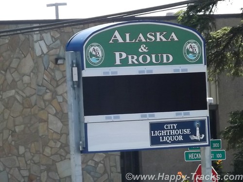
Our stop in Ketchikan was scheduled for 4 hours to allow the ship to take on diesel fuel to continue our trip into Prince Rupert. Since we had been unable to find postcards since leaving Haines, we disembarked and went into the commercial area near the dock. We tried a hotel and a restaurant and finally found the postcard at an A&P (Alaska and Proud) grocery store.
We went back onboard for lunch and asked the purser about mailing our postcard. She told us that it wouldn’t go out until after the ship went back north the following week but told us the post office was at the edge of the ferry dock parking lot so we went back ashore to the post office.
Leaving Ketchikan, we stayed within the Tongass Narrows for some time and got to enjoy some inland scenery from the water.
We were going to be landing in Prince Rupert around midnight and didn’t have reservations. We overheard some folks talking about driving on to Prince George as they expected it to be hard to find rooms in Prince Rupert. Prince George is 9 hours from Prince Rupert and while the fog would surely dissipate as you left the coast, it didn’t seem like a palatable alternative to us. The purser did have a list of hotels in Prince Rupert though with phone numbers. One of our fellow passengers was a German woman who was traveling without a vehicle and she was also trying to make arrangements for lodging but the language was creating a barrier for her getting recommendations. It wasn’t clear about how to get from the docks to the hotels and she was getting frustrated. We did share that the list was available and gave her one. We didn’t see her again and hoped she made a connection that was suitable.
We pulled into Prince Rupert in a heavy fog and the line at Customs was slow as the whole ship unloaded at once. We passed through relatively quickly (considering the line) and found a room just a couple of miles away at the downtown area of Prince Rupert.
You can see all of the pictures from this leg of the trip here.
We invite you to continue along with us and hope you enjoy the account!
Tag Archives: Haines
Summer 2014: Alaska via the AlCan; Haines, Ft. Seward
Leaving the Customs station (Pleasant Camp Border Crossing) with a brochure from the Hawaiian Customs Agent, we continued alongside the Chilkat Inlet towards Haines. Primary task for us at the moment is finding lodging for the next two nights and its about 7:30 pm. Waiting until this late to start finding lodging hasn’t worked out well for us in the past.
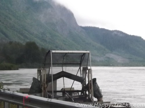
We find a place to pull over and make some calls and see this contraption. It looks sort of like a paddle wheel or even an automated fish catching device. We later find that its a device mounted by the state to help count the salmon population.
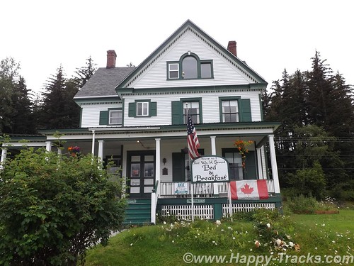
The first place (a BNB) we called had nothing available for the two nights we needed. We tried a second call and connected with a woman who said she could accommodate us at the Ft. Seward Lodge although she wasn’t at the lodge but could meet us there in the half hour we needed to get there. She said she had to put her child down to sleep for the night and would meet us there.
We drove through the edge of Haines and arrived outside the office door to find it locked and apparently no one around. We waited a bit and then called again and the call went to voice mail. We finally saw someone going out that looked like they might work there. It turned out the young lady did work there but had also had issues with getting someone to answer the phone. She did tell us another phone number to try though which also went to voice mail. After waiting this long, we were certainly tempted to go somewhere else but there didn’t seem to be any where else to go. Eventually, the owner showed up and checked us into our room.
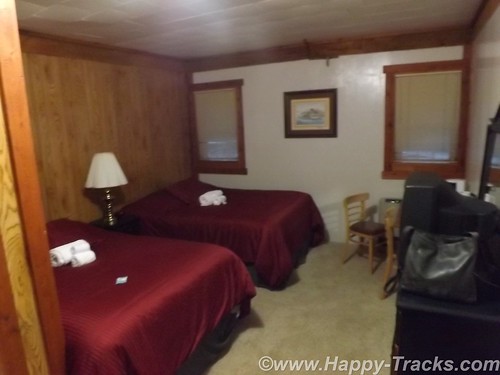
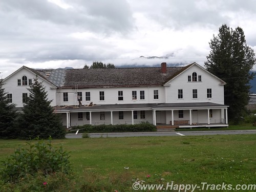
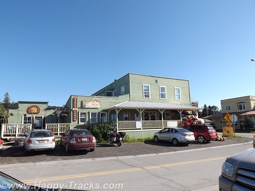
The Ft. Seward Lodge building had been the PX when the post was still active. This particular building had housed the exchange, a barber shop, soda fountain, bar and the bowling alley. The long wing containing our room had once been the bowling alley.
Haines, Ft. Seward, and Port Chilkoot history is like many of the towns in Alaska ranging over the Native population, the US acquisition, the gold rushes, fishing and the tourism industry.
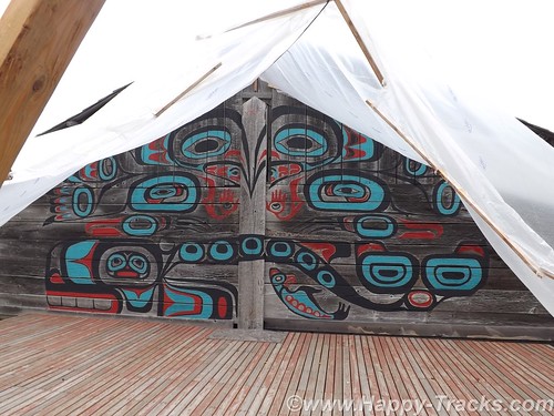
The Tlingit Indians established the first permanent settlements around 8,000 years ago. The area is relatively temperate, has abundant food resources and geographically provides a portage opportunity to connect the Chilkoot and Chilkat Inlets. The Tlingits established trade with other groups and became wealthy. They also are recognized as the artists of some of the finest indigenous creations.
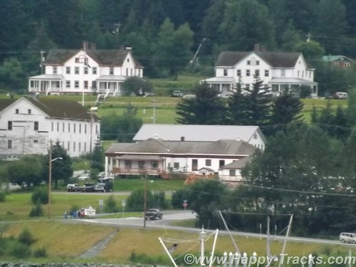
White settlement came in 1881 with the Presbyterian mission. Shortly after came salmon canneries, mines and the construction of Ft. Seward by the US Army. Due to ongoing border dispute with Canada, the US built Ft. Seward as a demonstration of might and resolve and encompassed 4,000 acres which had been deeded over from the Presbyterian church in 1902. The docks were first to be built to bring in supplies and construction materials. Italian stone masons were imported to build the granite foundations for the post and master carpenters from the lower states gave Ft. Seward style that exceeded most rudimentary construction of that era. The first contingent of soldiers arrived in late 1904 and Ft. Seward became regimental headquarters for Alaska. Ft. Seward was renamed Chilkoot Barracks in 1922.
Over the next two decades, the Army dismantled other Frontier-era forts around Alaska so that Chilkoot Barracks was the only Army post in Alaska. During World War II, Chilkoot Barracks became an induction and rest center for soldiers arriving in Alaska to form the new posts and bases needed to support the war effort.
Like many military bases, Chilkoot Barracks provided an anchor for the town’s economy during its operation but in 1946, the Army declared it surplus in favor of more strategic locations in interior Alaska. A group of WWII veterans decided to buy the surplus post and continue to operate it as a cooperative. The cooperative failed but several of the veterans established small businesses that survived serving tourists and passengers from the small cruise ships that used the old Army dock. With the infrastructure to support the post (fire department, utilities, etc), the city of Port Chilkoot was formed and merged with the Main St. area to become the city of Haines in 1970.
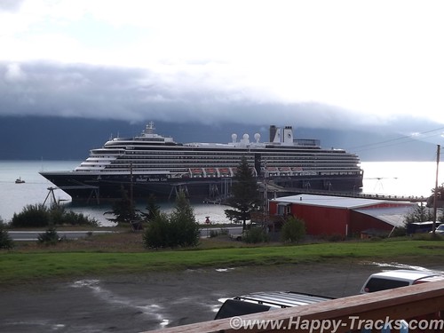
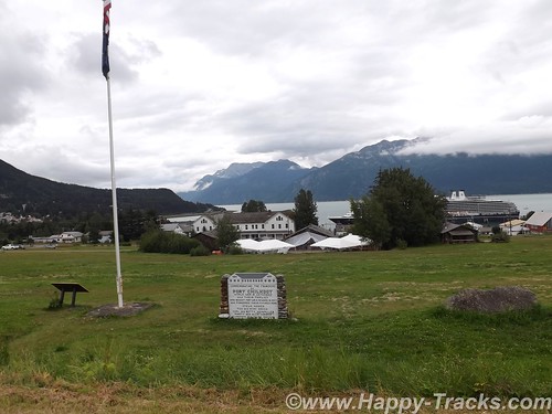
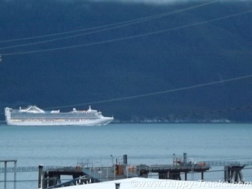
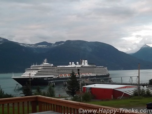
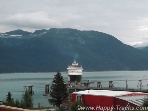
The scenery had changed when we looked outside the next morning. A cruise ship (relatively small) now sat at the pier. I say relatively small as it was smaller than what we had seen in Seward and smaller than the ones we saw cruising down the far side of the Chilkoot Inlet making their way to and from Skagway (20 miles away by boat, hundreds of miles by car including traveling into the Yukon Territory). We happened to hit cruise ship day in Haines when most of the shops would be open.
Haines only allows one ship per week to dock. Previously some of the larger ships had been thought to be more detrimental to the local ecology than they needed so the good folks of Haines sent them away and now the larger and more numerous ships land at Skagway instead.
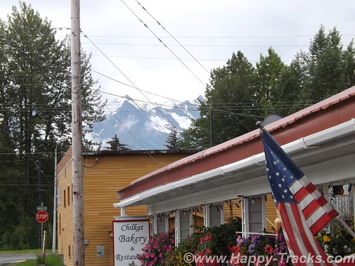
We went for a ride around Haines looking for breakfast and happened upon the Chilkat Bakery and Restaurant which looked to be popular with the locals and a little far off the beaten path for the cruisers. As we paid our tab, we asked the owner how late they were open and she answered and said she’d stay open as long as we were there by closing time. We ended up there again for dinner but well before closing time.
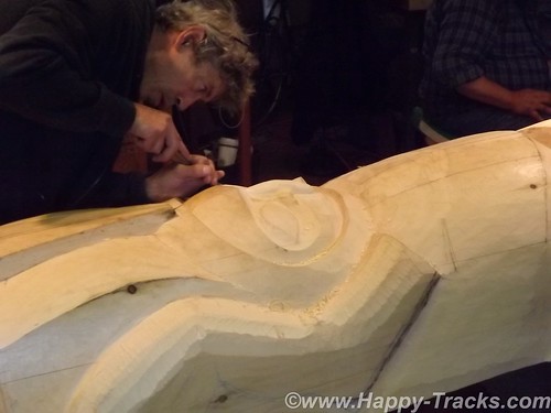
We went back to the Lodge to park the truck and then began our walking tour of Ft. Seward. We walked up the hill of Soapsuds Alley which had been married enlisted housing and many of the wives had taken in laundry to supplement incomes. As we topped the hill, we worked our way around the parade ground counter clockwise with our first stop being the old hospital, now home to the Alaska Indian Arts which seeks to preserve the arts including carving. The non-profit foundation provides workspace for the carvers as well as preparing pieces on commission. The tour included the workshop where a totem was being carved.
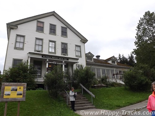
Historically, the hospital provided medical care for the Army personnel and their dependents but regulations allowed the doctors to supplement their incomes by taking patients from the surrounding area.
We continued walking around the parade ground. Along the upper and longer side, the houses had been officer and senior personnel quarters which were larger and more grandiose than those on Soapsuds Alley. The far end (third side of the rectangle) had what had been the commanding officer’s quarters and the headquarters building which were large enough that they now were in use as a hotel. Filling out the third side was the firehouse with its tower to allow the hoses to dry after use without freezing.
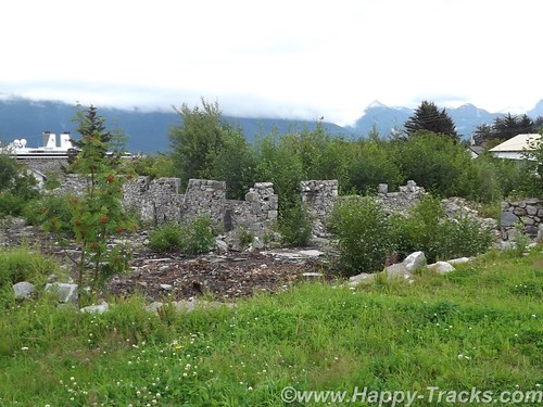
The fourth (lower) side of the parade grounds had a large enlisted barracks building which is currently undergoing work to preserve and return it to its 1940s configuration. The granite foundation to another large barracks building sets next to the first barracks building. The second building had been destroyed by fire in 1981.
The cruise ship being in port increased the population for the day and the weekend would bring the Southeast Alaska State Fair to Haines so preparations were underway. The parade ground at Fort Seward was being prepped.
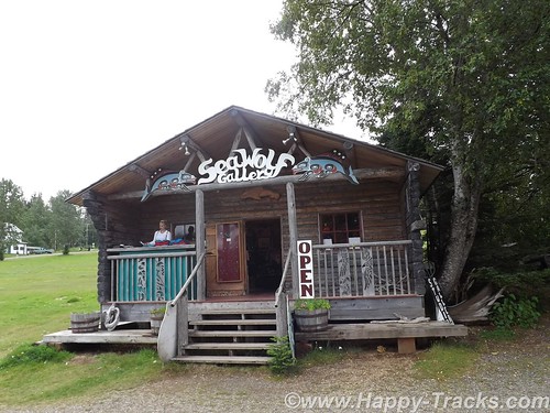
With a population just over 2500 in the 2010 Census, Haines has perhaps the highest percentage of residents involved in the artistic professions and is dubbed the arts capital of Alaska. One artist we kept running into (and met setting up his shop on the parade grounds for the fair) is Tresham Gregg. Mr. Gregg’s works are largely wood sculpture although we also found several of his designs in leather belts (made in China). He apparently owns/runs several full-time shops in Haines.
We opted for a late lunch at the Fireweed Cafe which was also popular with the cruise ship crowd. We took seats at the bar and both had salmon dishes. Also seated at the bar were a couple of honeymooners from the ship and another couple from Vancouver who were spending the summer at the RV park next to the town docks. Their conversation mentioned tales of the park, including a guest who hadn’t realized that the inlet was saltwater and had been using it for washing up. They also shared that their older teen daughter had gone over to Skagway on the “fast” (passenger only) ferry as there was just too much small town laidback-ness to keep her occupied. Fresh salmon makes for a good lunch, by the way.
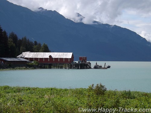
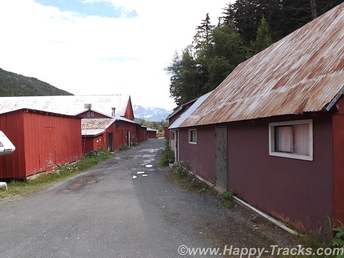
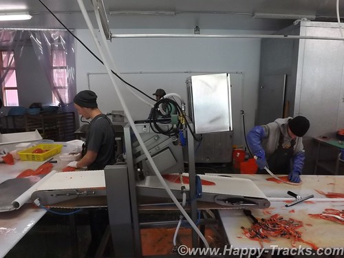
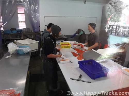
After lunch, it was back to the truck to find what lay beyond our walking limits. On the Chilkat Inlet side of the peninsula is the Haines Packing Company located at what may be the oldest cannery site in Alaska. The operation was modernized in 2007 and primarily freezes, packs and ships fresh salmon with no canning taking place there anymore. The property is open to tour (self-guided) and lets one see the historic setting as well as a modern machine cleaning operation if your timing is lucky. There is also (of course) a gift shop with handcrafts from the proprietor and others and you could buy salmon and have it shipped most anywhere.
You are separated from the processing operation by windows so I was pleased to learn that I could take pictures without the glass glare by pressing the lens of the camera up to the glass. (I did learn later that doesn’t work when you have two widely spaced layers of glass.)
We went back into Haines and checked out several of the shops and the museum. We skipped the Hammer Museum. In retrospect, that may not have been such a great idea. The shops ran the gamut from imported plastic stuff that said Alaska on it to expensive handmade jewelry and carvings, not necessarily Alaska-made. The museum, actually the Sheldon Museum and Cultural Center, was small but contained several interesting exhibits in its small space. The Sheldon Family, who had been prominent citizens of Haines in the early 20th century, donated much of the museum’s initial collections.
We headed back to the Chilkat Bakery and Restaurant for dinner (well before closing time) and had excellent Thai food for dinner.
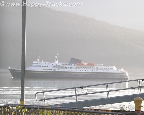
An early start the next morning was in our plans so we headed back to the Lodge for the evening where we watched the cruise ship’s intricate routine of casting off and getting underway. The main dock sticks out perpendicular to the shore. The ship is longer than the dock is wide so the bow and stern lines went to standalone bollards. A crewmember was dispatched in a small rowboat to each bollard where he climbed up the ladder to let the lines go and then climbed back down the ladder to go to the other one and repeat the performance. In this day of machinery and automation, it seemed somehow quaint to require this procedure. After loosing the lines, the ship backed away from the dock and turned its bow south and away.
The lodge owner was on the deck as we watched the cruise ship prepare to depart and shared her story of coming to Haines from Montana to marry her husband who ran a heli-skiing business. Heli-skiing refers to carrying skiers to the top of the slopes and then letting them ski down from there, places they couldn’t reach other ways. The lodge fit into that by ensuring their winter customers and friends had accommodations for their winter adventures.
She ran the bar and the lodge and told us a bit about why it was difficult to find help and run a restaurant in the lodge. Primarily, she attributed it to an inability to estimate the seating at a particular meal and the difficulty in obtaining fresh produce when much had to be pre-ordered and shipped from the lower 48.
Early the next morning, we made our way to the ferry (Alaska Marine Highway System) landing to line up for loading for the trip south.
You can see all of the pictures from this leg of the trip here.
We invite you to continue along with us and hope you enjoy the account!
Summer 2014: Alaska via the AlCan; Homer to Haines
After a good night’s rest in Anchor Point, we loaded up and headed back into Homer.
We had one recommendation but went instead to Maura’s Cafe and Deli in the old part of Homer. They looked to be doing a great business and we believe in the old adage to eat where the locals eat.
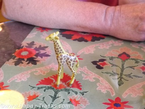
When we went inside, there was a line to order and no seats to be had. By the time we got to place our order a couple of tables had emptied out. We both ordered the quiche and were given a plastic giraffe to take to the table with us instead of a number.
As we waited, it became clear the morning rush had been a good one and they were running out of things. We enjoyed our meal and went out to explore.
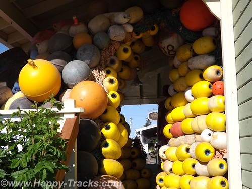
There was an interesting tableau of buoys on the porch of the store next door.
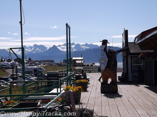
Then we followed the road down to the beach and on out to the Homer Spit. The Homer Spit is 4.5 miles of land sticking out into Cook Inlet and home to both deep water on one side and shallow water on the other. The theories to its origins differ with one suggesting that the Spit is the result of glacial movement and one suggesting that it’s the buildup of sand deposited by the comings and goings of tide and wave action over millennia.
The spit includes a fishing lagoon which is stocked each spring from the nearby salmon hatchery.
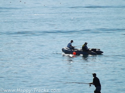
On this particular summer Sunday, the Spit was packed with tourists (just like us) in all manner of vehicles from compact cars and bicycles to huge RVs. At the water end, the M/V Kennicott, part of the Alaska Marine Highway System (ferries operated by the state) was loading. We stopped to watch for a while and then noticed the birds. In this case, the birds were bald eagles. In total we probably saw 4 of them.
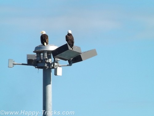
Among other things, Homer is known as the home of the Bald Eagle Lady, Jean Keene. Ms. Keene had been feeding the eagles for years before the town passed an ordinance making it illegal to feed them. One renowned photo of Keene shows her sitting on the ground and feeding 24 of the birds clustered around her. Homer’s ordinance, passed in 2006, granted a reprieve for Keene who had been feeding the birds for 25 years at that time. The reprieve was only to last until 2010 but Ms. Keene passed in 2009.
The eagles, in such abundance, were said to be a nuisance by appearing threatening to humans as well as small dogs and other birds. ABC News reported in 2007 that any close up picture you had seen of a bald eagle was likely taken in Homer. Their presence contributes to the tourism in Homer, even in the winter.
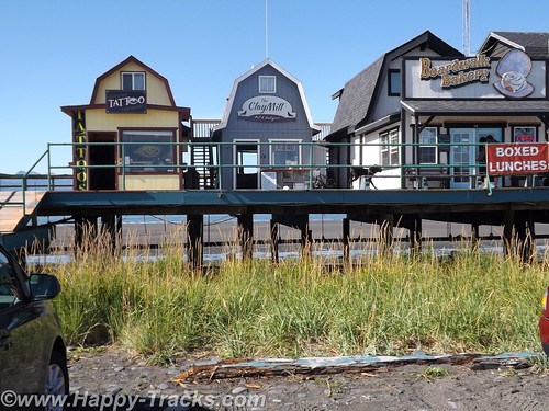
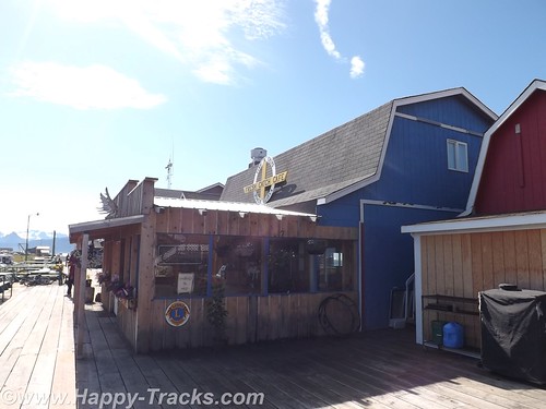
After watching the eagles and the ferry load for a bit, we headed back towards town and stopped at one of several collections of small shops built on stilts above the ground. The shops were an eclectic mix of tour offices (go fishing, climb the visible but distant glaciers, boat tours, etc.) and restaurants and shops of all descriptions. The wares varied from Made in China fare to high end art piece carvings of all sorts.
We stopped in one shop which sold antiques and curiosities and talked with the shopkeeper. One item he had was an “electrician’s knife”. It was the same style of knife I have in my toolbox with a single sharp blade and a screwdriver that I had since my days in Uncle Sam’s Underwater Canoe Club. If I didn’t already have mine, I would have bought it ($10) on general principle.
There is also a Seafarer’s Memorial to those lost at sea but we didn’t see it, only found out about it in our research to write this piece. It’s not particularly tall and is on the edge of a parking lot which was filled with campers and vans the day we were there.

Feeling that we had seen most of what we wanted to see in Homer and on the spit, we turned inland and generally north headed back towards Anchorage.
Since there is largely one road in and the same road out, we repeated the same beautiful scenery along the coast and stopped in Soldotna for a late lunch/early dinner at Buckets Sports Grill. The halibut sandwich and clam chowder were just the thing to power us on our way.
We passed through the Funny River fishing region again. There seemed to be more folks out on the riverbanks than there had been the day before but still couldn’t tell if anyone was catching or what they were catching. Traffic was moving well but was a bit heavier through here.
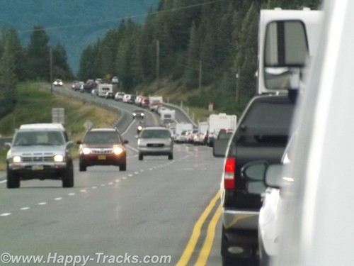
After we passed the Alyeska Resort area, traffic was noticeably heavier and very soon came to a complete stop. At first we theorized an accident up ahead (and there may have been but we never saw signs of it) but it seemed to just be heavy volume of weekend travelers headed home on Sunday evening plus the squeeze from two lanes to one as we squeezed between the mountains and the water as it moved along again as the alternate roads became available going into town.
This Sunday in Homer marked the halfway point. We had been gone from home 21 days on what was to turn out to be a 42 day trip. We were also as far from home as we were going to be. Google maps shows Homer to be 4,469 miles from home and we had driven 6,581 miles following a different route through the continental US and numerous side trips.
We got on the phone and booked a room at the Golden Lion Best Western in Anchorage. It was time to call it a night.
When we started planning out this trip, we had picked a number of “backup” locations in the vicinity of the Wrangell-St. Elias National Park in case we hadn’t seen them earlier, places like mines and glaciers. With plans to possibly pass through that area, it made sense to book passage on the ferry from Haines to see the Inland Passage. We needed to be in Haines on the ferry on Friday morning or stay another week.
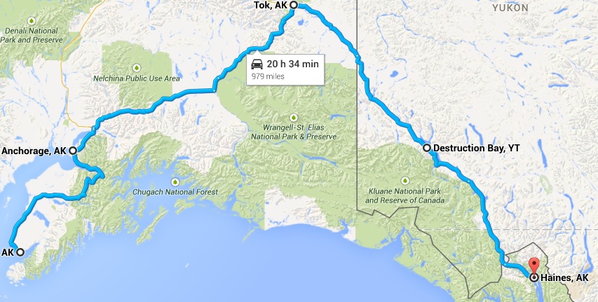
The combination of the reservation plus having seen mines and glaciers and the realization that several of the sites in Wrangell-St. Elias would be rough and slow road in a drive in and then reverse and drive back out the same road lead us to decide to skip Wrangell and concentrate on making our way to Haines, some 975 miles from Anchorage via the roads.
On Monday morning, we started making our way towards Tok via AK-1. This was a different route than when we had left Tok. The scenery was beautiful and the skies were clear, unlike when we had first gone from Fairbanks to Anchorage.
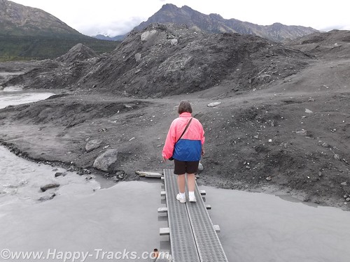
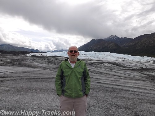
Traveling this way, the roads were more hilly and curved and along the way, we would pass by the Matanuska Glacier. The Matanuska Glacier was described as a “drive-up” glacier, unlike Exit Glacier where one has to climb the hillside to reach the glacier itself.
Betty describes the side trip to Matanuska as “chasing butterflies”, a phenomenon that was really one of the highlights of this trip. Without a firm agenda or schedule to meet, we were able to chase a butterfly off on a side trip. Matanuska is a valley glacier meaning that it is lower in elevation and occupies the land between two hills or mountains.
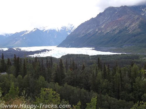
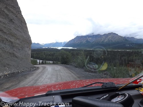
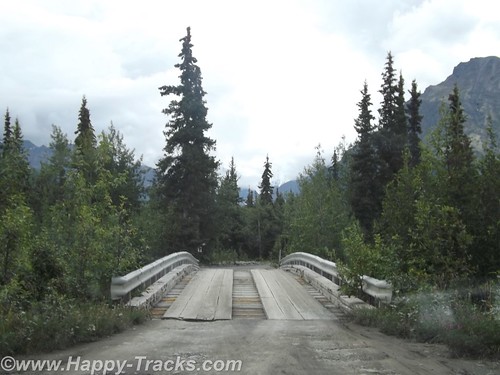
We allowed a half hour or so to make the trip to the drive up glacier just since we were so close. From our vantage point on the highway, you could see the Matanuska Glacier below us in the valley. There was a winding dirt road off the highway to get down to it. We crossed over a narrow high bridge of planks and steel. You continued along until a house and store where you bought your tickets.
From there, you passed through a gate and then it was about a mile to the toe (foot?) of the glacier. We pulled up in the parking area with the other vehicles and started making our way across the black and wet moraine to the glacier. We walked for a ways before realizing there was a marked path on the other side of the water and walked back towards the truck to reach the path. We later discovered the path started from the other end of the parking lot.
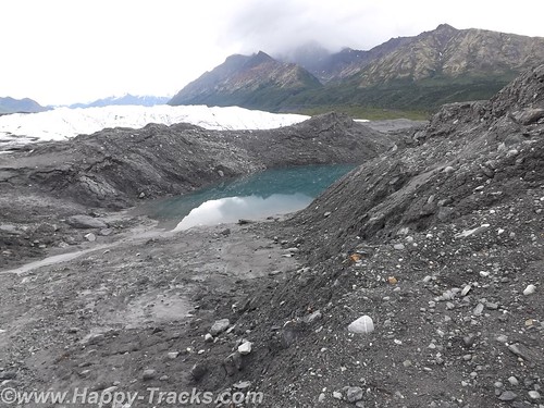
The way out included planks over some of the wetter and trickier areas. There was a group with a guide who were on their way farther out into the middle area of the glacier with their ice spikes. We stopped for a few pictures along the edge and then began making our way back. A family that looked to include Grandma, Mom and Dad, and the kids met us coming the other way. The passing on the planks required some coordination but we safely passed.
About two hours after we had taken the turn on to the dirt road, we were once again on our towards Tok where we stayed again at the Golden Bear Lodge. We have discovered since being home several versions of the origins of the name Tok. Several conflicting sources exist but there is a reference to it being known at Tok as early as 1901. It does represent the junction of the Alaska Highway and a cut-off which allows lower 48 travelers to reach Anchorage and Valdez without proceeding further north to Delta Junction.
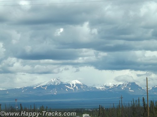
We left the following morning for Canada, crossing into the Yukon Territory and stopping for lunch at Destruction Bay. We continued south past Kluane Lake and took the turn in Haines Junction where we continued through beautiful scenery. This stretch of road is particularly desolate, though in good repair.
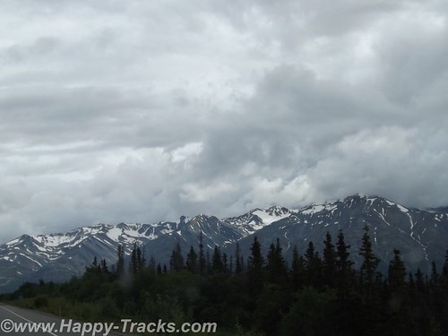
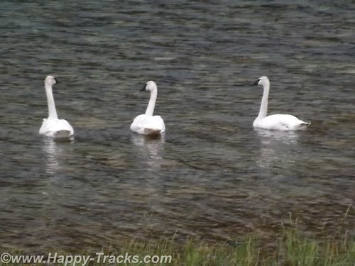
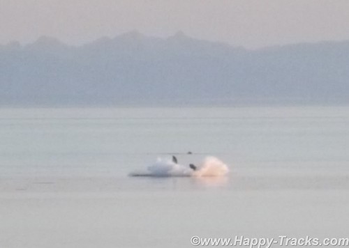
The highlights of this stretch include more mountaintop glaciers, a couple of airstrips and a trio of trumpeter swans alongside the Haines Highway. We also noted several signs advising that snow plows might be in your lane so beware!
About 7:00 that night, we reached the Customs station at the border back in to the US. It looked deserted but we sat and in a few minutes the agent came out of the building. He was friendly and chatty. We hadn’t seen a car in the last 80 miles or so and figured he spent a bit of time by himself unless he walked over to the Canadian side and talked to their agents. He remarked that he didn’t see too many Maryland plates up that way. He also said he didn’t see many from his home state either. We asked where that was and he told us Hawaii. He had the opportunity to come to this station as a temporary summer assignment but assured us he would be back home before winter hit.
Before we left, he gave us the brochure for Haines including a list of lodging. On that road, that’s the only place you could possibly be going. We wished him well and went on our way.
You can see all of the pictures from this leg of the trip here.
We invite you to continue along with us and hope you enjoy the account!