We left Medora and headed east on I-94 towards the Missouri River and Bismarck. We called a couple of hotels but found no rooms available without a reservation. Someone recommended the Prairie Knights Resort. Since it was about 50 miles off the highway, we called ahead to check on room availability. They told us they had plenty of rooms so there was no need to make a reservation. Mmmmmkay?
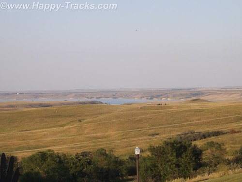
We drove south with the Missouri River to our left through a couple of very small settlements and passed the Ft. Lincoln State Park entrance. It really is 50 miles and there is virtually nothing until you reach the Prairie Knights Casino and Resort. Prairie Knights is a casino and lodge located on the Standing Rock Indian Reservation. It is operated by the Standing Rock Indian Tribe. The casino offers high stakes gaming options, along with 725 slot machines, blackjack, craps, among other games. The lodge portion of the casino consists of 200 guest rooms.
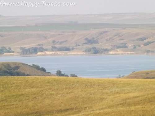
Once we finally get there, we see that they have a landing on the River, the lodge, a restaurant (buffet style), the casino and a small gas station with prices comparable to what we’d seen in Bismarck.
When we go to check in, the clerk asked if we were members of the Prairie Club. Uh, no. Before we get registered, they suggest we go into the casino and register. The registration is free but it knocks $25 off our room rate and gives us $10 to spend in the casino. We are now Prairie club members! We walk around a bit, get some dinner at the buffet and call it a night.
The next morning we head back north towards Mandan and the Ft. Lincoln State Park. Although we didn’t use them, it should be noted that the park has primitive and developed campgrounds and rental cabins near the riverbank. We didn’t go to those areas of the park to check them out. There are also hiking and biking trails.
The visitor center building contains a display that includes exhibits from the Lewis and Clark expedition and from the Mandan Indians who had a village there.
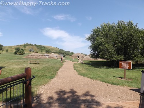
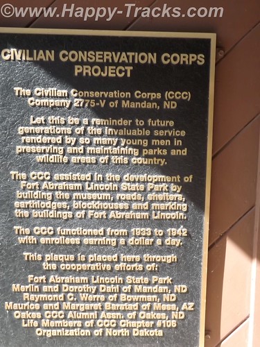
This is where the tour starts for the On-A-Slant Mandan Indian Village. Parts of the village have been the subject of archaeological research and some restoration. Their society was matriarchal with families dwelling in the same lodge including daughters and sons-in-law. The lodge would pass to the eldest daughter on the death of her mother.
The lodges were circular with a fire pit in the center, venting through a hole in the roof which could be covered in hides in times of bad weather. The lodges were also built into the earth with dirt and grass on the outside and over the roof which provided insulation from the temperature extremes. The guide told us of the lodges maintaining 60 degrees even in the coldest parts of winter and they were cool on this hot day when we visited. Generally, the lodge was entered from the side with a partition wall separating the entrance from the main room for weather and defenses. Sleeping pads were around the circumference.
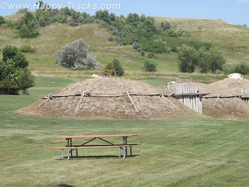
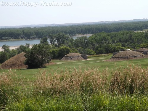
The Mandans were stationary people with language similar to the Sioux. They grew crops and hunted animals while trading with the nomadic tribes. A typical Mandan village consisted of 12 to 100 of these dome-shaped lodges. Their oral traditions indicated they had once occupied the eastern North America.
Their villages were often stockaded for protection and they hosted many of the European explorers, including the Lewis and Clark Expedition and Prussian scientist Prince Maximillian.
In 1750 there were nine large Mandan villages, but recurrent epidemics of smallpox, pertussis (whooping cough), and other diseases introduced through colonization reduced the tribe to two villages by 1800. In 1837 another smallpox epidemic left only 100 to 150 Mandan survivors. Some of these accompanied the Hidatsa to a new settlement near Fort Berthold (northwest of Bismarck) in 1845; others followed later, as did members of the Arikara tribe. The Mandan, Hidatsa, and Arikara eventually became known as the Three Affiliated Tribes (also called the MHA Nation).
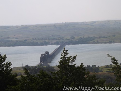
In the mid-20th century, the Three Affiliated Tribes lost a considerable portion of their reservation to the waters of Lake Sakakawea, which rose behind the newly built Garrison Dam. With the flooding of the river bottoms, on which had been the best agricultural land, many tribal members shifted from agriculture to ranching or off-reservation pursuits.
In the 1870s, at the same location where the Mandan tribe had established their village, a military post was built in June 1872 by two companies of the 6th U.S. Infantry under Lt. Col. Daniel Huston, Jr., as Fort McKeen, opposite Bismarck, Dakota Territory.
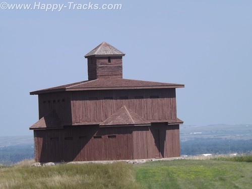
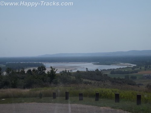
Standing today are two of the watchtowers that overlooked the juncture of the Heart and Missouri Rivers and the town of Bismarck.
The three-company infantry post’s name was changed to Fort Abraham Lincoln on November 19, 1872, and expanded to the south to include a cavalry post accommodating six companies. Among the 78 permanent wooden structures at Fort Lincoln were a post office, telegraph office, barracks for nine companies, seven officer’s quarters, six cavalry stables, a guardhouse, granary, quartermaster storehouse, bakery, hospital, laundress quarters, and log scouts’ quarters. Water was supplied to the fort by hauling it from Missouri River in wagons, while wood was supplied by contract.
By 1873, the 7th Cavalry moved into the fort to ensure the expansion of the Northern Pacific Railway. The first post commander of the expanded fort was Lieutenant Colonel George A. Custer, who held the position until his death in 1876.

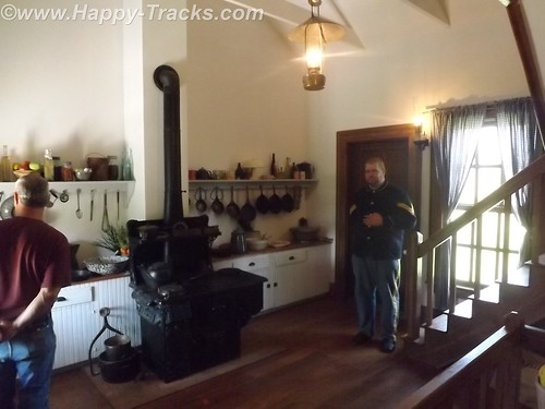
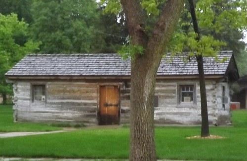
Several buildings remain at the post, including Custer’s restored (and furnished) house, the commissary (now the souvenir shop) and some stable and storage buildings.
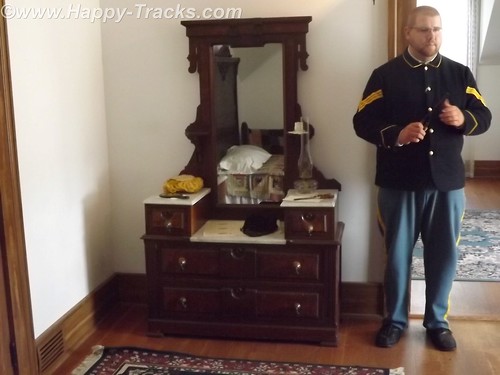
Custer’s house is open to guided tours. The tour is conducted by a man in period uniform in the role of one of Custer’s aides. The tour is alternately conducted by a woman who was in period dress. The setting is 1875 so the tour does not address the Colonel’s demise at Little Big Horn. Guests are shown through the house as arriving guests for a party to be given that evening by Colonel and “Mrs. Colonel” Custer.
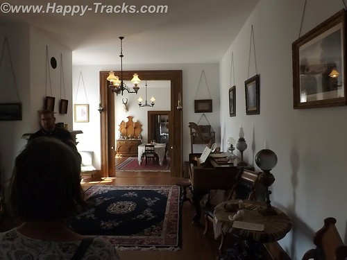
The tour includes a discussion of some additions to the original house that were ordered by Col. Custer following fire damage as well as some entertainments provided to help make the rugged outpost more pleasant for Mrs. Colonel Custer.
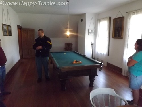
One point on the tour is the cellar where the Colonel’s pet wildcat was kept. We also toured the billiards room upstairs which served as something of an officer’s club.
As we returned from our visit to 1875, it was time to load up the truck and continue east to our next night in Fargo, ND. Our knowledge of Fargo was initially limited to the movie starring William H Macy which was somewhat gruesome. We were somewhat disappointed to find that the movie seemed to occupy a large part of the tourist industry with Woodchippers being the local drink at the bar and directions to go take pictures at the chipper in all the tourist literature. Fargo is the largest city in North Dakota at just over 113,000 people. Opposite Fargo and across the Red River of the North is Moorhead, Minnesota. The Fargo area is growing with much construction along both sides of the interstate with much of it devoted to housing, hotels and support of the petroleum industry. Some of the news stories and features of the area talk of the shortage of housing and the boom being fueled by petroleum.
After breakfast the next morning, we made tracks across Minnesota finally stopping in Hudson, Wisconsin just across Lake St. Croix from Minneapolis-St. Paul.
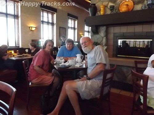
Hudson appears to be a small touristy town which is also a distant bedroom suburb of the twin cities. Our late lunch was in a small (but very friendly) pub style bar where we also called my nephew to see about meeting up with him as we passed near his home north of Chicago. We drove late that night, finally stopping in Loves Park, Illinois for the night.
We did connect with my nephew (whom I hadn’t seen in over 10 years) and met him for breakfast but didn’t get the opportunity to see his family due to other commitments and the short notice we had given them. Our visit was short but it was good to see him.
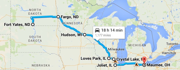
We continued on and spent the night in Maumee, Ohio.
You can see all of the pictures from this leg of the trip here.
We invite you to continue along with us and hope you enjoy the account!
Don’t forget the trip calendar we put together at CafePress. We think it turned out pretty well and would make a great holiday gift. 
Tag Archives: Ohio
Summer 2014: Alaska via the AlCan, Maryland to South Dakota
Sunday, July 6th had finally arrived. It was time to begin the big adventure. As it was the third day of the 4th of July holiday weekend, we had thoughts of getting an early start to avoid the leaving Washington traffic. It was probably a good idea but…we pulled out of the driveway at 11:15. It was still morning but hardly qualified as an early start. Thankfully, traffic was not particularly heavy as we headed west on I70 out of Frederick but by the time we reached Breezewood, PA (our usual entry point to the PA Turnpike), the usual weekend stop and go stretched for a couple of miles. It was a good time for lunch. When we came back out, it was apparent that the route onto the turnpike would be a grind but that traffic going west on Hwy 30 was very light. In our first “let’s see where this goes” move, we headed west on 30 and joined up with the turnpike in Bedford.
This part of the trip is one we’ve done several times over the years while Ryan was at college so our focus was on covering miles. We stopped the first night in Fremont IN where we discovered (quite by accident) that hotel nightly rates are sometimes negotiable. Keith hadn’t engaged the filters and said “ouch” when told what the rate was. The desk clerk asked what we had expected to pay and lowered the rate. Hmmm, might come in handy to know that later.
We did manage to get a slightly earlier start on Monday at 10:00 although we were now in Central time zone. We’re still making miles and decide to skip the RV/Motorhome Hall of Fame in Elkhart IN.
Stopping for gas, we start a conversation with a gentleman from Nokesville VA. He seemed a little surprised we knew where Nokesville was. He’s probably my age, maybe a little older. He and his wife were traveling west with his inlaws in a motorhome towing a Jeep. Their trip was to celebrate an 80th birthday for one of the inlaws. Wanderlust doesn’t give up easily, I guess.
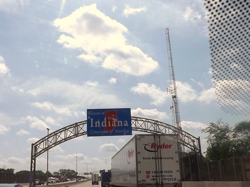
Continuing on I90, we manage to make Chicago in time to decide that there are some places where traffic is a constant and that’s not a good thing. While there was likely a better way to get past it, we follow I90 which leads us right through the construction zones downtown. But we did see the Willis Tower (formerly Sears Tower) and the glass-floored viewing platforms (from the ground, not up close and personal).
I90 takes us past Janesville, also known as the hometown of 2012 VP candidate, Rep Paul Ryan. We also pass the state capital, Madison.
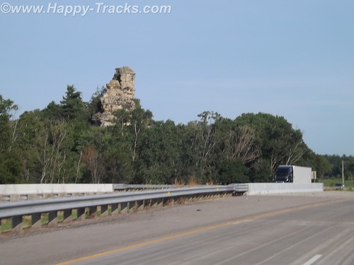
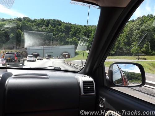
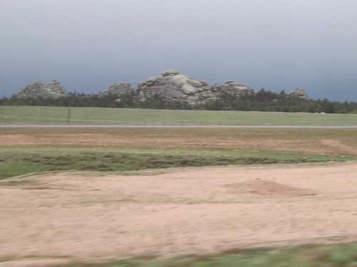
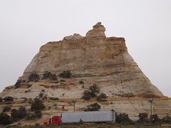
North of Madison and just before I90 and I94 part ways, we pass Camp Douglas, the location for Mill Bluff State Park. During WWI, the site was chosen as a permanent training center in part because of the terrain, such as the stone pillars seen in the picture.  During the Cuban Missile Crisis, a black bear caused the nuclear-armed bombers to scramble. You can read more about that here.
We also saw a weather front moving across rather dramatically. The rain never really materialized for us. 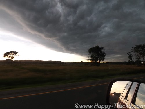
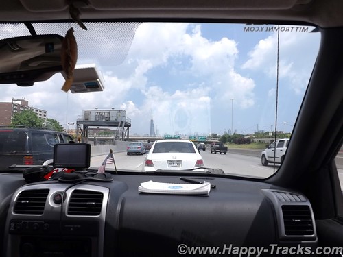
We cross the Mississippi into Minnesota and eventually arrive in Rochester MN, home of the world-renowned Mayo Clinic. We stayed in the suburbs next to the fairgrounds and had a view of the Rochester skyline.
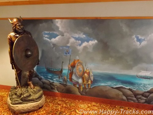
Our hotel was a shuttle stop for multiple shuttles running in to the Clinic each day. While we expected that to be somewhat depressing as folks who are visiting the Clinic are often seriously, even life-threateningly ill but the mood seemed pretty upbeat. Also, our hotel featured a bronze Viking sculpture in the lobby.
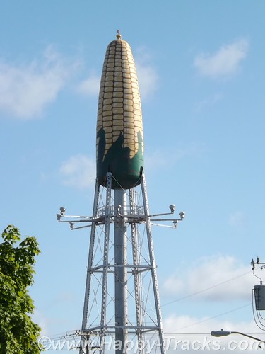
The fairgrounds also had a water tower sculpture of a corn cob which reminded us of the Peachoid in Gaffney SC.
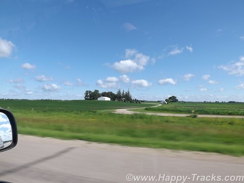
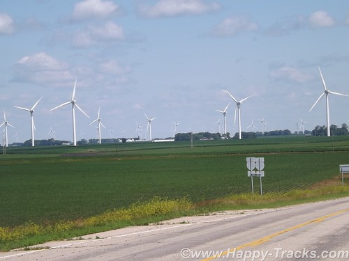
An even earlier start on Tuesday morning as we continued west on I90. Farms dotted the landscape and we passed numerous power-generating windmills.
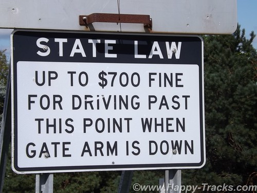
 While it may be commonplace to those in those areas, we were surprised to see the railroad crossing style arms for blocking off the highway during blizzard conditions.
Although the temperature was well into the mid 80s, the humidity was low and the continuing breeze kept things pleasant, even bordering on cool.
We crossed into South Dakota on our way to the Corn Palace in Mitchell. The Corn Palace was mentioned to us as a possible stop when I had called the Credit Card company. When she was a child, her family trip across this part of the country included a stop at the Corn Palace which she had specifically remembered from that childhood trip.
The Corn Palace is located in the center of Mitchell (right next to City Hall). Its original purpose was partly to be a tourist attraction decorated with corn cob and husk murals. It also used as an auditorium, a sports venue, the High School Prom and other civic functions.
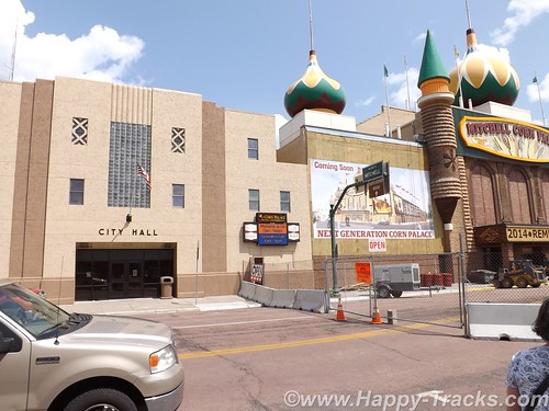
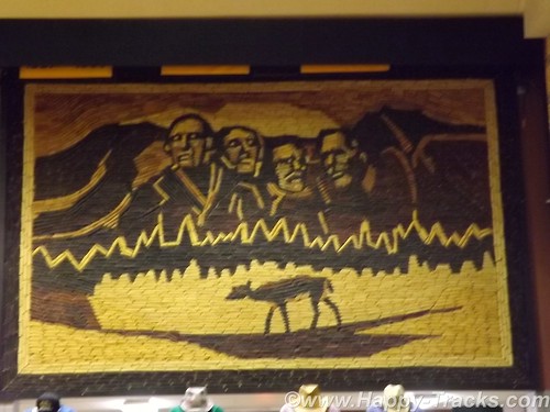
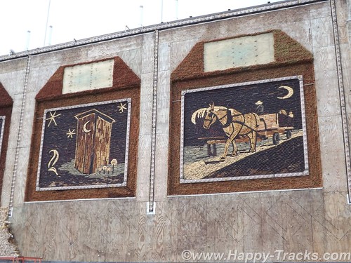
After a short visit to the Corn Palace (where the murals are being redone for the coming year), we were back onto I90 and headed towards the Missouri River. This crossing marked a first for both of us.
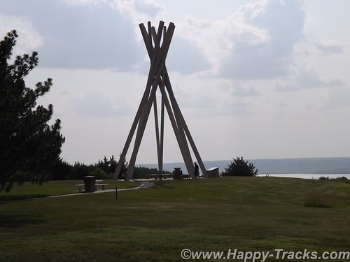
South Dakota marks their rest areas with a rather unique concrete structure recognizing the teepees of the Native Americans.
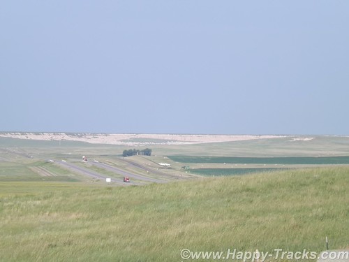
The landscape seems to stretch forever with a gentle roll as we get closer to the SD Badlands.
We continued towards another tourist attraction, the Wall Drug complex in Wall SD. Wall Drug is and was first a drug store/pharmacy for the people of Wall SD. It was purchased in 1929 and has a become a popular tourist attraction and example of the power of marketing, initiated with giving away free ice water. See more of the history here. It is now a complex of shopping and a landmark from the early days of automotive travel.
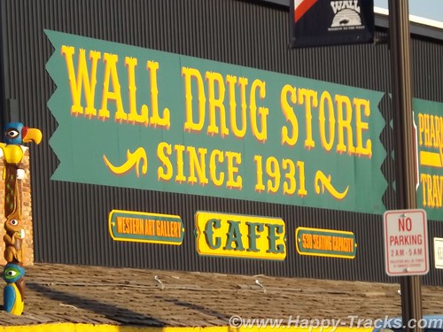
After a piece of pie and 5 cents cups of coffee, we stopped in Wall for the night.
You can see all of the pictures from this leg of the trip here.
We invite you to continue along with us and hope you enjoy the account!
Desert Expedition III: Nevada – Post 7 — West to East – Nevada to Maryland and Home
The air had turned cooler overnight and the wind had picked up as well. We hadn’t gotten the showers but there had been wind-driven sprinkles. Although we planned to go to Great Basin today, it didn’t look like a great day for being out and about. It was time to head home. Gary and Ace weren’t outside yet but they were both up as I’d heard them stirring around. I packed up and told them I was heading for home.
Ace gave me directions to hit Rt. 50 which should make for a scenic drive home. I was planning to take a bit more time headed east than I had taken going west.
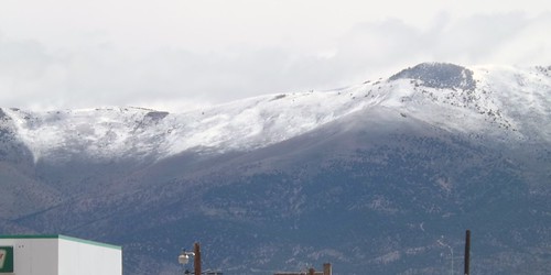
The last 5 miles to US 50 were windy and raining pretty hard. Maybe it would be better once I crossed the ridge.
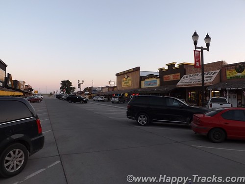
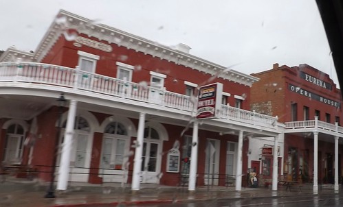
I drove on through the rain through Eureka and Ely with no signs of clearing.
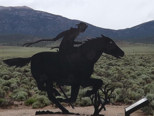
50 is called the Lincoln Highway and was built to connect the country’s east and west coasts. Parts of the Pony Express routes follow roughly the same lines.
By the time I had reached I80 and the Utah state line, the weather had let up a bit so I decided to hit the Nevada Welcome Station on the way out of state. The woman working at the tourist info desk was a bounty of information. She asked where I was going and I told her I was headed for home after a week of ghost towns. I asked about non-camping accommodations as Betty and I had toyed with making a similar trip without the camping. She told me that in the small mining towns, upwards of 60% of the hotel rooms were occupied by workers at the mines or construction. Further south, where we had been it was closer to 40%. The point being that a trip such as ours without camping that you should make reservations before arriving. She also had two audio CDs provided by BLM for a car tour of the mining areas and the Pony Express routes.
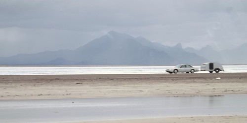
I hit the road and quickly was back into the rain. As I crossed over the Bonneville Salt Flats, I noticed another teardrop headed west.
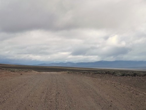
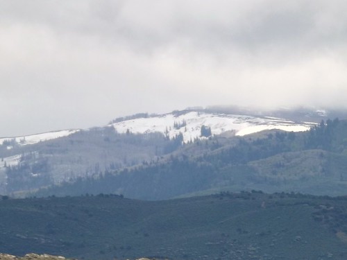
The scenery continued to be great, even though the rains continued.
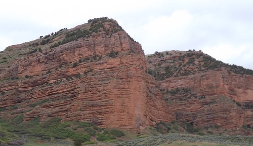
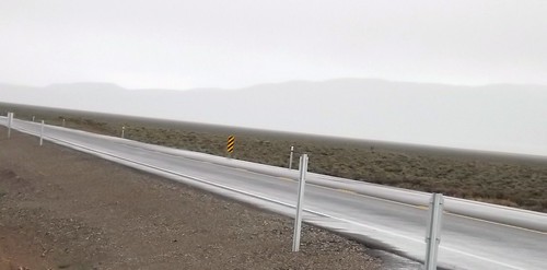
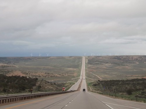
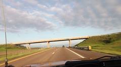
Crossing into Wyoming, the rains continued. Spending most of my life on the East Coast, I’m still taken aback when I see a road this long and straight.
In Wyoming, I decided it was time to stop fighting the rain and check into a motel. A hot shower and a comfy bed worked wonders.
The weather continued (sort of like on the trip west) to be unsettled. From the limited weather information, I had thoughts of possibly driving out of it eventually. Radio weather reports and severe warnings usually give the county affected. As a traveler, I’ll usually know what city I’m near but not always what county so word of Tornado Watches for XYZ County just meant somewhere nearby but could have been in front of me or behind me, who knows?
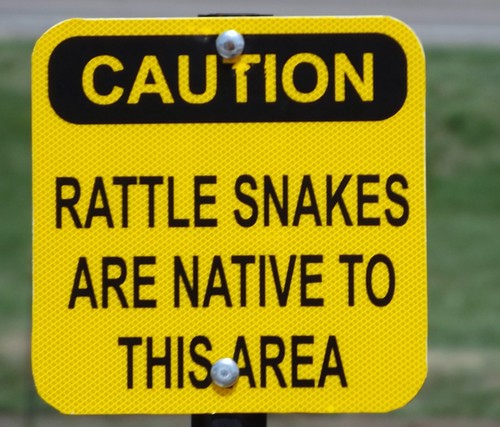
On the whole trip, I’ve mentioned that the only reptiles I saw were lizards. When I stopped at a Nebraska rest area, I’ll admit the thought that crossed my mind was “We’re going to argue natives versus tourists here?”
Nebraska does do well with the promoting local tourism though. Almost every exit had an 8×10 feet sign in color advising of tourist attractions at that or an upcoming exit. Not just “Historic Marker 500 feet”. That’s how I found this original Pony Express station when I had to stop for fuel.
I kept seeing the heavy clouds and lightning and hearing reports of severe weather. Going through my mind was the notion that perhaps I would be in more danger if I stopped for the night than if I just kept going and was aware of what was going on around me. This kept me going until well after midnight and into Iowa where I pulled into a rest stop for some sleep in the Little Guy.
I did discover that Iowa rest stops along I80 all have free wifi!
By the next morning, the sun was shining and it was an uneventful trip through Illinois, Indiana, Ohio, Pennsylvania and into Maryland and home!

It was a great trip with some quality folks. I got to see things I’d never seen and learned more about the area. I also learned a few things about this type of travel (overlanding or travel camping) where you’re in a different place each night. I identified a few things that need adjustment to the truck, the trailer and the way I pack.
Where to next?
More photos from this leg of the trip.
If you’d like to be notified of new posts, use the Subscribe button in the upper left and provide your email. Your email will not be used for any other purpose!
Desert Expedition III: Nevada – Post 1 – Zooming Across Country
In June 2012, Scott B. over at Expedition Portal starting discussing a third Desert Expedition for early summer 2013. The early planning just talked about a trip to visit ghost towns in Nevada. Several jumped in with possible locations to include and some early commit-ers saying they were in as well as a couple of the “regulars” who had taken part in DE 1 and/or DE2.
In January 2013, my plans to retire in March were firming up so I committed to joining in. Good thing I did as Scott capped off the list shortly thereafter. I said goodbye to my employer and officemates in March and started getting ready.
The roadways indicate that this was a trip for the truck and I decided to take the Little Guy as the truck bed, at 5 feet, is too short for me to sleep in except in emergencies. As provisioning stops would be few and widespread, I had to add capacity for water and fuel. While I probably overdid, I carried about 20 gallons of water and 10 gallons of gasoline in containers. I also carried my Edgestar refrigerator/freezer (works on AC or DC); tools; recovery gear; clothing; and some food with plans to restock and finish loadout with perishables before we met up in Cedar City, Utah. Also included in my packing was my SPOT messenger which allows me to check in with a select group of family and friends with my progress even when cellphone service isn’t an option.
The trip by the numbers:
- 5482 miles driveway to driveway.
- 14 days (all good).
- 2 blown tires (neither were mine but both went to the same guy).
- Gas: 306 gallons. High price $4.199; low was $3.599.
- Motel nights 4.
- Bottles of water consumed by me 22.
- Post cards sent home 8.
- Animals: Fish (too many to count in a couple of springs and stock tanks); Reptiles – lizards only (no snakes); Mammals – horses (wild and domestic); donkey; jack rabbits; dog; cattle; pronghorn antelope; 1 dead field mouse.
- Extra-terrestrials (none confirmed but I can come up with no other explanation for the knot on my head and walking into a tree in a broad daylight outside the Little Ale’ Inn).
- Good fellow travelers 7 human, 1 canine. Jerks in our party – 0.
- Pictures taken 1312. (Don’t worry I won’t try to share them all).
I left home Friday morning, May 17th. We were supposed to meet on Tuesday morning and I figured on a nice  leisurely trip out of about 4 days putting me in town on Monday sometime. I planned to get at least part, if not all, the way across Illinois the first day. I had a bit of adrenaline going as well as the uncertainty of how far I’d feel like driving on subsequent days so I got all the way across Illinois and decided to try to get out of range of St. Louis morning traffic.
 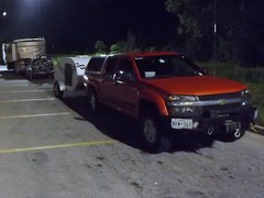 Using the GPS, I started looking for a Comfort Inn around midnight and got directed to an empty lot. (So much for recently updating the GPS maps!) By that time, I was pretty beat and stopped for gas and a walkaround and then noticed a Walmart at that exit. (Walmart has a general policy — there are exceptions — of allowing RVs, even little ones, to spend the night in their parking lots.) I stopped in and picked up a pan I had not gotten at home and checked to make sure they allowed for overnights. So back out to the edge of the parking lot and a couple of hours of sleep in the Little Guy.
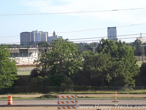
 I woke up before sunrise and got rolling again across Missouri. My route took me on the outskirts of Kansas City in the early morning. Topeka, Kansas was later in the day and looked like it might be more picturesque as it is the capital of the state. While I passed within sight of the capitol building, it was covered in scaffolding for a renovation project. So onward to the wide open plains. Totally different from any part of the country I had seen before and breathtaking. To tell the truth, it was breathtaking the first couple of hundred miles but got repetitive after that.
Scooting across Kansas, there was a couple pulling a Scamp or Casita trailer that seemed to be stopping at the same rest areas. One time, I would pull in as they pulled out and then later they would pull in as I pulled out. We did eventually talk when we reached the Colorado welcome stop. They winter in Florida and were on their way to sons near Ft. Collins for the summer. We spent some time comparing notes on trailers and came to the conclusion that theirs is more livable but in a world of $4.00/gallon gasoline, mine was preferable for towing.
While in Kansas, I saw the occasional pump jack in addition 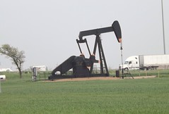 to wind farms. I guess that Kansas is covering their bets on two different sides of the energy issue. Also in Kansas, I heard reports
 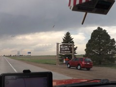 of nasty weather which always seemed to be about 40 miles behind me. In a couple of days, the devastating tornado in Moore, OK would hit. I pulled out of the Colorado Welcome Station as the rains hit. I drove out of the rain and back into the sunshine pretty soon but was seeing clouds on the peaks around Denver. Seemed like a good time for gas, so I pulled into a rundown looking truckstop. The gas pumps wouldn’t accept my credit card and I assumed it was related to the seedy look of the station and paid cash. Several declined purchases later, I called the credit card company. You know that ad where the couple is thrilled that the Bank has stopped their card from being fraudulently used in a foreign country? Its not all smiles when you’re trying to use your card and find that your bank (or credit union) decides that buying gas on a cross country trip is “suspicious activity”. Just 20 minutes on hold and we can get this all taken care of. Sheesh!
 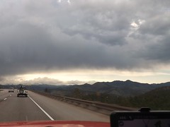 .
.
Buying gas proved to be a good idea as the trek up the mountains and through the pass was sucking down some fuel. As I neared Vail, we added precipitation into the mix and it was sticking.
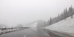
It was close to dark, I didn’t know what the roads or the weather had in store for me and my efforts to find a motel that night before hadn’t turned out well so I holed up in the Comfort Inn in Eagle CO for the night. A hot shower and comfy bed sure felt good. It had been a long day (or two). I figured I had about 450 miles to go before Monday night so I was in good shape.
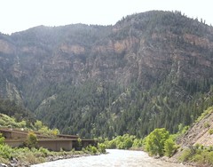
Sunday morning found me paralleling and in sight of the Colorado River for a while. The engineering of stacking an Interstate Highway on top of the river and squeezing the railroad tracks in there as well impressed me. And don’t forget to squeeze in a parking lot and river access, too!
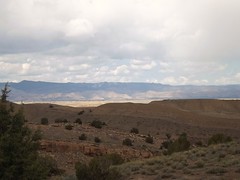
As I moved into Utah, things didn’t really level out but the slopes seemed to be gentle and the views longer. The weather was still mixed but mostly good driving weather.
And what does every 4×4 driver think of when they think of Utah? Moab, of course. So here I am, easily a day ahead of schedule within 30 miles of 4×4 Mecca. So what do I do?
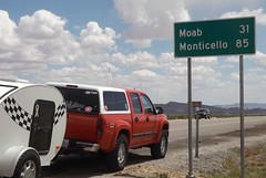
I take the safe way out. No one knows quite where I am, I don’t really know my way around and I have this great trip in front of me. So, Moab is close but oh, so far away. Something else to stay on the “to do” list for now.
The views are breathtaking but the locals have seen them before. I got an earful at this rest area after driving through a construction zone at the speed limit (65) for holding up these nice folks…but in spite of me, they still had time to stop and catch the view at the rest area?
I pulled into Cedar City on Sunday afternoon a full day ahead of my schedule. Luckily my motel had a room available but not the room I had reserved for Monday night. It was fine by me. I sorted the stuff in the truck, did some shopping/provisioning and filled my gas and water jugs. I even got my walk in while doing some sightseeing.
Cedar City has an extensive Veterans Memorial Park which I enjoyed. I was surprised to find water running in the rain gutters along the road. I figured it to be waterline maintenance or such but later figured it was the runoff from lawnsprinklers which seemed to be running everywhere with no particular concern for missing the grass.
Cedar City also has an “historic” downtown Main Street which includes a drugstore complete with old-fashioned soda fountain in the old Sheep Association building. Take note of the bronze statues of historic figures on the sidewalks. Similar idea to the OBX Pegasus statues and DC’s donkeys and elephants but classier.
More photos from this leg of the trip.
If you’d like to be notified of new posts, use the Subscribe button in the upper left and provide your email. Your email will not be used for any other purpose!