In the early 50s, Mom and Dad went up and down the AlCan twice with my sisters (before I was born). In those days, mobile homes were still pretty mobile. On the second trip, they pulled their Spartan mobile home behind the Packard on the way up and behind a Chevy pickup on the way down.

Traveling along with them on the way to Alaska were 4 other families, also pulling their own mobile homes. The adults in those five families were lifelong friends, in part due to their shared adventures. To the best of my knowledge, two of the wives are still alive. I know my Mom stayed in touch with those folks until her death in 2007.
On that second trip, Mom had an Argus C3 that she bought with money earned from baking pies which Dad sold at work. I heard about their trip my entire life and saw the pictures and had this trip on my “bucket list” before I knew what a bucket list was. You can find quite a few of Mom’s pictures here.
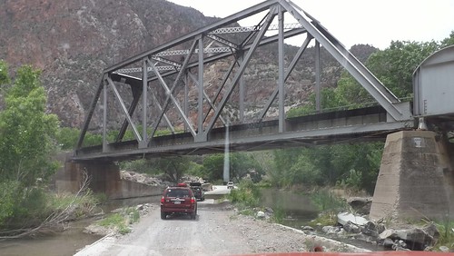
On Sunday, July 6, 2014, Betty, my wife and I loaded up our Chevy Colorado and left Maryland with plans to reach Alaska and to retrace some of their route.
Much of the 1950s AlCan highway no longer exists. The AlCan was hastily constructed in 1942 as a means to reach from the contiguous United States to the Alaska territory as part of the effort to defend the territory against the Japanese in World War II and also to enable the transport of US warplanes to Russia, our allies in WWII.
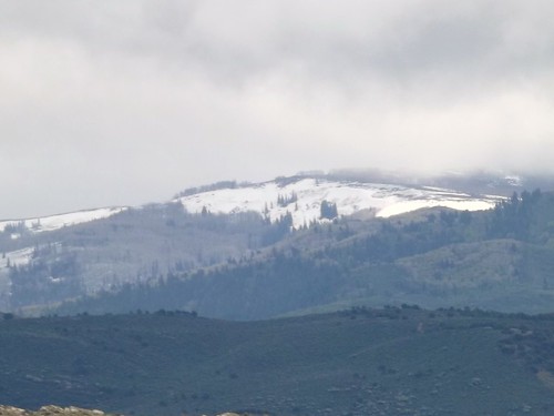
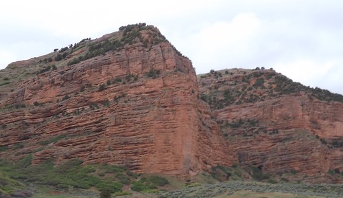
Our 2014 trip included trying to re-trace part of their route and also to visit some places we’d not seen before. Our trip included time in National and state parks as well as kitschy tourist destinations along the way.
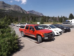 Our trip was taken in a Chevy Colorado crew cab pickup truck. There was no trailer but we did have a shell on the back and had taken the rear seat out to accommodate a 43 quart refrigerator/freezer that ran off of the 12 VDC accessory plug along with a spare battery. We packed a small bag with 3 or 4 outfits of shorts and t-shirts, a larger bag with several changes of warmer clotes and a loose bag with our winter coats, gloves and boots. We packed some basic foods, a camp stove, some cheese sticks and trail mix. We also had 2 spare tires, a container with an extra 5 gallons of gasoline and my toolbox and recovery equipment and a first aid kit and fire extinguisher. Electronics included our two cell phones, the truck’s OnStar setup, a laptop PC, a digital Fuji camera, a CB radio, a Ham 2M handheld, and a device called a SPOT tracker for emergency communications and routine checking in via satellite. See Find Me Spot
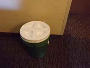
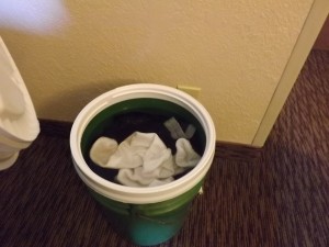
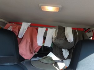
Along the way, we did laundry using a 5 gallon plastic bucket (originally a deli-sized container of pickle chips) with a gamma — leak resistant — sealed lid to wash clothes. We would add the dirty clothes, a little detergent and about 4 gallons of water and let it ride in the back of the truck to agitate. At night, we would take the bucket inside with us and rinse the clothes then hang them on plastic hangers from a ratchet strap strung between the two rear seat assist handles in the truck. Got a few odd looks at border crossings but it worked out well.
 By way of preparation, we had to prepare to leave the house for 6 weeks to 2 months (our itenerary was fluid). This meant paying the routine bills (utilities, storage rental, newspaper, cellphones) in advance as we don’t use online banking or bill paying; arranging for the grass to be cut, the mail held and the newspaper delivery stopped. We also notified a few close, strategically-located neighbors of our coming absence and expected comings and goings around the house. We also attempted (unsuccessfully) to arrange for some Canadian cash through our bank and made certain our credit card company was aware we would be on the road and expecting to use the card in places and with frequency outside our normal usage patterns.
The Washington Post didn’t manage to process the vacation hold on the newspaper but our neighbor intercepted most of the unplanned deliveries. Bank of America couldn’t process our request for Canadian cash in sufficient time to get our cash before we left but a TD Bank in Alberta accepted our ATM (ABM for you Canadians) card to dispense the desired currency. One of the lamps on a timer at home decided to blow the bulb sometime (1 day? 6 weeks?) before we returned. The credit card was refused once on our trip but we think that may have been input error by the hotel rather than an issue with the CC company. Of all the logistics to be arranged, these were minor glitches that had minimal impact in the grand scheme of things.
A few statistics for your consideration.
Total driven miles: 11,704
Gasoline consumption: 556 US gallons at an average cost of $4.20 per gallon.
40 hotel nights and one on the ferry between Haines AK and Prince Rupert BC
14 states traveled and 3 Canadian provinces
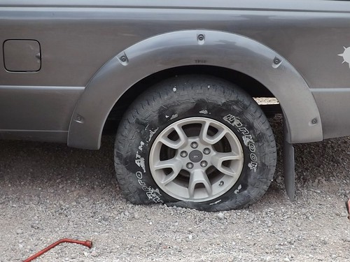
1 flat tire and 1 cracked windshield
Most days, we posted up to 10 pictures on Facebook which some of you have already seen. This blog will share our story and give you a chronological account of our trip along with some more pictures and the story behind some of those pictures you’ve already seen.
We invite you to come along with us and hope you enjoy the account!
Category Archives: Uncategorized
Boardwalks, Bunkers, Bungalows, Beaches, Birds and Bombs
The Delaware Beaches of Rehoboth, Lewes and Cape Henlopen
Our travels around this great country are multipurpose. One purpose is trying to decide where we want to live in our retirement. That quest led us to spend some time not far from home but new to us, the Delaware Beaches which includes for our purpose, Rehoboth Beach, Dewey Beach, Bethany Beach and Lewes. We’ve made two trips there so far and the pictures are from both trips.
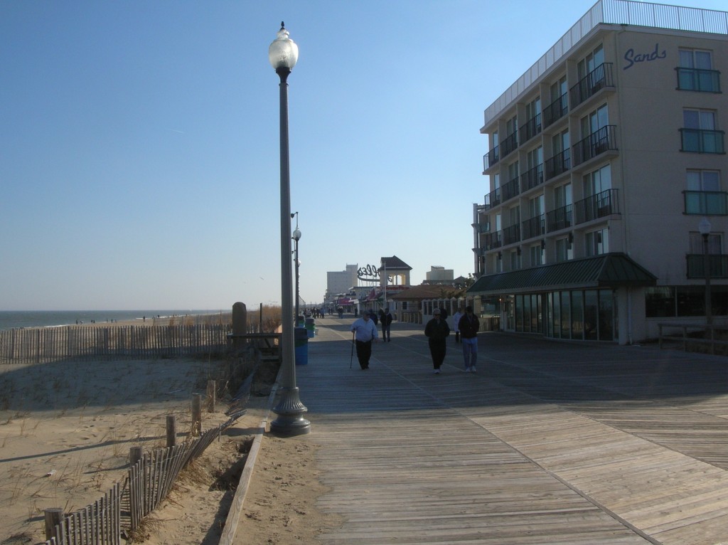 On our first trip over the long Presidents’ Day weekend, we stayed at the Hampton Inn on Coastal Hwy. It is a little less than 4 miles to the Boardwalk at Rehoboth Beach. Boardwalks are fairly common in the middle Atlantic Beaches from about Ocean City northward. Rehoboth’s is actually made of boards and is somewhat deserted in the middle of February. We walked around a bit (in the cold) and the carnival midway gameroom and several eateries including fries, hot dogs and the like. There are several hotels on the boardwalk (along with condos) that look to have a great view. Much of the area surrounding the boardwalk look to be houses that are rented for the week or the season. Driving north there are more extensive condo developments and a park leading past the Gordon Flats Wildlife area and into Cape Henlopen State Park.
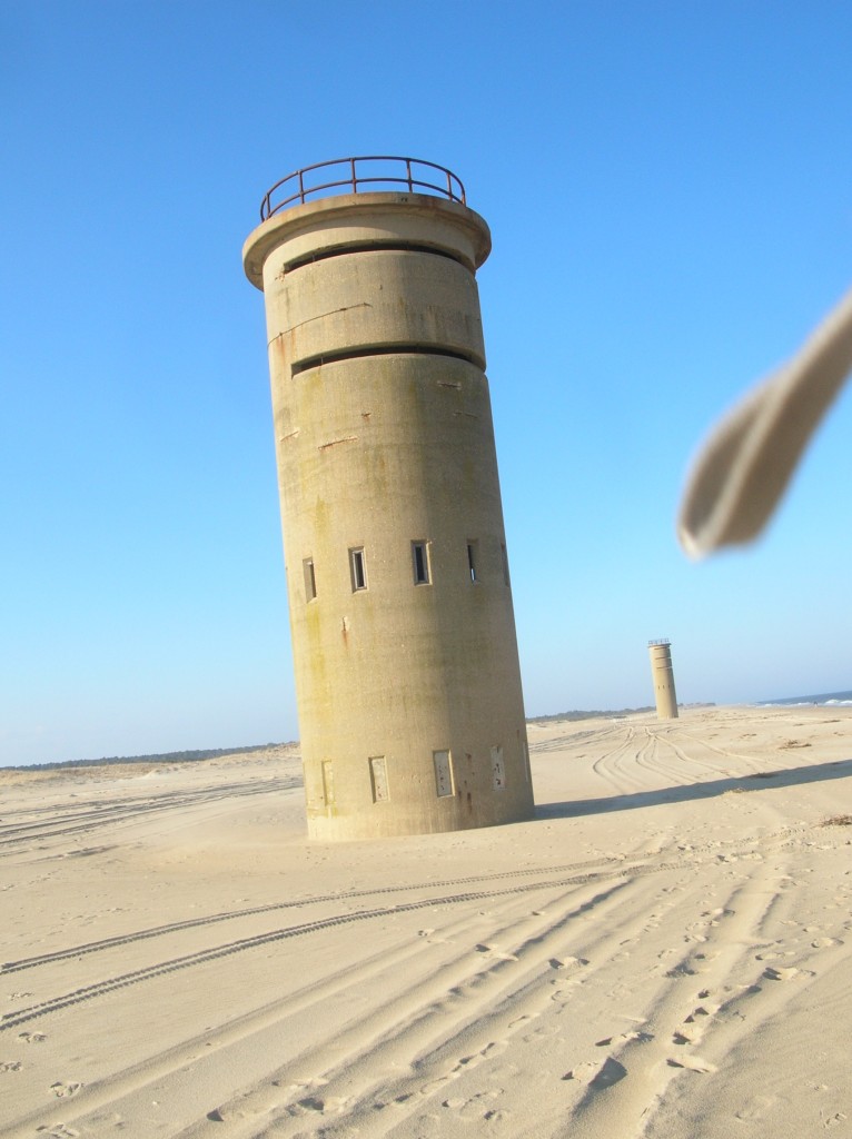 Walking along the beach, we found two of these. They aren’t lighthouses, the doors at the bottom are sealed and the openings higher up aren’t covered. We pondered and looked but came up with no answers yet. As we rode around later, we discovered there are more of them spread along the coast. There are three south of Dewey Beach and at least three further north before Lewes. One of the towers south of Dewey offered a clue in the form of a website link on a sign next to the highway. Save the Tower They’re WWII fire control towers, built to guard the entrance to the Delaware Bay.
The towers are open on top with a wide slit running halfway around the circumference. They were manned by lookouts
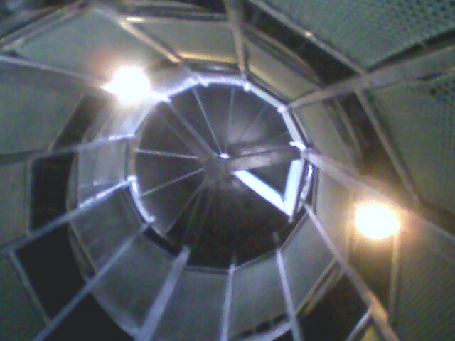
 and specialists who calculated the trajectory and angle of the artillery fire. Perhaps most amazing in this age is that the calculations didn’t have modern electronics (calculators, computers) to assist. A combination of the known distance between two towers and the height of the observation deck allowed the personnel to triangulate and located the precise location of a target and feed the necessary information to an armed battery. We couldn’t find information on how successful these efforts were as the towers at Henlopen weren’t tested in actual combat. More of the towers were erected (perhaps 1000) along the coastline as far north as Maine and New Hampshire. Many of them have been destroyed although a few remain, both on privately and publicly owned property.
One of the towers at Cape Henlopen has been repurposed by the Delaware Pilots Association to watch the Delaware Bay entrance and the ship traffic there. 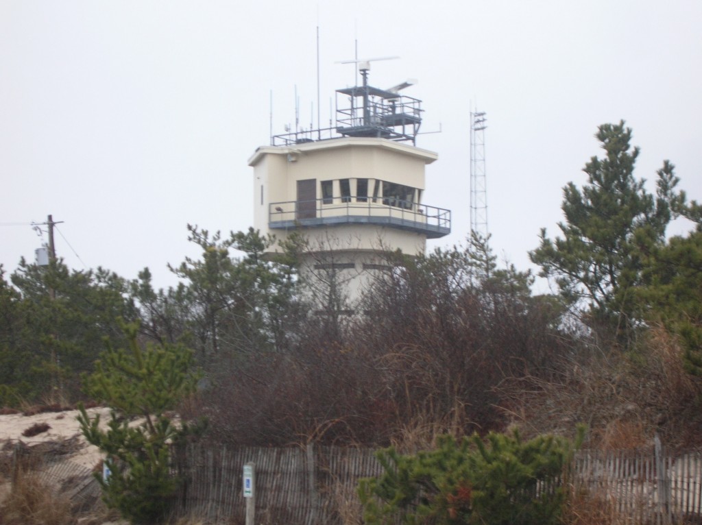 Also check out the Delaware Seashore Preservation Foundation.
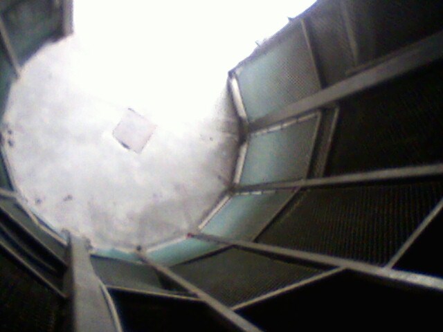
For some reason the towers really captured our attention and we made a point to see as many of them as we could while we were there. It did seem that we were jinxed on trying to get pictures of the inside of one. When we visited in February (and they were closed), the battery in the camera died just before we tried to sneak an inside picture and again in July, the camera batteries died when we climbed the tower at Cape Henlopen State Park but we did get a couple of lower quality shots with the old cell phone.
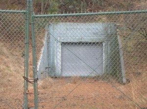 Within the confines of Cape Henlopen State Park are the remnants of Ft. Miles. Ft. Miles is about 5000 acres in size and was an active military installation from 1941 until 1996. There is an ongoing effort to preserve and restore much of the history of the post, originally constructed to help protect the oil depots and refineries as well as the port of Philadelphia during WWII. Luckily for the preservation-minded, the 261st Coastal Artillery was somewhat practiced at rust prevention techniques. The naturally-occurring sand dunes helped form protection for the underground bunkers for
  storage and personnel.
Strategic placement at the mouth of the Delaware Bay helped ensure the area’s involvement in US history dating back to the War of 1812. The town of Lewes is home to the Cannonball House. The Cannonball House is home to the Lewes Historical Society’s Maritime Museum and is famous in part because of the cannonball embedded in its stone foundation since the war of 1812. Across the street from the Cannonball House is the War of 1812 Park. The Park is the site for Lightship Overfalls and the Lewes Life Saving Station, both the subject of local preservation efforts. 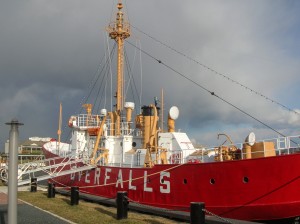 Lewes is also at one end of the Cape May-Lewes ferry run, connecting to the NJ peninsula. We didn’t make that trip this time around but had ridden the ferry back in the early 1980s.
We had contacted Deb Griffin , a local Realtor, and told her we were interested in visiting the area and were looking for some guidance. She agreed to guide for us and show us some houses while we were there. As its turned out, Deb has given us 3 days of her time in person (plus her prep time) and shown us a variety of homes in our price range and shown us some of the local color and significant spots. We haven’t yet decided just where the heck we’re going to wind up but certainly appreciate her combined goodwill ambassador and real estate/tour guide efforts. She’s also pointed us at some good restaurants in the area.
Three eateries stand out as being especially good for us among the locals.
We had dinner one evening at Henlopen City Oyster House. Their menu changes daily and has an abundance of seafood dishes, including a sampler of oysters on the half shell (which we didn’t try). Feeling a bit adventurous, I had the Day Boat Scallops which were a combo of broiled scallops with bacon, caramel and plantains. Absolutely delicious and served with potatoes and broccoli that evening.
Lunch one day was at Tout de Suite Patisserie at Paynter’s Mill in Milton. We opted for a light lunch although the bakery cases were filled with yummy- (and very rich) looking pastries and desserts. The soup and sandwich were quite the treat as well and worthy of a return visit.
We also grabbed a late lunch at the Pickled Pig Pub on the Coastal Hwy in Rehoboth and I’ll recommend the Cuban Press as being delicious and filling.
Of course, there is a variety of the expected chain eateries including Panera and IHOP. I think we will need to be careful of our eating or take up a more active lifestyle should the Rehoboth area win the decision for a retirement locale.
You can see all the pictures from the Delaware beaches by clicking the highlighted text.
Desert Expedition III: Nevada – Post 7 — West to East – Nevada to Maryland and Home
The air had turned cooler overnight and the wind had picked up as well. We hadn’t gotten the showers but there had been wind-driven sprinkles. Although we planned to go to Great Basin today, it didn’t look like a great day for being out and about. It was time to head home. Gary and Ace weren’t outside yet but they were both up as I’d heard them stirring around. I packed up and told them I was heading for home.
Ace gave me directions to hit Rt. 50 which should make for a scenic drive home. I was planning to take a bit more time headed east than I had taken going west.
The last 5 miles to US 50 were windy and raining pretty hard. Maybe it would be better once I crossed the ridge.
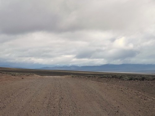
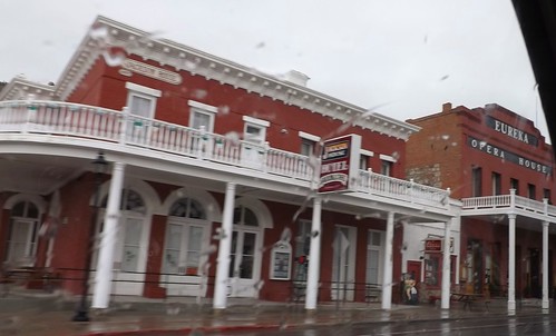
I drove on through the rain through Eureka and Ely with no signs of clearing.
50 is called the Lincoln Highway and was built to connect the country’s east and west coasts. Parts of the Pony Express routes follow roughly the same lines.
By the time I had reached I80 and the Utah state line, the weather had let up a bit so I decided to hit the Nevada Welcome Station on the way out of state. The woman working at the tourist info desk was a bounty of information. She asked where I was going and I told her I was headed for home after a week of ghost towns. I asked about non-camping accommodations as Betty and I had toyed with making a similar trip without the camping. She told me that in the small mining towns, upwards of 60% of the hotel rooms were occupied by workers at the mines or construction. Further south, where we had been it was closer to 40%. The point being that a trip such as ours without camping that you should make reservations before arriving. She also had two audio CDs provided by BLM for a car tour of the mining areas and the Pony Express routes.
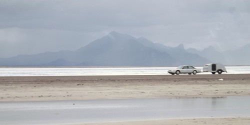
I hit the road and quickly was back into the rain. As I crossed over the Bonneville Salt Flats, I noticed another teardrop headed west.
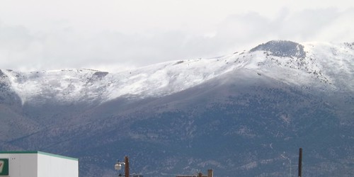
The scenery continued to be great, even though the rains continued.
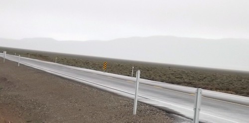
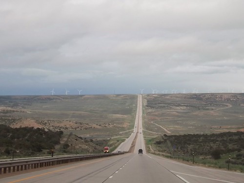
Crossing into Wyoming, the rains continued. Spending most of my life on the East Coast, I’m still taken aback when I see a road this long and straight.
In Wyoming, I decided it was time to stop fighting the rain and check into a motel. A hot shower and a comfy bed worked wonders.
The weather continued (sort of like on the trip west) to be unsettled. From the limited weather information, I had thoughts of possibly driving out of it eventually. Radio weather reports and severe warnings usually give the county affected. As a traveler, I’ll usually know what city I’m near but not always what county so word of Tornado Watches for XYZ County just meant somewhere nearby but could have been in front of me or behind me, who knows?
On the whole trip, I’ve mentioned that the only reptiles I saw were lizards. When I stopped at a Nebraska rest area, I’ll admit the thought that crossed my mind was “We’re going to argue natives versus tourists here?”
Nebraska does do well with the promoting local tourism though. Almost every exit had an 8×10 feet sign in color advising of tourist attractions at that or an upcoming exit. Not just “Historic Marker 500 feet”. That’s how I found this original Pony Express station when I had to stop for fuel.
I kept seeing the heavy clouds and lightning and hearing reports of severe weather. Going through my mind was the notion that perhaps I would be in more danger if I stopped for the night than if I just kept going and was aware of what was going on around me. This kept me going until well after midnight and into Iowa where I pulled into a rest stop for some sleep in the Little Guy.
I did discover that Iowa rest stops along I80 all have free wifi!
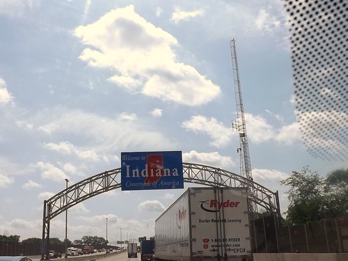
By the next morning, the sun was shining and it was an uneventful trip through Illinois, Indiana, Ohio, Pennsylvania and into Maryland and home!

It was a great trip with some quality folks. I got to see things I’d never seen and learned more about the area. I also learned a few things about this type of travel (overlanding or travel camping) where you’re in a different place each night. I identified a few things that need adjustment to the truck, the trailer and the way I pack.
Where to next?
More photos from this leg of the trip.
If you’d like to be notified of new posts, use the Subscribe button in the upper left and provide your email. Your email will not be used for any other purpose!
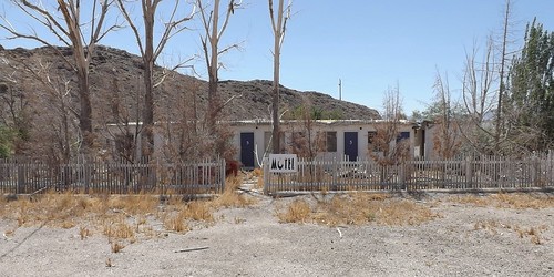
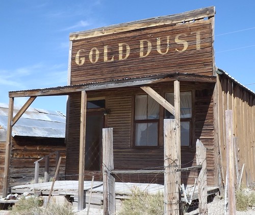
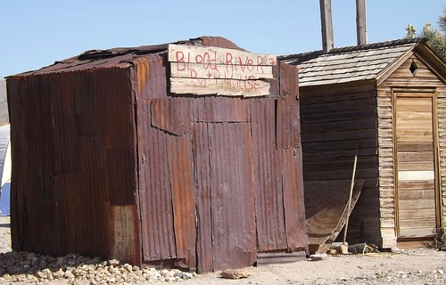
Desert Expedition III: Nevada – Post 6 – Goldfield, Tonopah, Manhattan, Belmont and Pine Creek Campground
Alas, Monday morning comes and folks have places to be, loved ones to see and commitments to be met. We bid adieu to the others but Gary, Ace and I stayed together with plans to see some more and hoped to make it to Great Basin National Park.
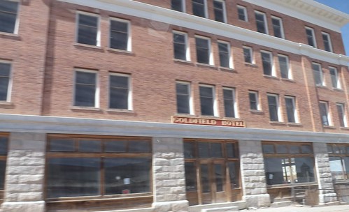
We left and headed back to Tonopah for re-provisioning. Along the way, we passed through Goldfield NV but didn’t stop. Goldfield is more recent town which grew from the discovery of gold in 1902. Mining until 1940, over $86 million was extracted. Much of the town was destroyed by a fire in 1923, although several buildings survived and remain today, notably the Goldfield Hotel, the Consolidated Mines Building (the communications center of the town until 1963), and the schoolhouse. Gold exploration still continues in and around the town today. The hotel is not currently open and some accounts describe it as haunted. There is an ongoing effort to restore many of the old buildings and build the tourist trade. You can find out more at Ghost Town Operations.com website.
Teddy Roosevelt visited Goldfield and there is a story that Wyatt Earpp came to Goldfield after the Gunfight at the OK Corral but there is little to support that. It is confirmed that his brother, Virgil, worked, lived and died in Goldfield although he is buried in Portland, Oregon.
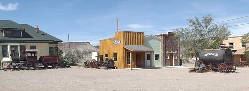
The school is the building in the right of the picture above.
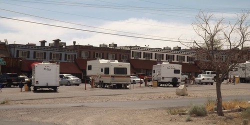
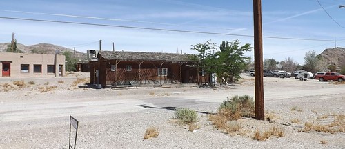
RV parking behind the casino in Tonopah.
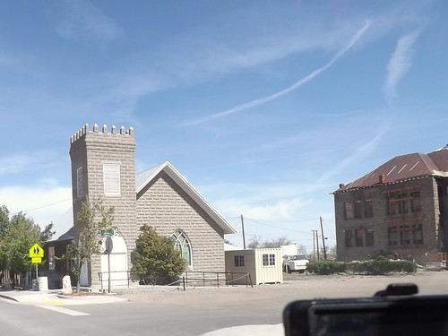
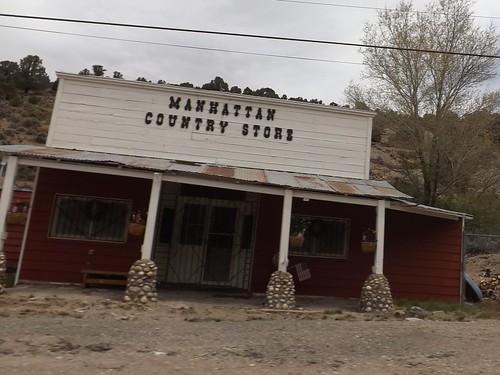
Continuing along to Manhattan, we find another town’s mainstreet which has obvously seen better days.
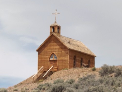
This church, which sets on a hill above Manhattan’s main street was orignially constructed in Belmont.

We stopped for lunch outside of town and then went on to Belmont, NV.

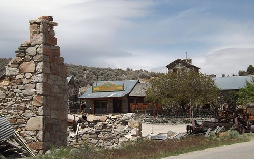
Although closed this day, there are still accommodations to be had at the old Combination Miining Co. building, including the Old Boots Saloon.
Remains of the bank.
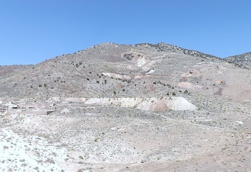
Belmont is the site of a spring used by the Shoshone. In 1865, the discovery of silver ore led to a boom that eventually led to the buildup of a commercial center including schools, a post office, a newspaper and eventually becoming the county seat of Nye County from 1867 to 1905.
Belmont was known as a rowdy town with saloons, a red light district and various ethnic neighborhoods. Roughly $4 million was extracted from the shallow ore.
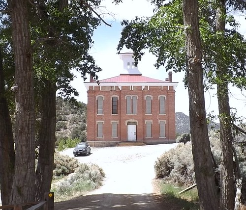
Courthouse from the days of County seat.
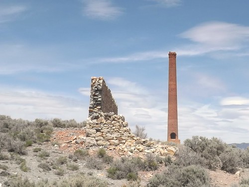
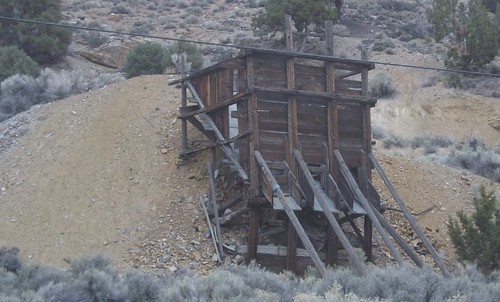
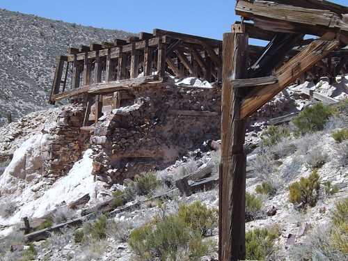
Remnants of the Combination Mining Mill in East Belmont.
We traveled further north and found a spot for the night in the Pine Creek Campground in the Toiyabe National Forest.

The weather forecasts were calling for cold, possible rain/sleet and this spot seemed fairly sheltered.
More photos from this leg of the trip.
If you’d like to be notified of new posts, use the Subscribe button in the upper left and provide your email. Your email will not be used for any other purpose!
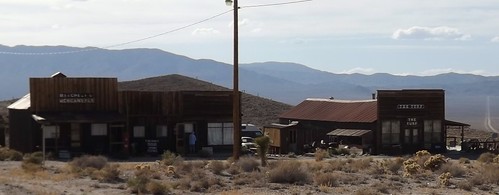
Desert Expedition III: Nevada – Post 5 – Silver Peak and Gold Point NV
Sunday we visited Silver Peak and Gold Point. These two fit the definition of a ghost town that is still alive but significantly less-populated than in their peak times.
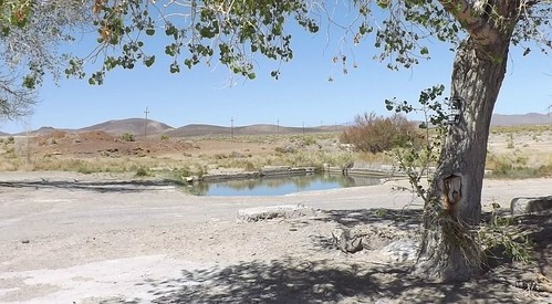
To get to Silver Peak, we headed back in the direction of Tonopah and the highway. We turned off and stopped at a crossroads at Pearl Springs. In this location, the water supplies for several settlements branched out. We again found koi in the pool. This spot was marked as private property so our views were limited and we moved on.
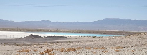
Signs warned of road construction on our way to Silver Peak. On the approach to SIlver Peak, we spotted a large lake with aqua/turquoise blue water, obviously showing the effects of chemical content. The lake and its surrounding activity are parts of the active lithium mining by Rockwood Lithium, taking place in the area.
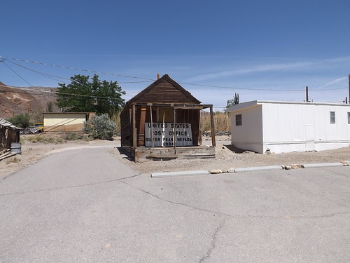
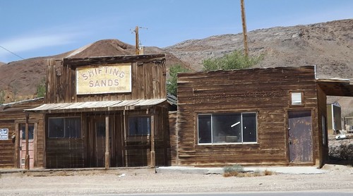
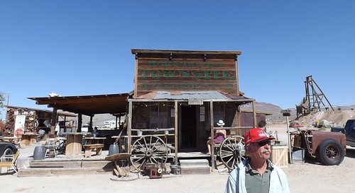
Silver Peak still has a post office along with the building that was formerly the post office. There are several commercial buildings, including a 6 unit motel along the center of the town, most of which have sale or lease signs in the window. As a note of comparison, there are photos on the web from 2000 that show many of these buildings having operating businesses.
We left Silver Peak en route to Gold Point. Along the way, Michael experienced his second blowout of the trip.
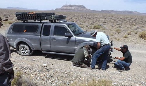
While we had been in Tonopah on Saturday, Michael had attempted to replace the first blown tire but unfortunately found a merchant who believed that his role was to soak every customer once while you had the chance. This tire store in Tonopah is closed on weekends, there may be others where you would have a much better experience. Among the many other charges, a weekend callout fee was included in the $600 the merchant wanted to replace the first blown out tire. Michael declined and decided to chance it without a spare of his own but his luck didn’t carry him through. In the picture, you can plainly see the blown rear tire while everyone is working on the front. The thought process was to put the off-sized spare on the non-drive front and move the same size front to the rear to avoid excessive wear on the rear driveline. It seemed like a good idea at the time. As it worked out, the odd size tire interfered with the brakes operation and they wound up having to switch the tires back before Michael was able to move. We located another tire store across the line in California that would open on Sunday and had two tires in stock that combined cost less than the one in Tonopah. Michael spoke later of how the guy there was very thorough and customer-oriented. I don’t know the names of the two tire stores involved and don’t wish to mislead but advise the reader to proceed with caution if you’re in a similar situation.
While Michael went off to tend to tires, the rest of us went on to Gold Point with plans to meet up later that day. The meetup didn’t happen until the next morning. This is testimony as to why the longer range HAM radio has a place in desert traveling over the limited range CB radio. Enough about all that.
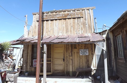
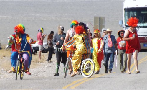
Gold Point is a tourist destination with an active, though maybe limited, tourism industry to support the preservation of the town. Memorial Day weekend is designated as paranormal weekend and Labor Day weekend also has a theme which escapes me at the moment. As part of the festivities, there was a parade through town which included clowns, the transparent woman and even a unicycle rider.
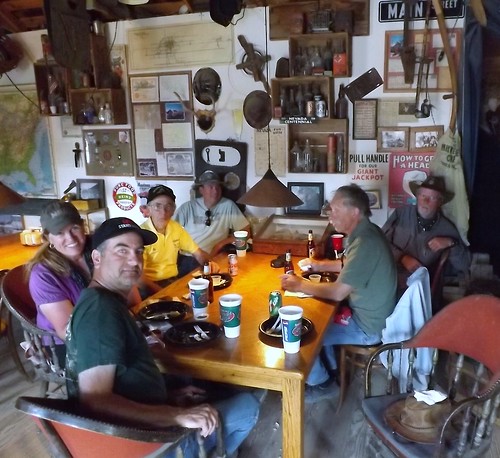
Gold Point’s preservation/restoration is a project largely credited to Sheriff Stone. To help raise funds for the restoration, several of the houses are available for rent on the weekends. Stone also prepares quite a spread for breakfast and dinner for a reasonable price. We decided to hang around for steak dinner.
There are a number of old fire trucks on the property as well. I never quite got the connection unless its another hobby of a collector.

For over 20 years now Walt and I, with many thousands of dollars from our own money from working, have been purchasing building materials and working on all the different cabins and buildings. It takes thousands of dollars to rebuild and preserve even a small old miner’s cabin, and we have 12, not to mention the other bigger buildings, so it’s been a slow process. Each year we find the price of wood products continues to climb.
It takes a lot of different materials to save a cabin. The only thing we generally do to the outside is put on a roof. We try not to put on any new wood unless absolutely necessary. Rolled asphalt roofing is usually applied first. Then as we get the extra money we put on the cedar shingles.
Inside is a little more complex. These 100 year old cabins and buildings were built without any framing like we build today. The walls are only as thick as the 1 x 12 inch board and bats that were used. We go in and strip the walls down to the original walls and then build a 2 x 4 frame inside. This stabilizes the cabin tremendously. We can then install the electrical wires, insulation, sheet rock, paint and/or old newspapers or old fashioned wall paper, carpet, curtains and finally furniture. From www.GoldPointGhostTown.com
We visited the open businesses including the saloon and the mercantile and got some hints for a spot to camp that night. We had an interesting discussion with one of the landowners/residents who told us a bit about what its like to live in a place like this. This particular resident has retired and stays in Gold Point mainly but also has a second home elsewhere. The resident specifically asked that details not get shared on the internet so you’re just going to have to visit and find out for yourself. 🙂
After our steak dinner, we wandered around a bit more.
I met a guy in the saloon who was asking about the Little Guy as he also had a teardrop trailer that he and his son had used in one of the parks for their vacation.
Eventually we decided to go find a camping spot away from the crowd. We eventually landed at a dry wash about half mile or so out of town after turning down several spots.
More photos from this leg of the trip.
If you’d like to be notified of new posts, use the Subscribe button in the upper left and provide your email. Your email will not be used for any other purpose!
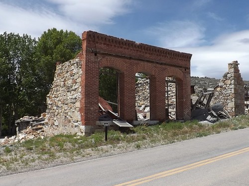
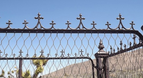
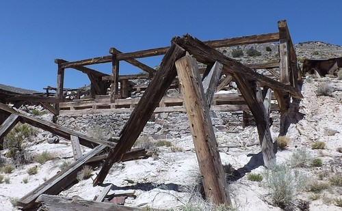
Desert Expedition III: Nevada – Post 3 – Helene Graveyard and Delamar NV
On Wednesday morning we headed in search of Delamar NV, a classic mining ghost town which saw its hey day in the 1890s. Gold was discovered there in 1889 and the original mines along with most of the major mines in the immediate area were purchased by Captain Joseph Raphael De Lamar for about $150,000. Some cursory research on the man shows he left his maritime interests and invested in mining claims. The one in Nevada paid off fairly well, producing over $13 million in gold.
Delamar at one time boasted a population of 1500 and amenities such as a hospital, an opera house and a central water system pumping water from a well some 12 miles away. Unfortunately, the gold in these hills was embedded in quartzite which lead to deadly silicosis when ground to dust as in the ore extraction process. One source said the population of Delamar included 400 widows at one point in time. The moniker “widow-maker” was apparently well-deserved. Remaining at Helene is a tailings pile from one excavation and a much-vandalized graveyard. Helene is on the way and just over the crest from Delamar.
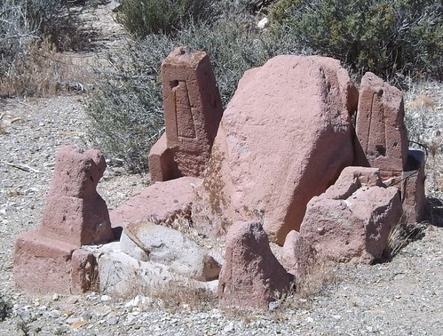
Gravestones are pretty much non-existent but the remaining decorative iron work is impressive in its detail and how well-preserved it remains.
Moving on over the hill, we could see a lot more of the remains of the town and the mining and millng operations. It was obvious this had been a significant operation in its day.
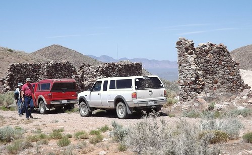
We decided we would spend the afternoon investigating further and stay in Delamar for the night.
We found a clear level spot above the mill and along the roadway with enough room for all of us and we hoped some protection from the wind. It commanded a great view of the area.
During the night and early morning, I got quite ill. I’m not sure if it was the excitement, the altitude, something I ate or an allergy pill I’d decided to skip. Although my allergies are pretty mundane fare around home, I’ve discovered that I can be very allergic to rare flowering plants in Hawaiian volcanoes and possibly the Nevada desert. While I’ll spare the details, the morning found me worried about dehydration and seriously considering cancelling the remainder of the trip. As it turns out, I was somewhat weak the next day but after that one night, all seemed to be okay.
Frenchie, on the other hand, was not quite as lucky as he also got ill. He tied the symptoms to a medical issue he’d dealt with a month or so earlier and did leave the trip to visit medical pros to follow up. We heard from him later that he got home okay though. He was missed along the rest of the trip as he is quite an entertaining travel companion.
More photos from this leg of the trip.
If you’d like to be notified of new posts, use the Subscribe button in the upper left and provide your email. Your email will not be used for any other purpose!
Desert Expedition III: Nevada – Post 2 – Cedar City UT to Rainbow Canyon NV
On Tuesday morning, we were all to meet at Smith’s Market in Cedar City with some time planned to meet and greet and then get on the road.
Timing can be a relative thing but we did all eventually show up and get ready.
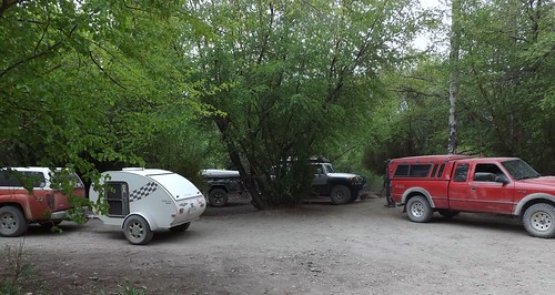
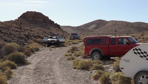
Along for the ride were: Scott B and his navigator, Laura in the recently repowered white Ranger; Sib (Sibastian who also is Scott’s father) in his white Ranger; Gary (gwittman) in his red Ranger; Michael (mjmcdowell) in his gray Ranger; Frenchie (Frechiexj) in his white Jeep JK; Martin (martinjmpr) in his maroon 4Runner; Ace (Ace Brown) in his silver FJCruiser with Kyla the golden retriever and Keith (4x4x4doors) in the orange Colorado.
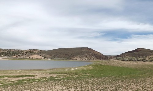
We left Cedar City on UT56 and went off pavement before we got into Nevada. We eventually got into Echo Canyon State Park and found a spot next to the reservoir for lunch.
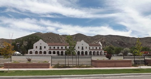
Our next waypoint was Caliente, the first ghost town of our journey. This is probably a good spot to define exactly what is a ghost town. Many of us think of a place that is totally abandoned and derelict but Merriam-Webster includes towns whose population has significantly declined from previous levels due to the collapse of an industry or resource such as when a mine is closed. Detroit, Michigan would fit the part of the definition that includes a significant decline in population without being completely and totally abandoned. Caliente, Nevada (and several of our other stops) fit that significant decline defintion. Caliente gained its name from the nearby hot springs. The Union-Pacific Railroad came to town in 1905 and the train station, built in 1923, is built in the style of Spanish missions. Today it houses a museum and the town’s municipal offices and a library.
After passing through Calienete, we veered left into Rainbow Canyon and followed the stream and the railroad tracks for a ways.
Climbing out of the canyon, CB radio traffic tells Michael that something doesn’t look right just as he discovers that he has a blowout.
Replacing the tire turns into a group project with Scott providing his racing jack, Martin providing his four way lug wrench and various folks providing labor and advice. Ultimately, its clear the tire is toast and well-beyond repair and we’re back on our way.
We pass onto federally-owned and managed Bureau of Land Management (BLM) land. Different rules apply to passage and camping so ownership and management of the land is significant. We ride along a ridge road and see one other vehicle. Eventually we wind down into lower ground and start looking for a place to spend the night.

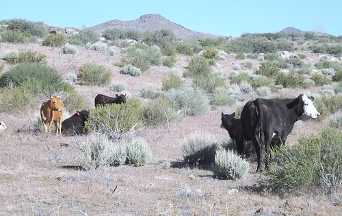
This is range land and we happen upon some cattle and a stock tank and nearby clearing that had been used for camping before based on several fire rings in the clearing.
We set up camp for the night. Just before dark, we noticed four horses approaching with great interest. While they checked us out a bit, they decided to go on. Apparently our sheltered location was also used by the to bed down for the night.
As we pulled out in the morning, the cattle followed for a while. One calf showed a particular interest in Martin’s 4Runner and ran after him for possibly a mile! There’s probably an off color joke that fits but I’ll refrain.
More photos from this leg of the trip.
If you’d like to be notified of new posts, use the Subscribe button in the upper left and provide your email. Your email will not be used for any other purpose!
January 27: Old Friends Touring DC: Navy Memorial and National Portrait Gallery
A rare treat for the Old Friends weekend, we were able to tour on Sunday as well. Today included breakfast, church and then a trip to downtown DC to visit the Navy Memorial (site of the Lone Sailor) and the National Portrait Gallery.
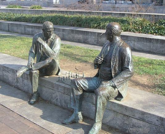
Our first stop after finding parking (which was free on the street where we were since it was Sunday), was a walking trip through Judiciary Square where we found these two gents deeply absorbed in an impromptu chess game. They didn’t include a timer. Russ pointed out that the board was also set wrong, not something to be noticed by the casual observer.
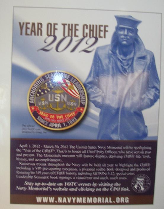
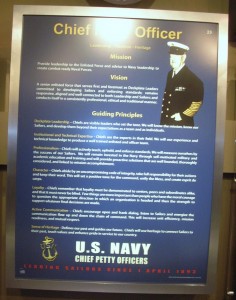
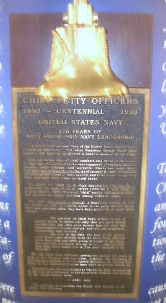
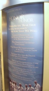
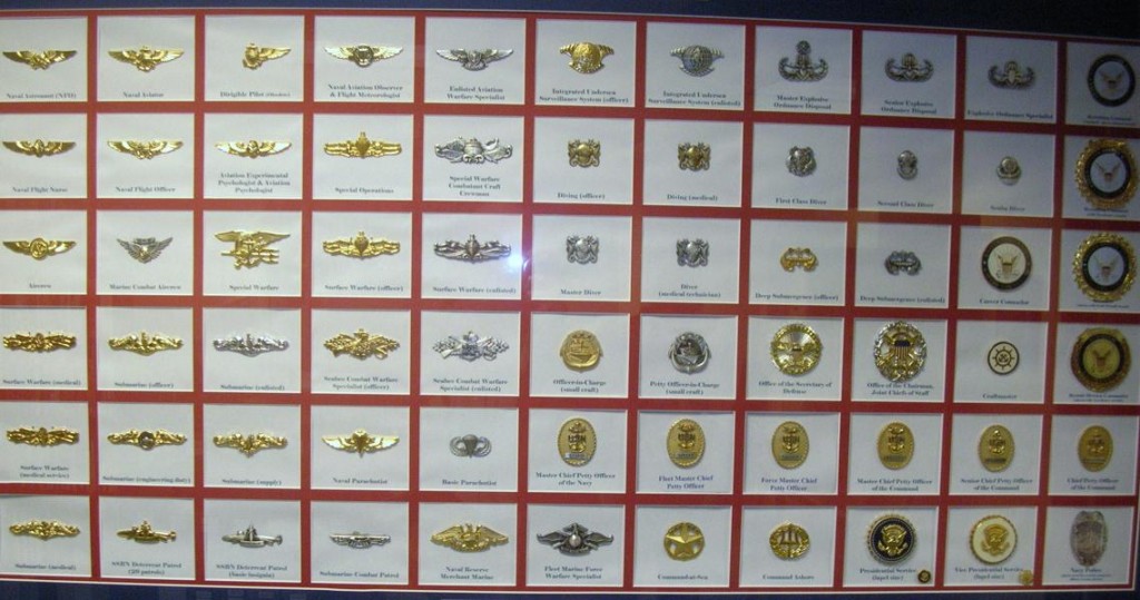
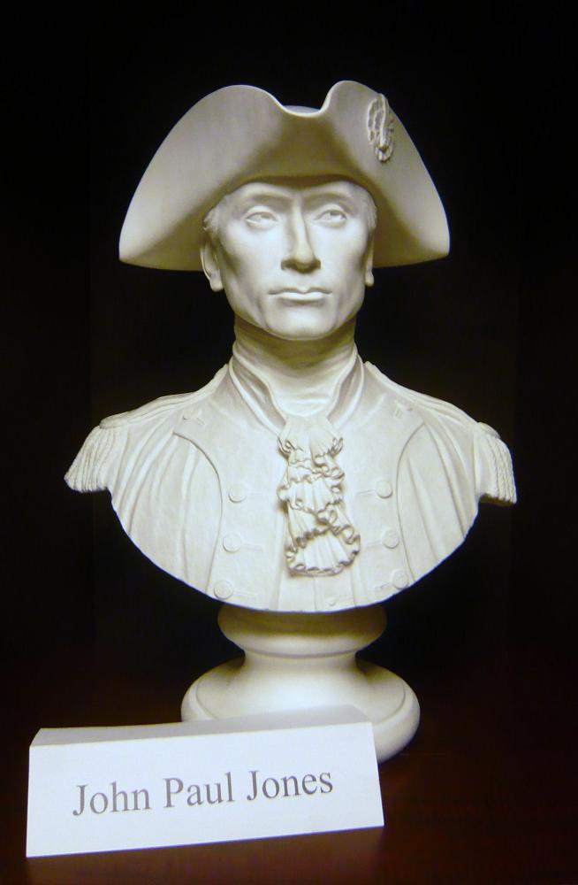
Our primary stop was just around the corner on Pennsylvania Avenue at the Navy Memorial. Best known for the statue of the Lone Sailor out front, there are exhibits and a theater inside. 2012 was celebrated as the Year of the Chief.
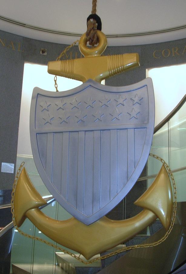
 This centerpiece hangs in the center of the spiral staircase leading down to the main exhibit floor. This one is beautifully made of wood with the woodgrain showing as the gold color with painted silver for the shield. This is a replica of the traditional Chief Petty Officer’s collar device, the fouled anchor.
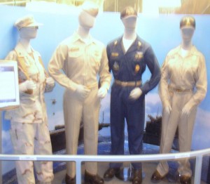
Chief Petty Officer uniforms
I’ll take a moment to apologize here for the quality of some of the pictures that follow. The lighting showed a glare on several of the displays. Normally, I’d reject those pictures but I believe the Navy Memorial needs to be shared a bit more and I’ll compromise the picture quality to give you a better idea what’s there.
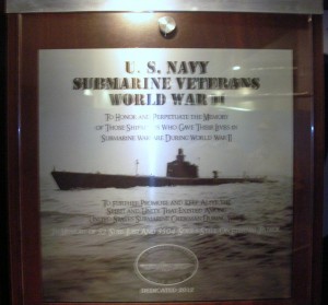
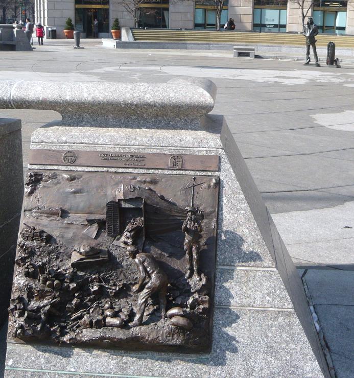
Memorial plaque for submarine sailors of WWII
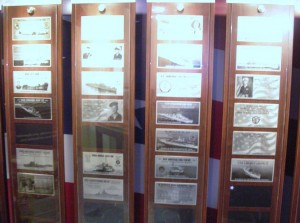
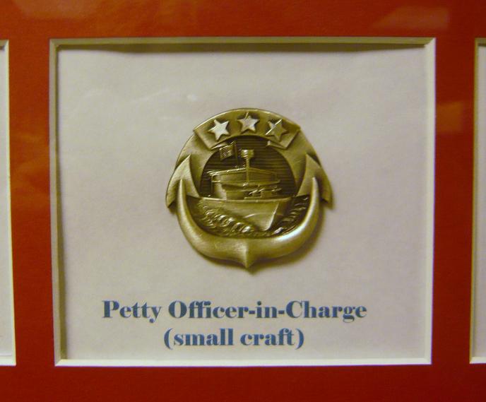
Multiple memorial plaques provided in exchange for donations. There were a number of displays similar to this one.
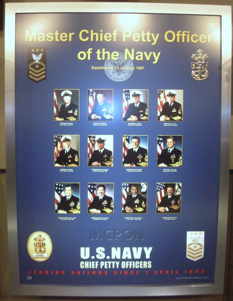
The Senior Enlisted Sailor in the Navy is the Master Chief Petty Officer of the Navy (MCPON). This display pays tribute to those who have served in this capacity. Of the 13 men who have served as MCPON, three were submarine-qualified (James Herdt 1998-2002; Terry Scott 2002-2006; and Rick West 2008-2012)
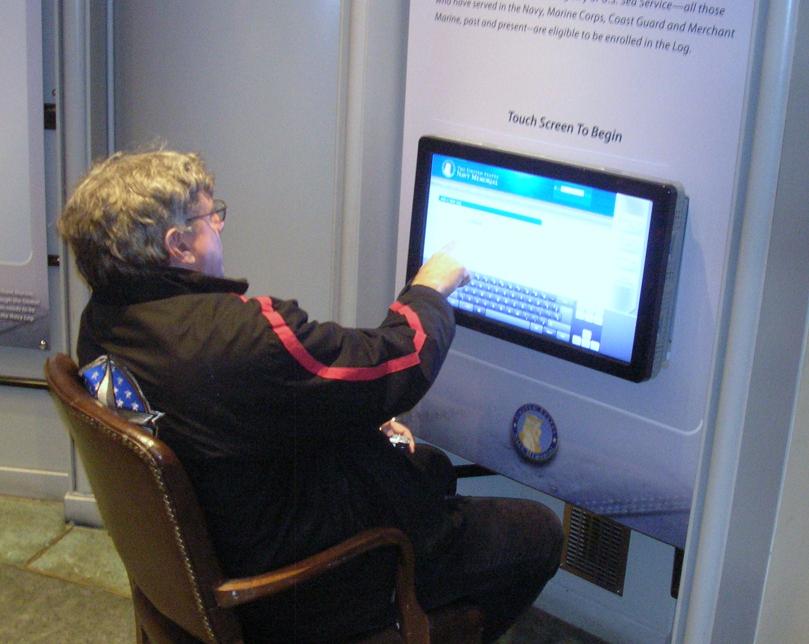 The Navy Memorial maintains a log that allows sailors or their families to enter pertinent data about the sailor as part of the memorial. Their goal is to include all Navy Sea Service Vets. Father Steve was looking things over but decided to complete the entry back at Chateau Pierre.
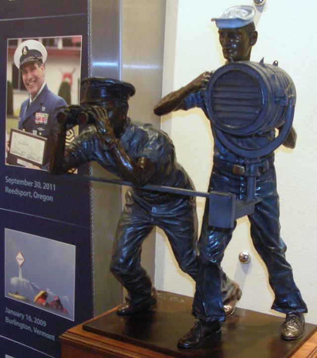
Signalmen and spotters served in good weather and bad.
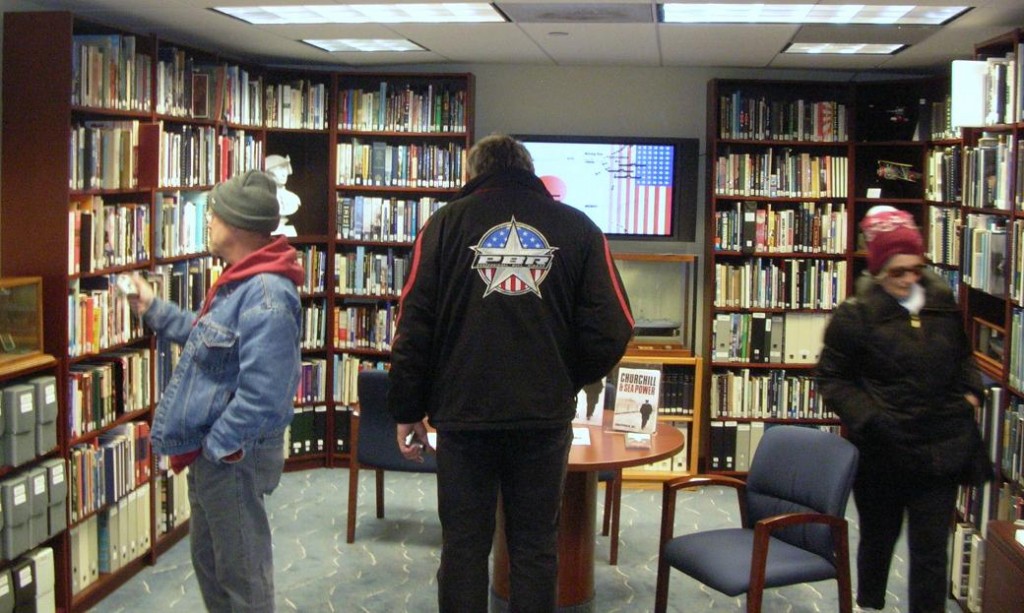
The Memorial includes a library of books (fiction and non-fiction) about the Navy and its sailors and also by some of the sailors.
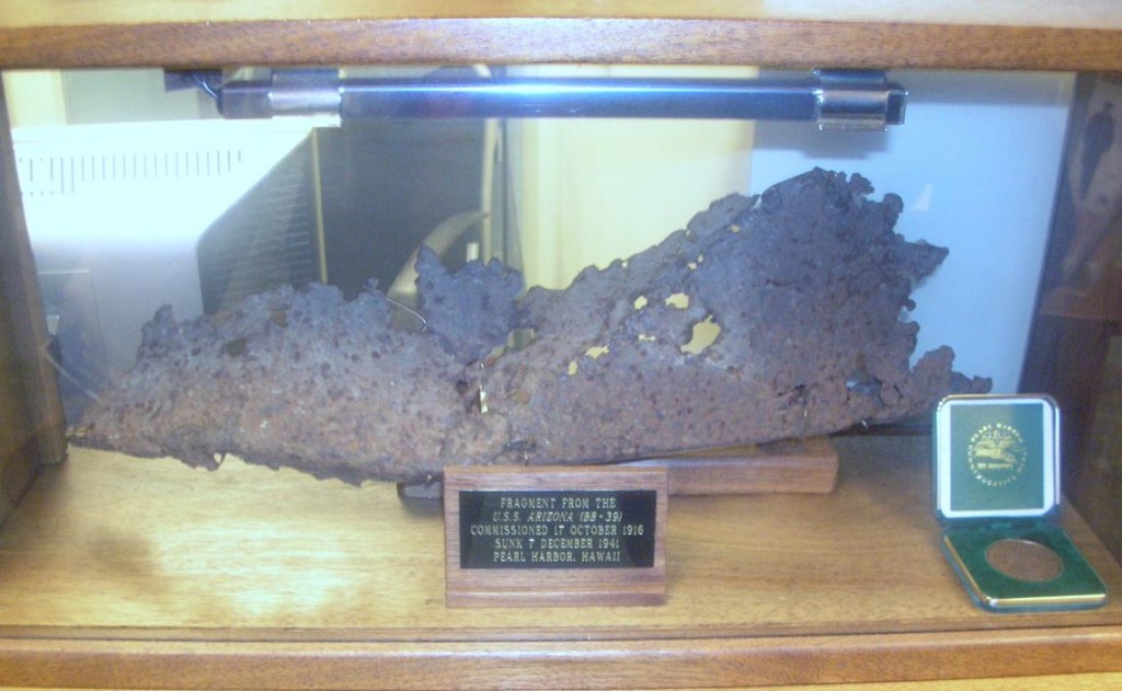
A piece of the USS Arizona, bombed and sunk in the attack on Pearl Harbor.
The display included portraits of Presidents who had served in the Navy. This one is John Kennedy. Also included were Lyndon Johnson, Richard Nixon, Gerald Ford, Jimmy Carter and George H.W. Bush.
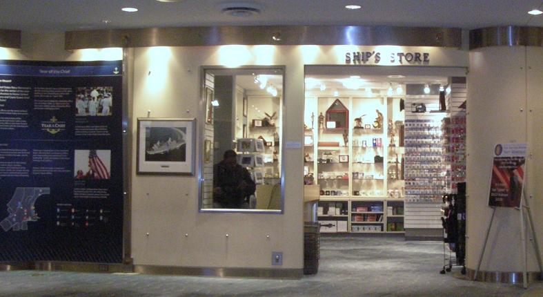
The Ship’s Store
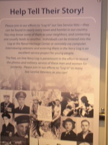
The Navy Memorial maintains a log of sea service veterans. This poster reminds us that sea service veterans are all around us and asks to help. Visit their website at www.NavyMemorial.org
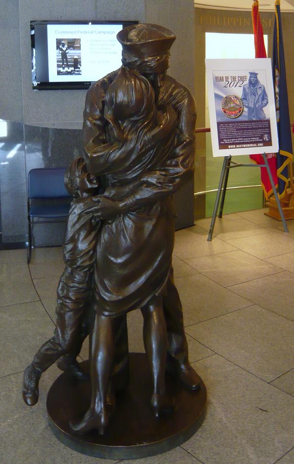
Statue depicts “The Kiss”, subject of a famous Life magazine cover at the end of WWII.
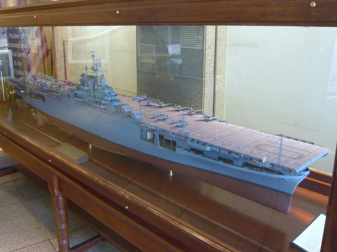
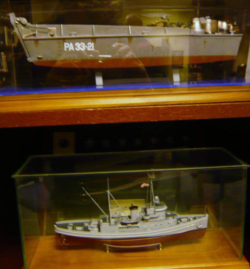
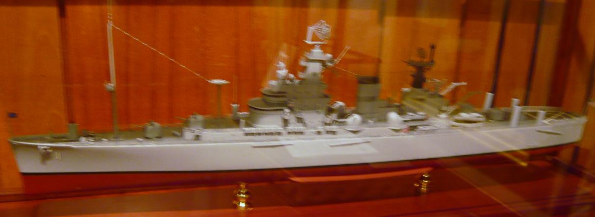
 There are a number of scale models of Navy ships on display.
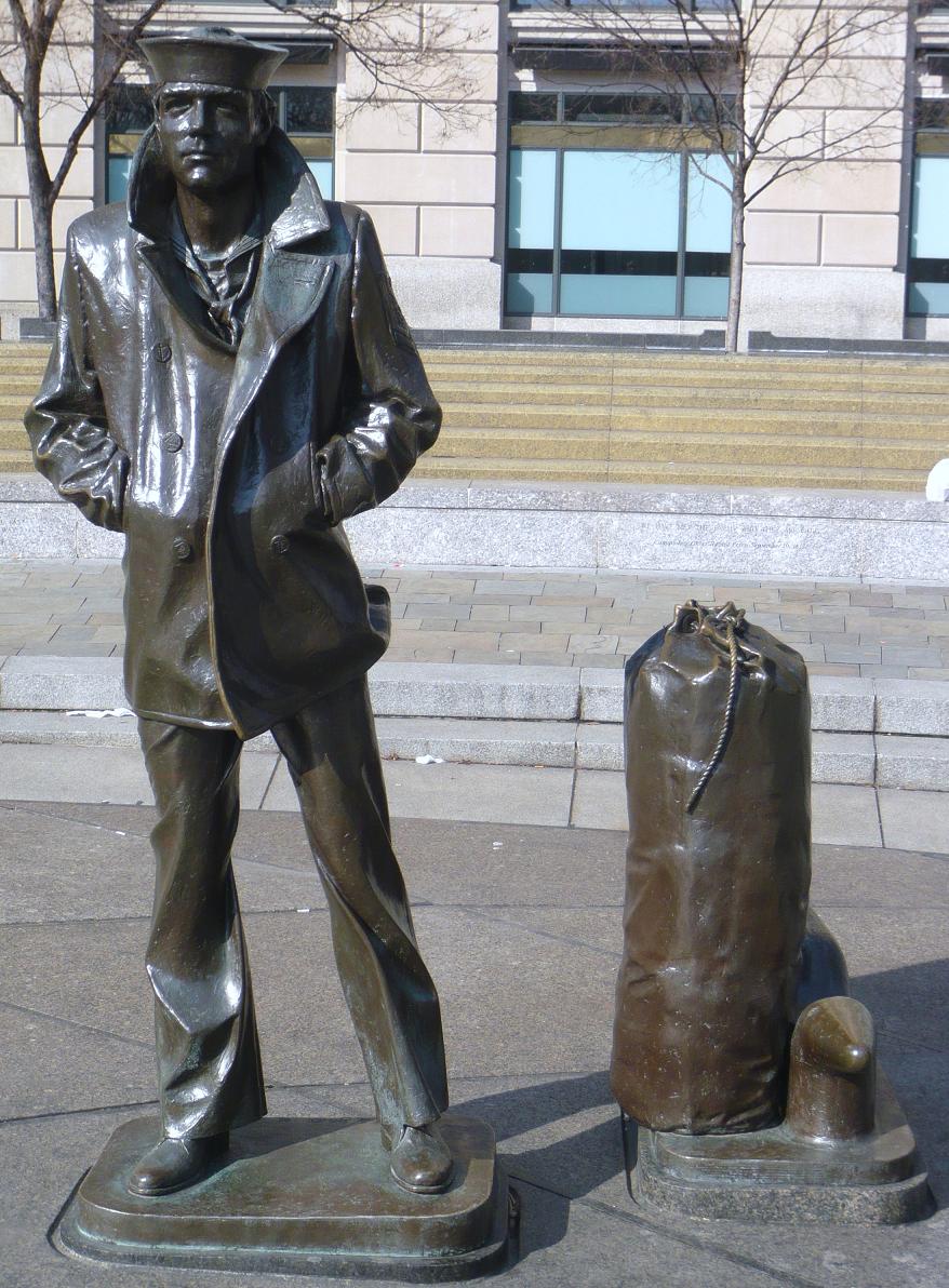
The Lone Sailor
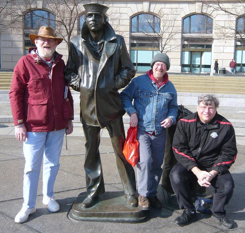
The Lone Sailor with friends
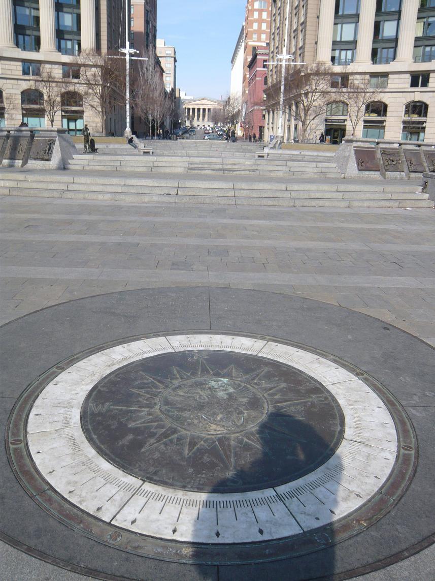
The compass in the Memorial Plaza.
After visiting the Navy Memorial we headed over to visit the National Portrait Gallery. The National Portrait Gallery is part of the Smithsonian Institution and is dedicated to the display of portraits of persons who have made significant contributions to American history and culture. There is an extensive display of Presidential portraiture including a wire sculpture of President George H.W. Bush pitching horseshoes. The American Art Museum (which shares the building) included exhibits displaying the national parks and other persons in our history. There was an exhibit depicting Amelia Earhart and artifacts from the US Patent Office.
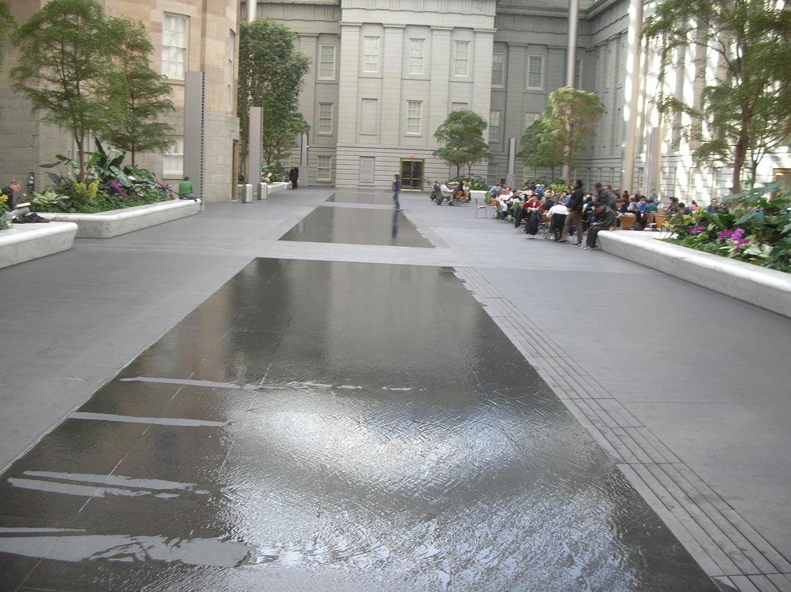
We highly recommend that you take the time to visit. While you’re there, allow time to take in the atrium in the center courtyard shown in the pictures below.
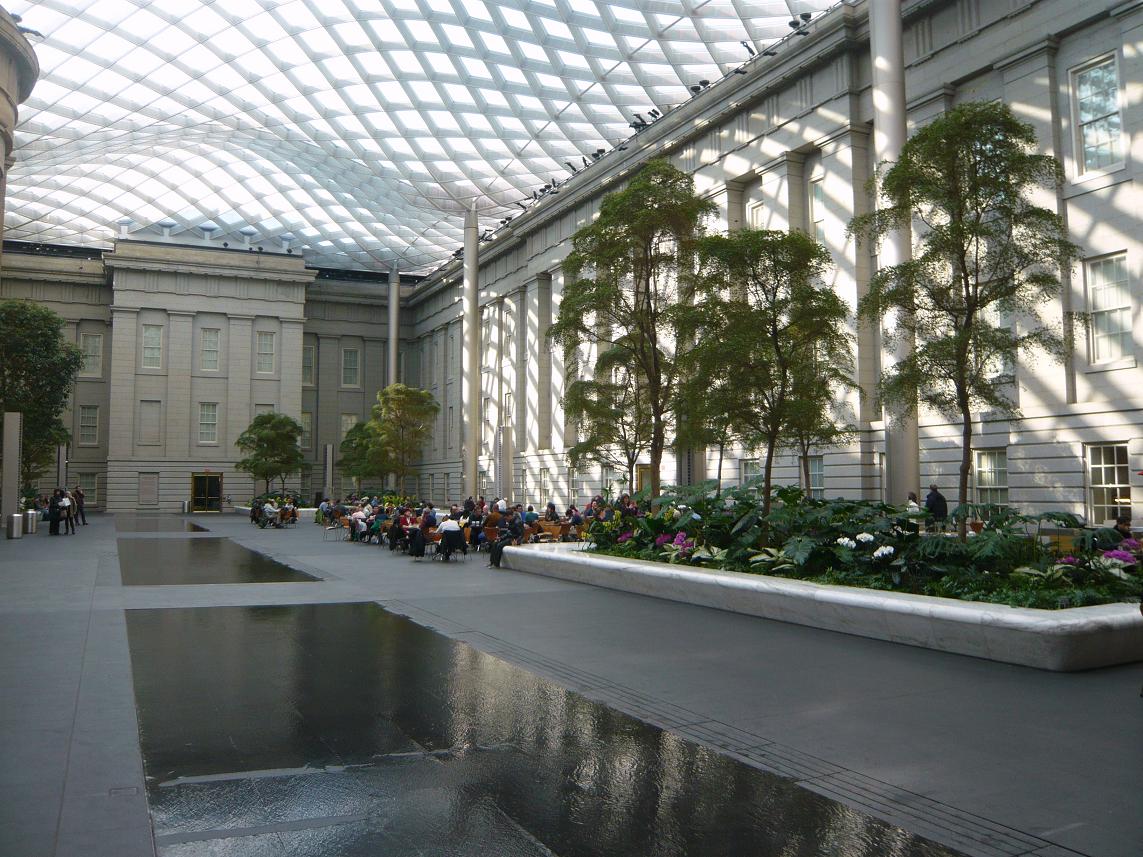
The water in this picture is no more than a quarter to half inch deep. Although it appears to be much deeper.
We chose to grab lunch in the atrium. There were a number of folks who seemed to be just enjoying the opportunity to relax and read or study in the pleasant temperatures and the sunshine coming through the glass roof. It sure beat the cold outside.
 After we left the Portrait Gallery, it was time for Russ to hit the road south while Father Steve, Betty and Keith headed back to Germantown.
Father Steve left on Monday via BWI where he experienced his unusual luck at finding delayed flights but arrived safely back at home, albeit a bit later than planned.
It was another great weekend with great friends, exploring the sights right here in our own backyard.
January 25: Old Friends Touring Monticello
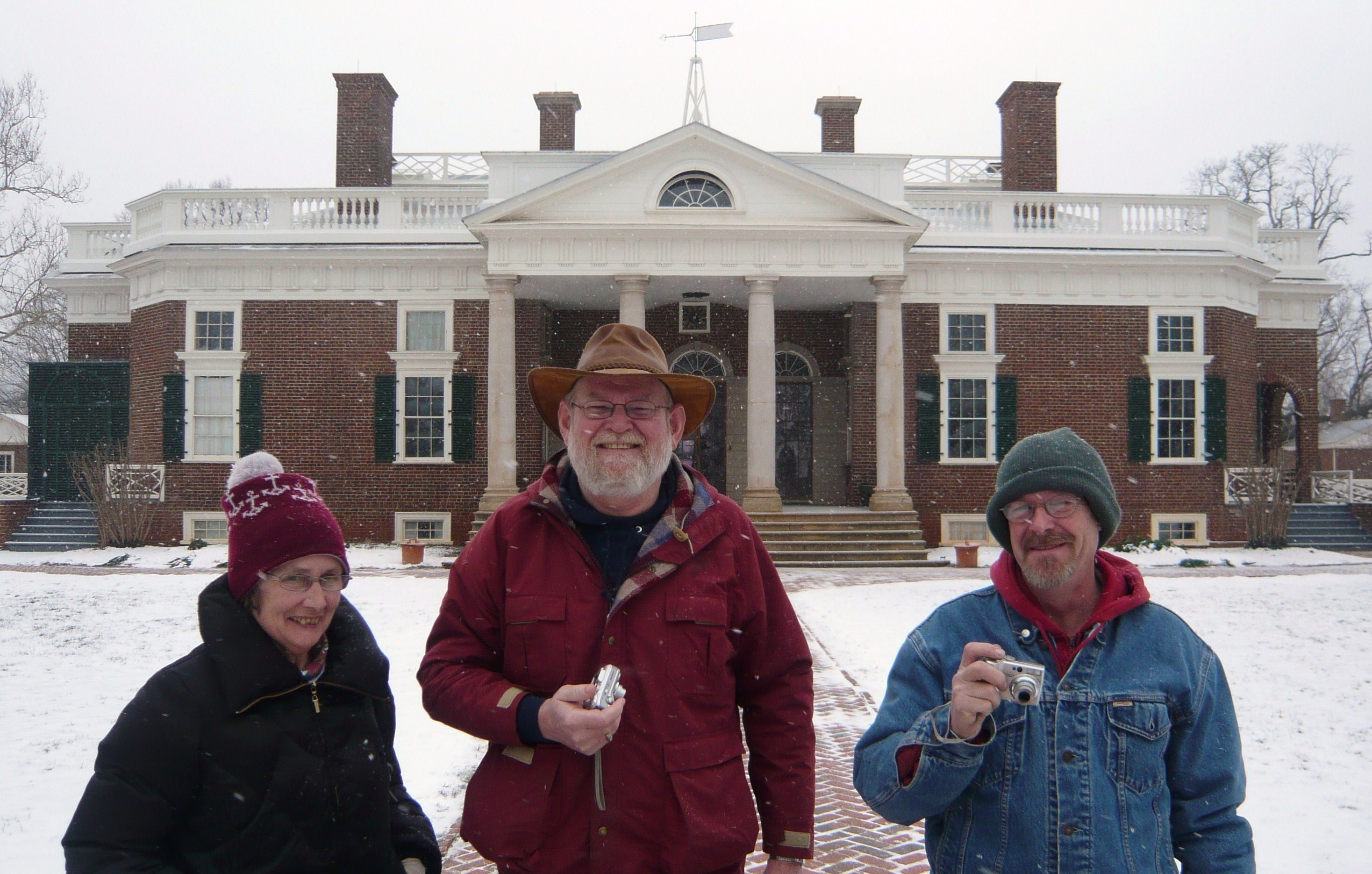
Steve and Russ were two of Keith’s roommates when we were at the Navy’s training facility in New York. Although our paths diverged quite a bit afterwards, it was an intense time in our lives and the friendship that really got its roots there has continued and deepened through the years. At least once per year, we try to get together and visit with each other and to play tourist somewhere. For point of reference, Betty and Keith met while Steve, Russ and he were roommates.
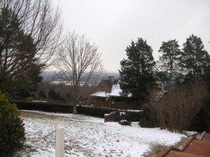
On January 24, the website for Thomas Jefferson’s home in the hills near Charlottesville VA indicated that they had closed early due to the inclement weather but to check back for the schedule for the next 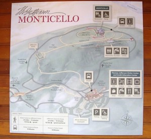 day. At sometime after 9:00 am on Friday, January 25 the website indicated they would be open normal hours so we loaded up with hopes of seeing Monticello and maybe even Monroe’s Ash Lawn and Madison’s Montpelier. The forecast was calling for the possibility of light snow in the early evening.
Not in any particular hurry to get there, we meandered a bit and considered getting lunch on the way but decided to wait until after our tour and pulled into the nearly deserted parking lot about 1:00. It appears the flurries and cold had discouraged many less hearty souls from the hilltop this afternoon. We went inside the cluster of buildings and bought our tickets for the 1:30 tour. After we purchased our tickets, we were told that would be the last tour this day as they would be closing early today because of the weather. When I had last toured Monticello (a time best measured as a couple of decades rather than a specific number of years), tickets were purchased at booths similar to those seen at a fair rather than the complex of steel and cedar with brick walkways. 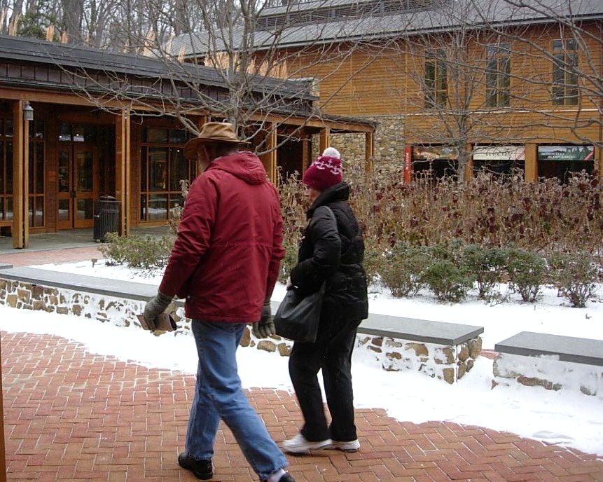 Since our tour was departing soon, we decided to skip past the gift shop and theater
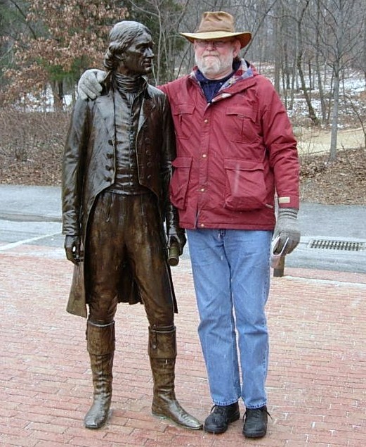
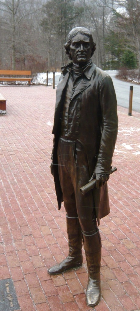
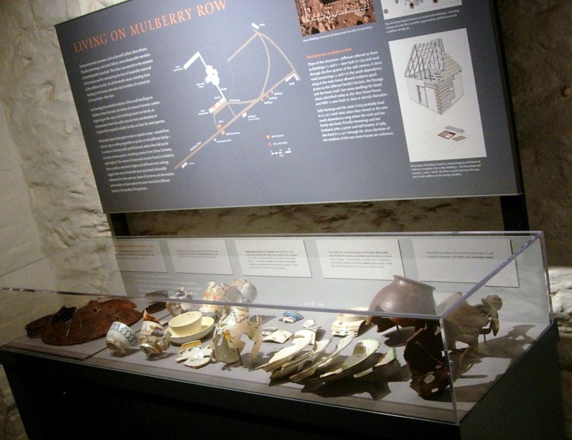
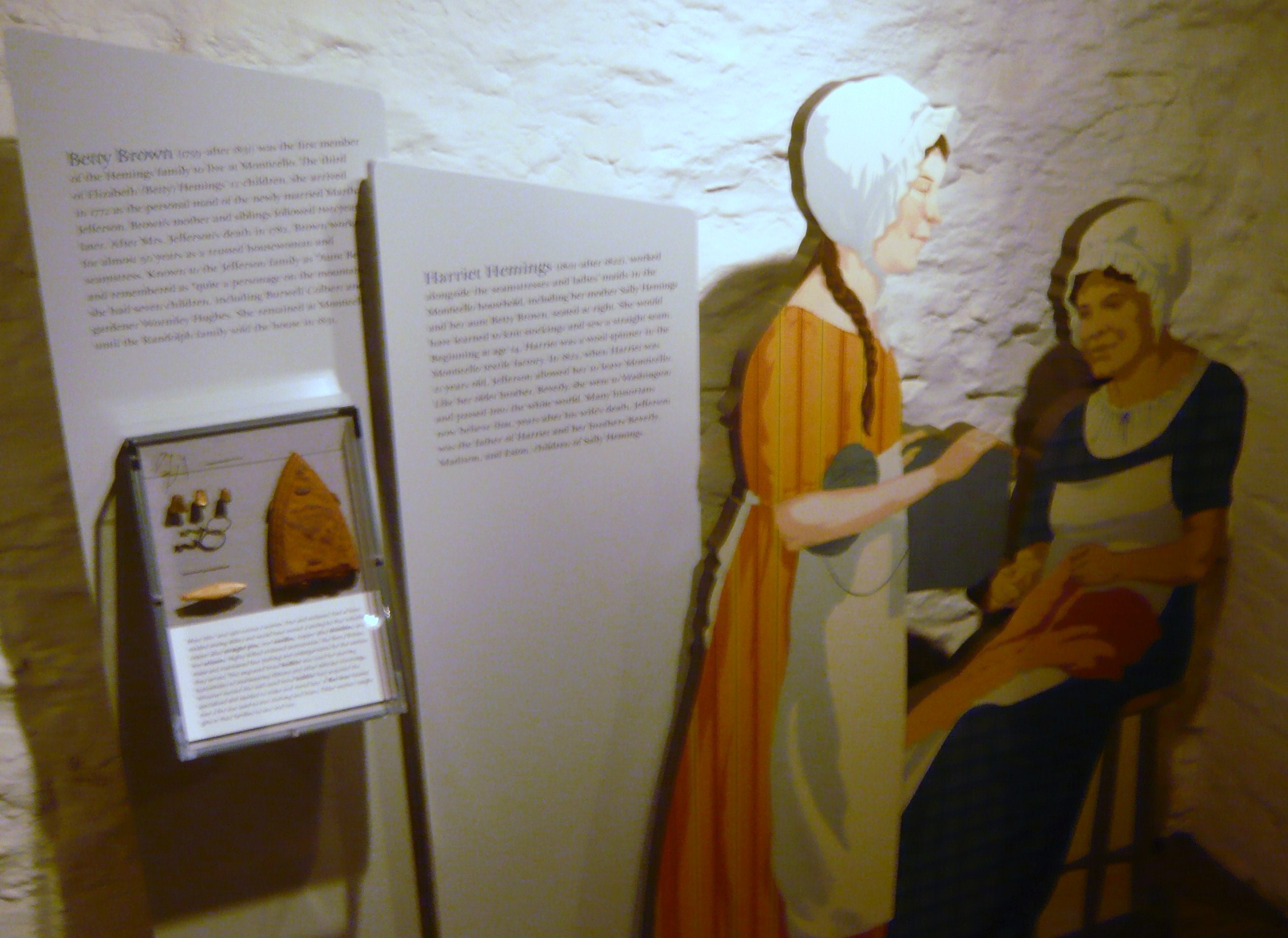
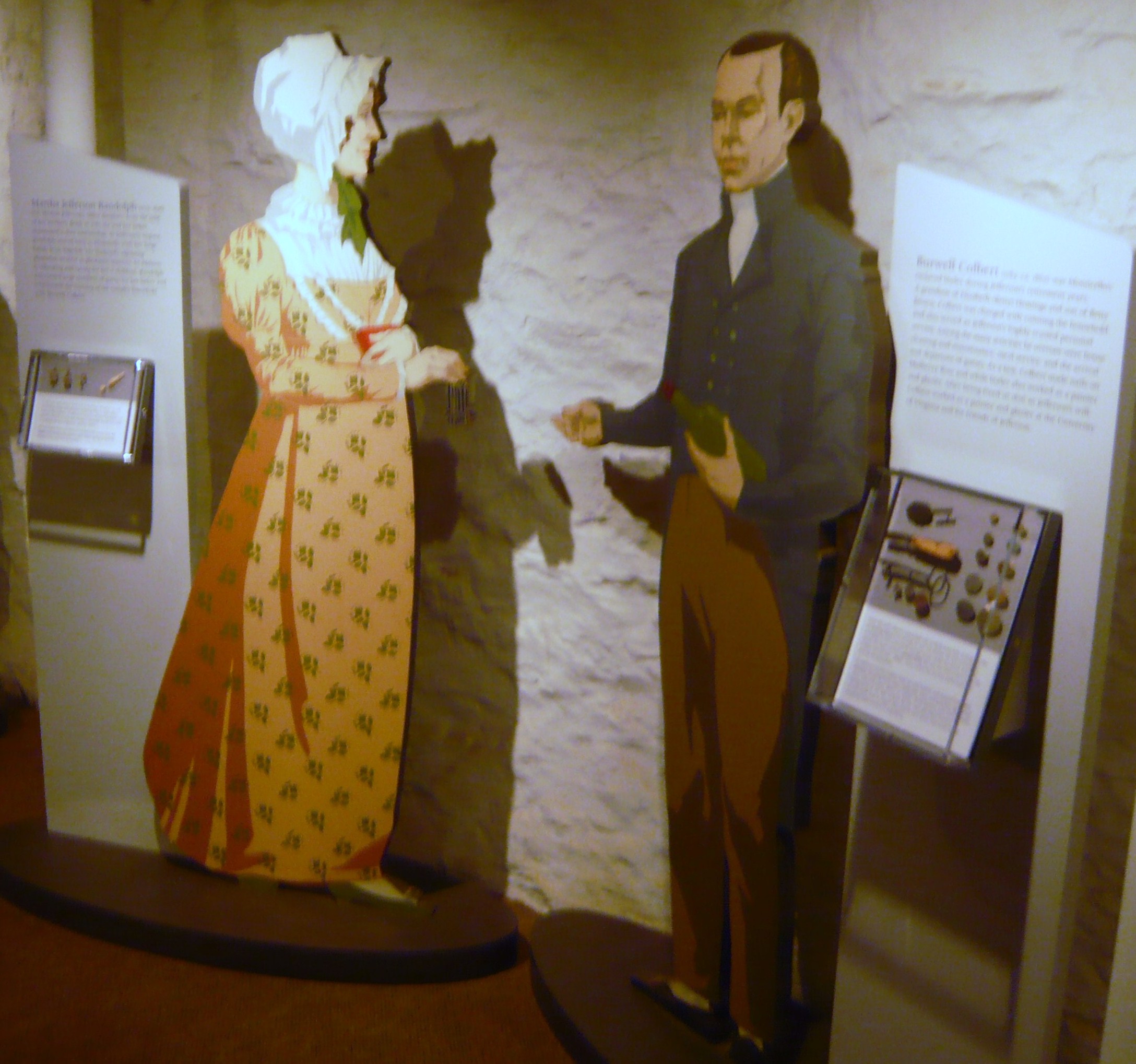
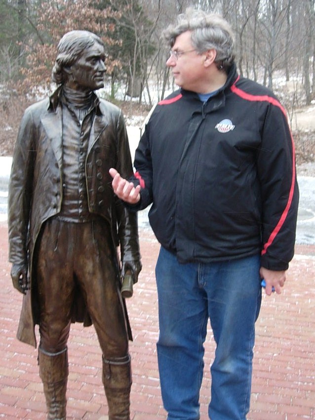 but went into the museum to await the shuttle. The museum exhibit was themed more around the lives and times of the others living at Monticello, including the slaves of his era and later occupants. Outside the museum was a life-sized bronze statue of our third President and we all took the time to speak with him one-on-one.
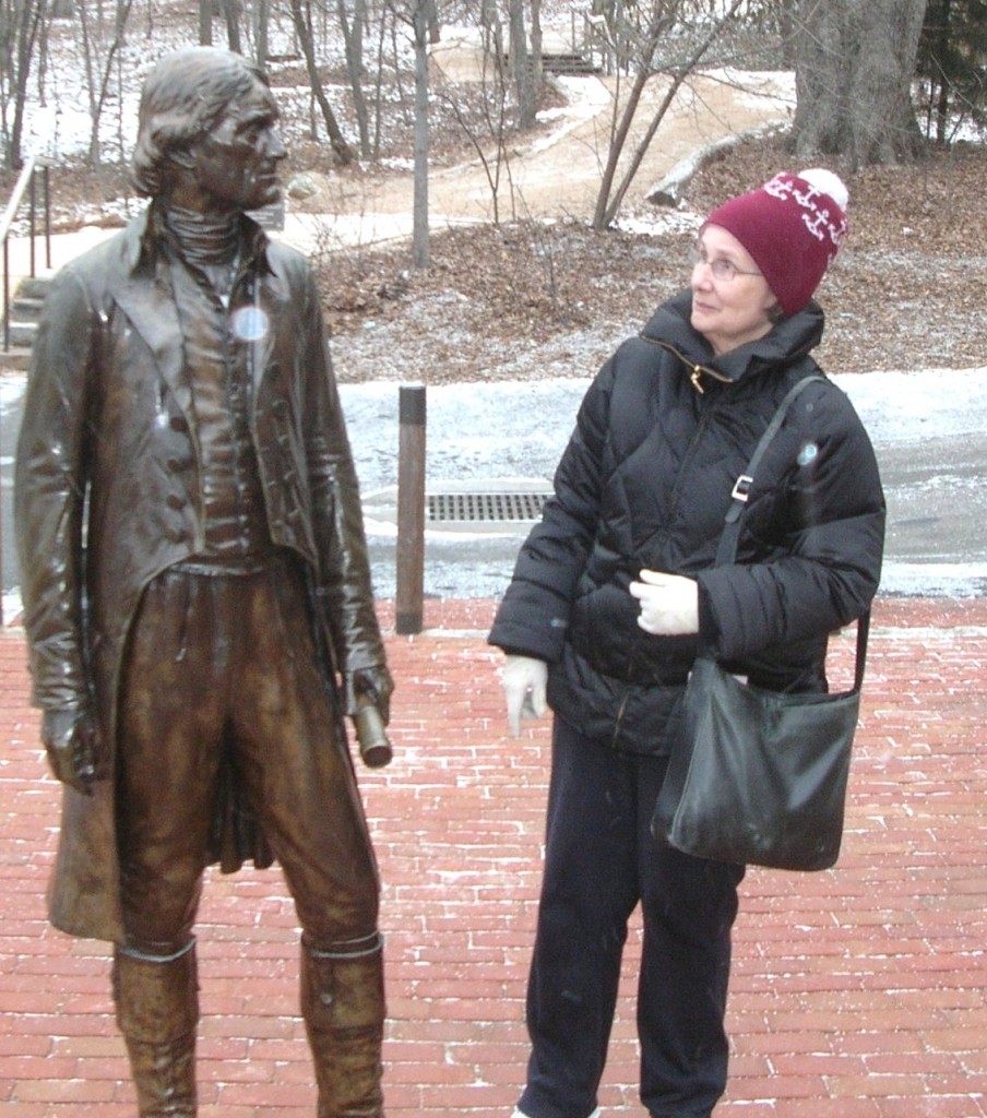
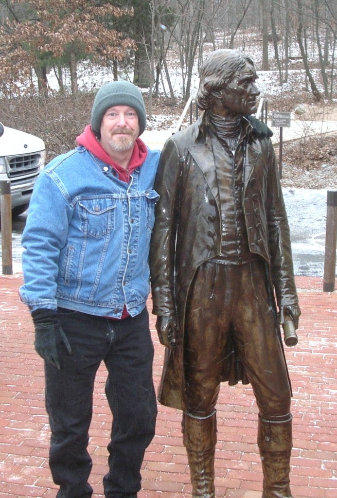 We boarded the bus and Jefferson watched us head up the hill. He’d be there when we returned.
We rode in the shuttle bus up to the main house and you could feel it getting colder and the snow flurries came more frequently.
Perpetual tourists. Seemingly oblivious to the cold but cameras in hand…
“Y’all take your time looking around out there. We’re waiting on another bus but I’m closing this door.”
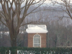
The low square structure at the corner is a cistern for saving rainwater.
Jefferson’s library and personal quarters from the outside. The openings along the ground under the floor level allowed for warming fires to support the plants he grew.
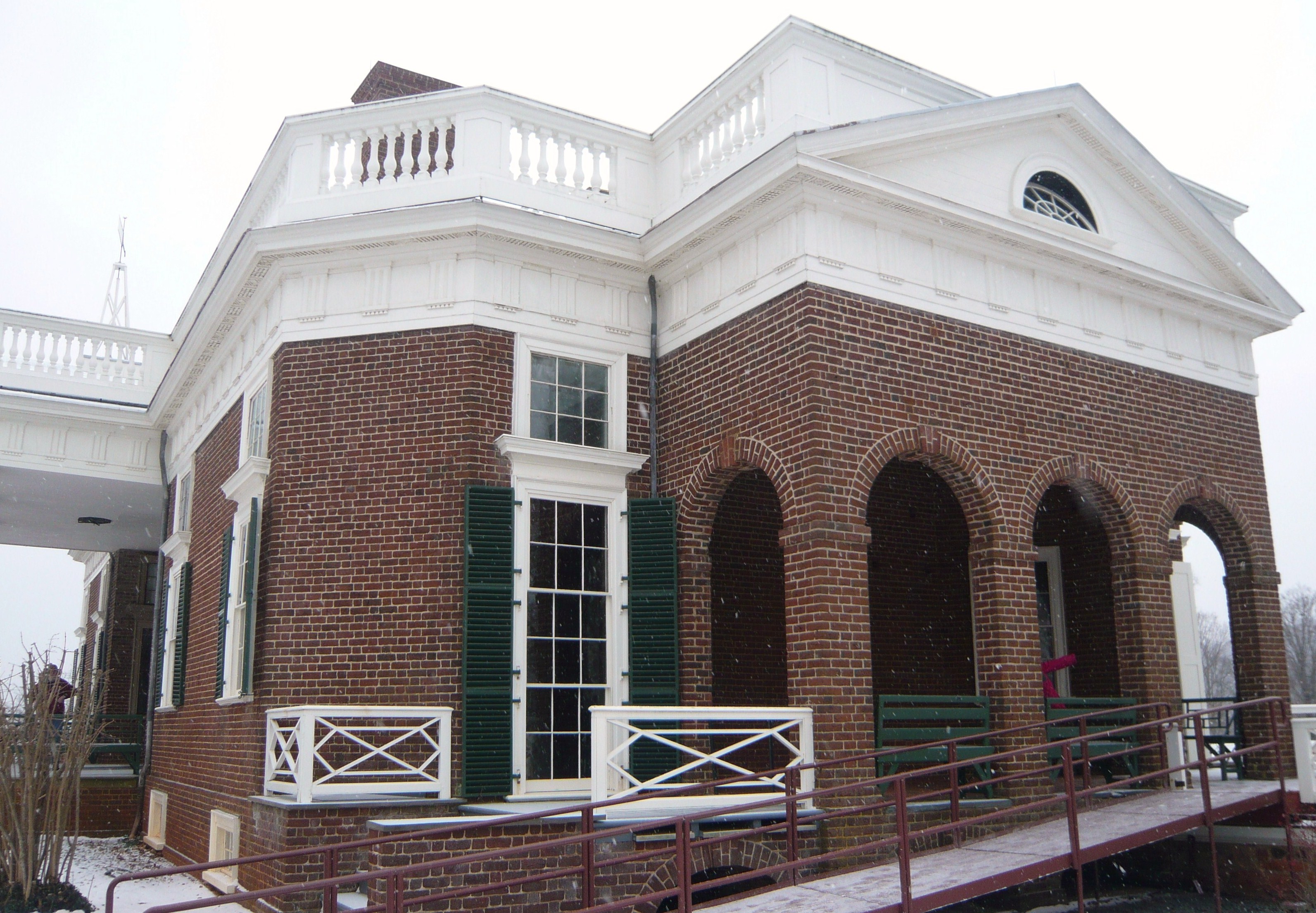
Guest rooms occupied the rooms to the left in this picture and a tea room was to the right (rear). While Jefferson was ahead of his time in many regards, the accessible ramp is a more recent addition.
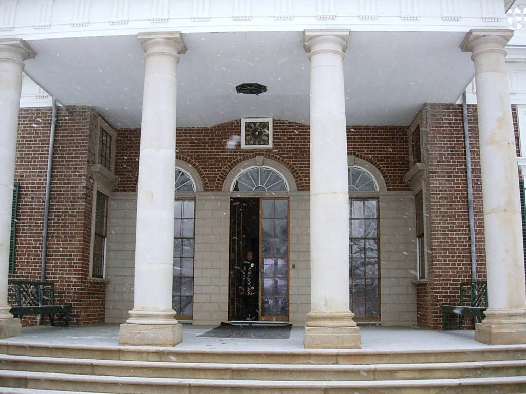
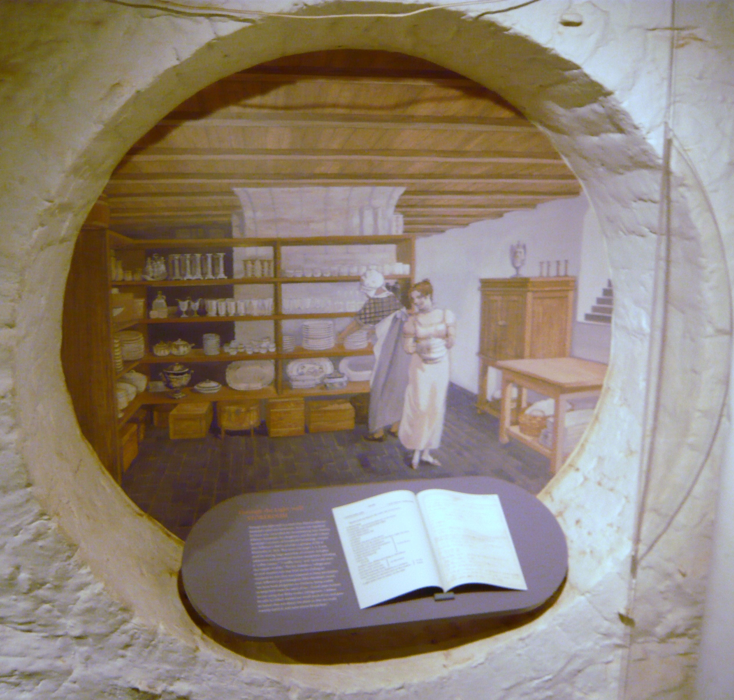
Our tour began on the first floor inside but the cameras had to be put away there due to copyright and ownership issues on some of the loaned display items. I suggest you visit the website here where more detailed discussions and pictures can be found.
The first room we visited was the main entry which included a view of the large one-week clock which Jefferson had built as well as artifacts from the Lewis and Clark Expedition into the Louisiana Purchase.
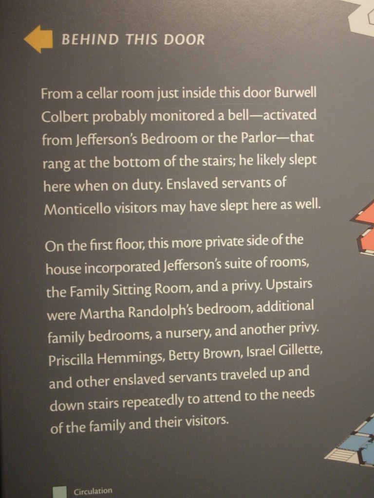
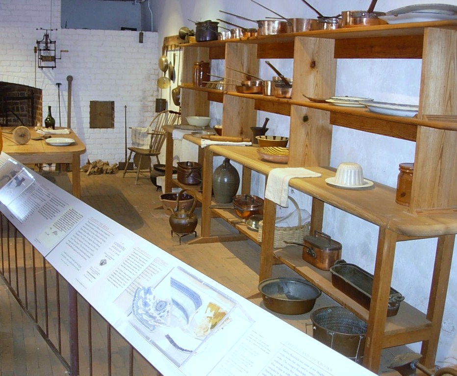
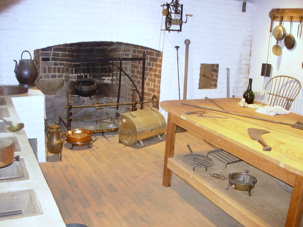
We moved into the family’s quarters seeing Jefferson’s library and hothouse which was heated in part by fires under the brick floor. We curved across the backside of the house and into the dining area with bright paint which seemed a cross between sunflowers and marigolds. Continuing around to the opposite front corner of the house, we viewed a guestroom and then moved down a narrow stairway to what would be service areas of the house, generally used by the servants and working folks rather than house guests.
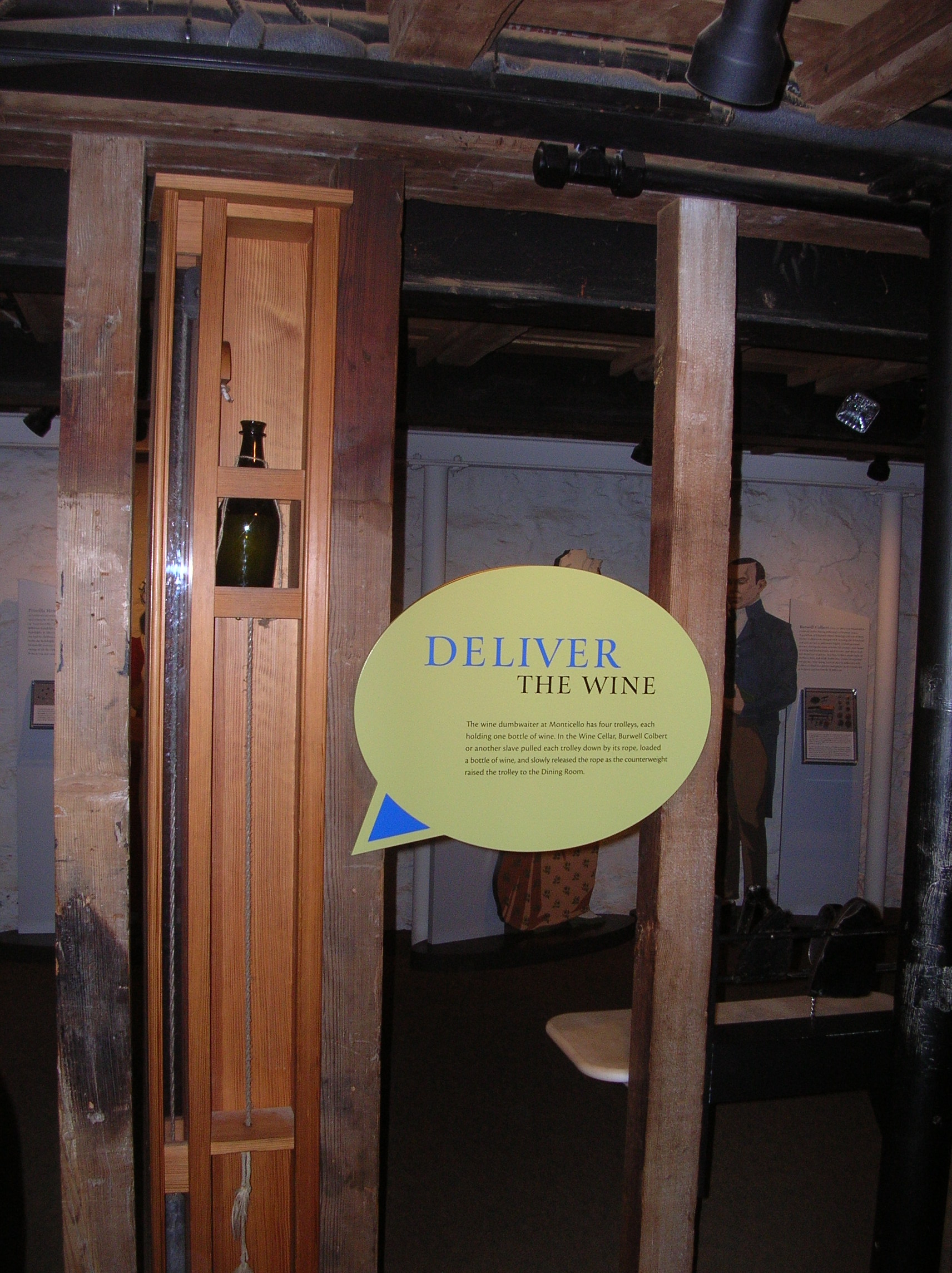
This bottle-sized dumb waiter allowed sending wine directly from the wine cellar to the butler’s pantry off the dining room.
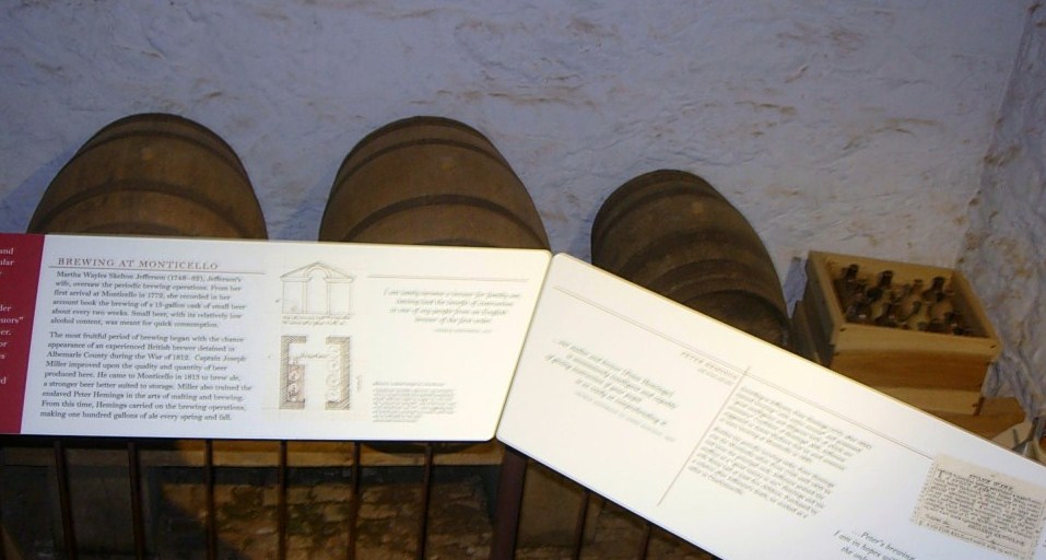
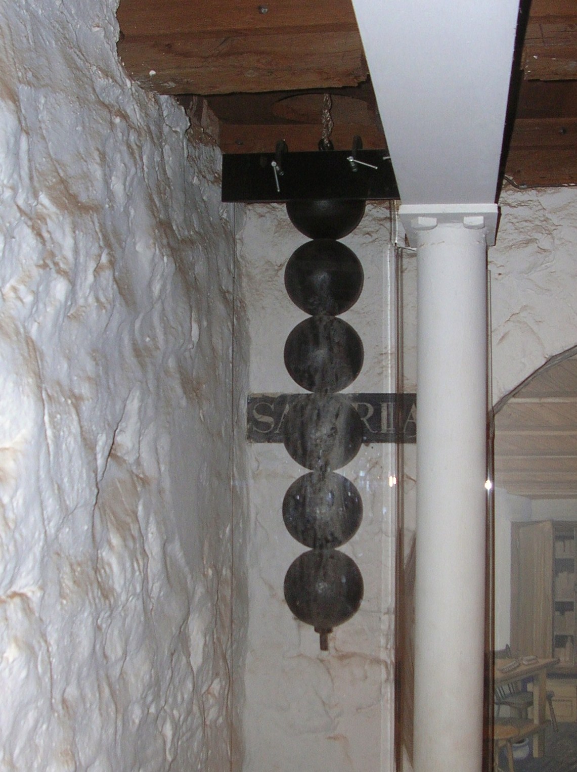
The 7 day clock upstairs is operated by these weights but the length is too much to be fully contained on one floor so the end of the weights goes into the cellar.
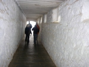
This passage leads from the cellar south to the outside.
One of the cisterns. Because of periodic shortages of water, Mr. Jefferson installed 4 at strategic locations to catch rainwater from the house and walkways. Each of the four potentially held 3,800 gallons.
These were single rooms that were used as a study or quiet place by Jefferson and his guests.
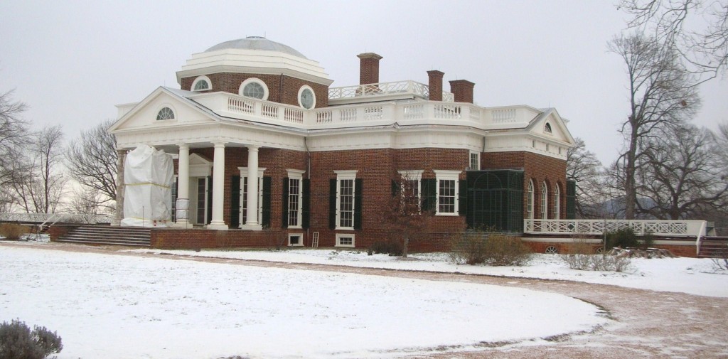
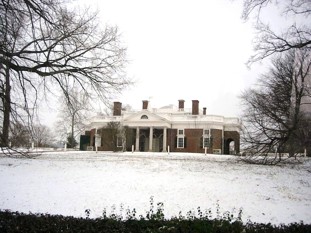
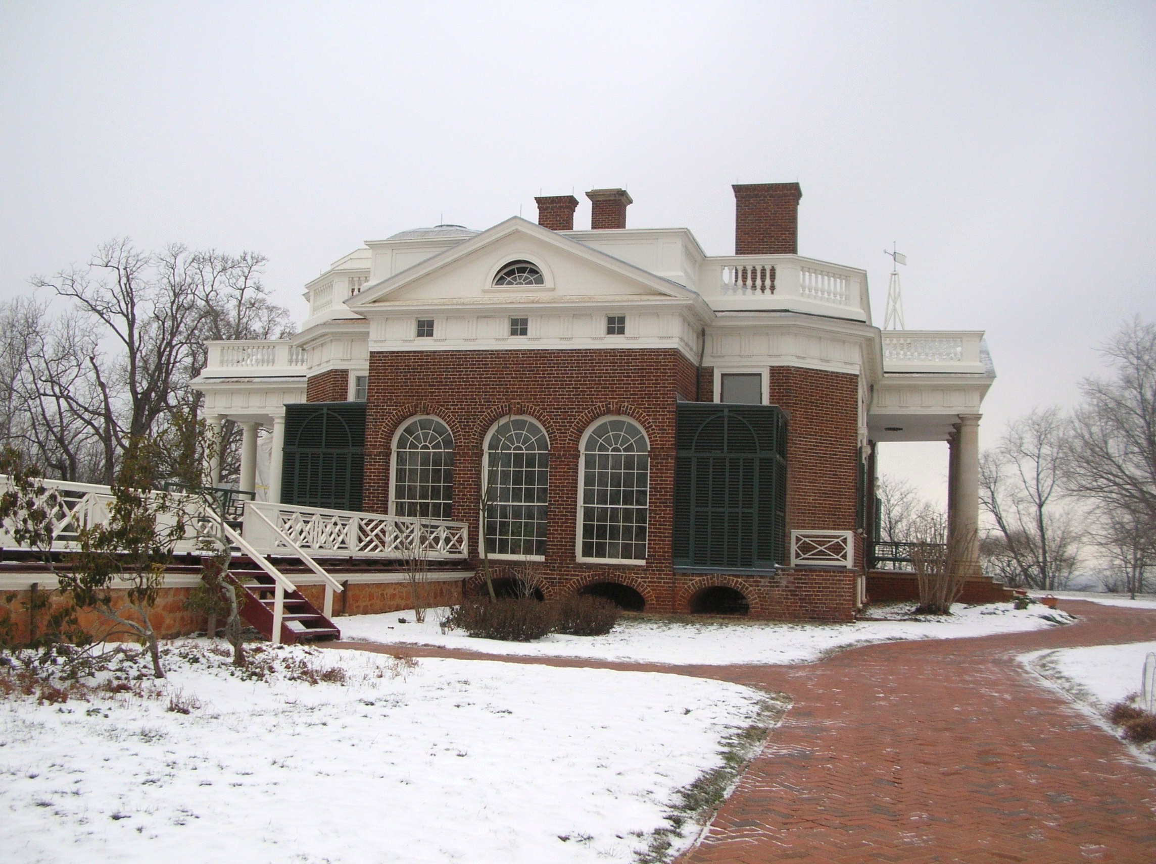
The more famous views of the house were actually the back. The white sheeting covering the columns is to protect renovation/restoration work in progress.
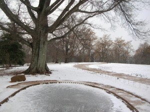
The fish pond is covered in ice. Fish caught in neighboring streams were kept alive until needed for the table.
The view to the south
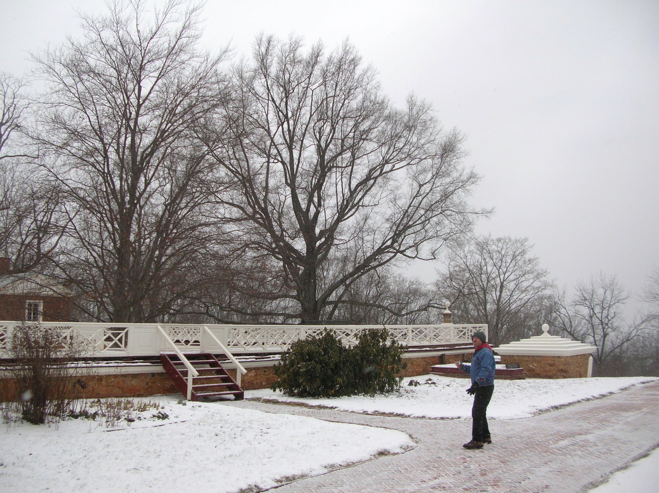
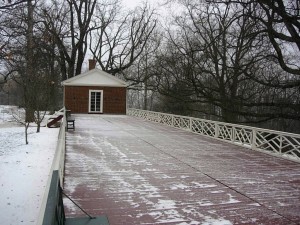
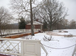
The Garden Pavilion, favored by Jefferson as a quiet and peaceful place to read in the cool of the evening, was toppled by several windstorms following his death and was restored in 1984.
The south pavilion was called the “outchamber” by Jefferson. Thomas and Martha originally lived in this. The lower story was at first a kitchen until it was later converted to a laundry (1808). In about 1818, the laundry was moved to the North Pavilion as it was closer to a natural spring.
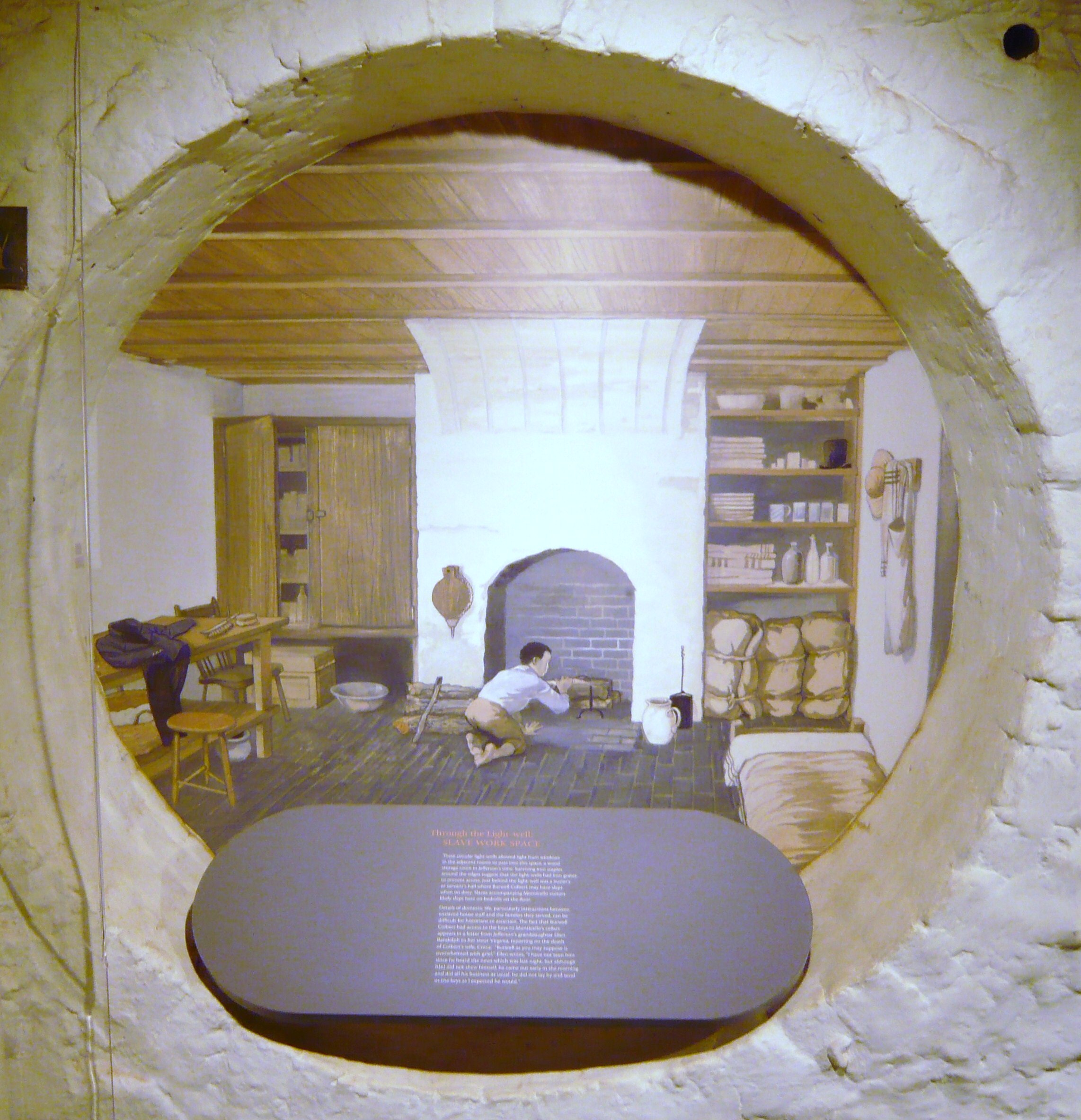
Under the walkway leading to the South Pavilion were several rooms which included a dairy (where milk was stored and butter made) and quarters for the enslaved workers who worked in and around the house.
Under the walkway leading to the South Pavilion were numerous rooms
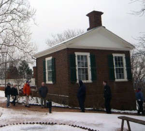
North Pavilion
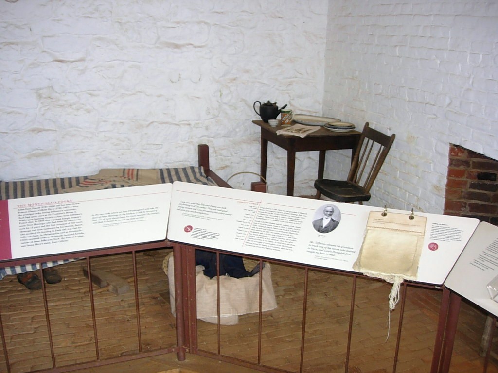
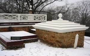
Our tour guide graciously led us to the back of the house and invited us to look around but told us the last shuttle down the hill would be leaving soon. On the way down the hill back out to the visitors center, we were given a brief stop by the Jefferson family graveyard. 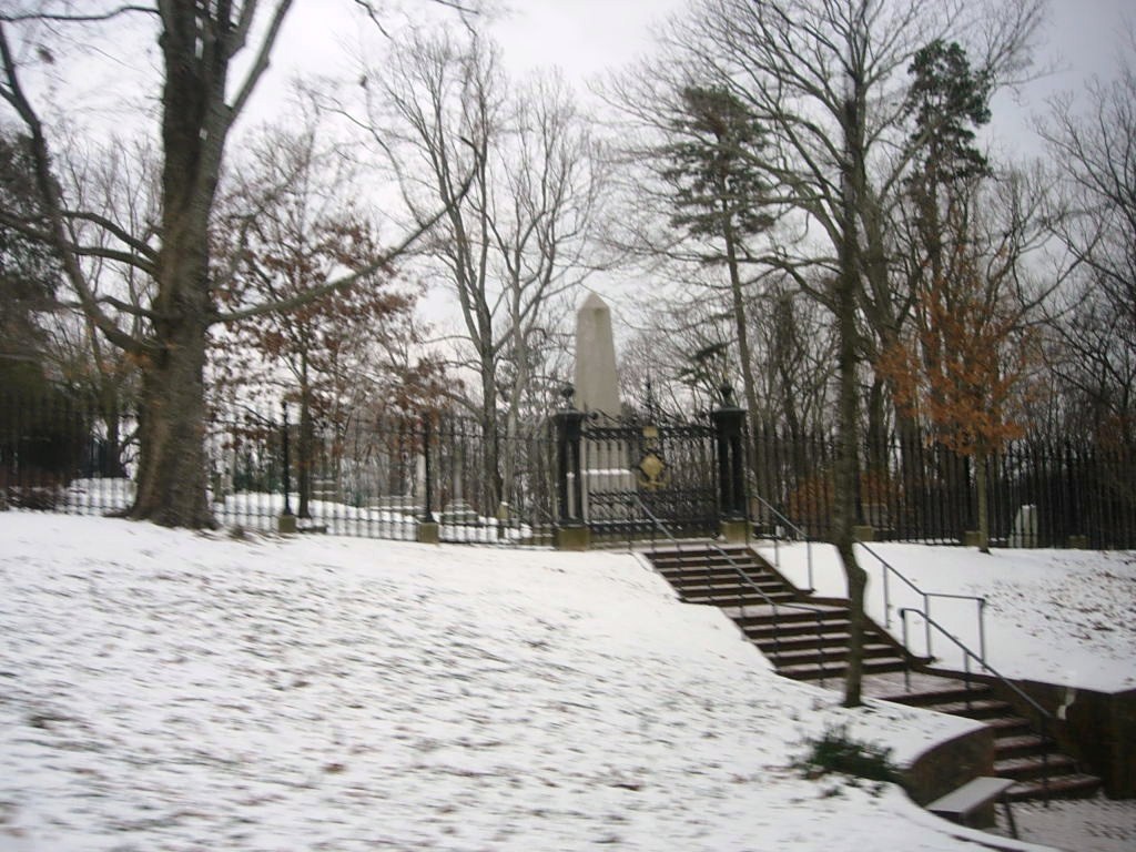
When we reached the visitors’ center, everything was locked up so no gift shop or looking around a bit further. It was back to the car to move along so they could close the gates.
In fairness to the folks at Monticello, we need to relate a bit more of the story. Yes, their website had said they would be open regular hours and the forecast was for slippery roads coming down off the hill but that was the same forecast they had when they announced they would be open all day. No one was rude but you could sense that the folks who worked there were concerned about getting safely home and we were what stood between them and being on their way. When we got home, we sent an email expressing a concern that the daily update of the website could stand a reevaluation of policy. They agreed and said they would be looking into that. They also sent us a set of tickets to be used for another day and a nice book from their gift shop. It’s often said that the true measure of customer service and graciousness is how you handle an issue, rather than a perfect record of never having an issue. They handled the recovery well.
After we left Monticello, we drove over to see nearby Ash Lawn, the estate of President John Monroe, owned and operated by his alma mater, the College of William and Mary. Alas, they were also closed due to the weather but we did manage to get a couple of pictures.
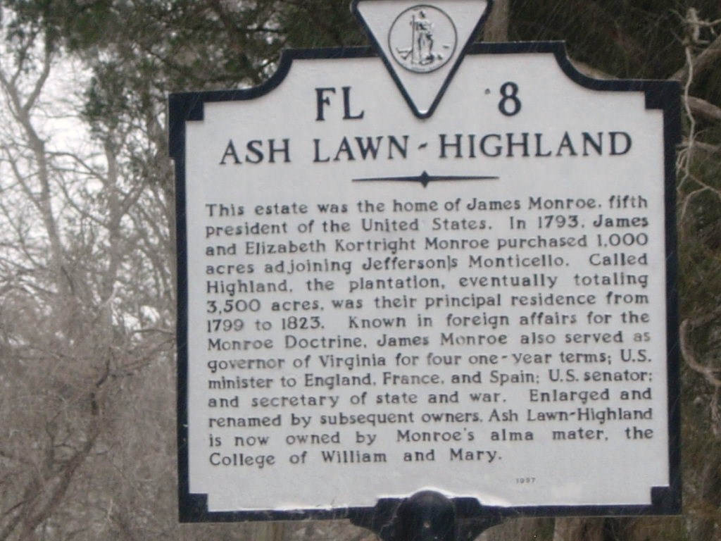
Bit of trivia, Virginia’s governor now serves for one five year term.
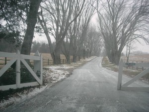
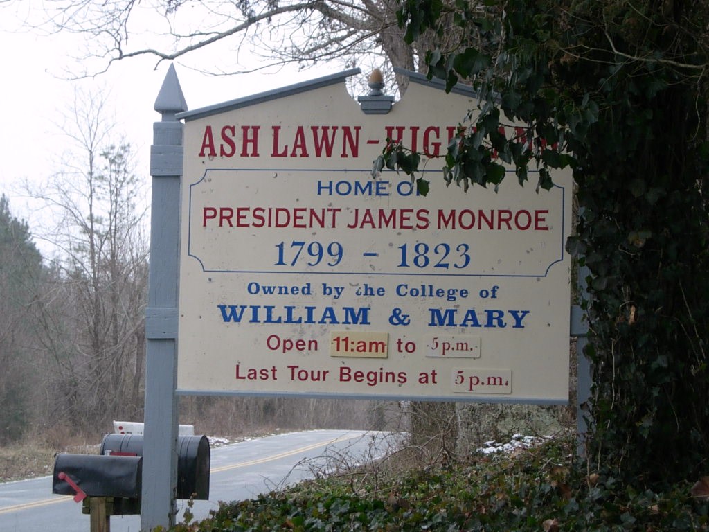 We’ll have to save Ash Lawn for another day. Perhaps an earlier start will get us to Montpelier as well.
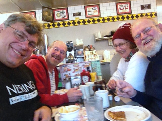
And so we headed for home but we had skipped lunch and were all getting a bit hungry. In the course of seeking a restaurant that suited all, it became known that Father Steve HAD NEVER EATEN AT A WAFFLE HOUSE!!! So we remedied that.
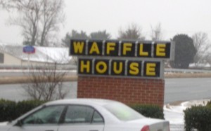
There’s something very, very wrong with this sign. Do you know what it is?
 After food, it really was back to the house with a stop at Wawa (somewhere else Steve had never been).
The Uno Championshp Series continued well into the night!
Transition South, Another Wreck, a Different Beach
Friday was a transition day moving from the northern beaches around Corolla down south to Hatteras Island and our reservations in Buxton.
We started our morning with breakfast at the Hampton and got underway about 10:30 or so. We took the bypass until the KMart and then cut over to the beach road with plans to stop at the Croatan Surf Club in search of another wreck which sometimes appears on the beach there. We parked at the Albemarle Public Access and walked along the beach to the beach of the Croatan but found nothing to indicate our missing wreck. Sometimes the tide and erosion work for you, sometimes they don’t.
We moved on down the beach and through Nags Head to come out on Highway 12. Our next stop was the Bodie Island Light where renovations have recommenced after stopping last year when the NPS reached the extent of their budget.
Next stop was the top of the Bonner Bridge. Ongoing construction work there results is a section of one lane road on the aging span controlled by a temporary traffic light. Too early for our check-in, we meandered onto the Hatteras Deli for lunch. The fresh yellowfin tuna salad sandwich and the open faced “Matey” (thin sliced roast beef and melted cheese) were delicious and just right for lunch. Our next stop was a repeat visit to the beached wreck off Flambeau Rd. 


Since we knew that driving on the beach was in our plans, we went to the ORV Permit office to pay our $50 for a weekly pass and view the 7 minute indoctrination film. The only folks there were the two NPS employees and us. One employee directed us to filling out the form, compared the registration and driver’s license and started the DVD player. She also escorted us into the third room where a second employee took our cash, printed a receipt and handed us our pass. He also instructed us to keep the paperwork in the vehicle.
Next stop was the Hatteras Inn Buxton (formerly the Comfort Inn) to check in. Then we headed back to Coquina Beach (on the north side of Oregon Inlet) to try once again to find the wreck of the Laura Barnes. We had seen it in about 1996 when we visited and it was marked by the highway and was located between the double row of dunes and was largely visible. Nowadays, the dune line has shifted westward and a section about 3 feet in length is visible on the sea side of the first row of dunes. Maybe not an exciting find to others, but significant to us.

Dinner at Rusty’s was up next. We both had the bay scallops broiled. Betty had coleslaw and red potatoes, Keith had mashers and collards. A very tasty dinner indeed which left no room for dessert. Back to the room and settle in for the night.

