Despite the time change, we weren’t up at the crack of dawn on Friday, October 7. We rolled out after a good night’s sleep and took advantage of the included Comfort Inn breakfast bar, looked at the maps and decided we were off to the Grand Canyon today. As we went outside, we saw that the occasional snowflake we had seen on Thursday night had turned into a definite “trace” with white covering the elevated surfaces. (That night’s TV weather report confirmed they had gotten a record amount of snow since the previous record was “none”.) We got into the Avenger, plugged in the GPS and headed out.
We plugged in a route to Tusayan, AZ, the location of the airport where the helicopter tours were based with thoughts of taking the flight today for an overview and then exploring on the ground based on what we saw. The GPS route was a bit different than the one we had drawn on the map. The GPS sent us west on I40 towards Williams where we would head north on State Rt. 64. First surprise came on the Interstate where we discovered the speed limit was 75 mph. While the DC Beltway traffic sometimes eggs you on to those speeds to avoid being run over, in the wide open spaces this seemed to be a comfortable speed. I was pleased by how well the Avenger held those speeds using the cruise control without a lot of shifting. Knowing the car was available with both a 4 cylinder and a 6 cylinder, I made a mental note to check which ours had later.
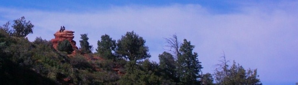
The I40 route was sparsely traveled at that time. While we saw other vehicles, they were well spaced and traffic was not an issue. An occasional glance at the rearview mirrors, we saw the San Francisco mountain peaks with their white dusting of snow and realized the view of the moment might actually be behind us.

Along Rt. 64
When we got to Williams (for the tiny town, there were several interstate exits), we turned to head north on 64. Rt. 64 is a relatively straight two lane highway passing through a couple of small settlements on its way to the gates into the Grand Canyon National Park. It rises and falls a bit and slows as it passes the intersections.
We arrived in Tusayan at the Grand Canyon airport. Internet research led us to Maverick Helicopters to arrange for their Canyon Spirit Tour. We had investigated booking in advance but hadn’t really been comfortable with the cancellation policy, i.e., it wasn’t clear what would happen if they decided to cancel for weather or other reasons. When we arrived, we found they had only single seats available on Friday’s flight but we made reservations for Saturday to both be on the same chopper at 12:30. Flexible plans are great so we decided to head into the Canyon at ground level after a quick stop at Tusayan McDonald’s for coffee.

Line at the gate
As we pulled up to the gate, there were several lanes open, including one marked for those with passes which had no line. We weren’t sure at the time that we qualified for the pass lane with our Senior National Access pass but we did. The going rate into the park is $25.00 per car load. Our Senior pass was obtained a couple of years ago for $10 at Olympia National Park and has proven to be a real bargain, allowing up to 4 people in on the pass where individual admission is charged, a car load where admission is charged per car and even offers discounted campground fees at National Monument, National Forest and National Park campgrounds. If you qualify, buy one. If you don’t yet qualify, go for the annual pass at $80. See http://www.nps.gov/findapark/passes.htm
After we passed through the gate, we drove around to the parking area at Mather Point (Elev. 7120 ft.) As we walked from the car to the viewing point, I was literally speechless!

Breathtaking!
I had seen pictures, I had heard from others but nothing captured the scale and beauty. As I posted on Facebook that evening, “Wow. Just wow.” With that in mind, I’m going to let the pictures say it. You can get a larger picture by clicking on the smaller version here.


Rock Squirrel identified by white spots on his back. This little guy was checking to see who would ignore the "Do not feed the wildlife" sign.

Storm over on the North Rim
 Next was lunch at Market Plaza. The deli had a selection of soups and sandwiches. While all looked tempting, the marble rye bread drug us both towards some type of sandwich and they were yummy. The store also had basic supplies for campers and hikers as well as souvenirs and such. There was pretty stuff but nothing more than a postcard or two really captured our fancy.
After lunch, it was back to the car for a short ride over to the Hotels on the Rim. Although we drove, there was a free shuttle within the park which would certainly come in handy during times of higher volume. The views were again breathtaking and are shown (as well as can be) in the photos. Verkamp’s Visitor Center had some displays of the history of the park as a National Park and the obligatory souvenir shop.

Hopi House
Several historical businesses and structures are in this area of the Park. One of the more distinctive-appearing is the Hopi House, originally constructed to provide living quarters and a stage/backdrop for the Hopi people who provided entertainment and educational demonstrations for the tourists at the 1930’s era El Tovar Lodge. Mary Colter was the architect responsible for the Hopi House, Lookout Studio, Bright Angel Lodge and The Watchtower (which we see later in the day). There are several lodges located here including El Tovar Lodge, Cokachina Lodge, Thunderbird Lodge and Bright Angel Lodge which function as lodging for guests of the Park but have long waiting lists for reservations.

El Tovar Lodge

Looking down to the lower observation platform at Lookout Studio built into the rim

- In the very center of this picture, down in the canyon are some unidentified buildings. We haven’t been able to discover the story behind them.


 This is also the area where the famous mule rides down into and back up out of the canyon originate. We also declined the opportunity to participate in this activity.
 Mule ride staging area


The Mule Pens
Checking the map, we saw Desert View Drive would take us around the South Rim and to the East Entrance to the park. A quick comparison showed it was approximately the same distance as returning the way we had come and gave us some different perspectives.
As we moved along, we came to realize that this would also take us past another Mary Colter structure, The Watchtower. We got our distances a bit wrong however and we came to the conclusion that we wouldn’t make it to the Watchtower in time to climb it before closing time of 6:00. Oh well, we’re on vacation where schedules are flexible. We’ll drive on and look at it from the outside anyway. As we approached the parking lot, the sign showed a 7:00 pm closing, not 6:00 as the brochure had indicated. We had time to make it but it would be cutting it close so let’s climb the tower first and then look around outside.
The Watchtower is not intended as a reproduction or restoration of a particular structure but was constructed in 1932 for tourists to view and provide a rest stop. The structure does remind of towers found in the southwest which were generally used as storage silos.
Access is via an internal circular, narrow and uneven stairway. It was a bit of a stretch for us to hurry up three flights of stirs to the top before closing time to enjoy the view. This rushing uphill before closing would repeat itself in the days to come.


- The Watchtower built on the rim
After our run up and back down the Watchtower, we left the East Entrance of the Park and headed east to Cameron and south on US 89. Dinner was after we got to Flagstaff in the IHOP near our hotel.
 Tomorrow, we see the Canyon from the air!