Halloween at the Beach Part 4: Tying Up Loose Ends

Sunday the skies were sunny but the wind was still whipping albeit with less force than on Saturday and the temps were in the 50s. Janet and Bruce called from the Diamond Shoals where we joined them for breakfast before they headed for home. (Jeremy and Rosemary had left earlier.)  After farewell wishes for a safe journey, Betty and Keith decided to go back to Ocracoke to further the pursuit of known shipwrecks.

The ferry was just finishing loading and we were the last car onboard. The ride over was less exciting than either trip the day before. As happens seemingly too often, Keith was mistaken for someone else and we were approached by fellow travelers who believed Keith was an old high school chum but it lead to a friendly conversation included a look at the strangers wind screen contraption made from 2×2’s about 6 feet long with silt fence stretched between to block the blowing sand. He indicated it worked fairly well on the sand but still allowed too much wind to keep really warm.

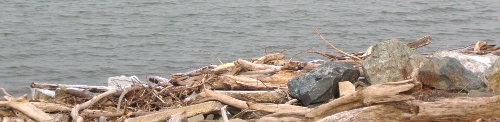
We entered the beach at the northern most Ocracoke ramp and turned towards the north point. The island has grown since last spring with this area covering more territory. The texture was the hard damp sand we had seen on the southern end on Saturday. We scoped it out then turned south towards a wreck believed to be about ½ mile north of the Ocracoke Pony Pens. At the GPS-designated point, we noted nothing indicative of a shipwreck although we were adjacent to an area of dunes that had been replenished since Irene. The beach was relatively narrow here and we found we were very very close to the highway as well.

We turned back to the ramp and headed into the town of Ocracoke for quick trip to the welcome center gift shop and then off to Ramp 72 to try once again for the shipwreck noted to be there. Since today’s weather was better, we were able (willing) to walk across the dunes to search. We never made it to the west side shore of the point but sighted something n the marshgrass but we weren’t prepared to walk/wade to get close up.

There was more loose sand making small dunes and large ripples on this section of the beach so that staying back from the water resembled a roller coaster.

We turned north on the beach to check for more shipwrecks and condition of the shore. There were a few fishermen and others enjoying the beach. We even saw a couple of folks trying to surf but the waves weren’t really cooperating.


As we passed Ramp 67, there was no indication that there was not another ramp ahead but we eventually reached the end of the open to vehicles part of the beach and turned around to leave at Ramp 67.

There was one more shipwreck indicated on Ocracoke Island just north of the pony pens so we stopped at the crossover there. Several of the ponies were out in the pen so we walked over and took a few pictures. We also learned a few things that made the Ocracoke ponies unique including two fewer vertebrae than other horses, fewer ribs and denser bones.
We then headed up the beach on foot in search of one more but it eluded us as well. Total for our long weekend had us finding two confirmed sightings on Hatteras Island and one maybe on Ocracoke. It later occurred to us that several previous trips had a goal which we had not met because of ferry schedules or darkness or hunger but this time, without trying, we had managed to cover ALL of the drivable ocean side of Ocracoke Island!

We caught the ferry back to Hatteras. We had ridden the ferry 4 times this weekend and not ridden the same one twice. This time we were onboard the Chicamacomico which was pictured on the postcard back to the folks at home.

One place we had missed in our travels that is always part of our trip was a ride out to the point and past the Cape Hatteras Light. The approach by the campground and where Ramps 43 and 44 meet the pavement was underwater as we had learned before arriving. It’s on National Park Service property but for some reason doesn’t drain and hasn’t for a while. One can’t help but think it contributes to the mosquito population that plagued the island after Hurricane Irene. This beach had obviously had more traffic than any other beach we had been to this weekend. We drove out to the point and around but would have needed to drive across water if we hadn’t turned back. We made our way back to the pavement and off to dinner.

Dinner was at Rusty’s, one of our favorites and tonight didn’t disappoint. Broiled bay scallops for Betty and a Caribbean-spiced snapper for Keith followed by New York style cheesecake (not too dry) and with a light glaze on the plate of raspberry and mango gels with coffee for a near-perfect finish for the meal and our weekend.

We aired up the tires on the truck and made fresh coffee to fill the thermos bottles for the trip home and we were set after returning to shower and off to bed. We head home on Monday.

Halloween at the Beach: Part 3 Visiting the Moonscape

Saturday morning we headed over to the Red Drum for a headlight and a tire gage as I discovered the digital gage in the console had a dead battery. While there, I met Mr. John Couch of OBPA and internet fame. He is president of the OBPA, one of the organizations fighting to maintain access for pedestrians, sportsmen and other folks who use the Cape Hatteras National Seashore Recreation Area for recreation. In conversations with Rob Schonk, the principal in the Robert and Jean Schonk Foundation, Rob recommended that I make the time to make Mr. Couch’s acquaintance. After installing the new headlight, we headed to Frisco and Wave Hopper to gather Bruce, Jeremy and Rosemary for some time on the beach.

We headed over to Ocracoke in spite of the weather forecast. The day was to be windy and the forecast was accurate on that account. The predicted rain held off however. The wind was strong off the sound and made the landing of the ferry somewhat exciting with the captain using the pilings to bounce his way into the slip.

We headed to Howard’s Pub, one of our favorite lunch spots. Bruce had the chowder, Betty had grilled shrimp, Keith had marinated tuna steak, Jeremy had the tuna steak sandwich and Rosemary had the grilled tuna salad. The food was excellent as usual. After lunch, we headed into town to do a little shopping and found our way to Mermaid’s Folly and Craftsmen Paradise on Howard Street. It was a successful trip. Everyone found something to their liking and connected on some items which we couldn’t find.

Next we headed for the beach, more particularly the South Point. It was a surreal sort of moonscape actually having been flattened with only the occasional small dune still there. The wet sand was pretty hard requiring the four wheel drive rarely. Looking over the inlet to Portsmouth Island you could see shafts of sunlight coming through.

The loose sand was blowing across the hard wet sand making interesting patterns and beginning to form ridges and small dunes.

As we headed back towards the ramp off the beach, we noticed a pair in a pickup that seemed to be making more downward progress than forward. It was a pair of fisherman whose four wheel drive was malfunctioning. After lending them a shovel which wasn’t enough to get them out, a tug on our towstrap got them back over to the hard surface and on their way. As we got to the ramp, Bruce saw Jeremy and Rosemary headed up the ramp and began to follow them off the beach and back towards the ferry on Highway 12. Keith and Betty lost sight of him but decided that was the direction he was headed. Of course, Keith and Betty also had Jeremy and Rosemary in the rearview mirror. After failing to see Bruce, we gave him a call to inform him that he was lost as we did not know where he was. It turns out that Bruce was following a different dark-colored F150. But as it was getting time to head back to Hatteras Island, it worked out for the best.

We commented earlier about the difficulties getting the ferry into the dock but the weather had worsened and the docking of the ferry to take us back was quite a spectacle. One gets torn between fascination with the difficulty in putting the ferry where it belongs and admiration to the captain for doing so in spite of the conditions. At one point, the ferry was perpendicular to the slip and hard against all three pilings and the engines roaring at near full throttle with little effect. Eventually the ferry came into the slip and we pulled out only a few minutes after our scheduled 5:30 departure. We found out Sunday that the ferry had stopped running with the 6:30 departure Saturday evening. Had we stayed on Ocracoke for dinner, we may have stayed the night or whenever the schedule resumed.

The five of us had dinner at Diamond Shoals Restaurant in Buxton and bade our farewells to our friends. Across the street to our hotel and the nightly computer checks, tv, shower and bed.

Halloween at the Beach: Part 2 Hunting for Shipwrecks and the Aftermath of Irene


Friday, Betty and Keith had breakfast at the Hatteras Island Inn (formerly the Comfort Inn) and then set about our day which included a stop at the Really, Really Free Market in Salvo. Friends at home had filled two storage containers with needed and requested items. We had a piece of carpet and some clothing to contribute as well. The carpet remnant, we were told, was being set aside for a local 80 year old woman who had been through this ordeal without insurance and was putting things at home back together.

Betty and Keith had set out to locate some of the many shipwrecks for which we had found GPS coordinates. After finding one last spring, that seemed like it would make for fun.

As we headed north from Salvo, we took a bit more time to check off the main highway for remaining damage. The KOA campground was open for business. They had cleared the portion near the ocean and were working their way back toward the highway. The camping cabins (basically shell sheds with built-in bunk beds) looked to be basically undamaged but had been floated off their footings. The ones that appeared undamaged had water damage to worry about but were structurally sound. The bathhouses all had siding taken away to allow drying out.

The Chicomacomico Lifesaving Station was closed. Reports on the interwebs had indicated there was much cleanup to be done as well as resetting on footers.

We drove again over the new bridge and stopped to get some pictures by walking through the dune line to the beach and coming around. The speed with which the current moved through the inlet was impressive. I’ve tried to get some pictures but am not sure they really convey the current. It makes one wonder how much more the inlet will open in the unfortified sections with time. We stopped at the Coquina Beach day use area to see if we could find the remains of the shipwreck there. Like most of the wrecks, changing sand profiles will expose or cover from season to season. We didn’t find it this time.

Next we headed further north to Nags Head for lunch. Having heard so much about Sam and Omie’s across from the new pier. They were busy and we had about a 20 minute wait. The food was good, the clientele and food were local as well. Betty had the mushroom and crab soup and an order of onion rings. Keith had the scallop cake Sam-wich, think crab cakes make with scallop bits. If we lived nearby, they would be on our regular rotation for lunch but don’t qualify for driving 50 miles just to eat there. Good and repeatable but not a special treat to work for. When we came out, it had started to rain lightly.

We turned south again to the Bodie Island Lighthouse. Bodie Island Light was/is under a major renovation. When the funding ran out, they took down the scaffolding until more funding allows them to continue the work. The light is removed from the structure for now and will be replaced when the renovations resume.

Next stop is the Oregon Inlet fishing pier. During Irene, all the fishing boats left for less exposed locations. The flooding damaged the piers which delayed the reopening and return of the fleet. Now with new piers installed, life appears to be near normal again.

Before leaving home, we had entered the GPS coordinates for several known shipwrecks which are sometimes visible from the beach. As we passed Salvo, we noted three showed on our track as being nearby. We entered the beach access ramp 23. The GPS coordinates revealed three near to the ramp. The first was just as you entered the beach. According to the coordinates, we were literally right on top of it. If the coordinates were correct, this particular wreck wasn’t visible at this time but there were two others in the vicinity. As we drove north on the beach, we saw what looked like it could be a buoy that had blown up on the beach similar to one we had seen on a past trip to Carova. As we got closer, we realized that we had found the remains of a sidewheeler that had wrecked on the beach in 1862. It was just offshore, inside the breakers. The pieces we saw were iron and probably the remains of part of the propulsion machinery. We were 1 for 4.

We moved further down the island and decided that timing was such we could probably hit the shopping area at the ferry landing and move on to another wreck site that we had seen last spring. The remains of an unidentified ship, probably a schooner, can be found at the end of Flambeau Road in Hatteras Village. We parked and walked over the low dune line on a boardwalk. Considerably more of the wreck was visible than had been in either of our spring visits. We then joined Jeremy and Rosemary, Bruce, and Janet for dinner at the rented house, Wave Hopper. As we pulled in the carport, we noticed a nail lying on the concrete. As we looked around, we noticed a few more, and then a few more. By the time we had arrived at the top floor, we had picked up easily two dozen or more ranging from roofing nails to siding nails to 10 penny galvanized nails. Apparently a roofer had been doing some patchwork after the hurricane and been less than meticulous about picking up loose nails. To the best of our knowledge, no one’s tires helped us pick them up. Our delicious dinner was a cooperative effort on their part and included salad, red potatoes and individual shrimp and scallop casseroles. Accompanying our dinner was a Chilean grape merlot which had been bottled by Jeremy. For dessert, Rosemary had made a sweet potato pie. We enjoyed our meal and some fine company afterwards.

We headed for the hotel around 9:30. It’s about a 6 mile drive and midway we met a Dare County Sheriff’s Deputy coming the other way. Just as we pull even with him, he flashes the blue lights and pulls a u-turn after we pass. Assuming he is responding to an emergency call, we slow down and move over to let him pass but he just stays right behind us with the blues flashing. We pull over and turn on the interior lights while waiting for him to walk up and introduce himself and state his business. It turns out we have blown a headlight and he is concerned for our safety since the local deer population has been rather active. In fact, we had observed a pack of raccoons the previous night.

After asking where we were going and where we had been, he advises us of an auto parts store near our hotel and asks if I’d had anything to drink. I honestly replied that I’d had a glass of wine with dinner several hours earlier. He asks for my license and goes back to his car. When he returns, he has the mobile breathalyzer and asks for a sample. He goes back to the car and returns a few minutes later and informs me that I’m not impaired. While a number of things pass through my mind, the only thing out of my mouth (thankfully the filter was working) was thank you and have a good night.

We head back to the hotel, check email, and get ready for bed.

Halloween at the Beach: Part 1

We got underway around 10:00 Thursday morning. This trip is somewhat traditional for us as we have headed to the beach on Halloween weekend for several years. The trip has had several labels, including the S10 trip, CORE and Friends and now Keith and Friends as the attendee list varies from year to year although the numbers have dwindled. I think this may be among our lowest turnout for the October trip as there are six of us: Betty and Keith, Jeremy and Rosemary, Bruce and Janet. But the numbers aren’t as important as the people themselves and the trip itself.

Because of the devastation wreaked on the northern end of Hatteras Island by Hurricane Irene, the trip itself had been in doubt but NC DOT managed to get the temporary bridge across New New Inlet, the break in Pea Island which had cut off access from the islands to go north on Route 12. The only access for some time was via an emergency ferry for residents only, then later access was available via a 2.5 hour ferry ride from Swan Quarter to Ocracoke Island and then the 45 minute ferry from Ocracoke Island to Hatteras Village at the lower end of Hatteras Island. The temporary bridge opened about two weeks ago and all access has been restored to the Islands. You can still see significant damage to the northern villages of Rodanthe, Waves and Salvo. Some of the best coverage and photographs of the current state and the damages can be seen at www.IslandFreePress.org.

We stopped at the Aunt Sarah’s pancake house at Exit 104 which has become a staple for us. We arrived at Buxton about 6:30 (a little later than we had planned) and gave Janet and Bruce a call after we got checked in. They turned out to be a little bit behind us and we made arrangements to meet at the Captain’s Table for dinner. Jeremy and Rosemary also came up from Frisco (they had arrived earlier) and joined us. It was good to do some catching up as well as enjoy the excellent food and service. After dinner, we decided to join them at Wave Hopper (the house they rented) for some more conversation and Bruce shared some great music with us. Jeremy, especially since retiring from USN after 21 years earlier this month, had been making some wine which he shared. Excellent! Bruce had also stopped in Raleigh and delivered a couple of internet purchases I was making. We headed back to the motel with plans to get together Friday for dinner at the house.