November 30 and December 1: Beaufort and Port Royal SC and the trip home

We had breakfast at the Atlanta Bread Company one more time before leaving Savannah, checked out of the hotel and drove to Beaufort. We had reservations at the Hilton Garden Inn in the central district and quickly learned one of the facts of life about living in and around Beaufort.

Our reservation was for 3:00 and we arrived around 1:00. Due to the proximity of the Parris Island USMC Recruit Training Depot (boot camp), hotel rooms are in short supply on Wednesday and Thursday nights as families are in town for Family Days and weekly graduation ceremonies. Graduation takes place 38 weeks of each year. Fridays are heavy checkout days and rooms are rarely available early. In making the reservations, we learned that room rates are significantly higher on those nights.

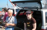
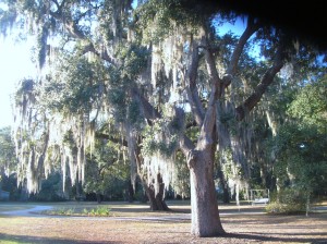
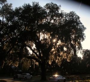
We met up with Bruce and then followed him to his friend’s, Eddie and Donna’s, place on Lady’s Island. We went beyond the end of the paved roads and turned onto the dirt road leading back to their place. Turning onto the dirt road was interesting as the road went to either side of two large oak trees. At least in our mind, it appeared as if the dirt road was divided and had a landscaped median! (We later found out that the road had been re-routed/doubled as there was insufficient room to allow fire trucks to make the turn should they ever be necessary.)

We had planned to spend some time learning about housing options from Eddie, a custom builder as well as meeting Donna and their horses. Two were shires (draught) horses and one was a thoroughbred. The shires towered over all of us. Eddie and Donna have a few (5?) acres at the end of the dirt road with all the necessary fixtures to support the horses.

They also have a rather unique residence. Its a large metal building with horse stables on one side with doorways to a paddock. On the other side is storage for Eddie’s construction business and equipment with large enough doors to drive the loaded trucks in and through. In the center, raised above the main floor is their living quarters. Donna told us they originally constructed the living quarters so they could hire someone to tend the horses and watch the property but decided to move in themselves after it was finished.

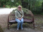
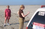
Eddie was detained with a builders meeting so we got to spend quite a bit of time visiting with Donna who gave us a tour and shared some insider information about living in the area. She also walked us over to meet one of the neighbors, Jason, who is a caterer and has an interest in old military vehicles. We spent some time with him ogling HUGE trucks and listening to them run. Jason has also rigged a zip line across his property for entertainment. Jason’s family also provides temporary foster care for dogs who are between stable home situations. The assortment of dogs ran from a big lab all the way down to a small dachshund who welcomed the additional attention once they decided we belonged there. Remember, dogs are great judges of character so we take their endorsement well.

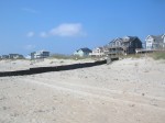
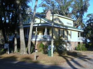
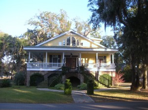
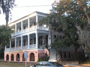
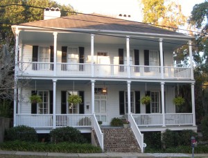
We enjoyed our visit tremendously and left to go look around the area a bit. Bruce showed us a development called Newpoint tucked off the main road. Newpoint is a residential community built with older, low country styles (big porches, close to the street) and is quite an attractive neighborhood with an older flavor. Nicely done with a few houses for sale and a couple of lots available for building but not in our price range. The neighborhood is definitely walkable with an ice cream cafe at the entrance but the car would be needed for most any other errand.

We grabbed lunch at The Upper Crust at the Shoppes at Hamilton Village. Eddie met us briefly as we arrived on his way to another commitment. He was able to answer some general questions for us as it had been a very long time since we had paid attention to details of modern construction methods. First impressions count and he seemed like someone we could potentially work with if we decide to build in that area.

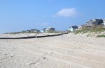
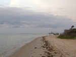
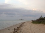
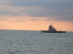
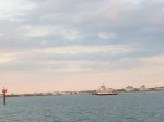
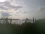
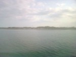
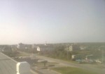
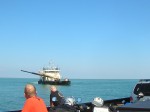
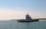
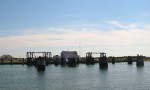
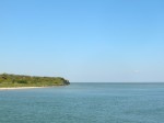
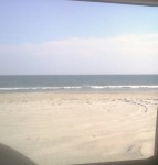
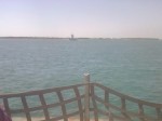
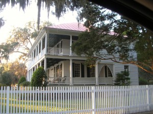
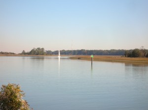
We next went over to look around in Port Royal. Port Royal is actually an older (30-50 years? mostly) town with the same sort of feel as Newpoint. Houses are more cottage sized. Commercial operations are situated along the waterfront with a big sign announcing a coming condo complex.

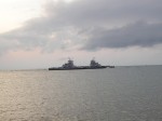
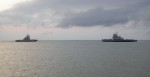
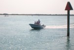
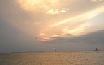
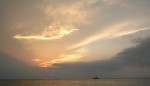
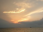
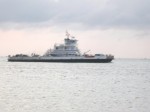
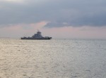
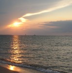
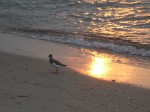
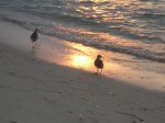
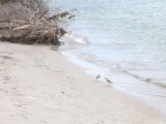
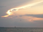
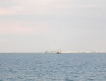
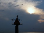
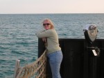
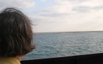
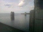
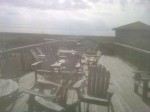
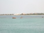
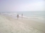
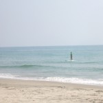
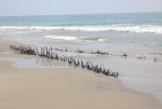
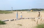
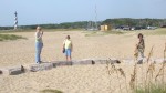
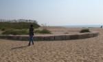
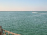
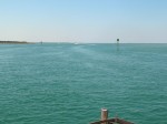
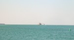
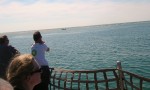
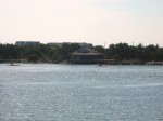
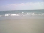
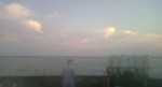
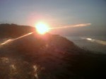
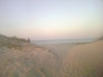
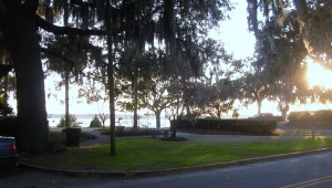
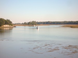
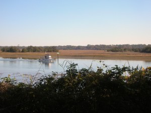
Port Royal is a scenic little town across the water from the Parris Island facility. We enjoyed sightseeing there. We also got to watch the sunset over some of the fishing fleet.

DSCN7755 DSCN7756 DSCN7758
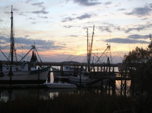
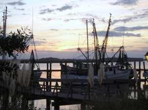
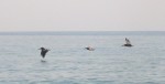
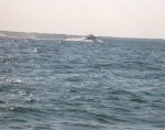
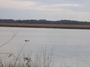
As we watched the sunset, we also saw a couple of porpoises rolling in the water.

After watching the sunset, we returned Bruce to stay at Eddie and Donna’s and then returned to the Hilton Garden for the night. Tried to get some shots of the nearly full moon through the trees but they didn’t turn out.

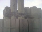
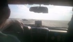
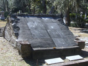
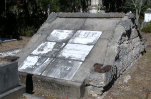
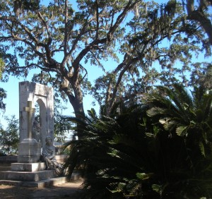
We woke Saturday morning and began the drive back home. The most direct route home took us through Yemassee to I95. We passed by the Old Sheldon Church ruins but didn’t take time to stop this trip but its on the list for a future trip.

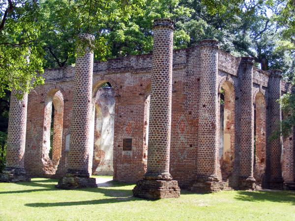
Old Sheldon Church ruins. Image courtesy of Google.

The remainder of our ride home was uneventful. As usual, we enjoyed sleeping in our own bed again.

November 29: Beaufort SC

After checking out Garden City and Pooler GA, we headed over to Beaufort SC. Its about an hour drive. We had tried to get reservations at the Hilton Garden Inn in the central district and quickly learned one of the facts of life about living in and around Beaufort. Due to the proximity of the Parris Island USMC Recruit Training Depot (boot camp), hotel rooms are in short supply on Wednesday and Thursday nights as families are in town for Family Days and weekly graduation ceremonies. Graduation takes place 38 weeks of each year. Fridays are heavy checkout days and rooms are rarely available early. In making the reservations, we learned that room rates are significantly higher on those nights.

Betty had found an excellent little guide book to help with our familiarization with the Beaufort area. We went to the park at Pigeon Point and then headed into the historic area.

DSCN7742

DSCN7741

DSCN7743

DSCN7744

DSCN7745

DSCN7746

In addition to many homes, we found this historic African Baptist Church and the light seemed just right to grab a picture or two. DSCN7747

DSCN7748

DSCN7751

Milton Maxey House
Craven Street – ca. 1813
Built around 1813 on original tabby foundation dating 1743, the Maxey House is known as the “Secession House” after the first meeting in favor of secession was held here.

DSCN7752

William Fickling House School masters house now rectory St. Helena

DSCN7753

DSCN7754

Charles Edward Leverett House

Following our self-guided tour of the historic district, we decided to check out shopping options in the local area while we awaited the arrival of our friend, Bruce. We went to the Cross Creek Shopping Plaza and walked through a couple of stores, including Belk and JCPenney. We skipped the Walmart. While we were walking about, Bruce called to let us know he had arrived.

When we got together, Bruce contacted his friends Eddie and Donna to see if they would be able to join us but they were unable to meet us but we made plans to get together on Friday.

Dinner was on Lady’s Island at a place called . Barbara Jeans, a local chain with locations in from St. Simons to Charleston. Bruce had been there before and knew what he was getting. Bruce had the pot roast, Betty had the grilled Catfish and Keith had the crabcakes. All were delicious and the desserts sounded yummy as well but our appetites were well satisfied after dinner.

We parted ways with Betty and Keith returning to Savannah and Bruce headed for Yemassee with plans to meet again the next day.

November 26: Bonaventure Cemetery, Savannah and a “Made in the USA” find

The cover photo for the book (and later movie) Midnight in the Garden of Good and Evil featured a sculpture known as the Bird Girl and located in Bonaventure Cemetery near Savannah in Thunderbolt GA. As it turns out, the sculpture’s role in the book was primarily only a symbol of the cemetery but it stirred up enough tourist traffic in the cemetery to warrant its movement to the Telfair Museum of Art in Savannah.

The Bonaventure Cemetery is located next to a creek leading from the Savannah River to the Atlantic Ocean via Wassaw Sound. Its setting includes a waterfront view of the Intracoastal Waterway and massive oak trees dripping Spanish moss. We parked near the water and were greeted by a fisherman who cheerfully asked where we were from. Whether the out of state plates on the car or the likelihood that anyone in that area was a tourist clued him in is anyone’s guess.

DSCN7622DSCN7659DSCN7661

DSCN7619

Is this a china berry tree?

DSCN7623DSCN7624

DSCN7626

Among the more famous persons buried in Bonaventure is Johnny Mercer

DSCN7627

DSCN7639

Many of the graves have a cross built into the vault top. It is believed that at least part of the reason for this is to prevent the grave from being used for voo doo rituals.

DSCN7628DSCN7625DSCN7630DSCN7631DSCN7632DSCN7633DSCN7634DSCN7635DSCN7636DSCN7637DSCN7638DSCN7640DSCN7641DSCN7642DSCN7643DSCN7644DSCN7645DSCN7646DSCN7647DSCN7648DSCN7649DSCN7652DSCN7654DSCN7658DSCN7660DSCN7664DSCN7665DSCN7666DSCN7667
DSCN7668After our walking tour through the cemetery, we returned to the HGI and had lunch at Carey Hilliard’s. Carey Hilliard’s had been a staple for us when we lived in Summerville SC and they still make some mighty fine onion rings and sweet tea. I’ve seen some online reviews that weren’t overly impressed but we cleaned our plates and will be back sometime somewhere.

Our next stop was a short (well, we expected it to be shorter than it was) trip to Walthourville GA to find Lawn Chairs USA.

Trying to find their store/factory was a bit of trick however. There are no street numbers on the building. There is no sign of any kind on the building. Luckily, I had looked it up on Google Maps and found the picture below which helped us identify it.

LawnChairUSA manufactures the style of folding lawn chair that our parents used. Most amazingly is that the frame and webbing is made right here in their factory in southeast Georgia. Their prices are similar to the ones you may find in KMart (only in the summer) made in China. If you’ve sat in these chairs, you already know they are more comfortable than the umbrella type chairs you commonly see. Lawn Chair USA. sells chairs and webbing but shipping is a little high in comparison to the price of the chairs. You can also visit them directly in Walthourville GA and save the cost of shipping. We managed to fill the car trunk and then headed northeast back towards Savannah through several smaller towns.

Dinner tonight was once again at the Atlanta Bread Company. Betty had the Roasted Organic Butternut Squash soup. Keith opted for the Turkey Berry Brie on Asiago Foccaccia served with made-from-scratch Stuffing. Both were excellent choices.

November 25: Sometimes, you just gotta get away

It had been a long stretch. Work was busy and vacation time was tight. Some upcoming life changes showed over the horizon but not close enough. We had had it. We’ve got to get out of town and do something different.

Now that we’ve agreed on that, where do we go next? San Diego has been on the list for awhile but you’ve got to make reservations and flights are generally crowded and expensive this close to the holidays. Friends in Texas and along the east coast were due a visit and had been promised one for a while. How about Savannah? We liked it there and wanted to go back, its within driving distance and it should be warmer. Share Thanksgiving and the day after enjoying family and some of the rituals and then load up and leave town.

We pulled into Savannah on Saturday evening after an uneventful ride down I95 and made ourselves at home in the Hilton Garden Inn for several days. There was a wedding reception in the ground floor banquet room and the parking lot was crowded but that didn’t deter us.

Sunday dawned bright and clear. After breakfast at the local Atlanta Bread Co., we headed for Tybee Island. In our previous visit, we had briefly visited just the lighthouse area but wanted to see the rest of the island this time.

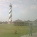
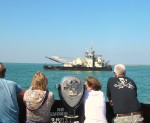
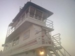
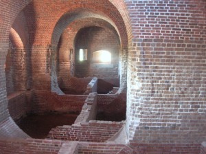
As we headed out the causeway towards Tybee, we noticed a sign to Ft. Pulaski Nattional Monument and decided to check it out. Someone’s senior card allowed us to enter at no additional charge.

After entering the gate, we drove across a bridge over the old South channel into Savannah and wound our way to the visitors center and the parking lot.

Like most of the forts from this era, the low walls surrounded a modified pentagon shape enclosure. Unlike the others we had seen, Ft. Pulaski was surrounded by a moat, complete with drawbridges. The Park Ranger giving our tour explained that the area outside the fort but within the moat (The Demilune) had never been part of the enclosed fort but had been used for kitchens and in later years for storage of ammunition.

The inner walls showed the standard archways leading to the various rooms of the fort. The picture below replicates a set of barriers put up to help protect the inner rooms from ordnance landing inside the fort walls. The angled wood helped to move the ordnance from the structure and storage areas as well as giving additional strength to the walls.

One area showed a partial excavation so you could see the brick structure supporting the wooden floors between the walls. In its life, the fort had been used to garrison troops for the Civil War as well.

DSCN7534This picture also shows the mortar used to fasten the bricks.

Tuck-pointing and repairing old mortar joints remains one of the team’s major focuses inside Fort Pulaski. In the 1930s the Civilian Conservation Corps (CCC) repaired crumbling mortar joints inside the fort using the latest technology, Portland cement, without knowing its damaging effects. However, Portland cement does not allow lime mortar to absorb and release moisture. Thus, the lime mortar is reduced to powder. The weakening mortar leads to cracking and flaking of historic bricks which threatens the overall integrity of the fort.

With more than 25 million bricks, the challenge of preservation and restoration involves removing the Portland cement and replacing it with more traditional lime mortar and natural cements.

DSCN7524Adjacent to Ft. Pulaski is the lighthouse on Cockspur Island. Savannah history includes multiple references to the Waving Girl, who was known to all the sailors entering the Port of Savannah (but not for reasons that first come to mind of a girl and sailors!)

View from the wall

Old style drawbridge. The chain works for raising and lowering

View of Cockspur Island lighthouse from Old US 80 and the Lazaretto Creek Marina

Egret

After leaving Ft. Pulaski, we continued on to Tybee Island. As mentioned above, we had visited here before but stayed up in the vicinity of the lighthouse at the northern end. This time we headed to the extreme southern end of the island and parked the car to walk on the beach.

Manmade concrete jetty structure to protect the beach.

The beach here is very, very flat/gently sloping and has a low duneline as well. It would seem to the untrained mind (like mine) to be very vulnerable to wave action, particularly during storms. Along the beach in several places are jetties, a combination of the concrete structures seen above and huge rocks.

“Time to eat”. So we did!

Under the fishing pier

There is a concrete fishing pier and pavilion with vendors in the summer and its available for rent for special occasions. On this day it was pretty much deserted except for a few of us tourists.

We left via the boardwalk where there were condos/apartments and several businesses including a restaurant/pub with a a big sign saying “time to eat”. We ducked in for coffee and a snack (really good guacamole and empanadas) before making our way back to the car and the ride back to Savannah. They also provided paper-covered tables and crayons to ease the wait.

Sea-themed Christmas tree on the boardwalk

By the time we got back to Savannah, it was well on its way to being dark. We headed down towards River St. Parking can be a little tricky but we headed to the public garage under Ellis Square. When we had last visited Savannah, there was a huge (and not attractive) aboveground garage but it was being torn down to be replaced by this underground garage and a rebuilt Ellis Square at street level complete with fountain. There are a couple of daytime pictures in the next couple of postings.

Our dual mission for the evening included dinner and securing something to bring home for Ryan and for the neighbor who watches the house and mail for us. The latter would be solved by a trip to Savannah’s Candy Kitchen for pralines! (If you don’t know what a praline is, you have my sympathy…let’s just say they could be the reason why God made pecans…or maybe pecan pie was the reason.) At any rate, they are a sinful delight made primarily of sugar and pecans. These are some of the best commercially available ones I’ve had. You can order them online at Savannah Candy Company. Miss Edith’s were better to my way of thinking but she’s not around to make them anymore so these are a great substitute

Dinner was also a reprise location from a previous trip, the Riverhouse Restaurant. The plan was to save enough room for dessert but it didn’t work out that way. Their regular dinner menu is tempting and Betty ordered the Scallops Patricia but I was intrigued by the special salmon with an orange glaze. I just had to see how the orange went with the salmon. They were both delicious as were the pumpkin biscuits.  When the waitress returned to ask about dessert, there wasn’t enough room.

Sated, we made our way out to walk along the riverfront. There was a huge freighter going by but the lighting didn’t work out for pictures. The stop to try was enough time for the panhandler to corner us with his palmetto frond rose and his pitch for a donation. We finally gave in and then went on out way back to the car. I couldn’t find the ticket to pay (but didn manage to find one from our last trip). The attendant asked when we had come in and based our charge on that rather than the daily maximum which was appreciated.

We cruised back towards the HGI for the night. There was something going on in the banquet rooms but not as well-attended as the wedding reception from the night before.

Off to bed in preparation for tomorrow’s travels.

Columbus Day: Starting off Ugly and Staying out of the rain

Monday, October 8:

The federal recognition of Christopher Columbus’ landing in the Caribbean occurs on a Monday making for a 3 day weekend for those whose work recognizes this as a holiday. We were lucky that both Ryan’s and Keith’s employers considered it a day off.

We cleared the room and checked out. Had a few more things we wanted to see and we needed to get home. First stop was the Orange Blossom Cafe  to procure a legendary Apple Ugly. Sweets for breakfast wasn’t really going to be enough so next stop was Diamond Shoals Restaurant  for a real breakfast involving eggs and bacon and we were headed north.

.Today’s plans include a trip up to Carova at the northern end of the barrier islands to hopefully find the wild horses. Betty and Keith’s last trip had been particularly productive in that regard and we hoped to share with Ryan.

The ride up Hatteras Island was more scenic than it had been coming in (since it was daylight and sunny!). We got to see the parasails in Canadian Hole and stopped to take a look at the renovations at Bodie Island Light. After we got to Nags Head, we shifted over to the beach road to find some recognizable landmarks from Ryan’s last trip (1993?). We had stayed at the Sea Oatel then (long gone) and the Holiday Inn Express (still there) and had really enjoyed the Keeper’s Galley restaurant (also gone, now a Sushi place).

Somewhere along the way, it started to rain. When we got to Corolla, we took a short hop over to the beach access on Albacore St. to visit another beached shipwreck we had discovered on a previous trip. We drove down a little ways to see what we’d come to see and then proceeded to go back the way we came.

A drift had built up on the Albacore Street ramp which had been no big deal on the way down to the beach but in going up the ramp, we found ourselves high-centered and blocking the ramp. We tried several things to get the truck loose and were in the process of digging as it appeared our only hope was to eliminate the sand drift that had high centered us. The winch didn’t help as it wasn’t functioning correctly and there was nothing to anchor to. (Note to self: Investigate pull pal.)

While we were digging, we saw a white pickup top the ramp and give us a short blast on the siren. In it were two young men who walked over and took a look and then told us they were headed down to the next ramp and would be back in a few to help get us out.

I continued digging while they circled around and came down the beach from another ramp. We hooked my tow strap to their truck and a gentle pull had us moving again.

Recognizing the insignia on the truck as being Corolla Ocean Rescue  I asked if there was a charge for the tow or even a suggested donation which they declined. Told me they were just doing their job of keeping the ramp clear for emergency use. Not quite sure I totally buy that but I sure appreciated their appearance and their help. Ryan noted the wardrobe of sweatsuits and bare feet.

Maybe they figured they’d have to haul this old guy to the hospital (or worse) if they let him keep digging. In any event, in my mind this is worthy of a shout out and much appreciated.

After we got down on the beach again, we headed north to the next ramp (why hadn’t I thought of that before getting stuck?) and headed back into Corolla for a restroom, place to change my wet jeans and maybe some lunch as the hour was advancing. We found it in the form of Dunkin Donuts.

We then headed on in the rain seeking the wild horses. We got a look at the Currituck Light as we drove by.

We rode all the way up to the VA/NC line and saw none. OK, now what? Sometimes you see a few in the vicinity of the Post Office and Fire Department so we head over that way. More rain and no horses. Oh well, we tried. Time to throw in the towel and head for home.

As we pull past the town hall building, Betty spies something over there in the woods. We back up and sure enough, there is ONE horse huddled under a tree to stay out of the rain. At least someone has sense to come in out of the rain. That was not someone inside the truck. We snap a couple of wet and blurry pics and head towards home. We do make a quick stop for a couple of souvenirs and for gas and we’re off. By the time we got to the Border Station in Moyock, it was pouring rain which made it fun to get in and out and to refill the tires to regular pressure. I will commend their coin-op air for tires as being one of the best I’ve run into, sufficient pressure to be effective and it runs long enough to get to all four tires. Border Station is located on the VA/NC line with parts of the store in one state and part in the other. Some things are treated differently tax wise in one state over the other so the gas pumps are in VA and the cigarettes and fast food are in NC.

Much less traffic and a much quicker trip home than it had been down. We stopped at a Waffle House in Newport News for dinner. Wish we had been earlier to allow for some sightseeing there or to hit up Pitts BBQ in Williamsburg but it didn’t work out that way. We made it home around 11:00. We didn’t get quite as much rest and relaxation as we usually do on our OBX runs but it was still an enjoyable trip where we got to see our favorite beach and some great friends.

Next time, we’ll plan a little longer stay.

Catching a few sights

Sunday, October 7: Sunday morning found us meeting at the Diamond Shoals for breakfast and some entertaining conversations. After that, Bruce was off to other tasks for the day and the others headed in the general direction of Ocracoke with an intermediate stop in Hatteras Village.

No trip to the Outer Banks would be complete without a visit to the famous Hatteras Light. We visited the old lighthouse site and the circle of stones marking its location. From there, it was easy to see just how far they had to move the gigantic structure. We also went up to the current location and the ladies cruised the gift shop and the keeper’s house.

Betty and Keith have come to depend upon the Flambeau Rd.shipwreck to be our “go to” example of a Graveyard of the Atlantic visual aid and it didn’t disappoint. While not as exposed as it had been during our last visit, there was a sufficient exposure to satisfy. Nearby, we found a lane prepared for an unhatched sea turtle nest.

From there, another peaceful ride on the ferry not unlike the day before followed by lunch at Howard’s Pub in Ocracoke. In our multiple crossings, Sarah pointed out that the ferries now each wore the colors of  one of the colleges or universities in the NC State system.

We made it to Sarah’s ferry to the mainland with time to spare for a bit more conversation and promises to get back together soon.

On our way back north, we stopped and explored the beach around the Hatteras landing including a trip down the Pole Rd to spend a little time watching the ferries and other traffic in the channel from the sound side. The shifts in the channel brought the marine traffic very close to the shore there and allowed for some fun pictures.

We left the Pole Rd and headed back to Avon where dinner was at Dirty Dick’s. Although we had tried, we didn’t manage to get Ryan tired of shrimp this trip. Hopefully we’ll get another chance in the future.

Back to our room at the Cape Pines for showers and an early bedtime after another great day on the Banks.

“Quick” Trip to Hatteras with Family and Friends

Friday, Oct. 5 Worked all day but kept going because I knew the beach was beckoning. We pulled away from Ryan’s place on schedule around 6:00. Destination: Three days in Cape Hatteras National Seashore Recreation Area. We’d made reservations at the Cape Pines Motel  which had been recommended for years from folks staying there but was somehow never our chosen landing base camp. During the shoulder season, their office closes at 10:00 pm so we knew we’d need to call ahead to have them leave the light on for us.

We figured a slow trip but had no idea just how much traffic there could be on 95 on the Friday evening of a three day (for many) weekend. We’d managed to avoid that particular trap with planning before. About 9:00 (3 hours into the trip), we called Cape Pines from Stafford and told them we expected to get there around 2:00. They left us instructions for getting in and we were to come down Saturday morning and take care of the registration details. It turned out to be about 3:30. One of our longest times for that trip. But it was worth it!

We hoped to meet Ryan’s friend and former roommate Sarah in Ocracoke over the weekend and also our friend Bruce who would be staying at the Cape Pines.

Saturday, Oct. 6 : The alarm went off promptly at 8:00. Darn it! Using the cell phone alarm made it an unusual noise and not an automatic reach out and slap it so we were up.

It was a beautiful morning despite the rapidity with which it arrived. We got all checked in and then met Bruce over at Diamond Shoals for breakfast and headed towards Ocracoke to meet Sarah.

We had heard there was a bit of a backup on the Hatteras to Ocracoke ferry because of shoaling and the need to run smaller ferries at slower speeds. During the day, departures are still every 30 minutes so the wait wasn’t that long.  There were a couple of large vehicles (a motorhome towing a vehicle and a gasoline tanker) so we feared being delayed but turned out not to be a problem as the tanker was going later.

The ferry was crowded and we slowed in a couple of spots to clear the dredge and the returning ferry in the narrow channel.  It was a new experience for Ryan and we enjoyed the time in the sun. After disembarking at the northern end of Ocracoke, we headed to the south end of the island through the village to meet Sarah where the big ferry had dropped her as she left her car on the mainland.

She reported the ride was pleasant but not well-suited for reading as she had just too much motion going on to be comfortable. We left the trucks and started walking the street. Our obligatory stop at Mermaid’s Folly  was fruitful with a new skirt joining us. Bruce and Keith left the ladies to move the trucks from the one hour parking zone.  We rejoined the ladies on Howard Street at the Village Craftsmen.  Managed to spot an old graveyard inside someone’s yard.  Also managed to spy a 1940 Buick looking all spiffy and well-preserved. Somehow, the ladies had managed to avoid seeing the dead snake in the road which was a good thing.

It had been a while since breakfast and lunch was in order. We decided to try Dajio  which had been recommended but never tried. We had been missing a treat. Various sandwiches and the bisque were delectable and just the right amount of food for our hungry group. For reference, the ladies room is apparently interesting as well. We spotted numerous rental golf carts and scooters and discussed those as ways to get about on the island.

We headed back to the trucks to go take care of the paying of the toll (or whatever you call the fee to drive on the beach now) and then off in the general direction of the beach with a stop by the Ocracoke Lighthouse  . and then to Keith’s favorite part of Ocracoke, Southpoint and the beaches.

There had been chatter in the truck about this and that but as we cleared the dune line, it got real quiet and then we heard from the backseat just one word, “Wow.”  We rode down to the point and got out to walk about a bit. This is heaven. Pictures do a better job than words but don’t adequately capture it.

After a bit, we got back in the truck (with someone unknowingly leaving his “nice” flip flops setting on the front bumper) and drove north as far as the closure for a turtle nest and then back to the pavement by way of the airport  and then north to the pony pens. Today there were a few out in the enclosure but none near to the observation platform.

Then it was back to the Hatteras Ferry where we shared the ride with the gasoline tanker we had seen earlier. The combination of its weight with the shoaling channel and the smaller ferry left us with empty spaces as the sun began to set.

Dinner was next on the agenda and Rusty’s was the place.  A big breakfast and lunch left Betty and Keith not finishing but the sea air had awakened Ryan’s appetite. We’ll just leave it that Rusty’s crew did not disappoint and there were no empty plates!

Our next stop was the Hatteras Island Inn  where Ryan and Sarah were staying the night. Worth mentioning is that the long-awaited freshening seems to have gotten started inside the rooms with fresh paint and a generally cheerier appearance. The planned improvements in amenities and outside freshening aren’t there yet but there’s hope. The ladies reported satisfaction with their accommodations when we met for breakfast next morning.

The remaining three of us headed to the Cape Pines and fairly quickly called it a night. Apparently little sleep and sea air brought the sandman quickly.


Getting An Ugly, Moving off the main roads

There seems to be a pattern to our visits to Buxton. We’ve done it a couple of times before and did again this time. We make the reservations with a day to be home before returning to work and then extend for the extra night. While it doesn’t allow for the day of rest from the trip before returning to work, the extra day of chillin’ at the shore tends to even it all out. The weather was warm and sunny and near perfect beach weather.

After telling the front desk we’d be here another night, we went to the much talked about Orange Blossom Bakery to finally taste the famous Apple Ugly. While I’ve heard lots of folks discuss them, I’ve never really heard anyone say exactly what they are. We were clued in at the party last night that it’s a deep-fried pastry with a sugar glaze that sounded a bit like what we would call an apple fritter. I think what actually convinced us to try them was a recommendation that their coffee was terrific! And sure enough, it was! We recommend the morning blend coffee when you go in for your apple ugly!

Much of the time in our visits has been spent going from place to place, primarily along the beach (when that was an option) or else along Hwy. 12. Recognizing that there was much of the villages that was not along the main highway, we did some exploring back into the residential areas. We started into Buxton Woods where we discovered the elementary school and a new residential facility (perhaps this is the one being built for teacher housing?). We also discovered some of the low hills that make Buxton one of the high spots on the island. We wandered on up to Brigand’s Bay and just beyond in the soundside residential areas.

We crossed over to the beach at Blly Mitchell (Ramp 49) where once again, we found the path along the beach limited to only one in and out with a retrace necessary. Heading further north, we stopped for lunch at the Atlantic Coast Cafe (again) by the Avon pier. Last night’s dinner was not a fluke, lunch was also quite good. We looked through the shop at the Avon pier and then moved north along the beach some more and stopped to see the Kinnakeet Life Saving station which has been undergoing restoration for a couple of years now. We went on past it to the sound side where we stopped to watch the windsurfers get underway. It looked a bit like this may have been the conclusion of a class where one of the surfers was doing his solo run. After watching them get going and snapping a few pics, we went into the residential area of Avon and stopped to see the sailboarders zipping back and forth.

We spent some time catching up on the blog and pictures and then went to dinner at the Diamond Shoals where Betty had the Tomato Basil Crab Bisque with nice chunks of crab. Keith went for the salad bar with the gilled shrimp. We finished off with the high chocolate and peanut butter pie! The Diamond Shoals has added a sushi bar and done away with the aquariums. We had heard the large eel had died this past winter.

Back to the room. It appears there are about 5 rooms occupied tonight. We settled in to watch some tv and further typing and picture editing. Looks like we’re headed for home on Monday.

Transition South, Another Wreck, a Different Beach

Friday was a transition day moving from the northern beaches around Corolla down south to Hatteras Island and our reservations in Buxton.
We started our morning with breakfast at the Hampton and got underway about 10:30 or so. We took the bypass until the KMart and then cut over to the beach road with plans to stop at the Croatan Surf Club in search of another wreck which sometimes appears on the beach there. We parked at the Albemarle Public Access and walked along the beach to the beach of the Croatan but found nothing to indicate our missing wreck. Sometimes the tide and erosion work for you, sometimes they don’t.
We moved on down the beach and through Nags Head to come out on Highway 12. Our next stop was the Bodie Island Light where renovations have recommenced after stopping last year when the NPS reached the extent of their budget.
Next stop was the top of the Bonner Bridge. Ongoing construction work there results is a section of one lane road on the aging span controlled by a temporary traffic light. Too early for our check-in, we meandered onto the Hatteras Deli for lunch. The fresh yellowfin tuna salad sandwich and the open faced “Matey” (thin sliced roast beef and melted cheese) were delicious and just right for lunch. Our next stop was a repeat visit to the beached wreck off Flambeau Rd.


Since we knew that driving on the beach was in our plans, we went to the ORV Permit office to pay our $50 for a weekly pass and view the 7 minute indoctrination film. The only folks there were the two NPS employees and us. One employee directed us to filling out the form, compared the registration and driver’s license and started the DVD player. She also escorted us into the third room where a second employee took our cash, printed a receipt and handed us our pass. He also instructed us to keep the paperwork in the vehicle.
Next stop was the Hatteras Inn Buxton (formerly the Comfort Inn) to check in. Then we headed back to Coquina Beach (on the north side of Oregon Inlet) to try once again to find the wreck of the Laura Barnes. We had seen it in about 1996 when we visited and it was marked by the highway and was located between the double row of dunes and was largely visible. Nowadays, the dune line has shifted westward and a section about 3 feet in length is visible on the sea side of the first row of dunes. Maybe not an exciting find to others, but significant to us.


Dinner at Rusty’s was up next. We both had the bay scallops broiled. Betty had coleslaw and red potatoes, Keith had mashers and collards. A very tasty dinner indeed which left no room for dessert. Back to the room and settle in for the night.

A Different Beach and An Anniversary

Thursday April 26 found us traveling around Currituck County and Corolla at the northern end of the Outer Banks. It also marked the occasion of our 32nd wedding anniversary. Congratulations to us!

We were staying at the Hampton Inn in Corolla. It’s located beachfront and we were in a “partial view” room. Partial view means you are on the side of the building. Currently, Hampton Inn has vacant land on both sides so it’s really a pretty good view of undeveloped Outer Banks with low scrub growth, the dune line and the water. Since the National Audubon Society decided (after years of paying the lower conservation area tax rate) that the land donated to them had no value as conservation, they decided a couple of years ago to sell it off for future development and $25 million. Seems a little underhanded to me as they were suing to shut down public access to much of the Cape Hatteras National Seashore Recreation Area just 20-30 miles south but there was apparently nothing illegal about the transaction. The development called Pine Island will fill in the area to the north and south of the Hampton soon as construction is currently underway.

After breakfast, we decided to head to the beach for a walk. The Hampton has a boardwalk over the dunes and we headed that way then north along the shore. It was a glorious day. We appreciated our jackets and met another couple walking along the shore. We continued as far the first few houses. Individual homes had boardwalks over the dune line. As the wind moves the sand, the boardwalks get covered and homeowners build new ones, sometimes on top of the old one! It makes for an interesting sight with the double decker boardwalk with the lower level being only a few feet below the new one.

In our investigations, we had discovered there was another shipwreck sometimes visible next to the dune line in Corolla. Since our adventures last year, we have sort of “gotten into” finding the wrecks on the Outer Banks. With the shifts in sand due to the storms and just routine erosion by wind and water, what’s visible today may be buried tomorrow and vice versa.

Armed with an address for the house in front of the wreckage, we drove to Corolla where the Metropolis site is marked with an historic marker alongside Hwy. 12. We also discovered that Corolla has no on street parking. It looked like we would park n the shopping center and walk the half mile to the beach but we discovered a public access (including vehicle) at the end of the street. Carefully reading the sign, we discover that Currituck County allows driving on the beach from October 1 to April 30! Score! We drive the truck over the ramp to discover the beach is pretty much hard pack, similar to the beach at Daytona. While I wouldn’t recommend it in 2wd, it’s potentially doable.

The description we’d seen of the Metropolis indicated it was visible depending on the tides, erosion and the amount of digging the kids (primarily) had done on the beach and sometimes gave off the aroma of turpentine (pine). From the marker, we learned it was a steamer that had wrecked in 1878 and lost 85 lives. As a result of the tragedy, changes were made in the Coast Guard policies regarding beach rescue. We walked around a bit and took a few pictures and decided to drive along and see what the beaches there were like.

The hard pack continued north all the way to the fence which separates the “4wd area” at the north edge of Corolla. The fence is primarily to keep the wild ponies out of town. There is a walk through gate (unlocked) with enough of a turn to keep the horses from walking through. There is a also a drive through gate which is locked and limited to “authorized vehicles” only. We took a couple of pictures and headed back south. The beach was pretty sparsely populated. We did see one or two other vehicles with a fisherman and all his gear and some tracks from earlier in the day. We headed back south just a short distance to the first off ramp which came out by the Corolla Lighthouse and turned north into the 4wd area.

The local news is abuzz with the Currituck County Commission considering adding a fee for a permit for the 4wd area beaches. In the past year, the tour companies which conduct the wild horse tours getting attention due to the amount of traffic they generate in the residential areas as well as a number fo folks not giving the horses the distance the rules require. On past trips, we had seen a few of the horses but always back behind the dunes in the residential areas. On this trip, we saw the horse on the beach. We were seeing more horses than we ever had seen anywhere and they were all on the beach. By the time we had gone north to the Virginia state line and back, we counted 44! For the most part, they were in groups of 5 or 6 but there was one by itself. We just couldn’t believe it. 44 horses sighted over a period of around two hours!

The one horse by itself was at the foot of the dunes and eating the sea oat plants. I guess this is near the embodiment of the question: What am I supposed to do if I see an endangered animal eating an endangered plant? Neither comes under the category of endangered but both are protected.

One group of 3 or 4 were in the dunes next to another discovery for us, a life saving station! We had visited several on the Hatteras and Ocracoke Islands but not one that far north. It turns out that this one, Wash Woods, had been in service until the 1950s and was restored in 1999. It is currently in use as the Twiddy Real Estate office for the area. Parked outside was a neat bus that had been restored as well for touring the 4wd area.

As we came off the beach, we were in search of the deli where we had those terrific sandwiches on an earlier trip with friends Donna and Mike. We found the building but it was obviously in the process of changing tenants. Across the parking lot was the OBX Deli and Cheesesteaks which we hoped was the same establishment in a new location. As it turned out, it was another new business with a phenomenal selection of fudge and other candies but the deli sandwich was nothing special. It was good but disappointing after psyching ourselves up for the other place.

After lunch, we ventured over to the shops around the lighthouse for a couple of souvenirs and then went back onto the beach to see where we came out if we headed south. We continued south past the Hampton and the houses of Pine Island. Just offshore, maybe 20 years, we discovered a previously unknown to us piece of wreckage sticking up out of the water. There were three pieces to it, 2 looked as if they could have been most anything, but the third was definitely machinery. It was shaped somewhat like an engine connecting rod (its the part that moves up and down and transmits the rotational motion of an engine’s crankshaft to up and down motion of a piston). I did a little internet research afterwards and found another reference to its existence but no help with identification. A gentleman walking along the beach also pointed out that there was a piece of wood further along the beach that could easily be wreckage as well. So we continued along to find a strong straight piece of wood with the rusty iron spikes common to the wrecks to be found in this area.

We continued along into Duck. The beaches in Duck are also open to drive but there is no public access from the town. It appears the only accesses are on private property or from the beach, as we entered and exited. As we got into Duck, the sand was softer and I was beginning to regret not lowering the tire pressure more when we had entered the beach. The beach also was getting narrower as it got softer so we turned around within sight of the Research Pier.

We traveled back north and exited the beach where we had entered in Corolla. We treated the truck to a full tank and went back to the hotel with plans for dinner at the Rt. 12 Steak and Seafood. As we were standing outside the doors, we ran into one of those fellows who is able to see the virtually invisible mark our family carries that apparently says “Talk to me”. He proceeded to share that business in America should be conducted more standing by the tailgate of a pickup truck than in an office or over the exchange of documents. After telling us how he had just worked out the details of the plumbing for his construction there, he launched into his political leanings and his opinion of the current occupant of the White House. Not generally a conversation one gets into with someone you just saw (but haven’t yet met) but apparently it worked for him.

Dinner was Shrimp Aristotle and Broiled shrimp. The Shrimp Aristotle was a combination of a cheesy garlic sauce with olives and was quite tasty. The broiled shrimp also pleased the palate. The vegetable medley (green beans, tomato and carrots) was just a bit too close to raw for our tastes but complemented the meal well. After dinner, we walked the shops which were mostly closed and then headed back to the Hampton and eventually to bed where the day’s activities in the sunshine and fresh air lead to a peaceful sleep.

Important numbers from today:
44 horses
32 years
3 new to us shipwrecks
1 new life saving station.
1 new beach where we could ride and enjoy the sights.