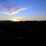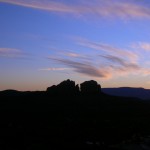
Sunday was to include a scenic detour, shopping, a water slide, some insight into a question that had been on my mind for quite a while and finished up the day with the full moon rising as we left a fascinating church structure. Still enjoying sleeping in a bit in the morning and breakfast just down the hall in the hotel lobby.
We swung by the Flagstaff WalMart to pick up a few supplies and then headed for Sedona. Since we were on vacation, it really wasn’t that big a deal when we missed our exit on the way, although the one we took looked familiar. We ended up winding through a residential area where the houses were set into the trees and looked like a combination of retirement cottages and weekend getaways. From a sheer directions standpoint, I think the Garmin could have gotten us back on the right track without quite as extensive a tour but it was a pleasant diversion to somewhere we hadn’t seen before.
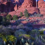
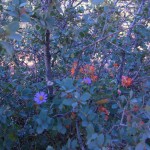
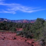
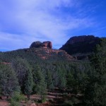
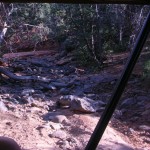
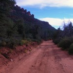
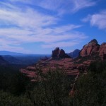
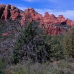
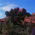
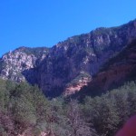
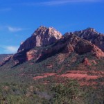
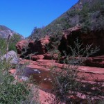
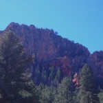
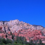
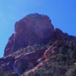
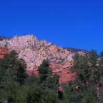
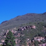
Rt. 89A takes one through Oak Creek Canyon and delivers some scenic forest and water views.


 Also along this stretch of 89A is a bridge across a gully known as Hoel’s Wash. Adjacent to Hoel’s Wash is Hoels Indian Shop and Rental Cabins. The open sign was lit so we stopped and went in. The merchandise was all Indian-themed and Mr. Hoel was very knowledgeable about his merchandise and his artists. We probably spent the better part of an hour looking at EVERYTHING and we found the piece that was “it”. Mr. Hoel wrapped it up and we were once again on our way. (It was a ring by Greg Lewis but I have no pictures. It was a gift for our daughter.)
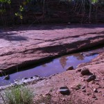
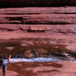
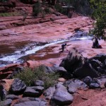
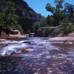
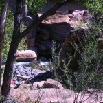
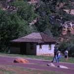
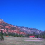
 Next along the way is Slide Rock Park, a joint venture between the US Forest Service and
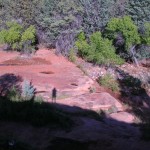
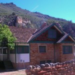
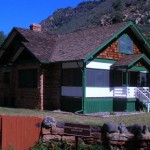
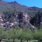
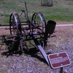
 Arizona State Parks. Originally the Pendley Homestead, the park is a 43-acre historic apple farm located in Oak Creek Canyon. Frank L. Pendley, having arrived in the canyon in 1907, formally acquired the land under the Homestead Act in 1910. Due to his pioneering innovation, he succeeded where others failed by establishing a unique irrigation system still in use by the park today. This allowed Pendley to plant his first apple orchard in 1912, beginning the pattern of agricultural development that has dominated the site since that time. Pendley also grew garden produce and kept some livestock. Historically significant because of early efforts at agriculture and the 1930’s addition of guest cottages (no longer used). Recreationally, its significance is tied to the natural water chute and slide.
There were a number of families and small groups enjoying the park during our visit. Only one family seemed to be actually in the water and on the slide though. The rest were enjoying the sun and the view as we were. 

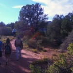
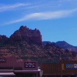
We spent some time enjoying the warm sunshine and then trekked back to our rented car to head into Sedona. The midday ride was a bit faster-paced than yesterday’s but not rushed at all. As we had scoped out the town somewhat, we quickly recognized that an on-street parking spot would work and lucked into finding one in the first block or so. We had some time and wandered about trying to find just the right spot for a light lunch. The Canyon Breeze is relatively open in a food-court sort of way and we chose tacos. My experience with tacos had always been either the crunchy corn shells or a soft flour more  like a burrito. These were flour but with some crunch. A bit lighter and a good flavor. They hit the spot quite well.
After we finished lunch, we made our way a few doors down to await our scheduled Jeep tour ride.
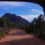
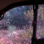
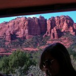
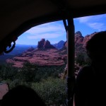
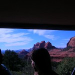
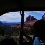
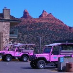
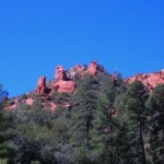
There were four of us scheduled to make the ride and the other two were being retrieved by our driver down the road a ways. We watched as other groups met with their drivers and departed. And then other groups would come along and depart with their driver. It was about to become an issue worth inquiring about when a red Jeep TJ pulled in off the main road and our driver, who introduced himself as Mike (I think), came to collect us. It turns out we had added another pair to the mix and there would be 6 of us plus our guide. Our tour was with the Red Rock Western Jeep Tours. It appears there are at least 6 tour companies in town specializing in this type of tour. Most of them use Jeep Wranglers of the YJ or TJ variety for those of you who know the difference. What they all share is modifications that include a higher canopy and additional seating in the rear area. In theory, the one we rode could carry 7 passengers plus the driver but it would be snug. The added seats were smooth and narrow so you really needed to cinch down on the seatbelt to stay in place when the going got rough.
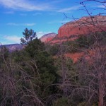
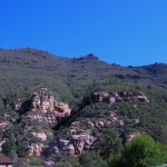
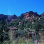
 National Forest. We passed through several traffic circles (or as they call them in Maryland — traffic calming devices!) We passed the house formerly owned by one of my personal favorites, Lucille Ball. A domineering and impressive structure with covered balcony porches overlooking the red rock landscape and the town of Sedona.
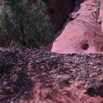
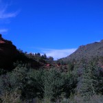
 This took us out Schnebly Road, named for one of the founders of the town. According to guide (and I add the appropriate disclaimer as all tour guides seem to have a blurry line between historical accuracy and delivering a good line, a practice commonly known by storytellers everywhere as not letting the facts ruin a good story) the town was to be named after the nearby Oak Creek Canyon but instead was named after one of the Schnebly brothers’ wives. Her death and the death of their only child within a few years lead to the Schneblys abandoning the area.
Old Bear Wallow
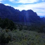
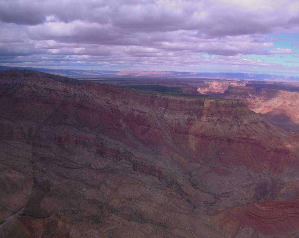
Climb this early stagecoach route along Schnebly Hill Road through Bear Wallow Canyon just below the Mogollon Rim to enjoy STUNNING VIEWS of Sedona and Oak Creek Canyon 2000 Feet below. Step onto Munds Wagon or Huckaby Trail and hear stories of Sedona’s early pioneer days. The 2-hour tour features a 4×4 excursion along the scenic volcanic Mogollon Rim Trail among the world’s largest continuous stand of Ponderosa Pines.Canyons & Cowboys
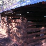
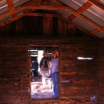
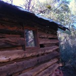
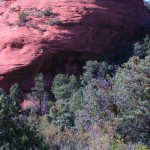
Your Red Rock Western Guide takes you through a scenic wonderland surrounded by seven majestic canyons into historic Dry Creek Basin. Relive early cowboy days with tales of MURDER AND MOONSHINE at the old “Van Derin” cabin, a focal point of your tour, permitted ONLY to select jeep tour companies.


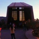
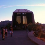
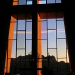
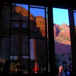
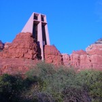
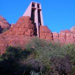
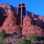
Built on a twin pinnacled spur about 250 feet high, jutting out of a thousand foot red rock wall, “solid as the Rock of Peter” the building of the Chapel was completed in April 1956. Just the physical construction was a physical miracle, overcoming difficult conditions to construct this chapel.

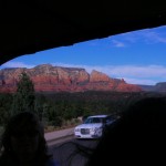
 We finished the day with a last pass through the streets of Sedona and found a nice bar and grill, The Open Range. Looked like they enjoyed a brisk business and a nice view but since we were there after dark, the view was invisible. After finishing our dinner, we returned to Flagstaff via the Interstate and called it a night.