Ocracoke, New Folks and a Hot Idea

The morning started out with a light misty rain which would continue most of the day but the day would end with some new sights and meeting some new people.

We started out with Breakfast at the Hatteras Island Inn and decided to head for Ocracoke. We wanted to do some shopping and look around some in the village where we hadn’t before.

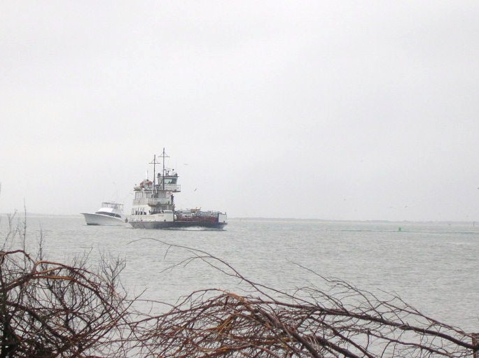
We arrived at the ferry dock at about 20 past the hour, not sure what the schedule was today since we had watched the crossings on Friday being more frequent than the advertised on the hour sailings. As it turned out, they are still on the hour but will put a second boat in service when the need makes itself known. We were to ride the Croatoan, one of the newer, larger ferries with the portion of the deck that’s covered. Sharing the ride with us were some of the folks who are in town for Bike Week in the OBX, the motorcycle kind.


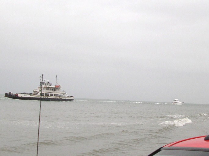
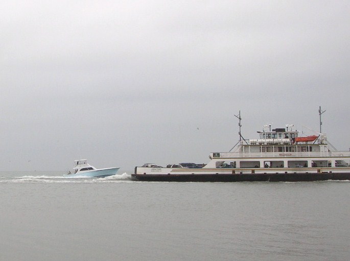
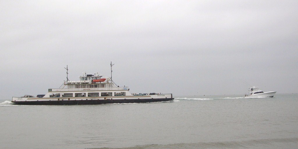
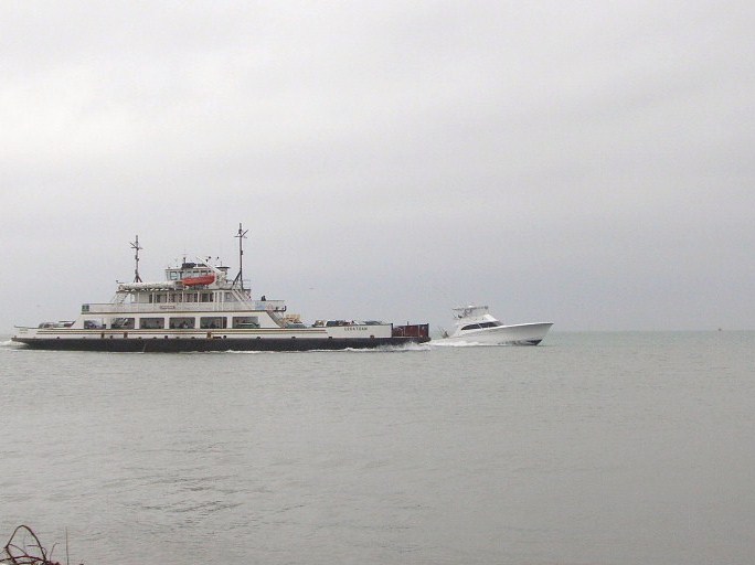
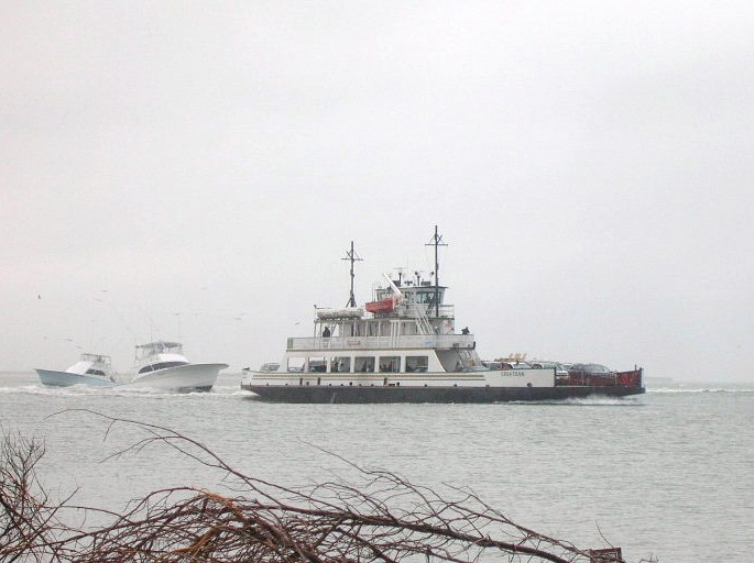
The ferry was to be packed. The motorcycles were not all one big group when they got on but when the crew saw the second contingent of bikes, they had two of the cars back out from under the cover to allow all the motorcycles to be sheltered. Sure it took a few extra minutes but it demonstrates putting your guests’ comfort first with just a little extra effort. Good show!

When we arrived on Ocracoke Island, the rain continued and the line stretched from the dock around the curve, past the visitor parking area. A significant part of the line was motorcycles and their riders waiting in the rain. Well, truth be told, a significant part of the line was motorcycles and their drivers as their passengers stood under the shelter out of the rain. I heard one of the riders relating how she had asked about the priority system which allows residents to jump to the head of the line and why those folks riding motorcycles in the rain didn’t qualify as priority. The story was told with some good nature so let’s give credit. Of course, she hadn’t yet gotten to experience the ferry crew making a space under the cover for the motorcycles and their riders.

We stopped at Howard’s for lunch as per usual, along with many many motorcyclists. Although we usually chow down hearty, we decided to go a bit lighter this time and got a “small” pizza. Small wasn’t especially and their crusts are thick so it filled more than we expected. It was tasty as Howard’s food usually is.

We next went into town to shop at Mermaid’s Folly which seems to be the only place we can find a particular maker of skirt but they had none in the right size this time.

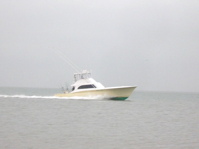
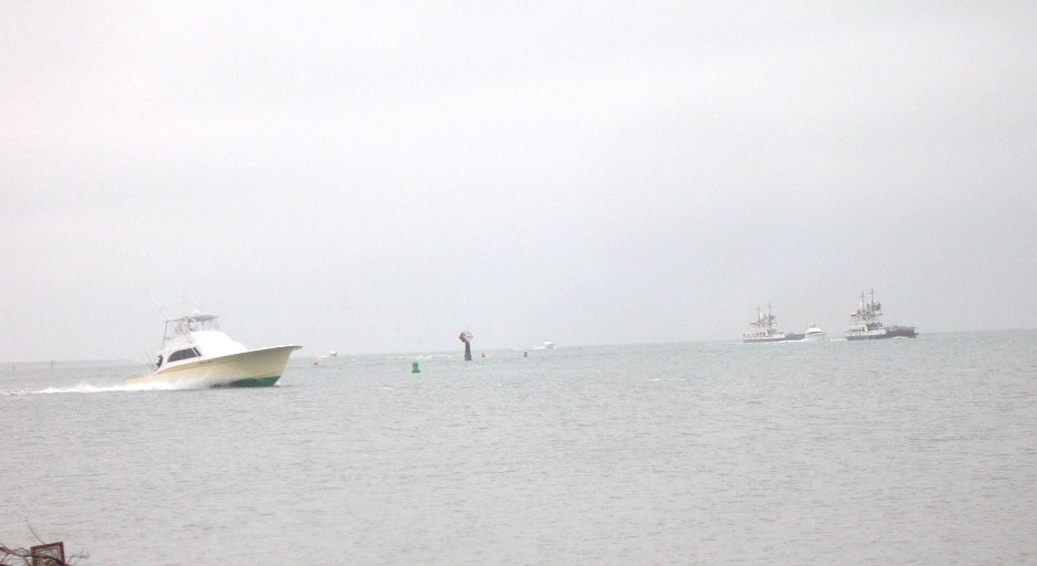
Our next stop was a ride out to the beach and to see the area around the South Point. Plenty of strings and signs and a few fisherman were braving the rain. The rough waters didn’t seem to be helping them at all. We turned and headed north to what I believe may be the only place in the entire Recreation Area where you can ride from one ramp to the next on the beach, that being between ramps 70 and 72. The beach was blocked just north of 70. Cruising up the highway later, it appeared you might be able to enter and exit at ramp 67 as well but you wouldn’t be able to get to the next ramp. Supposedly, under the new ORV plan, the Park Service may add a few ramps to allow some spots where you can enter through one ramp and exit at the next one instead of doubling the traffic as you enter then backtrack to the same point to exit. Time will tell, I guess.

We went back into the village to see some of the backstreets. We went past the school, several inns and shops but none that seemed worth a special stop. So it was back to the ferry and ride over to Hatteras again.

We swung by the Graveyard of the Atlantic Museum which was about to close so we skipped i(hours are 10-4, Monday through Saturday). Next we decided to try again to find the Ramp 55 wreck. Per the latitude and longitude coordinates, we sat on top of the spot but saw nothing.

Net we drove out the pole road and reached the soundside where it became clear how close the channel has shifted to shore. Repeated dredging when you can’t/don’t move the sand any significant distance just doesn’t hold long.

Back to the Hatteras Island Inn and gave a call to Rob Schonk. We had been trying to get together for a face-tot-face this weekend and finally managed to join he and his wife Linda for dinner at the Atlantic Coast Cafe in Avon. Betty had the grilled shrimp and Keith had the special which was crab cake, coconut shrimp and herbed mahi-mahi. We think this may qualify as the best meal we’ve had so far this trip.

After dinner, we horned in on an invitation to meet JAM and some of the folks from the OBC forums at JAM’s place. As I’m horrible with names, I won’t try to name all the folks we met there but will speak highly of the great hospitality and some interesting folks. We are appreciative both for the hospitality and the invite.

Keith was particularly taken by the bonfire keg which is a stainless steel keg which has had one end removed and vent holes. Very efficient burner and clever idea. Conveniently its also sized right for the grill and lid from a weber. Keith is now on the search for a stainless steel keg for himself.

Considerable discussion of life on Hatteras Island and the ongoing issues with the NPS including the Congressional hearings relative to HR 4094 and a companion bill in the Senate.

Then it was back to the hotel to settle in for the evening.

Transition South, Another Wreck, a Different Beach

Friday was a transition day moving from the northern beaches around Corolla down south to Hatteras Island and our reservations in Buxton.
We started our morning with breakfast at the Hampton and got underway about 10:30 or so. We took the bypass until the KMart and then cut over to the beach road with plans to stop at the Croatan Surf Club in search of another wreck which sometimes appears on the beach there. We parked at the Albemarle Public Access and walked along the beach to the beach of the Croatan but found nothing to indicate our missing wreck. Sometimes the tide and erosion work for you, sometimes they don’t.
We moved on down the beach and through Nags Head to come out on Highway 12. Our next stop was the Bodie Island Light where renovations have recommenced after stopping last year when the NPS reached the extent of their budget.
Next stop was the top of the Bonner Bridge. Ongoing construction work there results is a section of one lane road on the aging span controlled by a temporary traffic light. Too early for our check-in, we meandered onto the Hatteras Deli for lunch. The fresh yellowfin tuna salad sandwich and the open faced “Matey” (thin sliced roast beef and melted cheese) were delicious and just right for lunch. Our next stop was a repeat visit to the beached wreck off Flambeau Rd.


Since we knew that driving on the beach was in our plans, we went to the ORV Permit office to pay our $50 for a weekly pass and view the 7 minute indoctrination film. The only folks there were the two NPS employees and us. One employee directed us to filling out the form, compared the registration and driver’s license and started the DVD player. She also escorted us into the third room where a second employee took our cash, printed a receipt and handed us our pass. He also instructed us to keep the paperwork in the vehicle.
Next stop was the Hatteras Inn Buxton (formerly the Comfort Inn) to check in. Then we headed back to Coquina Beach (on the north side of Oregon Inlet) to try once again to find the wreck of the Laura Barnes. We had seen it in about 1996 when we visited and it was marked by the highway and was located between the double row of dunes and was largely visible. Nowadays, the dune line has shifted westward and a section about 3 feet in length is visible on the sea side of the first row of dunes. Maybe not an exciting find to others, but significant to us.


Dinner at Rusty’s was up next. We both had the bay scallops broiled. Betty had coleslaw and red potatoes, Keith had mashers and collards. A very tasty dinner indeed which left no room for dessert. Back to the room and settle in for the night.

A Different Beach and An Anniversary

Thursday April 26 found us traveling around Currituck County and Corolla at the northern end of the Outer Banks. It also marked the occasion of our 32nd wedding anniversary. Congratulations to us!

We were staying at the Hampton Inn in Corolla. It’s located beachfront and we were in a “partial view” room. Partial view means you are on the side of the building. Currently, Hampton Inn has vacant land on both sides so it’s really a pretty good view of undeveloped Outer Banks with low scrub growth, the dune line and the water. Since the National Audubon Society decided (after years of paying the lower conservation area tax rate) that the land donated to them had no value as conservation, they decided a couple of years ago to sell it off for future development and $25 million. Seems a little underhanded to me as they were suing to shut down public access to much of the Cape Hatteras National Seashore Recreation Area just 20-30 miles south but there was apparently nothing illegal about the transaction. The development called Pine Island will fill in the area to the north and south of the Hampton soon as construction is currently underway.

After breakfast, we decided to head to the beach for a walk. The Hampton has a boardwalk over the dunes and we headed that way then north along the shore. It was a glorious day. We appreciated our jackets and met another couple walking along the shore. We continued as far the first few houses. Individual homes had boardwalks over the dune line. As the wind moves the sand, the boardwalks get covered and homeowners build new ones, sometimes on top of the old one! It makes for an interesting sight with the double decker boardwalk with the lower level being only a few feet below the new one.

In our investigations, we had discovered there was another shipwreck sometimes visible next to the dune line in Corolla. Since our adventures last year, we have sort of “gotten into” finding the wrecks on the Outer Banks. With the shifts in sand due to the storms and just routine erosion by wind and water, what’s visible today may be buried tomorrow and vice versa.

Armed with an address for the house in front of the wreckage, we drove to Corolla where the Metropolis site is marked with an historic marker alongside Hwy. 12. We also discovered that Corolla has no on street parking. It looked like we would park n the shopping center and walk the half mile to the beach but we discovered a public access (including vehicle) at the end of the street. Carefully reading the sign, we discover that Currituck County allows driving on the beach from October 1 to April 30! Score! We drive the truck over the ramp to discover the beach is pretty much hard pack, similar to the beach at Daytona. While I wouldn’t recommend it in 2wd, it’s potentially doable.

The description we’d seen of the Metropolis indicated it was visible depending on the tides, erosion and the amount of digging the kids (primarily) had done on the beach and sometimes gave off the aroma of turpentine (pine). From the marker, we learned it was a steamer that had wrecked in 1878 and lost 85 lives. As a result of the tragedy, changes were made in the Coast Guard policies regarding beach rescue. We walked around a bit and took a few pictures and decided to drive along and see what the beaches there were like.

The hard pack continued north all the way to the fence which separates the “4wd area” at the north edge of Corolla. The fence is primarily to keep the wild ponies out of town. There is a walk through gate (unlocked) with enough of a turn to keep the horses from walking through. There is a also a drive through gate which is locked and limited to “authorized vehicles” only. We took a couple of pictures and headed back south. The beach was pretty sparsely populated. We did see one or two other vehicles with a fisherman and all his gear and some tracks from earlier in the day. We headed back south just a short distance to the first off ramp which came out by the Corolla Lighthouse and turned north into the 4wd area.

The local news is abuzz with the Currituck County Commission considering adding a fee for a permit for the 4wd area beaches. In the past year, the tour companies which conduct the wild horse tours getting attention due to the amount of traffic they generate in the residential areas as well as a number fo folks not giving the horses the distance the rules require. On past trips, we had seen a few of the horses but always back behind the dunes in the residential areas. On this trip, we saw the horse on the beach. We were seeing more horses than we ever had seen anywhere and they were all on the beach. By the time we had gone north to the Virginia state line and back, we counted 44! For the most part, they were in groups of 5 or 6 but there was one by itself. We just couldn’t believe it. 44 horses sighted over a period of around two hours!

The one horse by itself was at the foot of the dunes and eating the sea oat plants. I guess this is near the embodiment of the question: What am I supposed to do if I see an endangered animal eating an endangered plant? Neither comes under the category of endangered but both are protected.

One group of 3 or 4 were in the dunes next to another discovery for us, a life saving station! We had visited several on the Hatteras and Ocracoke Islands but not one that far north. It turns out that this one, Wash Woods, had been in service until the 1950s and was restored in 1999. It is currently in use as the Twiddy Real Estate office for the area. Parked outside was a neat bus that had been restored as well for touring the 4wd area.

As we came off the beach, we were in search of the deli where we had those terrific sandwiches on an earlier trip with friends Donna and Mike. We found the building but it was obviously in the process of changing tenants. Across the parking lot was the OBX Deli and Cheesesteaks which we hoped was the same establishment in a new location. As it turned out, it was another new business with a phenomenal selection of fudge and other candies but the deli sandwich was nothing special. It was good but disappointing after psyching ourselves up for the other place.

After lunch, we ventured over to the shops around the lighthouse for a couple of souvenirs and then went back onto the beach to see where we came out if we headed south. We continued south past the Hampton and the houses of Pine Island. Just offshore, maybe 20 years, we discovered a previously unknown to us piece of wreckage sticking up out of the water. There were three pieces to it, 2 looked as if they could have been most anything, but the third was definitely machinery. It was shaped somewhat like an engine connecting rod (its the part that moves up and down and transmits the rotational motion of an engine’s crankshaft to up and down motion of a piston). I did a little internet research afterwards and found another reference to its existence but no help with identification. A gentleman walking along the beach also pointed out that there was a piece of wood further along the beach that could easily be wreckage as well. So we continued along to find a strong straight piece of wood with the rusty iron spikes common to the wrecks to be found in this area.

We continued along into Duck. The beaches in Duck are also open to drive but there is no public access from the town. It appears the only accesses are on private property or from the beach, as we entered and exited. As we got into Duck, the sand was softer and I was beginning to regret not lowering the tire pressure more when we had entered the beach. The beach also was getting narrower as it got softer so we turned around within sight of the Research Pier.

We traveled back north and exited the beach where we had entered in Corolla. We treated the truck to a full tank and went back to the hotel with plans for dinner at the Rt. 12 Steak and Seafood. As we were standing outside the doors, we ran into one of those fellows who is able to see the virtually invisible mark our family carries that apparently says “Talk to me”. He proceeded to share that business in America should be conducted more standing by the tailgate of a pickup truck than in an office or over the exchange of documents. After telling us how he had just worked out the details of the plumbing for his construction there, he launched into his political leanings and his opinion of the current occupant of the White House. Not generally a conversation one gets into with someone you just saw (but haven’t yet met) but apparently it worked for him.

Dinner was Shrimp Aristotle and Broiled shrimp. The Shrimp Aristotle was a combination of a cheesy garlic sauce with olives and was quite tasty. The broiled shrimp also pleased the palate. The vegetable medley (green beans, tomato and carrots) was just a bit too close to raw for our tastes but complemented the meal well. After dinner, we walked the shops which were mostly closed and then headed back to the Hampton and eventually to bed where the day’s activities in the sunshine and fresh air lead to a peaceful sleep.

Important numbers from today:
44 horses
32 years
3 new to us shipwrecks
1 new life saving station.
1 new beach where we could ride and enjoy the sights.


New Year’s Day Traditions

New Year’s Day is one of those holidays that is steeped in traditions, some of which are predictors of future events, some of which are actions designed to influence future events.

For many years, Daddy would arise well before daylight and make his way to his his cousin’s farm to hunt quail. He often hunted there and it was believed to be good luck if the first visitor of the New Year was male. My Grandma Holman believed whatever you did on New Year’s Day would be repeated throughout the year. Grandma lived next door and avoided cooking and housework that day. It was one of the few holidays that she really took to heart in her observance.Our family lore includes the story of my Mother, taking advantage of a day off from work and Daddy being out of the house, was doing laundry and hanging it out on clothesline in our backyard. Grandma observed Mother hanging laundry and rushing out to get her to stop as it would doom her doing housework all year. I guess Daddy hunting and visiting with his cousins really fit in with that, too.

In carrying on the family tradition, for the last decade, I’ve made a point to be spending the day in the woods with friends. It’s usually been with whatever four wheel drive club but 2012 finds me “unaffiliated” with a club. My friend, Miles and I decided to head down to George Washington National Forest and ride some trails we’d not ridden in a long time that were remembered as being fairly easy. Since there were only the two of us, we both went in my truck so that we could do some catching up as well.

We got to Harrisonburg late morning and headed towards the lower end of the Second Mountain Trail. It had been a long while since either of us had been there and it was an entertaining ride, just enough challenge but not so difficult as to interfere with the verbal exchange! After we got to the ATV loading area at the top, we started the trail along the top of Dictum Ridge which is part of the Rocky Run ATV loop.Where Rocky Run turns to go down from the ridge and over towards Second Mountain, Dictum Ridge is now closed to motor vehicle travel. Find us on a SPOT map

No vehicles past this point

Dictum Ridge 2012

"Before" picture from Dictum Ridge taken in 2001

Halloween at the Beach Part 4: Tying Up Loose Ends

Sunday the skies were sunny but the wind was still whipping albeit with less force than on Saturday and the temps were in the 50s. Janet and Bruce called from the Diamond Shoals where we joined them for breakfast before they headed for home. (Jeremy and Rosemary had left earlier.)  After farewell wishes for a safe journey, Betty and Keith decided to go back to Ocracoke to further the pursuit of known shipwrecks.

The ferry was just finishing loading and we were the last car onboard. The ride over was less exciting than either trip the day before. As happens seemingly too often, Keith was mistaken for someone else and we were approached by fellow travelers who believed Keith was an old high school chum but it lead to a friendly conversation included a look at the strangers wind screen contraption made from 2×2’s about 6 feet long with silt fence stretched between to block the blowing sand. He indicated it worked fairly well on the sand but still allowed too much wind to keep really warm.

We entered the beach at the northern most Ocracoke ramp and turned towards the north point. The island has grown since last spring with this area covering more territory. The texture was the hard damp sand we had seen on the southern end on Saturday. We scoped it out then turned south towards a wreck believed to be about ½ mile north of the Ocracoke Pony Pens. At the GPS-designated point, we noted nothing indicative of a shipwreck although we were adjacent to an area of dunes that had been replenished since Irene. The beach was relatively narrow here and we found we were very very close to the highway as well.

We turned back to the ramp and headed into the town of Ocracoke for quick trip to the welcome center gift shop and then off to Ramp 72 to try once again for the shipwreck noted to be there. Since today’s weather was better, we were able (willing) to walk across the dunes to search. We never made it to the west side shore of the point but sighted something n the marshgrass but we weren’t prepared to walk/wade to get close up.

There was more loose sand making small dunes and large ripples on this section of the beach so that staying back from the water resembled a roller coaster.

We turned north on the beach to check for more shipwrecks and condition of the shore. There were a few fishermen and others enjoying the beach. We even saw a couple of folks trying to surf but the waves weren’t really cooperating.


As we passed Ramp 67, there was no indication that there was not another ramp ahead but we eventually reached the end of the open to vehicles part of the beach and turned around to leave at Ramp 67.

There was one more shipwreck indicated on Ocracoke Island just north of the pony pens so we stopped at the crossover there. Several of the ponies were out in the pen so we walked over and took a few pictures. We also learned a few things that made the Ocracoke ponies unique including two fewer vertebrae than other horses, fewer ribs and denser bones.
We then headed up the beach on foot in search of one more but it eluded us as well. Total for our long weekend had us finding two confirmed sightings on Hatteras Island and one maybe on Ocracoke. It later occurred to us that several previous trips had a goal which we had not met because of ferry schedules or darkness or hunger but this time, without trying, we had managed to cover ALL of the drivable ocean side of Ocracoke Island!

We caught the ferry back to Hatteras. We had ridden the ferry 4 times this weekend and not ridden the same one twice. This time we were onboard the Chicamacomico which was pictured on the postcard back to the folks at home.

One place we had missed in our travels that is always part of our trip was a ride out to the point and past the Cape Hatteras Light. The approach by the campground and where Ramps 43 and 44 meet the pavement was underwater as we had learned before arriving. It’s on National Park Service property but for some reason doesn’t drain and hasn’t for a while. One can’t help but think it contributes to the mosquito population that plagued the island after Hurricane Irene. This beach had obviously had more traffic than any other beach we had been to this weekend. We drove out to the point and around but would have needed to drive across water if we hadn’t turned back. We made our way back to the pavement and off to dinner.

Dinner was at Rusty’s, one of our favorites and tonight didn’t disappoint. Broiled bay scallops for Betty and a Caribbean-spiced snapper for Keith followed by New York style cheesecake (not too dry) and with a light glaze on the plate of raspberry and mango gels with coffee for a near-perfect finish for the meal and our weekend.

We aired up the tires on the truck and made fresh coffee to fill the thermos bottles for the trip home and we were set after returning to shower and off to bed. We head home on Monday.

Halloween at the Beach: Part 3 Visiting the Moonscape

Saturday morning we headed over to the Red Drum for a headlight and a tire gage as I discovered the digital gage in the console had a dead battery. While there, I met Mr. John Couch of OBPA and internet fame. He is president of the OBPA, one of the organizations fighting to maintain access for pedestrians, sportsmen and other folks who use the Cape Hatteras National Seashore Recreation Area for recreation. In conversations with Rob Schonk, the principal in the Robert and Jean Schonk Foundation, Rob recommended that I make the time to make Mr. Couch’s acquaintance. After installing the new headlight, we headed to Frisco and Wave Hopper to gather Bruce, Jeremy and Rosemary for some time on the beach.

We headed over to Ocracoke in spite of the weather forecast. The day was to be windy and the forecast was accurate on that account. The predicted rain held off however. The wind was strong off the sound and made the landing of the ferry somewhat exciting with the captain using the pilings to bounce his way into the slip.

We headed to Howard’s Pub, one of our favorite lunch spots. Bruce had the chowder, Betty had grilled shrimp, Keith had marinated tuna steak, Jeremy had the tuna steak sandwich and Rosemary had the grilled tuna salad. The food was excellent as usual. After lunch, we headed into town to do a little shopping and found our way to Mermaid’s Folly and Craftsmen Paradise on Howard Street. It was a successful trip. Everyone found something to their liking and connected on some items which we couldn’t find.

Next we headed for the beach, more particularly the South Point. It was a surreal sort of moonscape actually having been flattened with only the occasional small dune still there. The wet sand was pretty hard requiring the four wheel drive rarely. Looking over the inlet to Portsmouth Island you could see shafts of sunlight coming through.

The loose sand was blowing across the hard wet sand making interesting patterns and beginning to form ridges and small dunes.

As we headed back towards the ramp off the beach, we noticed a pair in a pickup that seemed to be making more downward progress than forward. It was a pair of fisherman whose four wheel drive was malfunctioning. After lending them a shovel which wasn’t enough to get them out, a tug on our towstrap got them back over to the hard surface and on their way. As we got to the ramp, Bruce saw Jeremy and Rosemary headed up the ramp and began to follow them off the beach and back towards the ferry on Highway 12. Keith and Betty lost sight of him but decided that was the direction he was headed. Of course, Keith and Betty also had Jeremy and Rosemary in the rearview mirror. After failing to see Bruce, we gave him a call to inform him that he was lost as we did not know where he was. It turns out that Bruce was following a different dark-colored F150. But as it was getting time to head back to Hatteras Island, it worked out for the best.

We commented earlier about the difficulties getting the ferry into the dock but the weather had worsened and the docking of the ferry to take us back was quite a spectacle. One gets torn between fascination with the difficulty in putting the ferry where it belongs and admiration to the captain for doing so in spite of the conditions. At one point, the ferry was perpendicular to the slip and hard against all three pilings and the engines roaring at near full throttle with little effect. Eventually the ferry came into the slip and we pulled out only a few minutes after our scheduled 5:30 departure. We found out Sunday that the ferry had stopped running with the 6:30 departure Saturday evening. Had we stayed on Ocracoke for dinner, we may have stayed the night or whenever the schedule resumed.

The five of us had dinner at Diamond Shoals Restaurant in Buxton and bade our farewells to our friends. Across the street to our hotel and the nightly computer checks, tv, shower and bed.

Halloween at the Beach: Part 2 Hunting for Shipwrecks and the Aftermath of Irene


Friday, Betty and Keith had breakfast at the Hatteras Island Inn (formerly the Comfort Inn) and then set about our day which included a stop at the Really, Really Free Market in Salvo. Friends at home had filled two storage containers with needed and requested items. We had a piece of carpet and some clothing to contribute as well. The carpet remnant, we were told, was being set aside for a local 80 year old woman who had been through this ordeal without insurance and was putting things at home back together.

Betty and Keith had set out to locate some of the many shipwrecks for which we had found GPS coordinates. After finding one last spring, that seemed like it would make for fun.

As we headed north from Salvo, we took a bit more time to check off the main highway for remaining damage. The KOA campground was open for business. They had cleared the portion near the ocean and were working their way back toward the highway. The camping cabins (basically shell sheds with built-in bunk beds) looked to be basically undamaged but had been floated off their footings. The ones that appeared undamaged had water damage to worry about but were structurally sound. The bathhouses all had siding taken away to allow drying out.

The Chicomacomico Lifesaving Station was closed. Reports on the interwebs had indicated there was much cleanup to be done as well as resetting on footers.

We drove again over the new bridge and stopped to get some pictures by walking through the dune line to the beach and coming around. The speed with which the current moved through the inlet was impressive. I’ve tried to get some pictures but am not sure they really convey the current. It makes one wonder how much more the inlet will open in the unfortified sections with time. We stopped at the Coquina Beach day use area to see if we could find the remains of the shipwreck there. Like most of the wrecks, changing sand profiles will expose or cover from season to season. We didn’t find it this time.

Next we headed further north to Nags Head for lunch. Having heard so much about Sam and Omie’s across from the new pier. They were busy and we had about a 20 minute wait. The food was good, the clientele and food were local as well. Betty had the mushroom and crab soup and an order of onion rings. Keith had the scallop cake Sam-wich, think crab cakes make with scallop bits. If we lived nearby, they would be on our regular rotation for lunch but don’t qualify for driving 50 miles just to eat there. Good and repeatable but not a special treat to work for. When we came out, it had started to rain lightly.

We turned south again to the Bodie Island Lighthouse. Bodie Island Light was/is under a major renovation. When the funding ran out, they took down the scaffolding until more funding allows them to continue the work. The light is removed from the structure for now and will be replaced when the renovations resume.

Next stop is the Oregon Inlet fishing pier. During Irene, all the fishing boats left for less exposed locations. The flooding damaged the piers which delayed the reopening and return of the fleet. Now with new piers installed, life appears to be near normal again.

Before leaving home, we had entered the GPS coordinates for several known shipwrecks which are sometimes visible from the beach. As we passed Salvo, we noted three showed on our track as being nearby. We entered the beach access ramp 23. The GPS coordinates revealed three near to the ramp. The first was just as you entered the beach. According to the coordinates, we were literally right on top of it. If the coordinates were correct, this particular wreck wasn’t visible at this time but there were two others in the vicinity. As we drove north on the beach, we saw what looked like it could be a buoy that had blown up on the beach similar to one we had seen on a past trip to Carova. As we got closer, we realized that we had found the remains of a sidewheeler that had wrecked on the beach in 1862. It was just offshore, inside the breakers. The pieces we saw were iron and probably the remains of part of the propulsion machinery. We were 1 for 4.

We moved further down the island and decided that timing was such we could probably hit the shopping area at the ferry landing and move on to another wreck site that we had seen last spring. The remains of an unidentified ship, probably a schooner, can be found at the end of Flambeau Road in Hatteras Village. We parked and walked over the low dune line on a boardwalk. Considerably more of the wreck was visible than had been in either of our spring visits. We then joined Jeremy and Rosemary, Bruce, and Janet for dinner at the rented house, Wave Hopper. As we pulled in the carport, we noticed a nail lying on the concrete. As we looked around, we noticed a few more, and then a few more. By the time we had arrived at the top floor, we had picked up easily two dozen or more ranging from roofing nails to siding nails to 10 penny galvanized nails. Apparently a roofer had been doing some patchwork after the hurricane and been less than meticulous about picking up loose nails. To the best of our knowledge, no one’s tires helped us pick them up. Our delicious dinner was a cooperative effort on their part and included salad, red potatoes and individual shrimp and scallop casseroles. Accompanying our dinner was a Chilean grape merlot which had been bottled by Jeremy. For dessert, Rosemary had made a sweet potato pie. We enjoyed our meal and some fine company afterwards.

We headed for the hotel around 9:30. It’s about a 6 mile drive and midway we met a Dare County Sheriff’s Deputy coming the other way. Just as we pull even with him, he flashes the blue lights and pulls a u-turn after we pass. Assuming he is responding to an emergency call, we slow down and move over to let him pass but he just stays right behind us with the blues flashing. We pull over and turn on the interior lights while waiting for him to walk up and introduce himself and state his business. It turns out we have blown a headlight and he is concerned for our safety since the local deer population has been rather active. In fact, we had observed a pack of raccoons the previous night.

After asking where we were going and where we had been, he advises us of an auto parts store near our hotel and asks if I’d had anything to drink. I honestly replied that I’d had a glass of wine with dinner several hours earlier. He asks for my license and goes back to his car. When he returns, he has the mobile breathalyzer and asks for a sample. He goes back to the car and returns a few minutes later and informs me that I’m not impaired. While a number of things pass through my mind, the only thing out of my mouth (thankfully the filter was working) was thank you and have a good night.

We head back to the hotel, check email, and get ready for bed.

Halloween at the Beach: Part 1

We got underway around 10:00 Thursday morning. This trip is somewhat traditional for us as we have headed to the beach on Halloween weekend for several years. The trip has had several labels, including the S10 trip, CORE and Friends and now Keith and Friends as the attendee list varies from year to year although the numbers have dwindled. I think this may be among our lowest turnout for the October trip as there are six of us: Betty and Keith, Jeremy and Rosemary, Bruce and Janet. But the numbers aren’t as important as the people themselves and the trip itself.

Because of the devastation wreaked on the northern end of Hatteras Island by Hurricane Irene, the trip itself had been in doubt but NC DOT managed to get the temporary bridge across New New Inlet, the break in Pea Island which had cut off access from the islands to go north on Route 12. The only access for some time was via an emergency ferry for residents only, then later access was available via a 2.5 hour ferry ride from Swan Quarter to Ocracoke Island and then the 45 minute ferry from Ocracoke Island to Hatteras Village at the lower end of Hatteras Island. The temporary bridge opened about two weeks ago and all access has been restored to the Islands. You can still see significant damage to the northern villages of Rodanthe, Waves and Salvo. Some of the best coverage and photographs of the current state and the damages can be seen at www.IslandFreePress.org.

We stopped at the Aunt Sarah’s pancake house at Exit 104 which has become a staple for us. We arrived at Buxton about 6:30 (a little later than we had planned) and gave Janet and Bruce a call after we got checked in. They turned out to be a little bit behind us and we made arrangements to meet at the Captain’s Table for dinner. Jeremy and Rosemary also came up from Frisco (they had arrived earlier) and joined us. It was good to do some catching up as well as enjoy the excellent food and service. After dinner, we decided to join them at Wave Hopper (the house they rented) for some more conversation and Bruce shared some great music with us. Jeremy, especially since retiring from USN after 21 years earlier this month, had been making some wine which he shared. Excellent! Bruce had also stopped in Raleigh and delivered a couple of internet purchases I was making. We headed back to the motel with plans to get together Friday for dinner at the house.